Appendix - 124487 - Porphyryr Creek
Site Location
PSCIS crossing 124487 is on Porphyryr Creek and Highway 16 approximately 18km south of New Hazelton, BC. The crossing is located approximately 145m upstream from the confluence with the Bulkley River. Highway 16 is the responsibility of the Ministry of Transportation and Infrastructure.
Background
At crossing 124487, Porphyryr Creek is a fourth order stream with a watershed area upstream of the crossing of approximately 43.5km2. The elevation of the watershed ranges from a maximum of 2300m to 330m at the highway. Upstream, rainbow trout and dolly varden have been recorded (MoE 2020a). A large railway trestle bridge is located over the stream approximately 500m upstream of the highway.
PSCIS stream crossing 124487 was ranked as a high priority for follow up by Irvine (2018) due to the large quantity of habitat modelled upstream and selected for assessment in 2020 following consultation with Alecia Fernando from the Gitksan Watershed Authority. Wilson and Rabnett (2007) assessed the site and reported it as not a priority restoration site due to “the limited amount of high value habitat upstream of Highway 16.” A map of the watershed is provided in map attachment 093M.102.
Stream Characteristics at Crossing
At the time of the survey, the two culverts under Highway 16 were un-embedded, non-backwatered and ranked as a barrier to upstream fish passage (MoE 2011). The culvert is located under an estimated 40m of highway fill. The pipes were 5m in diameter with lengths of 99m, a culvert slope of 4%, a stream width ratio of 2.2 and outlet drops of 2.5m (Table 5.21). Water temperature was 9\(^\circ\)C, pH was 7.6 and conductivity was 73uS/cm. Survey conditions were difficult at the time of assessment as stream flows were high due to recent rain events.
Stream Characteristics Downstream
The stream was surveyed downstream from the culvert for 145m to the confluence with the Bulkley River (Figures 5.24 - 5.25). Total cover amount was rated as moderate with boulders dominant. Cover was also present as small woody debris, large woody debris, and overhanging vegetation (Table 5.22). The average channel width was 11.2m, the average wetted width was 10.2m and the average gradient was 2.8%. The dominant substrate was boulders with cobbles subdominant. The cascade-boulder habitat was rated as moderate value as it was considered an important migration corridor with moderate value habitat for salmonid rearing and spawning. During the survey, an approximately 40cm long salomonid was observed attempting to ascend from the outlet pool into the culvert outlet.
Stream Characteristics Upstream
The stream was surveyed upstream from 124487 for 540m (Figures 5.26 - 5.27). Within the area surveyed, total cover amount was rated as moderate with boulders dominant. Cover was also present as small woody debris, large woody debris, and overhanging vegetation (Table 5.22). The average channel width was 10.7m, the average wetted width was 9.9m and the average gradient was 4.8%. The dominant substrate was boulders with cobbles subdominant. There were pockets of gravel suitable for spawning for resident and anadromous species with minimal pool habitat observed. Habitat value was rated as moderate as an important migration corridor with limited spawning habitat and moderate rearing potential for coho, dolly varden, cutthrout rearing and spawning.
Table 5.23 presents preliminary fish passage modelling data for crossing 124487 with spawning and rearing habitat estimated for chinook, coho, sockeye and steelhead. Modelled estimates of the total length of salmon or steelhead habitat upstream of the crossing before potential barriers are 3.9km of potential spawning habitat and 9.5km of potential rearing habitat.
Structure Remediation and Cost Estimate
Structure replacement with a bridge (31m span) is recommended to provide access to the habitat located upstream of PSCIS crossing 124487. The cost of the work is estimated at $15,500,000 for a cost benefit of 0.5 linear m/$1000 and 5.5m2/$1000.
Conclusion
There is an estimated 8km of mainstem habitat upstream of crossing 124487. Habitat in the areas surveyed upstream of the crossing was rated as moderate value for salmonid rearing/spawning. The crossing represents a complete barrier to upstream migration for fish in the Bulkley River watershed regardless of species or life stage. Highway 16 is the responsibility of the Ministry of Transportation and Infrastructure. The crossing was ranked as a high priority for proceeding to design for replacement.
| Location and Stream Data |
|
Crossing Characteristics | – |
|---|---|---|---|
| Date | 2020-08-25 | Crossing Sub Type | Round Culvert |
| PSCIS ID | 124487 | Diameter (m) | 5 |
| External ID | – | Length (m) | 99 |
| Crew | AI, KP | Embedded | No |
| UTM Zone | 9 | Depth Embedded (m) | – |
| Easting | 603073 | Resemble Channel | No |
| Northing | 6113363 | Backwatered | No |
| Stream | Porphyryr Creek | Percent Backwatered | – |
| Road | Highway 16 | Fill Depth (m) | 9.99 |
| Road Tenure | FLNR Nadina 7543 | Outlet Drop (m) | 2.5 |
| Channel Width (m) | 11.2 | Outlet Pool Depth (m) | 4 |
| Stream Slope (%) | 2.8 | Inlet Drop | Yes |
| Beaver Activity | No | Slope (%) | 4 |
| Habitat Value | High | Valley Fill | Deep Fill |
| Final score | 42 | Barrier Result | Barrier |
| Fix type | Replace with New Open Bottom Structure | Fix Span / Diameter | 31 |
Photos: From top left clockwise: Road/Site Card, Barrel, Outlet, Downstream, Upstream, Inlet.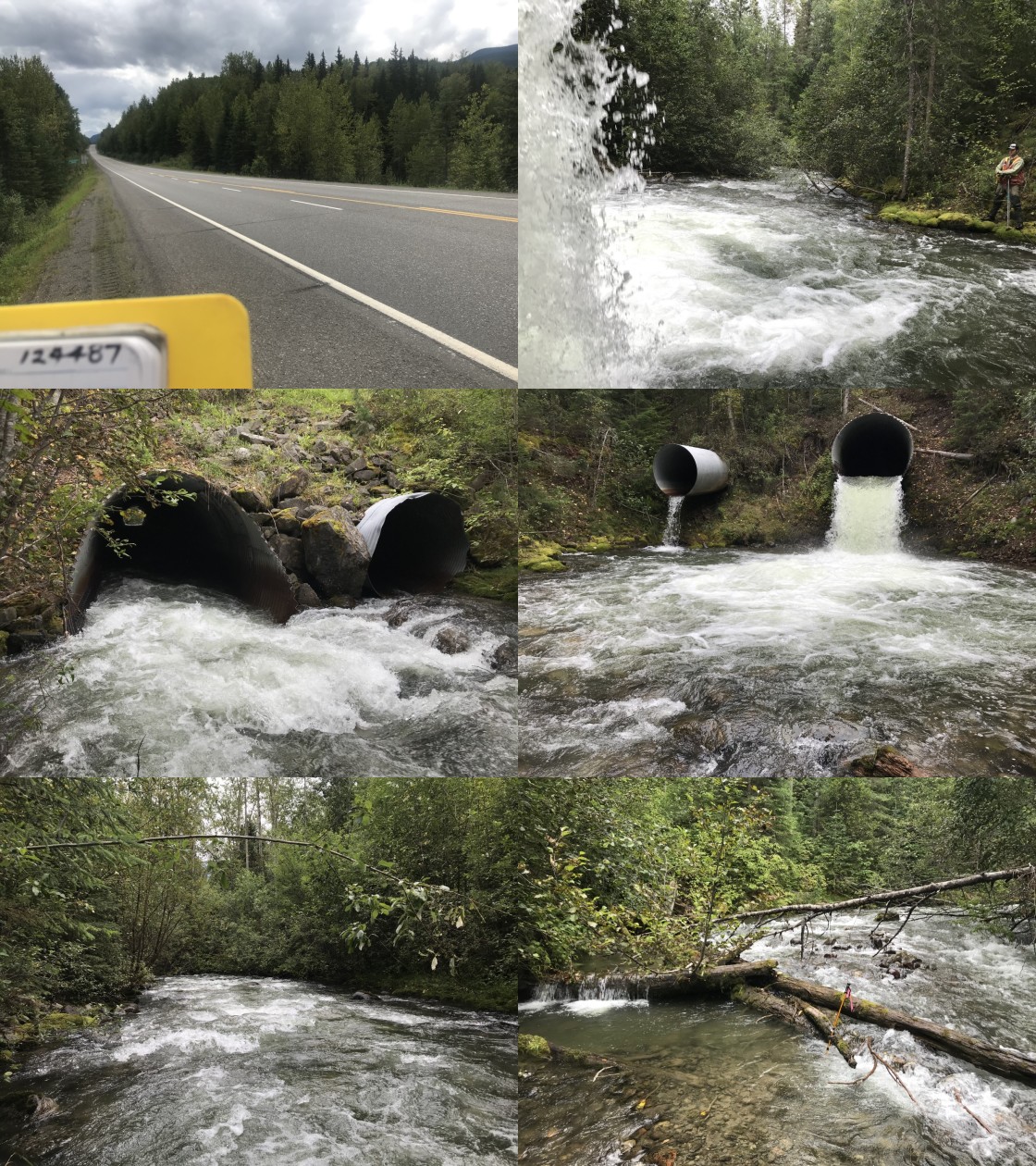
|
|||
| Comments: Unpassable to all life stages and species. Fill depth is approximately 35m. Salomid (50cm) observed trying to ascend to outlet of main pipe. |
| Site | Location | Length Surveyed (m) | Channel Width (m) | Wetted Width (m) | Pool Depth (m) | Gradient (%) | Total Cover | Habitat Value |
|---|---|---|---|---|---|---|---|---|
| 124487 | Upstream | 540 | 10.7 | 9.9 | 0.3 | 4.8 | moderate | moderate |
| 124487 | Downstream | 145 | 11.2 | 10.2 | 0.5 | 2.8 | moderate | moderate |
| Habitat | Potential | Remediation Gain | Remediation Gain (%) |
|---|---|---|---|
| Salmon Network (km) | 15.2 | 15.2 | 100 |
| Salmon Lake Reservoir (ha) | – | – | – |
| Salmon Wetland (ha) | – | – | – |
| Steelhead Network (km) | 16.7 | 16.7 | 100 |
| Steelhead Lake Reservoir (ha) | – | – | – |
| Steelhead Wetland (ha) | – | – | – |
| CH Spawning (km) | 1.2 | 1.2 | 100 |
| CH Rearing (km) | 3.9 | 3.9 | 100 |
| CO Spawning (km) | 3.9 | 3.9 | 100 |
| CO Rearing (km) | 3.9 | 3.9 | 100 |
| CO Rearing (ha) | – | – | – |
| SK Spawning (km) | 0.0 | 0.0 | – |
| SK Rearing (km) | 0.0 | 0.0 | – |
| SK Rearing (ha) | – | – | – |
| ST Spawning (km) | 1.2 | 1.2 | 100 |
| ST Rearing (km) | 9.5 | 9.5 | 100 |
| All Spawning (km) | 3.9 | 3.9 | 100 |
| All Rearing (km) | 9.5 | 9.5 | 100 |
| All Spawning and Rearing (km) | 9.5 | 9.5 | 100 |
| * Model data is preliminary and subject to adjustments. |
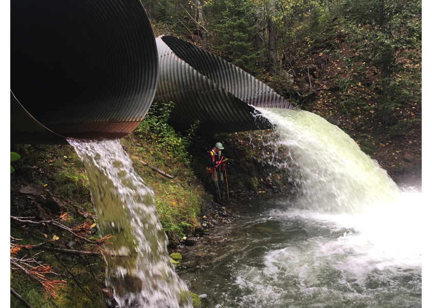
Figure 5.24: Outlets of PSCIS crossing 124487.
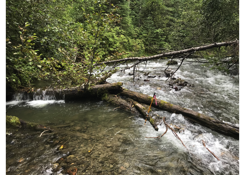
Figure 5.25: Typical habitat downstream of crossing 124487 below the railway bridge and adjacent to the Bulkley River mainstem.
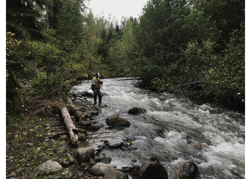
Figure 5.26: habitat upstream of PSCIS crossing 124487.
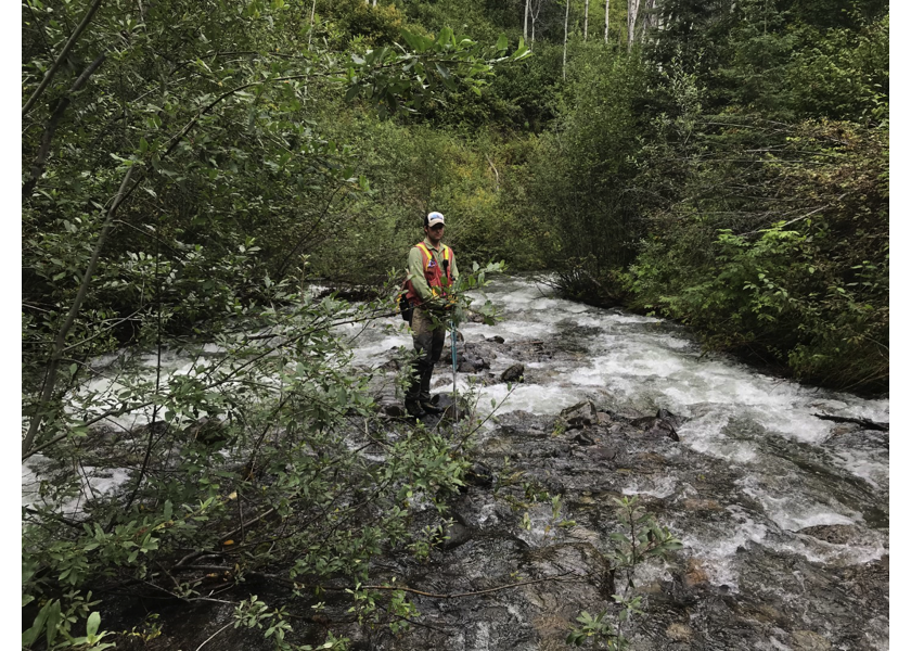
Figure 5.27: Habitat upstream of PSCIS crossing 124487.