
Returns a SpatRaster of elevation cropped to a buffered AOI. Source is a
local file, an HTTP COG (/vsicurl/), or an S3 COG (/vsis3/). Defaults to
MRDEM-30 — NRCan's Medium-Resolution Digital Elevation Model (30 m, all of
Canada, public S3, no auth) — a sensible default for watershed-scale BC
floodplain work.
Usage
fl_dem_aoi(
  aoi,
  source = NULL,
  buffer = 2000,
  target_crs = NULL,
  res = NULL,
  pipeline = NULL
)
Arguments
- aoi
An
sforsfcobject — polygon, lines, or points. Buffered bybuffer(viasf::st_buffer()) before crop. To crop tightly along a stream corridor (memory-efficient when the watershed-scale AOI has sparse stream coverage), pass the streamssfhere rather than the full WSG polygon.- source
Character. Path or URL for the source raster.
NULL(default) uses MRDEM-30 DTM via/vsicurl/. Local file paths,/vsicurl/https://...URLs, and/vsis3/...S3 paths all work —terra::rast()handles them identically.- buffer
Numeric. Distance in metres to buffer
aoibefore crop. Default2000.- target_crs
CRS spec recognised by
sf::st_crs()(EPSG code, WKT, PROJ string, orcrsobject).NULL(default) returns the raster in the input AOI's CRS. Reprojection happens after crop, never before — the 84 GB MRDEM COG must not be reprojected as a whole.- res
Numeric. Output cell size in
target_crsunits, used when the raster is reprojected.NULL(default) takes the source's cell size when the source andtarget_crsshare linear units (MRDEM-30 to BC Albers gives exactly 30 m). Atarget_crsin degrees has no single equivalent of a metre cell, so thereresmust be given; the error quotes the degree value at the AOI's latitude. Any other unit mismatch (a US-foot target, a geographic source with a projected target) also needsres.- pipeline
Character or
NULL. The PROJ coordinate operation used to reproject.NULL(default) pins the operation between two NAD83 realizations on GRS80 (NAD83, NAD83(CSRS), ...; MRDEM-30 to BC Albers is one) to the projection-only pipeline, with no datum shift, when both are projected with easting-then-northing axes, and leaves any other pair to PROJ.""leaves every pair to PROJ. Any other string is a PROJ pipeline passed toterra::project()as given; supply one only between CRSs whose axes are easting then northing, because a pipeline can meet a CRS's authority axis order (lat/lon, or northing first) and silently returnNAor a misplaced raster. Whenaoiis intarget_crs, a supplied string is also used, inverted, to carry the AOI into the source CRS for the read window, so it must be invertible. Whenaoiis in a third CRS, its transforms take the default pin, not the string.""hands the AOI's transforms to sf's PROJ as well.
Value
A SpatRaster covering the buffered AOI. In the source CRS (and
res unset or equal to the source's) it is a crop on the source grid.
Otherwise it is on a grid of res cells whose edges are multiples of
res, spanning the buffered AOI's bounding box in target_crs.
Details
MRDEM-30 (s3://canelevation-dem/mrdem-30/mrdem-30-dtm.tif) is a single
84 GB Cloud-Optimized GeoTIFF in EPSG:3979 covering all of Canada. The
/vsicurl/ access pattern range-reads only the bytes intersecting the AOI,
so total bandwidth scales with AOI size, not the COG size.
When target_crs differs from the source CRS, the raster is projected onto
an explicit grid: the buffered AOI's bounding box in target_crs, snapped
outward to multiples of res. The grid therefore depends only on the AOI
and res, so the same AOI lands on the same cells whatever terra or GDAL
version runs it, and neighbouring AOIs share one alignment. Before flooded
0.7.0 GDAL chose the origin and cell size itself (MRDEM-30 came out at
30.4 to 30.5 m, depending on the AOI), and that choice moved between toolchains (GDAL 3.8.5 / PROJ 9.5.1
against GDAL 3.13.0 / PROJ 9.8.1) because the datum operation below moved
(#67).
Cells outside the buffered AOI can come back NA, where the grid's corners
reach past the area read from the source. An integer source is reprojected
through a floating-point copy, so those cells are NA whatever its NoData
value: projected directly from a file (a crop of the whole source, or one
terra keeps on disk), terra writes a NoData such as UInt32 4294967295 as
4294967296, a value, wherever the output reaches past the area read (#76).
The cell values depend on the coordinate operation, and left to PROJ that
choice follows its EPSG database: between MRDEM-30's NAD83(CSRS) and BC
Albers' NAD83, PROJ 9.5.1 applies no datum shift and PROJ 9.8.1 routes
through WGS 84, about 1.3 m apart in BC. So between projected CRSs on NAD83
realizations with easting-then-northing axes (MRDEM-30 to BC Albers is one)
the operation is pinned by default (see pipeline) and changes only with
flooded. With it pinned, GDAL 3.8.5's warper reproduces terra on GDAL
3.13.0 to within 0.2 mm per cell (#67). The gdalwarp utility's defaults
(an approximate transformer and a kernel widened with scale) differ from
terra's by up to ~10 m per cell, so re-derive a kept DEM through
fl_dem_aoi(), not gdalwarp, and record terra's GDAL and PROJ versions
(terra::gdal(lib = "all")) with it.
The AOI's own transforms, into the source CRS for the read window and
into target_crs for the grid, go through sf's PROJ, and between projected
NAD83 pairs they are pinned the same way (#78). Left to PROJ, a datum step
of about a metre moves an edge that lies that close to a cell boundary by
a whole cell: on the bundled streams it changed 47 to 91 cells of a 30 m
DEM for 3 of 60 AOI positions, all outside the buffered AOI. Where the
AOI's pair is not pinned (a geographic, northing-first or non-NAD83 CRS on
either side) and with pipeline = "", those edges still follow sf's PROJ,
so record sf's PROJ too (sf::sf_extSoftVersion()).
For sub-10 m riparian-scale work where lidar coverage exists, query the
stac-elevation-bc STAC catalog and pass an item's COG URL as source. See the
example below.
Examples
aoi <- sf::st_read(
system.file("testdata/streams.gpkg", package = "flooded"),
quiet = TRUE
)
# Local file (any path or URL works the same way)
dem <- fl_dem_aoi(
aoi,
source = system.file("testdata/dem.tif", package = "flooded"),
buffer = 200
)
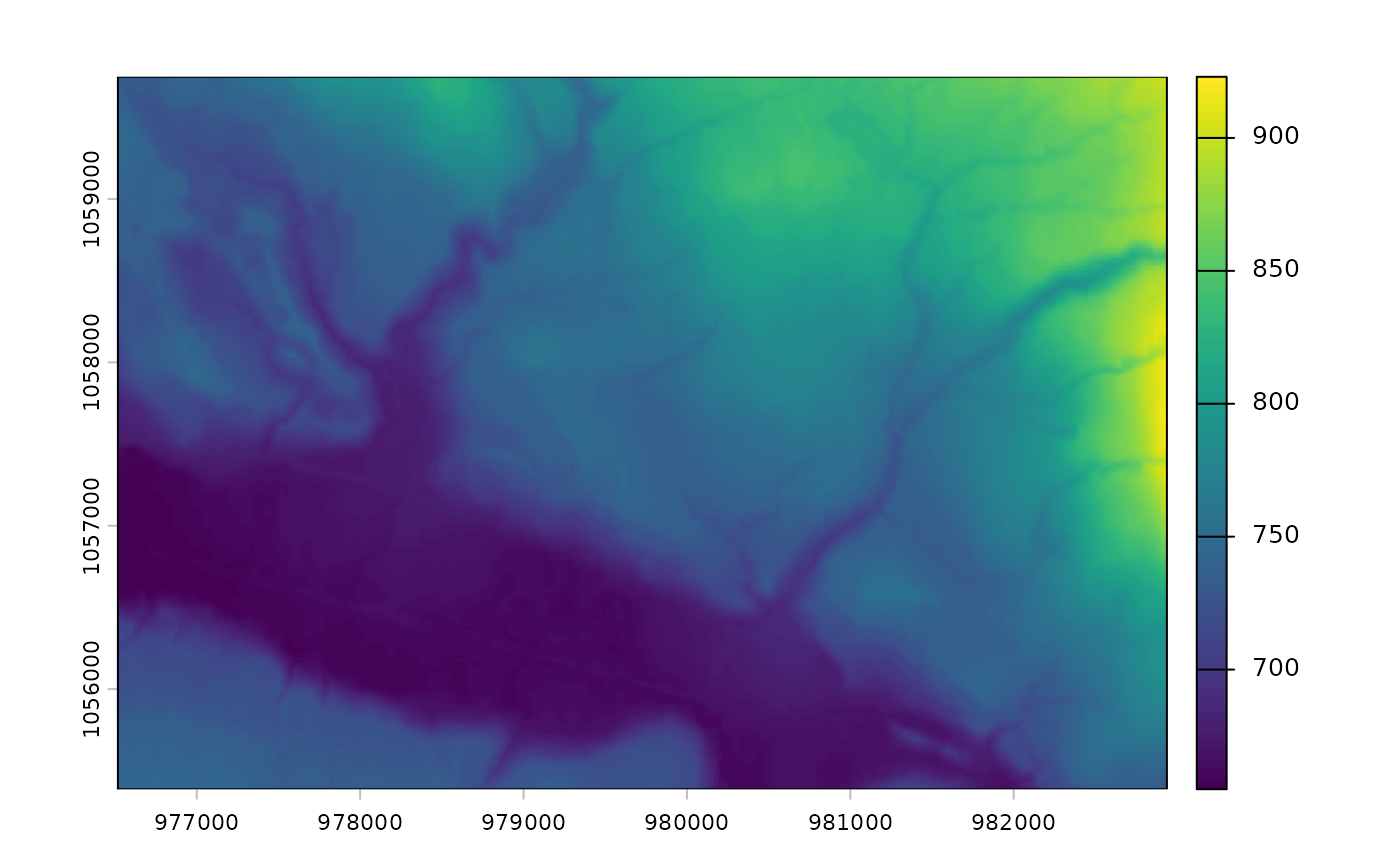
terra::plot(dem)
 if (FALSE) { # \dontrun{
# Default: MRDEM-30 DTM via /vsicurl/ — fetched lazily from NRCan S3
dem <- fl_dem_aoi(aoi, buffer = 2000)
terra::plot(dem, main = "MRDEM-30 over AOI")
# LidarBC via stac-elevation-bc — sub-10 m where lidar coverage exists
bbox_4326 <- sf::st_bbox(sf::st_transform(aoi, 4326))
items <- rstac::stac("https://images.a11s.one/") |>
rstac::stac_search(
collections = "stac-elevation-bc",
bbox = unname(bbox_4326)
) |>
rstac::post_request() |>
rstac::items_fetch()
if (length(items$features) > 0L) {
cog <- paste0("/vsicurl/", items$features[[1]]$assets$dem$href)
dem_lidar <- fl_dem_aoi(aoi, source = cog, buffer = 100)
}
} # }
if (FALSE) { # \dontrun{
# Default: MRDEM-30 DTM via /vsicurl/ — fetched lazily from NRCan S3
dem <- fl_dem_aoi(aoi, buffer = 2000)
terra::plot(dem, main = "MRDEM-30 over AOI")
# LidarBC via stac-elevation-bc — sub-10 m where lidar coverage exists
bbox_4326 <- sf::st_bbox(sf::st_transform(aoi, 4326))
items <- rstac::stac("https://images.a11s.one/") |>
rstac::stac_search(
collections = "stac-elevation-bc",
bbox = unname(bbox_4326)
) |>
rstac::post_request() |>
rstac::items_fetch()
if (length(items$features) > 0L) {
cog <- paste0("/vsicurl/", items$features[[1]]$assets$dem$href)
dem_lidar <- fl_dem_aoi(aoi, source = cog, buffer = 100)
}
} # }