
Estimate photo footprint polygons from centroids and scale
Source:R/fly_footprint.R
fly_footprint.RdCreates rectangular polygons representing the estimated ground coverage of each airphoto, based on film negative dimensions and the reported scale.
Arguments
- centroids_sf
An sf point object with a
scalecolumn (e.g. "1:31680"). Amediacolumn (e.g."Film - BW","Digital - Colour") selects the recording format per frame when present. Geometry must be POINT.sf::st_coordinates()returns one row per vertex for anything else, so a POLYGON input silently multiplies the rows by the vertex count; this is refused rather than coerced, because re-estimating a footprint from the centroid of an estimated footprint is not meaningful.- negative_size
Negative dimension in inches (default 9 for standard 9" x 9"). Applies to film frames —
media"Film - BW","Film - Colour","Film - BW IR"and"Film - Colour IR"— and to every frame when there is nomediacolumn. It never sizes a digital frame — seeformat_size.- format_size
Named numeric vector of recording-format widths in inches, keyed by
mediavalue, merged over the shipped film defaults. Frames it names are sized from the reportedscale, as film is, and it takes precedence over the shipped camera table — it is the escape hatch for a cameraflydoes not know. See Details.- dem
Optional elevation raster used to size each frame from its true height above ground rather than the reported scale. A
terra::SpatRaster, a file path, or a/vsicurl/URL. Requiresflying_heightandfocal_lengthcolumns, and theterrapackage.NULL(default) keeps the flat-terrain behaviour — see Terrain below.
Value
An sf polygon object in the same CRS as input, with footprint
rectangles, a footprint_basis column recording how each was sized, a
footprint_terrain column recording which terrain treatment was applied,
footprint_bearing giving the flight azimuth each rectangle was rotated
onto (NA where it was drawn axis-aligned because no bearing could be
computed), height_agl giving the metres above ground each was sized from,
height_source recording where that height came from or why there is none
(see Terrain), dem_coverage giving the fraction of each footprint the
DEM actually covered (0 where it covered none, NA only where there is no
footprint), dem_elev_sd giving the standard deviation in metres of the
DEM values under that footprint — NA wherever dem_coverage is, and also
wherever the DEM described fewer than two cells, since a spread needs
two. The common case of the second is a frame the DEM does not reach at all,
which has dem_coverage of 0 rather than NA and so is the one place the
two columns differ. And dem_shortfall_m giving the metres the DEM would
have to extend to contain that footprint, where 0 is an answer: the DEM
already spans the frame, so any missing cells are nodata inside its extent and
no re-crop will recover them.
Frames whose format could not be resolved get an empty geometry. Every
class the input carries is carried through, so a tibble-backed sf — which
is what bcdata::collect() returns — comes back tibble-backed. The order
is not preserved: sf::st_transform() moves sf to the front, so a
bcdc_sf input returns sf, bcdc_sf, ..., as it always has.
Details
Ground coverage is computed as negative_size * scale_number * 0.0254 metres
per side. Rectangles are constructed in BC Albers (EPSG:3005) for accurate
metric distances, then transformed back to the input CRS.
The scale denominator is parsed from the scale column string (e.g.
"1:12000" becomes 12000).
Film and digital are not the same measurement. The 9-inch default
reflects the standard 228 mm negative used by BC aerial survey cameras
(e.g. Wild RC-10, Zeiss RMK). A digital frame has no negative, and the
catalogue mixes the two in one layer — roughly a fifth of frames in a
sampled area are Digital - Colour. Ground width scales with the recording
format, so applying a negative dimension to a sensor produces a rectangle
that is wrong by an unknown factor while still drawing, still overlapping
neighbours, and still yielding a coverage percentage.
Each row is therefore sized from its media value, and footprint_basis
records the outcome:
- the
mediavalue format resolved from the format table: one of the four film values, sized from
negative_size(infrared film since fly#89, measured to be the same 9-inch negative); a value named informat_size; or a digital frame whose camera the shipped table resolved by calibration or PAT-B identity"inferred_format"digital frame with no calibration and no camera named in its PAT-B file, sized from a format inferred from its
focal_length"assumed_default"no
mediacolumn;negative_sizeapplied"unknown_format"mediapresent but unknown; empty geometry
Digital frames
A digital frame has no negative, and the catalogue mixes film and digital in one
layer — 223,667 of 1,670,471 frames province-wide are Digital - Colour. Sensor
dimensions are not in the centroid metadata, but they are recoverable from the
calibration report each frame links to through camera_calibration_url, and fly
ships them (inst/extdata/camera_formats.csv, built by
data-raw/make_camera_formats.R).
Digital frames are sized as pixel count x ground_sample_distance, which needs
neither scale nor a DEM. scale is never used for a digital frame fly sized
itself. That field is not the true image scale for digital: measured against
terrain on 40 UltraCam Eagle frames it gives 34% of true width, because it is a
derived nominal figure — the pixel pitch it implies is about 12.5 um for every
camera regardless of model, against real pitches of 3.9 to 12 um.
ground_sample_distance is in centimetres.
Where a frame carries no camera_calibration_url — about a fifth of digital frames —
there are two remaining routes, in this order.
The catalogue publishes the camera that flew the frame in the per-frame
georeferencing file it links through patb_georef_url. fly_camera_patb() fetches
and parses those and attaches camera_serial, camera_name and patb_gsd; where
those columns are present, fly_footprint() sizes the frame from the named sensor on
the ordinary px x GSD route, needing no DEM, and width_source records
patb_serial= or patb_camera=. patb_gsd is used only where the catalogue's own
ground_sample_distance is absent or zero, which it is for whole years of digital
imagery. This function never reaches the network itself.
Failing that, the format is inferred from focal_length and footprint_basis records
"inferred_format". Sensor width spreads only 1-3% at a given focal length, but
pixel count spreads 32-83%, so an inferred frame can only be sized through a DEM
(width x height above ground / focal length) and never from its GSD.
width_source names the calibration file, camera or fallback rule per row, so every
footprint traces back to a source — and so does every refusal. Calibrations that could
not be corroborated are listed in inst/extdata/camera_formats_excluded.csv with the
reason, and frames naming one are refused rather than inferred (withheld:). A camera
identity the shipped table does not recognise is likewise refused rather than guessed
from the model string beside it (unknown_serial:, unknown_camera:,
ambiguous_serial:); unlike a withheld calibration, that refusal does not block the
focal-length inference, because it says nothing about the sensor's size.
Every footprint is rotated onto the flight line using fly_bearing(), and
footprint_bearing records the azimuth each was rotated onto. Where no bearing can
be computed — a single-frame roll, or absent film_roll / frame_number columns —
the rectangle stays axis-aligned, footprint_bearing is NA and width_source
says so.
Digital sensors are not square, running from 1.10:1 (Leica DMC II) to 1.80:1 (Intergraph DMC), so rotating them is visibly load-bearing. Film is square, which is why rotating it was deferred until fly#26 — but a square rotated 45 degrees overlaps its axis-aligned self by only about 83%, so leaving film alone was not neutral. It was reporting coverage of ground the frame does not photograph. Film footprints on off-cardinal headings therefore move as of v0.9.0.
Supply format_size to size a frame fly cannot, or to override it:
fly_footprint(photos, format_size = c("Digital - Colour" = 3.54))Filter on footprint_basis to keep only frames sized from a known format.
Focal length and flying height are available. FOCAL_LENGTH,
FLYING_HEIGHT and SCALE are fully populated in
WHSE_IMAGERY_AND_BASE_MAPS.AIMG_PHOTO_CENTROIDS_SP and carried through to
the bundled test data. Note the field is SCALE, not PHOTO_SCALE — the
latter returns all NULL, which reads as missing data rather than a wrong
field name.
Terrain
Without dem, footprints are sized from the reported scale, which assumes
flat ground at whatever elevation the scale was computed for. That assumption
costs more than it looks: on the bundled Upper Bulkley AOI the reported scale
understates footprint area by a median 14%, ranging to 26% — and always in
the same direction, because the scale is referenced to an elevation above the
valley floor the photos actually cover.
Supplying dem removes that bias. FLYING_HEIGHT is metres above sea level,
not height above ground, so subtracting terrain elevation is what turns it
into the height ground coverage actually scales with:
height above ground = flying_height - terrain elevation
ground width        = format width * (height above ground / focal length)
Elevation is the mean under the whole footprint, not a reading at the centroid — on a 7.2 km wide 1:31680 frame the two differ by up to 140 m. That is measured in two passes, because the footprint being averaged over is itself what the correction changes: the first pass averages over the nominal-scale rectangle, the second over the rectangle the first produced. The second pass is a refinement rather than the substance — it moves area by at most 0.5% against the correction's own 14% — and a third moves it by 0.03%, so two is where this settles.
footprint_terrain records what happened to each frame:
"nominal_scale"sized from the reported scale (no
dem, or a fallback — see below)"gsd_scaled"digital frame sized from its pixel count and ground sample distance; used neither the reported scale nor a DEM, so
height_aglanddem_coverageareNA"dem_agl"sized from height above ground
"no_dem_coverage"demsupplied but does not cover the frameNAno footprint to place — see
footprint_basis
A frame the DEM cannot correct falls back to nominal scale with a warning,
rather than being dropped. The same applies where the DEM puts terrain at or
above the aircraft, which means flying_height is not in metres ASL.
Or that the frame is not where the catalogue puts it. On five roll-heights
(bc77026 2042 m, bc77070 1158 m, bc77072 1829 m and 1981 m, bc77087
1158 m) the logbook pages write the catalogued height above sea level for at
least 90% of the frames they read, and the photos show the catalogue's step
between centroids is
longer than the air base (fly#97), so a second warning names any of their frames
that land under the terrain, keyed on film_roll, flying_height,
focal_length and scale. The label is per roll-height: not every frame on
them is read by the logbook, bc77087's page rests on a digit settled by a read
that was not blind (fly#101), and bc77070's step margin is at the instrument's
resolution. The footprint is unchanged, still drawn at the centroid, and nothing
is added to the output. The list is the roll-heights labelled so far, read from
inst/extdata/flying_height_image_overlap_keys.csv, not a census: an unlisted
roll-height is not thereby clean. Most were never measured, and four that fly#97
measured carry another label. Which frames are named depends on your DEM,
and only frames under the terrain are. Of the 311 frames on these roll-heights
that fly#93's census holds (those in band above sea level but below it over the
ground, and those under the terrain),
112 are under MRDEM's terrain; the other 199 are below the band and refused by
the height check with its own warning. Frames in band are sized from the DEM as
usual. Without dem, nothing is named.
flying_height is checked before it is believed. Sizing from it means
inheriting whatever is wrong with it, and the catalogue's is about 10.76 times
(3.28084 squared) too large on 1,589 film frames from 13 rolls flown between
1974 and 2005 — a feet-to-metres conversion applied the wrong way round, which
draws a 1:35000 frame 110 km across. On six roll-heights flown 1978-2000 the flight
logbooks show the factor is exactly 10 instead (fly#71), and those frames are
carried in the roll table below, as are two more that the same roll's
adjacent frames settle (fly#74). A film frame states its height above
ground twice, as flying_height minus terrain and as scale times focal length,
so the two are compared, and height_source records the outcome:
"reported"the two agree to within a factor of 1.6, as 99% of frames do; sized from
flying_heightas supplied"corrected_unit_slip"they disagree, and dividing
flying_heightby 10.76 brings them back into agreement; sized from the corrected height.height_aglis the height used. Yourflying_heightcolumn is not overwritten, so on these rowsflying_height - height_aglis not the ground elevation"corrected_roll_table"they disagree, and the frame sits on one of the roll-heights in
inst/extdata/flying_height_rolls.csv, which the province's flight logbooks, or failing them an adjacent frame on the same roll in an exact named relation, together with the spacing between adjacent frames, settled (fly#60, fly#71, fly#72, fly#74, fly#91): a height with one or two digits dropped (a logbook "20.0", thousands of feet, catalogued as 2,000 ft), a height recorded ten times too large, a leading digit added, or a correct height beside a wrongscale— on either side of the band, including frames around twice their nominal scale whosescaleis recorded at half its denominator. Checked before the 10.76 slip above. Sized from the measured height; matched onfilm_roll,flying_height,focal_lengthandscaletogether, so it needs afilm_rollcolumn. As with the slip,flying_heightis not overwritten"implausible"they disagree some other way, or
flying_heightis above 16,000 m or below the terrain. Nothing can say whether the height, the scale or the focal length is the wrong one — a 305 mm lens catalogued as 153 and a scale recorded at half its denominator look the same from here, and the roll table separates them only where it was measured — so the height is not used: a film frame falls back to nominal scale, and a digital frame with no other route has no footprintNAno height was judged: no
dem, a frame the DEM route does not size (one sized from its ground sample distance, or with no footprint at all for another reason), one the DEM does not cover, orflying_heightorfocal_lengthmissing — except that a height above 16,000 m is"implausible"even wherefocal_lengthis missing
Measured over the whole catalogue, the two corrections for a height that is too
large apply to those 1,589 frames and to nothing else: 308 by the roll table,
the rest by 10.76. (The table's factor-1 rows correct a scale, not a height, so
they are not among them.) A digital frame's scale is a nominal figure, not
its image scale, so it is not compared: only the 16,000 m ceiling, or terrain at
or above the aircraft, can refuse one. To list the frames worth a second look:
dplyr::filter(fp, height_source != "reported").
Still assumed, with or without a DEM: the camera points straight down. The BC catalogue carries no tilt, roll or crab, so footprints stay axis-aligned rectangles and corner rays are not projected individually. On this AOI that per-corner refinement is worth roughly 2%, against the 14% the DEM addresses.
DEM sources. Any raster terra can open works. Three that suit BC:
MRDEM-30 — NRCan's 30 m bare-earth DTM, all of Canada, public and unauthenticated. A good default, and what the bundled
dem.tifis cut from:/vsicurl/https://canelevation-dem.s3.ca-central-1.amazonaws.com/mrdem-30/mrdem-30-dtm.tifReading it over/vsicurl/needs no download: the DEM is sampled through one window per frame, so two frames take seconds rather than the minutes a whole-vector read cost before 0.13.0.LidarBC — sub-10 m where coverage exists; query the
stac-elevation-bcSTAC catalogue and pass an item's COG URL.BC TRIM — 25 m provincial DEM via the
bcdataCLI (bcdata get-dem).
Bare earth or surface model. Over forest the camera images the canopy, so
a bare-earth DEM draws a frame slightly too wide. Measured against MRDEM's own
DSM (mrdem-30-dsm.tif, on the DTM's grid), that is a weighted median 0.17%
of width and 0.46% at the 95th percentile, with 2.1% of fine-scale frames over
1% — under what the package acts on, so the DTM stays the recommendation.
Either surface works; note that a canopy also feeds the flying_height check,
so a frame near the edge of the band can change height_source between them.
See inst/notes/terrain-correction.md (fly#80).
Resolution matters less here than extent. A 30 m DEM resolves a 2.7 km
footprint's mean elevation perfectly well; a DEM that stops short of the
frame edges does not, and this is the ordinary failure rather than an exotic
one — a DEM cropped to an AOI simply stops. no_dem_coverage is reached only
when a footprint finds no elevation at all. A footprint that is merely
truncated is still corrected, from the mean of the part the DEM described,
and warns once that falls below 95%. dem_coverage reports the fraction per
frame — measured against the cells the footprint should have covered, not the
cells that came back — so a truncated footprint can be filtered rather than
merely noticed.
Two remedies, and the column that tells them apart. Partial coverage has
two causes that dem_coverage reports identically. A DEM whose extent stops
short of the frame can be re-cropped and the frame recovered exactly, and
dem_shortfall_m says by how much — max(fp$dem_shortfall_m) is the buffer
that would contain every footprint in the batch. A DEM with nodata inside its
extent cannot be re-cropped at all, and reports 0. Against a remote MRDEM
read the shortfall is always 0, because the window is fetched per frame;
the first case is what a DEM cropped to an area of interest produces.
What truncation costs, and why two columns report it. Measured over 11,520
truncations of 120 real frames against each frame's own full-coverage answer:
the error is exactly the elevation bias divided by the height above ground, so
it is a median 0.18% of footprint width at 80-90% coverage, 0.34% at 60-80%,
and 1.5% below 20% — but it reaches 24% on broken ground. The median is not
what one frame is exposed to: at a fixed dem_coverage the error spans 13 to
52 times between frames, which is why dem_elev_sd ships beside it. Frames
above the median spread for their coverage sit 2.3 to 4.1 times further from the
full-coverage answer than those below it. Read the pair together — coverage
says how much is missing, dem_elev_sd says how much that could be worth — and
see inst/notes/terrain-correction.md for the distribution and its limits.
Falling back to nominal scale is not the better answer at any coverage: the
DEM route beats it in the median even below 20% covered.
A coastal frame is sized from land and sea together. MRDEM carries
near-shore sea at about 0.14 m, not nodata, so the mean takes in the sea
surface the photo images and dem_coverage stays near 1. Against a ray-cast
of the true footprint on bare earth, that is closer on area than the
land-only mean, and the land-only mean places the land edge better. The first
holds, to first order, under the canopy BC actually has (fly#80), and matched for
relief the sea does make the land edge worse than it is inland. LidarBC was mostly nodata over sea where probed, so
there the same frame is sized nearer the land-only mean. See inst/notes/terrain-correction.md (fly#65).
Buffer past the corner of the widest footprint, not its half-side: the
far point of a square is half_side * sqrt(2), which at 1:31680 is 5.1 km
rather than 3.6 km. Allow more again for the correction itself, which
enlarges footprints before the second pass samples them.
A remote DEM is read a window at a time, and each window is one footprint —
so cost scales with the number of frames and never with the distance
between them. Cropping a /vsicurl/ raster to your AOI first still saves a
little where the frames are close together (measured: 1.00 s against 1.23 s
for eight contiguous frames), but it allocates for the whole AOI rather than
one footprint, and it stops paying as the frames spread out — a crop of the
bundled extent costs 4.4 s on its own. Worth doing to work offline; not
worth doing for speed.
Coverage and overlap downstream (e.g. fly_coverage(), fly_overlap())
accept the same dem argument and inherit whichever basis you give them.
Examples
centroids <- sf::st_read(system.file("testdata/photo_centroids.gpkg", package = "fly"))
#> Reading layer `photo_centroids' from data source
#> `/home/runner/work/_temp/Library/fly/testdata/photo_centroids.gpkg'
#> using driver `GPKG'
#> Simple feature collection with 20 features and 16 fields
#> Geometry type: POINT
#> Dimension: XY
#> Bounding box: xmin: -126.7631 ymin: 54.34512 xmax: -126.449 ymax: 54.47635
#> Geodetic CRS: WGS 84
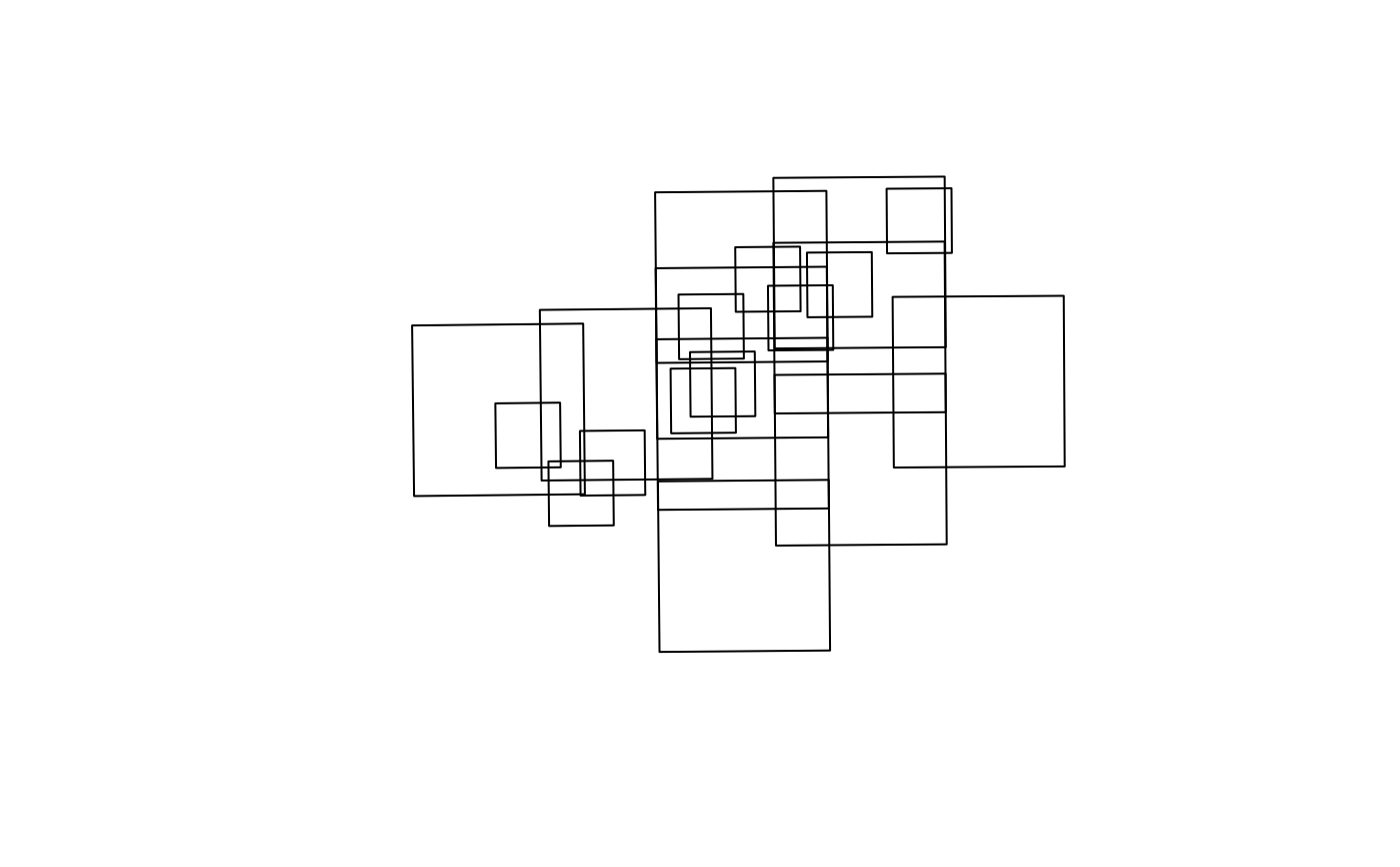
footprints <- fly_footprint(centroids)
plot(sf::st_geometry(footprints))
 # How each footprint was sized
table(footprints$footprint_basis)
#>
#> Film - BW
#> 20
# Keep only frames sized from a known recording format
sized <- footprints[footprints$footprint_basis != "unknown_format", ]
nrow(sized)
#> [1] 20
# Terrain-adjusted: size each frame from its height above ground instead of
# the reported scale. On this AOI every footprint grows, by a median 14%.
# terra is Suggests-only, so the DEM path is guarded here.
if (requireNamespace("terra", quietly = TRUE)) {
terrain <- fly_footprint(
centroids,
dem = system.file("testdata/dem.tif", package = "fly")
)
print(round(100 * (as.numeric(sf::st_area(sf::st_transform(terrain, 3005))) /
as.numeric(sf::st_area(sf::st_transform(footprints, 3005))) - 1), 1))
print(table(terrain$footprint_terrain))
}
#> [1] 16.9 11.1 15.3 4.9 0.5 13.4 14.0 2.1 18.1 12.8 16.1 16.0 15.0 11.0 9.0
#> [16] 26.4 6.2 9.1 16.3 15.5
#>
#> dem_agl
#> 20
# How each footprint was sized
table(footprints$footprint_basis)
#>
#> Film - BW
#> 20
# Keep only frames sized from a known recording format
sized <- footprints[footprints$footprint_basis != "unknown_format", ]
nrow(sized)
#> [1] 20
# Terrain-adjusted: size each frame from its height above ground instead of
# the reported scale. On this AOI every footprint grows, by a median 14%.
# terra is Suggests-only, so the DEM path is guarded here.
if (requireNamespace("terra", quietly = TRUE)) {
terrain <- fly_footprint(
centroids,
dem = system.file("testdata/dem.tif", package = "fly")
)
print(round(100 * (as.numeric(sf::st_area(sf::st_transform(terrain, 3005))) /
as.numeric(sf::st_area(sf::st_transform(footprints, 3005))) - 1), 1))
print(table(terrain$footprint_terrain))
}
#> [1] 16.9 11.1 15.3 4.9 0.5 13.4 14.0 2.1 18.1 12.8 16.1 16.0 15.0 11.0 9.0
#> [16] 26.4 6.2 9.1 16.3 15.5
#>
#> dem_agl
#> 20