Appendix - Phase 1 Fish Passage Assessment Data and Photos
| Location and Stream Data |
|
Crossing Characteristics | – |
|---|---|---|---|
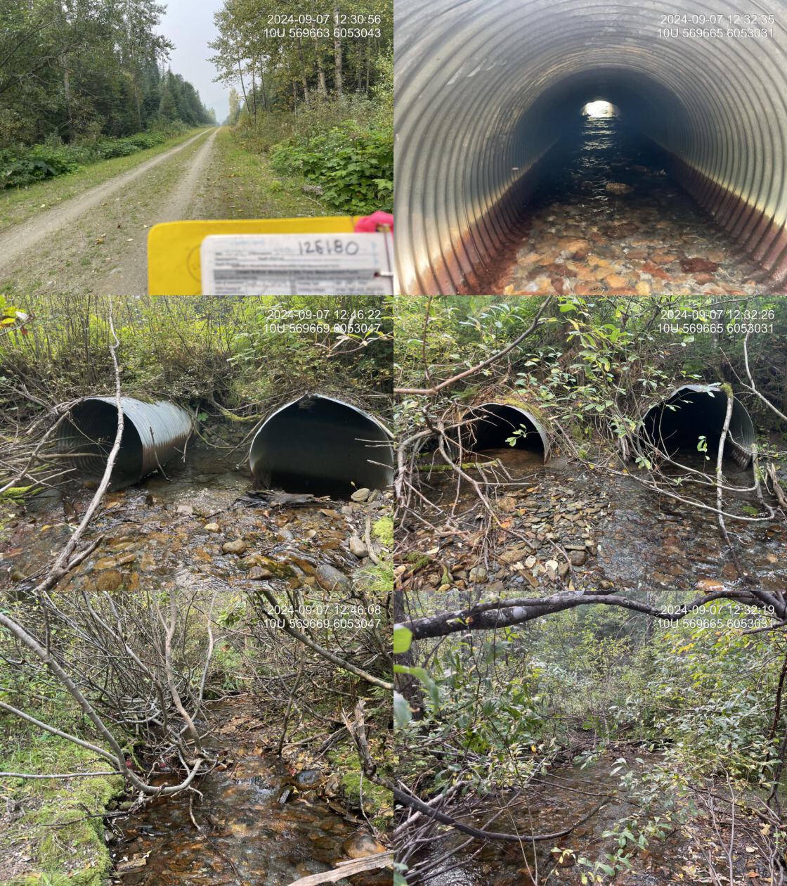
| Date | 2024-09-07 | Crossing Sub Type | Round Culvert |
| PSCIS ID | 125180 | Diameter (m) | 2.4 |
| External ID | – | Length (m) | 16 |
| Crew | LS AI | Embedded | Yes |
| UTM Zone | 10 | Depth Embedded (m) | 0.2 |
| Easting | 569665 | Resemble Channel | Yes |
| Northing | 6053047 | Backwatered | No |
| Stream | Tributary to Missinka River | Percent Backwatered | – |
| Road | Chuchinka-Missinka FSR | Fill Depth (m) | 1 |
| Road Tenure | Winton R01821 51A | Outlet Drop (m) | 0 |
| Channel Width (m) | 4.1 | Outlet Pool Depth (m) | 0 |
| Stream Slope (%) | 4 | Inlet Drop | Yes |
| Beaver Activity | No | Slope (%) | 2 |
| Habitat Value | Medium | Valley Fill | Deep Fill |
| Final score | 19 | Barrier Result | Potential |
| Fix type | Replace with New Open Bottom Structure | Fix Span / Diameter | 15 |
| Comments: Two pipes each at 1.2m in diameter, with one showing an inlet drop. Both pipes are embedded, except for 1 m at the inlet of one pipe, allowing them to function as embedded culverts, resulting in a low priority for replacement. The habitat is high quality, featuring deep pools and gravels. Rainbow trout ranging from 40-140 mm were captured during sampling.. 12:26:48 | |||
| Photos: PSCIS ID 125180. From top left clockwise: Road/Site Card, Barrel, Outlet, Downstream, Upstream, Inlet. | |||
|
| Location and Stream Data |
|
Crossing Characteristics | – |
|---|---|---|---|
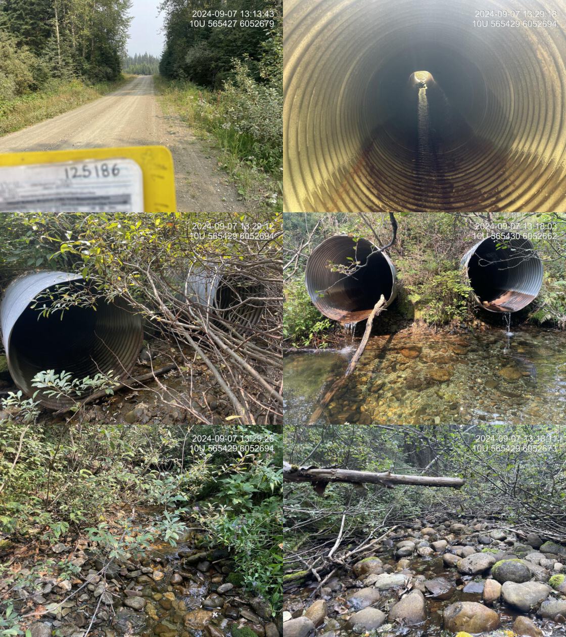
| Date | 2024-09-07 | Crossing Sub Type | Round Culvert |
| PSCIS ID | 125186 | Diameter (m) | 2.4 |
| External ID | – | Length (m) | 18 |
| Crew | LS AI | Embedded | No |
| UTM Zone | 10 | Depth Embedded (m) | – |
| Easting | 565424 | Resemble Channel | No |
| Northing | 6052679 | Backwatered | No |
| Stream | Tributary to Missinka River | Percent Backwatered | – |
| Road | Chuchinka-Missinka FSR | Fill Depth (m) | 1.5 |
| Road Tenure | Winton R01821 51A | Outlet Drop (m) | 0.34 |
| Channel Width (m) | 2.8 | Outlet Pool Depth (m) | 0.85 |
| Stream Slope (%) | 5 | Inlet Drop | No |
| Beaver Activity | No | Slope (%) | 4 |
| Habitat Value | Medium | Valley Fill | Deep Fill |
| Final score | 36 | Barrier Result | Barrier |
| Fix type | Replace with New Open Bottom Structure | Fix Span / Diameter | 15 |
| Comments: Two 1.2 m diameter pipes are present, with a significant outlet drop and a deep outlet pool. The habitat was good and consisted of cobbles, boulders, and woody debris, providing complexity and cover for fish.The stream flows into the inlet from the east but goes subsurface approximately 10 m upstream, with occasional small, shallow pools. The well-defined stream channel suggests it often carries higher flows. A wetland area to the east of the inlet likely contributes flow to the stream. An ~8 m wide area directly in front of the inlet was dry at the time of assessment but showed evidence of flowing water during higher flows.. 13:14:10 | |||
| Photos: PSCIS ID 125186. From top left clockwise: Road/Site Card, Barrel, Outlet, Downstream, Upstream, Inlet. | |||
|
| Location and Stream Data |
|
Crossing Characteristics | – |
|---|---|---|---|
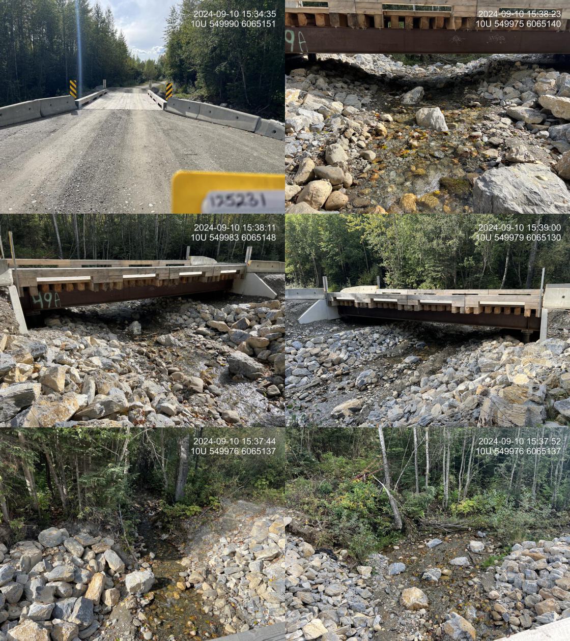
| Date | 2024-09-10 | Crossing Sub Type | Bridge |
| PSCIS ID | 125231 | Diameter (m) | 12.2 |
| External ID | – | Length (m) | 5 |
| Crew | AI LS | Embedded | – |
| UTM Zone | 10 | Depth Embedded (m) | – |
| Easting | 549973 | Resemble Channel | – |
| Northing | 6065136 | Backwatered | – |
| Stream | Tributary to Table River | Percent Backwatered | – |
| Road | Chuchinka-Table FSR | Fill Depth (m) | – |
| Road Tenure | Canfor R09333 UZ6_16 | Outlet Drop (m) | – |
| Channel Width (m) | – | Outlet Pool Depth (m) | – |
| Stream Slope (%) | – | Inlet Drop | – |
| Beaver Activity | No | Slope (%) | – |
| Habitat Value | – | Valley Fill | – |
| Final score | 0 | Barrier Result | Passable |
| Fix type | – | Fix Span / Diameter | – |
| Comments: Culvert replaced with Bridge by Canfor in the summer of 2024 with environmental oversight and engineering from DWB. Very nicely designed structure that fits the stream channel well. Minimal rock placement within areas likely to be within the natural channel with not constricting the channel. It is recommended that future projects incorporate vegetated riprap and reinstall the vegetation removed from the construction footprint within the same area.. 15:35:51 | |||
| Photos: PSCIS ID 125231. From top left clockwise: Road/Site Card, Barrel, Outlet, Downstream, Upstream, Inlet. | |||
|
| Location and Stream Data |
|
Crossing Characteristics | – |
|---|---|---|---|
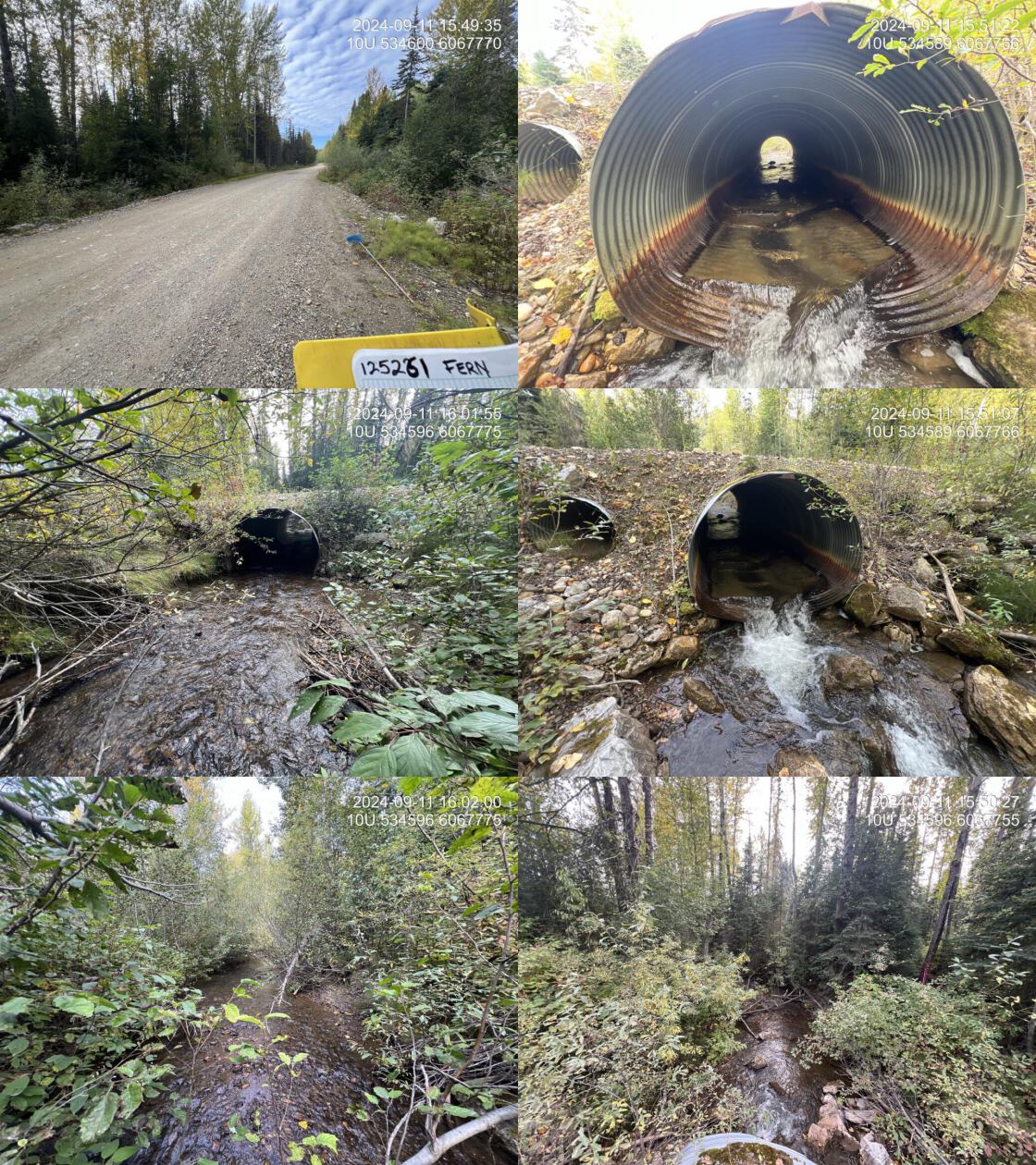
| Date | 2024-09-11 | Crossing Sub Type | Round Culvert |
| PSCIS ID | 125261 | Diameter (m) | 2.15 |
| External ID | – | Length (m) | 12 |
| Crew | AI | Embedded | No |
| UTM Zone | 10 | Depth Embedded (m) | – |
| Easting | 534595 | Resemble Channel | No |
| Northing | 6067775 | Backwatered | No |
| Stream | Fern Creek | Percent Backwatered | – |
| Road | Chuchinka-Table FSR | Fill Depth (m) | 0.5 |
| Road Tenure | MoF | Outlet Drop (m) | 0.23 |
| Channel Width (m) | 5 | Outlet Pool Depth (m) | 0.15 |
| Stream Slope (%) | 1.5 | Inlet Drop | No |
| Beaver Activity | Yes | Slope (%) | 2 |
| Habitat Value | High | Valley Fill | Deep Fill |
| Final score | 26 | Barrier Result | Barrier |
| Fix type | Replace with New Open Bottom Structure | Fix Span / Diameter | 15 |
| Comments: Reassessed as part of a baseline assessment before hopeful future replacement. Fish sampling was conducted in a 75-meter stretch downstream and a 50-meter stretch upstream of the culvert, and fish 60 mm or greater were tagged with PIT tags. There are baffles made of metal in the culvert and ¾ of the pipe is embedded with streambed material. The outlet of the pipe sits on a large pile of rip rap creating a 30 cm cascade that occurs approximately a meter after the outlet of the pipe. There are two overflow pipes each at 0.9 m in diameter. . 15:58:48 | |||
| Photos: PSCIS ID 125261. From top left clockwise: Road/Site Card, Barrel, Outlet, Downstream, Upstream, Inlet. | |||
|
| Location and Stream Data |
|
Crossing Characteristics | – |
|---|---|---|---|
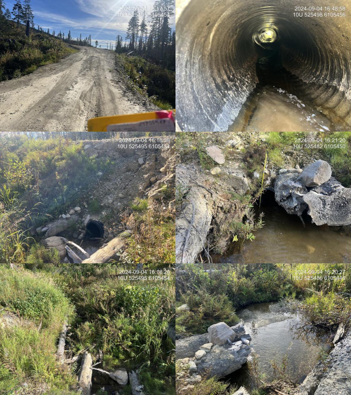
| Date | 2024-09-04 | Crossing Sub Type | Round Culvert |
| PSCIS ID | 199662 | Diameter (m) | 0.45 |
| External ID | 24755467 | Length (m) | 12 |
| Crew | AI | Embedded | No |
| UTM Zone | 10 | Depth Embedded (m) | – |
| Easting | 525498 | Resemble Channel | No |
| Northing | 6105456 | Backwatered | No |
| Stream | Tributary to Colbourne Creek | Percent Backwatered | – |
| Road | Chuchinka-Colbourne FSR | Fill Depth (m) | 1.8 |
| Road Tenure | MoF | Outlet Drop (m) | 0 |
| Channel Width (m) | 1 | Outlet Pool Depth (m) | 0.2 |
| Stream Slope (%) | 4 | Inlet Drop | No |
| Beaver Activity | No | Slope (%) | 4 |
| Habitat Value | Low | Valley Fill | Deep Fill |
| Final score | 26 | Barrier Result | Barrier |
| Fix type | Replace Structure with Streambed Simulation CBS | Fix Span / Diameter | 3 |
| Comments: Small stream system with low habitat value. Limited flow volume and minimal channel structure, with sparse instream features such as large woody debris, pools, or gravels. Riparian vegetation consists of grasses, ferns, and small shrubs, providing minimal shading and bank stability. Slope estimated visually. . 16:12:04 | |||
| Photos: PSCIS ID 24755467. From top left clockwise: Road/Site Card, Barrel, Outlet, Downstream, Upstream, Inlet. | |||
|
| Location and Stream Data |
|
Crossing Characteristics | – |
|---|---|---|---|
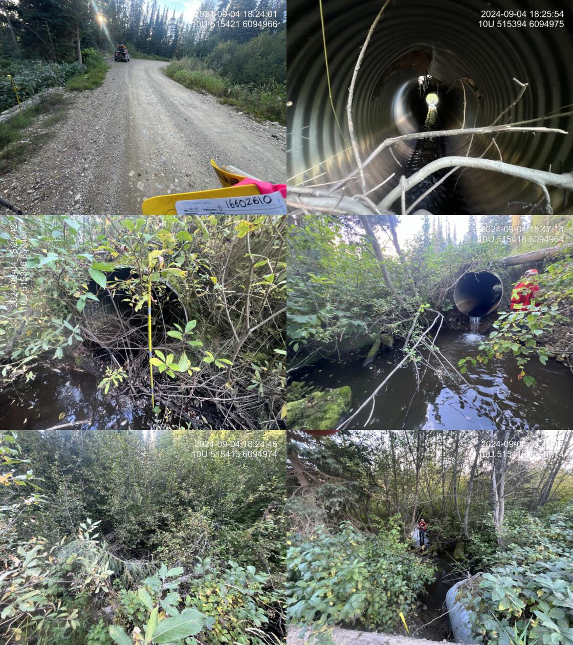
| Date | 2024-09-04 | Crossing Sub Type | Round Culvert |
| PSCIS ID | 199663 | Diameter (m) | 1.2 |
| External ID | 16602610 | Length (m) | 13 |
| Crew | AI LS | Embedded | No |
| UTM Zone | 10 | Depth Embedded (m) | – |
| Easting | 515397 | Resemble Channel | No |
| Northing | 6094977 | Backwatered | No |
| Stream | Tributary to Colbourne Creek | Percent Backwatered | – |
| Road | CHCO 11000 FSR | Fill Depth (m) | 0.5 |
| Road Tenure | BCTS | Outlet Drop (m) | 0.6 |
| Channel Width (m) | 2.5 | Outlet Pool Depth (m) | 0.4 |
| Stream Slope (%) | 1 | Inlet Drop | No |
| Beaver Activity | Yes | Slope (%) | 3 |
| Habitat Value | Medium | Valley Fill | Deep Fill |
| Final score | 36 | Barrier Result | Barrier |
| Fix type | Replace with New Open Bottom Structure | Fix Span / Diameter | 15 |
| Comments: The system has good flow and a significant outlet drop. Upstream substrate consists primarily of fine materials, likely indicating limited habitat complexity for fish.. 18:21:40 | |||
| Photos: PSCIS ID 16602610. From top left clockwise: Road/Site Card, Barrel, Outlet, Downstream, Upstream, Inlet. | |||
|
| Location and Stream Data |
|
Crossing Characteristics | – |
|---|---|---|---|
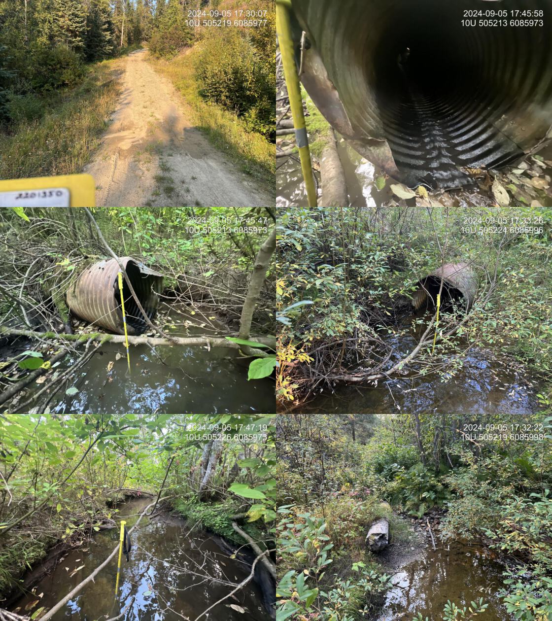
| Date | 2024-09-05 | Crossing Sub Type | Round Culvert |
| PSCIS ID | 199664 | Diameter (m) | 0.95 |
| External ID | 2201350 | Length (m) | 33 |
| Crew | AI | Embedded | No |
| UTM Zone | 10 | Depth Embedded (m) | – |
| Easting | 505221 | Resemble Channel | No |
| Northing | 6085999 | Backwatered | Yes |
| Stream | Tributary to McLeod Lake | Percent Backwatered | 30 |
| Road | Unnamed | Fill Depth (m) | 4.5 |
| Road Tenure | Canfor R02916 Q | Outlet Drop (m) | 0 |
| Channel Width (m) | 2.3 | Outlet Pool Depth (m) | 0.55 |
| Stream Slope (%) | 1 | Inlet Drop | No |
| Beaver Activity | No | Slope (%) | 10 |
| Habitat Value | Medium | Valley Fill | Deep Fill |
| Final score | 32 | Barrier Result | Barrier |
| Fix type | Replace with New Open Bottom Structure | Fix Span / Diameter | 19.5 |
| Comments: A low-gradient, low-energy system with moderate flow. Fish were observed downstream near the highway crossing. The culvert was deteriorating and was poorly installed, causing significant upstream water backup. Medium value habitat due to dense riparian vegetation, including shrubs and ferns.NULL. 17:35:22 | |||
| Photos: PSCIS ID 2201350. From top left clockwise: Road/Site Card, Barrel, Outlet, Downstream, Upstream, Inlet. | |||
|
| Location and Stream Data |
|
Crossing Characteristics | – |
|---|---|---|---|
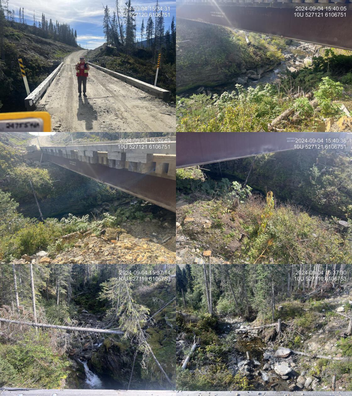
| Date | 2024-09-04 | Crossing Sub Type | Bridge |
| PSCIS ID | 199665 | Diameter (m) | 22.5 |
| External ID | 24755464 | Length (m) | 5 |
| Crew | AI LS | Embedded | – |
| UTM Zone | 10 | Depth Embedded (m) | – |
| Easting | 527121 | Resemble Channel | – |
| Northing | 6106753 | Backwatered | – |
| Stream | Tributary to Colbourne Creek | Percent Backwatered | – |
| Road | Chuchinka-Colbourne FSR | Fill Depth (m) | – |
| Road Tenure | MoF | Outlet Drop (m) | – |
| Channel Width (m) | – | Outlet Pool Depth (m) | – |
| Stream Slope (%) | – | Inlet Drop | – |
| Beaver Activity | No | Slope (%) | – |
| Habitat Value | – | Valley Fill | – |
| Final score | 0 | Barrier Result | Passable |
| Fix type | – | Fix Span / Diameter | – |
| Comments: New bridge in 2024. Small cascades upstream.. 15:27:12 | |||
| Photos: PSCIS ID 24755464. From top left clockwise: Road/Site Card, Barrel, Outlet, Downstream, Upstream, Inlet. | |||
|
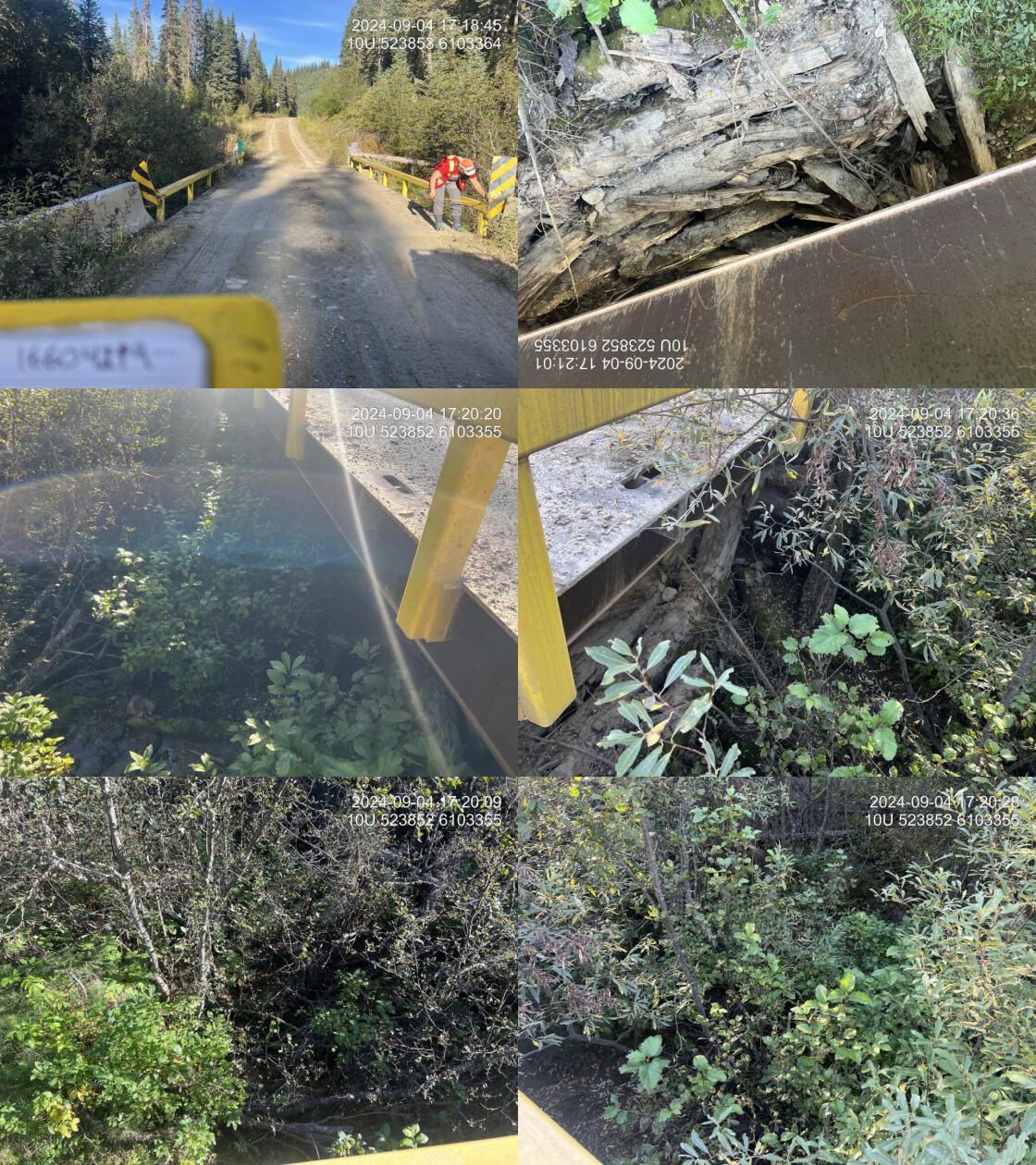
| Location and Stream Data |
|
Crossing Characteristics | – |
|---|---|---|---|
| Date | 2024-09-04 | Crossing Sub Type | Bridge |
| PSCIS ID | 199666 | Diameter (m) | 12 |
| External ID | 16604219 | Length (m) | 5 |
| Crew | AI LS | Embedded | – |
| UTM Zone | 10 | Depth Embedded (m) | – |
| Easting | 523853 | Resemble Channel | – |
| Northing | 6103364 | Backwatered | – |
| Stream | Tributary to Colbourne Creek | Percent Backwatered | – |
| Road | Chuchinka-Colbourne FSR | Fill Depth (m) | – |
| Road Tenure | MoF | Outlet Drop (m) | – |
| Channel Width (m) | – | Outlet Pool Depth (m) | – |
| Stream Slope (%) | – | Inlet Drop | – |
| Beaver Activity | No | Slope (%) | – |
| Habitat Value | – | Valley Fill | – |
| Final score | 0 | Barrier Result | Passable |
| Fix type | – | Fix Span / Diameter | – |
| Comments: New bridge in 2024. . 17:17:22 | |||
| Photos: PSCIS ID 16604219. From top left clockwise: Road/Site Card, Barrel, Outlet, Downstream, Upstream, Inlet. | |||
|
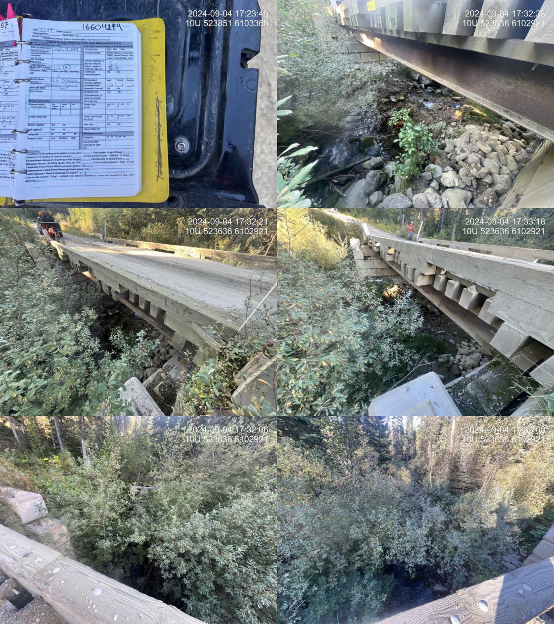
| Location and Stream Data |
|
Crossing Characteristics | – |
|---|---|---|---|
| Date | 2024-09-04 | Crossing Sub Type | Bridge |
| PSCIS ID | 199667 | Diameter (m) | 12 |
| External ID | 16602775 | Length (m) | 5 |
| Crew | AI LS | Embedded | – |
| UTM Zone | 10 | Depth Embedded (m) | – |
| Easting | 523637 | Resemble Channel | – |
| Northing | 6102924 | Backwatered | – |
| Stream | Tributary to Colbourne Creek | Percent Backwatered | – |
| Road | Chuchinka-Colbourne FSR | Fill Depth (m) | – |
| Road Tenure | MoF | Outlet Drop (m) | – |
| Channel Width (m) | – | Outlet Pool Depth (m) | – |
| Stream Slope (%) | – | Inlet Drop | – |
| Beaver Activity | No | Slope (%) | – |
| Habitat Value | – | Valley Fill | – |
| Final score | 0 | Barrier Result | Passable |
| Fix type | – | Fix Span / Diameter | – |
| Comments: New bridge in 2024. This is a large stream. . 17:30:20 | |||
| Photos: PSCIS ID 16602775. From top left clockwise: Road/Site Card, Barrel, Outlet, Downstream, Upstream, Inlet. | |||
|
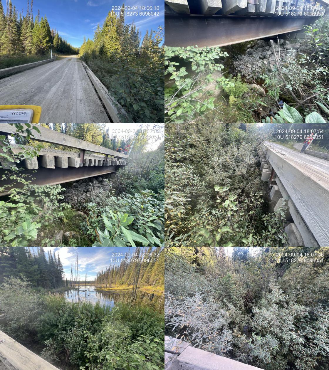
| Location and Stream Data |
|
Crossing Characteristics | – |
|---|---|---|---|
| Date | 2024-09-04 | Crossing Sub Type | Bridge |
| PSCIS ID | 199668 | Diameter (m) | 12 |
| External ID | 16602771 | Length (m) | 5 |
| Crew | AI LS | Embedded | – |
| UTM Zone | 10 | Depth Embedded (m) | – |
| Easting | 518282 | Resemble Channel | – |
| Northing | 6096051 | Backwatered | – |
| Stream | Tributary to Colbourne Creek | Percent Backwatered | – |
| Road | Chuchinka-Colbourne FSR | Fill Depth (m) | – |
| Road Tenure | MoF | Outlet Drop (m) | – |
| Channel Width (m) | – | Outlet Pool Depth (m) | – |
| Stream Slope (%) | – | Inlet Drop | – |
| Beaver Activity | No | Slope (%) | – |
| Habitat Value | – | Valley Fill | – |
| Final score | 0 | Barrier Result | Passable |
| Fix type | – | Fix Span / Diameter | – |
|
Comments: A 3 m high beaver dam is located just upstream of the road, with a large wetland area upstream.. 18:03:41 |
|||
| Photos: PSCIS ID 16602771. From top left clockwise: Road/Site Card, Barrel, Outlet, Downstream, Upstream, Inlet. | |||
|
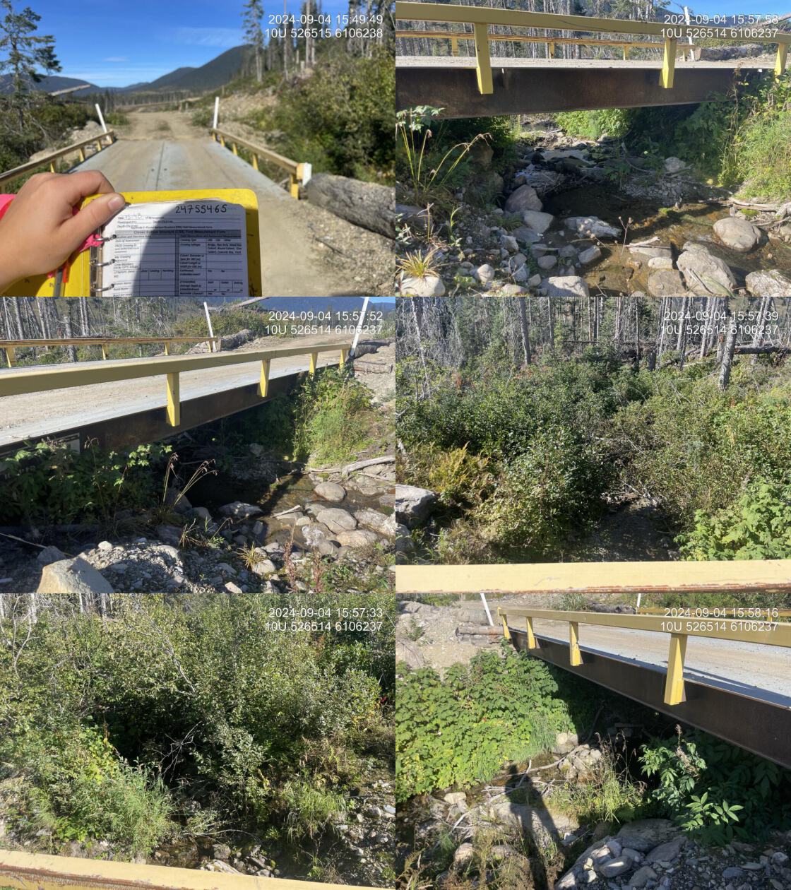
| Location and Stream Data |
|
Crossing Characteristics | – |
|---|---|---|---|
| Date | 2024-09-04 | Crossing Sub Type | Bridge |
| PSCIS ID | 199669 | Diameter (m) | 9.2 |
| External ID | 24755465 | Length (m) | 4 |
| Crew | LS AI | Embedded | – |
| UTM Zone | 10 | Depth Embedded (m) | – |
| Easting | 526514 | Resemble Channel | – |
| Northing | 6106241 | Backwatered | – |
| Stream | Tributary to Colbourne Creek | Percent Backwatered | – |
| Road | Chuchinka-Colbourne FSR | Fill Depth (m) | – |
| Road Tenure | BCTS | Outlet Drop (m) | – |
| Channel Width (m) | – | Outlet Pool Depth (m) | – |
| Stream Slope (%) | – | Inlet Drop | – |
| Beaver Activity | No | Slope (%) | – |
| Habitat Value | – | Valley Fill | – |
| Final score | 0 | Barrier Result | Passable |
| Fix type | – | Fix Span / Diameter | – |
|
Comments: New bridge in 2024. . 15:52:56 |
|||
| Photos: PSCIS ID 24755465. From top left clockwise: Road/Site Card, Barrel, Outlet, Downstream, Upstream, Inlet. | |||
|
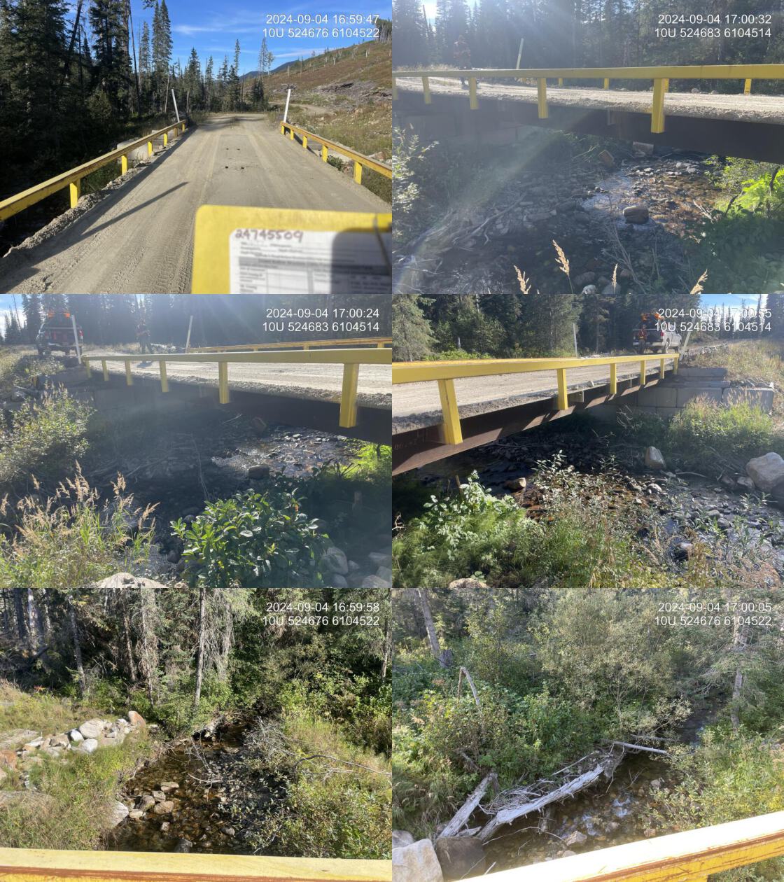
| Location and Stream Data |
|
Crossing Characteristics | – |
|---|---|---|---|
| Date | 2024-09-04 | Crossing Sub Type | Bridge |
| PSCIS ID | 199670 | Diameter (m) | 12.2 |
| External ID | 24745509 | Length (m) | 5 |
| Crew | LS AI | Embedded | – |
| UTM Zone | 10 | Depth Embedded (m) | – |
| Easting | 524680 | Resemble Channel | – |
| Northing | 6104513 | Backwatered | – |
| Stream | Tributary to Colbourne Creek | Percent Backwatered | – |
| Road | Chuchinka-Colbourne FSR | Fill Depth (m) | – |
| Road Tenure | MoF | Outlet Drop (m) | – |
| Channel Width (m) | – | Outlet Pool Depth (m) | – |
| Stream Slope (%) | – | Inlet Drop | – |
| Beaver Activity | No | Slope (%) | – |
| Habitat Value | – | Valley Fill | – |
| Final score | 0 | Barrier Result | Passable |
| Fix type | – | Fix Span / Diameter | – |
|
Comments: New bridge in 2024. . 16:57:19 |
|||
| Photos: PSCIS ID 24745509. From top left clockwise: Road/Site Card, Barrel, Outlet, Downstream, Upstream, Inlet. | |||
|
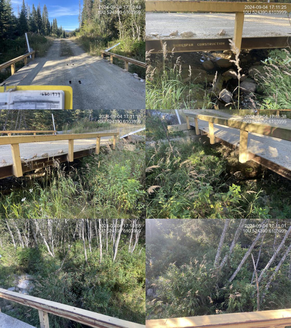
| Location and Stream Data |
|
Crossing Characteristics | – |
|---|---|---|---|
| Date | 2024-09-04 | Crossing Sub Type | Bridge |
| PSCIS ID | 199671 | Diameter (m) | 6.1 |
| External ID | 16601979 | Length (m) | 4 |
| Crew | LS AI | Embedded | – |
| UTM Zone | 10 | Depth Embedded (m) | – |
| Easting | 524391 | Resemble Channel | – |
| Northing | 6104000 | Backwatered | – |
| Stream | Tributary to Colbourne Creek | Percent Backwatered | – |
| Road | Chuchinka-Colbourne FSR | Fill Depth (m) | – |
| Road Tenure | MoF | Outlet Drop (m) | – |
| Channel Width (m) | – | Outlet Pool Depth (m) | – |
| Stream Slope (%) | – | Inlet Drop | – |
| Beaver Activity | No | Slope (%) | – |
| Habitat Value | – | Valley Fill | – |
| Final score | 0 | Barrier Result | Passable |
| Fix type | – | Fix Span / Diameter | – |
|
Comments: New bridge in 2024. . 17:07:54 |
|||
| Photos: PSCIS ID 16601979. From top left clockwise: Road/Site Card, Barrel, Outlet, Downstream, Upstream, Inlet. | |||
|
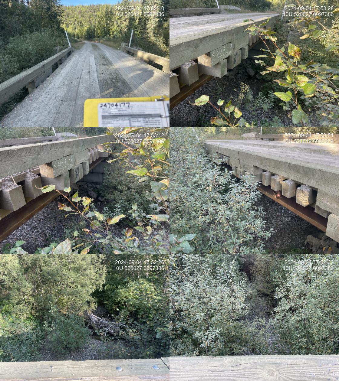
| Location and Stream Data |
|
Crossing Characteristics | – |
|---|---|---|---|
| Date | 2024-09-04 | Crossing Sub Type | Bridge |
| PSCIS ID | 199672 | Diameter (m) | 10 |
| External ID | 24704177 | Length (m) | 5 |
| Crew | LS AI | Embedded | – |
| UTM Zone | 10 | Depth Embedded (m) | – |
| Easting | 520025 | Resemble Channel | – |
| Northing | 6097384 | Backwatered | – |
| Stream | Tributary to Colbourne Creek | Percent Backwatered | – |
| Road | Chuchinka-Colbourne FSR | Fill Depth (m) | – |
| Road Tenure | MoF | Outlet Drop (m) | – |
| Channel Width (m) | – | Outlet Pool Depth (m) | – |
| Stream Slope (%) | – | Inlet Drop | – |
| Beaver Activity | No | Slope (%) | – |
| Habitat Value | – | Valley Fill | – |
| Final score | 0 | Barrier Result | Passable |
| Fix type | – | Fix Span / Diameter | – |
|
Comments: Bridge. Stream was dry at time of assessment. . 17:50:42 |
|||
| Photos: PSCIS ID 24704177. From top left clockwise: Road/Site Card, Barrel, Outlet, Downstream, Upstream, Inlet. | |||
|