Appendix - Phase 1 Fish Passage Assessment Data and Photos
| Location and Stream Data |
|
Crossing Characteristics | – |
|---|---|---|---|
| Date | 2025-09-15 | Crossing Sub Type | Round Culvert |
| PSCIS ID | 203577 | Diameter (m) | 1.5 |
| External ID | 5400047 | Length (m) | 40 |
| Crew | AI | Embedded | No |
| UTM Zone | 9 | Depth Embedded (m) | – |
| Easting | 666752 | Resemble Channel | No |
| Northing | 5984529 | Backwatered | No |
| Stream | Van Lear Creek | Percent Backwatered | – |
| Road | Unnamed | Fill Depth (m) | 2.5 |
| Road Tenure | MoTi | Outlet Drop (m) | 0 |
| Channel Width (m) | 2.5 | Outlet Pool Depth (m) | 0 |
| Stream Slope (%) | 1 | Inlet Drop | Yes |
| Beaver Activity | No | Slope (%) | 3 |
| Habitat Value | Low | Valley Fill | Deep Fill |
| Final score | 32 | Barrier Result | Barrier |
| Fix type | Replace with New Open Bottom Structure | Fix Span / Diameter | 15 |
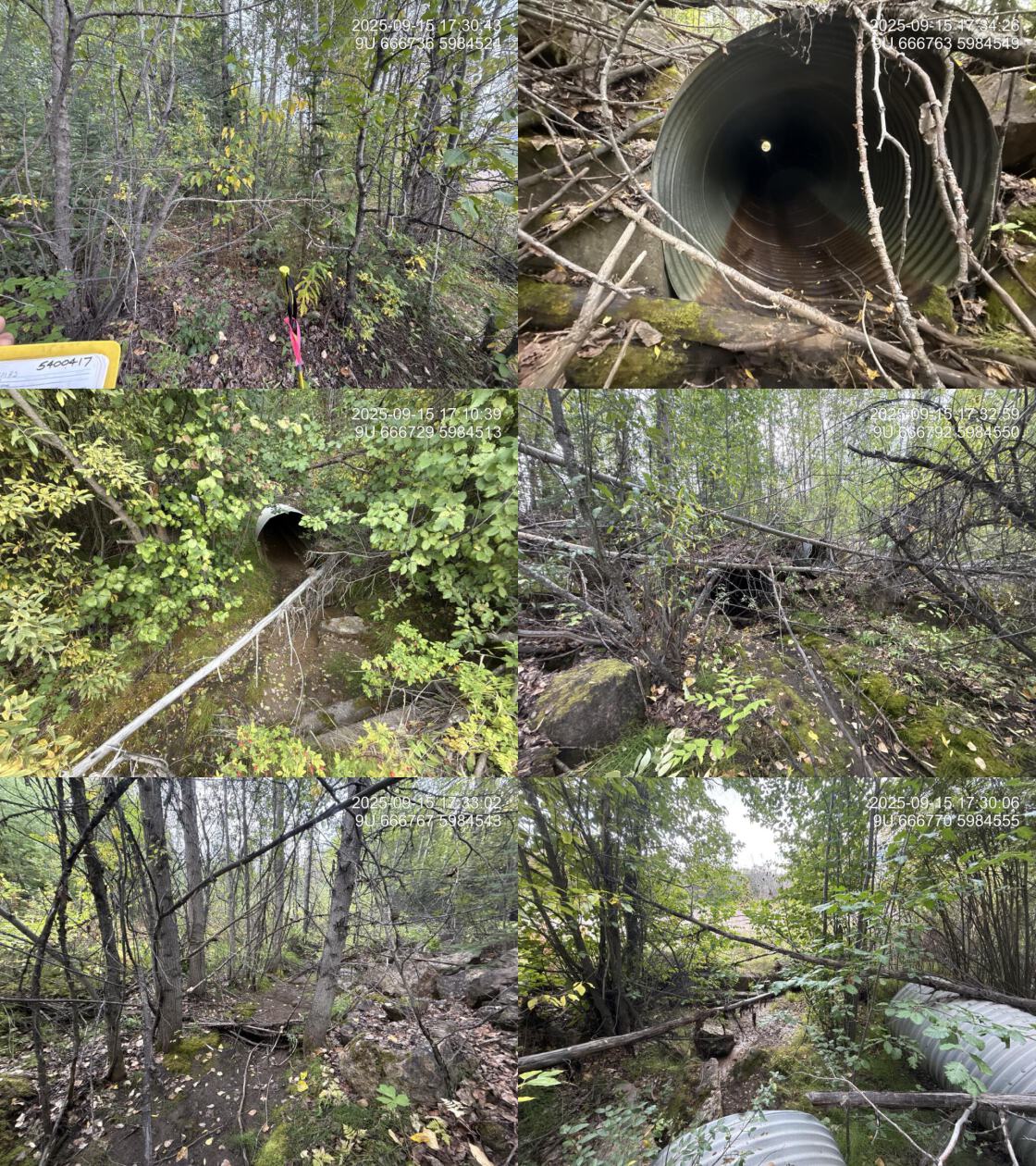
| Comments: This pipe, along with the adjacent overflow pipe, appeared to be located under what was likely the historic alignment of Colleymount Road. Approximately 3–4m downstream of the outlets, the road was armored with parking blocks that directed flow west into the oval culvert beneath the current road. The channel was dry at the time of assessment. | |||
| Photos: PSCIS ID 203577. From top left clockwise: Road/Site Card, Barrel, Outlet, Downstream, Upstream, Inlet. | |||
|
| Location and Stream Data |
|
Crossing Characteristics | – |
|---|---|---|---|
| Date | 2025-10-05 | Crossing Sub Type | Round Culvert |
| PSCIS ID | 203578 | Diameter (m) | 1.25 |
| External ID | 24403467 | Length (m) | 19 |
| Crew | AI | Embedded | No |
| UTM Zone | 10 | Depth Embedded (m) | – |
| Easting | 570742 | Resemble Channel | No |
| Northing | 5925896 | Backwatered | No |
| Stream | Tributary To Willow River | Percent Backwatered | – |
| Road | Willow FSR | Fill Depth (m) | 1 |
| Road Tenure | MoF | Outlet Drop (m) | 0.65 |
| Channel Width (m) | 3.2 | Outlet Pool Depth (m) | 0.85 |
| Stream Slope (%) | 3.5 | Inlet Drop | No |
| Beaver Activity | Yes | Slope (%) | 1.5 |
| Habitat Value | Medium | Valley Fill | Deep Fill |
| Final score | 34 | Barrier Result | Barrier |
| Fix type | Replace with New Open Bottom Structure | Fix Span / Diameter | 15 |
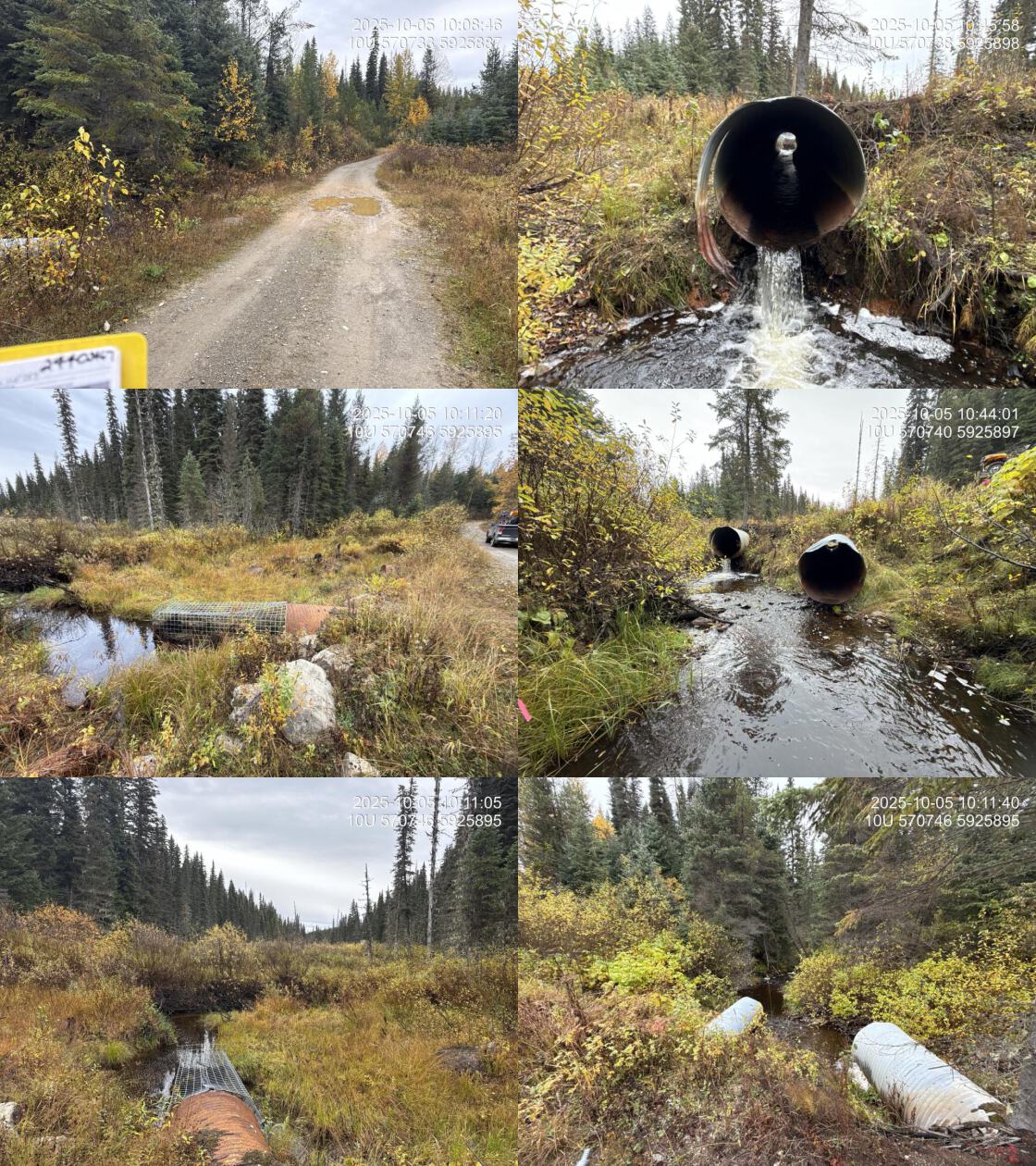
| Comments: Nice habitat downstream with abundant gravels, shallow pools, and woody debris. EDNA collected downstream. Wetland upstream. Two pipes with only one actively passing water at the time of survey, both 1.25m in diameter. Beaver grate on the inlet of the pipe. | |||
| Photos: PSCIS ID 203578. From top left clockwise: Road/Site Card, Barrel, Outlet, Downstream, Upstream, Inlet. | |||
|
| Location and Stream Data |
|
Crossing Characteristics | – |
|---|---|---|---|
| Date | 2025-10-05 | Crossing Sub Type | Round Culvert |
| PSCIS ID | 203579 | Diameter (m) | 1.1 |
| External ID | 24403486 | Length (m) | 12 |
| Crew | AI | Embedded | No |
| UTM Zone | 10 | Depth Embedded (m) | – |
| Easting | 572013 | Resemble Channel | No |
| Northing | 5922265 | Backwatered | Yes |
| Stream | Tributary To Willow River | Percent Backwatered | 100 |
| Road | Willow FSR | Fill Depth (m) | 1 |
| Road Tenure | MoF | Outlet Drop (m) | 0 |
| Channel Width (m) | 2 | Outlet Pool Depth (m) | 0.5 |
| Stream Slope (%) | 3.5 | Inlet Drop | Yes |
| Beaver Activity | No | Slope (%) | 0.5 |
| Habitat Value | Medium | Valley Fill | Deep Fill |
| Final score | 16 | Barrier Result | Potential |
| Fix type | Replace with New Open Bottom Structure | Fix Span / Diameter | 15 |
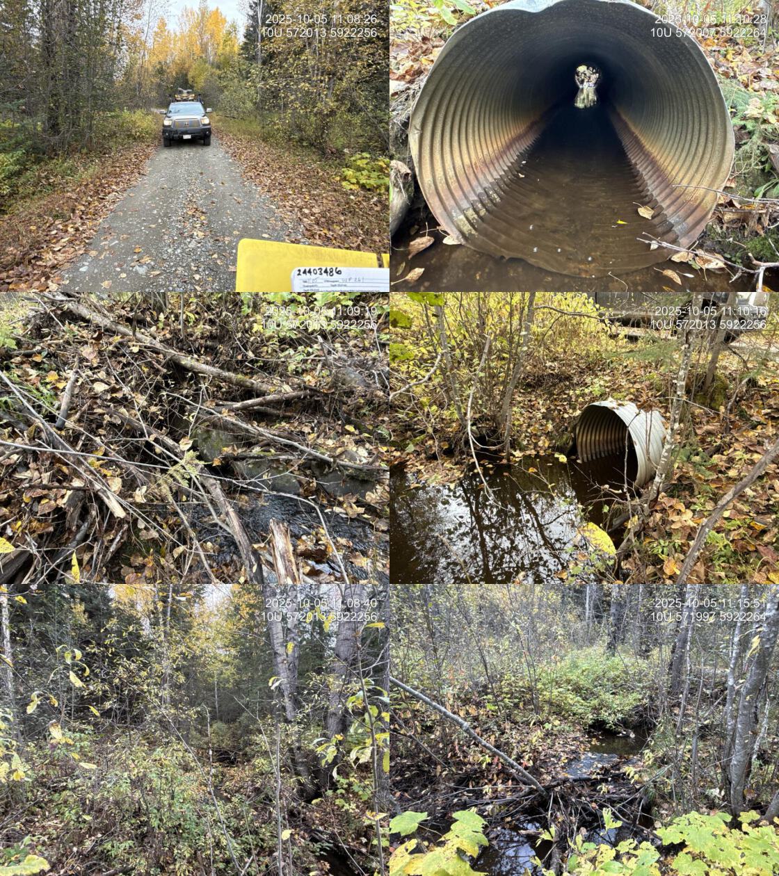
| Comments: Small stream with good flow. Small gravels upstream and downstream. Culvert was backwatered 100% at the time of survey. | |||
| Photos: PSCIS ID 203579. From top left clockwise: Road/Site Card, Barrel, Outlet, Downstream, Upstream, Inlet. | |||
|
| Location and Stream Data |
|
Crossing Characteristics | – |
|---|---|---|---|
| Date | 2025-09-15 | Crossing Sub Type | Oval Culvert |
| PSCIS ID | 203580 | Diameter (m) | 2.2 |
| External ID | 5400321 | Length (m) | 21 |
| Crew | AI | Embedded | Yes |
| UTM Zone | 9 | Depth Embedded (m) | 0.06 |
| Easting | 681754 | Resemble Channel | Yes |
| Northing | 5988177 | Backwatered | No |
| Stream | Cordella Creek | Percent Backwatered | – |
| Road | Colleymount Creek | Fill Depth (m) | 1 |
| Road Tenure | MoTi | Outlet Drop (m) | 0 |
| Channel Width (m) | 3.2 | Outlet Pool Depth (m) | 0.2 |
| Stream Slope (%) | 3.5 | Inlet Drop | No |
| Beaver Activity | No | Slope (%) | 1 |
| Habitat Value | High | Valley Fill | Deep Fill |
| Final score | 19 | Barrier Result | Potential |
| Fix type | Replace with New Open Bottom Structure | Fix Span / Diameter | 15 |
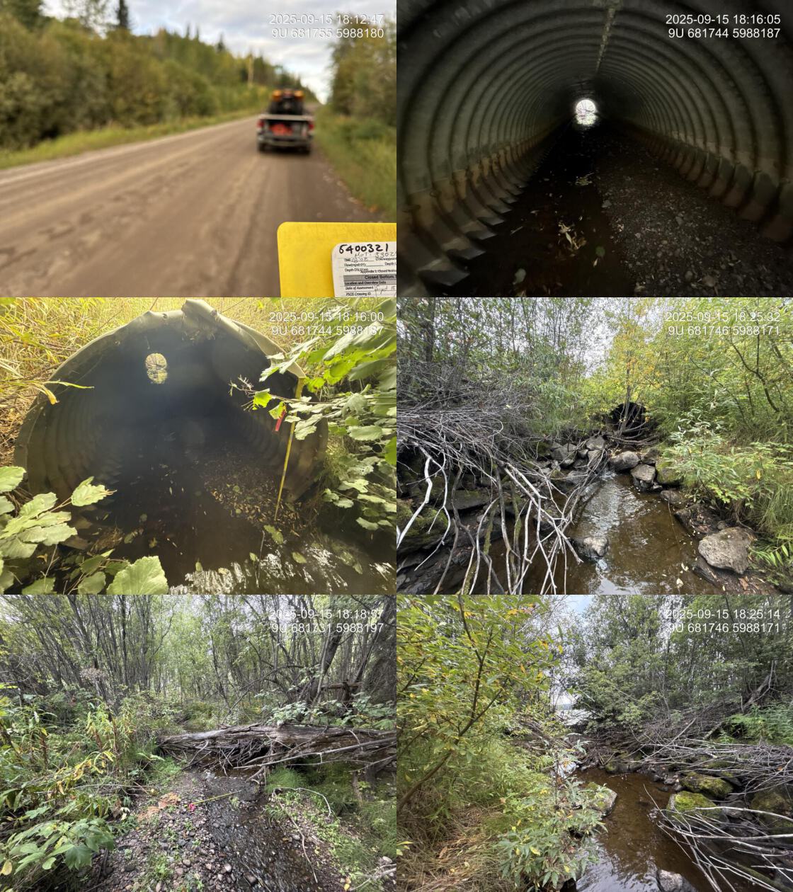
| Comments: Very nice stream with good flow and abundant, small gravel upstream and down. There is a boulder line approximately 3m downstream of the outlet that has removed the outlet drop but creates a ~40cm high cascade. Outlet of culvert is approximately 25m from François lake. | |||
| Photos: PSCIS ID 203580. From top left clockwise: Road/Site Card, Barrel, Outlet, Downstream, Upstream, Inlet. | |||
|
| Location and Stream Data |
|
Crossing Characteristics | – |
|---|---|---|---|
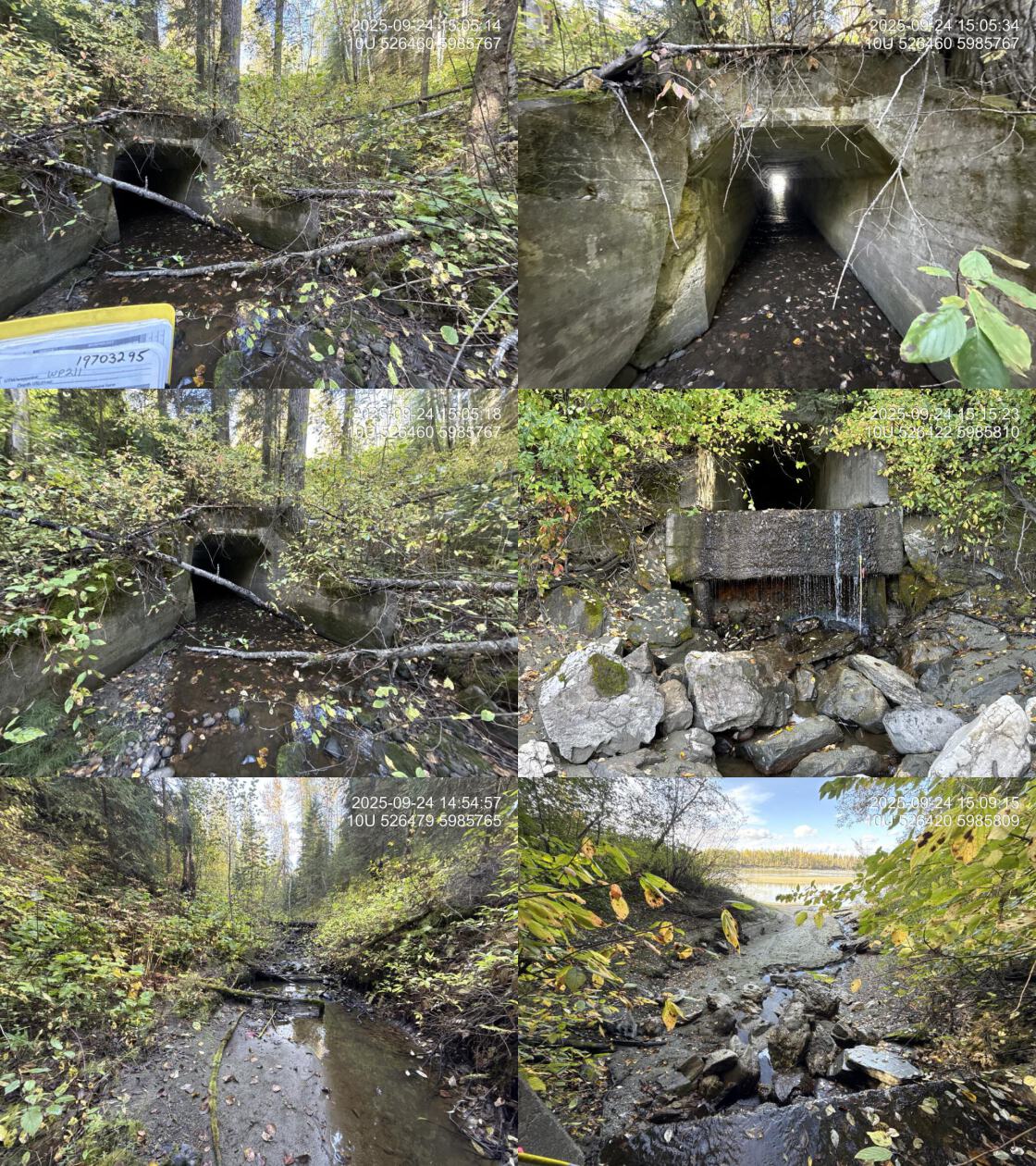
| Date | 2025-09-24 | Crossing Sub Type | Concrete Box |
| PSCIS ID | 203581 | Diameter (m) | 2.1 |
| External ID | 19703295 | Length (m) | 50 |
| Crew | AI | Embedded | No |
| UTM Zone | 10 | Depth Embedded (m) | – |
| Easting | 526469 | Resemble Channel | No |
| Northing | 5985767 | Backwatered | No |
| Stream | Tributary To Fraser River | Percent Backwatered | – |
| Road | Railway | Fill Depth (m) | 9.9 |
| Road Tenure | CN Rail | Outlet Drop (m) | 2.5 |
| Channel Width (m) | 4 | Outlet Pool Depth (m) | 0.1 |
| Stream Slope (%) | 2.5 | Inlet Drop | No |
| Beaver Activity | No | Slope (%) | 2.5 |
| Habitat Value | Medium | Valley Fill | Deep Fill |
| Final score | 37 | Barrier Result | Barrier |
| Fix type | Replace with New Open Bottom Structure | Fix Span / Diameter | 35.5 |
| Comments: Large concrete box structure with the outlet directly on the floodolain of the Fraser River. When the river is 2.5 - 3.5m higher the structure would backwater. Appears that the high watermark is near level with the outlet of the culvert. | |||
| Photos: PSCIS ID 203581. From top left clockwise: Road/Site Card, Barrel, Outlet, Downstream, Upstream, Inlet. | |||
|
| Location and Stream Data |
|
Crossing Characteristics | – |
|---|---|---|---|
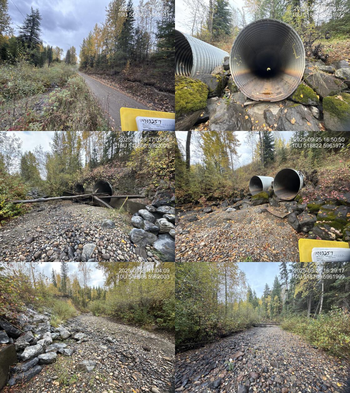
| Date | 2025-09-25 | Crossing Sub Type | Round Culvert |
| PSCIS ID | 203582 | Diameter (m) | 5.2 |
| External ID | 19703257 | Length (m) | 50 |
| Crew | AI | Embedded | No |
| UTM Zone | 10 | Depth Embedded (m) | – |
| Easting | 518844 | Resemble Channel | – |
| Northing | 5961981 | Backwatered | No |
| Stream | Tabor Creek | Percent Backwatered | – |
| Road | Railway | Fill Depth (m) | 10 |
| Road Tenure | CN Rail | Outlet Drop (m) | 0.3 |
| Channel Width (m) | 10 | Outlet Pool Depth (m) | 1 |
| Stream Slope (%) | 1.5 | Inlet Drop | No |
| Beaver Activity | No | Slope (%) | 0.5 |
| Habitat Value | Medium | Valley Fill | Deep Fill |
| Final score | 32 | Barrier Result | Barrier |
| Fix type | Replace with New Open Bottom Structure | Fix Span / Diameter | 36 |
| Comments: Two pipes at 2.6 m each. Pipes are in decent shape although it appears they had metal skirt sections (previously attached to bottom of pipes) at the outlets that have ripped off. Difficult to determine the size of the outlet drop as the stream was dry at the time of assessment. Culvert also crosses underneath a road and powerline on the east side of the railway | |||
| Photos: PSCIS ID 203582. From top left clockwise: Road/Site Card, Barrel, Outlet, Downstream, Upstream, Inlet. | |||
|
| Location and Stream Data |
|
Crossing Characteristics | – |
|---|---|---|---|
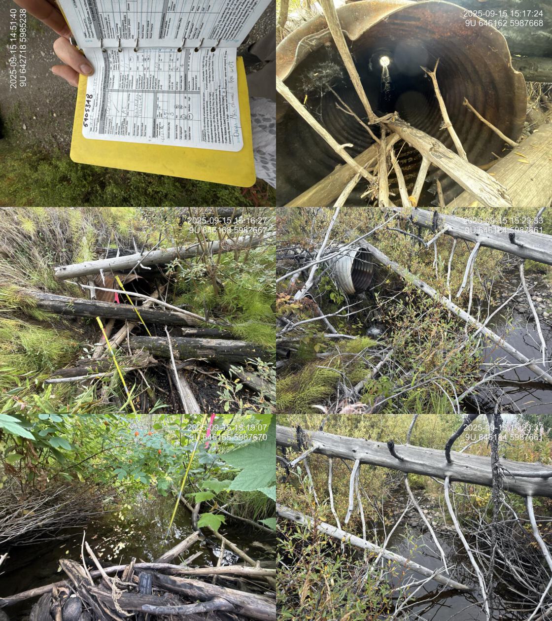
| Date | 2025-09-15 | Crossing Sub Type | Round Culvert |
| PSCIS ID | 203583 | Diameter (m) | 1 |
| External ID | 5405348 | Length (m) | 11 |
| Crew | AI | Embedded | No |
| UTM Zone | 9 | Depth Embedded (m) | – |
| Easting | 642730 | Resemble Channel | – |
| Northing | 5985238 | Backwatered | No |
| Stream | Tributary To Nadina River | Percent Backwatered | – |
| Road | Tahtsa FSR | Fill Depth (m) | 1 |
| Road Tenure | FLNR DND | Outlet Drop (m) | 0 |
| Channel Width (m) | 1.5 | Outlet Pool Depth (m) | 0 |
| Stream Slope (%) | 3 | Inlet Drop | Yes |
| Beaver Activity | No | Slope (%) | 4 |
| Habitat Value | Low | Valley Fill | Deep Fill |
| Final score | 26 | Barrier Result | Barrier |
| Fix type | Replace Structure with Streambed Simulation CBS | Fix Span / Diameter | 3 |
| Comments: Review of floodplain mapping indicates that this watershed actually drains to 1 km west through an open bottom structure. Adjacent land use is for cattle so this may be affecting drainage and habitat health upstream. | |||
| Photos: PSCIS ID 203583. From top left clockwise: Road/Site Card, Barrel, Outlet, Downstream, Upstream, Inlet. | |||
|
| Location and Stream Data |
|
Crossing Characteristics | – |
|---|---|---|---|
| Date | 2025-09-15 | Crossing Sub Type | Round Culvert |
| PSCIS ID | 203584 | Diameter (m) | 0.9 |
| External ID | 5405311 | Length (m) | 15 |
| Crew | AI | Embedded | No |
| UTM Zone | 9 | Depth Embedded (m) | – |
| Easting | 646168 | Resemble Channel | – |
| Northing | 5987669 | Backwatered | No |
| Stream | Tributary To Nadina River | Percent Backwatered | – |
| Road | Tahtsa FSR | Fill Depth (m) | 1.5 |
| Road Tenure | Canfor R03011 174 | Outlet Drop (m) | 1.1 |
| Channel Width (m) | 2.3 | Outlet Pool Depth (m) | 0.4 |
| Stream Slope (%) | 3.5 | Inlet Drop | No |
| Beaver Activity | No | Slope (%) | 0 |
| Habitat Value | Medium | Valley Fill | Deep Fill |
| Final score | 29 | Barrier Result | Barrier |
| Fix type | Replace with New Open Bottom Structure | Fix Span / Diameter | 15 |
| Comments: Larger stream than expected, with substantial flow, a large outlet drop, and a significant outlet pool indicating the culvert is likely undersized for the crossing. Some gravels suitable for bull trout spawning were present. | |||
| Photos: PSCIS ID 203584. From top left clockwise: Road/Site Card, Barrel, Outlet, Downstream, Upstream, Inlet. | |||
|
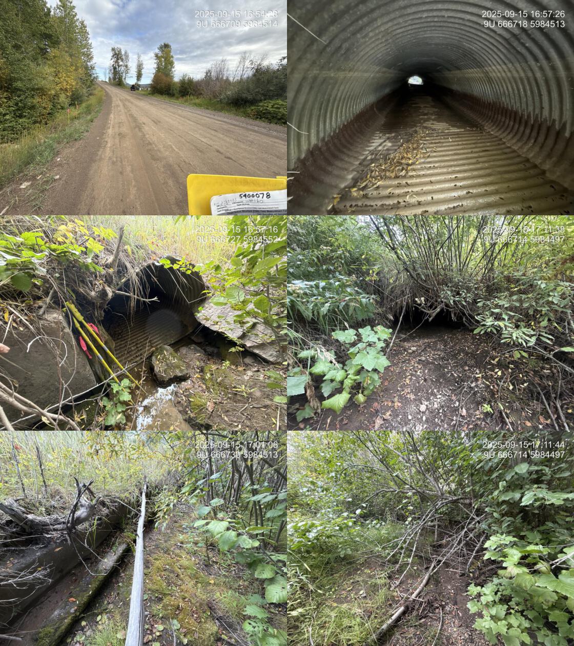
| Location and Stream Data |
|
Crossing Characteristics | – |
|---|---|---|---|
| Date | 2025-09-15 | Crossing Sub Type | Oval Culvert |
| PSCIS ID | 203585 | Diameter (m) | 1.7 |
| External ID | 5400078 | Length (m) | 16 |
| Crew | AI | Embedded | No |
| UTM Zone | 9 | Depth Embedded (m) | – |
| Easting | 666733 | Resemble Channel | – |
| Northing | 5984517 | Backwatered | No |
| Stream | Van Lear Creek | Percent Backwatered | – |
| Road | Colleymount Road | Fill Depth (m) | 1 |
| Road Tenure | MoTi | Outlet Drop (m) | 0 |
| Channel Width (m) | 2.5 | Outlet Pool Depth (m) | 0 |
| Stream Slope (%) | 1 | Inlet Drop | No |
| Beaver Activity | No | Slope (%) | 3 |
| Habitat Value | Low | Valley Fill | Deep Fill |
| Final score | 29 | Barrier Result | Barrier |
| Fix type | Replace with New Open Bottom Structure | Fix Span / Diameter | 15 |
| Comments: This is the crossing on Colleymount Road; however, two additional pipes located approximately 10m west and just upstream appear to be remnants of pipes under historic Colleymount Road location. The existing pipe was in poor condition, with rust-through observed along the upstream 2m. The stream was dry at the time of assessment. | |||
| Photos: PSCIS ID 203585. From top left clockwise: Road/Site Card, Barrel, Outlet, Downstream, Upstream, Inlet. | |||
|
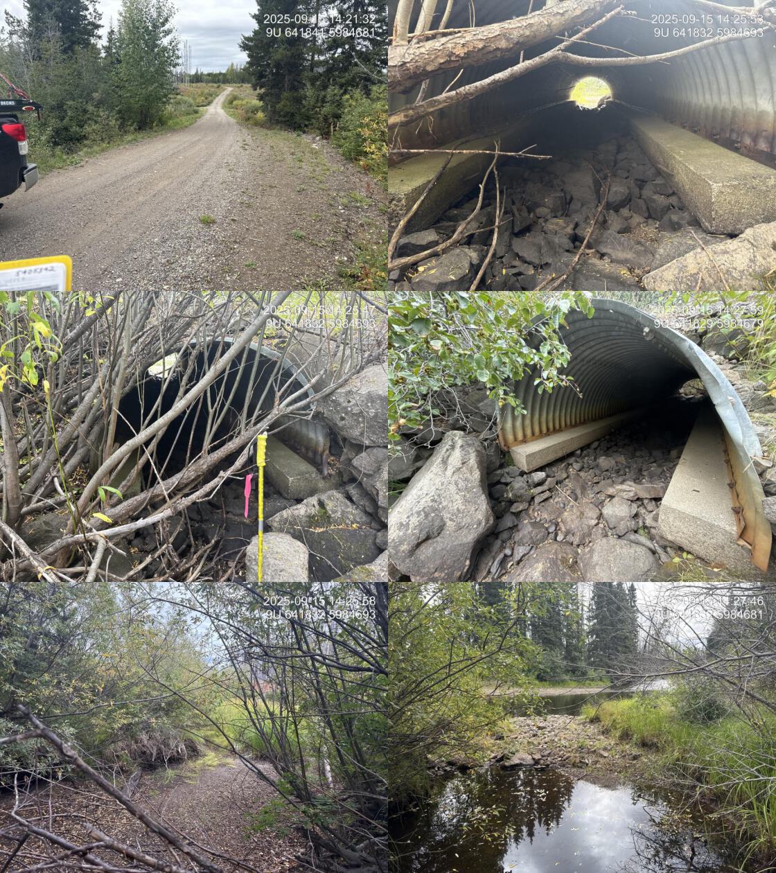
| Location and Stream Data |
|
Crossing Characteristics | – |
|---|---|---|---|
| Date | 2025-09-15 | Crossing Sub Type | Pipe Arch |
| PSCIS ID | 203586 | Diameter (m) | 16 |
| External ID | 5405342 | Length (m) | 2.25 |
| Crew | AI | Embedded | No |
| UTM Zone | 9 | Depth Embedded (m) | – |
| Easting | 641843 | Resemble Channel | – |
| Northing | 5984683 | Backwatered | No |
| Stream | Tributary To Nadina River | Percent Backwatered | – |
| Road | Tahtsa FSR | Fill Depth (m) | – |
| Road Tenure | FLNR DND | Outlet Drop (m) | 0 |
| Channel Width (m) | 0 | Outlet Pool Depth (m) | 0 |
| Stream Slope (%) | 0 | Inlet Drop | No |
| Beaver Activity | No | Slope (%) | 0 |
| Habitat Value | – | Valley Fill | – |
| Final score | 10 | Barrier Result | Passable |
| Fix type | – | Fix Span / Diameter | – |
| Comments: Numerous spawning sockeye immediately adjacent to culvert outlet and upstream. Channel dry at the time of assessment but appears as though this stream joins with and drains the watershed for the stream mapped as larger located to the east approximately 1km. Floodplain modelling shows this. | |||
| Photos: PSCIS ID 203586. From top left clockwise: Road/Site Card, Barrel, Outlet, Downstream, Upstream, Inlet. | |||
|
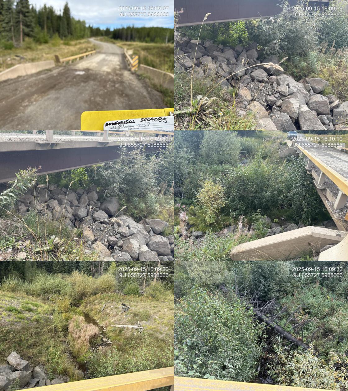
| Location and Stream Data |
|
Crossing Characteristics | – |
|---|---|---|---|
| Date | 2025-09-15 | Crossing Sub Type | Bridge |
| PSCIS ID | 203587 | Diameter (m) | 17 |
| External ID | 5404085 | Length (m) | 5.2 |
| Crew | AI | Embedded | No |
| UTM Zone | 9 | Depth Embedded (m) | – |
| Easting | 655728 | Resemble Channel | – |
| Northing | 5988666 | Backwatered | No |
| Stream | Tributary To Nadina River | Percent Backwatered | – |
| Road | Morice Owen East FSR | Fill Depth (m) | – |
| Road Tenure | MoF | Outlet Drop (m) | 0 |
| Channel Width (m) | 0 | Outlet Pool Depth (m) | 0 |
| Stream Slope (%) | 0 | Inlet Drop | No |
| Beaver Activity | No | Slope (%) | 0 |
| Habitat Value | – | Valley Fill | – |
| Final score | 10 | Barrier Result | Passable |
| Fix type | – | Fix Span / Diameter | – |
| Comments: Bridge | |||
| Photos: PSCIS ID 203587. From top left clockwise: Road/Site Card, Barrel, Outlet, Downstream, Upstream, Inlet. | |||
|
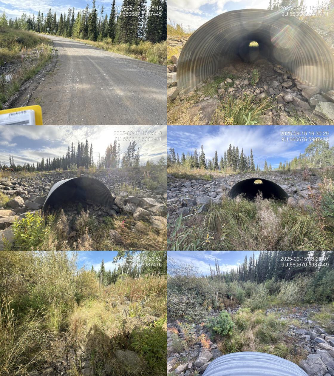
| Location and Stream Data |
|
Crossing Characteristics | – |
|---|---|---|---|
| Date | 2025-09-15 | Crossing Sub Type | Pipe Arch |
| PSCIS ID | 203588 | Diameter (m) | 30 |
| External ID | 5404090 | Length (m) | 3.6 |
| Crew | AI | Embedded | No |
| UTM Zone | 9 | Depth Embedded (m) | – |
| Easting | 660673 | Resemble Channel | – |
| Northing | 5987470 | Backwatered | No |
| Stream | Tributary To Nadina River | Percent Backwatered | – |
| Road | Morice Owen East FSR | Fill Depth (m) | – |
| Road Tenure | Canfor R13343 11 | Outlet Drop (m) | 0 |
| Channel Width (m) | 0 | Outlet Pool Depth (m) | 0 |
| Stream Slope (%) | 0 | Inlet Drop | No |
| Beaver Activity | No | Slope (%) | 0 |
| Habitat Value | – | Valley Fill | – |
| Final score | 10 | Barrier Result | Passable |
| Fix type | – | Fix Span / Diameter | – |
| Comments: Pipe Arch | |||
| Photos: PSCIS ID 203588. From top left clockwise: Road/Site Card, Barrel, Outlet, Downstream, Upstream, Inlet. | |||
|