Appendix - Effectiveness Monitoring Data and Potential Restoration Site Review
Site locations are available as a downloadable sites_reviewed_2024_202506.geojson which renders as an interactive map on GitHub.
# Table \@ref(tab:tab-ree1-caption)
my_caption <- ("Results from effectiveness monitoring data collected in 2024 and 2025")
my_tab_caption()# clean up the citations - just doing this once bc it is really slow!!!
path_gis <- "/Users/airvine/Projects/gis/restoration_wedzin_kwa/data_field/sites_reviewed_2024_202506.geojson"
path_repo <- "data/gis/sites_reviewed_2024_202506.geojson"
dat <- sf::st_read(
path_repo
)
dat |>
sf::st_drop_geometry() |>
dplyr::mutate(
date = as.Date(date_time_start)
) |>
dplyr::select(
# date_time_start,
site_id,
date,
reference = citation_key,
uav_flight,
works_completed,
new_site,
assessment_comment
) |>
xciter::xct_keys_to_inline_table_col(col_format = "reference") |>
# clean up when NA ends up in citation column
dplyr::mutate(
reference = dplyr::if_else(
reference == "NA",
"",
reference
)
) |>
# purrr::set_names(~ tools::toTitleCase(gsub("_", " ", .x)))
readr::write_csv("data/inputs_extracted/monitoring_2024_2025.csv", na = "")dat_raw <- readr::read_csv(
"data/inputs_extracted/monitoring_2024_2025.csv"
)
label_short <- function(x) {
x |>
gsub("bulkley_meints_", "", x = _) |>
gsub("bulkley_", "", x = _) |>
gsub("-2021$", "", x = _) |>
gsub("_0(\\d)", " \\1", x = _) |>
gsub("_", " ", x = _) |>
tools::toTitleCase() |>
gsub("Mickilligan Road", "McKilligan", x = _) |>
gsub("Mckilligan Rd", "McKilligan", x = _) |>
gsub("Foxy Maxan Confluence", "Foxy-Maxan", x = _)
}
dat <- dat_raw |>
dplyr::mutate(
label = label_short(site_id),
type = dplyr::case_when(
works_completed == "yes" &
!grepl("mud|kenneth", site_id, ignore.case = TRUE) ~
"Effectiveness Monitoring",
works_completed == "yes" &
grepl("mud|kenneth", site_id, ignore.case = TRUE) ~
"Fraser Site",
TRUE ~ "Potential Site"
),
type = factor(type, levels = c("Effectiveness Monitoring", "Potential Site", "Fraser Site"))
) |>
dplyr::mutate(
assessment_comment = dplyr::case_when(
reference == "Gottesfeld and Rabnett (2007)" ~
paste0("Newly proposed site adjacent to traditional fishing site. ", assessment_comment),
new_site == "yes" ~
paste0("Newly proposed site. ", assessment_comment),
TRUE ~ assessment_comment
),
uav_flight = dplyr::if_else(
uav_flight == "No",
NA_character_,
uav_flight
)
)|>
dplyr::arrange(type, label) |>
dplyr::select(
label,
date,
type,
reference,
uav_flight,
assessment_comment
) |>
tibble::rowid_to_column()
dat |>
my_dt_table(cols_freeze_left = 2, page_length = 5)Effectiveness Monitoring
BR1 — Bulkley River
site <- dplyr::filter(sites_all, site_id == "BR1-2021")
viewer_url <- stac_uav_viewer(site)
site_summary_table(site)| Date | 2024-09-28 |
| Stream | Bulkley River |
| Land Owner | Adrienne Dickson |
| UAV Flight | Yes |
| Width (m) | 8.5 |
| Length (m) | 67 |
| Reference | HWI |
| Assessment | Impressive willow growth in area of bank that has been reshaped and pegboarded. Low densities/cover percentage of planted riparian shrubs due to dense agronomic sods at the top of bank. UAV flight was conducted in 2023. |
| Habitat | Backwatered low gradient area on outside left bend. Small woody debris and willow matting providing overhanging cover. |
| Erosion | Bankful incision 0.4,0.5,0.2m. Current incision 2.0, 2.2, 1.6m. Some minor erosion approximately 30 to 40 m from the top end of the site |
| Condition | Site appears to be in great condition with some small areas of undercutting at the top end. Apparently freshet has been quite small I. The last two years due to low snowpacks. |
| Velocity | Very slow backwater flow due to beaver activity downstream. |
| Substrate | Substrate is primarily fines due to low velocities however, some gravel are visible underneath in some areas |
| Riparian | Upstream riparian is mature willow transitioning to 40m wide mature cottonwood forest approximately. Downstream rightbnk is the willow shrub for approximately 100m then transitioning to 40m wide mature cottonwood forest. |
| Flow Depth | 0.45, 0.85, 0.65m. Flows quite deep at the time of survey at over 80 cm at two points |
| Stability | Site is generally holding up well, however there is substantial slumping of the banks still with chunks of sod landing within the wetted channel |
| Revegetation | Revegetation of the site is impressive with height of willows, often exceeding 6 feet and densities of many many stems per meter. Beyond the sloping bank, the density of Willow is low, however and depth or width of Ron area is very narrow when compared to size of the stream. |
| Cover | Small Woody debris and some large debris incorporated into D sloped banks is providing extensive cover along the edge of the site with further growth expected in the coming years |
| Maintenance | There is some undercutting of the works and erosion of approximately one to 2 feet within the top 40 m of sight for a section approximately 10 m long. Mowing or removal of dense grasses along the fenceline replanting area and mulching to remove competition could encourage a wider riparian strip. |
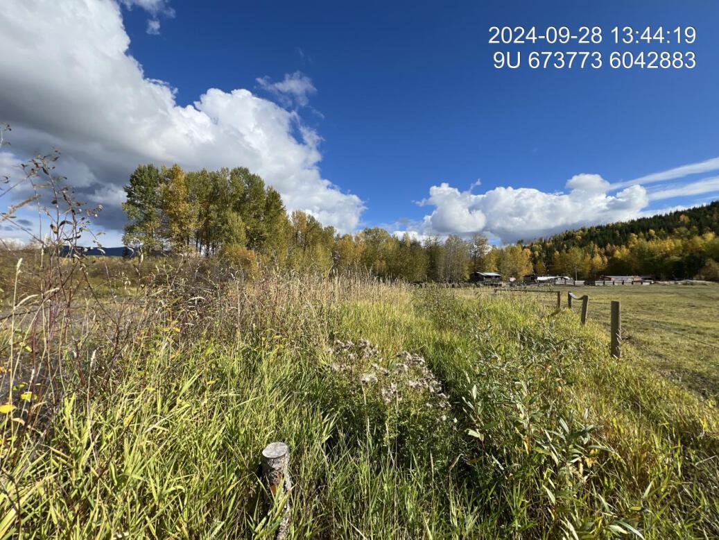
Figure 5.1: View of upstream end of site
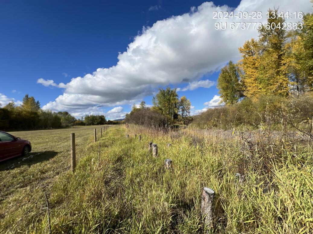
Figure 5.2: View of downstream end of site
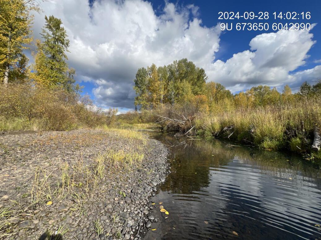
Figure 5.3: View of upstream end of site
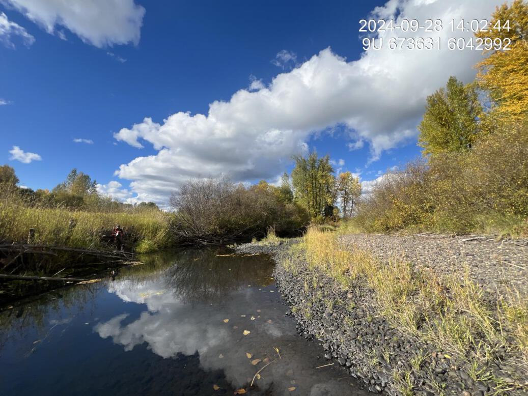
Figure 5.4: View of downstream end of site
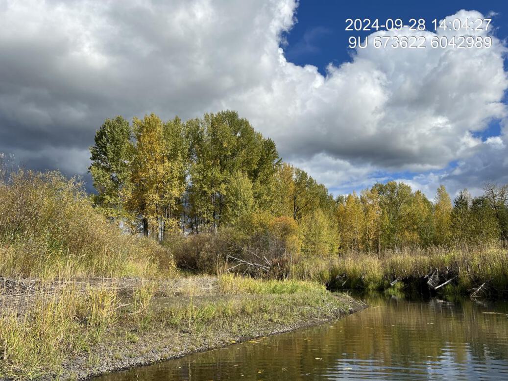
Figure 5.5: Riparian regrowth within site
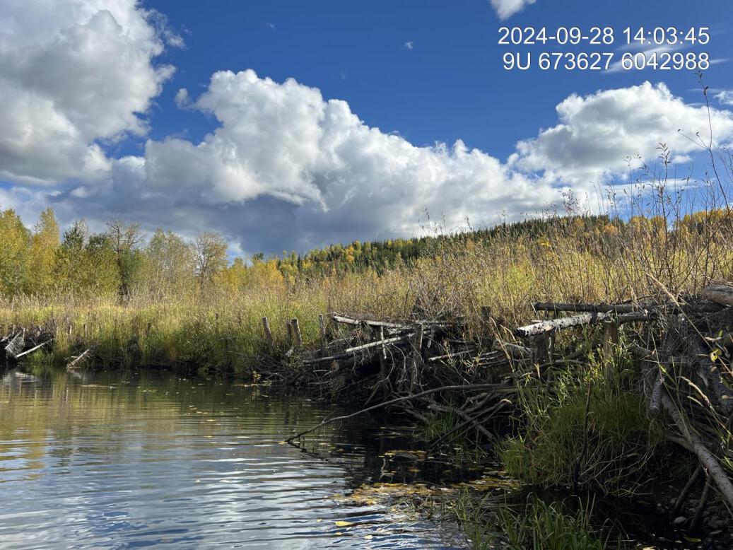
Figure 5.6: Revegetation status
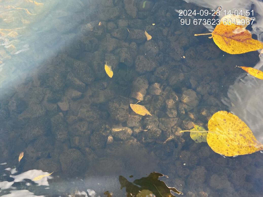
Figure 5.7: Substrate composition
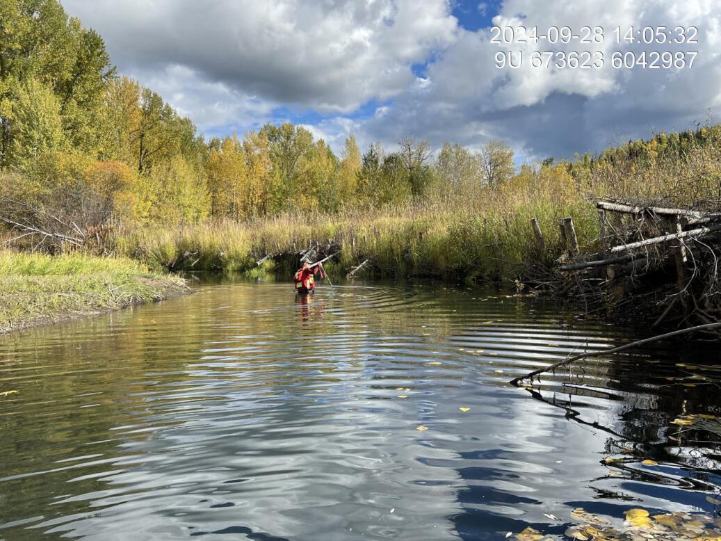
Figure 5.8: Flow depth

Figure 5.9: Bank stability
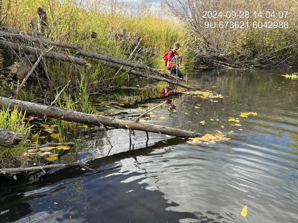
Figure 5.10: Fish cover
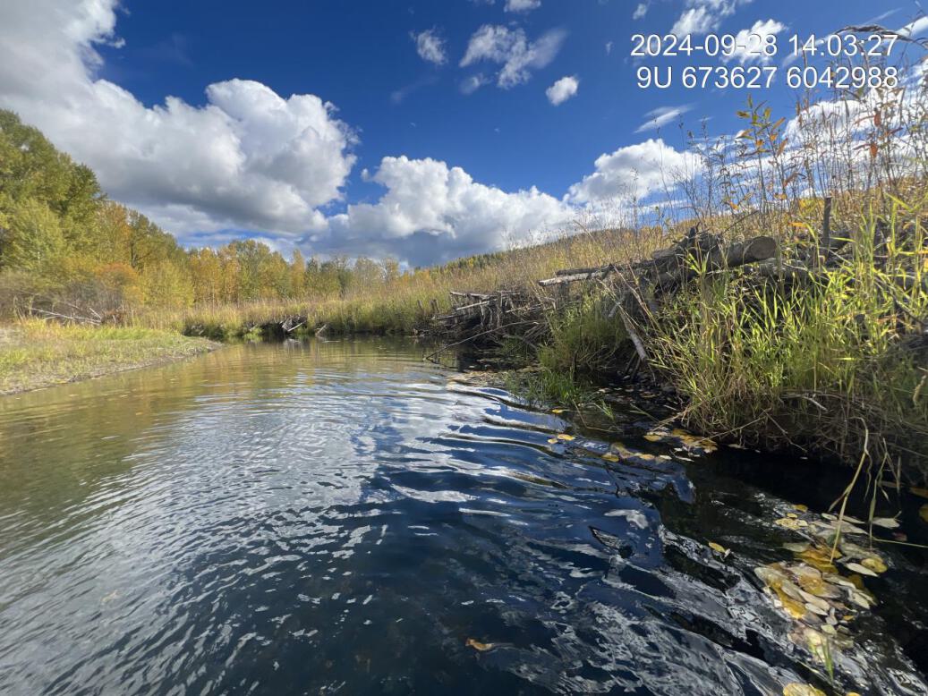
Figure 5.11: Structure condition
BR2 — Bulkley River
site <- dplyr::filter(sites_all, site_id == "BR2-2021")
viewer_url <- stac_uav_viewer(site)
site_summary_table(site)| Date | 2024-09-28 |
| Stream | Bulkley River |
| Land Owner | Adrienne Dickson |
| UAV Flight | Yes |
| Width (m) | 12 |
| Length (m) | 70 |
| Reference | HWI |
| Assessment | Site appears to be holding up well with no slumping occurring. As with the adjacent BR1 site - willow growth along sloped areas very good. Low densities/cover percentage of planted riparian shrubs due to dense agronomic sods at the top of bank. (appears to be reed canary grass but should be confirmed). UAV flight was conducted in 2023 |
| Habitat | Low gradient run with algae covered gravels. |
| Erosion | Bankful incision 0.5, 0.2, 0.1m. Current incision 2.2, 1.8, 1.8m Very minimal to no erosion observed along the entire site. |
| Condition | Re-sloped bank peg boarding and willow staking bundles are in excellent shape with no evidence of undercutting or erosion. Top of sloped area to the fence line cover of willow is very low as it has been choked out by Reid canary grass and other agronomic grass species. |
| Velocity | Very low gradient so low velocities at time of site survey |
| Substrate | Substrate is quite covered in algae, however, appears to be primarily large gravel |
| Riparian | Upstream riparian approximately 60m wide willow dominated shrub transitioning to mature cottonwood forest and trembling aspen. |
| Flow Depth | Depths measured 0.4, 0.7, 0.5m at time of survey. See erosion section for distance from water surface to high water level. |
| Stability | Site appears very stable with no or very little erosion. Spring runoff has been uncharacteristically low due to low snowpack for the last two years. |
| Revegetation | Re-vegetation along with Cutbank area is quite good with willow densities greater than three stems per metre with Reid canary grass interspersed throughout, particularly higher on the sloped area. From the top of the peg boarding back to the fence establishment of willow could be considered poor with very small percentage of cover, comprised of shrub as the predominant cover is red canary grass, and other agronomic grasses |
| Cover | Small way debris Inc. into bank works, appear to be functioning. Well as cover along the edge of the stream and continue growth of Willow is expected to provide more overhanging veg overtime. |
| Maintenance | No maintenance required for re-sloped and peg boarded area at this time. From edge of sloped area to fence line canary reed grass and agronomics could be removed, soil amended, thick mulch (8inches) placed, replanted and irrigated to establish meaningful shrub and tree riparian. |
Figure 5.12: View of upstream end of site
Figure 5.13: View of downstream end of site
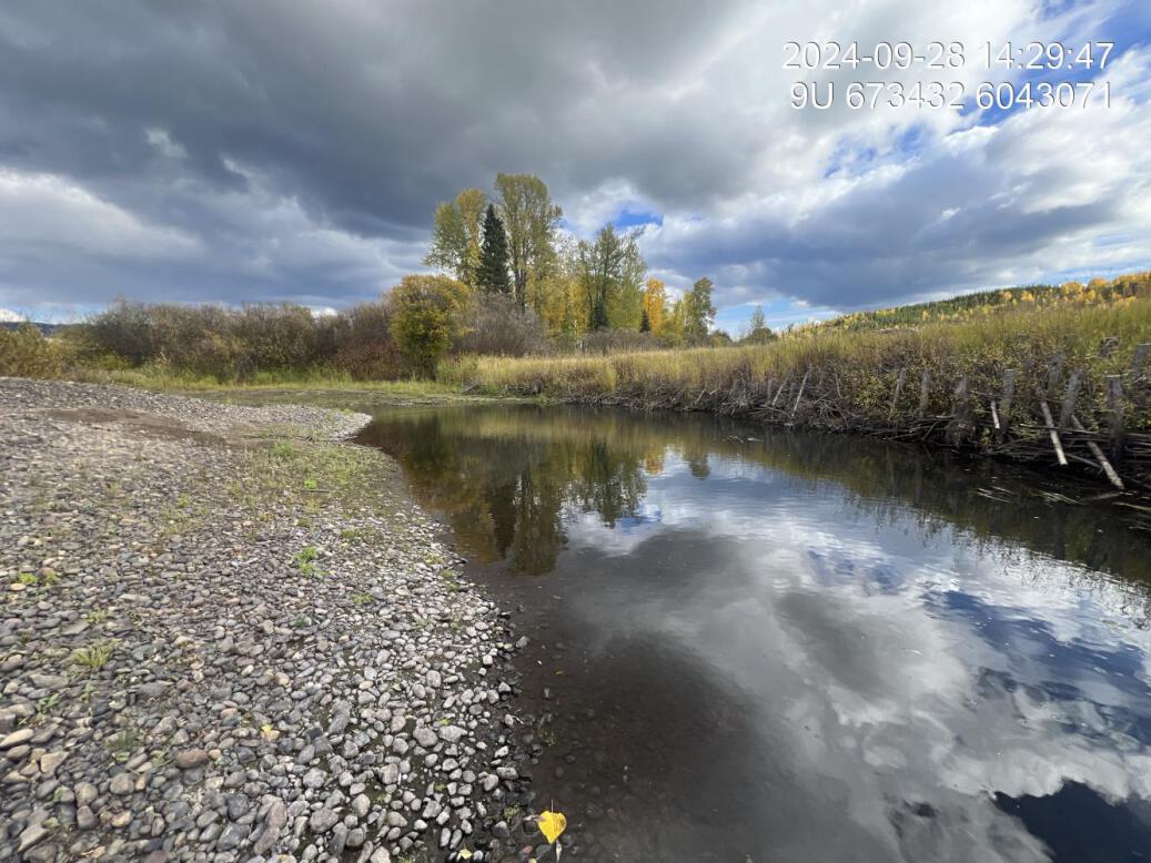
Figure 5.14: View of upstream end of site
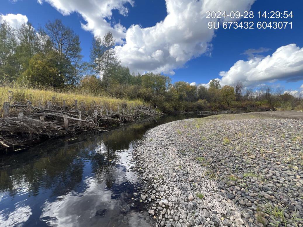
Figure 5.15: View of downstream end of site
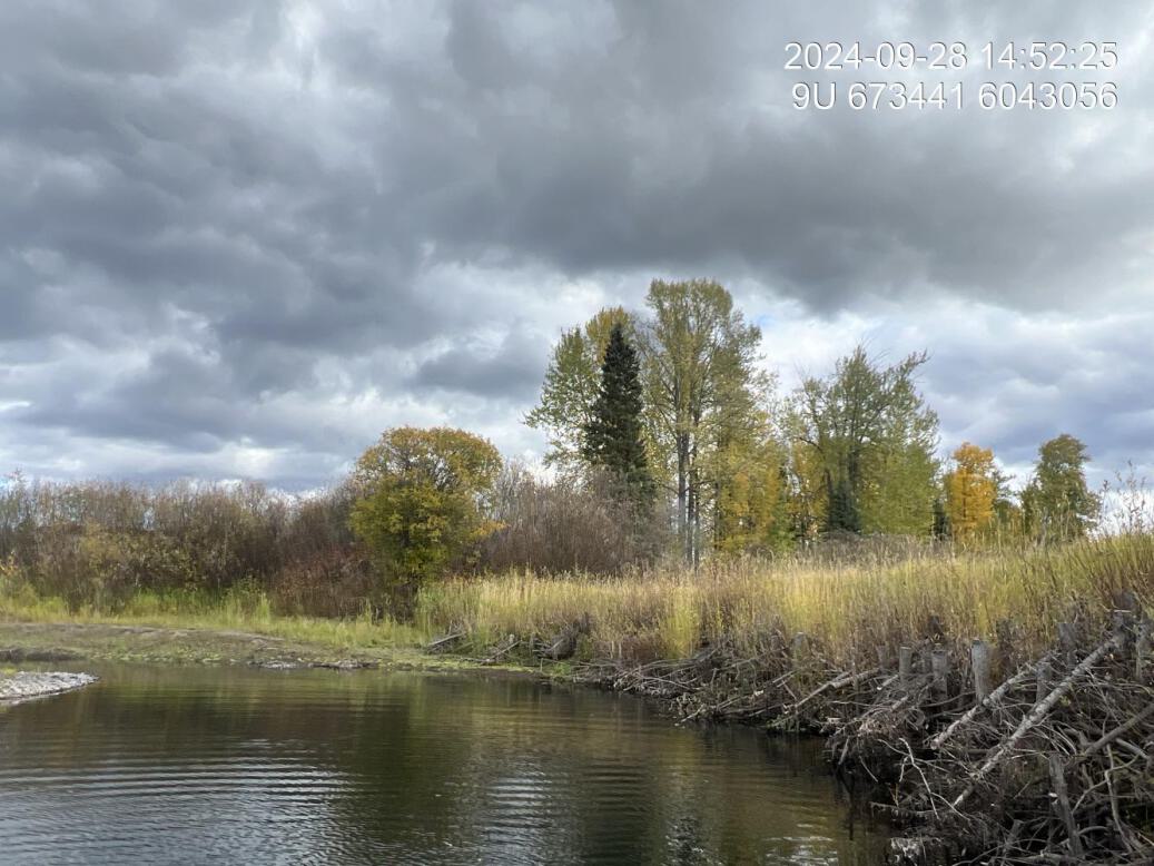
Figure 5.16: Riparian regrowth within site
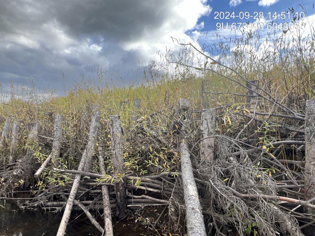
Figure 5.17: Revegetation status
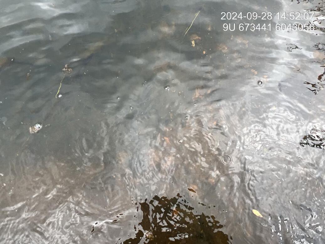
Figure 5.18: Substrate composition
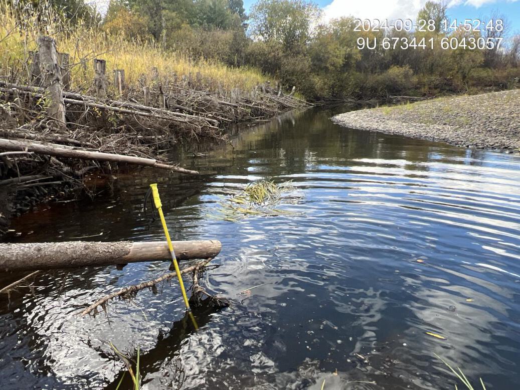
Figure 5.19: Flow depth
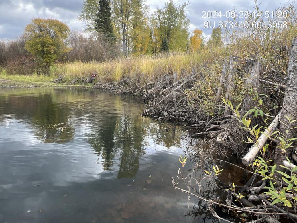
Figure 5.20: Bank stability
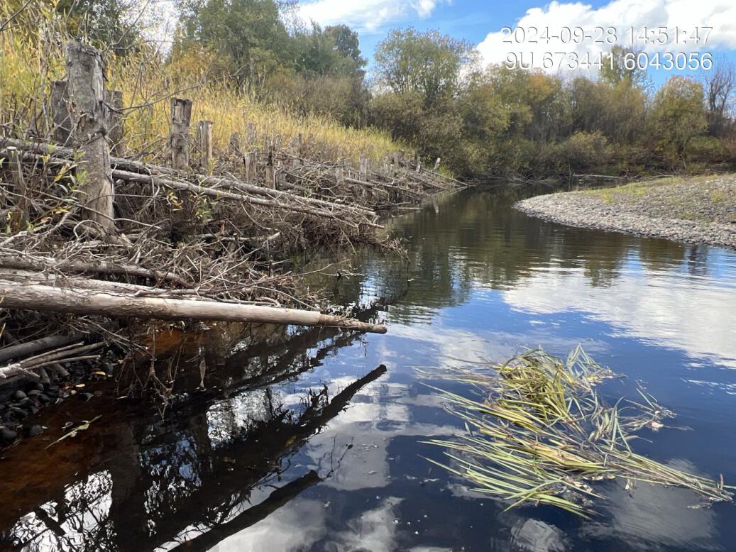
Figure 5.21: Fish cover
Figure 5.22: Structure condition
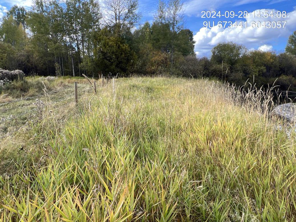
Figure 5.23: Maintenance requirements
BR5 — Bulkley River
site <- dplyr::filter(sites_all, site_id == "BR5")
viewer_url <- stac_uav_viewer(site)
site_summary_table(site)| Date | 2024-09-29 |
| Stream | Bulkley River |
| Land Owner | Roger Groot |
| UAV Flight | Yes |
| Width (m) | 12 |
| Length (m) | 95 |
| Reference | HWI |
| Assessment | Overall site appears to be relatively stable with some isolated areas of erosion. Structures in decent shape however, the riparian regeneration is very poor with very small conifers and near all shrub and cottonwood not surviving. Recommend the area of riparian enhancement be enlarged to provide more meaningful complexity and inputs for the coming 100 years. Suggest extending out a minimum of 30m from top of bank. |
| Habitat | Right bank meander with cobble and fine substrate. Engineered large wood debris structures, and a rock groin installed in 2016. |
| Erosion | Current incision 2.0, 2.4, 2.1m. Bankful incision 0.4, 1.0, 0.6m. Structures appear to have been mostly effective at preventing erosion at the site and additions of rock are holding together other areas. There is some erosion between the structures and immediately downstream of the second structure for sections of approximately 3 m long. |
| Condition | Structures appear in decent condition and there is no obvious major erosion occurring at the site. However, Revegetation of the site is poor with significant mortality |
| Velocity | Stream velocities are good with structures, likely throttling, high flows leading to some scour and infilling with fines behind the structure |
| Substrate | Placement of structures does not appear to have resulted in deposition of gravel downstream. Substrate is comprised primarily of cobble with some fines. |
| Riparian | Upstream is mature cottonwood forest with width exceeding 50m. Downstream is shrub along hayfield with grove of mature cottonwood at the end of the field. |
| Flow Depth | 0.70, 0.85, 1.1m current depths measured at the site. It appears there is a significant amount of scour under the upper Woody debris structure, creating a deep area underneath the structure. The lower structure on the other hand appears to have infield with downstream of structure |
| Stability | Structures appears stable. Photo comparison could help discern changes over time. |
| Revegetation | Riparian regeneration is low with high mortality of cuttings. Some soruce conifers are alive, showing decent vigor, but are small and there are not many. Suggest removing agronomic, grasses, decompacting soil, amending soil, adding mulch replanting at high densities, expanding area of riparian area planted and irrigating. |
| Cover | Rip rock and rock groin is providing some boulder cover. The first large beast structure is providing deep pool, larger debris structure, and the downstream structure has some shallow cover due to the root wad. |
| Maintenance | Suggest replanting of riparian and extending the area planted significantly if possible. Suggest that the site is stripped of agronomic grasses soils are amended soil. A thick layer of mulch is laid, and replanting is conducted at high density greater than one stem per square meter. Suggest tying planting together with local seed collection program Nursery and not a irrigation program could be tested at this site. |
Buc207 — Buck Creek
site <- dplyr::filter(sites_all, site_id == "Buc207")
viewer_url <- stac_uav_viewer(site)
site_summary_table(site)| Date | 2025-06-22 |
| Stream | Buck Creek |
| Land Owner | Private |
| UAV Flight | Yes |
| Width (m) | 30 |
| Length (m) | 100 |
| Reference | MacKay et al. (1998) |
| Assessment | It appears there has been recent erosion protection work here by MOTI and contractors with approximately 5m of riprap with geotextile and coconut matting above to the road edge. Road surface is approximately 5 m above the water. There is sparse shrub regeneration, particularly on the lower side of the area that has been revegetated above the rip wrap with some willow, rose and cottonwood. |
| Habitat | Riffle habitat for entire area adjacent to rip rap road edge. There is a breached beaverdam just upstream of the rip rap. Fair cover from overhanging vegetation on right bank adjacent to fenced pasture land. Upstream on the left bank has excellent shrub, riparian, and what appears to be deeply undercut banks. Downstream there is young coniferous forest and decent riparian providing overhanging vegetation. |
| Erosion | Minimal erosion present |
| Condition | Erosion protection works appear stable. Revegetation of southern half of slope is primarily sparse grasses and occasional shrub with the north end of the site on a better trajectory towards meaningful shrub riparian. |
| Velocity | Riffle to glide velocity in the middle of the thalwag with slower glide habitat at upstream end due to partial beaver dam. Rip rap is providing some refuge areas for fry and parr but has no overhanging cover with rocklikely a significant source of heat in the summer. |
| Substrate | Natural substrate within the channel comprised of primarily cobbles. Significant algal growth, indicating potentially high nutrient and temperature level levels. |
| Riparian | At area where revegetation has been attempted (i.e. the top half of the approximately 10m long slope) has fairly good tree and shrub regeneration at the north end with willow and cottonwood plants from 2 to 2.5 m tall. The southern half is primarily grasses with some sparse regrowth of rose and willow. |
| Flow Depth | Flow depths approximately 20 to 30cm at the time of assessment which potentially could have been greater if woody debris or some sort of scour structures were placed under the rock before armouring. |
| Stability | Slope appears stable with only very minor slumping at the top edge of the road where a small area of installed coconut matting has pulled away from the slope, but overall entire slope appears stable in good condition. |
| Revegetation | Southern half of slope has poor to medium regeneration of mostly grasses and occasional shrubs at the bottom edge of the area vegetated whereas the north end of the slope has better tree and shrub regrowth with cottonwood and willow individual plants from 2 to 2.5 metres tall. |
| Cover | Cover for the stream is poor with the bottom 5m being only riprap. This is probably providing a lot of heat to the stream during hotter times of day and year. There is minor amounts of cover due to the rock for fry and juvenile fish within the interstitial spaces, but overall cover is rated as poor. |
| Maintenance | Replanting of top edge of the slope and entire southern side could help regeneration of vegetation in the long-term however, guessing the failure of the original vegetation was due to thermal stress related to the east aspect or some component of the soils so irrigation would likely be required for the first couple years to reduce the risk of failure |
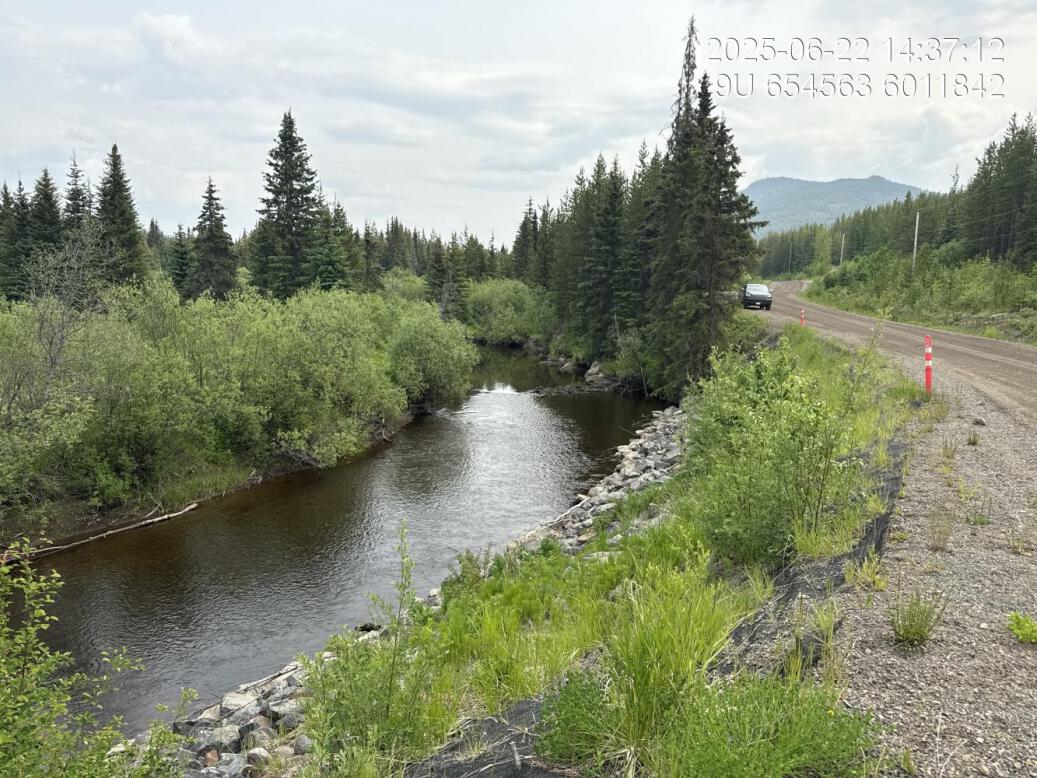
Figure 5.24: View of upstream end of site
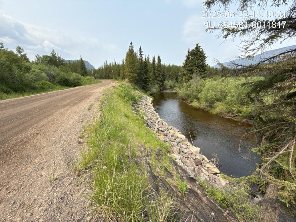
Figure 5.25: View of downstream end of site
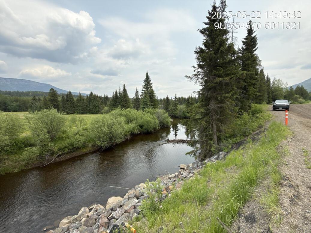
Figure 5.26: View of upstream end of site
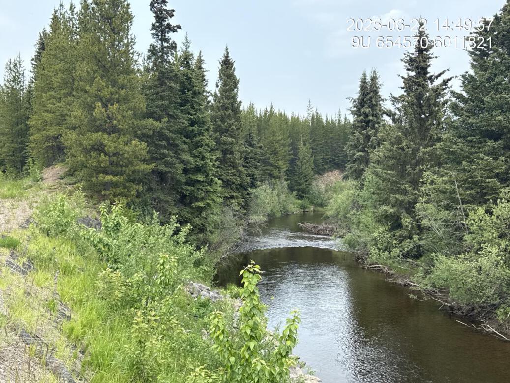
Figure 5.27: View of downstream end of site
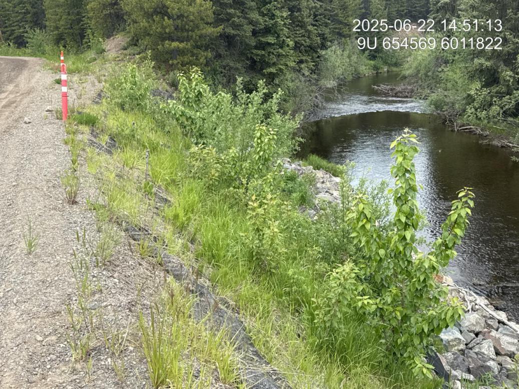
Figure 5.28: Riparian regrowth within site
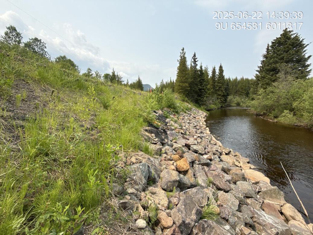
Figure 5.29: Revegetation status
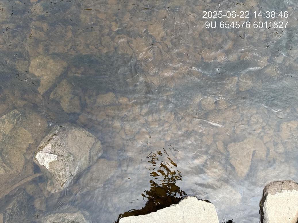
Figure 5.30: Substrate composition
Figure 5.31: Fish cover

Figure 5.32: Structure condition
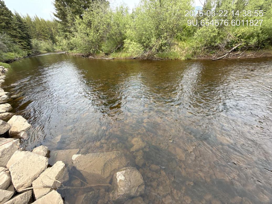
Figure 5.33: Flow velocity
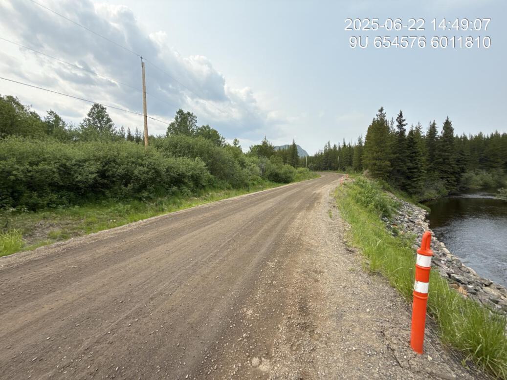
Figure 5.34: Access route
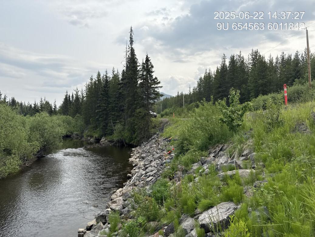
Figure 5.35: Mid-slope upstream
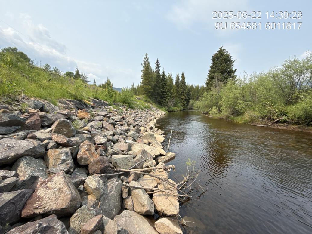
Figure 5.36: Toe of slope downstream
Craker Rd Lower — Bulkley River
site <- dplyr::filter(sites_all, site_id == "bulkley_meints_craker_rd_lower")
viewer_url <- stac_uav_viewer(site)
site_summary_table(site)| Date | 2024-09-23 |
| Stream | Bulkley River |
| UAV Flight | Yes |
| Reference | Gaboury and Smith (2016) |
| Assessment | WFN/LGL implementated prescription site. Six LWD structures and some rock armouring. Bank appears to be stable. No fencing. Some deep pools scoured behind lower structures. Decent cottonwood regeneration at downstream end of site with willow dispersed with agronomic grasses and Canada thistle. Upper end of site with poor riparian generation besides a narrow strip of willow. |
| Velocity | Small riffle at third structure from top then primarily run. |
| Substrate | Mostly cobble choked with algae. |
| Riparian | Some good Cottonwood regeneration, particularly at the downstream end of the site. Some willow establishment as well mixed in with agronomic grasses and some Thistle. |
| Flow Depth | 0.85, 1.0, 0.3 |
| Stability | Incision current 2.4, 2.0, 2.2. High water incision 0.9, 0.8, 0.6. |
| Revegetation | Decent regeneration within narrow right. Corridor ranging from 3 m to top of the bank to 12 m. Some Cottonwood regrowth, as well as Willow mixed with agronomic, grasses and dill. |
| Cover | Large Woody debris structures have created some areas of shallow pool cover adjacent to the structures on upstream end with areas of deep water scoured out for last two strictures. |
| Maintenance | There is no maintenance required for the actual structures however, fencing could be put in place and reparian width could be increased as well as density of plants. |
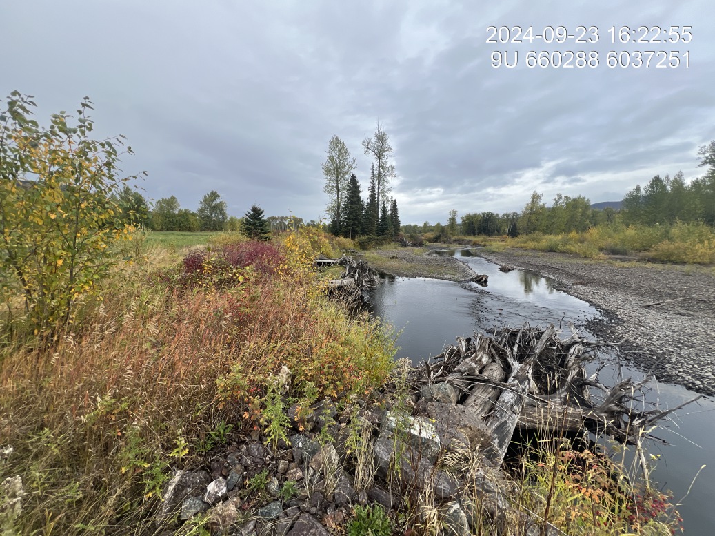
Figure 5.37: View of upstream end of site
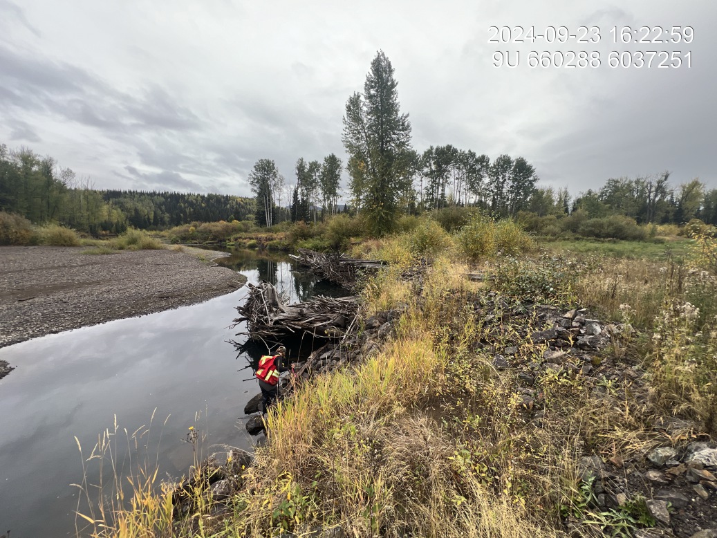
Figure 5.38: View of downstream end of site
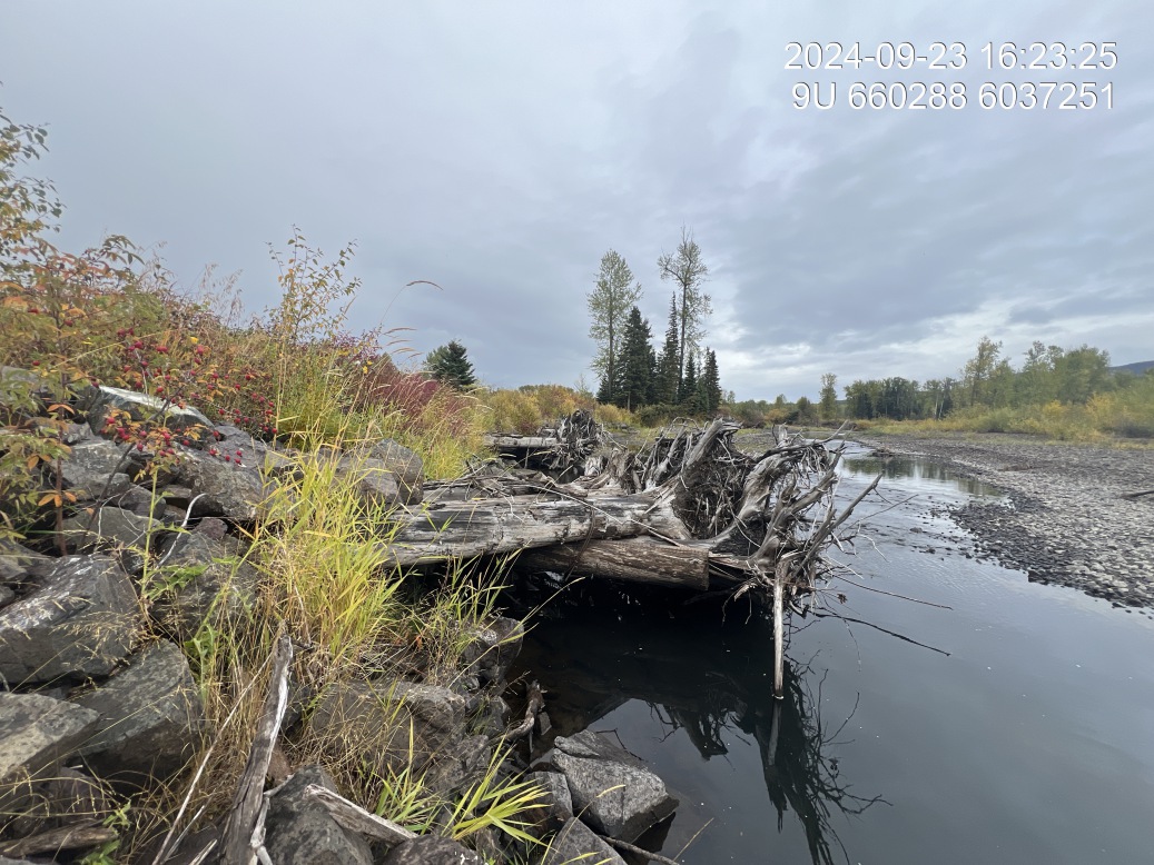
Figure 5.39: View of upstream end of site
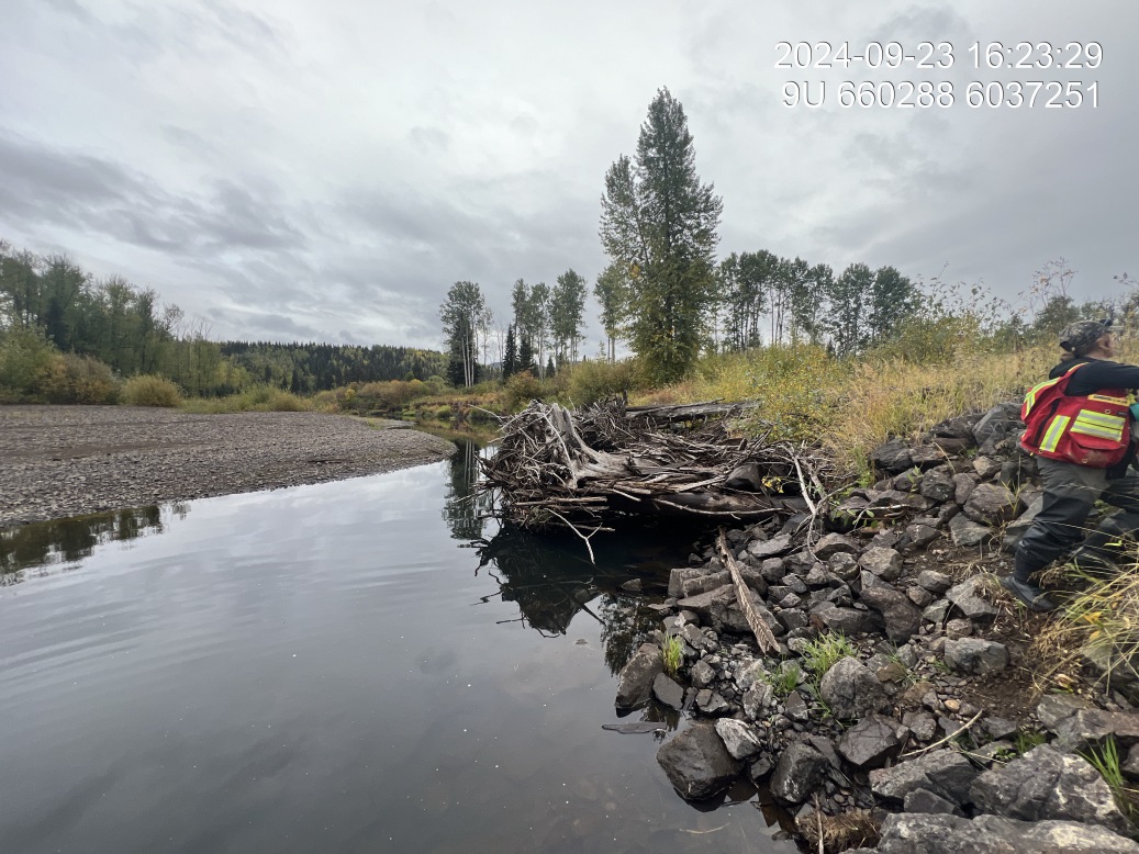
Figure 5.40: View of downstream end of site
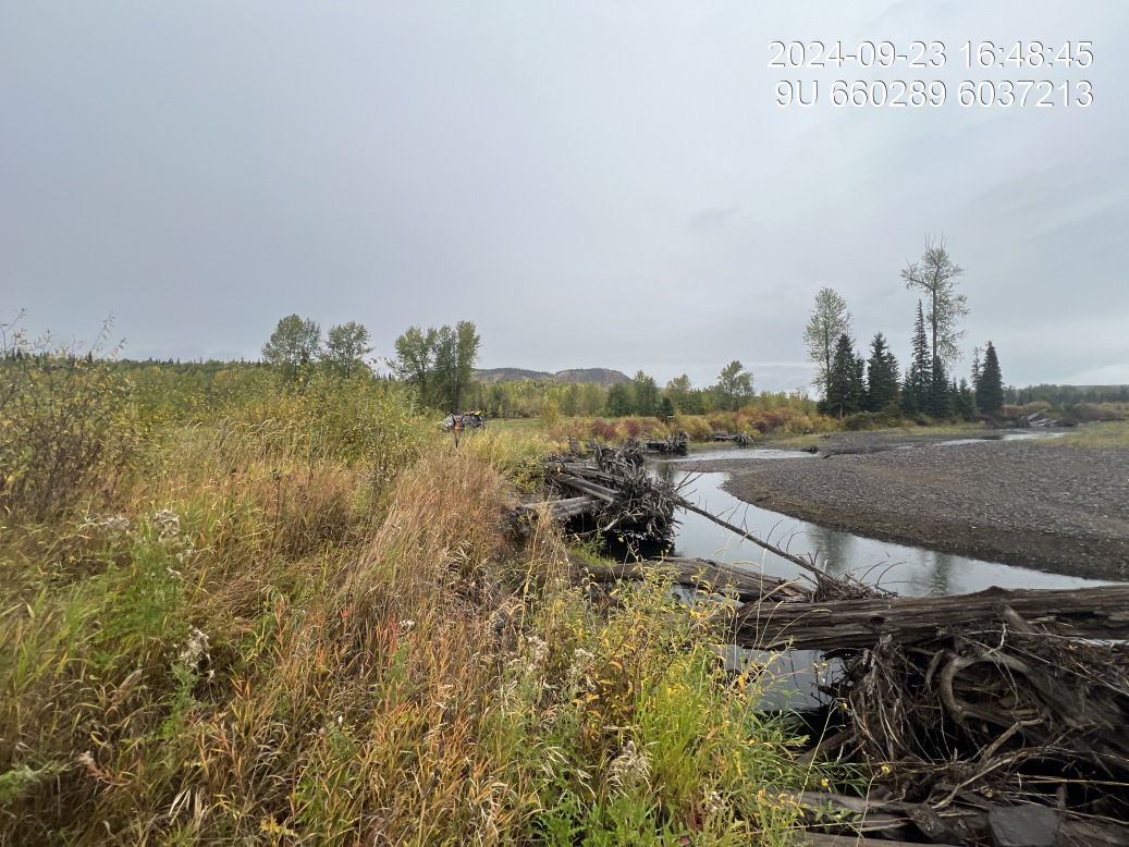
Figure 5.41: Riparian regrowth within site
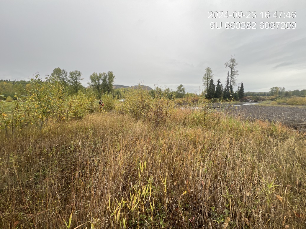
Figure 5.42: Revegetation status
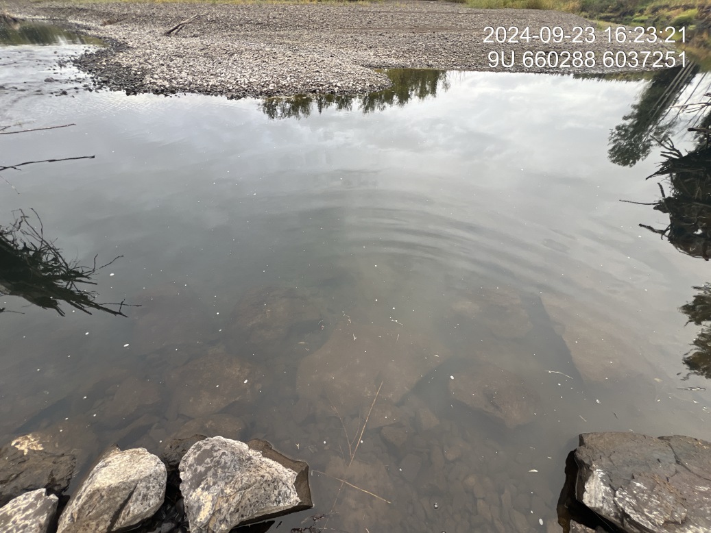
Figure 5.43: Substrate composition
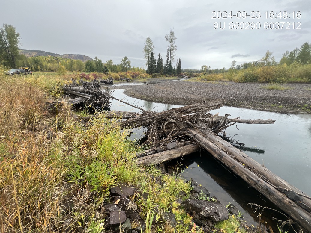
Figure 5.44: Bank stability
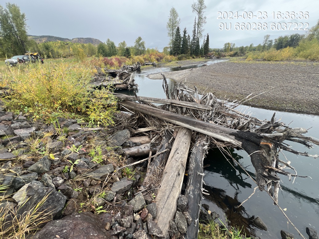
Figure 5.45: Fish cover
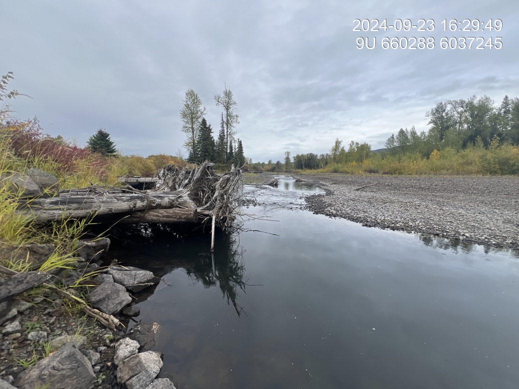
Figure 5.46: Barrel condition
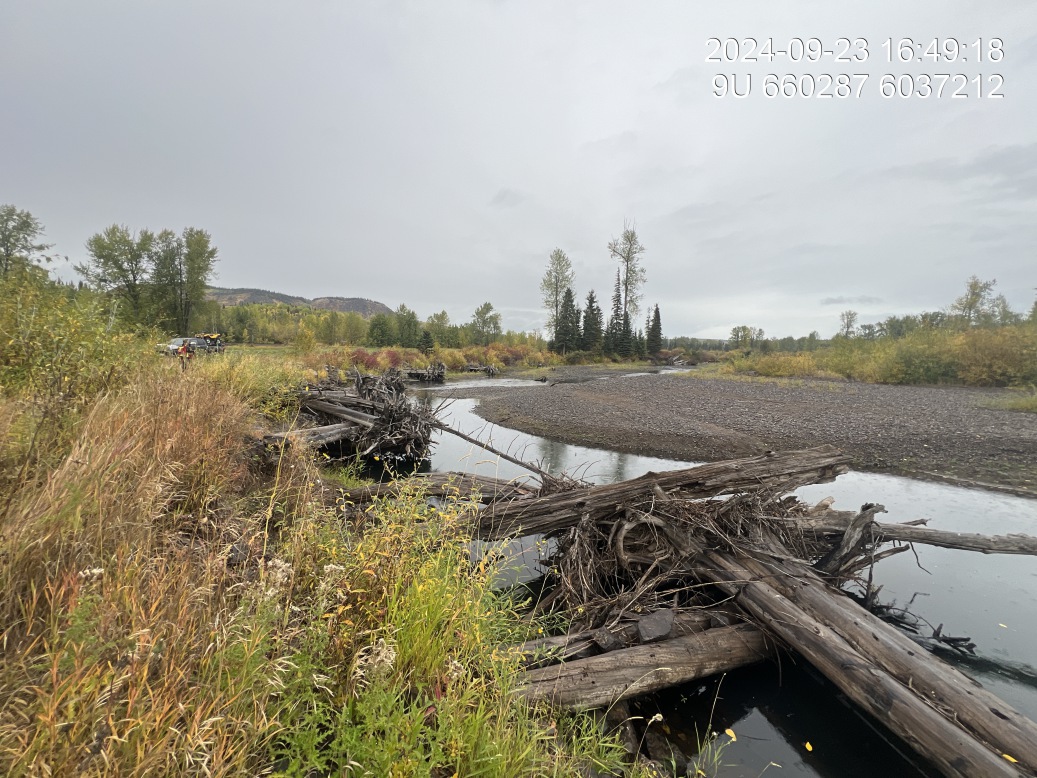
Figure 5.47: Channel constriction
McKilligan Upper — Bulkley River
site <- dplyr::filter(sites_all, site_id == "Mickilligan Road Upper")
viewer_url <- stac_uav_viewer(site)
site_summary_table(site)| Date | 2024-10-02 |
| Stream | Bulkley River |
| Land Owner | Andy Meints |
| UAV Flight | Yes |
| Length (m) | 230 |
| Reference | Gaboury and Smith (2016); (smith_gaboury2016BUILTREPORT?) |
| Assessment | 14 large Woody debris and boulder keyboard structures on left bank meander of the Bulkley river. Three of the wooden structures have completely failed and have been carried down the river. Significant amounts of erosion has taken place since works were conducted in 2016 or 17. Generally poor redden vegetation establishment and very narrow buffer between edges structures and cat exclusion, fencing. Large beaver dam, approximately 60 cm in height located approximately 50 m upstream of the top rock growing. |
| Erosion | Significant erosion throughout and approximately 80 m section. At the upstream end and downstream and bank protection seems to be somewhat effective, however preconstruction conditions. |
| Condition | At least three of the structures have completely failed and six out of 14 located at the peak of the outside corner have experienced excessive amounts of erosion with the bank receding approximately 7 to 10 m from the assumed post construction location. |
| Velocity | At time of survey velocity was near zero however, excessive erosion indicates there are times of high volume. |
| Substrate | Substrate primarily fines. |
| Riparian | Riparian upstream is young, primarily deciduous forest at 90m width and downstream primarily shrub with a width of approximately 70m. |
| Flow Depth | That’s the flow range between 40 to 100 cm with some deep areas adjacent to protruding route wards |
| Stability | Remaining structures appear somewhat stable however, the erosion appears to be increasing which will likely result in boss of more structures overtime. |
| Revegetation | Vegetation in general is poor with the large amount of Canada Thistle at the upstream end of the site and near no shrub or tree regeneration for the top 130 m. Downstream 100 m has a narrow strip of shrub right. Mixed with agronomic grasses, the maximum width of approximately 4 to 5 m. |
| Cover | The large Woody debris structures are providing some cover with significant amounts of debris accumulating on the lower five structures. The top five structures are as built without a large amount of degree catching on the upstream ends. There are some deep areas adjacent to the root wads that create deep pool cover. |
| Maintenance | Maintenance is needed to retain these remaining structures. Recommend armouring with large rip wrap and vegetation Incorporated along with significant red Terrian buffer of 50 m to be re-forced with Wood and shrub. |
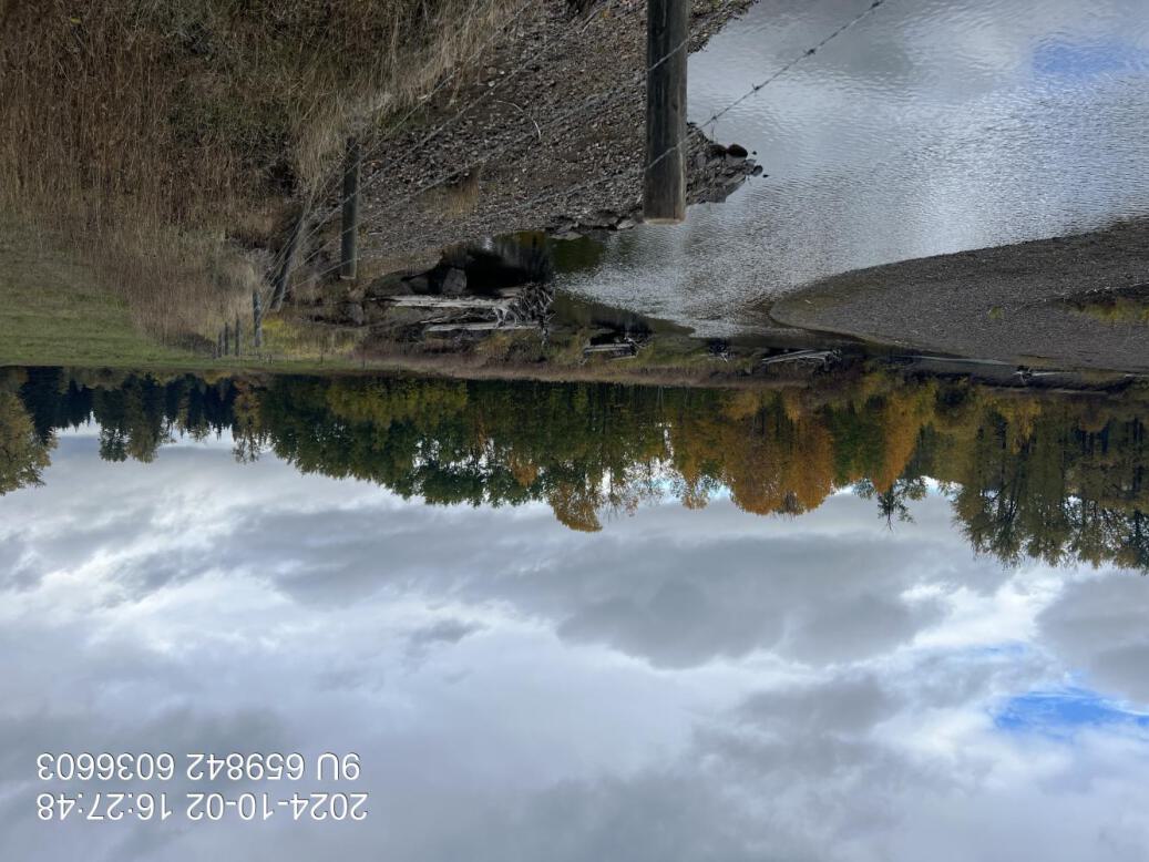
Figure 5.48: View of upstream end of site
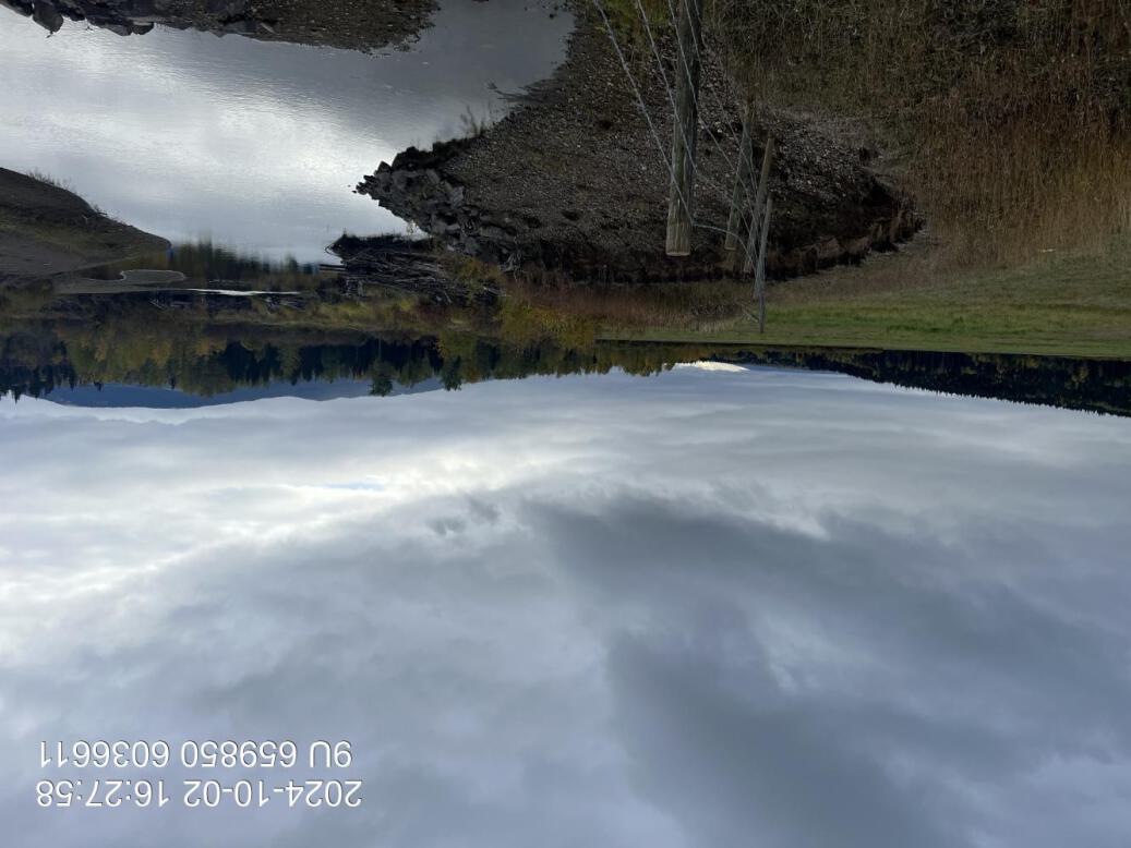
Figure 5.49: View of downstream end of site
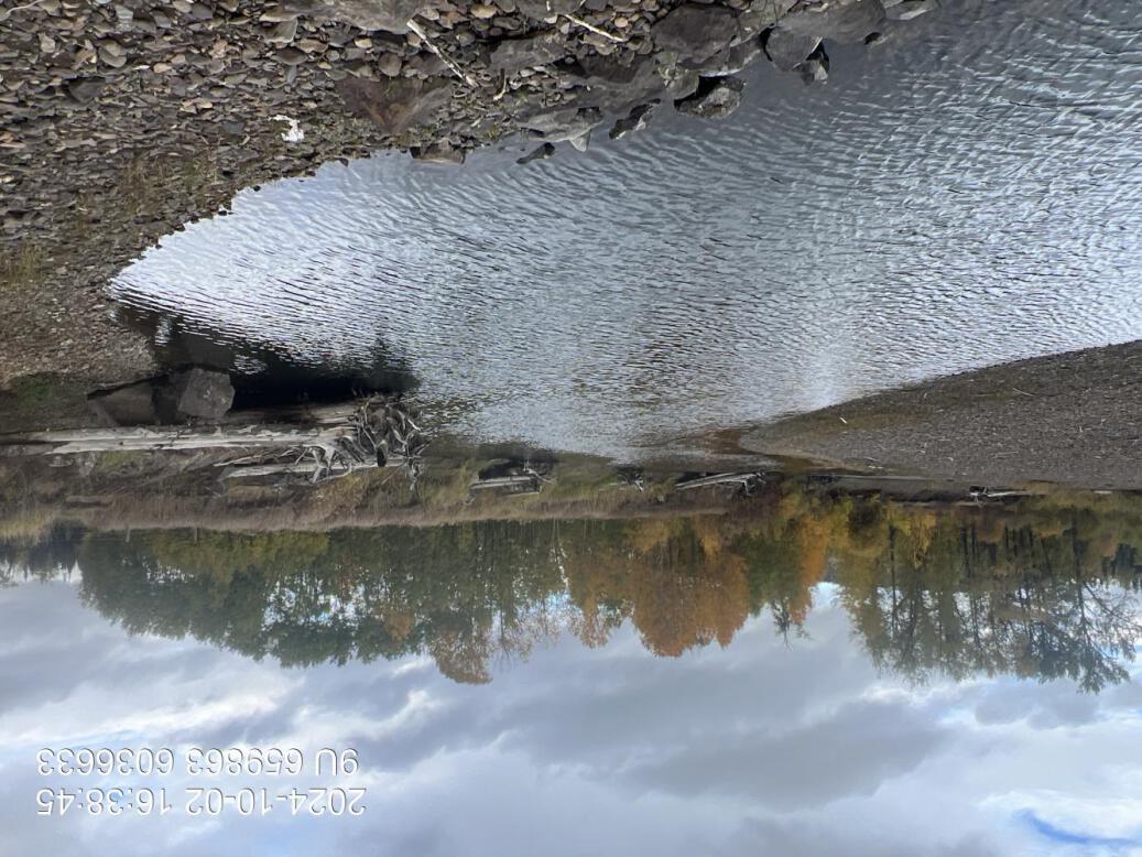
Figure 5.50: View of upstream end of site
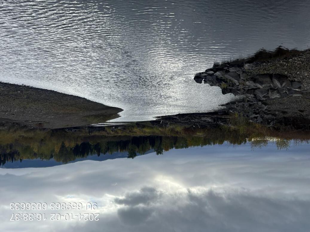
Figure 5.51: View of downstream end of site
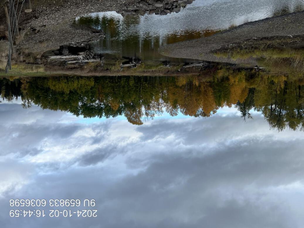
Figure 5.52: Riparian regrowth within site
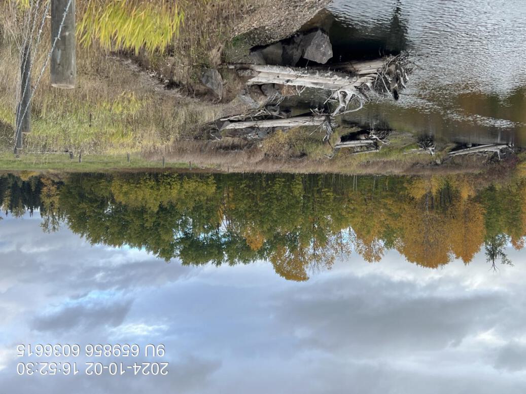
Figure 5.53: Revegetation status
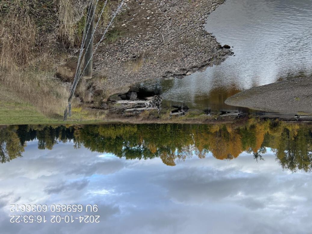
Figure 5.54: Bank stability
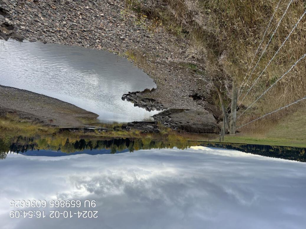
Figure 5.55: Maintenance requirements
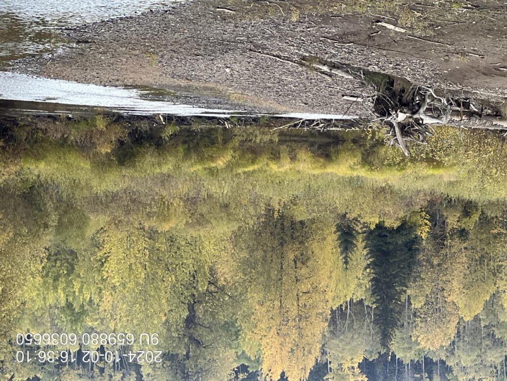
Figure 5.56: Beaver dam
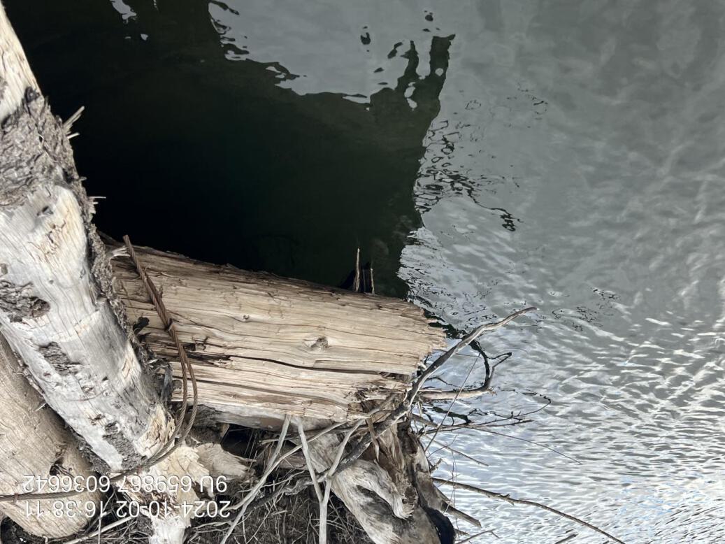
Figure 5.57: Deep pool
MX1 — Maxan Creek
site <- dplyr::filter(sites_all, site_id == "MX1")
viewer_url <- stac_uav_viewer(site)
site_summary_table(site)| Date | 2024-06-24 |
| Stream | Maxan Creek |
| Land Owner | Strimbold |
| UAV Flight | Yes |
| Width (m) | 15 |
| Length (m) | 130 |
| Reference | Gaboury and Smith (2016); (smith_gaboury2016BUILTREPORT?) |
| Assessment | The structures of the site seem to be holding up well it appears there are seven. Erosion just downstream of the third structure however, the fourth is still intact and a small enlarged weight reach out on a substream and which could result in the deposition of sediments and stabilization of the section in the long-term however, that is uncertain. Beaver activity obvious in this area with a breached down approximately 3/4 of the way Downstream. Overall riparian vegetation regrowth is poor estimated at one to 2% cover of planted willow whips and occasional naturals. It appears as though the planted stock could not compete with the economic grasses present here and may have experienced drought stress since replanting in 2021. |
| Habitat | Glide and pool habitat with estimated depths to 0.8m. Primarily fine substrates. Some small debris jam on fourth structure (from upstream end) and woody debris structure. Very nice gravels suitable for coho or sockeye spawning just downstream of the site. |
| Erosion | There is some significant erosion over an approximately 25 m section of the site between structures three and four. There may have been another structure in between but not sure. Other than that no significant erosion. |
| Condition | Overall, the woody debris structures seem to be functional and the bank is 95% intact. As noted - the riparian revegetation is poor and could be revisited with teh addition of coarse woody debris, removal of agronomic sods, replanting and the placement of mulch. |
| Velocity | Habitat is primarily glide throughout the treatment area with some scour behind the structures. Substrates throughout the area are primarily fines indicating overall very low velocity. Good fry and parr habitat. |
| Substrate | Primarily fines throughout with some pockets of gravel and significant amounts of high value gravels just downstream of the treatment site. |
| Riparian | Riparian regrowth on the site is poor with some survival lower down where plants are closer to the water table and along the bank. Overall - the percent cover of native shrub vegetation is very low and not expected to dominate in the long-term due to competition with agronomic grasses. At the top of the bank - survival is very poor with percent cover estimated that 1 - 2%. |
| Flow Depth | Depths are primarily shallow, but there is significant scour behind large woody debris structures 3, 4 and possibly others with depths exceeding 1m |
| Stability | Generally - stability of most structures appears good with structure 3 now cracked through the two main logs in the middle with erosion upstream |
| Revegetation | Revegetation of planed shrubs has failed likely due to lack of nutients, light and water related to presence of agronomic sods and lack of precipitation. Good grass cover. |
| Cover | Structures providing some cover for fish - particularly during periods of higher flow when they will provide areas of refuge. |
| Maintenance | Area could be fill planted with cottonwood to provide more meaningful riparian forest in the long-term however some sort of treatment to deal with competition from agronomic grasses would likely be required to ensure robust growth. Irrigation could also be beneficial. |
Figure 5.58: View of upstream end of site
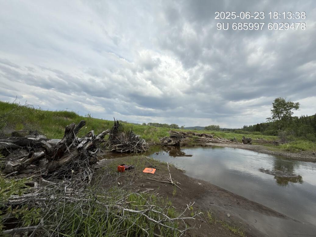
Figure 5.59: View of downstream end of site
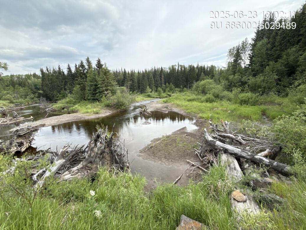
Figure 5.60: View of upstream end of site
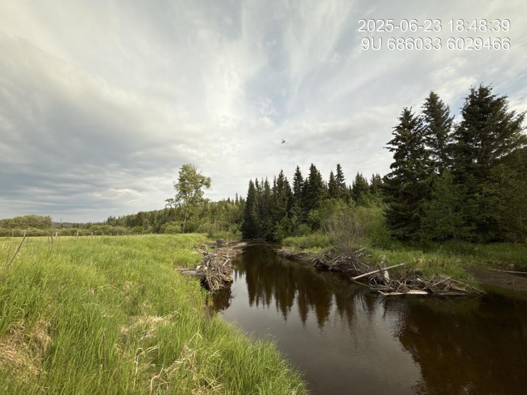
Figure 5.61: View of downstream end of site
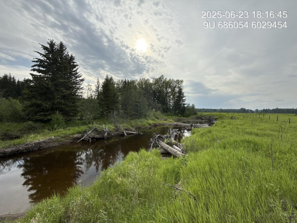
Figure 5.62: Riparian regrowth within site
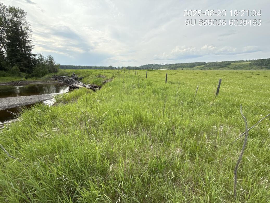
Figure 5.63: Revegetation status
Figure 5.64: Substrate composition
Figure 5.65: Flow depth
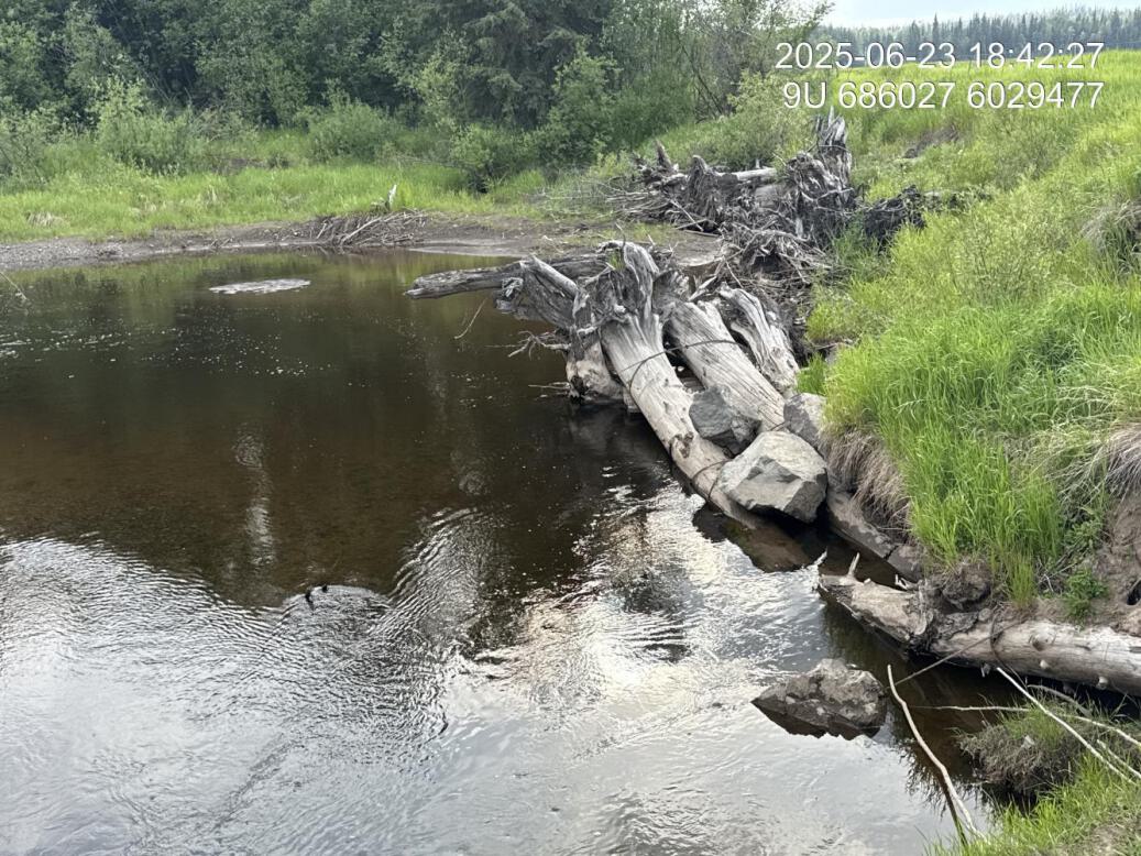
Figure 5.66: Bank stability

Figure 5.67: Fish cover
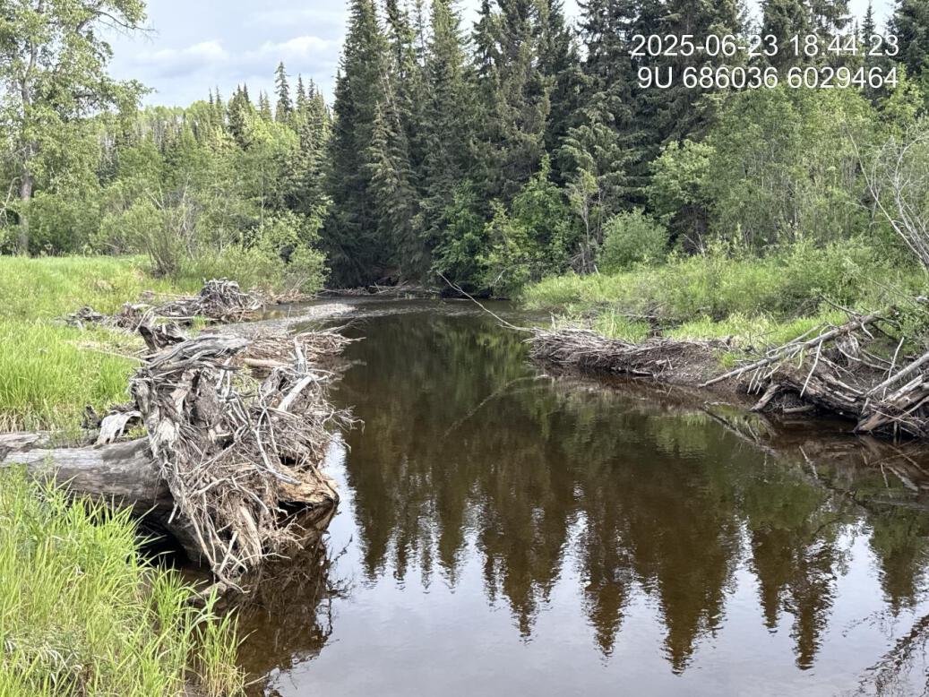
Figure 5.68: Flow velocity
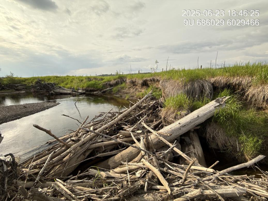
Figure 5.69: Maintenance requirements
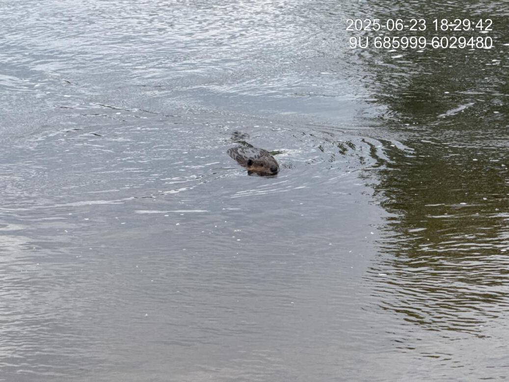
Figure 5.70: Beaver activity
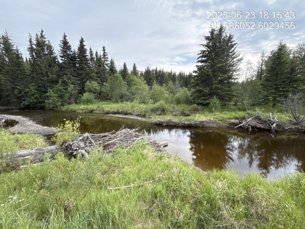
Figure 5.71: Breached beaver dam
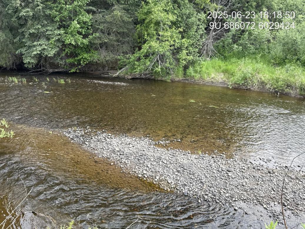
Figure 5.72: Gravels at downstream end
MX2 — Maxan Creek
site <- dplyr::filter(sites_all, site_id == "MX2")
viewer_url <- stac_uav_viewer(site)
site_summary_table(site)| Date | 2025-06-24 |
| Stream | Maxan Creek |
| Land Owner | Strimbold |
| UAV Flight | Yes |
| Width (m) | 15 |
| Length (m) | 85 |
| Reference | HWI |
| Assessment |
Site appears to be holding together quite well with sparse shrub cover but primarily agronomic grasses within footprint of the site. This is a peg boarding and wire site with stinger planted willow whips. Overall shrub and occasional cottonwood cover is estimated at 7%. Overall, wondering if this was a site where the stream was jumping the channel and flooding the adjacent likely historic wetland location. From review of ortho imagery and assessment it appears as though this agricultural field is likely a drain wetland area with noticeable trenching along the outside road has been built. There is a die like structure adjacent to the outside of the site running much farther than where treatment was done, indicating this is acting as a levy to keep Maxine creek away from areas used for agriculture. |
| Habitat | Simple riffle habitat throughout length of site with channel primarily on opposite side of the stream. Nice pool area just above top of site on the left bank. |
| Erosion | No significant erosion, except a tiny bit slightly upstream of where treatment was conducted |
| Condition | Does not appear to be any structural issues with the site. Overall shrub regeneration is better at upstream end of site. |
| Velocity | Fairly simple, shallow riffle habitat adjacent to the treatment site. Good value for growing insects (fish food), but relatively low value as fish habitat. |
| Substrate | Substrate is natural adjacent to treatment footprint with gravel and small cobbles similar to upstream and downstream. Significant algal growth on the substrate - potentially indicating nutrient enrichment. |
| Riparian | Downstream riparian appears to be primarily dense willow on both sides of the stream with young spruce forest on the left bank and mature cottonwood spruce upstream approximately 80m on the right bank. |
| Flow Depth | Flow is very shallow so not providing habitat for this other than fry along the margins |
| Stability | Entire area treated is stable with no evidence of slumping or fail |
| Revegetation | Riparian regrowth is fair with overall shrub and tree cover estimated at 10%. There is significant ululate browse of the willow which could be interpreted as a good thing. |
| Cover | Site basically does not provide cover for fish, except perhaps a very small amount at the upstream end. |
| Maintenance | Area could be fill planted with cottonwood to provide more meaningful riparian forest in the long-term however some sort of treatment to deal with competition from agronomic grasses would likely be required to ensure robust growth. Irrigation could also be beneficial. |
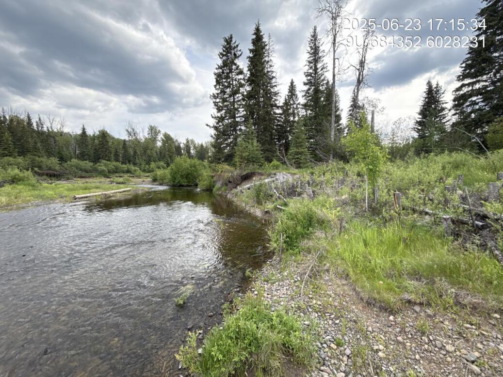
Figure 5.73: View of upstream end of site
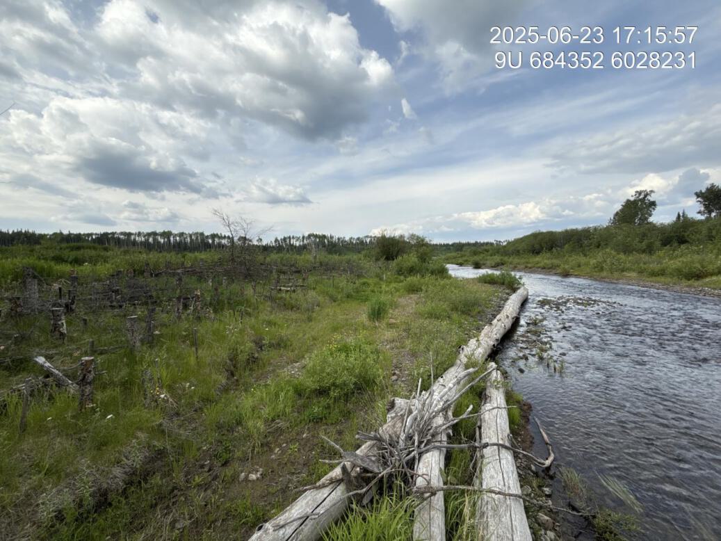
Figure 5.74: View of downstream end of site
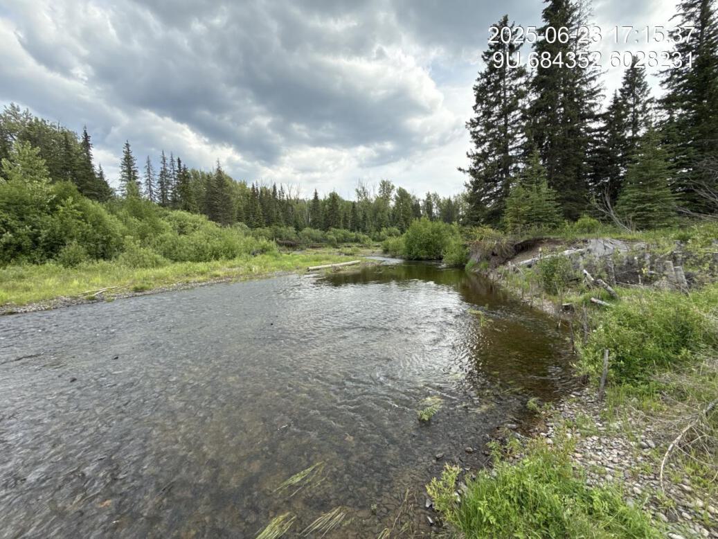
Figure 5.75: View of upstream end of site
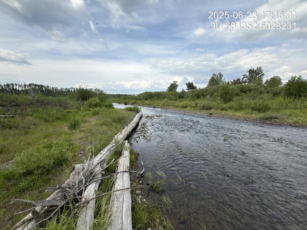
Figure 5.76: View of downstream end of site
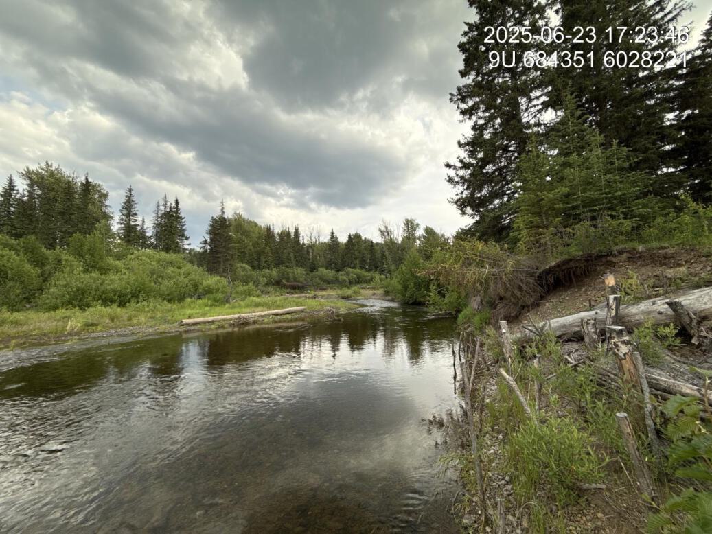
Figure 5.77: Riparian regrowth within site
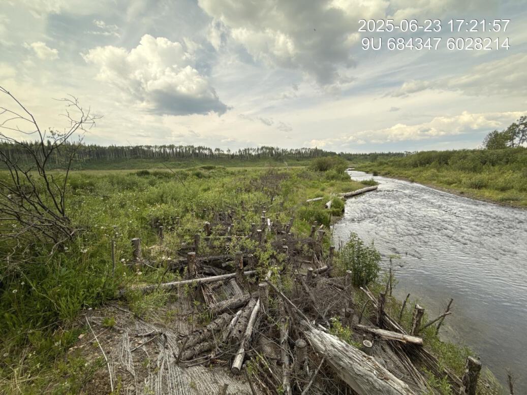
Figure 5.78: Revegetation status
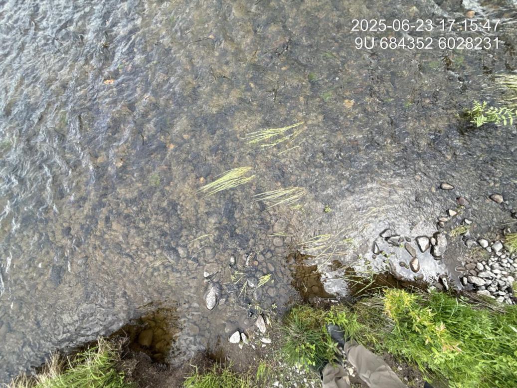
Figure 5.79: Substrate composition
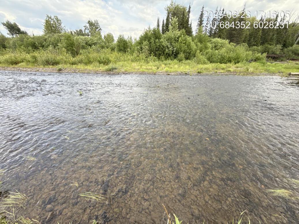
Figure 5.80: Flow depth
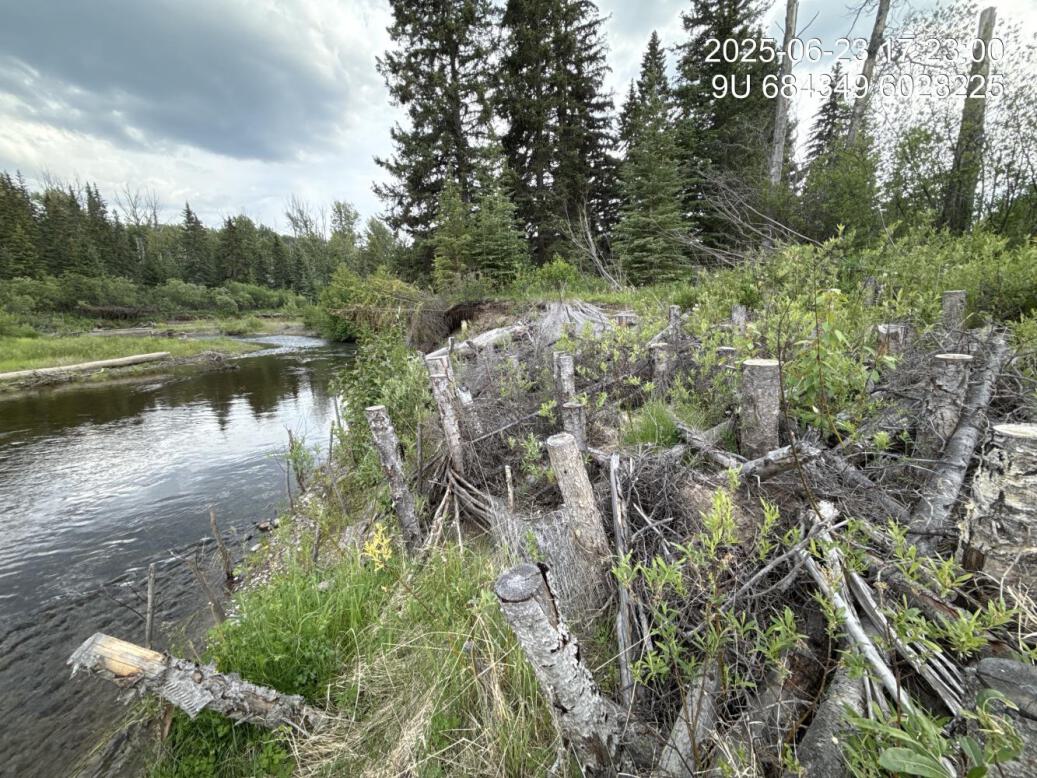
Figure 5.81: Bank stability
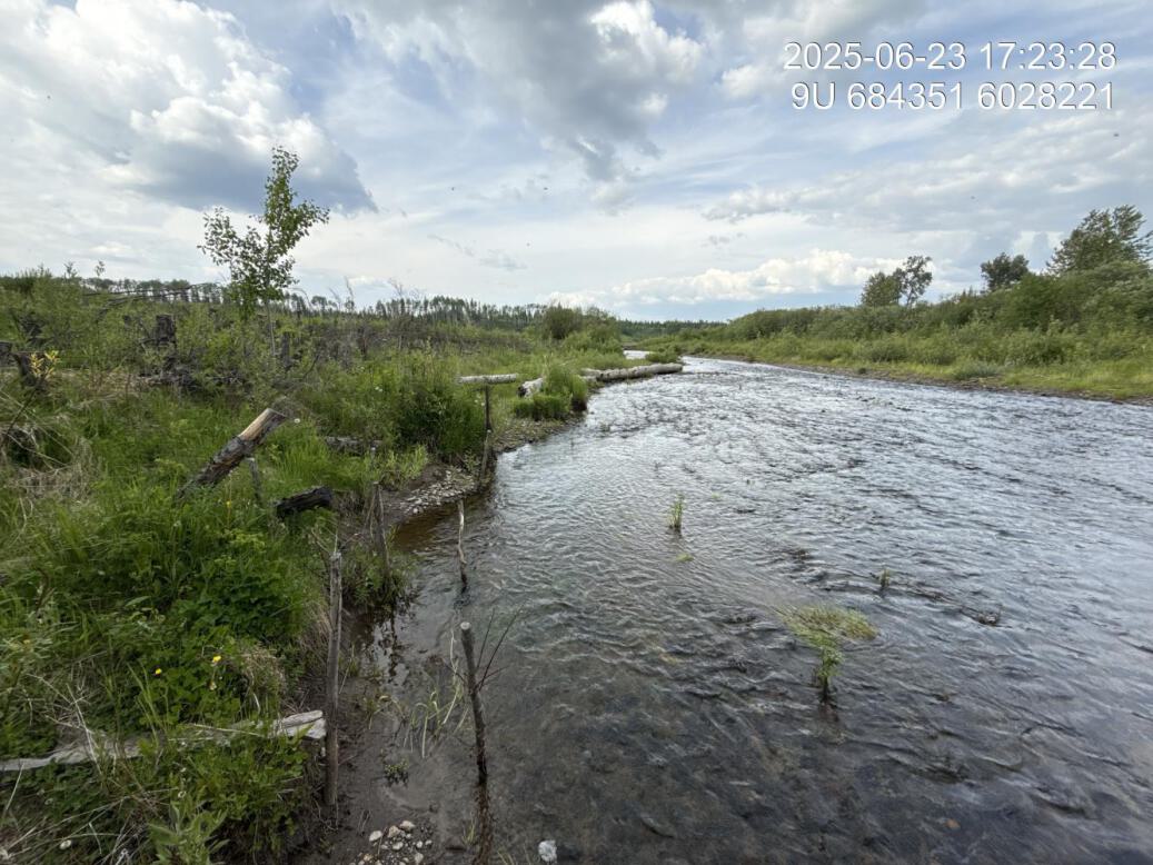
Figure 5.82: Fish cover
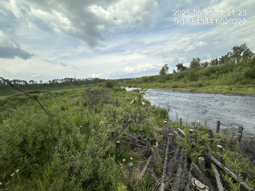
Figure 5.83: Structure condition
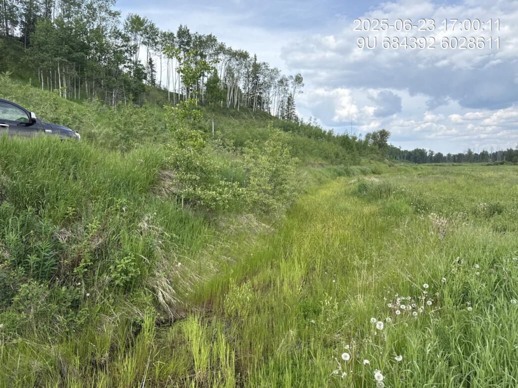
Figure 5.84: Ditching by road
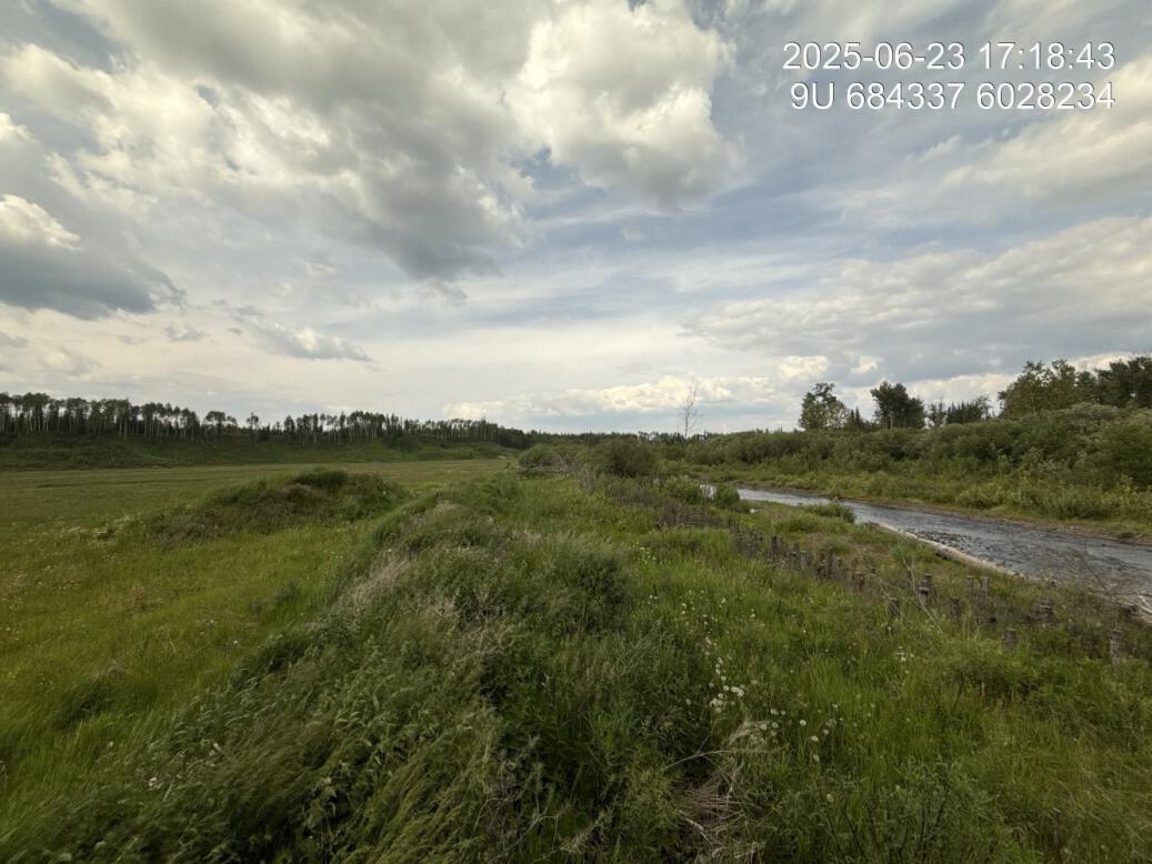
Figure 5.85: Dyke downstream
Potential Site
Buc172 — Buck Creek
site <- dplyr::filter(sites_all, site_id == "Buc172")
viewer_url <- stac_uav_viewer(site)
site_summary_table(site)| Date | 2025-06-22 |
| Stream | Buck Creek |
| Land Owner | Private |
| UAV Flight | Yes |
| Width (m) | 30 |
| Length (m) | 150 |
| Reference | MacKay et al. (1998) |
| Assessment |
This is a late 90s prescription location however no physical works appear to have been conducted at this site. There is significant erosion on the left bank adjacent to Buck Flats Road with the edge of erosion within 2m of the power and telephone line. Seems likely that this site will require erosion protection or relocation of the road to protect the road and power infrastructure. Likely a fairly heavy sediment source for the creek. The erosion extends upstream with the entire length of impacted area approximately 150 m long. |
| Habitat | Fairly simple riffle habitat with significant large and small wood debris at the downstream end of the site, likely generated from woody debris that has fallen in the stream from the erosion. |
| Substrate | Cobble |
| Riparian | Young forest upstream and downstream |
| Flow Depth | 20-50cm |
| Stability | Actively slumping |
| Cover | Good cover at downstream end of site due to large and small woody debris |
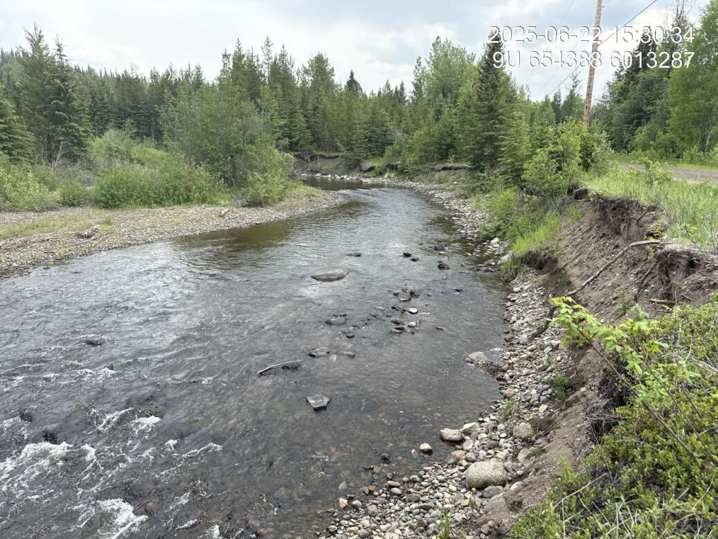
Figure 5.86: View of upstream end of site
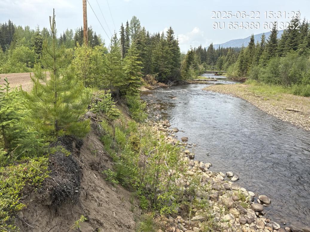
Figure 5.87: View of downstream end of site
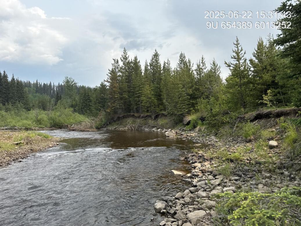
Figure 5.88: View of upstream end of site
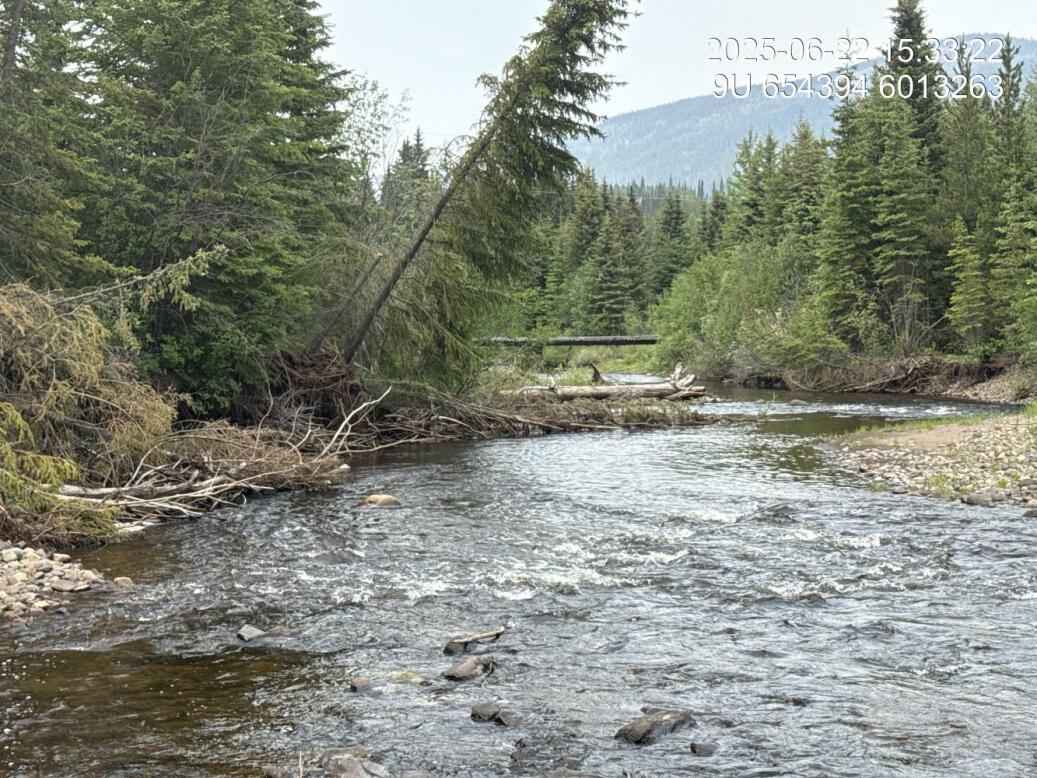
Figure 5.89: View of downstream end of site
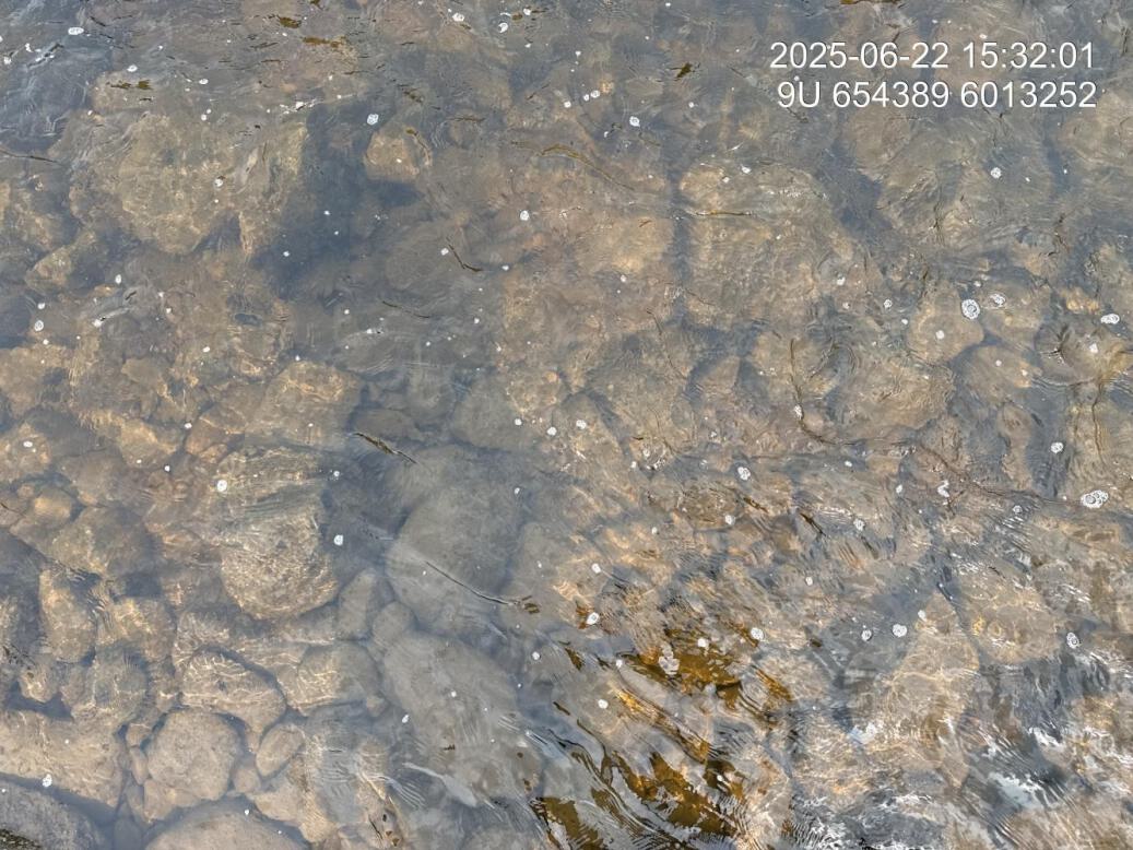
Figure 5.90: Substrate composition
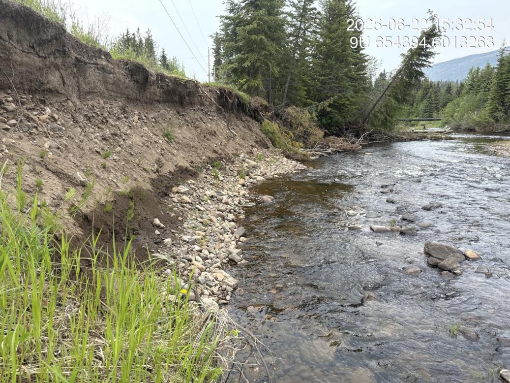
Figure 5.91: Bank stability
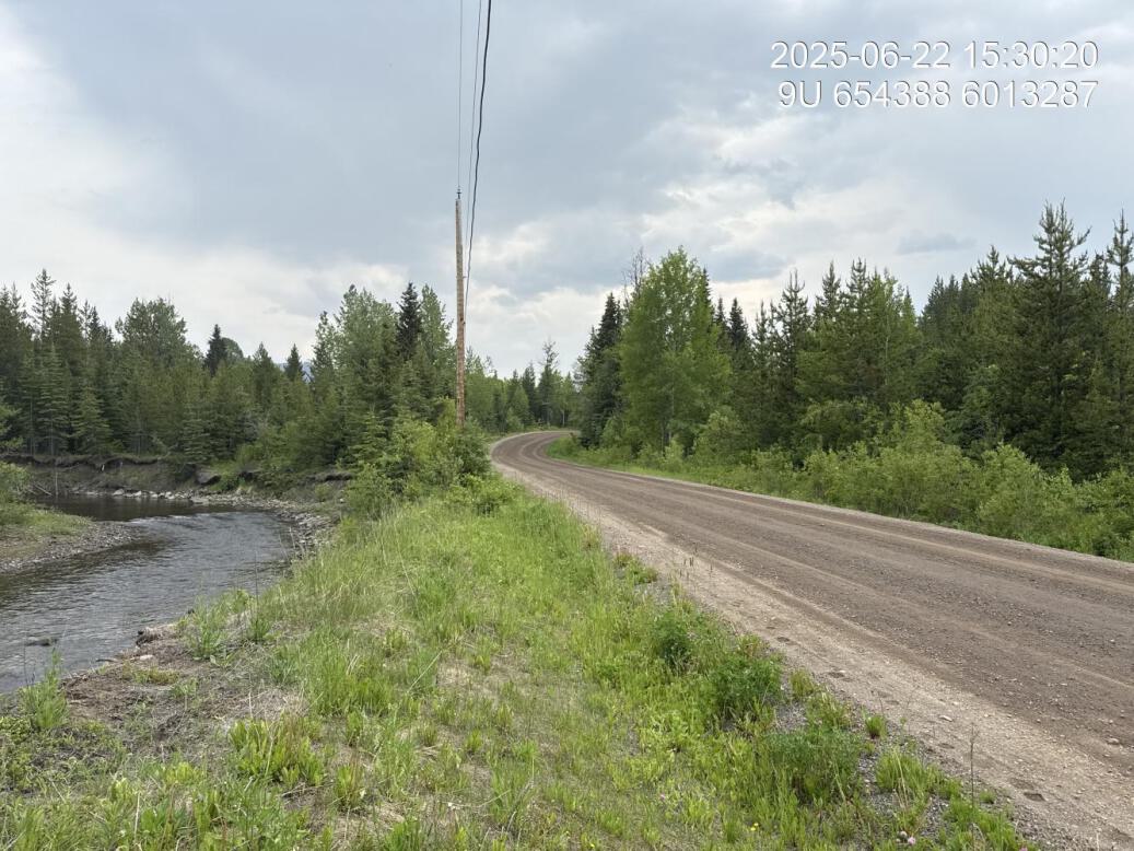
Figure 5.92: Access route
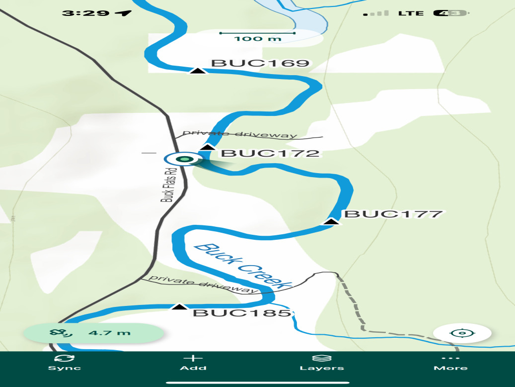
Figure 5.93: Site location overview
Buc7 — Buck Creek
site <- dplyr::filter(sites_all, site_id == "buc7")
viewer_url <- stac_uav_viewer(site)
site_summary_table(site)| Date | 2025-06-19 |
| Stream | Buck Creek |
| Land Owner | Municipal |
| UAV Flight | Yes |
| Width (m) | 50 |
| Length (m) | 1000 |
| Reference | MacKay et al. (1998) |
| Assessment | The stream in the last few years has redirected through a heavily forested cottonwood area with the main flow bypassing the right hand bank corner. This is an area of heavy simplification of the river due to decking structure on the right bank. Upstream of hear the creek is channelized with defined dykes on both sides. It appears there has been vegetation clearing along the riprap Dyke likely to reduce risk of failures due to Dropping trees. |
| Habitat | Site visit is coinciding with descending hydrograph and habitat functioning as side channel refuge and rearing habitat. As the stream is bordered by old growth cottonwood, dense willow and dogwood on the left bank there is nice cover as large wood debris and overhanging vegetation. Numerous fry and par seen rising. Adjacent to the dyke is primarily shallow 30 to 50cm riffle and glide with abundant gravels of 2 to 6 cm diameter throughout. |
| Erosion | No notable erosion besides normal Channell processes with the historic Dyke structure in great shape |
| Condition | The dyke is in good shape and has very recently had the vegetation cleared from rock face. |
| Velocity | Flows are low within this now side, channel area with velocities appearing to be fairly diverse - dependent on location within the channel. |
| Substrate | Gravels throughout the area adjacent to the rip rap. Gravel estimated at 8cm diameter and appearing relatively clear but with some algae growth present. |
| Riparian | Repair vegetation recently removed from face of the dyke. Old growth cottonwood, dogwood, and willow forest on the other side of the river. |
| Flow Depth | Lots of great overhanging banks and areas of large debris and overhanging vegetation along the left bank of the now side channel - historic channel. Seems to be functioning very well for fry and parr rearing with numerous fish rising for insects. |
Figure 5.94: View of upstream end of site
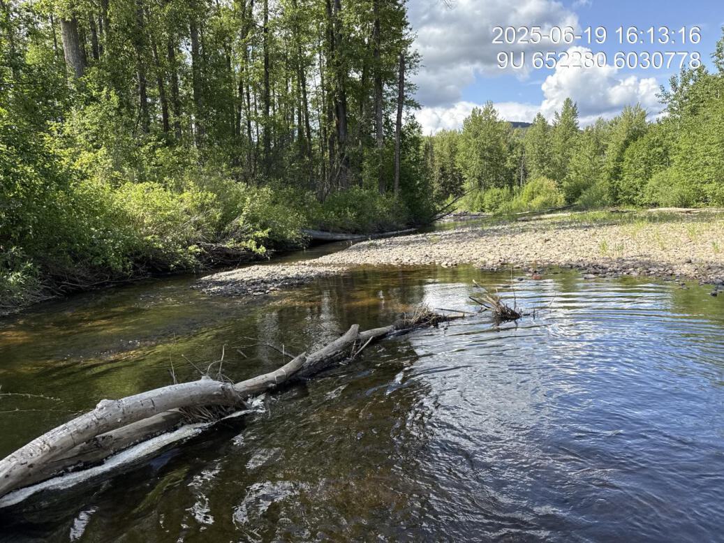
Figure 5.95: View of downstream end of site
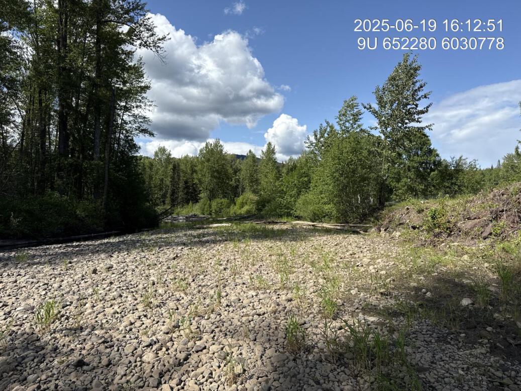
Figure 5.96: View of downstream end of site
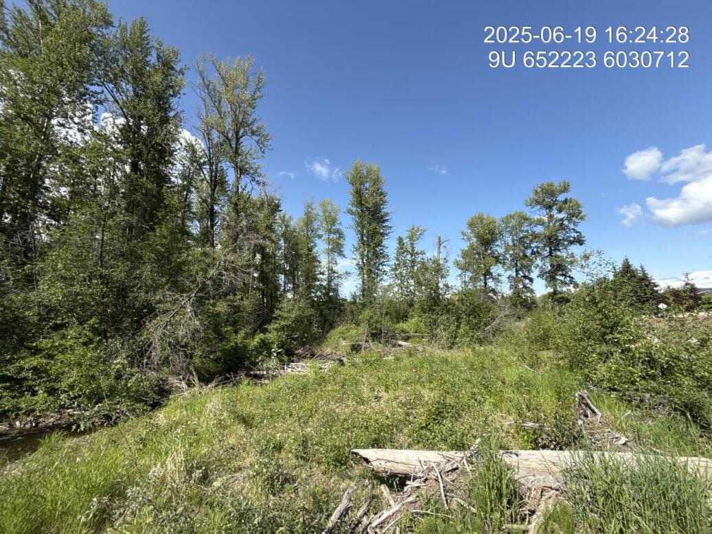
Figure 5.97: Riparian regrowth within site
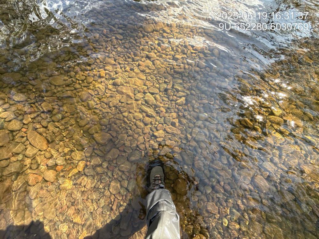
Figure 5.98: Substrate composition
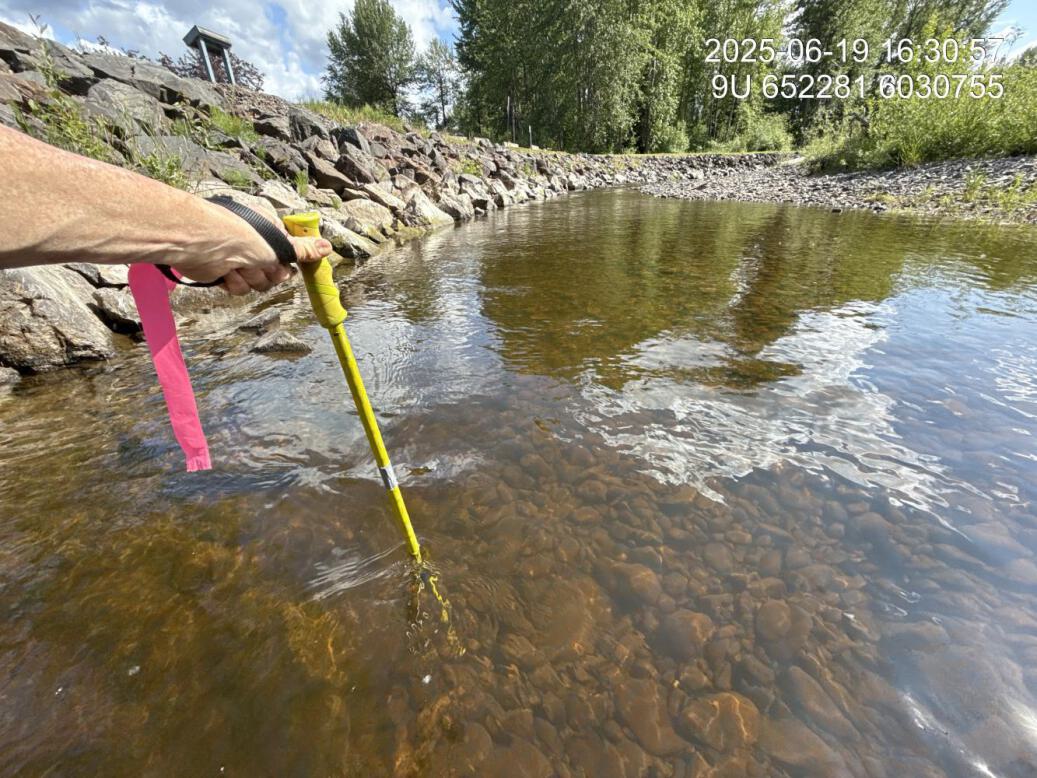
Figure 5.99: Flow depth
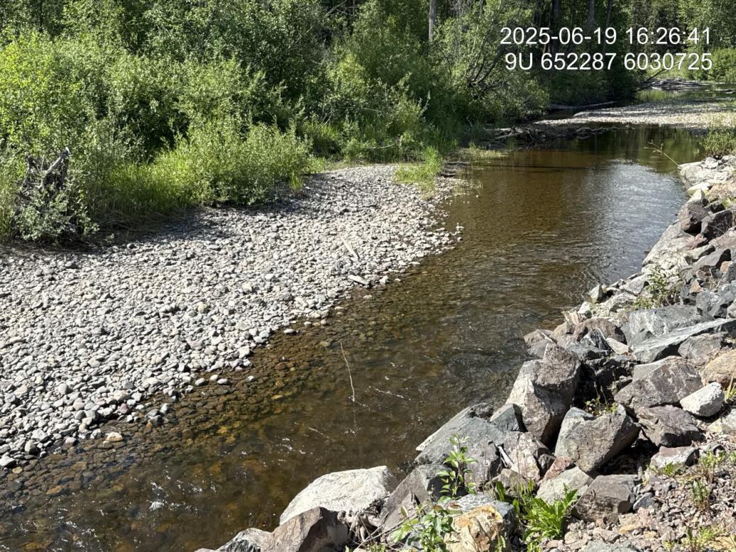
Figure 5.100: Flow velocity
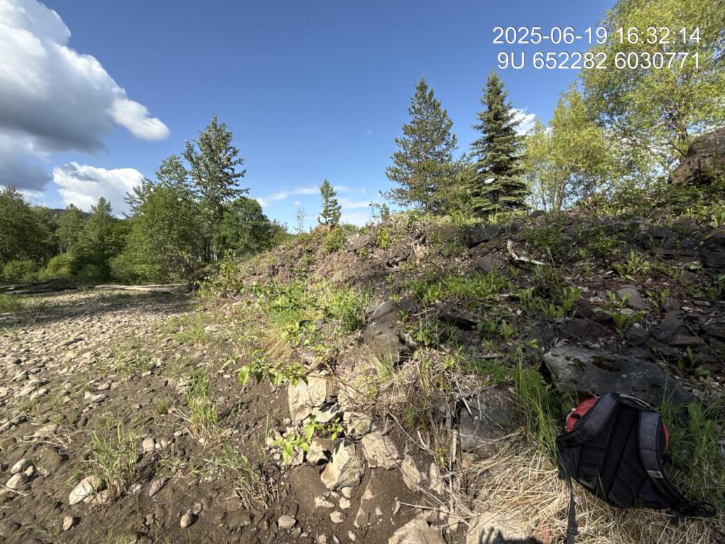
Figure 5.101: Vegetation removed at dyke
Figure 5.102: New channel upstream
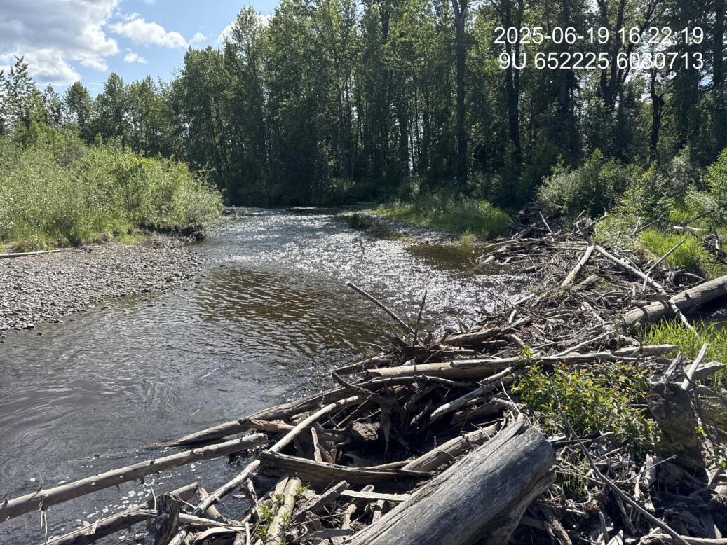
Figure 5.103: New channel inlet
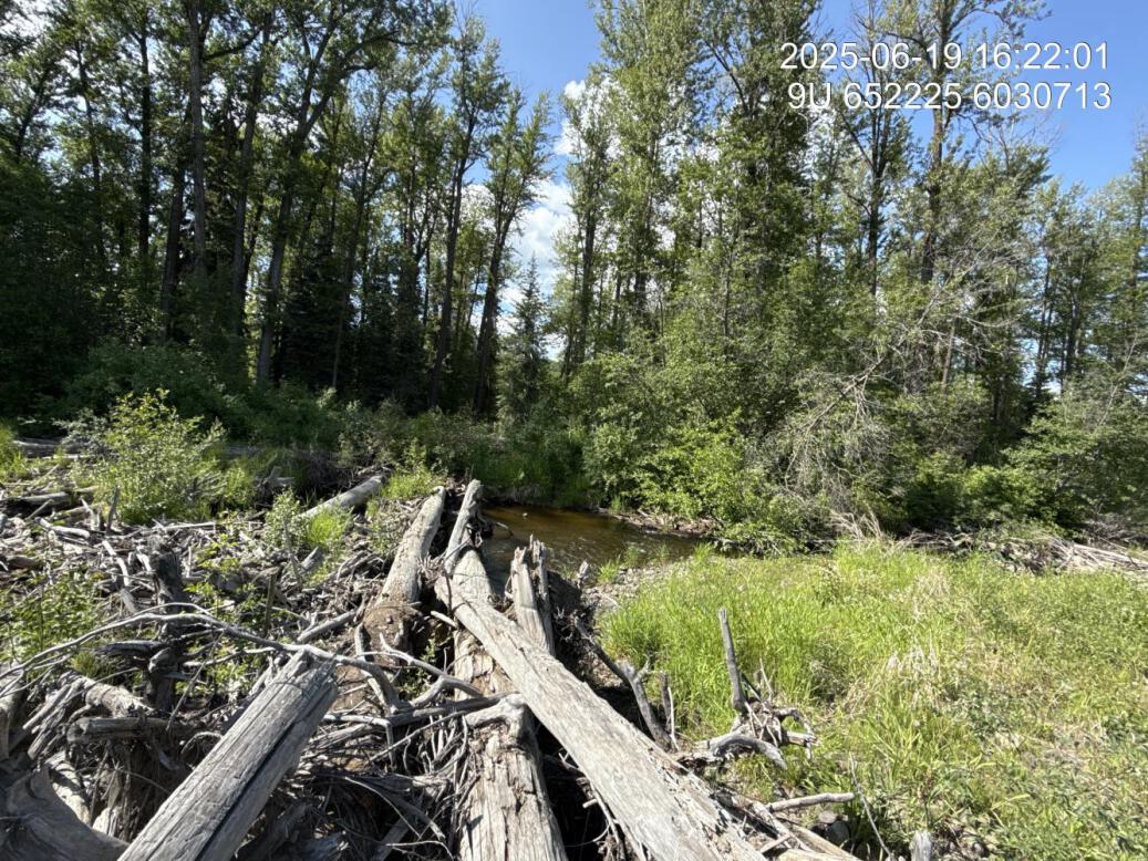
Figure 5.104: New channel downstream
Bul32 — Bulkley River
site <- dplyr::filter(sites_all, site_id == "bul32")
viewer_url <- stac_uav_viewer(site)
site_summary_table(site)| Date | 2025-06-20 |
| Stream | Bulkley River |
| Land Owner | Municipal |
| UAV Flight | Yes |
| Width (m) | 50 |
| Length (m) | 300 |
| Reference | MacKay et al. (1998) |
| Assessment | Historic prescription site. Erosion on left bank likely caused by high energy from riprap area of railway transferring to what appears to be a historic pasture area. Provincial land ownership layer indicates that this land belongs to the municipality. Across the highway just upstream is the location of a tributary stream that appears to have an annual blockage issues related to beaver. |
| Habitat | Rip rap along railway leads to outside meander with significant erosion and incision between 1.5 and 2.5 m deep. Some large woody debris at the beginning of the bend then near none until the far side of the corner where the old growth cottonwood forest begins. |
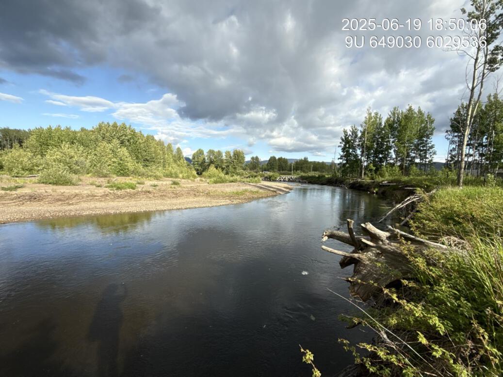
Figure 5.105: View of upstream end of site
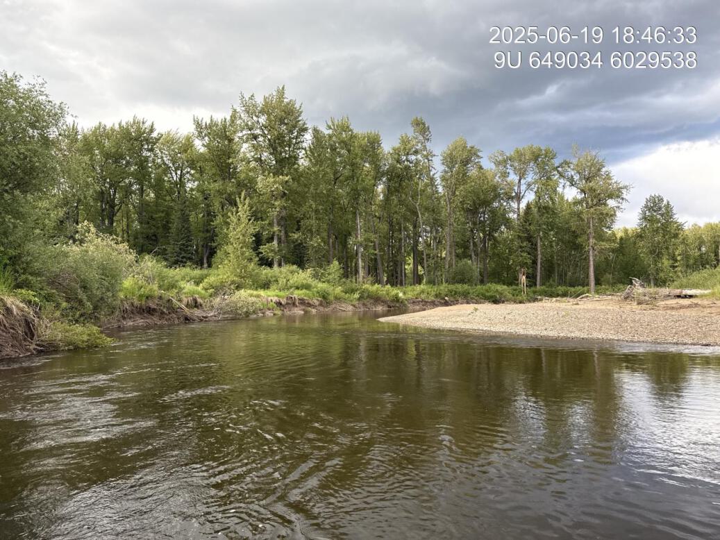
Figure 5.106: View of downstream end of site
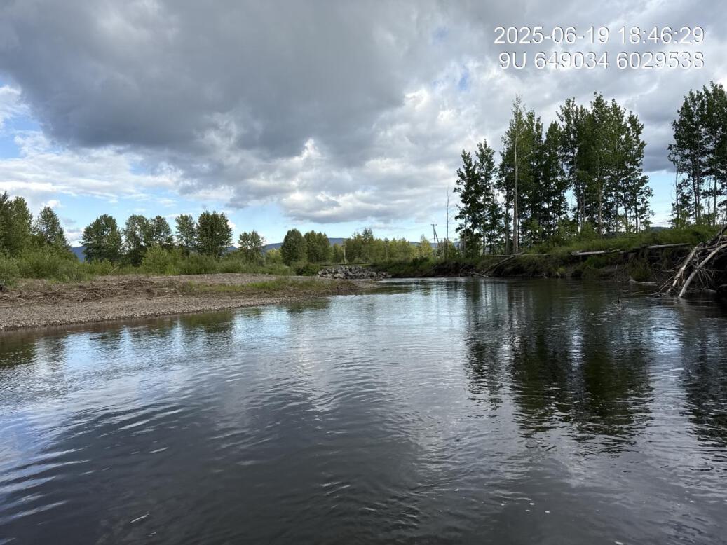
Figure 5.107: View of upstream end of site
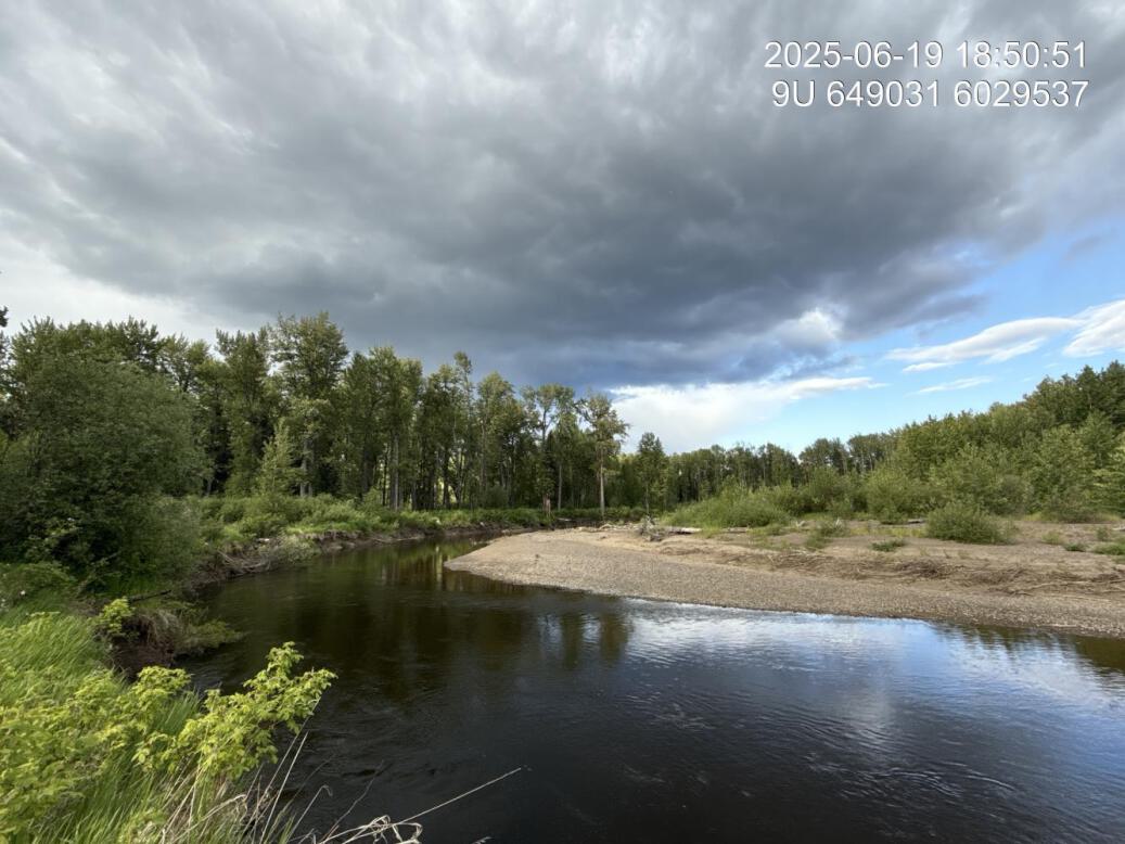
Figure 5.108: View of downstream end of site
Figure 5.109: Riparian regrowth within site
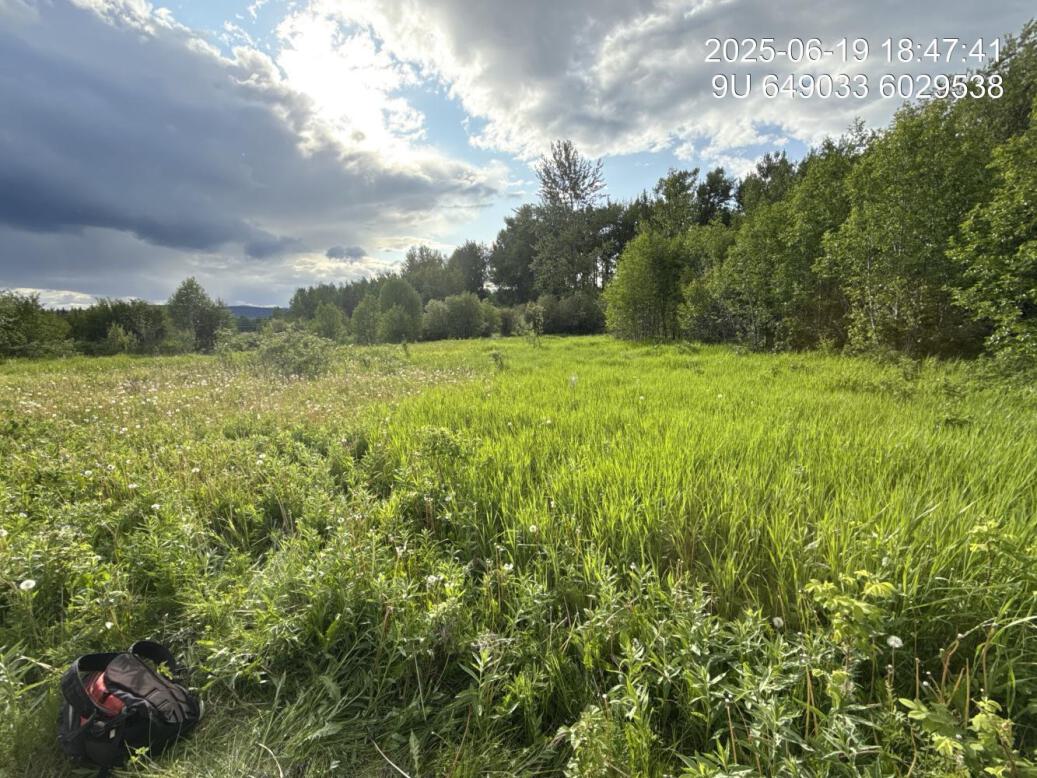
Figure 5.110: Revegetation status
Figure 5.111: Substrate composition
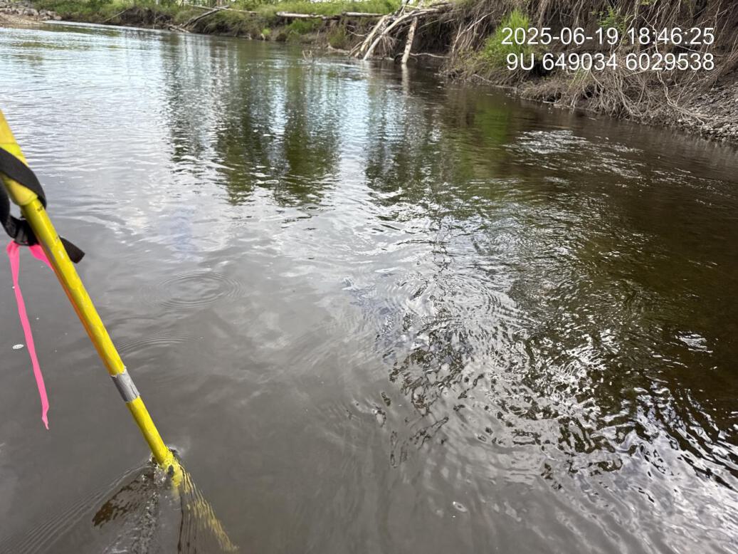
Figure 5.112: Flow depth
Figure 5.113: Culvert
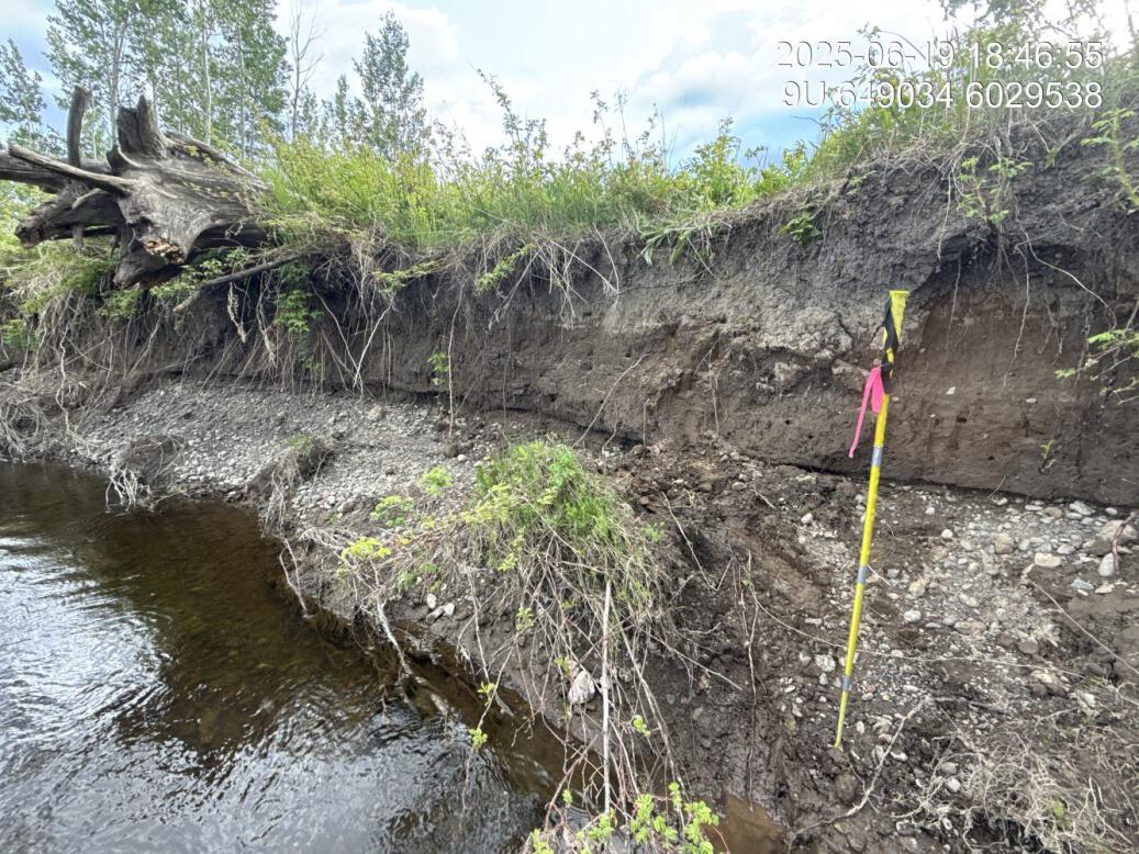
Figure 5.114: Channel incision
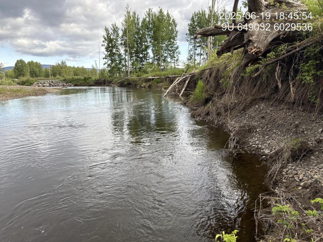
Figure 5.115: Channel incision upstream
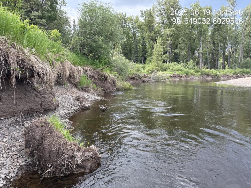
Figure 5.116: Channel incision downstream
Bul38 — Bulkley River
site <- dplyr::filter(sites_all, site_id == "Bul38")
viewer_url <- stac_uav_viewer(site)
site_summary_table(site)| Date | 2025-06-20 |
| Stream | Bulkley River |
| Land Owner | Public |
| UAV Flight | Yes |
| Width (m) | 100 |
| Length (m) | 250 |
| Reference | MacKay et al. (1998) |
| Assessment | Depth of incision of eroded bank is approximately 6m in height. Appears as though the large amount of slumping that took place was likely a result of vegetation clearing to accommodate the powerlines. |
| Habitat | SRight bank of outside bend of main stem. Large boulder approx 2/3 of the way down the eroded bank |
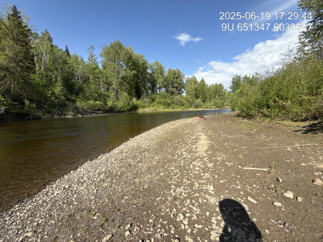
Figure 5.117: View of upstream end of site
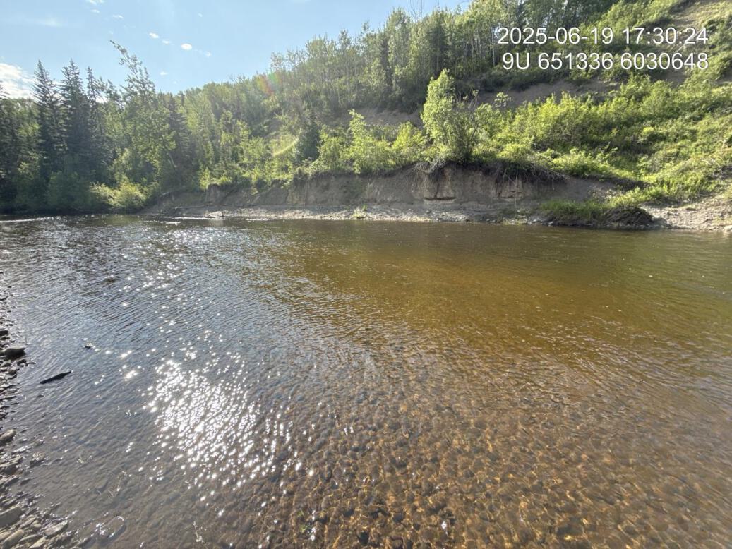
Figure 5.118: View of downstream end of site
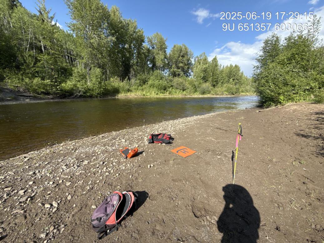
Figure 5.119: View of upstream end of site
Figure 5.120: View of downstream end of site
Figure 5.121: Riparian regrowth within site
Figure 5.122: Substrate composition
Figure 5.123: Flow depth
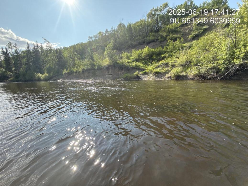
Figure 5.124: Flow velocity
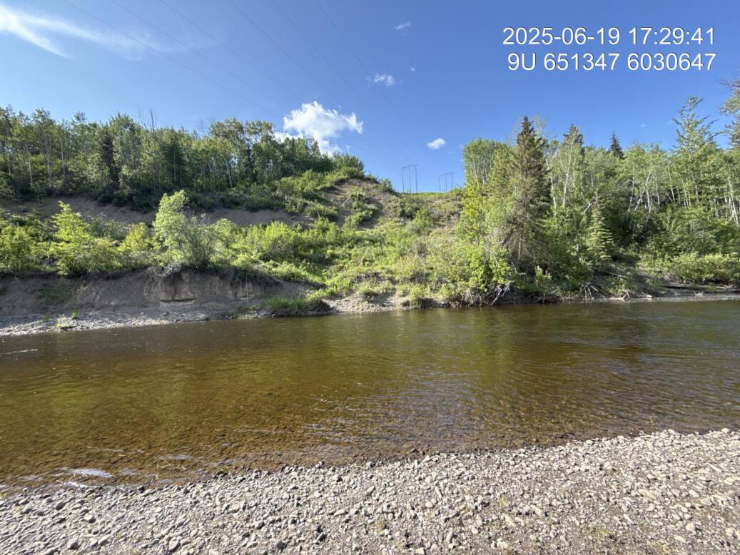
Figure 5.125: Powerline crossing
Craker Rd Middle — Bulkley River
site <- dplyr::filter(sites_all, site_id == "bulkley_meints_craker_rd_middle")
viewer_url <- stac_uav_viewer(site)
site_summary_table(site)| Date | 2024-09-23 |
| Stream | Bulkley River |
| UAV Flight | Yes |
| Reference | Gaboury and Smith (2016) |
| Assessment | WFN/LGL site prescription location but not implemented. Right Bank of river where erosion and flows appears to potentially be the slower than other sections of stream. Deep water with some large wood debris out in the middle of the channel. |
| Velocity | Slack water with near zero gradient |
| Substrate | Fine substrate |
| Riparian | Primarily shrugged right and upstream and narrow, mature, mixed forest downstream. Agronomic grasses in area adjacent to erosion. |
| Flow Depth | 0.65, 0.95, 1.6, 1.6 |
| Stability | Incision current 2.4, 2.4, 2.3. High water 1.1, 1.0, 1.1. Slumping occurring, but appears to be not as rapid as other areas. |
| Revegetation | No shrub regeneration in area of erosion, only grasses and weeds, including Canada thistle. |
| Cover | Deep channel in this area with some LWD in centre of site and channel. |
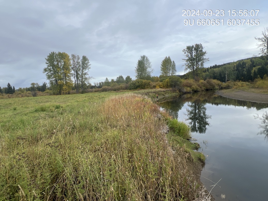
Figure 5.126: View of upstream end of site
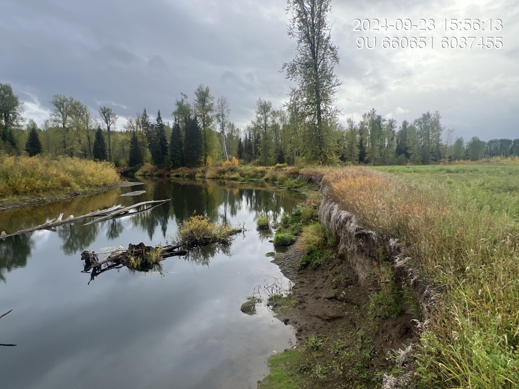
Figure 5.127: View of downstream end of site
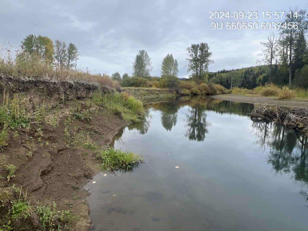
Figure 5.128: View of upstream end of site
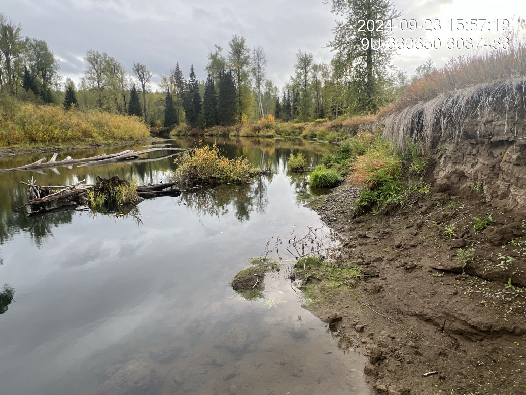
Figure 5.129: View of downstream end of site
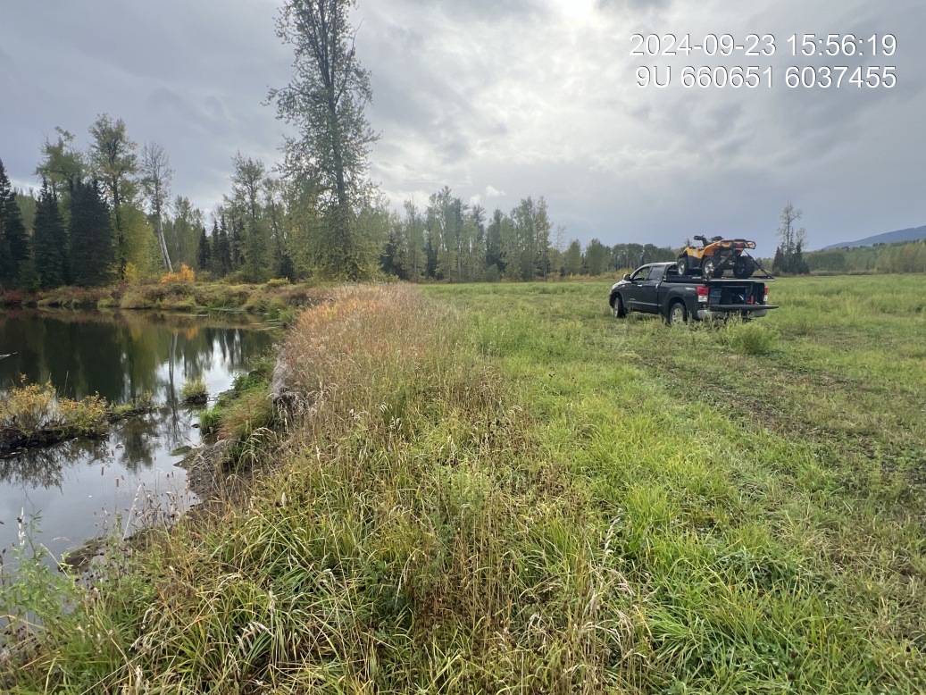
Figure 5.130: Riparian regrowth within site
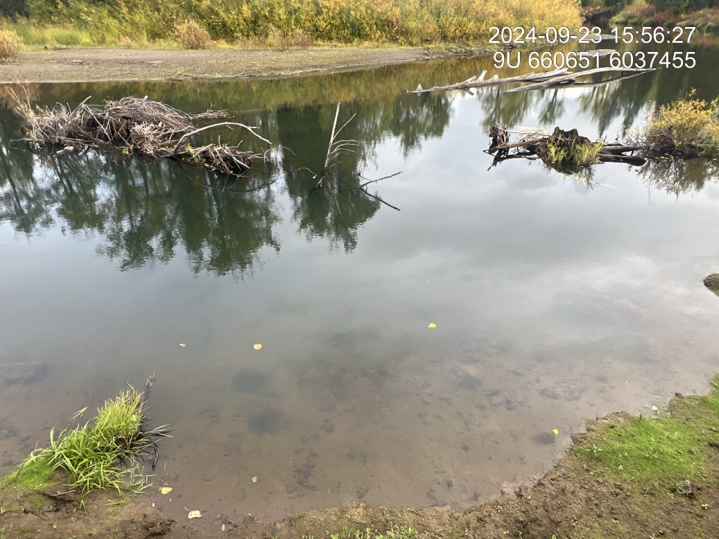
Figure 5.131: Substrate composition
Figure 5.132: Bank stability
Figure 5.133: Barrel condition

Figure 5.134: Large woody debris
Craker Rd Upper — Bulkley River
site <- dplyr::filter(sites_all, site_id == "bulkley_meints_craker_rd_upper")
viewer_url <- stac_uav_viewer(site)
site_summary_table(site)| Date | 2024-09-23 |
| Stream | Bulkley River |
| UAV Flight | Yes |
| Reference | Gaboury and Smith (2016) |
| Assessment | Adjacent to Craker Road. Prescription from WFN/LGL not implemented at this site in 2017. Old van in the river at this location. Cottonwood snag across entire wetted channel width. Right bank of the river with less pronounced erosion than many other sites. |
| Substrate | Fine substrates |
| Riparian | Primarily narrow shrub, repair and upstream and shrub with occasional Cottonwood downstream. |
| Flow Depth | Flows 1.5, 1.2, 1.6 |
| Stability | Incision current 2.5, 2.7, 2.1. High water incision 1.0, 0.5, 0.6 |
| Revegetation | Some natural willow generation along slumped banks but primarily agronomic grasses |
| Cover | Old van in the river, providing minimal cover and several pieces of large wood debris at bottom of corner. |
Figure 5.135: View of upstream end of site
Figure 5.136: View of downstream end of site
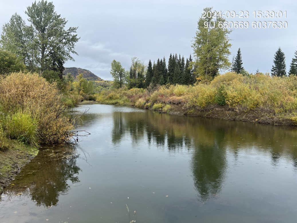
Figure 5.137: View of upstream end of site
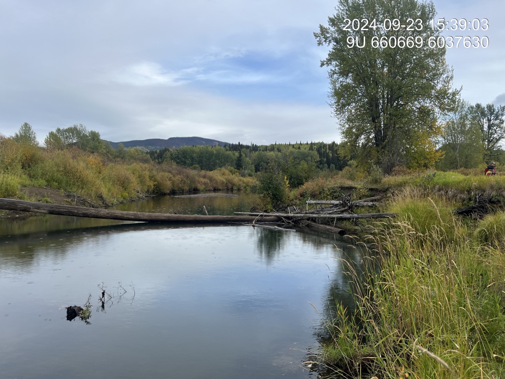
Figure 5.138: View of downstream end of site
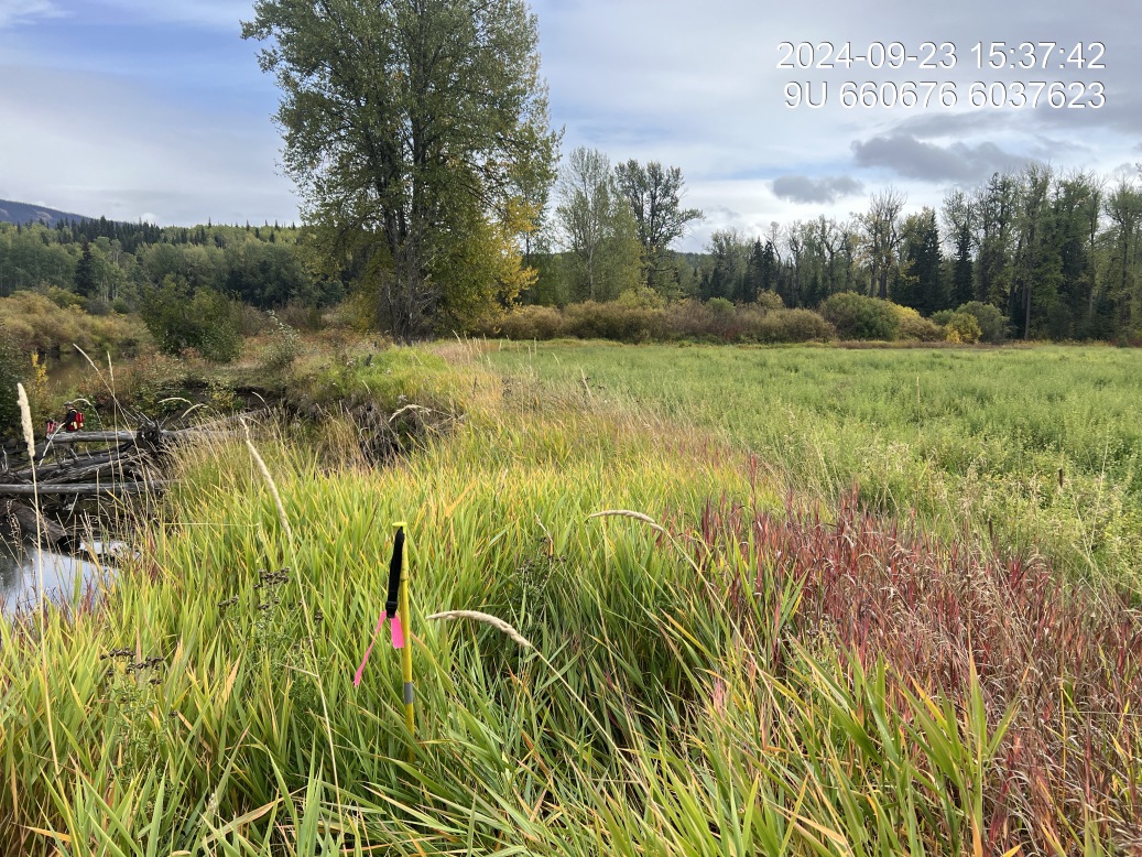
Figure 5.139: Riparian regrowth within site
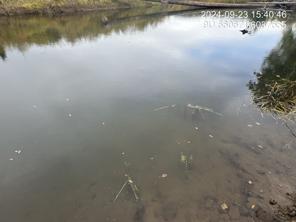
Figure 5.140: Substrate composition
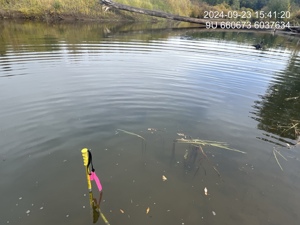
Figure 5.141: Flow depth
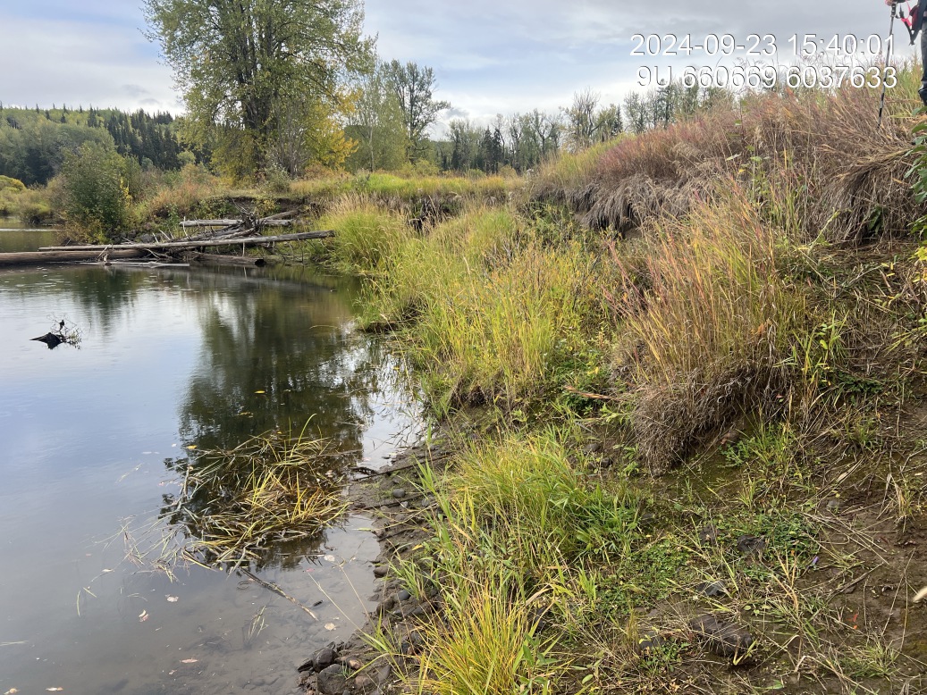
Figure 5.142: Bank stability
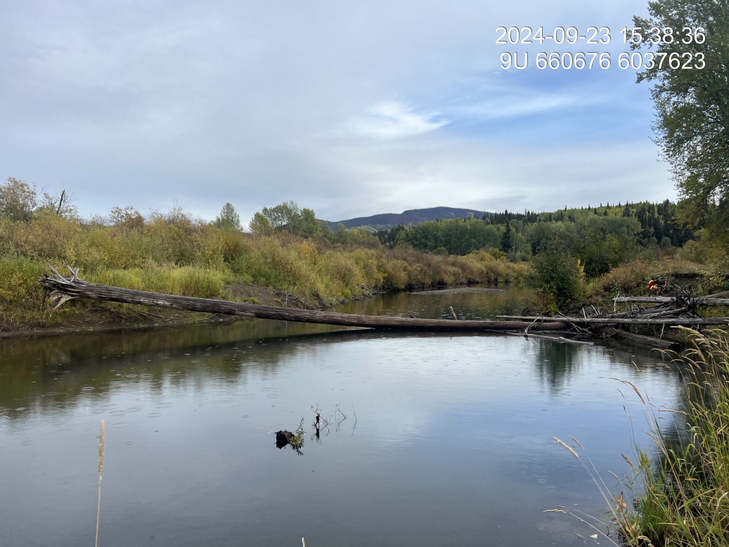
Figure 5.143: Barrel condition
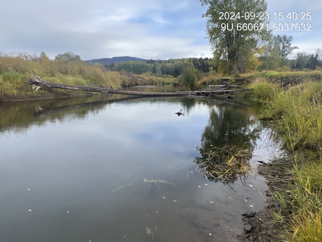
Figure 5.144: Large woody debris across channel
Foxy-Maxan — Foxy Creek
site <- dplyr::filter(sites_all, site_id == "Foxy Maxan Confluence")
viewer_url <- stac_uav_viewer(site)
site_summary_table(site)| Date | 2025-06-19 |
| Stream | Foxy Creek |
| UAV Flight | Yes |
| Width (m) | 30 |
| Length (m) | 50 |
| Reference | Gottesfeld and Rabnett (2007) |
| Assessment |
Right bank of Foxy Creek just upstream of the confluence with Maxan Creek. Eroding bank elevated 1.3 - 2m in depth of incision. Beyond approximately 30m from bank is a mature mixed trembling aspen and spruce forest. Adjacent to where the erosion is occurring is a nicely regenerating area with numerous black cottonwood and trembling aspen trees from 0.7 m to 2.5 m in height. |
| Habitat | High value habitat upstream. Extensive areas of gravel and numerous natual large woody debris structures with deep pools all suitable for coho and potentially chinook spawning. |
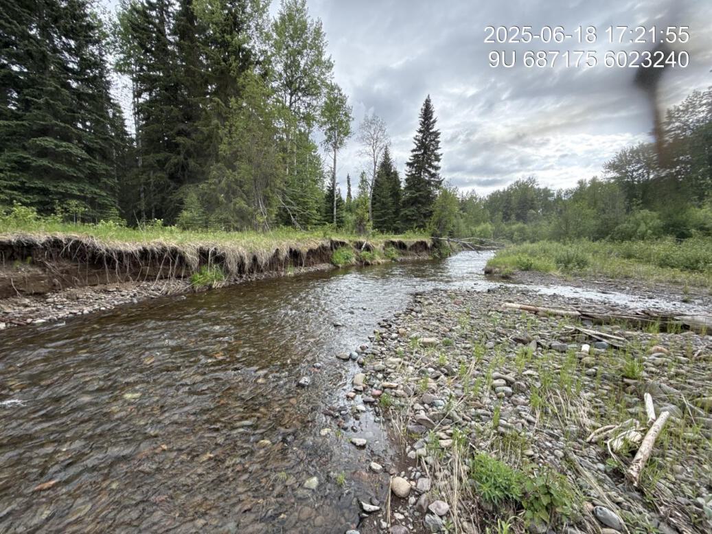
Figure 5.145: View of upstream end of site
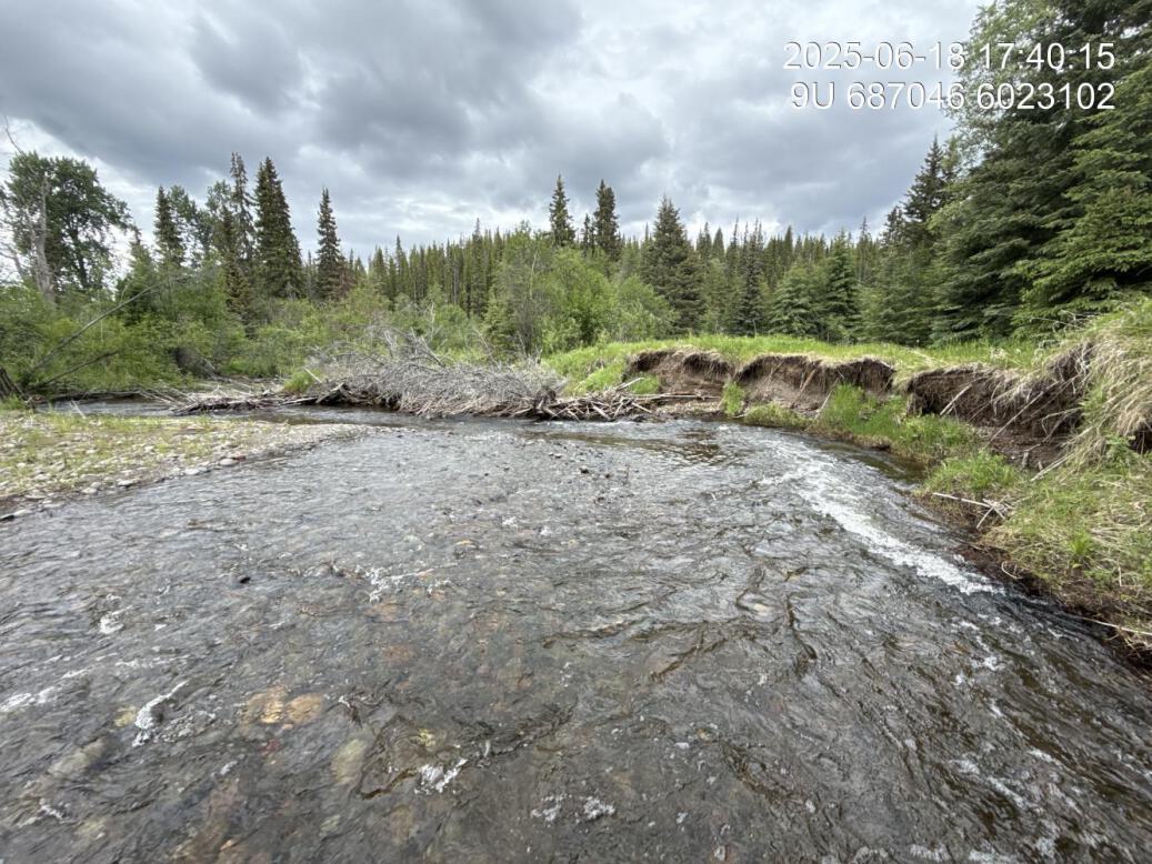
Figure 5.146: View of downstream end of site
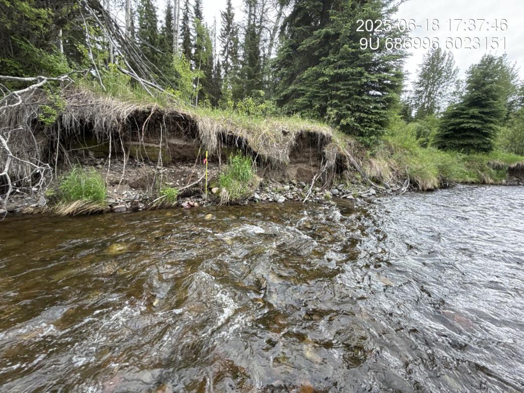
Figure 5.147: View of upstream end of site
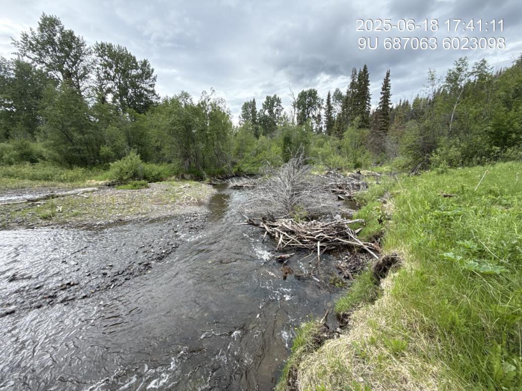
Figure 5.148: View of downstream end of site
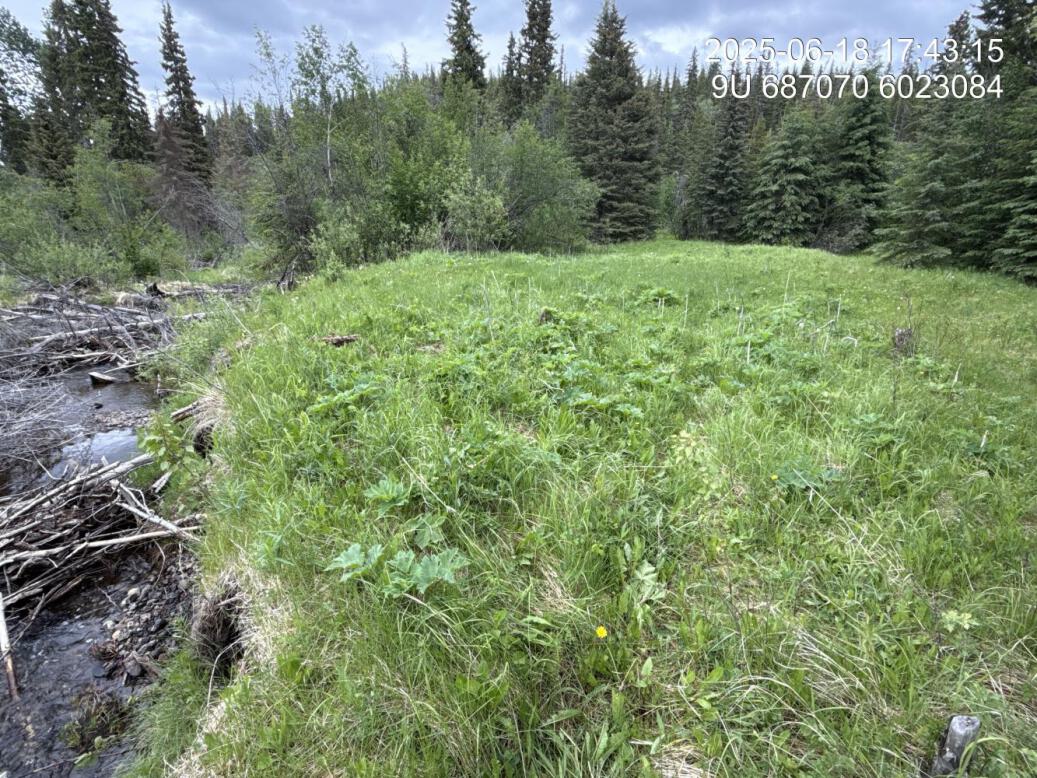
Figure 5.149: Riparian regrowth within site
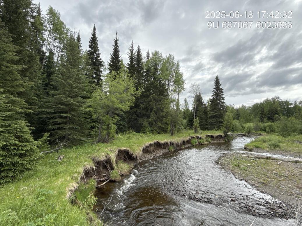
Figure 5.150: Revegetation status
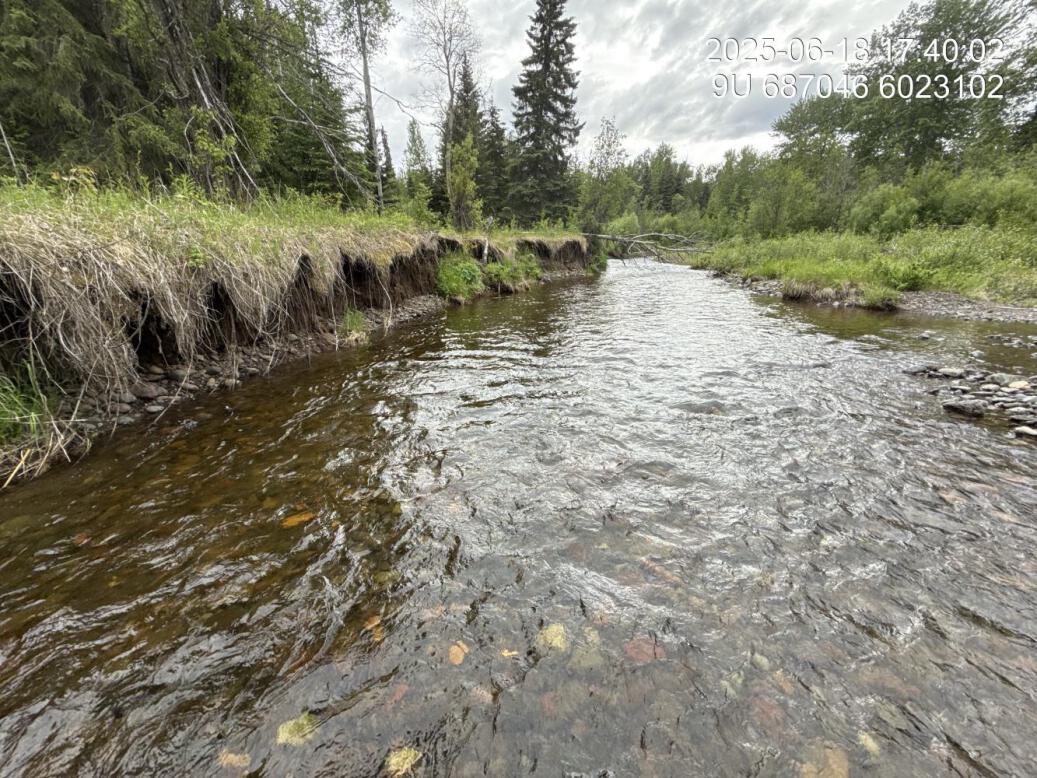
Figure 5.151: Substrate composition
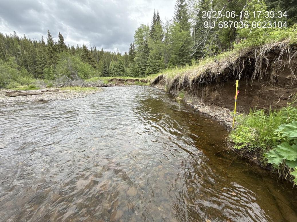
Figure 5.152: Bank stability
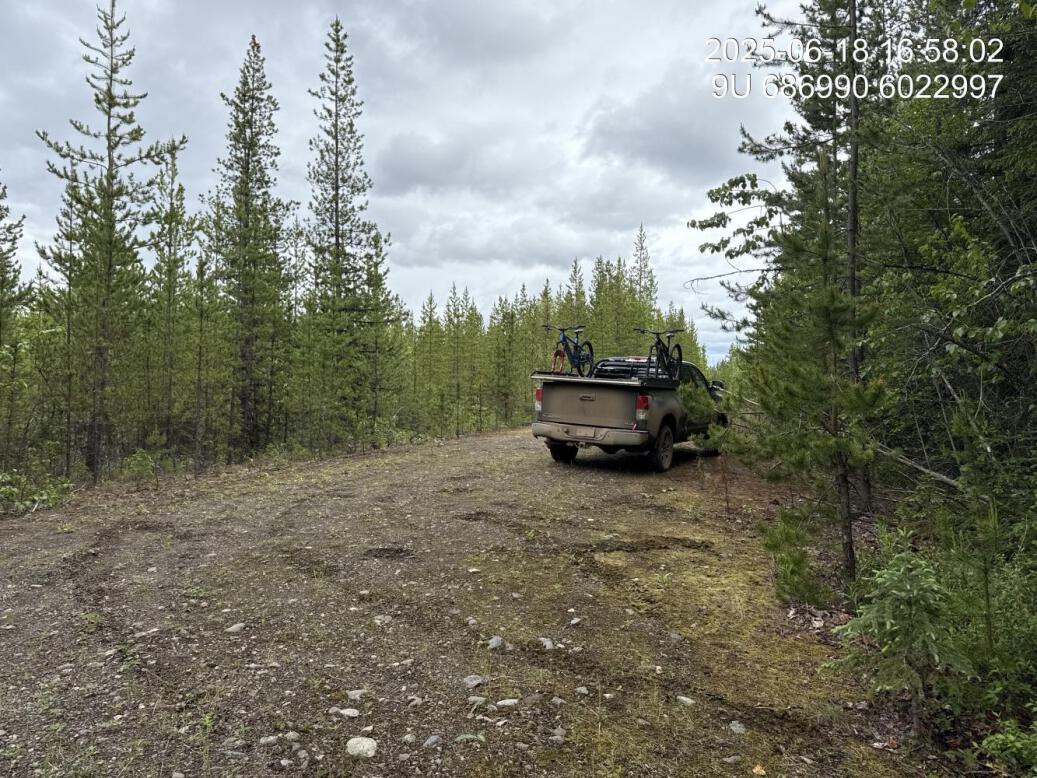
Figure 5.153: Access route
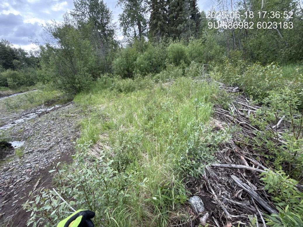
Figure 5.154: Dam breach upstream
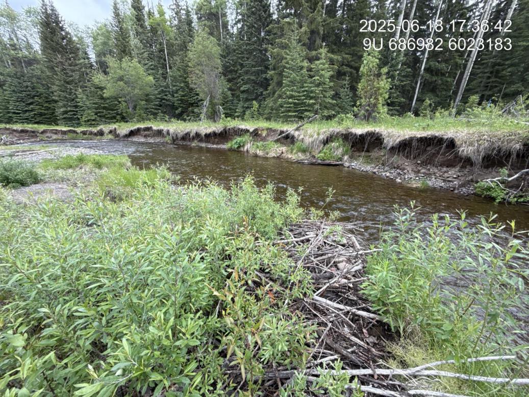
Figure 5.155: Dam breach downstream
Figure 5.156: Planted vegetation
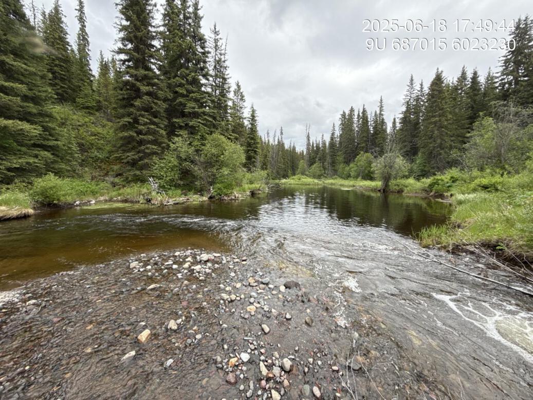
Figure 5.157: Confluenceus

Figure 5.158: Confluenceds
McKilligan Middle — Bulkley River
site <- dplyr::filter(sites_all, site_id == "Mckilligan Rd middle")
viewer_url <- stac_uav_viewer(site)
site_summary_table(site)| Date | 2024-10-03 |
| Stream | Bulkley River |
| Land Owner | Andy Meints |
| UAV Flight | Yes |
| Length (m) | 130 |
| Reference | Gaboury and Smith (2016) |
| Assessment | Potential site. This was a site visited and brought forward by Andy Mienst. It appears to be an area of cattle access to the river, which has caused excessive trampling of the banks. It’s an outside left bend of the Bulkley River with some erosion. |
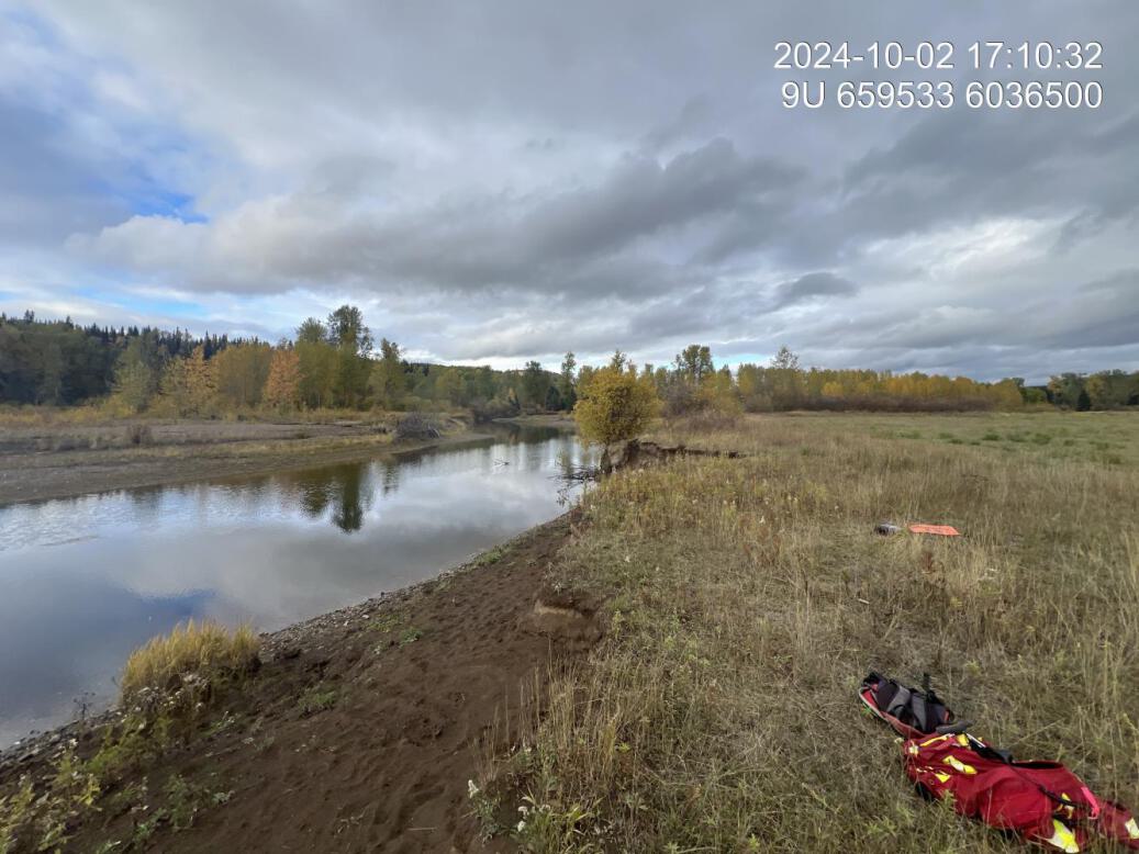
Figure 5.159: View of upstream end of site
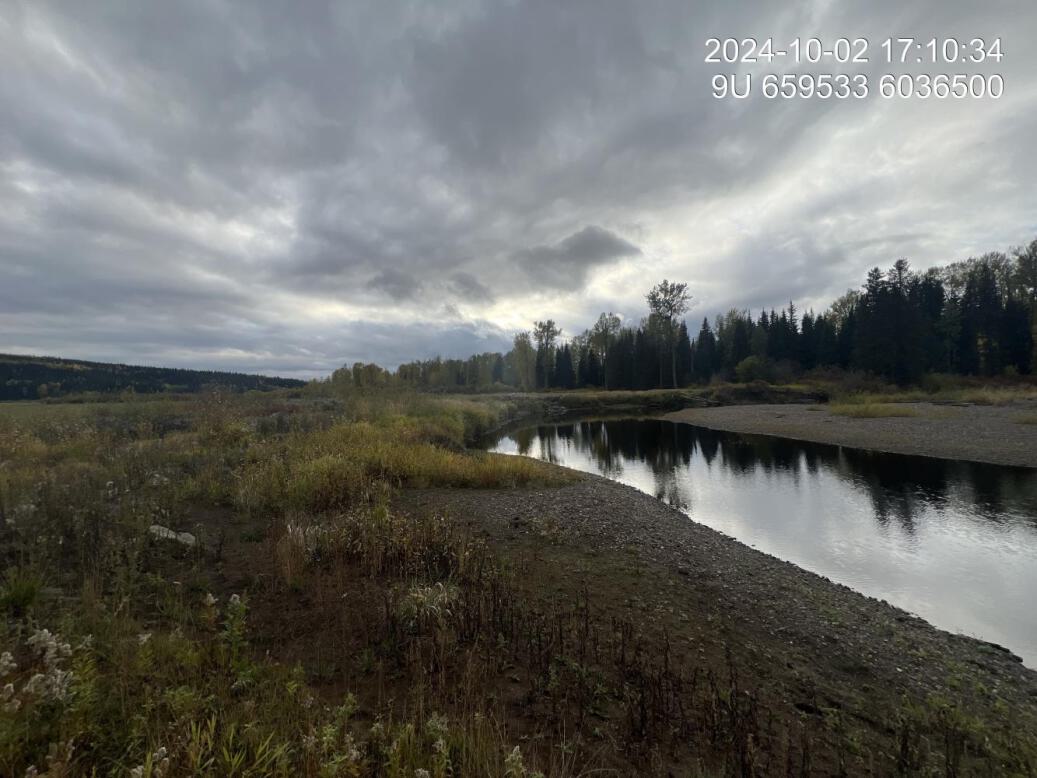
Figure 5.160: View of downstream end of site
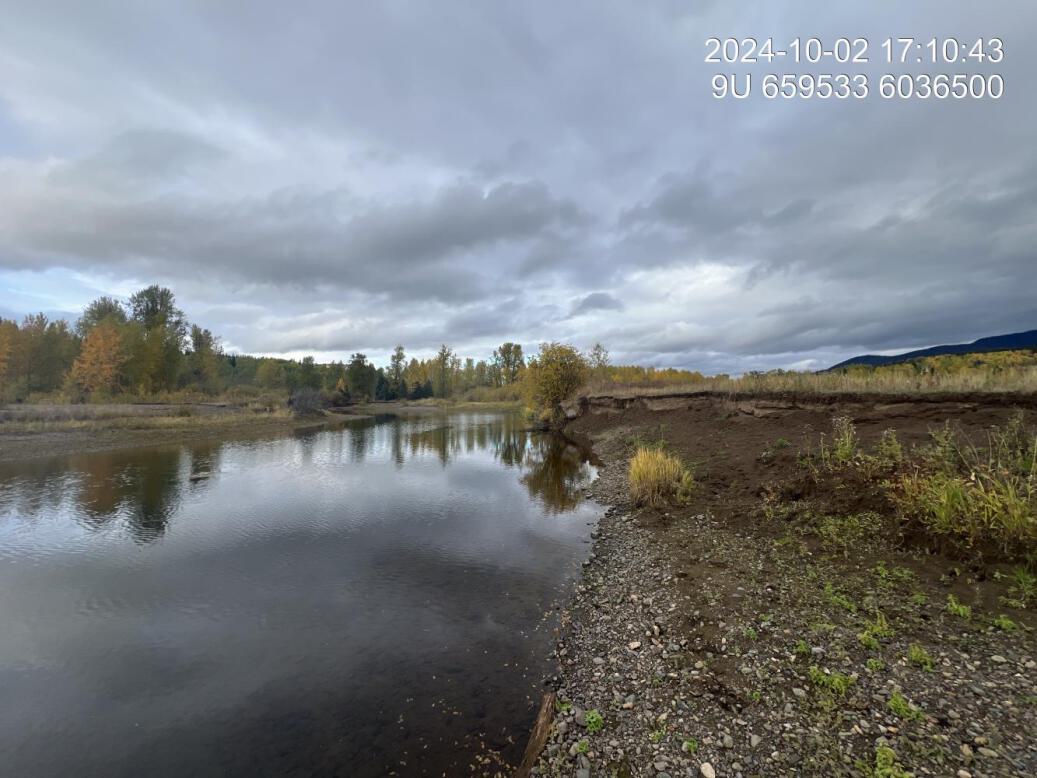
Figure 5.161: View of upstream end of site
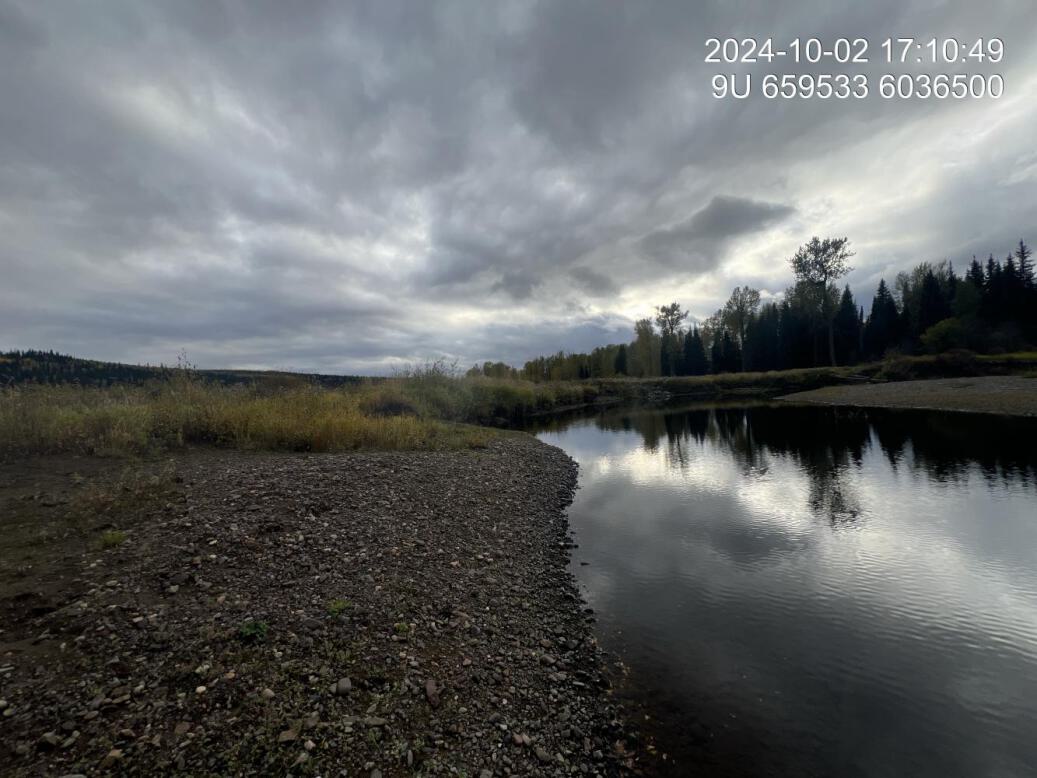
Figure 5.162: View of downstream end of site
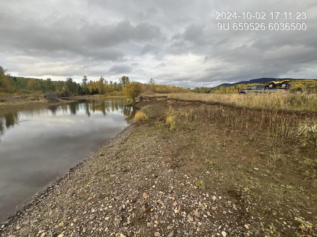
Figure 5.163: Cattle damage
Meints 1 — Bulkley River
site <- dplyr::filter(sites_all, site_id == "Meints_01")
viewer_url <- stac_uav_viewer(site)
site_summary_table(site)| Date | 2024-10-02 |
| Stream | Bulkley River |
| Land Owner | Andy Meints |
| UAV Flight | Yes |
| Length (m) | 230 |
| Assessment | Potential site. Left bank meander. Silty clay soils with significant incision and large amounts of erosion. Oxbox is ~150m downstream from site so risk that water will eventually blow through corner and straighten river at this location. Small beaver dam upstream. |
| Habitat | Fine substrate. |
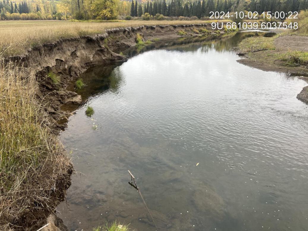
Figure 5.164: View of upstream end of site
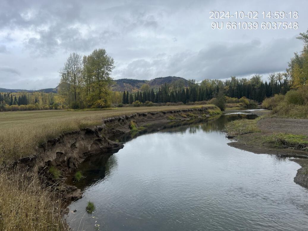
Figure 5.165: View of downstream end of site
Wilson 1 — Bulkley River
site <- dplyr::filter(sites_all, site_id == "bulkley_wilson_01")
viewer_url <- stac_uav_viewer(site)
site_summary_table(site)| Date | 2024-09-23 |
| Stream | Bulkley River |
| UAV Flight | Yes |
| Assessment | Upstream Wilson site on left bank corner where access to hay field pinches. Natural riparian adjacent is a mix of willow and young cottonwood with a few spruce young and is located approximately 20 m from the current eroded bank. Landowner has reported that he could move the road to much further away to access the field in behind. This would allow the current riparian to help protect the bank as erosion progresses. |
| Habitat | Appears to be potentially bank swallow holes in the bank, approximately 3/4 of the way downstream from the top |
| Substrate | Substrate is covered with substantial amounts of algae and is primarily gravel throughout |
| Riparian | Riparian adjacent to the erosion is hayfield with a mix of economic, grasses, and red canary grass along the immediate edge. Significant slumping of sections of field into the stream. |
| Flow Depth | Range from 0.45 to 1m at current water levels. Deepest area is the downstream curve where force and erosion is greatest. |
| Stability | Range of incision depths to water surface is 1.8 to 2.6m. To estimated high water is between 0.6 and 0.Bank is full failing throughout with greatest amount of erosion notable near bank swallow Ness, approximately 3/4 of the way down the bank. |
| Revegetation | This site has not had work done to it yet, but riparian in problem area is a hayfield however, there is riparian on the south side of the stream approximately 20 m away from the routing bank, consisting of primarily Willows and young immature Cottonwood with some young spruce. |
| Cover | Very minimal cover available throughout the site at low water flow with some areas of minor cover near where slabs of field have fallen into the river. |
| Maintenance | No previous works at site |
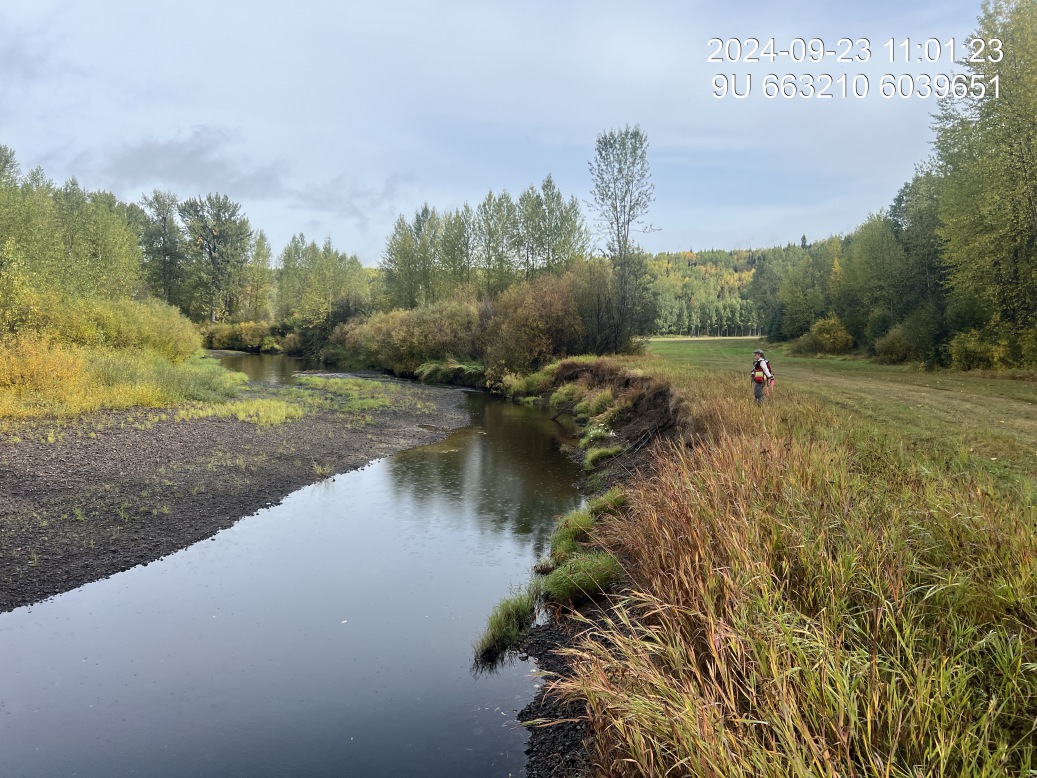
Figure 5.166: View of upstream end of site
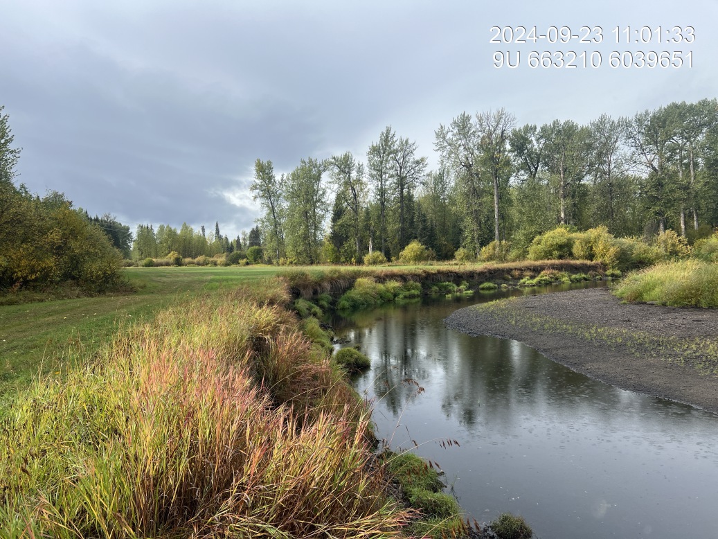
Figure 5.167: View of downstream end of site
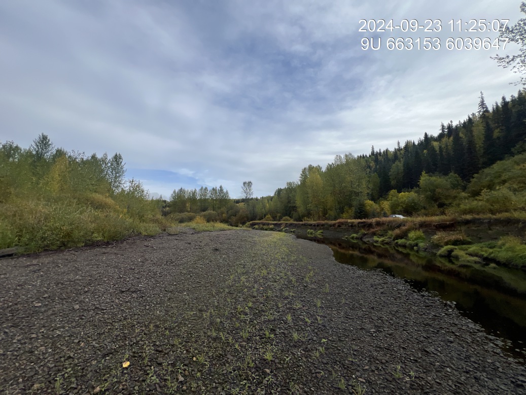
Figure 5.168: View of upstream end of site
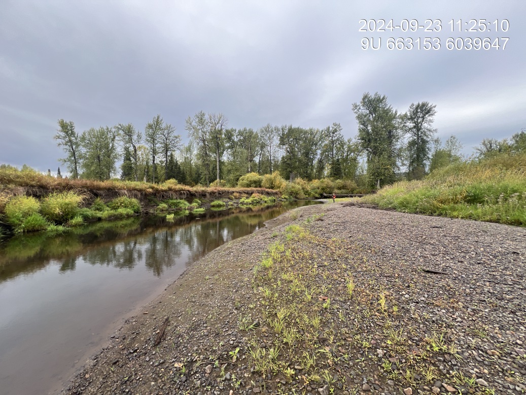
Figure 5.169: View of downstream end of site
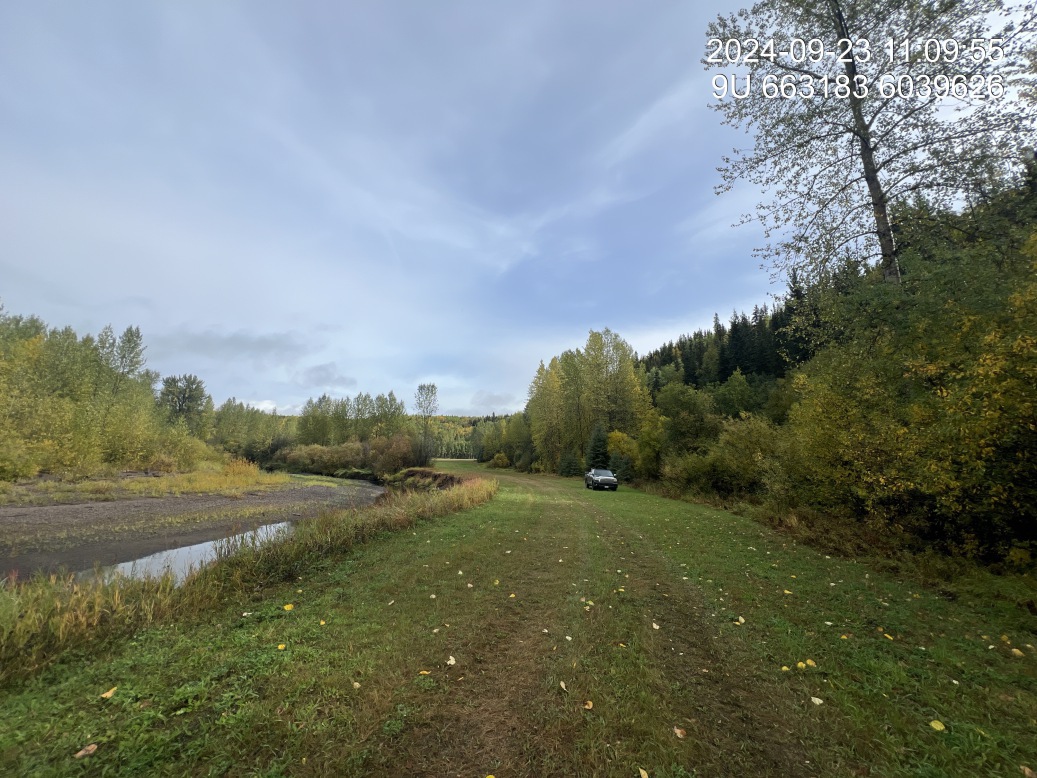
Figure 5.170: Riparian regrowth within site
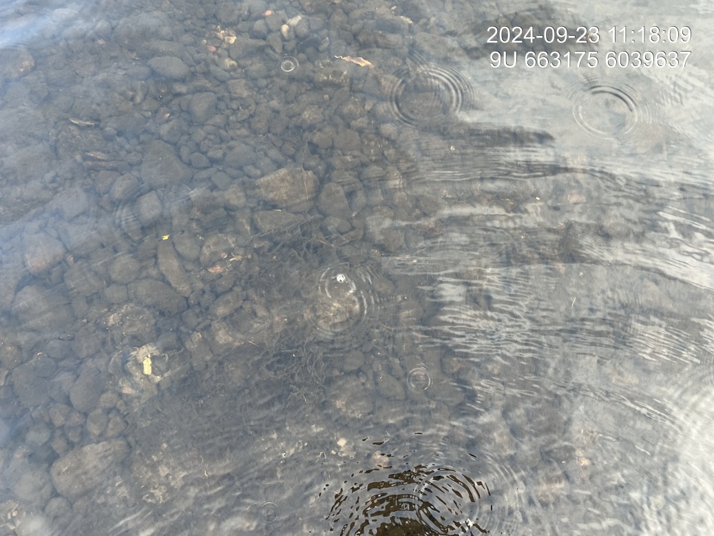
Figure 5.171: Substrate composition
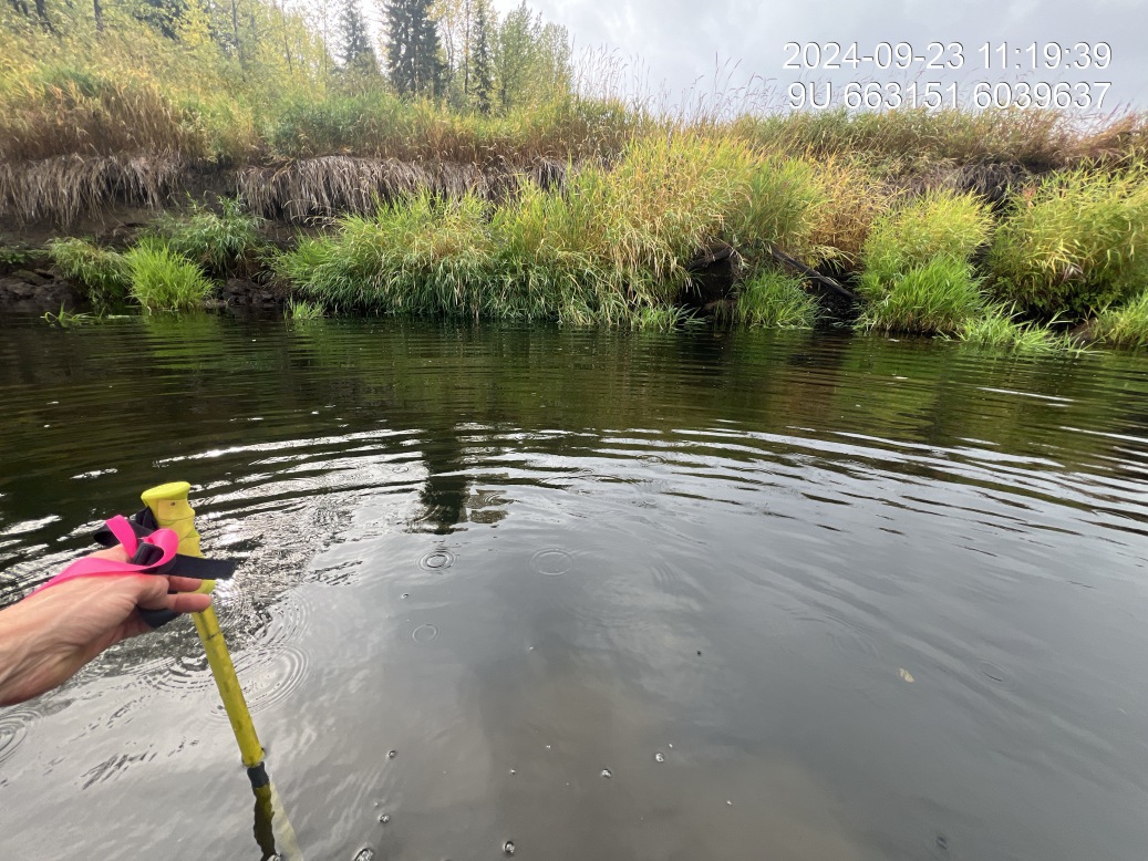
Figure 5.172: Flow depth
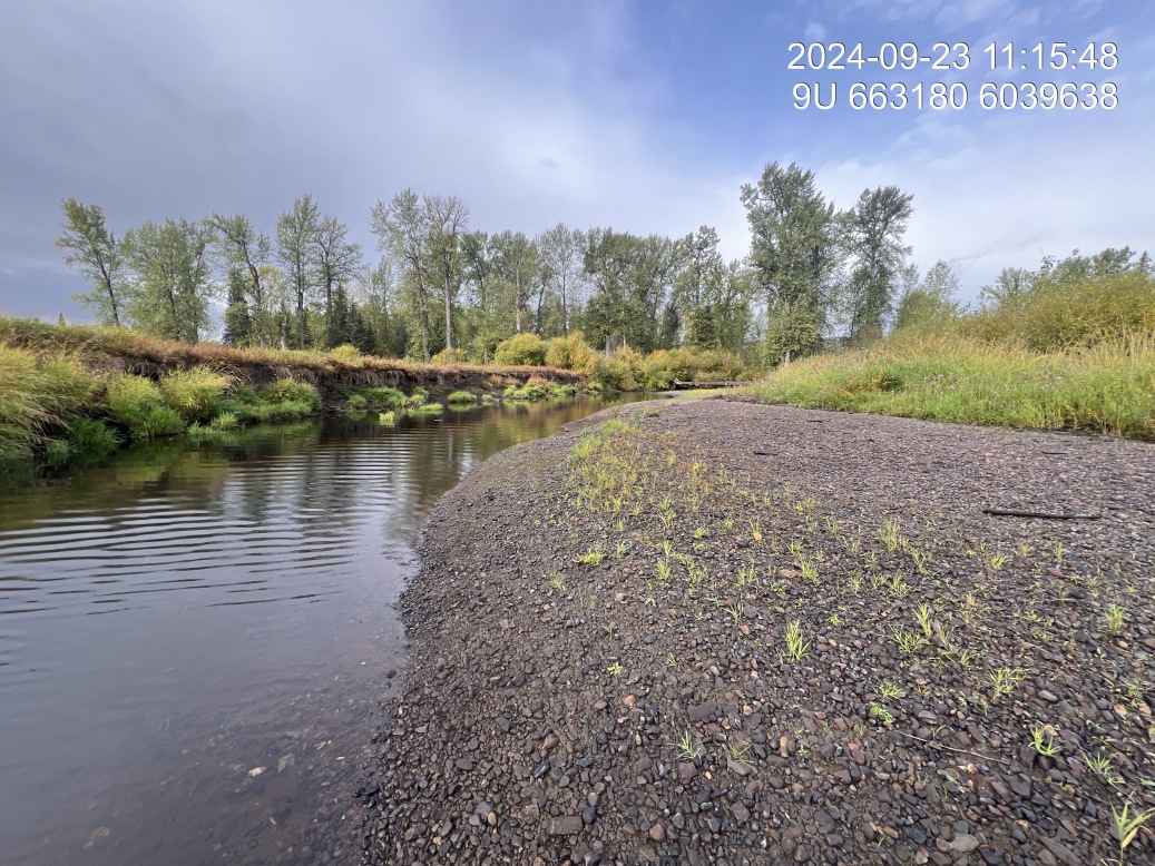
Figure 5.173: Bank stability
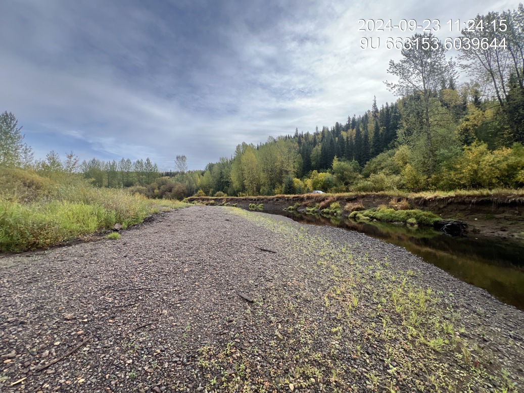
Figure 5.174: Barrel condition
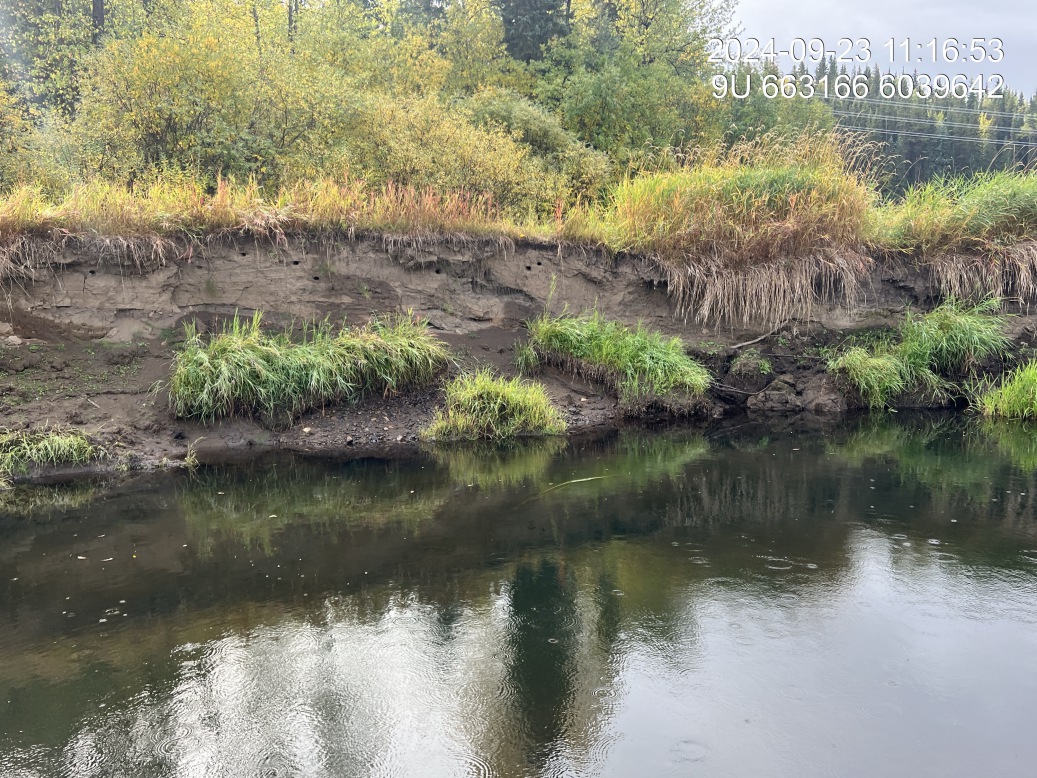
Figure 5.175: Swallow holes
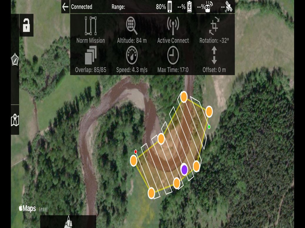
Figure 5.176: UAV survey plan
Wilson 2 — Bulkley River
site <- dplyr::filter(sites_all, site_id == "bulkley_wilson_02")
viewer_url <- stac_uav_viewer(site)
site_summary_table(site)| Date | 2024-09-23 |
| Stream | Bulkley River |
| Assessment | Log jam on right bank with mature old growth cottonwood forest on downstream end and young cottonwood forest and willow comprising riparian upstream. Landowner reports that stream floods adjacent field to the north almost every year with 2023 and 2024 being exceptions. Landowner reports that the logjam began approximately six years ago and with one or two logs and is now approximately 70 or 80 full-size pieces of wood. Point of concern for erosion is on downstream end near 90° corner where log jam is located. |
| Substrate | Fine substrate throughout. |
| Riparian | Downstream end of site is old growth Cottonwood Forest with upstream being young Cottonwood Forest with Willow. Along area of erosion is primarily reed canary grass with some Canada thistle. |
| Flow Depth | Flow depths range .45,0.55,0.8, 0.85 |
| Stability | Incision current 2.0 , 2.1, 2.1 with high water incision 0.4, 0, 0. Land owner reports that most active erosion is at the downstream side of the log jam where the 90° turn in the river occurs. |
| Revegetation | Occasional willows very rare along the edge of the hayfield, but Pont primarily canary grass with some thistle |
| Cover | Logjam is providing large amounts of cover throughout the site. Fish observed. |
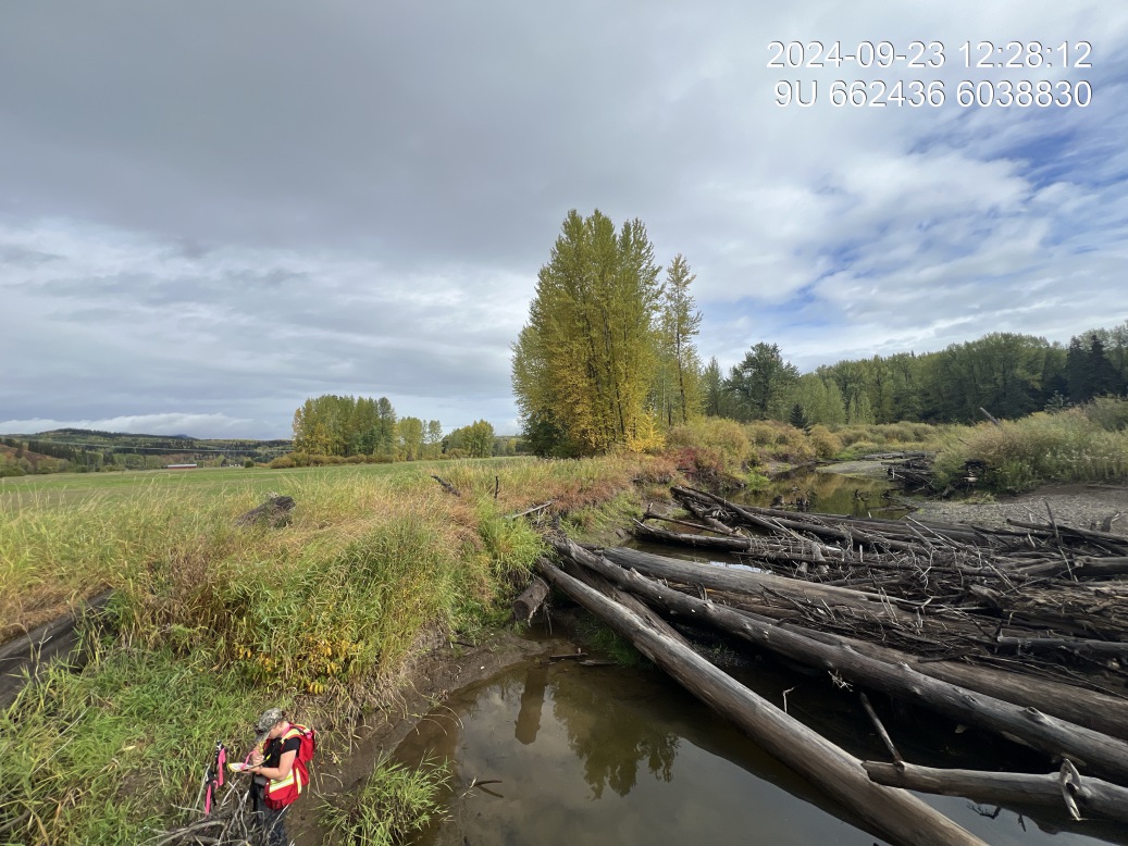
Figure 5.177: View of upstream end of site
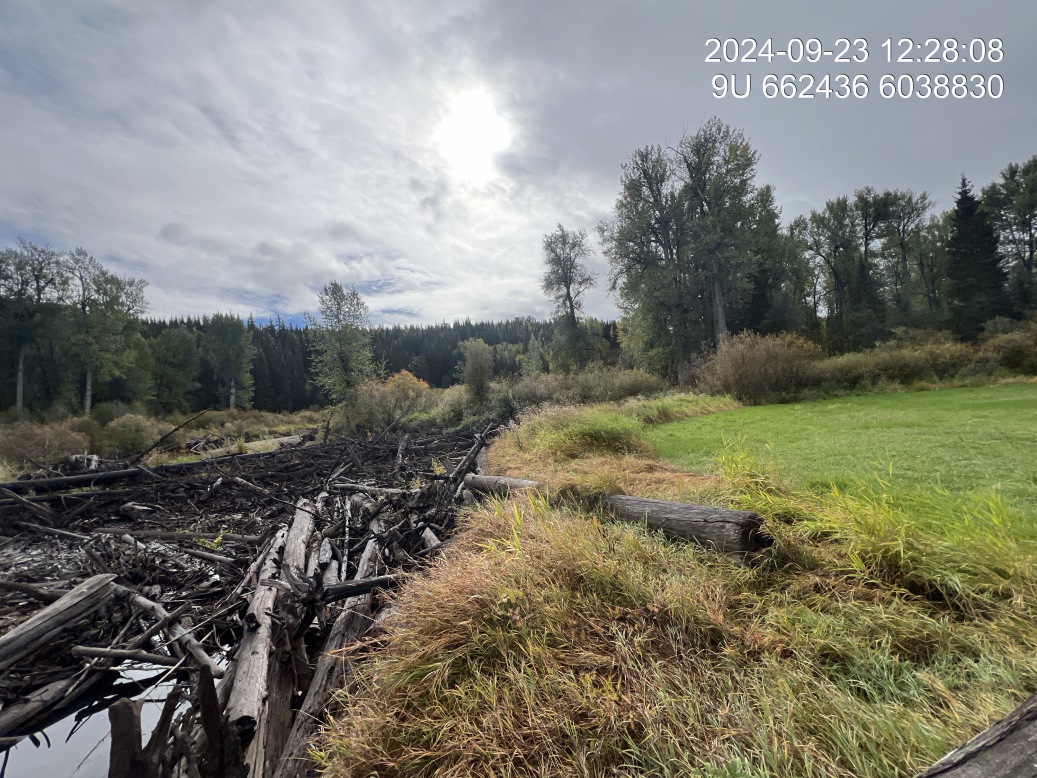
Figure 5.178: View of downstream end of site
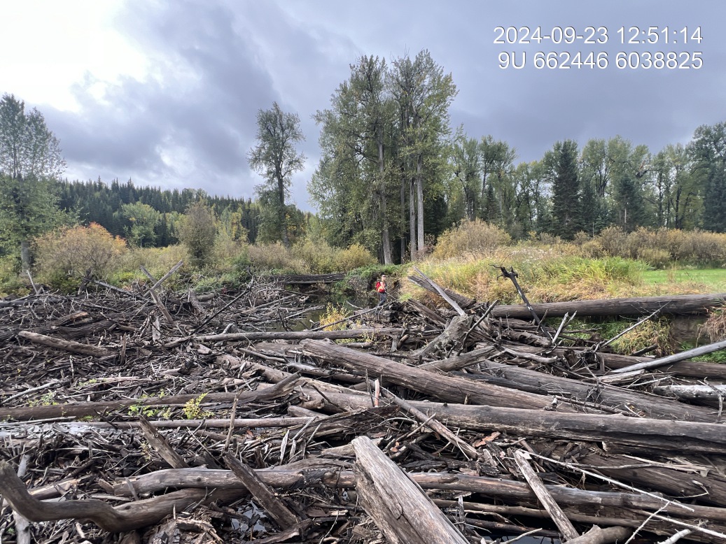
Figure 5.179: View of upstream end of site
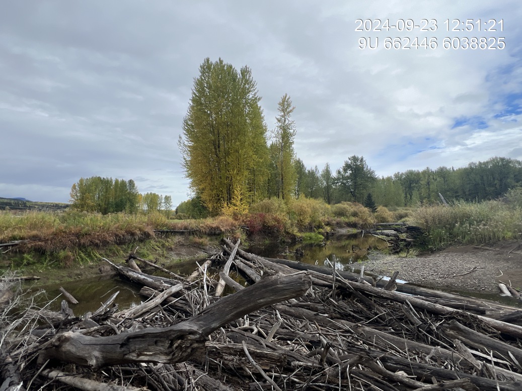
Figure 5.180: View of downstream end of site
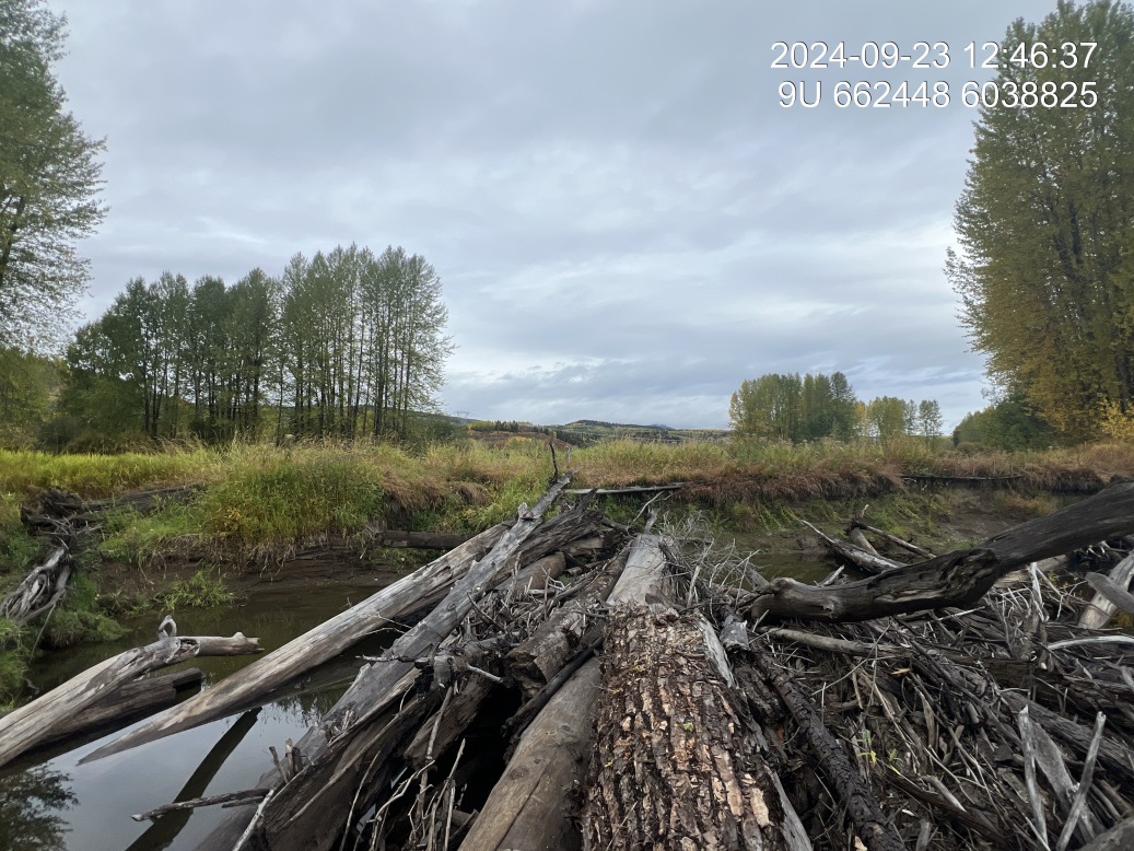
Figure 5.181: Riparian regrowth within site
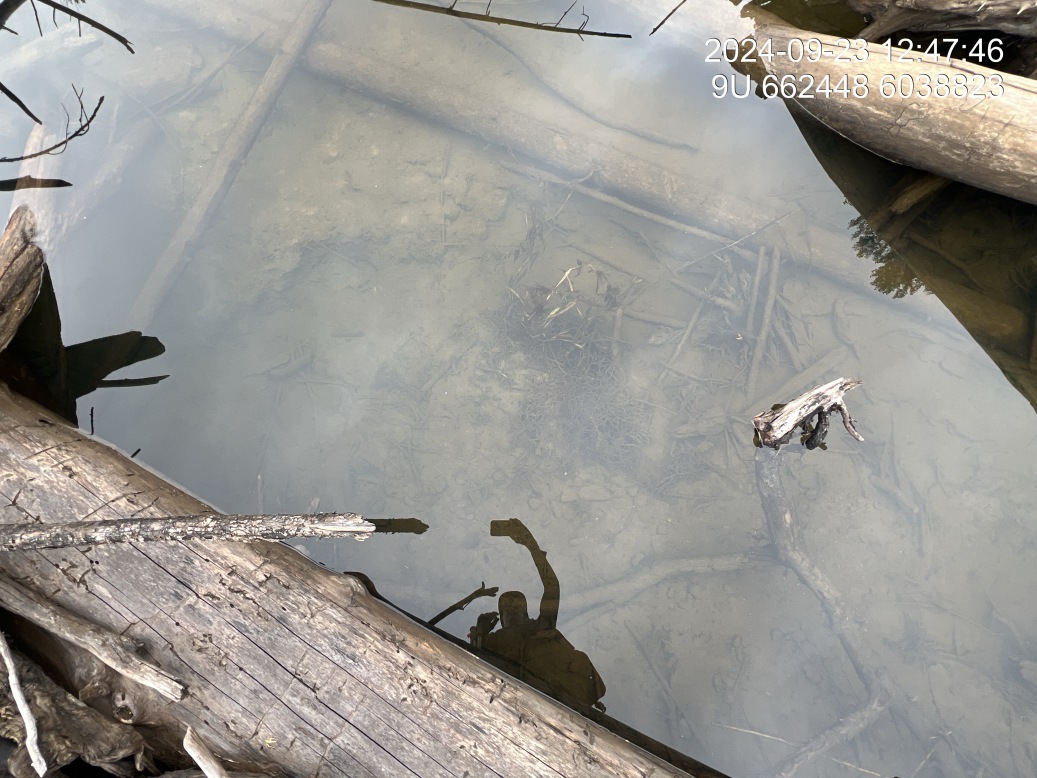
Figure 5.182: Substrate composition
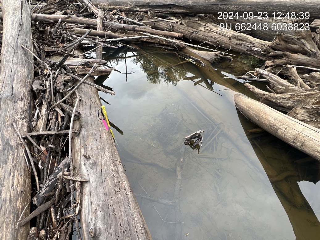
Figure 5.183: Flow depth
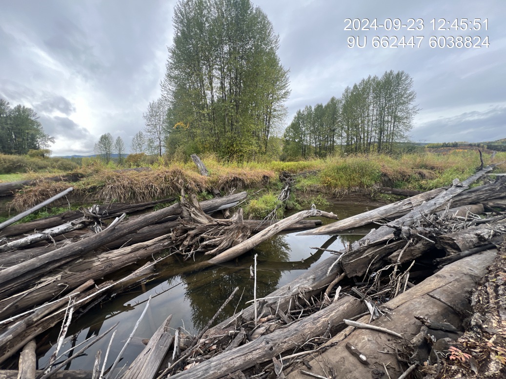
Figure 5.184: Bank stability
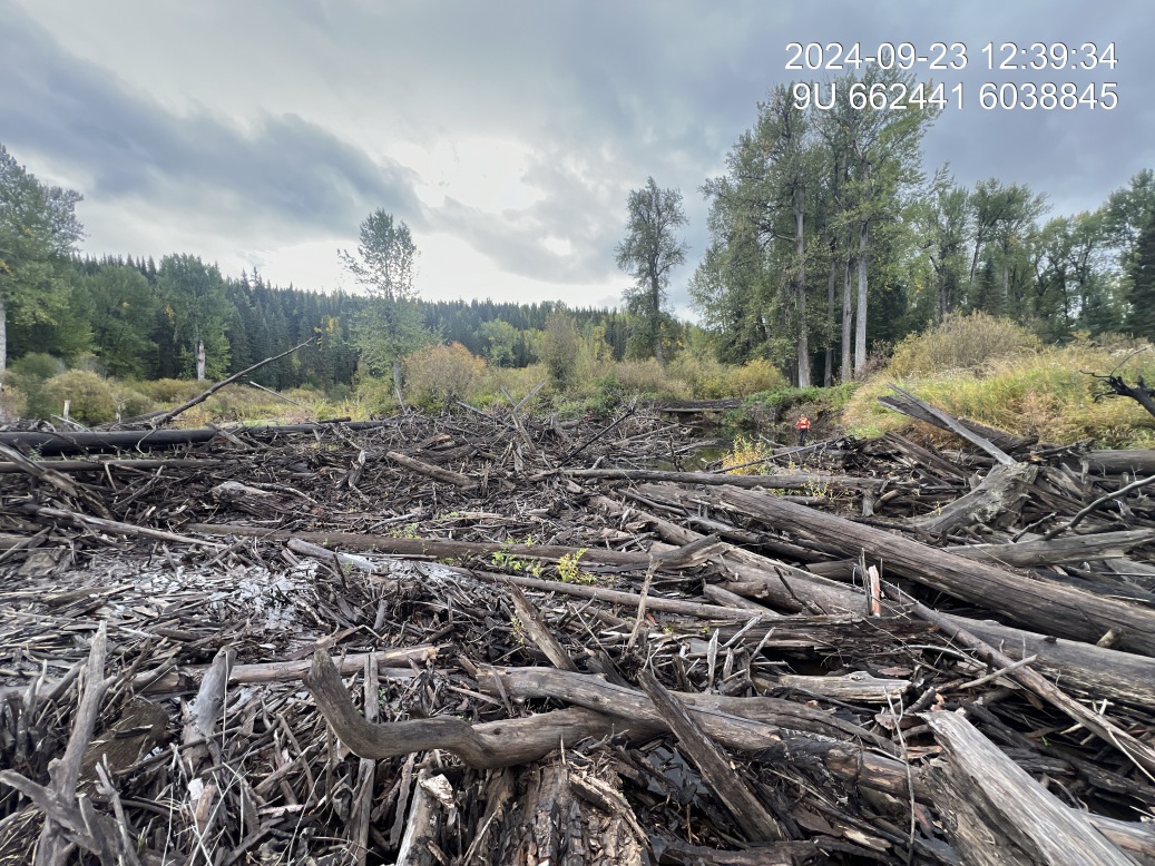
Figure 5.185: Fish cover
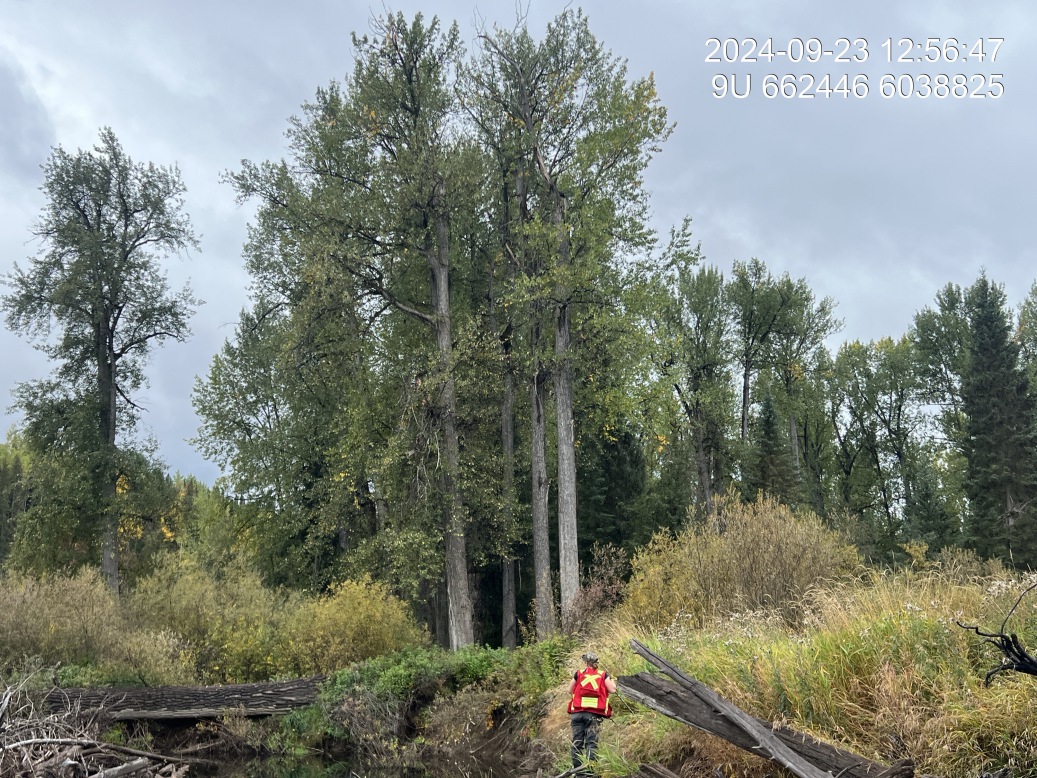
Figure 5.186: Old growth cottonwood
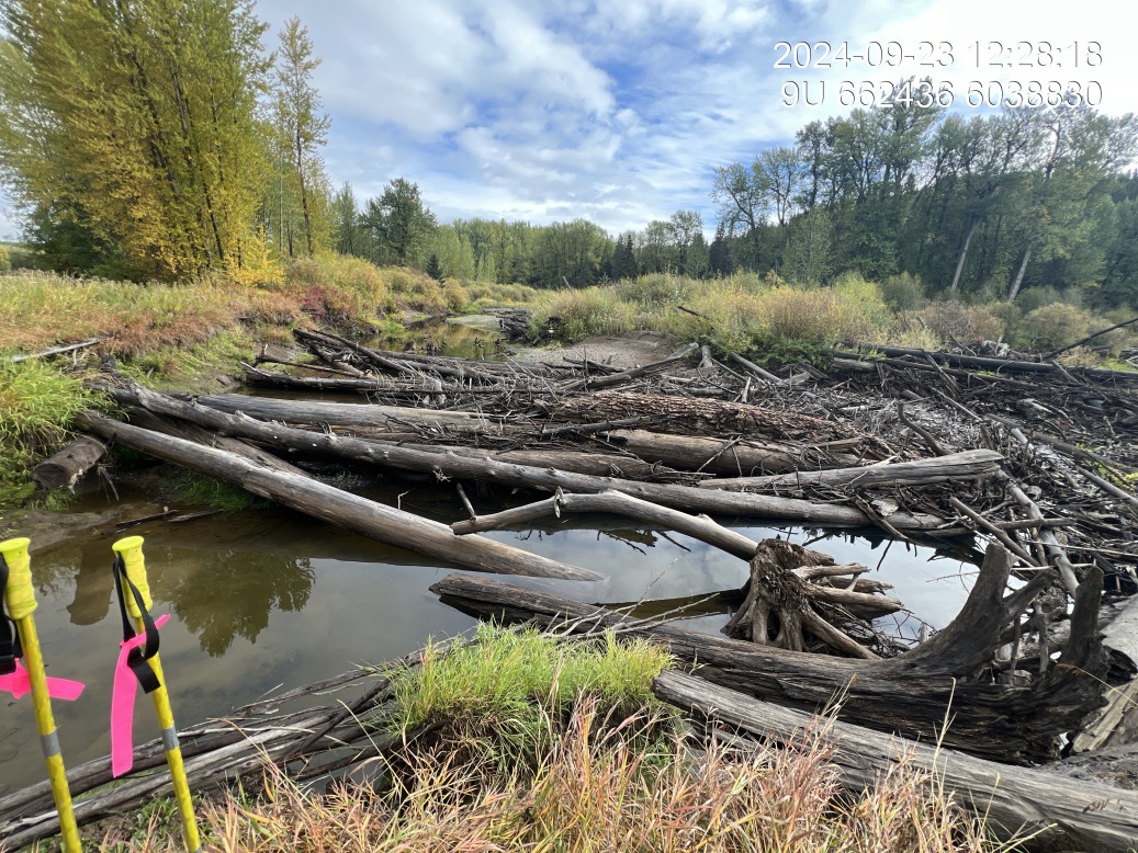
Figure 5.187: Na
Wilson 3 — Bulkley River
site <- dplyr::filter(sites_all, site_id == "bulkley_wilson_03")
viewer_url <- stac_uav_viewer(site)
site_summary_table(site)| Date | 2024-09-23 |
| Stream | Bulkley River |
| UAV Flight | No |
| Assessment | Right bank of river located downstream of Wilson residence. Very fine clay is undercutting the bank with extensive erosion. Just upstream is section of river highlighted as important chinook habitat by sources from the toboggan hatchery in the past. |
| Substrate | Fines throughout. |
| Riparian | Primarily willow downstream with young cottonwood and willow upstream on same bank. Edge of erosion in hay field. |
| Flow Depth | Range 0.6, 0.65, 1.0, 1.5 |
| Stability | Incision current 2.5, 2.3, 2.1 and high water estimated at 0.85, 0.85, 0.6Active slumping of field into river here. |
| Revegetation | No natural vegetation in erosion area. |
| Cover | Clay banks are undercut with depths of up to 1.5m so could provide cover. No overhanging vegetation or woody debris. |
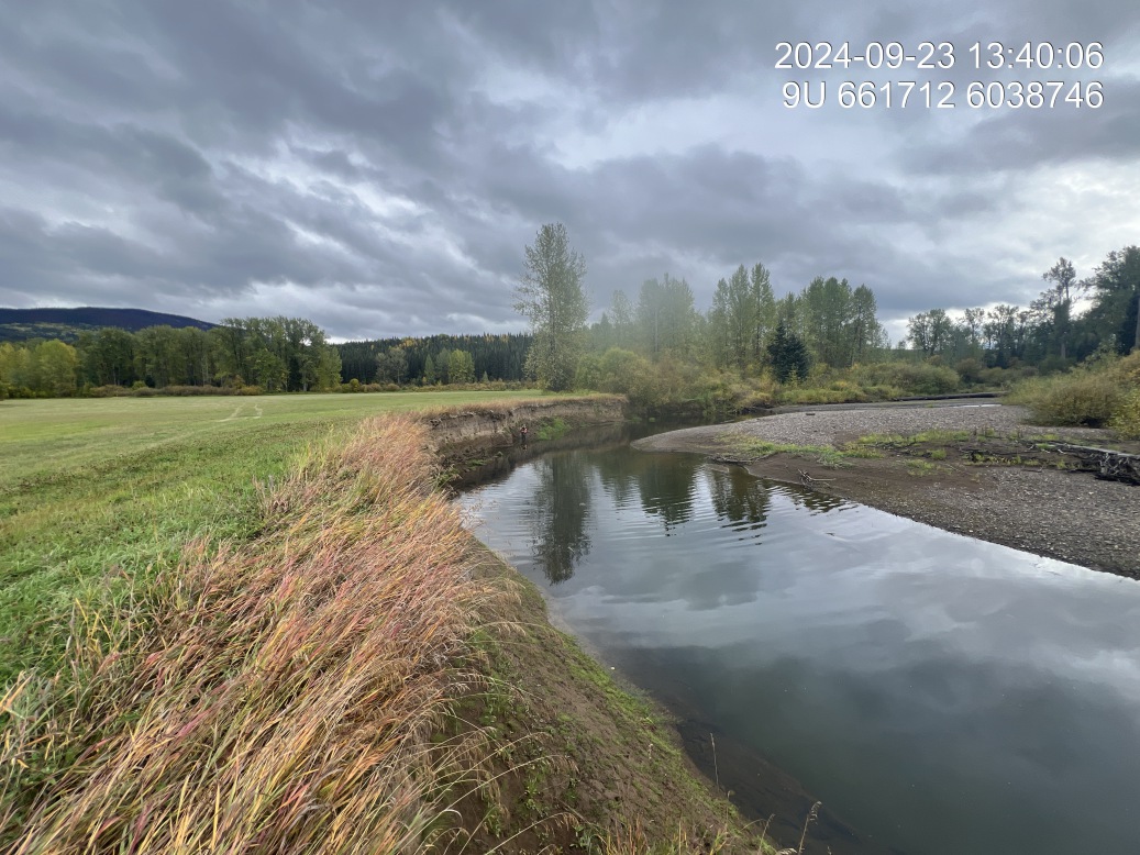
Figure 5.188: View of upstream end of site
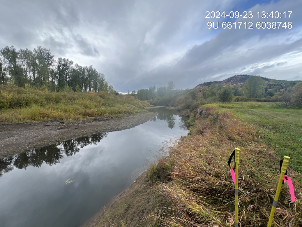
Figure 5.189: View of downstream end of site
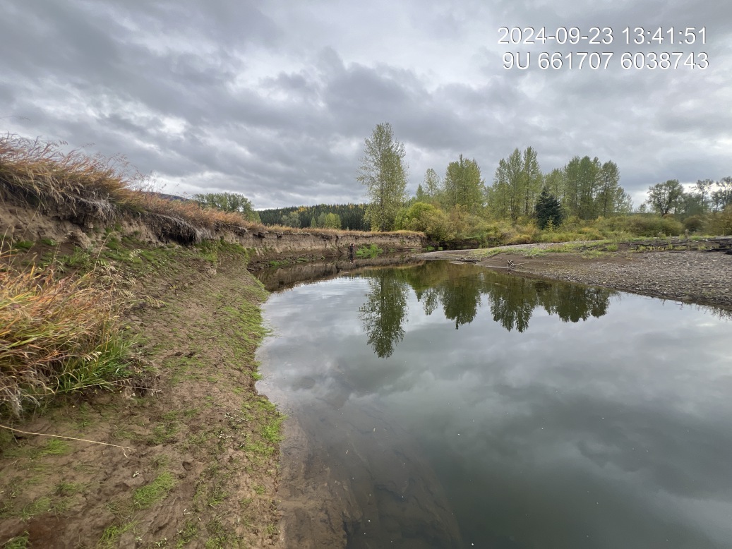
Figure 5.190: View of upstream end of site
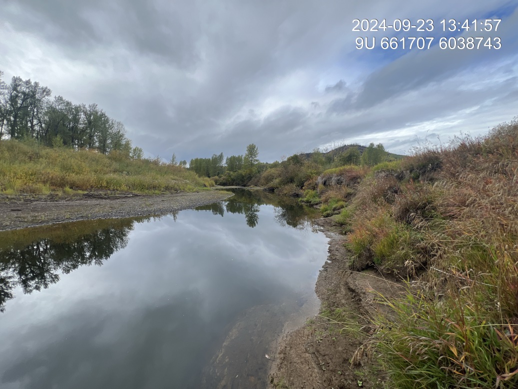
Figure 5.191: View of downstream end of site
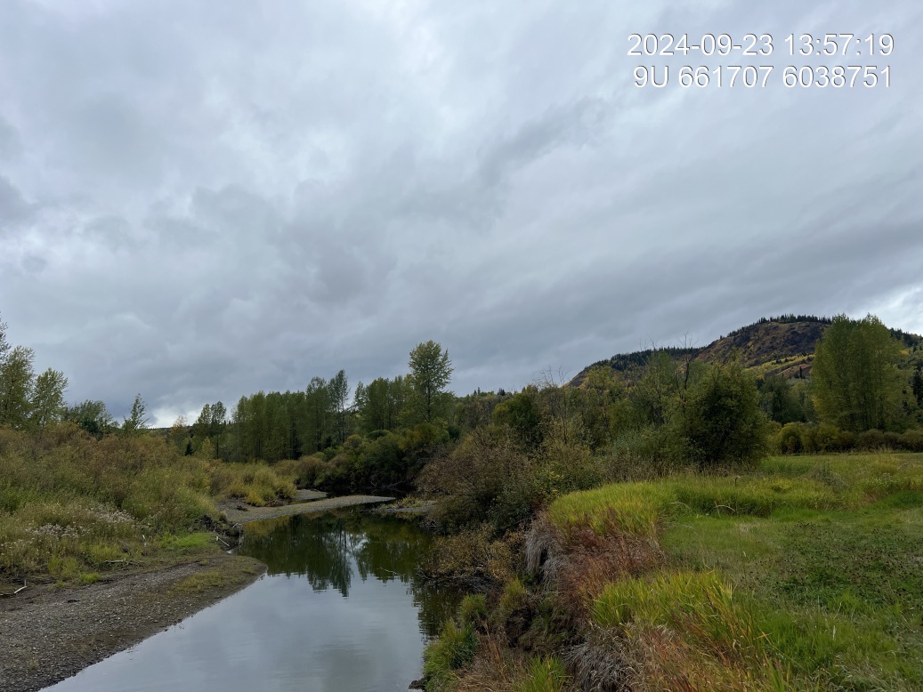
Figure 5.192: Riparian regrowth within site
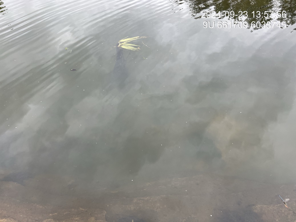
Figure 5.193: Substrate composition

Figure 5.194: Bank stability
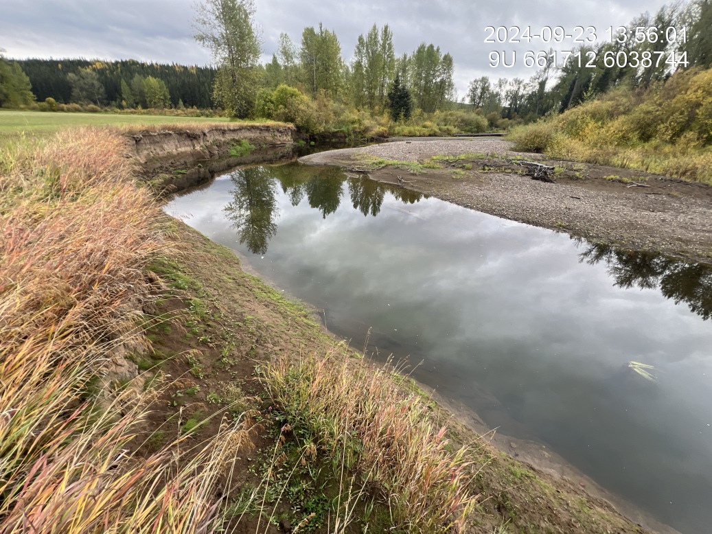
Figure 5.195: Fish cover