Appendix - 123795 - Tributary to Blunt Creek
Site Location
PSCIS crossing 123795 is located on tributary to Blunt Creek at km 18.9 of the Blunt Creek FSR. The site is accessed via Moricetown Road through Witset approximately 40km north of Smithers. The culvert is located approximately 670m upstream from the confluence with a major tributary to Blunt Creek. Blunt Creek flows east into Harold Price Creek which in turn flows into the Suskwa River. The Suskwa River enters the Bulkley River near Hazleton BC. Blunt Creek FSR is the responsibility of the FLNR - Skeena Stikine District.
Background
At crossing 123795, the tributary to Blunt Creek is a first order stream. The elevation of the watershed ranges from a maximum of 1260m to 1070m at the crossing. Upstream of the Blunt Creek FSR, salmon (general) have been previously recorded as present (MoE 2020a) with dolly varden recorded as present in the adjacent connected stream. We suspect the salmon noted were likely coho due to the smaller size of the watershed.
PSCIS stream crossing 123795 was ranked as a high priority for follow up by Irvine (2018) because there was salmon noted upstream and because PSCIS data indicated a larger channel containing habitat rated as high value. Although on a generally smaller stream, the crossing’s location on a forest service road was considered advantageous for funding eligibility through forestry supported programs such as the Land Based Investment Fund. A map of the watershed is provided in map attachment 093M.103.
Stream Characteristics at Crossing
At the time of the survey, the culvert under Blunt Creek FSR was un-embedded, non-backwatered and ranked as a barrier to upstream fish passage acoording to the provincial protocol (MoE 2011). The pipe was 0.9m in diameter with a length of 15m, a culvert slope of 1%, a stream width ratio of 1.6 and an outlet drop of 0.17m (Table 5.18). Water temperature was 10\(^\circ\)C, pH was 7.8 and conductivity was 56uS/cm.
Stream Characteristics Downstream
The stream was surveyed downstream from the culvert for 200m (Figures 5.20 - 5.21). Total cover amount was rated as moderate with undercut banks dominant. Cover was also present as overhanging vegetation (Table 5.19). The average channel width was 1.4m, the average wetted width was 1.2m and the average gradient was 3.7%. The dominant substrate was gravels with fines subdominant. Within the area surveyed, the stream was noted as having somewhat low complexity, with occasional deep pools and primarily glide habitat. Abundant gravels were noted as present but with only occasional patches unembedded. The habitat was rated as moderate value.
Stream Characteristics Upstream
The stream was surveyed immediately upstream from 123795 for approximately 650m to the location of a ford (PSCIS123796).(Figures 5.22 - 5.23). Within the area surveyed, total cover amount was rated as abundant with undercut banks dominant. Cover was also present as small woody debris, large woody debris, deep pools, overhanging vegetation, and instream vegetation (Table 5.19). The average channel width was 1.4m, the average wetted width was 1.3m and the average gradient was 7.2%. The dominant substrate was fines with cobbles subdominant. Deep glide habitat was noted as prevalent in the area surveyed. Gradients leveled out at top end of site, with primarily shrub and wetland riparian area present. Very occasional pockets of gravel suitable for resident and adfluvial salmonid spawning were noted. Habitat value was rated as moderate for salmonid spawning and rearing.
Table 5.20 presents preliminary fish passage modelling data for crossing 123795 with spawning and rearing habitat estimated for chinook, coho, sockeye and steelhead. Modelled estimates of the total length of salmon or steelhead habitat upstream of the crossing before potential barriers are 0km of potential spawning habitat and 0km of potential rearing habitat.
Structure Remediation and Cost Estimate
Replacement of PSCIS crossing 123795 with an embedded culvert (streambed simulation - 3m diameter) is recommended in the long term. The cost of the work is estimated at $62,000 for a cost benefit of 21 linear m/$1000 and 29.4m2/$1000.
Conclusion
A conservative estimate of mainstem habitat upstream of crossing 123795 is 1.3km. Habitat in the areas surveyed was rated as moderate value for salmonid rearing and spawning. Blunt Creek FSR is the responsibility of FLNR - Skeena Stikine District. The crossing was ranked as a moderate priority for proceeding to design for replacement. Future fish sampling is recommended upstream and downstream fo the road to clarify salmon species presence and assess densities of fish present.
| Location and Stream Data |
|
Crossing Characteristics | – |
|---|---|---|---|
| Date | 2020-08-24 | Crossing Sub Type | Round Culvert |
| PSCIS ID | 123795 | Diameter (m) | 0.9 |
| External ID | – | Length (m) | 15 |
| Crew | AI, KP | Embedded | No |
| UTM Zone | 9 | Depth Embedded (m) | – |
| Easting | 615760 | Resemble Channel | No |
| Northing | 6106892 | Backwatered | No |
| Stream | Tributary to Blunt Creek | Percent Backwatered | – |
| Road | Blunt Creek FSR | Fill Depth (m) | 0.75 |
| Road Tenure | FLNR Nadina 7543 | Outlet Drop (m) | 0.17 |
| Channel Width (m) | 1.42 | Outlet Pool Depth (m) | 0.05 |
| Stream Slope (%) | 3.7 | Inlet Drop | No |
| Beaver Activity | No | Slope (%) | 1 |
| Habitat Value | Medium | Valley Fill | Deep Fill |
| Final score | 29 | Barrier Result | Barrier |
| Fix type | Replace Structure with Streambed Simulation CBS | Fix Span / Diameter | 3 |
Photos: From top left clockwise: Road/Site Card, Barrel, Outlet, Downstream, Upstream, Inlet.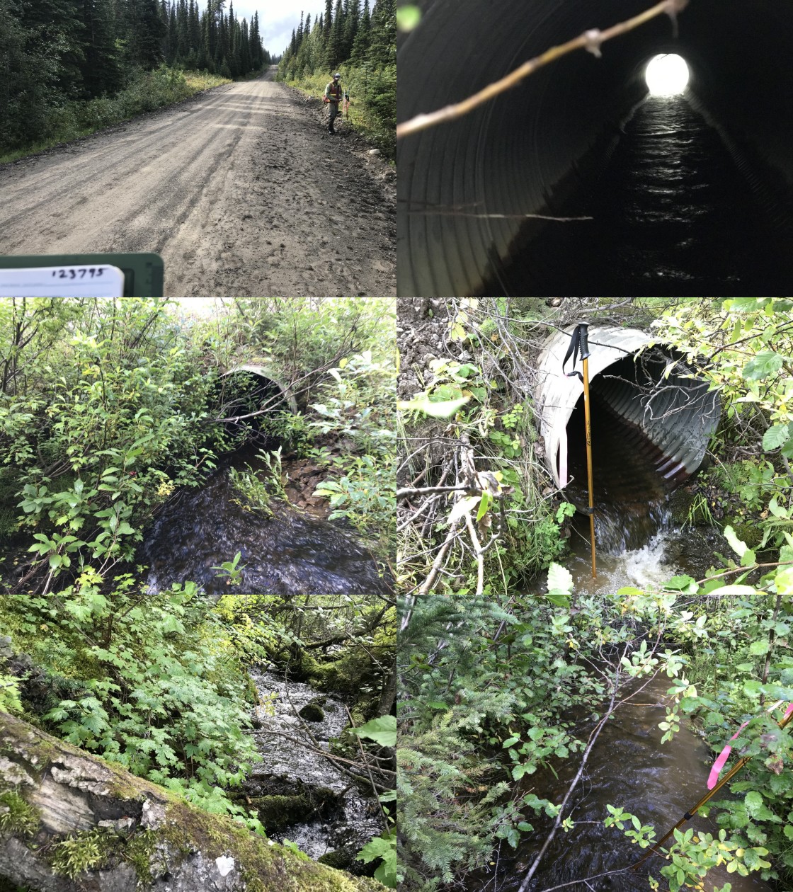
|
|||
| Comments: Smaller stream with good flow. Salmon point (juvenile) noted upstream. Recommend sampling upstream and downstream and habitat assessment of stream at associated PSCIS crossing 123785. |
| Site | Location | Length Surveyed (m) | Channel Width (m) | Wetted Width (m) | Pool Depth (m) | Gradient (%) | Total Cover | Habitat Value |
|---|---|---|---|---|---|---|---|---|
| 123795 | Downstream | 200 | 1.4 | 1.2 | 0.3 | 3.7 | moderate | moderate |
| 123795 | Upstream | 650 | 1.4 | 1.3 | 0.3 | 7.2 | abundant | moderate |
| Habitat | Potential | Remediation Gain | Remediation Gain (%) |
|---|---|---|---|
| Salmon Network (km) | 1.4 | 1.4 | 100 |
| Salmon Lake Reservoir (ha) | 0.0 | 0.0 | – |
| Salmon Wetland (ha) | 0.3 | 0.3 | 100 |
| Steelhead Network (km) | 1.4 | 1.4 | 100 |
| Steelhead Lake Reservoir (ha) | 0.0 | 0.0 | – |
| Steelhead Wetland (ha) | 0.3 | 0.3 | 100 |
| CH Spawning (km) | 0.0 | 0.0 | – |
| CH Rearing (km) | 0.0 | 0.0 | – |
| CO Spawning (km) | 0.0 | 0.0 | – |
| CO Rearing (km) | 0.0 | 0.0 | – |
| CO Rearing (ha) | – | – | – |
| SK Spawning (km) | 0.0 | 0.0 | – |
| SK Rearing (km) | 0.0 | 0.0 | – |
| SK Rearing (ha) | – | – | – |
| ST Spawning (km) | 0.0 | 0.0 | – |
| ST Rearing (km) | 0.0 | 0.0 | – |
| All Spawning (km) | 0.0 | 0.0 | – |
| All Rearing (km) | 0.0 | 0.0 | – |
| All Spawning and Rearing (km) | 0.0 | 0.0 | – |
| * Model data is preliminary and subject to adjustments. |
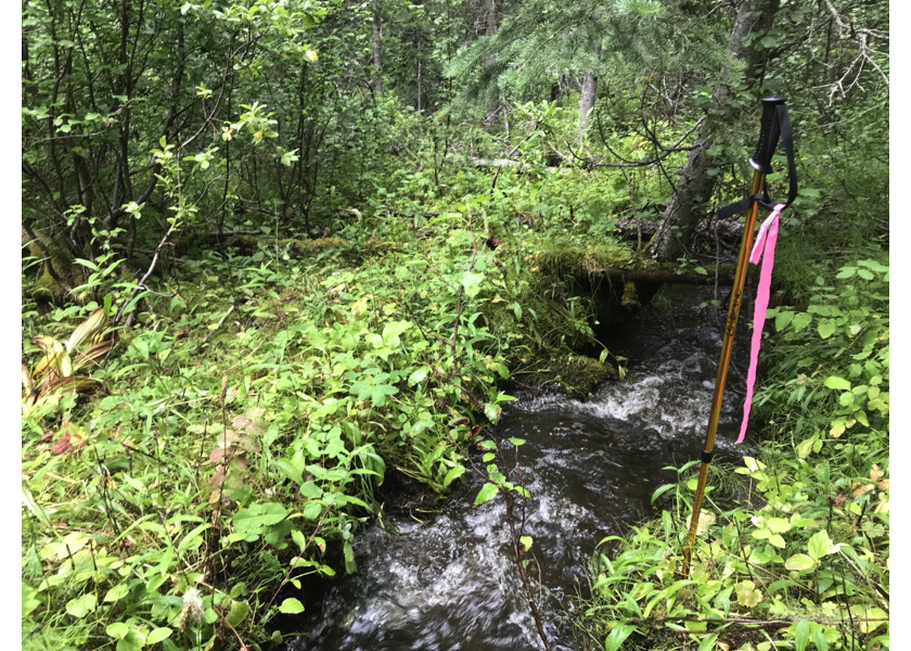
Figure 5.20: Habitat downstream of PSCIS crossing 123795.
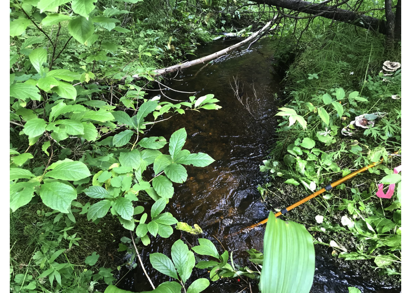
Figure 5.21: Habitat downstream of crossing 123795.
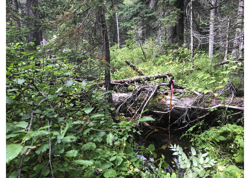
Figure 5.22: Habitat upstream of PSCIS crossing 123795.
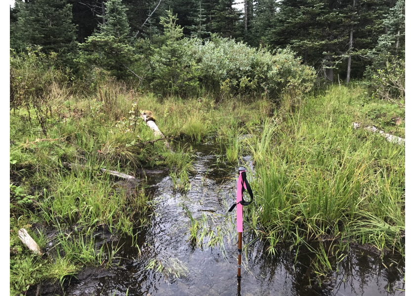
Figure 5.23: Cascade upstream of PSCIS crossing 123795.