Appendix - 3139 - Trib to McQuarrie Creek
Site Location
PSCIS crossing 3139 is located on a Trib to McQuarrie Creek at km 31 of North Road. North Road can be accessed from Summit Lake Rd East which meets Highway 16 approximately 11km east of Houston. The culvert is located approximately 490m upstream from the confluence with McQuarrie Creek. North Road is the responsibility of FLNR - Nadina Forest District.
Background
At crossing 3139, Trib to McQuarrie Creek is a third order stream with a watershed area upstream of the crossing of approximately 8.9km2, containing an estimated 23ha of wetland and 23ha of lake. The elevation of the watershed ranges from a maximum of 1200m to 935m at the crossing. Upstream of North Road, no fish have previously been recorded (MoE 2020a).
Downstream in McQuarrie Creek, longnose sucker, redside shiner, cutthroat trout, coho salmon, rainbow trout, steelhead, and chinook salmon have been recorded as present. Although MoE (2020a) note steelhead in McQuarrie Creek near the confluence with the subject stream (with source reference noted as “personal communications”), NCFDC (1998) recorded a 4-5 m impassable falls (significant overhanging section, lack of plunge pool) in the canyon downstream (UTM 9.662200.6045550). This falls was not recorded in provincial databases at the time of planning and reporting.
Beginning in 2016, the BC Ministry of Forests, Land, Natural Resource Operations and Rural Development (FLNRORD), Land and Water Section established a continuous discharge monitoring station on McQuarrie Creek just upstream of the highway (Westcott 2020). Additionally, three water temperature sensors have been deployed in the watershed. One is located in McQuarrie Creek just above Highway 16, another is in McQuarrie Creek above North Road and one is in McQuarrie Lake (Westcott 2020). Sensors in McQuarrie Creek have been gathering water temperature data at 1hour intervals since 2016 and the sensor in McQuarrie Lake is gathering maximum temperature information from 1m below the surface since July 2018. Data from the two McQuarrie Creek temperature monitoring stations is available through the Skeena Salmon Data Centre (DFO/FLNRO 2019c, 2019b).
The McQuarrie Creek watershed has been selected as a focus watershed for Environmental Stewardship Initiative (ESI) research including critical flow monitoring, benthic invertebrate sampling, water quality monitoring and fisheries assessments (pers. comm Don Morgan, Ministry of Environment and Climate Change Strategy).
PSCIS stream crossing 3139 was ranked as a high priority for follow up in Irvine (2018). It was also selected for follow up with habitat confirmation because McQuarrie Creek was noted as an important rearing area for steelhead by Tredger (1982), because the stream is lake headed (which can stabilize system flows), as steelhead were noted near the confluence, and due to engagement activities with Wet’suwet’en, FLNRO, and Ministry of Environment and Climate Change Strategy representatives that indicated that there could be potential benefits in fish passage remediation/monitoring activities in ESI target watersheds.
Of note, an erronous input into the provincial database for PSCIS crossing 3138 indicated that the oval culvert structure located on McQuarrie Creek just upstream of the confluence with the subject stream was an open bottomed structure and fully passable. The error was discovered during review of PSCIS photos as part of the background review for drafting of this report. NCFDC (1998) noted that this culvert was a barrier to upstream fish passage at low flows, was undersized and was causing fill slope erosion at the road crossing. A map of the watershed is provided in map attachment 093L.114.
Stream Characteristics at Crossing
At the time of the survey, the culvert under North Road was un-embedded, non-backwatered and ranked as a barrier to upstream fish passage according to the provincial protocol (MoE 2011). The pipe was 1.2m in diameter with a length of 27m, a culvert slope of 2%, a stream width ratio of 3.2 and an outlet drop of 1.02m (Table 5.1). Water temperature was 11\(^\circ\)C, pH was 7.7 and conductivity was 89uS/cm.
Stream Characteristics Downstream
The stream was surveyed downstream from the culvert for 285m to the confluence with Buck Creek (Figures 5.1 - 5.2). Total cover amount was rated as moderate with overhanging vegetation dominant. Cover was also present as small woody debris, large woody debris, and undercut banks (Table 5.2). The average channel width was 3.1m, the average wetted width was 2.2m and the average gradient was 3.9%. The dominant substrate was cobbles with boulders subdominant. There were occasional pockets of gravels suitable for resident salmonids. The habitat was rated as high value for resident salmonid rearing.
Stream Characteristics Upstream
The stream was surveyed immediately upstream from 3139 for approximately 625m (Figures 5.3 - 5.4). Within the area surveyed, total cover amount was rated as abundant with deep pools dominant. Cover was also present as small woody debris, large woody debris, boulders, undercut banks, and overhanging vegetation (Table 5.2). The average channel width was 3.3m, the average wetted width was 2.7m and the average gradient was 7.2%. The dominant substrate was cobbles with gravels subdominant. Extensive areas of gravels suitable for spawning resident salmonids were present and fry were observed throughout the surveyed area. Habitat value was rated as high value resident salmonid rearing and spawning.
Structure Remediation and Cost Estimate
Replacement of PSCIS crossing 3139 with a bridge (13m span) is recommended. The cost of the work is estimated at $162,000 for a cost benefit of 45.1 linear m/$1000 and 148.7m2/$1000.
Conclusion
A conservative estimate of mainstem habitat upstream of crossing 3139 is 7.3km to the top end of a 71ha wetland where rainbow trout have been recorded. Habitat in the areas surveyed upstream of the culvert were rated as high value for salmonid rearing and spawning with extensive areas of wetland and lake habitat located upstream. As there is a 4-5 m impassable falls downstream in McQuarrie Creek, remediation of fish passage at the crossing would benefit resident fish species in the watershed and not anadromous fish populations migrating from the Bulkley River mainstem. North Road is the responsibility of the Ministry of Transportation and Infrastructure. Crossing 3139 was ranked as a moderate priority for proceeding to design for replacement.
| Location and Stream Data |
|
Crossing Characteristics | – |
|---|---|---|---|
| Date | 2020-09-01 | Crossing Sub Type | Round Culvert |
| PSCIS ID | 3139 | Diameter (m) | 1.2 |
| External ID | – | Length (m) | 27 |
| Crew | KP, AI | Embedded | No |
| UTM Zone | 9 | Depth Embedded (m) | – |
| Easting | 656657 | Resemble Channel | No |
| Northing | 6048544 | Backwatered | No |
| Stream | Trib to McQuarrie Creek | Percent Backwatered | – |
| Road | North Road | Fill Depth (m) | 4 |
| Road Tenure | MoTi local | Outlet Drop (m) | 1.02 |
| Channel Width (m) | 3.9 | Outlet Pool Depth (m) | 0.25 |
| Stream Slope (%) | 3.1 | Inlet Drop | No |
| Beaver Activity | No | Slope (%) | 2 |
| Habitat Value | Medium | Valley Fill | Deep Fill |
| Final score | 34 | Barrier Result | Barrier |
| Fix type | Replace with New Open Bottom Structure | Fix Span / Diameter | 13 |
Photos: From top left clockwise: Road/Site Card, Barrel, Outlet, Downstream, Upstream, Inlet.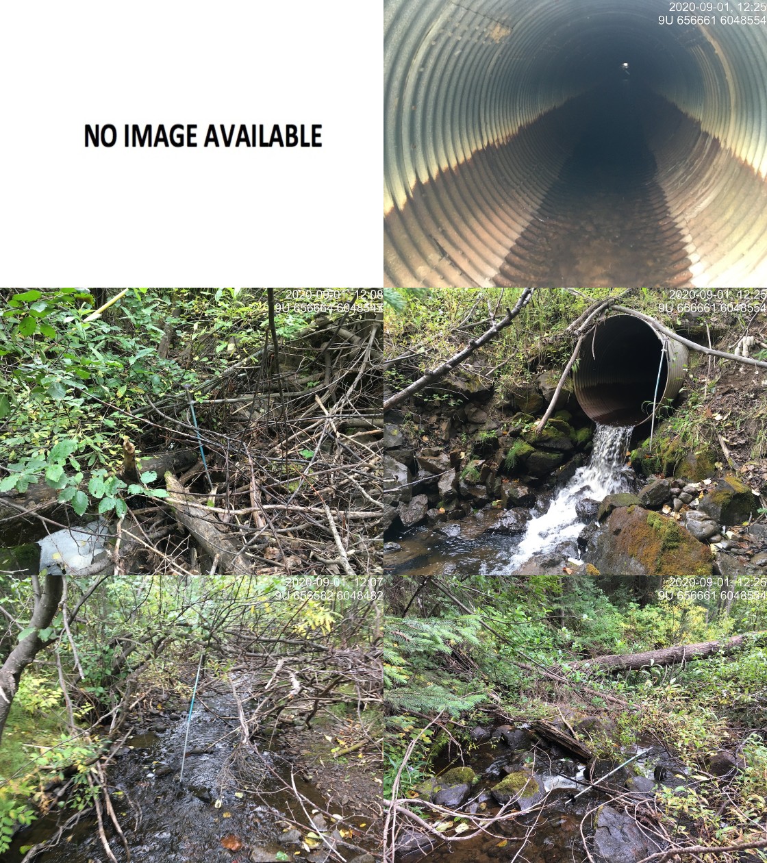
|
|||
| Comments: Inlet plugged with small and large woody debris. Fry and juvenile fish observed upstream. |
| Site | Location | Length Surveyed (m) | Channel Width (m) | Wetted Width (m) | Pool Depth (m) | Gradient (%) | Total Cover | Habitat Value |
|---|---|---|---|---|---|---|---|---|
| 3139 | Downstream | 285 | 3.1 | 2.2 | 0.4 | 3.9 | moderate | high |
| 3139 | Upstream | 625 | 3.3 | 2.7 | 0.4 | 7.2 | abundant | high |
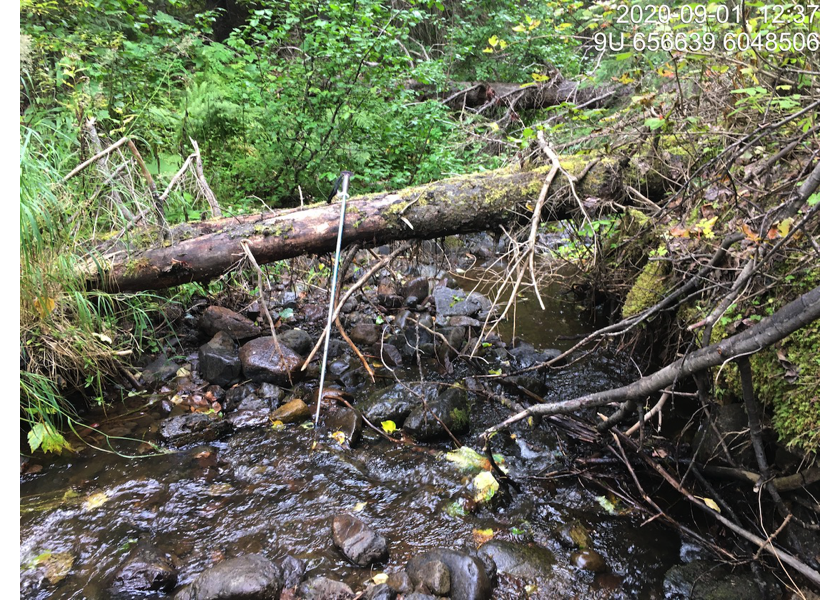
Figure 5.1: Habitat downstream of PSCIS crossing 3139.
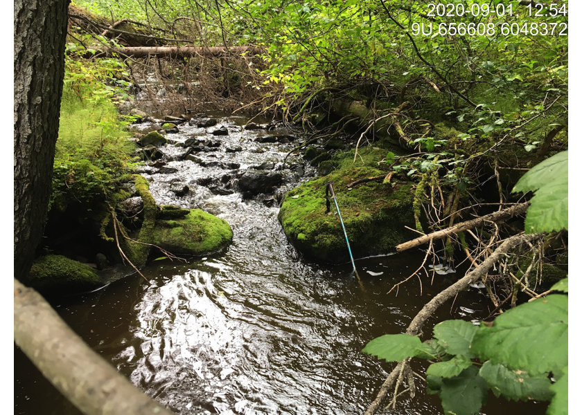
Figure 5.2: Habitat downstream of crossing 3139.
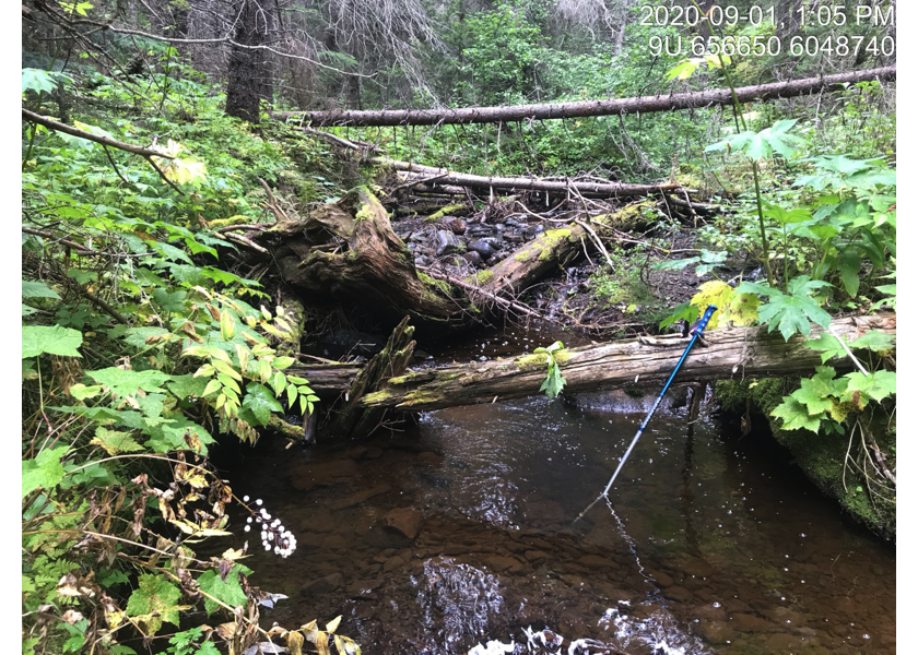
Figure 5.3: Habitat upstream of PSCIS crossing 3139.
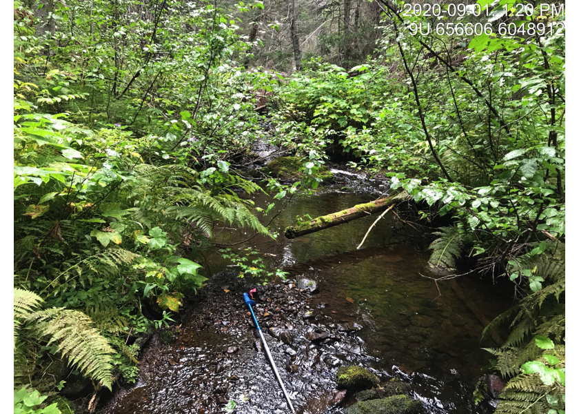
Figure 5.4: Habitat upstream of PSCIS crossing 3139.