Appendix - Phase 1 Fish Passage Assessment Data and Photos
| Location and Stream Data |
|
Crossing Characteristics | – |
|---|---|---|---|
| Date | 2024-10-09 | Crossing Sub Type | Round Culvert |
| PSCIS ID | 4931 | Diameter (m) | 1.55 |
| External ID | – | Length (m) | 6 |
| Crew | LS | Embedded | No |
| UTM Zone | 11 | Depth Embedded (m) | – |
| Easting | 344707 | Resemble Channel | No |
| Northing | 5862849 | Backwatered | No |
| Stream | Teepee Creek | Percent Backwatered | – |
| Road | Mount Tinsley Pit Road | Fill Depth (m) | 0.5 |
| Road Tenure | Carrier Lumber R13564 | Outlet Drop (m) | 1.3 |
| Channel Width (m) | 5.6 | Outlet Pool Depth (m) | 0.35 |
| Stream Slope (%) | 12 | Inlet Drop | No |
| Beaver Activity | No | Slope (%) | 5 |
| Habitat Value | High | Valley Fill | Shallow Fill |
| Final score | 36 | Barrier Result | Barrier |
| Fix type | Replace with New Open Bottom Structure | Fix Span / Diameter | 15 |
Photos: PSCIS ID 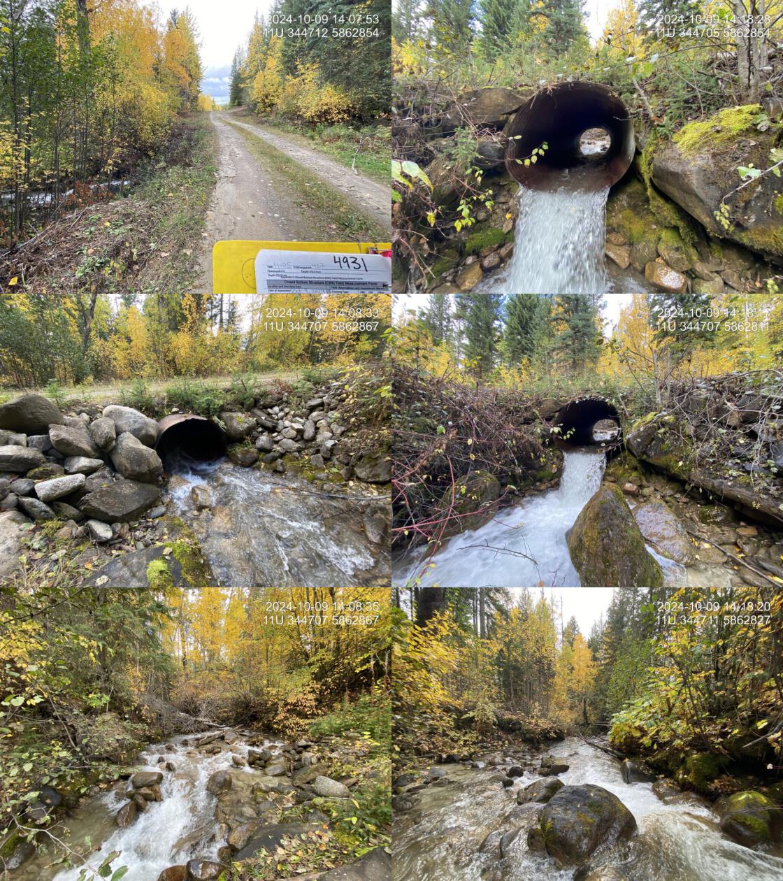 . From top left clockwise: Road/Site Card, Barrel, Outlet, Downstream, Upstream, Inlet.4931 . From top left clockwise: Road/Site Card, Barrel, Outlet, Downstream, Upstream, Inlet.4931
|
|||
| Comments: A significant outlet drop was present. The pipe was in good condition, but there was erosion under the outlet and on the road column on the outlet side. The stream provided high-quality habitat with known fish in the system, including a salmon point downstream. The gradient was steep at this crossing, but the downstream highway crossing had lower gradients with abundant gravels. The road was a small dirt road with minimal road fill, making replacement relatively straightforward. |
| Location and Stream Data |
|
Crossing Characteristics | – |
|---|---|---|---|
| Date | 2024-10-09 | Crossing Sub Type | Round Culvert |
| PSCIS ID | 7620 | Diameter (m) | 2.6 |
| External ID | – | Length (m) | 52 |
| Crew | LS | Embedded | Yes |
| UTM Zone | 11 | Depth Embedded (m) | 0.1 |
| Easting | 343425 | Resemble Channel | Yes |
| Northing | 5862437 | Backwatered | Yes |
| Stream | Teepee Creek | Percent Backwatered | 100 |
| Road | Railway | Fill Depth (m) | 7 |
| Road Tenure | CN Rail | Outlet Drop (m) | 0 |
| Channel Width (m) | 7.5 | Outlet Pool Depth (m) | 1 |
| Stream Slope (%) | 1 | Inlet Drop | No |
| Beaver Activity | Yes | Slope (%) | 1.5 |
| Habitat Value | Medium | Valley Fill | Deep Fill |
| Final score | 22 | Barrier Result | Barrier |
| Fix type | Replace with New Open Bottom Structure | Fix Span / Diameter | 27 |
Photos: PSCIS ID 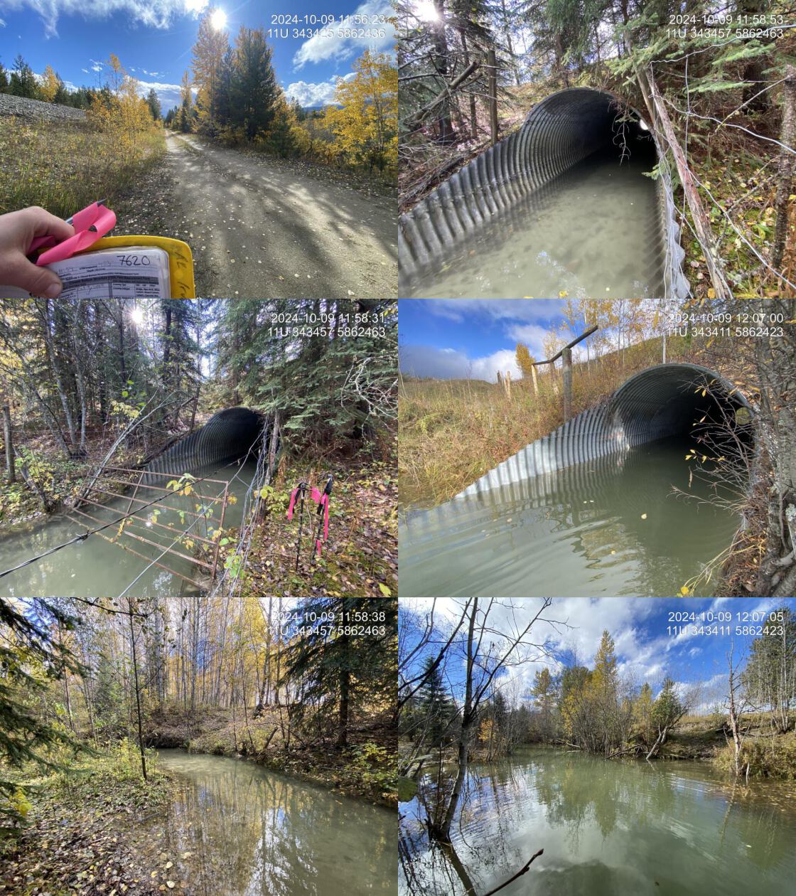 . From top left clockwise: Road/Site Card, Barrel, Outlet, Downstream, Upstream, Inlet.7620 . From top left clockwise: Road/Site Card, Barrel, Outlet, Downstream, Upstream, Inlet.7620
|
|||
| Comments: Long culvert which passed under the CN railway and a dirt road. A beaver dam located 50m downstream of the outlet created a larger beaver pond which was backwatering the culvert . Below the beaver dam, the stream had low gradients and provided good fish habitat. A gate across the inlet functioned as a beaver grate. The stream was fenced perpendicular to the channel both upstream and downstream, likely for cattle management. Signs of cattle accessing the stream were observed near the outlet. |
| Location and Stream Data |
|
Crossing Characteristics | – |
|---|---|---|---|
| Date | 2023-09-28 | Crossing Sub Type | Round Culvert |
| PSCIS ID | 199163 | Diameter (m) | 7.1 |
| External ID | 5400442 | Length (m) | 24 |
| Crew | AI | Embedded | No |
| UTM Zone | 10 | Depth Embedded (m) | – |
| Easting | 311759 | Resemble Channel | No |
| Northing | 6025526 | Backwatered | No |
| Stream | Tributary to Endako River | Percent Backwatered | – |
| Road | Highway 16 | Fill Depth (m) | 1.8 |
| Road Tenure | MOTI | Outlet Drop (m) | 0.85 |
| Channel Width (m) | 10 | Outlet Pool Depth (m) | 1.3 |
| Stream Slope (%) | 1.5 | Inlet Drop | No |
| Beaver Activity | No | Slope (%) | 2.5 |
| Habitat Value | Medium | Valley Fill | Deep Fill |
| Final score | 34 | Barrier Result | Barrier |
| Fix type | Replace with New Open Bottom Structure | Fix Span / Diameter | 15 |
Photos: PSCIS ID 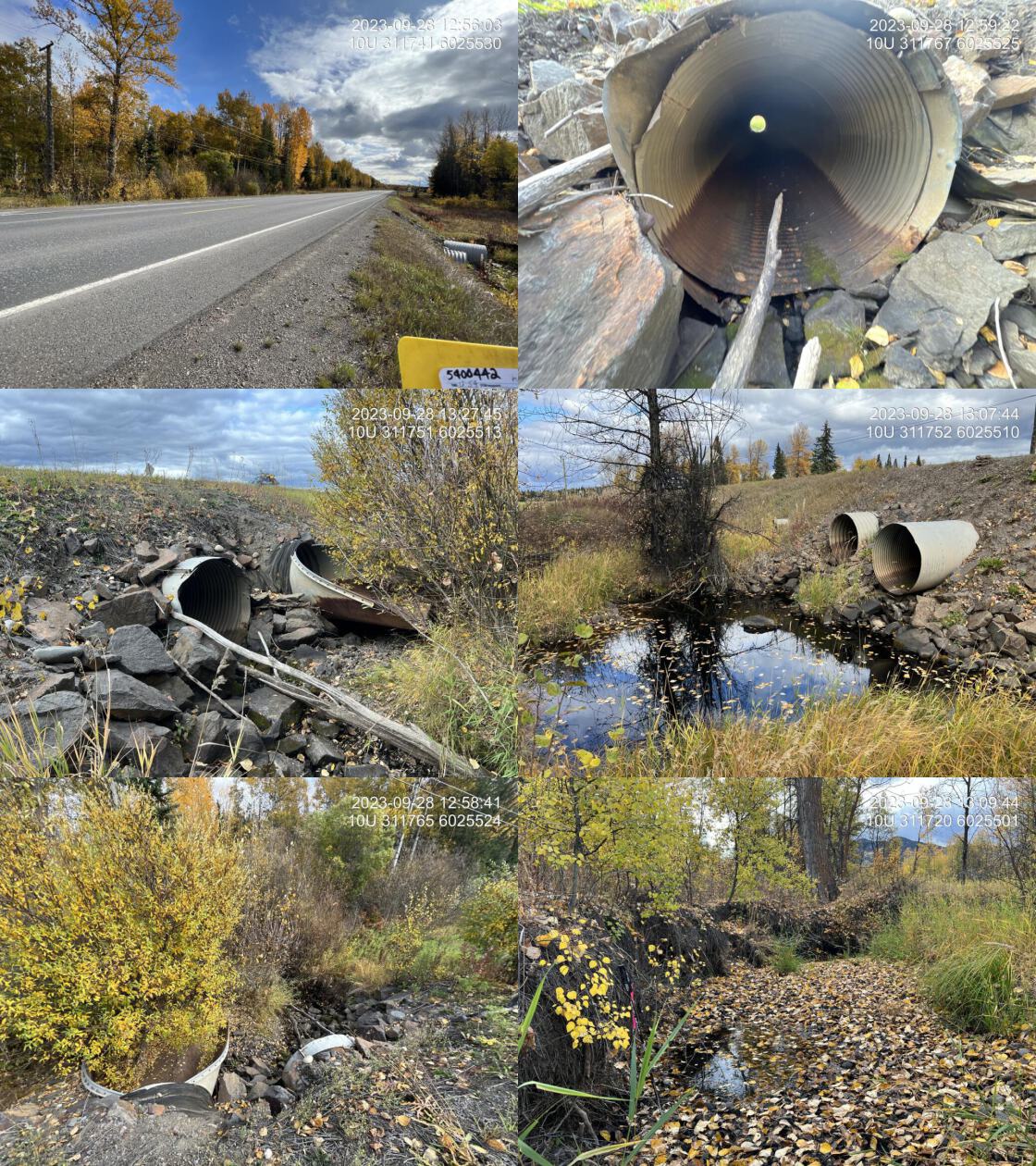 . From top left clockwise: Road/Site Card, Barrel, Outlet, Downstream, Upstream, Inlet.5400442 . From top left clockwise: Road/Site Card, Barrel, Outlet, Downstream, Upstream, Inlet.5400442
|
|||
| Comments: This is two 1.55 m pipes plus a 0.6 m overflow. The north large pipe has a strange apron on the inlet. The stream is deeply incised (2.5 m deep) within an agricultural field on the downstream side. No riparian for approximately 70 m downstream on the right bank. The stream is partially dewatered with stagnant pools throughout. Forgie Creek dam, owned by Hart George F/V B, is upstream and may be influencing flow. Channel is choked downstream with grasses in many places indicating flow is not occurring year around. MoTi chris_culvert_id: 2883939, 2076427, 2076426. 12:57:11 |
| Location and Stream Data |
|
Crossing Characteristics | – |
|---|---|---|---|
| Date | 2023-09-28 | Crossing Sub Type | Round Culvert |
| PSCIS ID | 199164 | Diameter (m) | 3.6 |
| External ID | 24707052 | Length (m) | 22 |
| Crew | AI | Embedded | No |
| UTM Zone | 10 | Depth Embedded (m) | – |
| Easting | 311577 | Resemble Channel | No |
| Northing | 6025364 | Backwatered | No |
| Stream | Tributary to Endako River | Percent Backwatered | – |
| Road | West Decker Road | Fill Depth (m) | 2 |
| Road Tenure | MOTI | Outlet Drop (m) | 0 |
| Channel Width (m) | 4 | Outlet Pool Depth (m) | 0.6 |
| Stream Slope (%) | 0.5 | Inlet Drop | No |
| Beaver Activity | No | Slope (%) | 0 |
| Habitat Value | Medium | Valley Fill | Deep Fill |
| Final score | 16 | Barrier Result | Potential |
| Fix type | Replace with New Open Bottom Structure | Fix Span / Diameter | 15 |
Photos: PSCIS ID 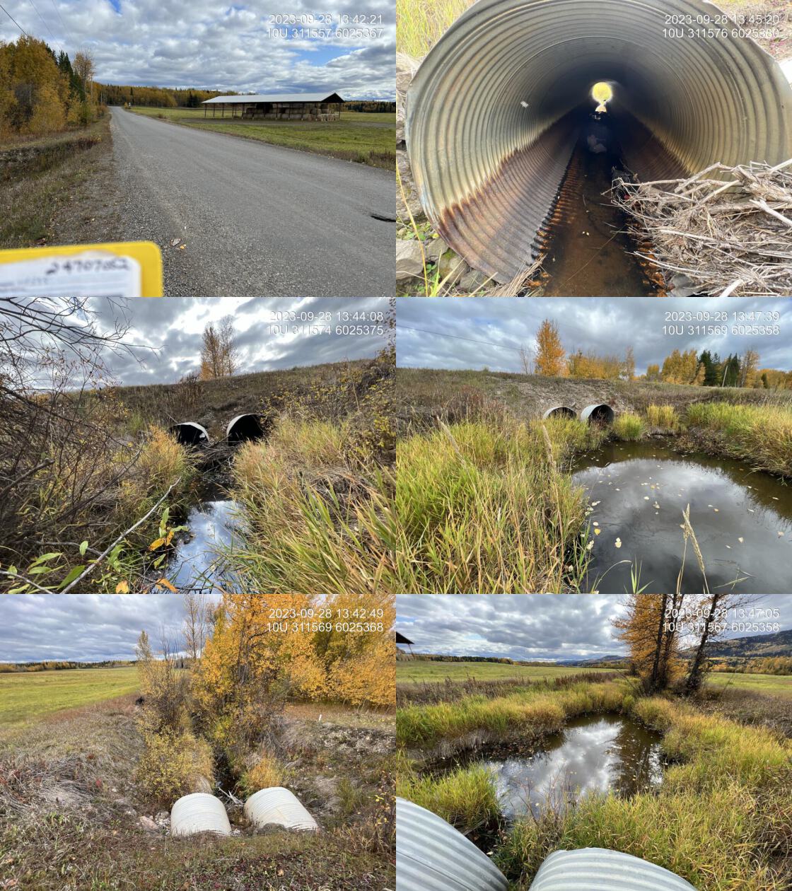 . From top left clockwise: Road/Site Card, Barrel, Outlet, Downstream, Upstream, Inlet.24707052 . From top left clockwise: Road/Site Card, Barrel, Outlet, Downstream, Upstream, Inlet.24707052
|
|||
| Comments: Was modelled as open bottom structure, has now been changed to CBS. Larger drainage with agricultural fields both upstream and downstream. Heavily impacted riparian with primarily field on either side upstream and downstream. Channel choked out with agronomic grasses. Mostly dewatered except for intermittent stagnant pools. Unassessed railway crossing downstream. MoTi chris_culvert_id: 2077140, 2077139. 13:48:59 |
| Location and Stream Data |
|
Crossing Characteristics | – |
|---|---|---|---|
| Date | 2023-09-29 | Crossing Sub Type | Round Culvert |
| PSCIS ID | 199165 | Diameter (m) | 1.8 |
| External ID | 5400216 | Length (m) | 25 |
| Crew | AI | Embedded | No |
| UTM Zone | 10 | Depth Embedded (m) | – |
| Easting | 341709 | Resemble Channel | Yes |
| Northing | 6003118 | Backwatered | No |
| Stream | Tributary to Endako River | Percent Backwatered | – |
| Road | Highway 16 | Fill Depth (m) | 2 |
| Road Tenure | MOTI | Outlet Drop (m) | 0 |
| Channel Width (m) | 2.6 | Outlet Pool Depth (m) | 0.3 |
| Stream Slope (%) | 1 | Inlet Drop | No |
| Beaver Activity | No | Slope (%) | 2 |
| Habitat Value | Medium | Valley Fill | Deep Fill |
| Final score | 24 | Barrier Result | Barrier |
| Fix type | Replace with New Open Bottom Structure | Fix Span / Diameter | 15 |
Photos: PSCIS ID 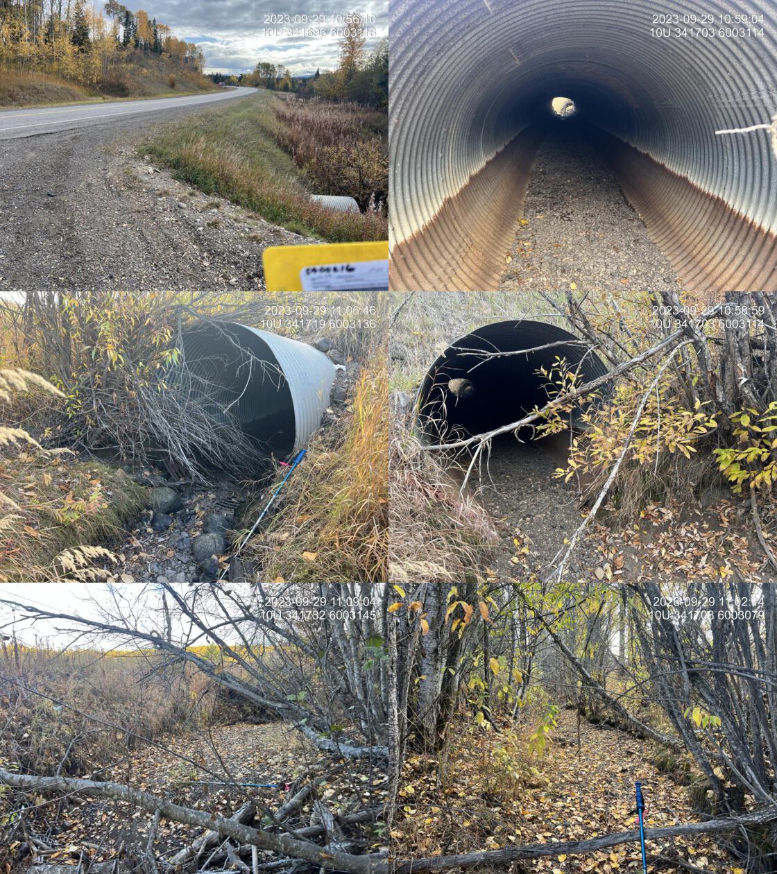 . From top left clockwise: Road/Site Card, Barrel, Outlet, Downstream, Upstream, Inlet.5400216 . From top left clockwise: Road/Site Card, Barrel, Outlet, Downstream, Upstream, Inlet.5400216
|
|||
| Comments: Dry at time of survey. Abundant gravels throughout. Crossing on railway downstream still unassessed. Modelled crossing below. First 5 m of pipe is rusted through on the bottom side. Deeply incised banks upstream indicate the stream has a lot of flow at sometimes in the year with a decent amount of power. 9m falls ~1km upstream.Upstream Co-op Lake stocked with KO from 2017-2023 and EB from 1963-2023. MoTi chris_culvert_id: 2069497. 10:56:54 |
| Location and Stream Data |
|
Crossing Characteristics | – |
|---|---|---|---|
| Date | 2023-09-29 | Crossing Sub Type | Round Culvert |
| PSCIS ID | 199166 | Diameter (m) | 0.6 |
| External ID | 5400121 | Length (m) | 14 |
| Crew | AI | Embedded | No |
| UTM Zone | 10 | Depth Embedded (m) | – |
| Easting | 346590 | Resemble Channel | No |
| Northing | 6001339 | Backwatered | No |
| Stream | Tributary to Endako River | Percent Backwatered | – |
| Road | Priestly Station Road | Fill Depth (m) | 0.7 |
| Road Tenure | MOTI Local | Outlet Drop (m) | 0.1 |
| Channel Width (m) | 1.8 | Outlet Pool Depth (m) | 0.25 |
| Stream Slope (%) | 0.5 | Inlet Drop | No |
| Beaver Activity | Yes | Slope (%) | 3 |
| Habitat Value | Medium | Valley Fill | Deep Fill |
| Final score | 26 | Barrier Result | Barrier |
| Fix type | Replace Structure with Streambed Simulation CBS | Fix Span / Diameter | 3 |
Photos: PSCIS ID 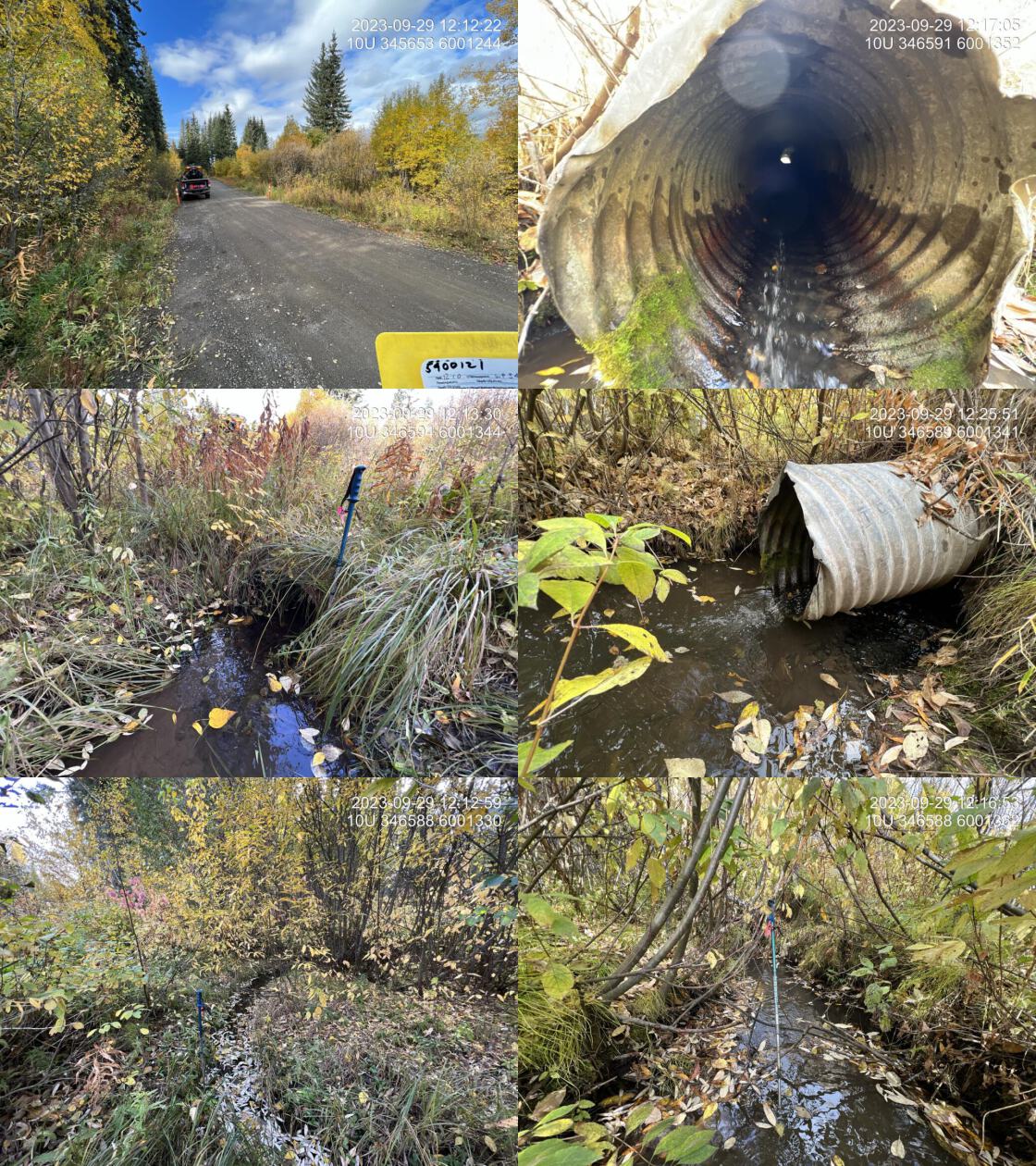 . From top left clockwise: Road/Site Card, Barrel, Outlet, Downstream, Upstream, Inlet.5400121 . From top left clockwise: Road/Site Card, Barrel, Outlet, Downstream, Upstream, Inlet.5400121
|
|||
| Comments: Small stream with very good flow immediately adjacent to the mainstem of the Endako River. Could be valuable Chinook rearing area during high flow periods. Pipe is bent in the middle so top half is backwatered but the bottom half is not. Small outlet drop. There is a large lump in the road at the pipe and pylons have been set up here likely to warn drivers.. 12:11:02 |
| Location and Stream Data |
|
Crossing Characteristics | – |
|---|---|---|---|
| Date | 2023-09-29 | Crossing Sub Type | Round Culvert |
| PSCIS ID | 199167 | Diameter (m) | 1.55 |
| External ID | 5400192 | Length (m) | 23 |
| Crew | AI | Embedded | No |
| UTM Zone | 10 | Depth Embedded (m) | – |
| Easting | 353705 | Resemble Channel | No |
| Northing | 5996651 | Backwatered | No |
| Stream | Sam Ross Creek | Percent Backwatered | – |
| Road | Highway 16 | Fill Depth (m) | 1.8 |
| Road Tenure | MOTI | Outlet Drop (m) | 0 |
| Channel Width (m) | 1.6 | Outlet Pool Depth (m) | 0 |
| Stream Slope (%) | 2.5 | Inlet Drop | No |
| Beaver Activity | No | Slope (%) | 1 |
| Habitat Value | Medium | Valley Fill | Deep Fill |
| Final score | 21 | Barrier Result | Barrier |
| Fix type | Replace Structure with Streambed Simulation CBS | Fix Span / Diameter | 3 |
Photos: PSCIS ID 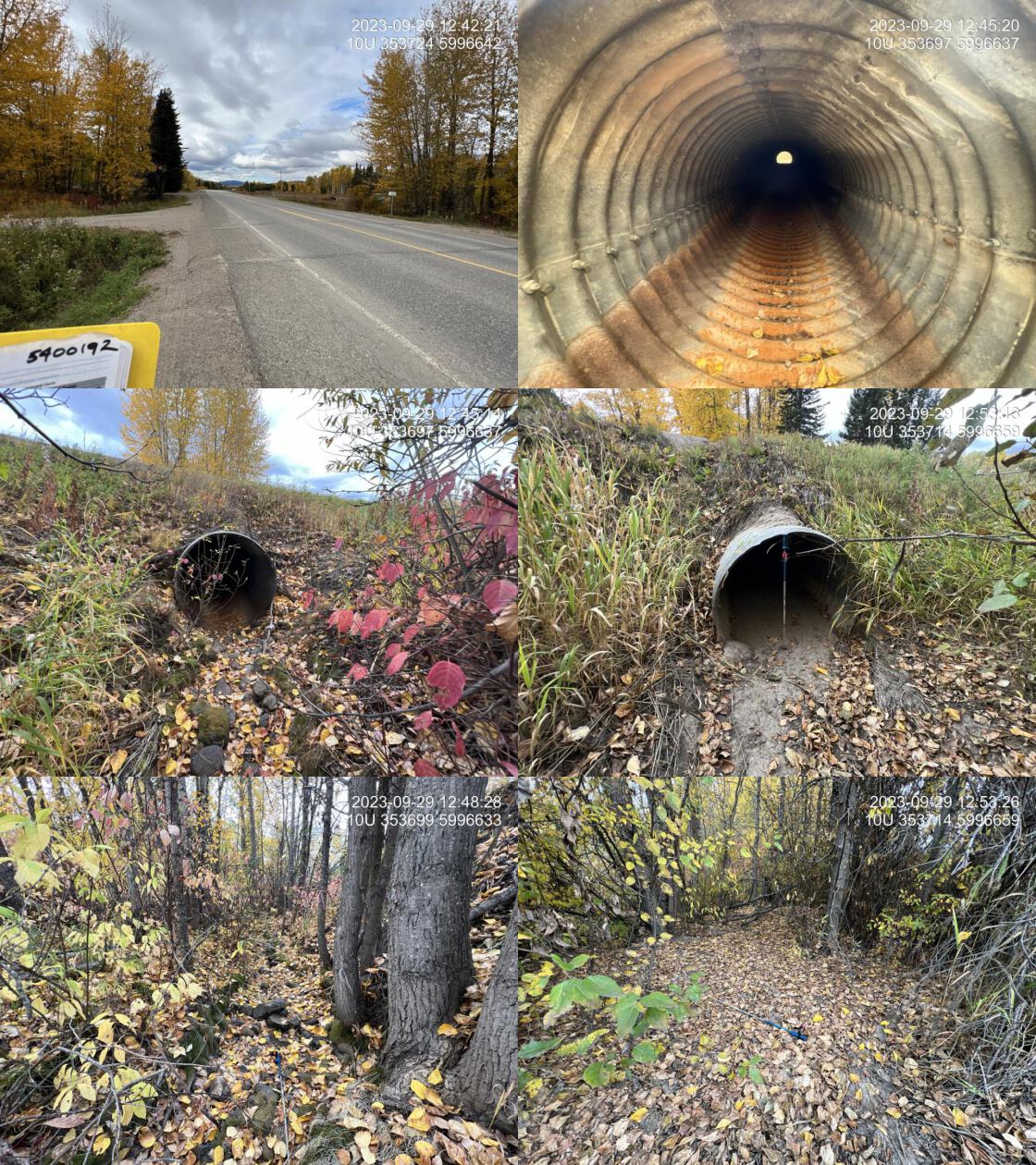 . From top left clockwise: Road/Site Card, Barrel, Outlet, Downstream, Upstream, Inlet.5400192 . From top left clockwise: Road/Site Card, Barrel, Outlet, Downstream, Upstream, Inlet.5400192
|
|||
| Comments: Dry at time of survey. Stream may be channelized upstream due to driveways to private properties on either side of the stream. Appears to have narrow, but decently healthy cottonwood dominated riparian, which could help dissipate flows and floods and runoff. Crack in Highway at culvert with minor erosion of road prism on downstream side. Stream labelled as Ross creek on sign. MoTi chris_culvert_id: 1793864. 12:42:58 |
| Location and Stream Data |
|
Crossing Characteristics | – |
|---|---|---|---|
| Date | 2023-09-29 | Crossing Sub Type | Round Culvert |
| PSCIS ID | 199168 | Diameter (m) | 0.9 |
| External ID | 5400235 | Length (m) | 20 |
| Crew | AI | Embedded | No |
| UTM Zone | 10 | Depth Embedded (m) | – |
| Easting | 371691 | Resemble Channel | No |
| Northing | 5993173 | Backwatered | No |
| Stream | Alf Creek | Percent Backwatered | – |
| Road | Highway 16 | Fill Depth (m) | 0.7 |
| Road Tenure | MOTI | Outlet Drop (m) | 1.2 |
| Channel Width (m) | 1 | Outlet Pool Depth (m) | 0.4 |
| Stream Slope (%) | 3 | Inlet Drop | No |
| Beaver Activity | No | Slope (%) | 2 |
| Habitat Value | Low | Valley Fill | Deep Fill |
| Final score | 31 | Barrier Result | Barrier |
| Fix type | Replace Structure with Streambed Simulation CBS | Fix Span / Diameter | 3 |
Photos: PSCIS ID 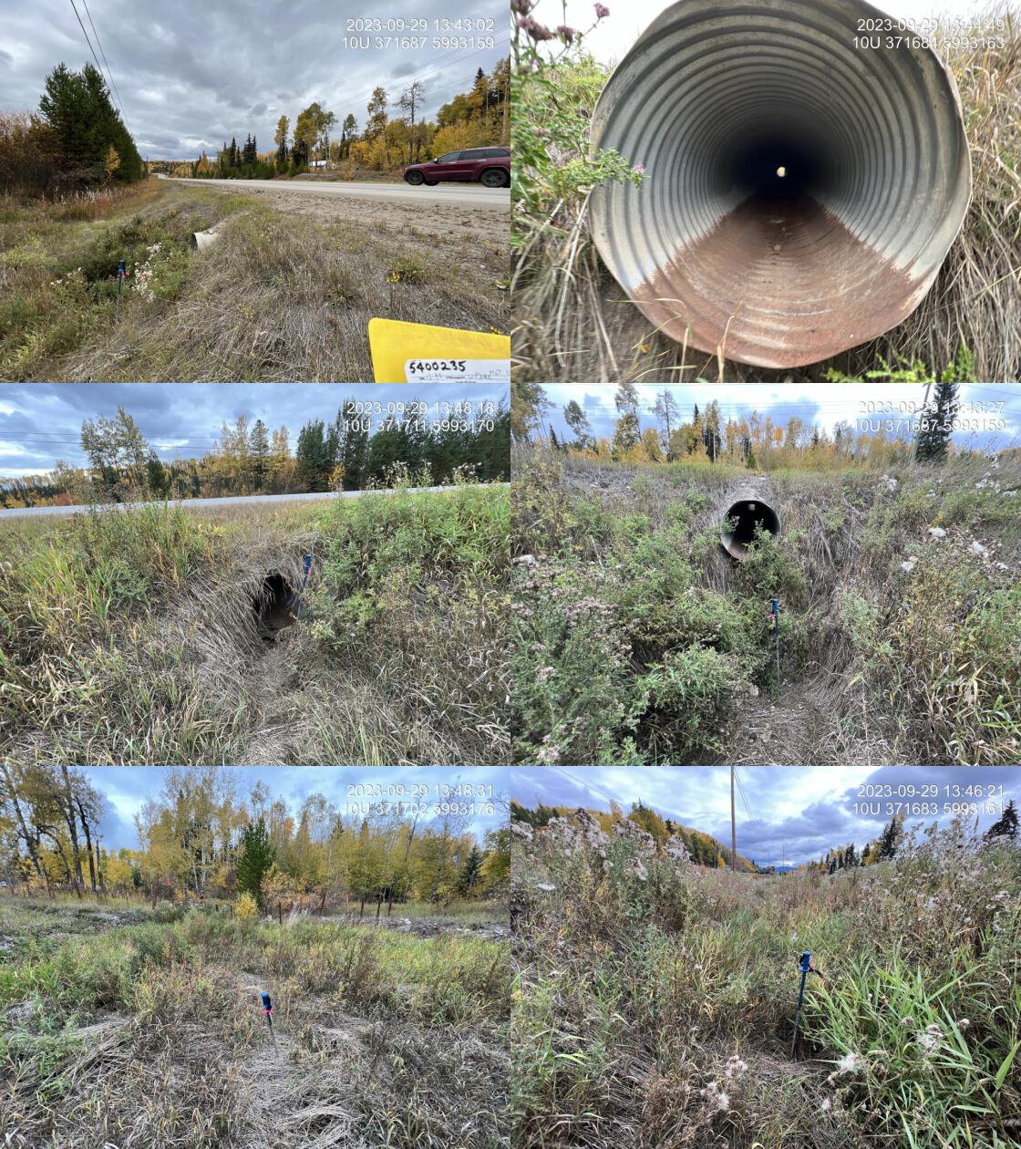 . From top left clockwise: Road/Site Card, Barrel, Outlet, Downstream, Upstream, Inlet.5400235 . From top left clockwise: Road/Site Card, Barrel, Outlet, Downstream, Upstream, Inlet.5400235
|
|||
| Comments: Dry with very poorly defined channel upstream and downstream. Seems very unlikely that this system could support fish. Pipe is rusted right through at the inlet for ~1m. Pipe is in very bad shape. MoTi chris_culvert_id: 1793794. 13:41:54 |
| Location and Stream Data |
|
Crossing Characteristics | – |
|---|---|---|---|
| Date | 2023-09-29 | Crossing Sub Type | Round Culvert |
| PSCIS ID | 199169 | Diameter (m) | 1.5 |
| External ID | 5400045 | Length (m) | 50 |
| Crew | AI | Embedded | No |
| UTM Zone | 10 | Depth Embedded (m) | – |
| Easting | 391513 | Resemble Channel | No |
| Northing | 5991795 | Backwatered | No |
| Stream | Tributary to Fraser Lake | Percent Backwatered | – |
| Road | Highway 16 | Fill Depth (m) | 9.9 |
| Road Tenure | MOTI | Outlet Drop (m) | 0.4 |
| Channel Width (m) | 4 | Outlet Pool Depth (m) | 0.5 |
| Stream Slope (%) | 2 | Inlet Drop | No |
| Beaver Activity | No | Slope (%) | 0.5 |
| Habitat Value | Medium | Valley Fill | Deep Fill |
| Final score | 32 | Barrier Result | Barrier |
| Fix type | Replace with New Open Bottom Structure | Fix Span / Diameter | 35.5 |
Photos: PSCIS ID 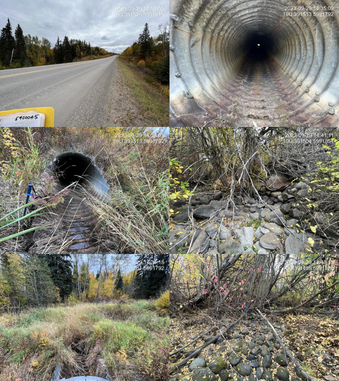 . From top left clockwise: Road/Site Card, Barrel, Outlet, Downstream, Upstream, Inlet.5400045 . From top left clockwise: Road/Site Card, Barrel, Outlet, Downstream, Upstream, Inlet.5400045
|
|||
| Comments: Dry at time of survey. Upstream channel is choked with reed canary grass. Downstream is extremely thick willow with multiple channels present. Stream provides access to Drywilliam lake. Road fill was measured at 12m, but changed to 9.9 to satisfy provincial submission requirements. MoTi chris_culvert_id: 1793348. 14:31:28 |
| Location and Stream Data |
|
Crossing Characteristics | – |
|---|---|---|---|
| Date | 2023-09-30 | Crossing Sub Type | Round Culvert |
| PSCIS ID | 199170 | Diameter (m) | 0.6 |
| External ID | 5400003 | Length (m) | 23 |
| Crew | AI | Embedded | No |
| UTM Zone | 10 | Depth Embedded (m) | – |
| Easting | 377178 | Resemble Channel | No |
| Northing | 5993874 | Backwatered | No |
| Stream | Perry Creek | Percent Backwatered | – |
| Road | Stella Road | Fill Depth (m) | 4 |
| Road Tenure | MOTI | Outlet Drop (m) | 0.3 |
| Channel Width (m) | 1 | Outlet Pool Depth (m) | 0 |
| Stream Slope (%) | 2 | Inlet Drop | No |
| Beaver Activity | No | Slope (%) | 1 |
| Habitat Value | Low | Valley Fill | Deep Fill |
| Final score | 34 | Barrier Result | Barrier |
| Fix type | Replace Structure with Streambed Simulation CBS | Fix Span / Diameter | 3 |
Photos: PSCIS ID 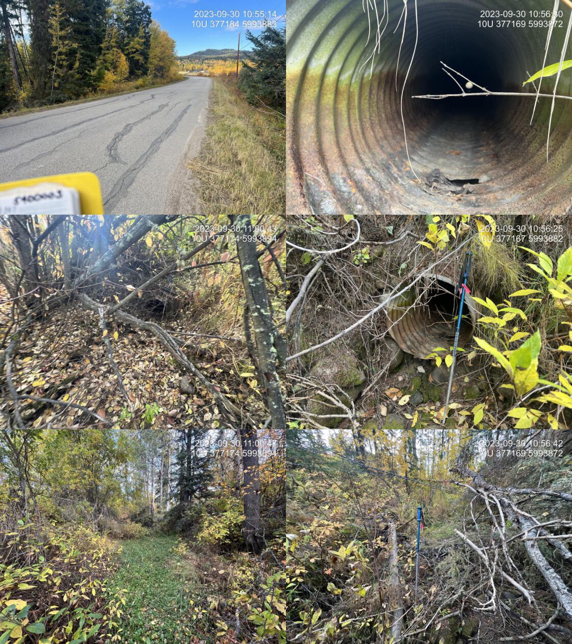 . From top left clockwise: Road/Site Card, Barrel, Outlet, Downstream, Upstream, Inlet.5400003 . From top left clockwise: Road/Site Card, Barrel, Outlet, Downstream, Upstream, Inlet.5400003
|
|||
| Comments: Small drainage. Dry with primarily vegetated channel indicating does not much flow for most of the year. Culvert rusting at inlet. MoTi chris_culvert_id: 1794274. 10:53:44 |
| Location and Stream Data |
|
Crossing Characteristics | – |
|---|---|---|---|
| Date | 2023-09-30 | Crossing Sub Type | Round Culvert |
| PSCIS ID | 199171 | Diameter (m) | 1 |
| External ID | 5400202 | Length (m) | 13 |
| Crew | AI | Embedded | No |
| UTM Zone | 10 | Depth Embedded (m) | – |
| Easting | 388944 | Resemble Channel | No |
| Northing | 5997002 | Backwatered | No |
| Stream | Tributary to Fraser Lake | Percent Backwatered | – |
| Road | Gala Bay Road | Fill Depth (m) | 1 |
| Road Tenure | MOTI Local | Outlet Drop (m) | 0.8 |
| Channel Width (m) | 1.7 | Outlet Pool Depth (m) | 0.6 |
| Stream Slope (%) | 2 | Inlet Drop | No |
| Beaver Activity | No | Slope (%) | 4.5 |
| Habitat Value | High | Valley Fill | Deep Fill |
| Final score | 36 | Barrier Result | Barrier |
| Fix type | Replace Structure with Streambed Simulation CBS | Fix Span / Diameter | 3 |
Photos: PSCIS ID 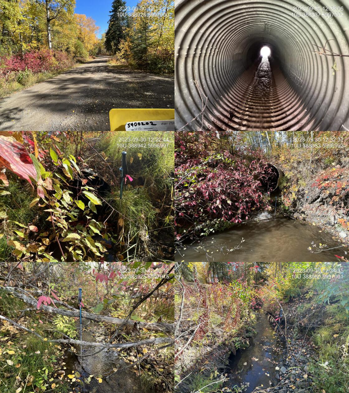 . From top left clockwise: Road/Site Card, Barrel, Outlet, Downstream, Upstream, Inlet.5400202 . From top left clockwise: Road/Site Card, Barrel, Outlet, Downstream, Upstream, Inlet.5400202
|
|||
| Comments: Very nice stream with good flow and abundant gravels upstream and downstream. Landowner indicated sockeye spotted along shoreline years ago. Massive outlet drop. Deserves habitat confirmation and consideration for replacement if no natural barriers upstream. There is a PSCIS assessed site (assessment_id = 7622) upstream that is a barrier. MoTi chris_culvert_id: 1790951. 12:12:56 |
| Location and Stream Data |
|
Crossing Characteristics | – |
|---|---|---|---|
| Date | 2023-09-30 | Crossing Sub Type | Round Culvert |
| PSCIS ID | 199172 | Diameter (m) | 1.1 |
| External ID | 5400203 | Length (m) | 25 |
| Crew | AI | Embedded | No |
| UTM Zone | 10 | Depth Embedded (m) | – |
| Easting | 388270 | Resemble Channel | No |
| Northing | 5996949 | Backwatered | No |
| Stream | Scotch Creek | Percent Backwatered | – |
| Road | Stella Road | Fill Depth (m) | 5 |
| Road Tenure | MOTI | Outlet Drop (m) | 1.4 |
| Channel Width (m) | 2.6 | Outlet Pool Depth (m) | 0.2 |
| Stream Slope (%) | 2 | Inlet Drop | No |
| Beaver Activity | No | Slope (%) | 4.5 |
| Habitat Value | High | Valley Fill | Deep Fill |
| Final score | 39 | Barrier Result | Barrier |
| Fix type | Replace with New Open Bottom Structure | Fix Span / Diameter | 21 |
Photos: PSCIS ID 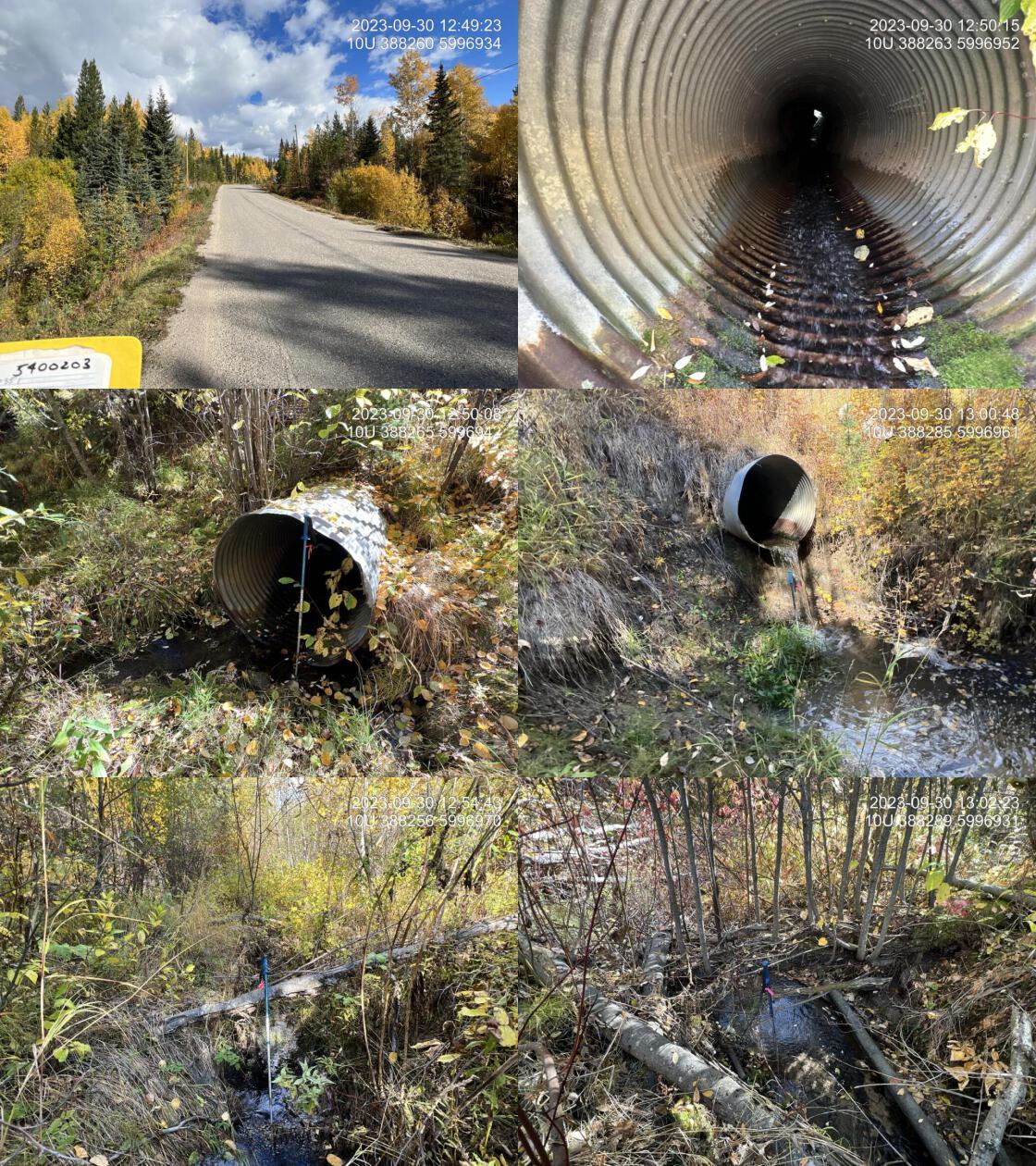 . From top left clockwise: Road/Site Card, Barrel, Outlet, Downstream, Upstream, Inlet.5400203 . From top left clockwise: Road/Site Card, Barrel, Outlet, Downstream, Upstream, Inlet.5400203
|
|||
| Comments: Very nice little stream with excellent flow for this time of year on a dry year. Crossing downstream on Gala Bay Road was fully embedded and passible at the time of the assessment. There is a historic chinook observation within this stream. This could be valuable Chinook rearing habitat and connectivity within the system should be restored, should no natural barriers be observed on a habitat confirmation assessment. MoTi chris_culvert_id: 1794198, 1794199. 12:47:26 |
| Location and Stream Data |
|
Crossing Characteristics | – |
|---|---|---|---|
| Date | 2023-09-30 | Crossing Sub Type | Round Culvert |
| PSCIS ID | 199173 | Diameter (m) | 0.95 |
| External ID | 15600277 | Length (m) | 12 |
| Crew | AI | Embedded | No |
| UTM Zone | 10 | Depth Embedded (m) | – |
| Easting | 398933 | Resemble Channel | No |
| Northing | 5996365 | Backwatered | No |
| Stream | Tributary to Nechako River | Percent Backwatered | – |
| Road | Dog Creek Road | Fill Depth (m) | 1.5 |
| Road Tenure | MOTI | Outlet Drop (m) | 0.4 |
| Channel Width (m) | 2.7 | Outlet Pool Depth (m) | 1 |
| Stream Slope (%) | 3 | Inlet Drop | No |
| Beaver Activity | Yes | Slope (%) | 3 |
| Habitat Value | High | Valley Fill | Deep Fill |
| Final score | 36 | Barrier Result | Barrier |
| Fix type | Replace with New Open Bottom Structure | Fix Span / Diameter | 15 |
Photos: PSCIS ID 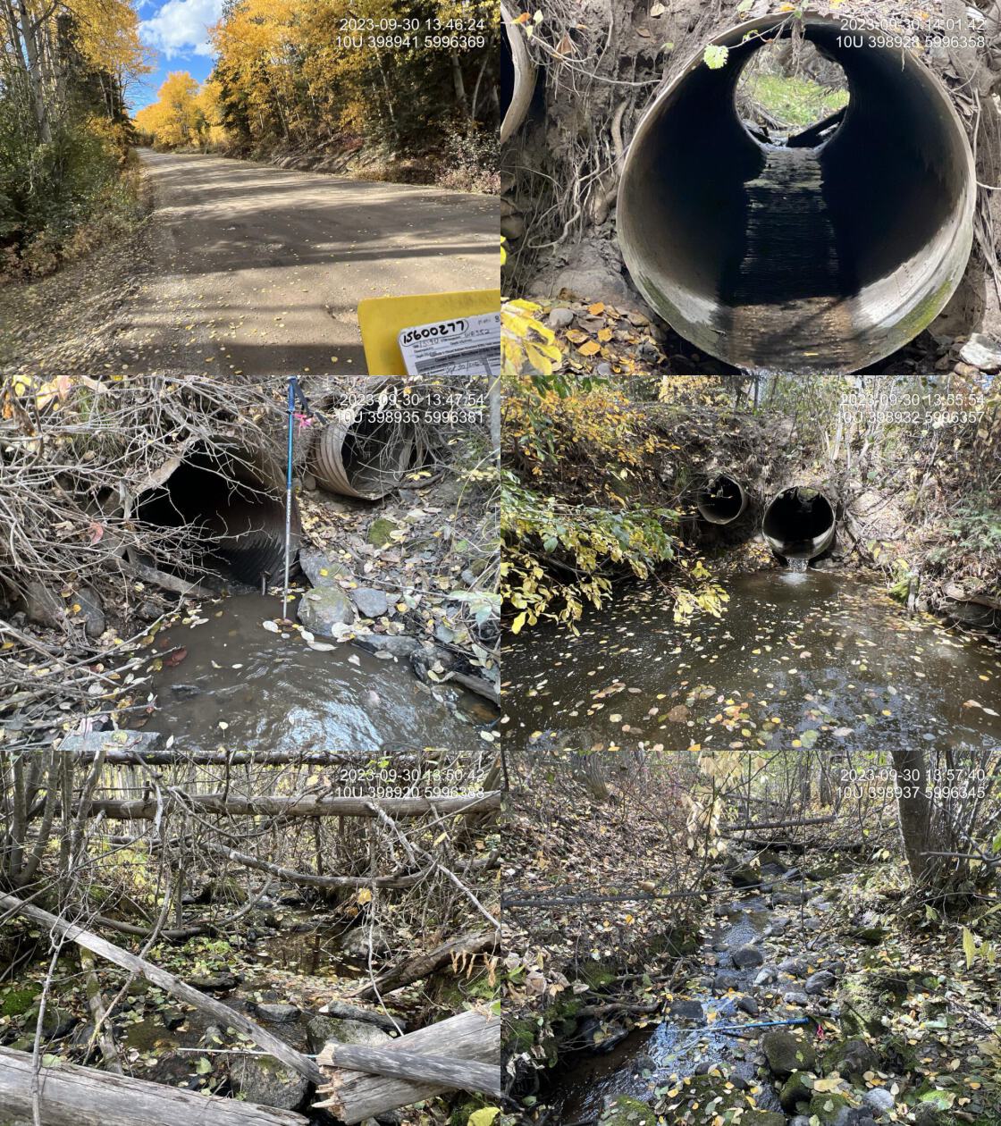 . From top left clockwise: Road/Site Card, Barrel, Outlet, Downstream, Upstream, Inlet.15600277 . From top left clockwise: Road/Site Card, Barrel, Outlet, Downstream, Upstream, Inlet.15600277
|
|||
| Comments: Very nice stream with excellent flow for this time of year on a dry year. Very large deep outlet pool with extensive erosion undercutting the main pipe and 0.6 m overflow. Locally known as Dog Creek. Chinook captured upstream and downstream of Dog Creek FSR in 2021, 2022, and 2023 reported here https://a100.gov.bc.ca/pub/acat/public/viewReport.do?reportId=62942. Connected to the Nechako River with observed chinook points downstream adjacent to the confluence. Road edge is failing at the culvert and eroding into stream. Highly degraded site upstream that would be a good candidate for restoration. MoTi chris_culvert_id: 1794340. 13:43:26 |
| Location and Stream Data |
|
Crossing Characteristics | – |
|---|---|---|---|
| Date | 2023-09-30 | Crossing Sub Type | Round Culvert |
| PSCIS ID | 199174 | Diameter (m) | 1.45 |
| External ID | 15604478 | Length (m) | 16 |
| Crew | AI | Embedded | No |
| UTM Zone | 10 | Depth Embedded (m) | – |
| Easting | 397160 | Resemble Channel | No |
| Northing | 5996558 | Backwatered | No |
| Stream | Tributary to Nechako River | Percent Backwatered | – |
| Road | Sutherland FSR | Fill Depth (m) | 0.5 |
| Road Tenure | West Fraser R09194 SE | Outlet Drop (m) | 0 |
| Channel Width (m) | 2.5 | Outlet Pool Depth (m) | 0.2 |
| Stream Slope (%) | 0.5 | Inlet Drop | Yes |
| Beaver Activity | No | Slope (%) | 2 |
| Habitat Value | Medium | Valley Fill | Deep Fill |
| Final score | 24 | Barrier Result | Barrier |
| Fix type | Replace with New Open Bottom Structure | Fix Span / Diameter | 15 |
Photos: PSCIS ID 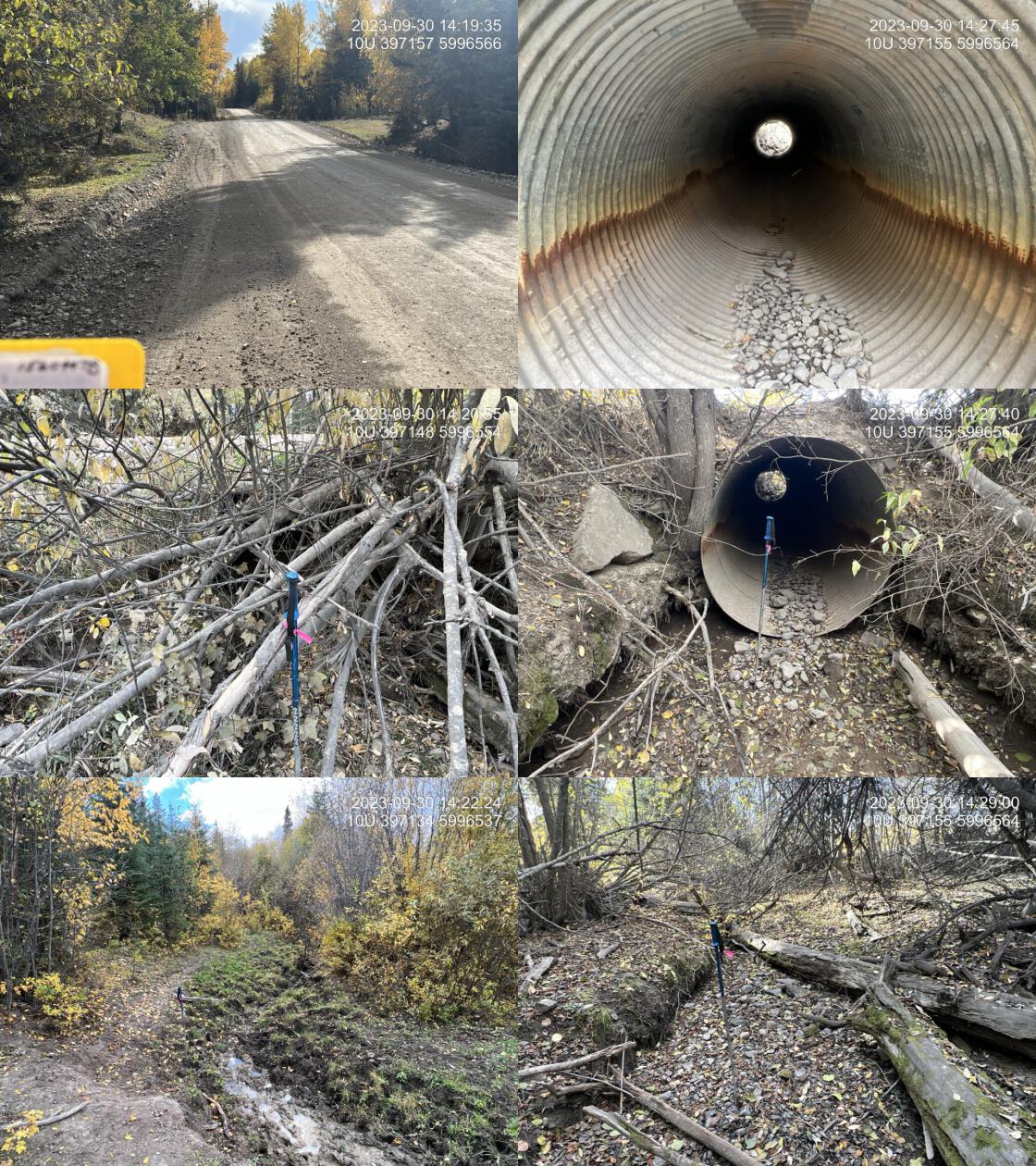 . From top left clockwise: Road/Site Card, Barrel, Outlet, Downstream, Upstream, Inlet.15604478 . From top left clockwise: Road/Site Card, Barrel, Outlet, Downstream, Upstream, Inlet.15604478
|
|||
| Comments: Extreme negative impacts due to cattle, particularly upstream of the FSR. Extensive trampling of the channel and banks, along with heavy grazing and removal of riparian. Dry at the time of assessment besides a small wallowing hole upstream of the inlet. Riparian exclusion fencing is required along with repairing vegetation, restoration irrigation, and monitoring. This is a fish bearing stream with high habitat values less than 2 km down the stream where it crosses Dog Creek Road.. 14:17:41 |
| Location and Stream Data |
|
Crossing Characteristics | – |
|---|---|---|---|
| Date | 2023-10-01 | Crossing Sub Type | Round Culvert |
| PSCIS ID | 199175 | Diameter (m) | 1.2 |
| External ID | 9903437 | Length (m) | 29 |
| Crew | AI | Embedded | No |
| UTM Zone | 10 | Depth Embedded (m) | – |
| Easting | 500733 | Resemble Channel | No |
| Northing | 5959822 | Backwatered | No |
| Stream | Aird Creek | Percent Backwatered | – |
| Road | Upper Mud River Road | Fill Depth (m) | 2 |
| Road Tenure | MOTI | Outlet Drop (m) | 1.5 |
| Channel Width (m) | 1.2 | Outlet Pool Depth (m) | 0 |
| Stream Slope (%) | 3 | Inlet Drop | No |
| Beaver Activity | No | Slope (%) | 5 |
| Habitat Value | Low | Valley Fill | Deep Fill |
| Final score | 36 | Barrier Result | Barrier |
| Fix type | Replace Structure with Streambed Simulation CBS | Fix Span / Diameter | 3 |
Photos: PSCIS ID 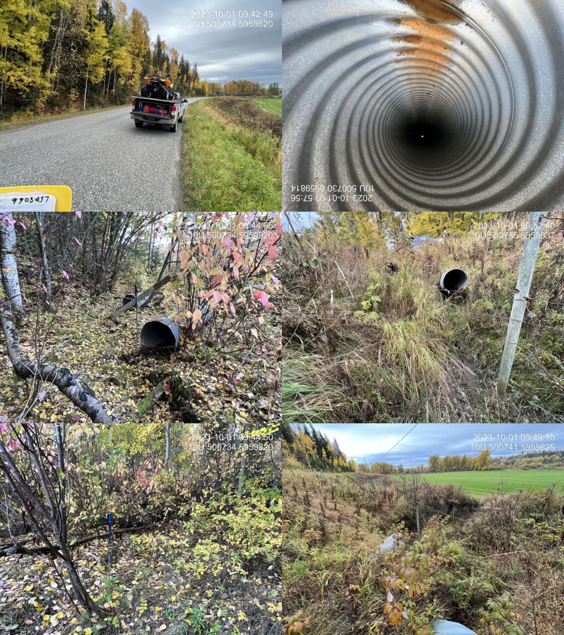 . From top left clockwise: Road/Site Card, Barrel, Outlet, Downstream, Upstream, Inlet.9903437 . From top left clockwise: Road/Site Card, Barrel, Outlet, Downstream, Upstream, Inlet.9903437
|
|||
| Comments: Two pipes at 0.6 m each. Agricultural field downstream. Appears that the stream has been modified to put the stream in the ditch of the agricultural field. Aird lake upstream with rainbow trout presence. Dry channel. Very small stream. Massive outlet drops. May have historically provided some rearing refuge for wetted periods of the year. MoTi chris_culvert_id: 1975643, 1975642. 09:41:29 |
| Location and Stream Data |
|
Crossing Characteristics | – |
|---|---|---|---|
| Date | 2023-10-01 | Crossing Sub Type | Round Culvert |
| PSCIS ID | 199176 | Diameter (m) | 0.9 |
| External ID | 9901826 | Length (m) | 10 |
| Crew | AI | Embedded | No |
| UTM Zone | 10 | Depth Embedded (m) | – |
| Easting | 498057 | Resemble Channel | No |
| Northing | 5955884 | Backwatered | No |
| Stream | Chilako Creek | Percent Backwatered | – |
| Road | Upper Mud River Road | Fill Depth (m) | 0.8 |
| Road Tenure | MOTI | Outlet Drop (m) | 0.25 |
| Channel Width (m) | 1.7 | Outlet Pool Depth (m) | 0.2 |
| Stream Slope (%) | 1 | Inlet Drop | No |
| Beaver Activity | No | Slope (%) | 3 |
| Habitat Value | Low | Valley Fill | Deep Fill |
| Final score | 31 | Barrier Result | Barrier |
| Fix type | Replace Structure with Streambed Simulation CBS | Fix Span / Diameter | 3 |
Photos: PSCIS ID 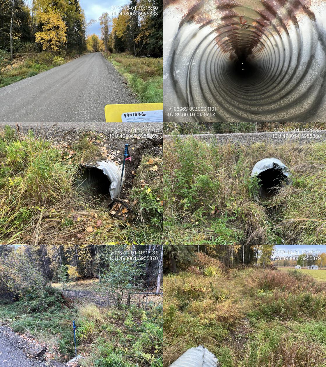 . From top left clockwise: Road/Site Card, Barrel, Outlet, Downstream, Upstream, Inlet.9901826 . From top left clockwise: Road/Site Card, Barrel, Outlet, Downstream, Upstream, Inlet.9901826
|
|||
| Comments: Dry at tme of assessment. One assessed crossing on private driveway located downstream. Stream is completely trampled and barely recognizable upstream due to cattle trampling and riparian removal. Downstream is ditch like with just grass and shrub riparian before mix forest begins proximately 40 m downstream of the road. Agricultural field on right back downstream. Some scouring of the channel downstream, but primarily choked with grasses indicating stream does not flow for much of the year lately. MoTi chris_culvert_id: 1975651. 10:20:58 |
| Location and Stream Data |
|
Crossing Characteristics | – |
|---|---|---|---|
| Date | 2023-10-01 | Crossing Sub Type | Round Culvert |
| PSCIS ID | 199177 | Diameter (m) | 1.5 |
| External ID | 9903963 | Length (m) | 16 |
| Crew | AI | Embedded | No |
| UTM Zone | 10 | Depth Embedded (m) | – |
| Easting | 491332 | Resemble Channel | No |
| Northing | 5956490 | Backwatered | No |
| Stream | Tributary to Chelako River | Percent Backwatered | – |
| Road | McBride Timber Road | Fill Depth (m) | 1.5 |
| Road Tenure | MOTI | Outlet Drop (m) | 0.75 |
| Channel Width (m) | 1.7 | Outlet Pool Depth (m) | 0.5 |
| Stream Slope (%) | 1 | Inlet Drop | No |
| Beaver Activity | Yes | Slope (%) | 3 |
| Habitat Value | Low | Valley Fill | Deep Fill |
| Final score | 36 | Barrier Result | Barrier |
| Fix type | Replace Structure with Streambed Simulation CBS | Fix Span / Diameter | 3 |
Photos: PSCIS ID 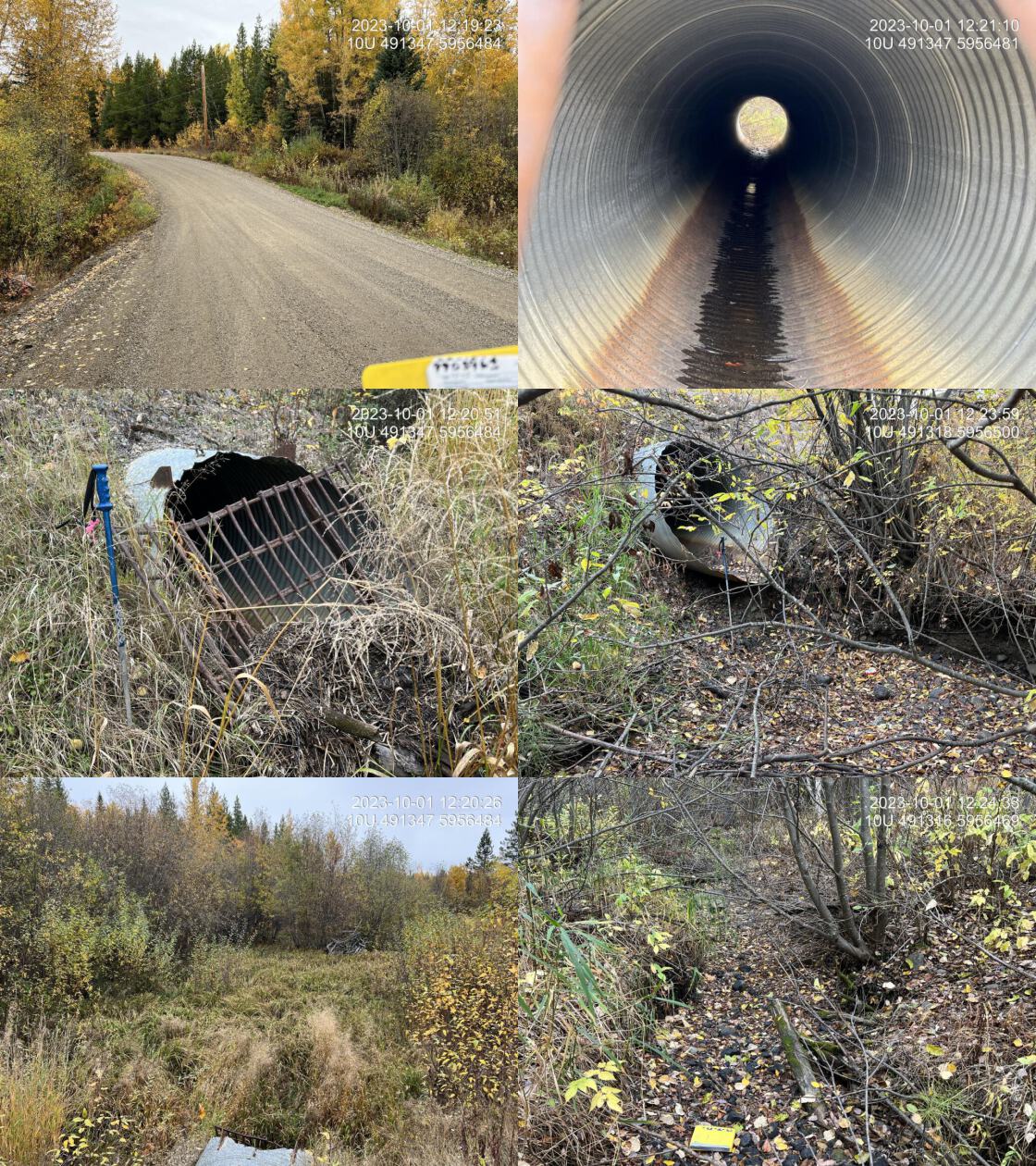 . From top left clockwise: Road/Site Card, Barrel, Outlet, Downstream, Upstream, Inlet.9903963 . From top left clockwise: Road/Site Card, Barrel, Outlet, Downstream, Upstream, Inlet.9903963
|
|||
| Comments: Dry at time of assessment. Two other crossings located upstream on non-active forestry roads. Extensive beaver activity upstream with water above both upstream crossings. Could consider opportunity for upgrading this crossing and removing the upper two. MoTi chris_culvert_id: 1976780. 12:17:51 |
| Location and Stream Data |
|
Crossing Characteristics | – |
|---|---|---|---|
| Date | 2023-10-01 | Crossing Sub Type | Round Culvert |
| PSCIS ID | 199178 | Diameter (m) | 4.5 |
| External ID | 9900367 | Length (m) | 33 |
| Crew | AI | Embedded | No |
| UTM Zone | 10 | Depth Embedded (m) | – |
| Easting | 509128 | Resemble Channel | No |
| Northing | 5959562 | Backwatered | No |
| Stream | Beaverley Creek | Percent Backwatered | – |
| Road | Blackwater Road | Fill Depth (m) | 2 |
| Road Tenure | MOTI | Outlet Drop (m) | 0 |
| Channel Width (m) | 5 | Outlet Pool Depth (m) | 1 |
| Stream Slope (%) | 0 | Inlet Drop | No |
| Beaver Activity | Yes | Slope (%) | 0 |
| Habitat Value | High | Valley Fill | Deep Fill |
| Final score | 19 | Barrier Result | Potential |
| Fix type | Replace with New Open Bottom Structure | Fix Span / Diameter | 15 |
Photos: PSCIS ID 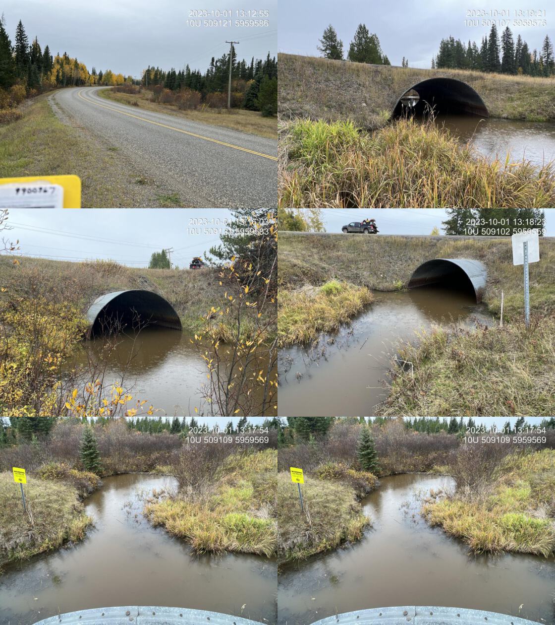 . From top left clockwise: Road/Site Card, Barrel, Outlet, Downstream, Upstream, Inlet.9900367 . From top left clockwise: Road/Site Card, Barrel, Outlet, Downstream, Upstream, Inlet.9900367
|
|||
| Comments: Moti major structure. Beaver dam located approximately 30 m downstream has backwatered the entire structure. MoTi chris_hwy_structure_road_id: 3755. 13:13:41 |
| Location and Stream Data |
|
Crossing Characteristics | – |
|---|---|---|---|
| Date | 2023-09-09 | Crossing Sub Type | Round Culvert |
| PSCIS ID | 199179 | Diameter (m) | 5 |
| External ID | 24716727 | Length (m) | 25 |
| Crew | MW | Embedded | No |
| UTM Zone | 10 | Depth Embedded (m) | – |
| Easting | 433506 | Resemble Channel | No |
| Northing | 5987089 | Backwatered | No |
| Stream | Murray Creek | Percent Backwatered | – |
| Road | Loop Rd | Fill Depth (m) | 1.5 |
| Road Tenure | Vanderhoof | Outlet Drop (m) | 0 |
| Channel Width (m) | 6.2 | Outlet Pool Depth (m) | 1.5 |
| Stream Slope (%) | 1 | Inlet Drop | No |
| Beaver Activity | No | Slope (%) | 1.5 |
| Habitat Value | High | Valley Fill | Deep Fill |
| Final score | 21 | Barrier Result | Barrier |
| Fix type | Replace with New Open Bottom Structure | Fix Span / Diameter | 15 |
Photos: PSCIS ID 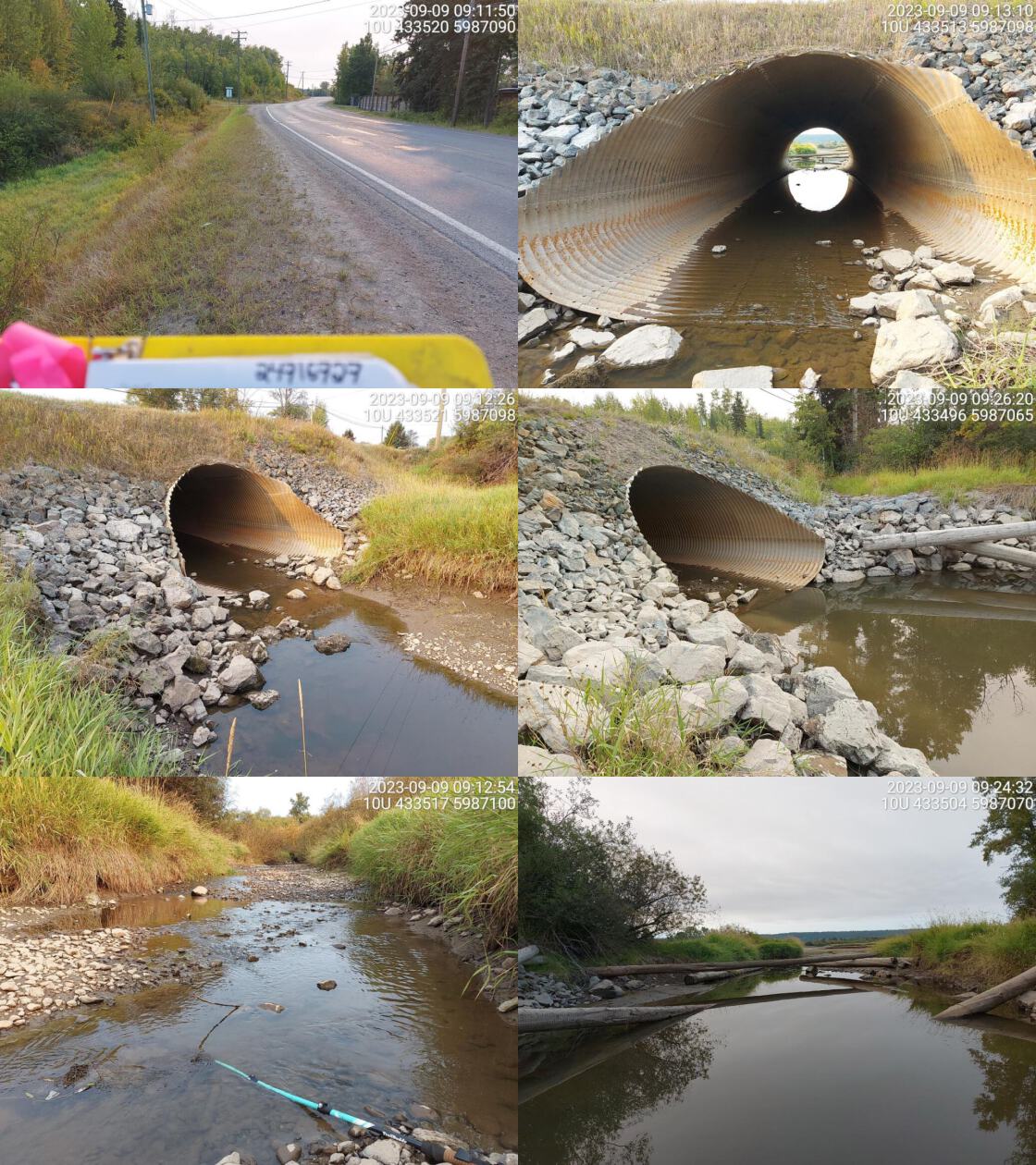 . From top left clockwise: Road/Site Card, Barrel, Outlet, Downstream, Upstream, Inlet.24716727 . From top left clockwise: Road/Site Card, Barrel, Outlet, Downstream, Upstream, Inlet.24716727
|
|||
| Comments: Huge system with wide channel. Hundreds of fry spotted upstream and some in culvert. Deep outlet pool suggesting culvert may be undersized. Extensive restoration activities in the watershed with many led by Nechako Environment and Watershed Stewardship Society.. 09:13:29 |
| Location and Stream Data |
|
Crossing Characteristics | – |
|---|---|---|---|
| Date | 2023-09-09 | Crossing Sub Type | Round Culvert |
| PSCIS ID | 199180 | Diameter (m) | 2.2 |
| External ID | 15600108 | Length (m) | 15 |
| Crew | MW | Embedded | No |
| UTM Zone | 10 | Depth Embedded (m) | – |
| Easting | 429831 | Resemble Channel | No |
| Northing | 5990320 | Backwatered | No |
| Stream | Murray Creek | Percent Backwatered | – |
| Road | Snell Rd E | Fill Depth (m) | 2 |
| Road Tenure | MOTI | Outlet Drop (m) | 0 |
| Channel Width (m) | 2.1 | Outlet Pool Depth (m) | 0.4 |
| Stream Slope (%) | 1 | Inlet Drop | No |
| Beaver Activity | No | Slope (%) | 0.5 |
| Habitat Value | Medium | Valley Fill | Deep Fill |
| Final score | 13 | Barrier Result | Passable |
| Fix type | – | Fix Span / Diameter | – |
Photos: PSCIS ID 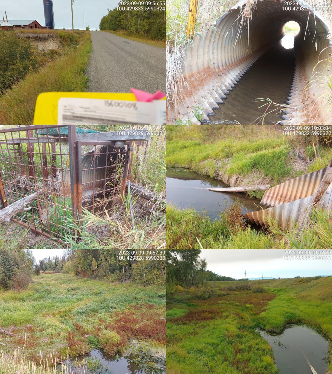 . From top left clockwise: Road/Site Card, Barrel, Outlet, Downstream, Upstream, Inlet.15600108 . From top left clockwise: Road/Site Card, Barrel, Outlet, Downstream, Upstream, Inlet.15600108
|
|||
| Comments: Grassy wetland habitat upstream and downstream. Culvert diameter used as channel width and stream slope estimated. Beaver grate present at inlet. Some flow in culvert. MoTi chris_culvert_id: 1808533. 09:55:51 |
| Location and Stream Data |
|
Crossing Characteristics | – |
|---|---|---|---|
| Date | 2023-09-09 | Crossing Sub Type | Round Culvert |
| PSCIS ID | 199181 | Diameter (m) | 3.2 |
| External ID | 15600467 | Length (m) | 16 |
| Crew | MW | Embedded | No |
| UTM Zone | 10 | Depth Embedded (m) | – |
| Easting | 429905 | Resemble Channel | No |
| Northing | 5990198 | Backwatered | No |
| Stream | Murray Creek | Percent Backwatered | – |
| Road | Loop Road | Fill Depth (m) | 4 |
| Road Tenure | MOTI Local | Outlet Drop (m) | 0.3 |
| Channel Width (m) | 2.2 | Outlet Pool Depth (m) | 1 |
| Stream Slope (%) | 1 | Inlet Drop | No |
| Beaver Activity | No | Slope (%) | 2 |
| Habitat Value | Medium | Valley Fill | Deep Fill |
| Final score | 28 | Barrier Result | Barrier |
| Fix type | Replace with New Open Bottom Structure | Fix Span / Diameter | 18 |
Photos: PSCIS ID 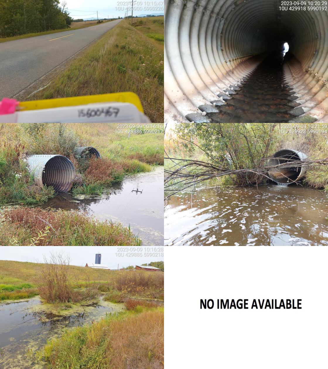 . From top left clockwise: Road/Site Card, Barrel, Outlet, Downstream, Upstream, Inlet.15600467 . From top left clockwise: Road/Site Card, Barrel, Outlet, Downstream, Upstream, Inlet.15600467
|
|||
| Comments: Known chinook system upstream and down. Two culverts, only left one has water flowing through. Left one is warped in the middle. Very deep outlet pool. Wetland habitat upstream. Agricultural land downstream, with defined channel and good flow. MoTi chris_culvert_id: 1802380, 1802381. 10:16:56 |
| Location and Stream Data |
|
Crossing Characteristics | – |
|---|---|---|---|
| Date | 2023-09-09 | Crossing Sub Type | Round Culvert |
| PSCIS ID | 199182 | Diameter (m) | 2.5 |
| External ID | 15600107 | Length (m) | 22 |
| Crew | MW | Embedded | No |
| UTM Zone | 10 | Depth Embedded (m) | – |
| Easting | 430580 | Resemble Channel | No |
| Northing | 5990313 | Backwatered | No |
| Stream | East Murray Creek | Percent Backwatered | – |
| Road | Snell Rd E | Fill Depth (m) | 0.5 |
| Road Tenure | MOTI Local | Outlet Drop (m) | 0 |
| Channel Width (m) | 1.7 | Outlet Pool Depth (m) | 0.5 |
| Stream Slope (%) | 1 | Inlet Drop | No |
| Beaver Activity | No | Slope (%) | 1 |
| Habitat Value | Low | Valley Fill | Deep Fill |
| Final score | 18 | Barrier Result | Potential |
| Fix type | Replace Structure with Streambed Simulation CBS | Fix Span / Diameter | 3 |
Photos: PSCIS ID 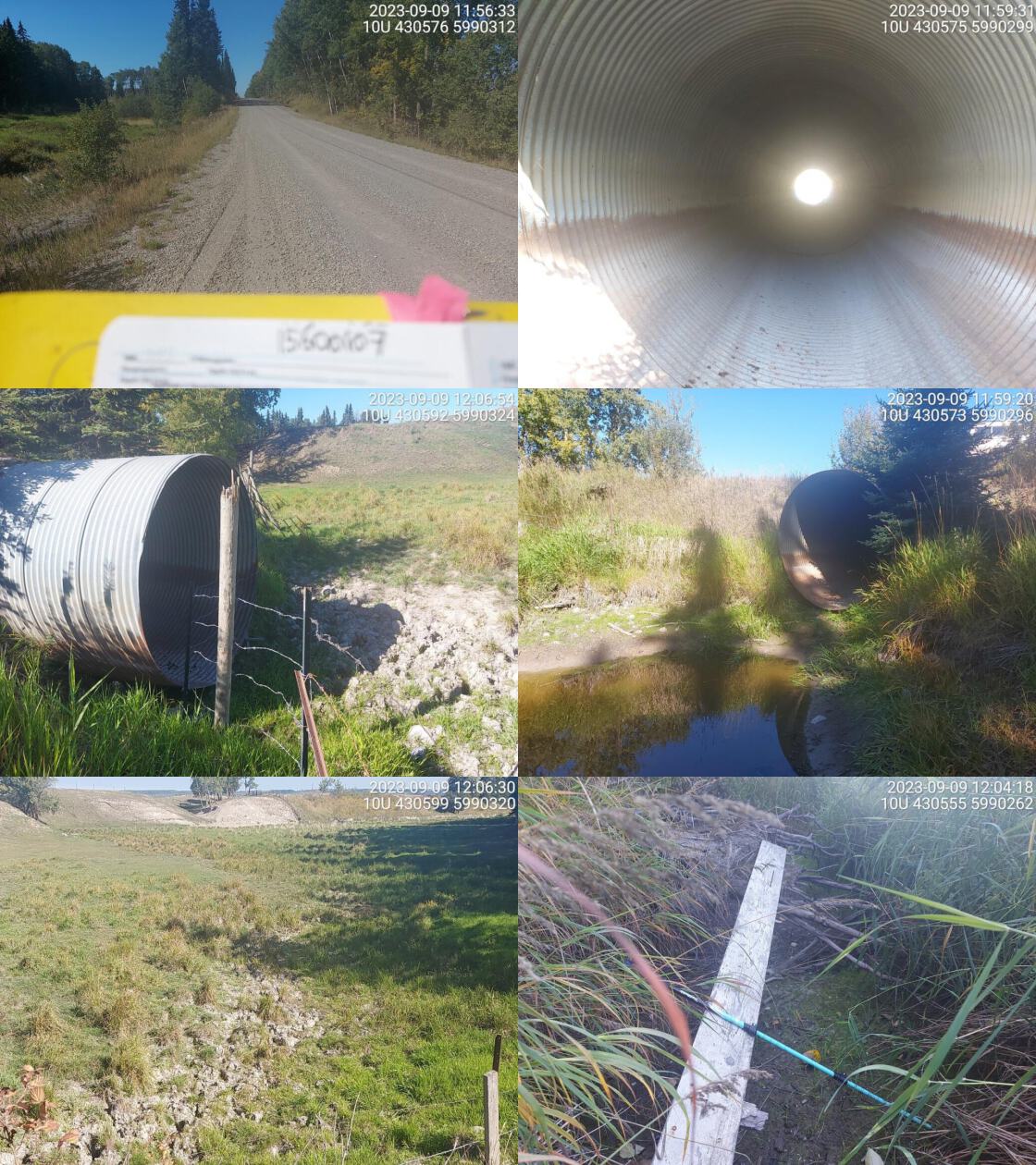 . From top left clockwise: Road/Site Card, Barrel, Outlet, Downstream, Upstream, Inlet.15600107 . From top left clockwise: Road/Site Card, Barrel, Outlet, Downstream, Upstream, Inlet.15600107
|
|||
| Comments: No water in culvert. Dewatered upstream. Some standing water in outlet pool, then dewaters downstream. Clear signs of cattle intruding into channel upstream. MoTi chris_culvert_id: 1808528. 12:00:12 |
| Location and Stream Data |
|
Crossing Characteristics | – |
|---|---|---|---|
| Date | 2023-09-09 | Crossing Sub Type | Round Culvert |
| PSCIS ID | 199183 | Diameter (m) | 1.8 |
| External ID | 15600190 | Length (m) | 12 |
| Crew | MW | Embedded | No |
| UTM Zone | 10 | Depth Embedded (m) | – |
| Easting | 431924 | Resemble Channel | No |
| Northing | 5991893 | Backwatered | No |
| Stream | McIntosh Creek | Percent Backwatered | – |
| Road | Mcleod Pit Rd | Fill Depth (m) | 0.5 |
| Road Tenure | MOTI Local | Outlet Drop (m) | 0 |
| Channel Width (m) | 1.6 | Outlet Pool Depth (m) | 0.3 |
| Stream Slope (%) | 1 | Inlet Drop | No |
| Beaver Activity | No | Slope (%) | 1 |
| Habitat Value | Low | Valley Fill | Deep Fill |
| Final score | 15 | Barrier Result | Potential |
| Fix type | Replace Structure with Streambed Simulation CBS | Fix Span / Diameter | 3 |
Photos: PSCIS ID 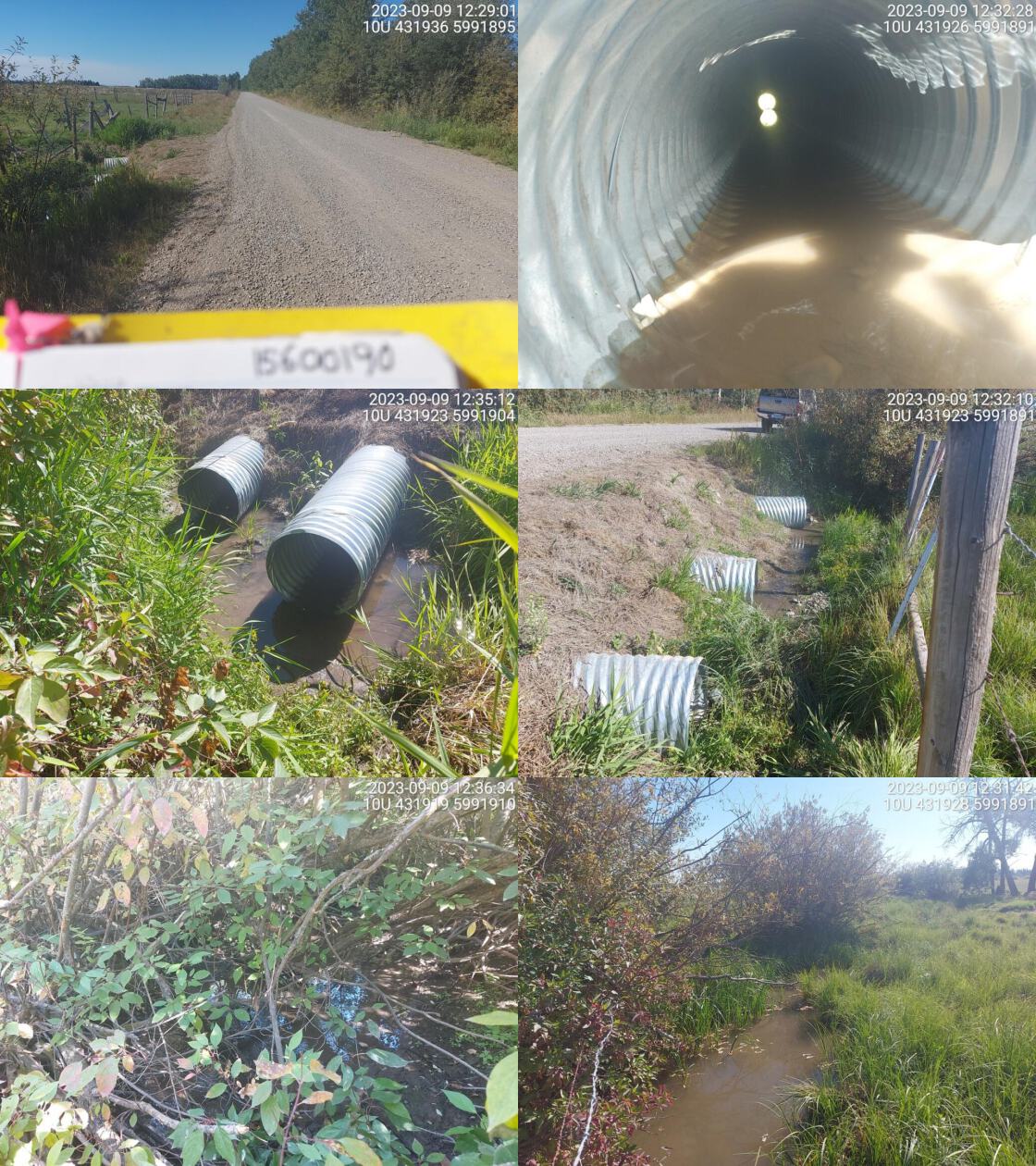 . From top left clockwise: Road/Site Card, Barrel, Outlet, Downstream, Upstream, Inlet.15600190 . From top left clockwise: Road/Site Card, Barrel, Outlet, Downstream, Upstream, Inlet.15600190
|
|||
| Comments: Three culverts. Water flowing through two pipes. The other one is dewatered, looks like it was installed too high. Overgrown channel upstream. Downstream goes through agricultural land. MoTi chris_culvert_id: 1807160, 1807157, 1807159. 12:30:04 |
| Location and Stream Data |
|
Crossing Characteristics | – |
|---|---|---|---|
| Date | 2023-09-09 | Crossing Sub Type | Round Culvert |
| PSCIS ID | 199184 | Diameter (m) | 0.5 |
| External ID | 15603995 | Length (m) | 10 |
| Crew | MW | Embedded | No |
| UTM Zone | 10 | Depth Embedded (m) | – |
| Easting | 431910 | Resemble Channel | No |
| Northing | 5995592 | Backwatered | No |
| Stream | McIntosh Creek | Percent Backwatered | – |
| Road | Stringer Rd | Fill Depth (m) | 1 |
| Road Tenure | MOTI Local | Outlet Drop (m) | 0 |
| Channel Width (m) | 0.7 | Outlet Pool Depth (m) | 0 |
| Stream Slope (%) | 1.5 | Inlet Drop | No |
| Beaver Activity | No | Slope (%) | 1 |
| Habitat Value | Low | Valley Fill | Deep Fill |
| Final score | 21 | Barrier Result | Barrier |
| Fix type | Replace Structure with Streambed Simulation CBS | Fix Span / Diameter | 3 |
Photos: PSCIS ID 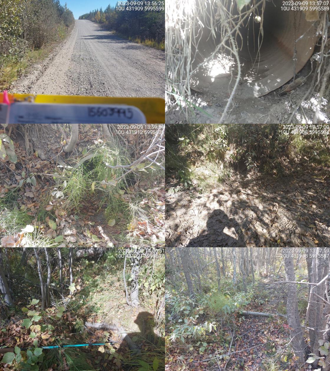 . From top left clockwise: Road/Site Card, Barrel, Outlet, Downstream, Upstream, Inlet.15603995 . From top left clockwise: Road/Site Card, Barrel, Outlet, Downstream, Upstream, Inlet.15603995
|
|||
| Comments: Fully dewatered. Very small culvert. Signs of a stream channel but doesn’t look like there has been water flowing in years. MoTi chris_culvert_id: 1806918. 13:57:33 |
| Location and Stream Data |
|
Crossing Characteristics | – |
|---|---|---|---|
| Date | 2023-09-09 | Crossing Sub Type | Round Culvert |
| PSCIS ID | 199185 | Diameter (m) | 1.7 |
| External ID | 15600011 | Length (m) | 14 |
| Crew | MW | Embedded | No |
| UTM Zone | 10 | Depth Embedded (m) | – |
| Easting | 439543 | Resemble Channel | No |
| Northing | 5988470 | Backwatered | No |
| Stream | Knight Creek | Percent Backwatered | – |
| Road | Gulbranson Rd | Fill Depth (m) | 1.5 |
| Road Tenure | MOTI Local | Outlet Drop (m) | 0 |
| Channel Width (m) | 1.7 | Outlet Pool Depth (m) | 2 |
| Stream Slope (%) | 1.5 | Inlet Drop | No |
| Beaver Activity | No | Slope (%) | 1 |
| Habitat Value | Medium | Valley Fill | Deep Fill |
| Final score | 18 | Barrier Result | Potential |
| Fix type | Replace Structure with Streambed Simulation CBS | Fix Span / Diameter | 3 |
Photos: PSCIS ID 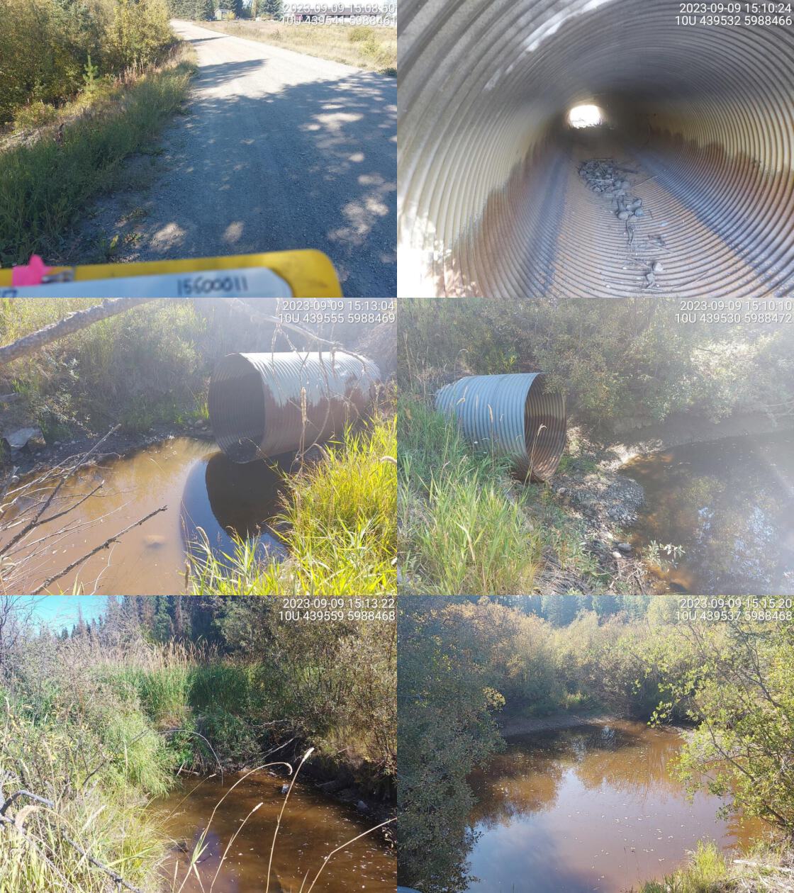 . From top left clockwise: Road/Site Card, Barrel, Outlet, Downstream, Upstream, Inlet.15600011 . From top left clockwise: Road/Site Card, Barrel, Outlet, Downstream, Upstream, Inlet.15600011
|
|||
| Comments: Huge outlet pool, but no outlet drop. No water in pipe and no flowing water in stream. MoTi chris_culvert_id: 1803926. 15:09:18 |
| Location and Stream Data |
|
Crossing Characteristics | – |
|---|---|---|---|
| Date | 2023-09-09 | Crossing Sub Type | Round Culvert |
| PSCIS ID | 199186 | Diameter (m) | 3 |
| External ID | 15600572 | Length (m) | 16 |
| Crew | MW | Embedded | No |
| UTM Zone | 10 | Depth Embedded (m) | – |
| Easting | 449681 | Resemble Channel | No |
| Northing | 5990078 | Backwatered | No |
| Stream | Tributary to Tritt Creek | Percent Backwatered | – |
| Road | Sturgeon Pt Rd | Fill Depth (m) | 1 |
| Road Tenure | MOTI | Outlet Drop (m) | 0 |
| Channel Width (m) | 3 | Outlet Pool Depth (m) | 0 |
| Stream Slope (%) | 1 | Inlet Drop | No |
| Beaver Activity | No | Slope (%) | 1.5 |
| Habitat Value | Low | Valley Fill | Deep Fill |
| Final score | 21 | Barrier Result | Barrier |
| Fix type | Replace with New Open Bottom Structure | Fix Span / Diameter | 15 |
Photos: PSCIS ID 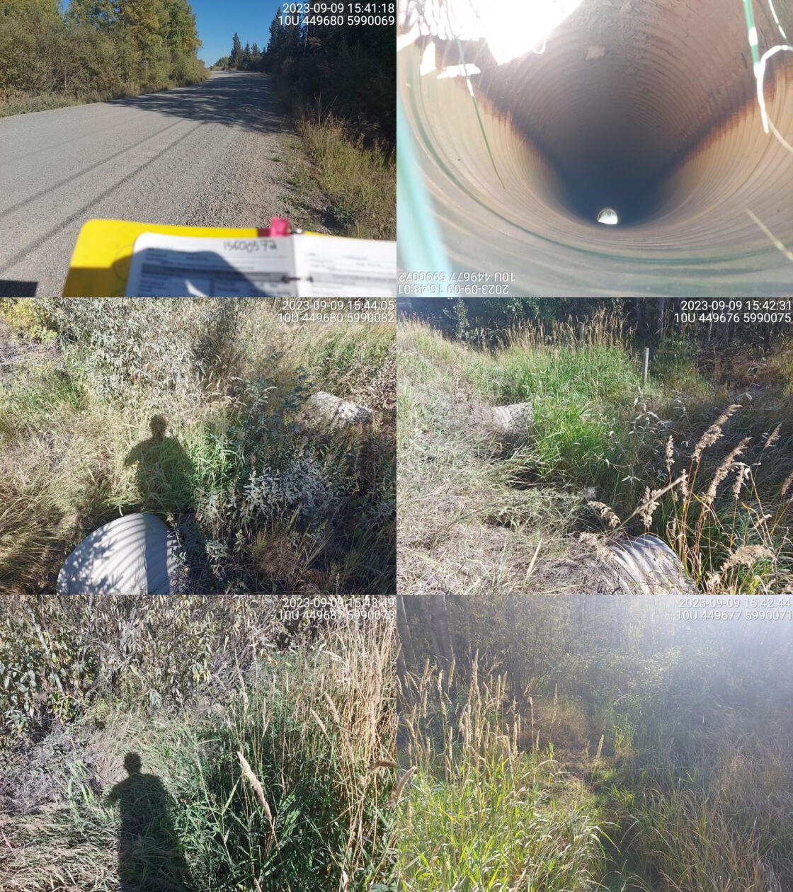 . From top left clockwise: Road/Site Card, Barrel, Outlet, Downstream, Upstream, Inlet.15600572 . From top left clockwise: Road/Site Card, Barrel, Outlet, Downstream, Upstream, Inlet.15600572
|
|||
| Comments: Dewatered. Vegetated stream channel. Three culverts, diameter totaled. MoTi chris_culvert_id: 1801577, 1801578. 15:44:14 |
| Location and Stream Data |
|
Crossing Characteristics | – |
|---|---|---|---|
| Date | 2023-09-10 | Crossing Sub Type | Oval Culvert |
| PSCIS ID | 199187 | Diameter (m) | 3.9 |
| External ID | 15600483 | Length (m) | 17 |
| Crew | MW | Embedded | No |
| UTM Zone | 10 | Depth Embedded (m) | – |
| Easting | 425343 | Resemble Channel | No |
| Northing | 5991993 | Backwatered | No |
| Stream | Clear Creek | Percent Backwatered | – |
| Road | Braeside Rd | Fill Depth (m) | 2 |
| Road Tenure | MOTI | Outlet Drop (m) | 0 |
| Channel Width (m) | 4.7 | Outlet Pool Depth (m) | 0.6 |
| Stream Slope (%) | 0.5 | Inlet Drop | No |
| Beaver Activity | No | Slope (%) | 1.5 |
| Habitat Value | High | Valley Fill | Deep Fill |
| Final score | 21 | Barrier Result | Barrier |
| Fix type | Replace with New Open Bottom Structure | Fix Span / Diameter | 15 |
Photos: PSCIS ID 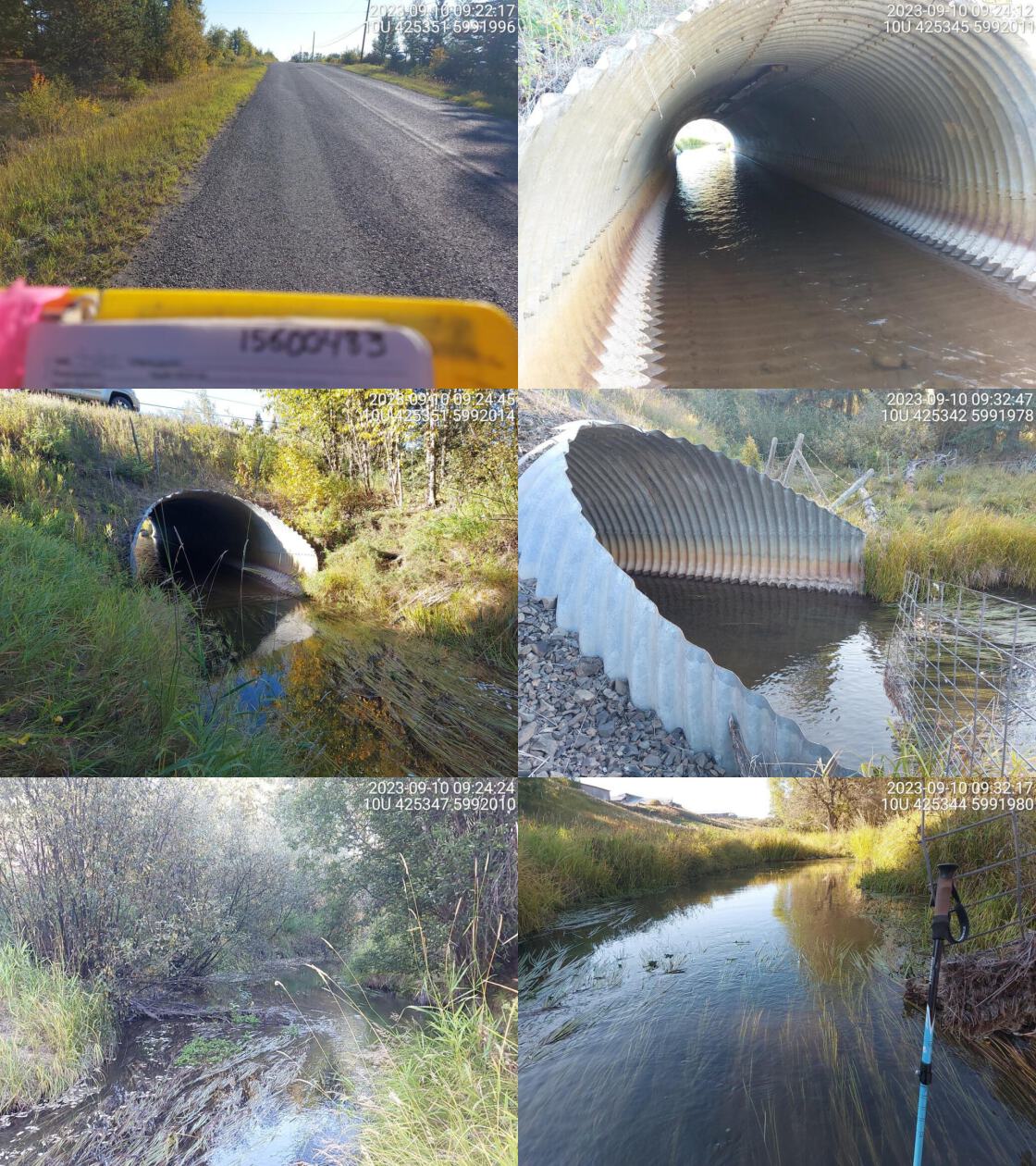 . From top left clockwise: Road/Site Card, Barrel, Outlet, Downstream, Upstream, Inlet.15600483 . From top left clockwise: Road/Site Card, Barrel, Outlet, Downstream, Upstream, Inlet.15600483
|
|||
| Comments: High quality habitat upstream, wide channel with good flow. Lots of instream vegetation near culvert. Fully backwatered and passable at time of assessement. MoTi chris_hwy_structure_road_id: 30525. 09:33:54 |
| Location and Stream Data |
|
Crossing Characteristics | – |
|---|---|---|---|
| Date | 2023-09-10 | Crossing Sub Type | Round Culvert |
| PSCIS ID | 199188 | Diameter (m) | 0.95 |
| External ID | 15600493 | Length (m) | 10 |
| Crew | MW | Embedded | No |
| UTM Zone | 10 | Depth Embedded (m) | – |
| Easting | 425987 | Resemble Channel | No |
| Northing | 5997655 | Backwatered | No |
| Stream | Tributary to Clear Creek | Percent Backwatered | – |
| Road | Blue Mountain Road | Fill Depth (m) | 1 |
| Road Tenure | MOTI Local | Outlet Drop (m) | 0.7 |
| Channel Width (m) | 1.1 | Outlet Pool Depth (m) | 0.7 |
| Stream Slope (%) | 4 | Inlet Drop | No |
| Beaver Activity | No | Slope (%) | 1 |
| Habitat Value | Medium | Valley Fill | Deep Fill |
| Final score | 28 | Barrier Result | Barrier |
| Fix type | Replace Structure with Streambed Simulation CBS | Fix Span / Diameter | 3 |
Photos: PSCIS ID 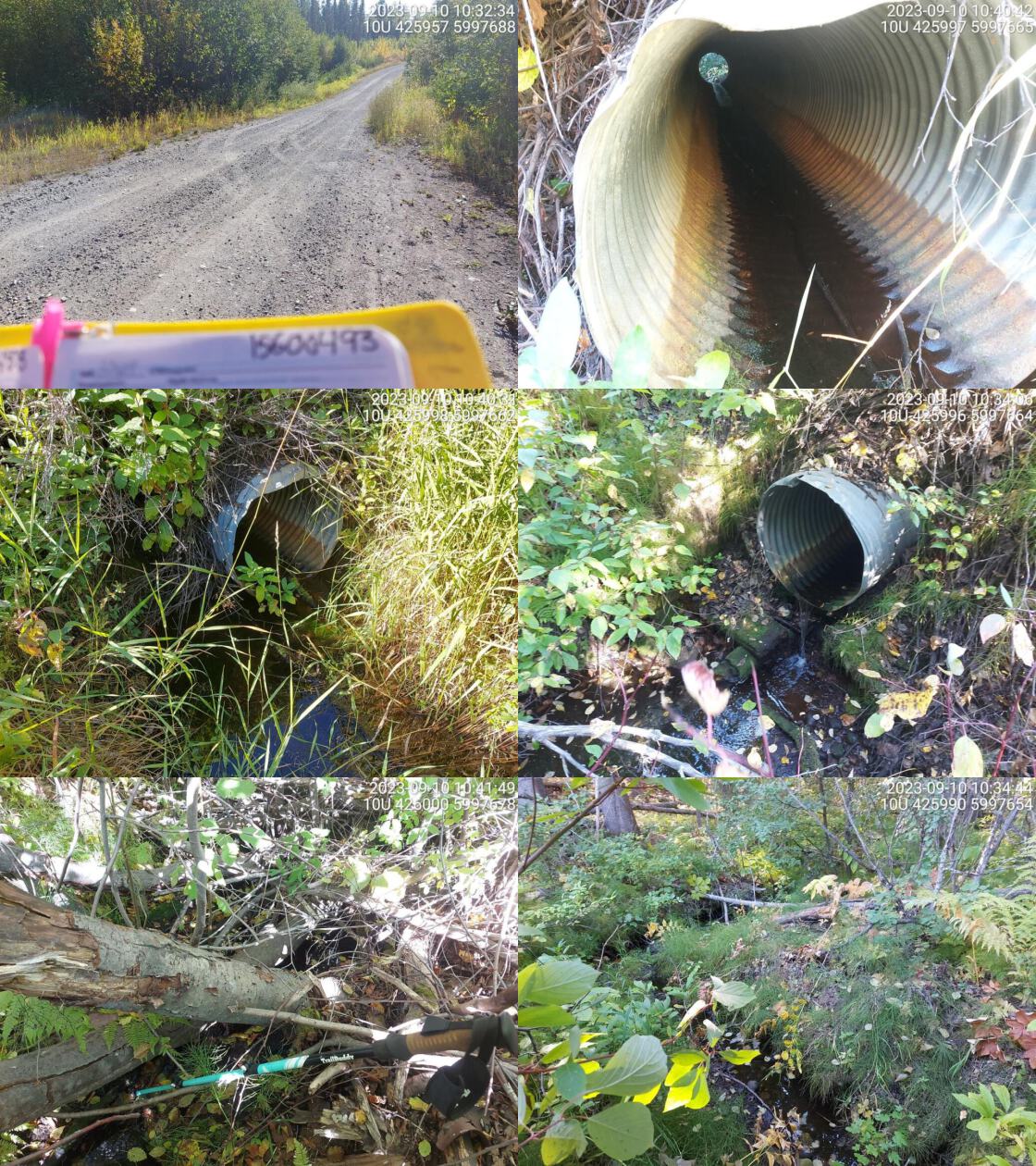 . From top left clockwise: Road/Site Card, Barrel, Outlet, Downstream, Upstream, Inlet.15600493 . From top left clockwise: Road/Site Card, Barrel, Outlet, Downstream, Upstream, Inlet.15600493
|
|||
| Comments: Upstream, overgrown with smaller channel. than downstream. Significant outlet drop.. 10:44:11 |
| Location and Stream Data |
|
Crossing Characteristics | – |
|---|---|---|---|
| Date | 2023-09-10 | Crossing Sub Type | Round Culvert |
| PSCIS ID | 199189 | Diameter (m) | 1.6 |
| External ID | 15600520 | Length (m) | 20 |
| Crew | MW | Embedded | No |
| UTM Zone | 10 | Depth Embedded (m) | – |
| Easting | 424104 | Resemble Channel | No |
| Northing | 6000564 | Backwatered | No |
| Stream | Clear Creek | Percent Backwatered | – |
| Road | Highway 27 S | Fill Depth (m) | 2 |
| Road Tenure | MOTI | Outlet Drop (m) | 0.1 |
| Channel Width (m) | 2.2 | Outlet Pool Depth (m) | 0.6 |
| Stream Slope (%) | 0 | Inlet Drop | No |
| Beaver Activity | No | Slope (%) | 0 |
| Habitat Value | Medium | Valley Fill | Deep Fill |
| Final score | 19 | Barrier Result | Potential |
| Fix type | Replace with New Open Bottom Structure | Fix Span / Diameter | 15 |
Photos: PSCIS ID 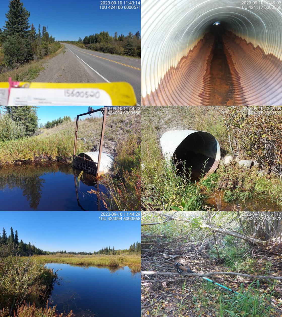 . From top left clockwise: Road/Site Card, Barrel, Outlet, Downstream, Upstream, Inlet.15600520 . From top left clockwise: Road/Site Card, Barrel, Outlet, Downstream, Upstream, Inlet.15600520
|
|||
| Comments: Big wetland upstream, beaver grate at inlet. Big debris jam in middle of culvert. Only water in pipe near inlet. Dewatered channel downstream at time of survey. MoTi chris_culvert_id: 1797338. 11:44:44 |
| Location and Stream Data |
|
Crossing Characteristics | – |
|---|---|---|---|
| Date | 2023-09-10 | Crossing Sub Type | Round Culvert |
| PSCIS ID | 199190 | Diameter (m) | 1.7 |
| External ID | 15600119 | Length (m) | 22 |
| Crew | MW | Embedded | No |
| UTM Zone | 10 | Depth Embedded (m) | – |
| Easting | 425557 | Resemble Channel | No |
| Northing | 5996141 | Backwatered | No |
| Stream | Clear Creek | Percent Backwatered | – |
| Road | Highway 27 S | Fill Depth (m) | 2.5 |
| Road Tenure | MOTI | Outlet Drop (m) | 0.3 |
| Channel Width (m) | 2.5 | Outlet Pool Depth (m) | 0.4 |
| Stream Slope (%) | 5 | Inlet Drop | No |
| Beaver Activity | No | Slope (%) | 7 |
| Habitat Value | High | Valley Fill | Deep Fill |
| Final score | 39 | Barrier Result | Barrier |
| Fix type | Replace with New Open Bottom Structure | Fix Span / Diameter | 15 |
Photos: PSCIS ID 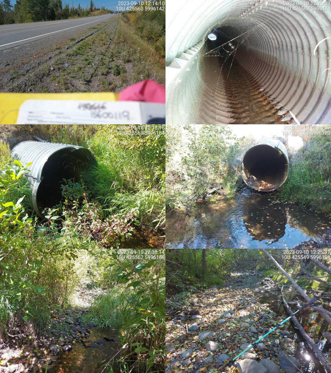 . From top left clockwise: Road/Site Card, Barrel, Outlet, Downstream, Upstream, Inlet.15600119 . From top left clockwise: Road/Site Card, Barrel, Outlet, Downstream, Upstream, Inlet.15600119
|
|||
| Comments: High value habitat, wide channel with good flow and gravels. Known chinook system downstream. Culvert is very damaged near outlet. There are holes on bottom of pipe about 5m from outlet where water is running through and under the pipe. Culvert is angled down near outlet. Good candidate for replacement. MoTi chris_culvert_id: 1806163. 12:15:10 |
| Location and Stream Data |
|
Crossing Characteristics | – |
|---|---|---|---|
| Date | 2023-09-10 | Crossing Sub Type | Round Culvert |
| PSCIS ID | 199191 | Diameter (m) | 1.6 |
| External ID | 24716705 | Length (m) | 18 |
| Crew | MW | Embedded | No |
| UTM Zone | 10 | Depth Embedded (m) | – |
| Easting | 422841 | Resemble Channel | No |
| Northing | 5993387 | Backwatered | No |
| Stream | Moss Creek | Percent Backwatered | – |
| Road | Braeside Rd | Fill Depth (m) | 2.5 |
| Road Tenure | MOTI | Outlet Drop (m) | 0 |
| Channel Width (m) | 2.2 | Outlet Pool Depth (m) | 0.2 |
| Stream Slope (%) | 1 | Inlet Drop | No |
| Beaver Activity | Yes | Slope (%) | 1 |
| Habitat Value | Medium | Valley Fill | Deep Fill |
| Final score | 24 | Barrier Result | Barrier |
| Fix type | Replace with New Open Bottom Structure | Fix Span / Diameter | 15 |
Photos: PSCIS ID 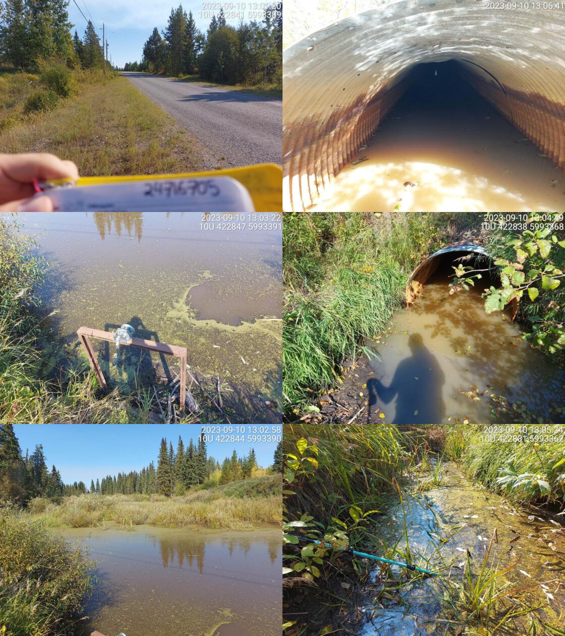 . From top left clockwise: Road/Site Card, Barrel, Outlet, Downstream, Upstream, Inlet.24716705 . From top left clockwise: Road/Site Card, Barrel, Outlet, Downstream, Upstream, Inlet.24716705
|
|||
| Comments: Inlet almost completely blocked by debris and wood. Wetland upstream. Beaver dam blocking most of water just downstream of outlet pool. Chinook observations noted downstream MoTi chris_culvert_id: 1804629. 13:01:50 |
| Location and Stream Data |
|
Crossing Characteristics | – |
|---|---|---|---|
| Date | 2023-09-10 | Crossing Sub Type | Round Culvert |
| PSCIS ID | 199192 | Diameter (m) | 1.5 |
| External ID | 15600122 | Length (m) | 30 |
| Crew | MW | Embedded | No |
| UTM Zone | 10 | Depth Embedded (m) | – |
| Easting | 420920 | Resemble Channel | No |
| Northing | 5993688 | Backwatered | No |
| Stream | Redmond Creek | Percent Backwatered | – |
| Road | Braeside Rd | Fill Depth (m) | 6 |
| Road Tenure | MOTI | Outlet Drop (m) | 0.5 |
| Channel Width (m) | 1.9 | Outlet Pool Depth (m) | 1 |
| Stream Slope (%) | 3 | Inlet Drop | No |
| Beaver Activity | No | Slope (%) | 2.5 |
| Habitat Value | High | Valley Fill | Deep Fill |
| Final score | 34 | Barrier Result | Barrier |
| Fix type | Replace Structure with Streambed Simulation CBS | Fix Span / Diameter | 3 |
Photos: PSCIS ID 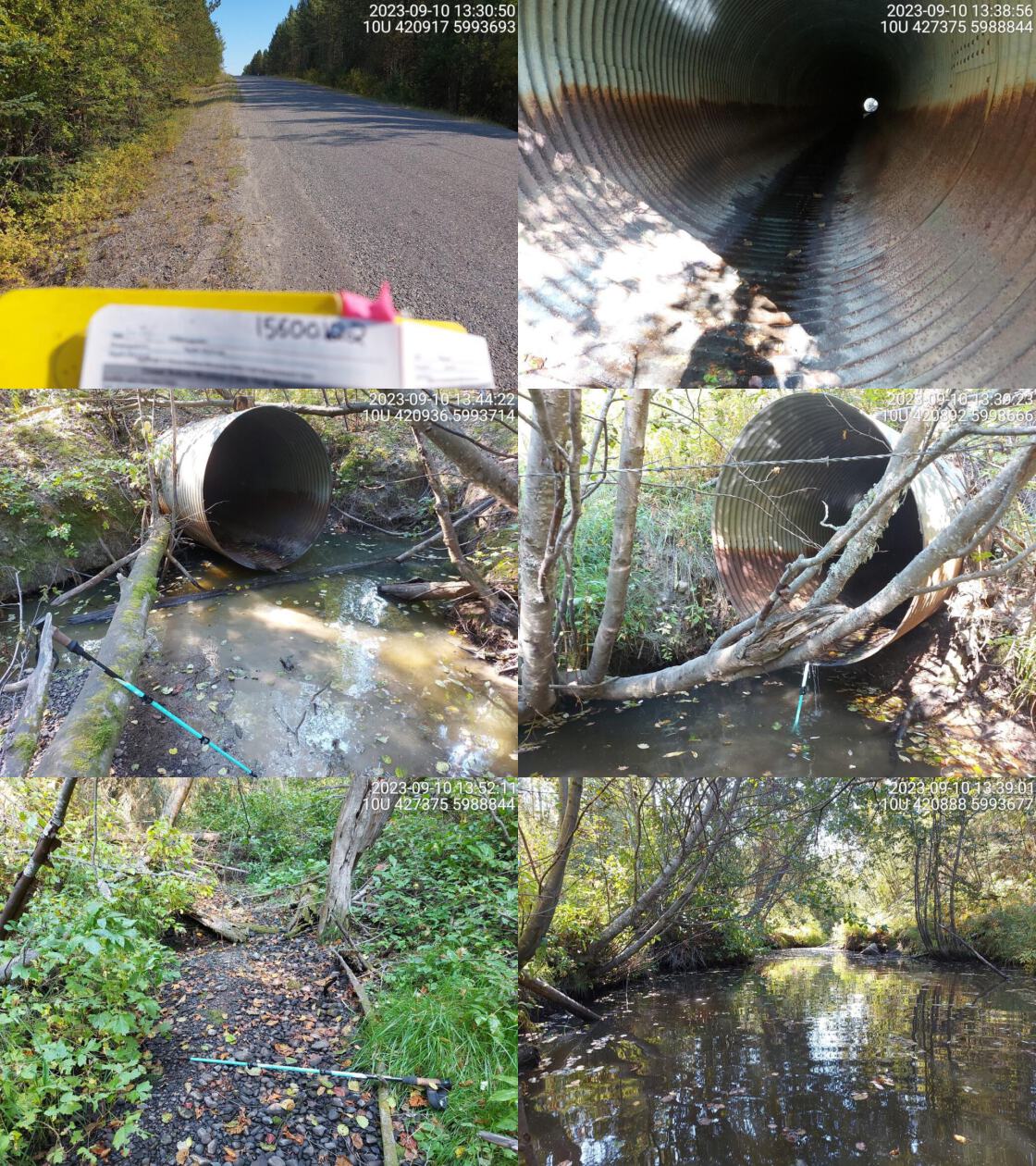 . From top left clockwise: Road/Site Card, Barrel, Outlet, Downstream, Upstream, Inlet.15600122 . From top left clockwise: Road/Site Card, Barrel, Outlet, Downstream, Upstream, Inlet.15600122
|
|||
| Comments: Big, deep outlet pool. Water is flowing from inlet under the pipe for ~10m and then entering pipe through small hole and then flowing in pipe to outlet. Very near Nechako on unpaved road. Perched pipe. MoTi chris_culvert_id: 1804624. 13:44:39 |
| Location and Stream Data |
|
Crossing Characteristics | – |
|---|---|---|---|
| Date | 2023-09-10 | Crossing Sub Type | Round Culvert |
| PSCIS ID | 199193 | Diameter (m) | 0.6 |
| External ID | 15600124 | Length (m) | 10 |
| Crew | MW | Embedded | No |
| UTM Zone | 10 | Depth Embedded (m) | – |
| Easting | 419953 | Resemble Channel | No |
| Northing | 5995257 | Backwatered | No |
| Stream | Redmond Creek | Percent Backwatered | – |
| Road | Walker Rd | Fill Depth (m) | 1 |
| Road Tenure | MOTI Local | Outlet Drop (m) | 0.5 |
| Channel Width (m) | 0.9 | Outlet Pool Depth (m) | 0.3 |
| Stream Slope (%) | 1 | Inlet Drop | No |
| Beaver Activity | No | Slope (%) | 0 |
| Habitat Value | Medium | Valley Fill | Deep Fill |
| Final score | 26 | Barrier Result | Barrier |
| Fix type | Replace Structure with Streambed Simulation CBS | Fix Span / Diameter | 3 |
Photos: PSCIS ID 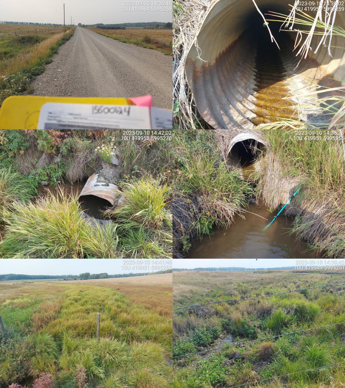 . From top left clockwise: Road/Site Card, Barrel, Outlet, Downstream, Upstream, Inlet.15600124 . From top left clockwise: Road/Site Card, Barrel, Outlet, Downstream, Upstream, Inlet.15600124
|
|||
| Comments: Very small channel. Agricultural fields upstream and downstream of crossing with no tree cover. Seems likely historic wetland area. MoTi chris_culvert_id: 1800221. 14:39:14 |
| Location and Stream Data |
|
Crossing Characteristics | – |
|---|---|---|---|
| Date | 2023-09-10 | Crossing Sub Type | Round Culvert |
| PSCIS ID | 199194 | Diameter (m) | 0.8 |
| External ID | 15600362 | Length (m) | 9 |
| Crew | MW | Embedded | No |
| UTM Zone | 10 | Depth Embedded (m) | – |
| Easting | 449050 | Resemble Channel | No |
| Northing | 5977312 | Backwatered | No |
| Stream | Tributary to Hulatt Creek | Percent Backwatered | – |
| Road | Barsness Rd | Fill Depth (m) | 0.5 |
| Road Tenure | MOTI Local | Outlet Drop (m) | 0 |
| Channel Width (m) | 0.8 | Outlet Pool Depth (m) | 0 |
| Stream Slope (%) | 1 | Inlet Drop | No |
| Beaver Activity | No | Slope (%) | 1 |
| Habitat Value | Low | Valley Fill | Deep Fill |
| Final score | 18 | Barrier Result | Potential |
| Fix type | Replace Structure with Streambed Simulation CBS | Fix Span / Diameter | 3 |
Photos: PSCIS ID 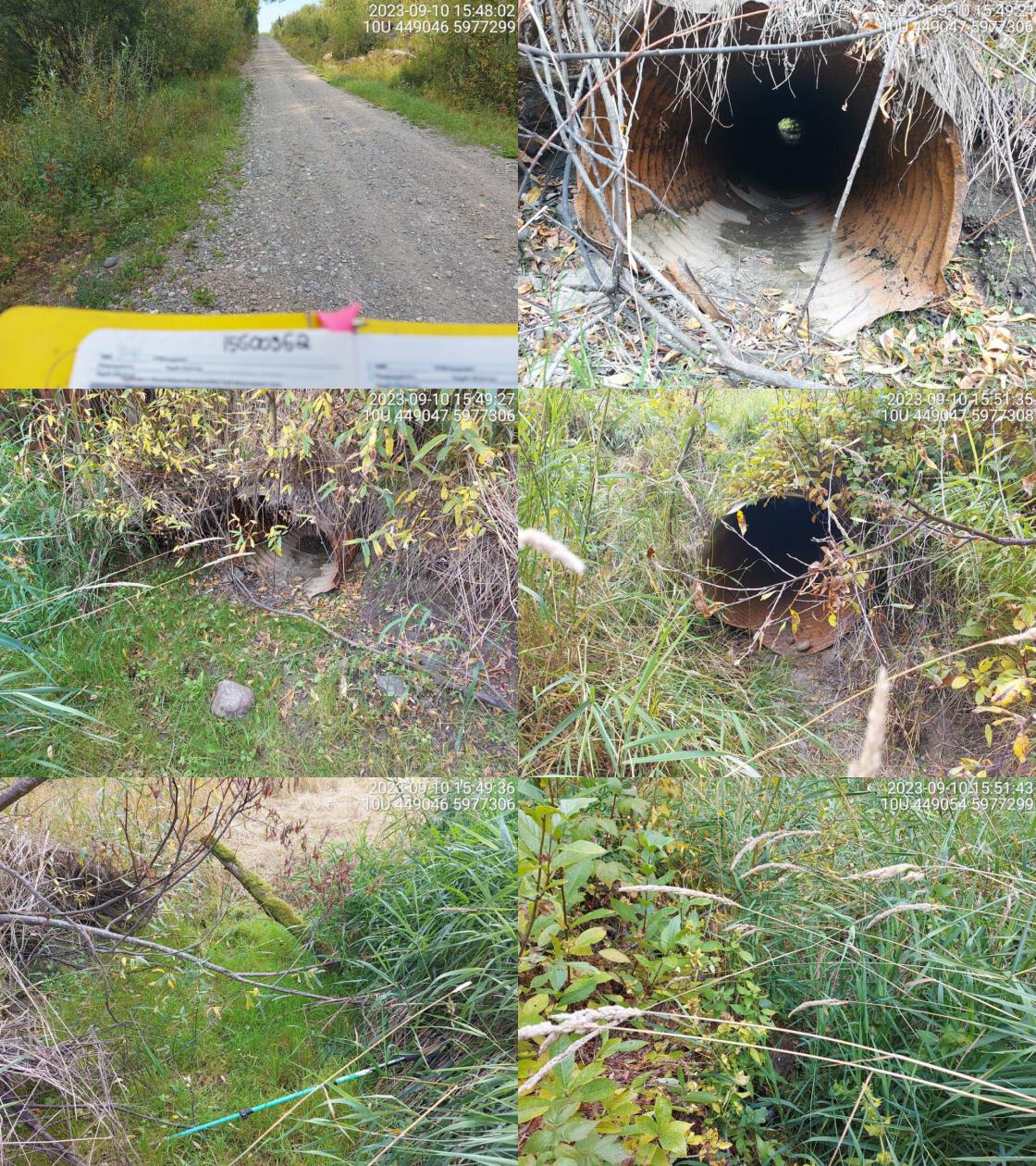 . From top left clockwise: Road/Site Card, Barrel, Outlet, Downstream, Upstream, Inlet.15600362 . From top left clockwise: Road/Site Card, Barrel, Outlet, Downstream, Upstream, Inlet.15600362
|
|||
| Comments: Dewatered pasture upstream with vegetated channel. Small channel downstream with no water. MoTi chris_culvert_id: 1807349. 15:54:33 |
| Location and Stream Data |
|
Crossing Characteristics | – |
|---|---|---|---|
| Date | 2023-09-11 | Crossing Sub Type | Round Culvert |
| PSCIS ID | 199195 | Diameter (m) | 0.9 |
| External ID | 15600434 | Length (m) | 10 |
| Crew | MW | Embedded | No |
| UTM Zone | 10 | Depth Embedded (m) | – |
| Easting | 442800 | Resemble Channel | No |
| Northing | 5991029 | Backwatered | No |
| Stream | Gilbert Creek | Percent Backwatered | – |
| Road | Gilbert Rd | Fill Depth (m) | 2 |
| Road Tenure | MOTI Local | Outlet Drop (m) | 0 |
| Channel Width (m) | 1.9 | Outlet Pool Depth (m) | 0 |
| Stream Slope (%) | 2.5 | Inlet Drop | No |
| Beaver Activity | No | Slope (%) | 1.5 |
| Habitat Value | Low | Valley Fill | Deep Fill |
| Final score | 21 | Barrier Result | Barrier |
| Fix type | Replace Structure with Streambed Simulation CBS | Fix Span / Diameter | 3 |
Photos: PSCIS ID 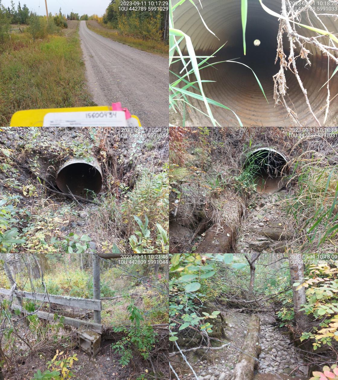 . From top left clockwise: Road/Site Card, Barrel, Outlet, Downstream, Upstream, Inlet.15600434 . From top left clockwise: Road/Site Card, Barrel, Outlet, Downstream, Upstream, Inlet.15600434
|
|||
| Comments: Landowner reports there hasn’t been water in stream since the spring. MoTi chris_culvert_id: 1806660. 10:18:36 |
| Location and Stream Data |
|
Crossing Characteristics | – |
|---|---|---|---|
| Date | 2023-09-11 | Crossing Sub Type | Round Culvert |
| PSCIS ID | 199196 | Diameter (m) | 0.9 |
| External ID | 15600431 | Length (m) | 15 |
| Crew | MW | Embedded | No |
| UTM Zone | 10 | Depth Embedded (m) | – |
| Easting | 441794 | Resemble Channel | No |
| Northing | 5990161 | Backwatered | No |
| Stream | Gilbert Creek | Percent Backwatered | – |
| Road | Sturgeon Point Rd | Fill Depth (m) | 1 |
| Road Tenure | MOTI | Outlet Drop (m) | 0.6 |
| Channel Width (m) | 1.2 | Outlet Pool Depth (m) | 0.2 |
| Stream Slope (%) | 1 | Inlet Drop | No |
| Beaver Activity | No | Slope (%) | 1 |
| Habitat Value | Medium | Valley Fill | Deep Fill |
| Final score | 34 | Barrier Result | Barrier |
| Fix type | Replace Structure with Streambed Simulation CBS | Fix Span / Diameter | 3 |
Photos: PSCIS ID 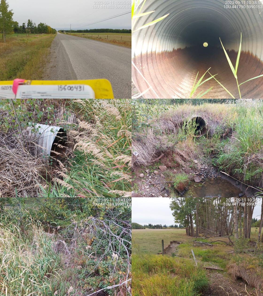 . From top left clockwise: Road/Site Card, Barrel, Outlet, Downstream, Upstream, Inlet.15600431 . From top left clockwise: Road/Site Card, Barrel, Outlet, Downstream, Upstream, Inlet.15600431
|
|||
| Comments: Mostly dewatered channel with small amount of water in outlet pool.. Large outlet drop. No well defined channel upstream. Channel width and gradient estimated as areas immediately upstream and downstream are fenced off. MoTi chris_culvert_id: 1801616. 10:37:09 |
| Location and Stream Data |
|
Crossing Characteristics | – |
|---|---|---|---|
| Date | 2023-09-11 | Crossing Sub Type | Round Culvert |
| PSCIS ID | 199197 | Diameter (m) | 3 |
| External ID | 15600311 | Length (m) | 14 |
| Crew | MW | Embedded | No |
| UTM Zone | 10 | Depth Embedded (m) | – |
| Easting | 444371 | Resemble Channel | No |
| Northing | 5989869 | Backwatered | No |
| Stream | Knight Creek | Percent Backwatered | – |
| Road | Bave Rd | Fill Depth (m) | 1.5 |
| Road Tenure | MOTI Local | Outlet Drop (m) | 0.6 |
| Channel Width (m) | 1.3 | Outlet Pool Depth (m) | 0 |
| Stream Slope (%) | 1 | Inlet Drop | No |
| Beaver Activity | No | Slope (%) | 1.5 |
| Habitat Value | Medium | Valley Fill | Deep Fill |
| Final score | 25 | Barrier Result | Barrier |
| Fix type | Replace Structure with Streambed Simulation CBS | Fix Span / Diameter | 3 |
Photos: PSCIS ID 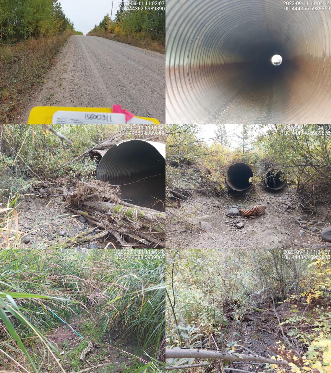 . From top left clockwise: Road/Site Card, Barrel, Outlet, Downstream, Upstream, Inlet.15600311 . From top left clockwise: Road/Site Card, Barrel, Outlet, Downstream, Upstream, Inlet.15600311
|
|||
| Comments: Two pipes. Dewatered at tiime of assessment. Large outlet drop. Debris jam near outlet blocking channel. Grassy habitat upstream, with small channel. MoTi chris_culvert_id: 1802489, 1802490. 11:10:27 |
| Location and Stream Data |
|
Crossing Characteristics | – |
|---|---|---|---|
| Date | 2023-09-11 | Crossing Sub Type | Round Culvert |
| PSCIS ID | 199198 | Diameter (m) | 1.45 |
| External ID | 15600314 | Length (m) | 18 |
| Crew | MW | Embedded | No |
| UTM Zone | 10 | Depth Embedded (m) | – |
| Easting | 446488 | Resemble Channel | No |
| Northing | 5982434 | Backwatered | No |
| Stream | Leona Creek | Percent Backwatered | – |
| Road | Sackner Rd | Fill Depth (m) | 5 |
| Road Tenure | MOTI Local | Outlet Drop (m) | 0 |
| Channel Width (m) | 0.7 | Outlet Pool Depth (m) | 0 |
| Stream Slope (%) | 2 | Inlet Drop | No |
| Beaver Activity | No | Slope (%) | 0 |
| Habitat Value | Low | Valley Fill | Deep Fill |
| Final score | 13 | Barrier Result | Passable |
| Fix type | – | Fix Span / Diameter | – |
Photos: PSCIS ID 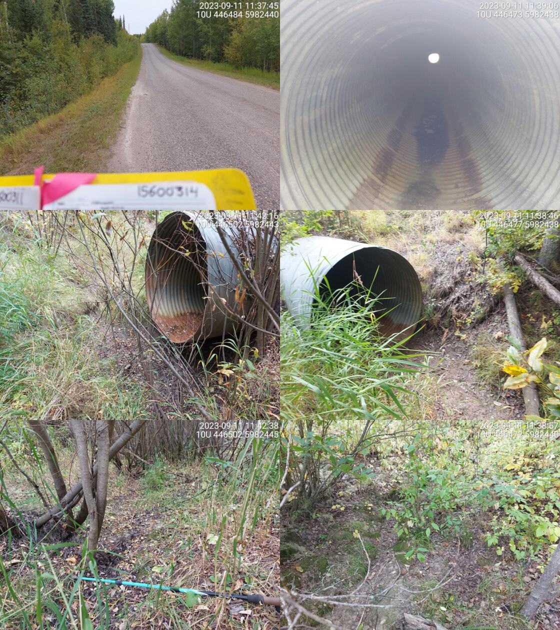 . From top left clockwise: Road/Site Card, Barrel, Outlet, Downstream, Upstream, Inlet.15600314 . From top left clockwise: Road/Site Card, Barrel, Outlet, Downstream, Upstream, Inlet.15600314
|
|||
| Comments: Dewatered at time of assessment. Very small channel upstream. Culvert was installed deep down into the valley. MoTi chris_culvert_id: 1801777. 11:40:33 |
| Location and Stream Data |
|
Crossing Characteristics | – |
|---|---|---|---|
| Date | 2023-09-11 | Crossing Sub Type | Round Culvert |
| PSCIS ID | 199199 | Diameter (m) | 1.4 |
| External ID | 15600305 | Length (m) | 30 |
| Crew | MW | Embedded | No |
| UTM Zone | 10 | Depth Embedded (m) | – |
| Easting | 442969 | Resemble Channel | No |
| Northing | 5985328 | Backwatered | No |
| Stream | Leduc Creek | Percent Backwatered | – |
| Road | Sackner Rd | Fill Depth (m) | 4 |
| Road Tenure | MOTI Local | Outlet Drop (m) | 0 |
| Channel Width (m) | 1 | Outlet Pool Depth (m) | 0 |
| Stream Slope (%) | 1 | Inlet Drop | No |
| Beaver Activity | No | Slope (%) | 0.5 |
| Habitat Value | Low | Valley Fill | Deep Fill |
| Final score | 16 | Barrier Result | Potential |
| Fix type | Replace Structure with Streambed Simulation CBS | Fix Span / Diameter | 3 |
Photos: PSCIS ID 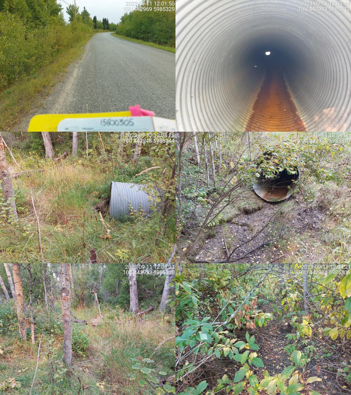 . From top left clockwise: Road/Site Card, Barrel, Outlet, Downstream, Upstream, Inlet.15600305 . From top left clockwise: Road/Site Card, Barrel, Outlet, Downstream, Upstream, Inlet.15600305
|
|||
| Comments: Dewatered at time of assessment. Small channel. Inlet side is fenced off by barbed wire. MoTi chris_culvert_id: 1801803. 12:10:19 |
| Location and Stream Data |
|
Crossing Characteristics | – |
|---|---|---|---|
| Date | 2023-09-11 | Crossing Sub Type | Round Culvert |
| PSCIS ID | 199200 | Diameter (m) | 3.6 |
| External ID | 15600459 | Length (m) | 16 |
| Crew | MW | Embedded | No |
| UTM Zone | 10 | Depth Embedded (m) | – |
| Easting | 433132 | Resemble Channel | No |
| Northing | 5991214 | Backwatered | No |
| Stream | East Murray Creek | Percent Backwatered | – |
| Road | Strieger Rd | Fill Depth (m) | 0.5 |
| Road Tenure | MOTI Local | Outlet Drop (m) | 0 |
| Channel Width (m) | 2.6 | Outlet Pool Depth (m) | 0 |
| Stream Slope (%) | 0 | Inlet Drop | No |
| Beaver Activity | No | Slope (%) | 1 |
| Habitat Value | Low | Valley Fill | Deep Fill |
| Final score | 18 | Barrier Result | Potential |
| Fix type | Replace with New Open Bottom Structure | Fix Span / Diameter | 15 |
Photos: PSCIS ID 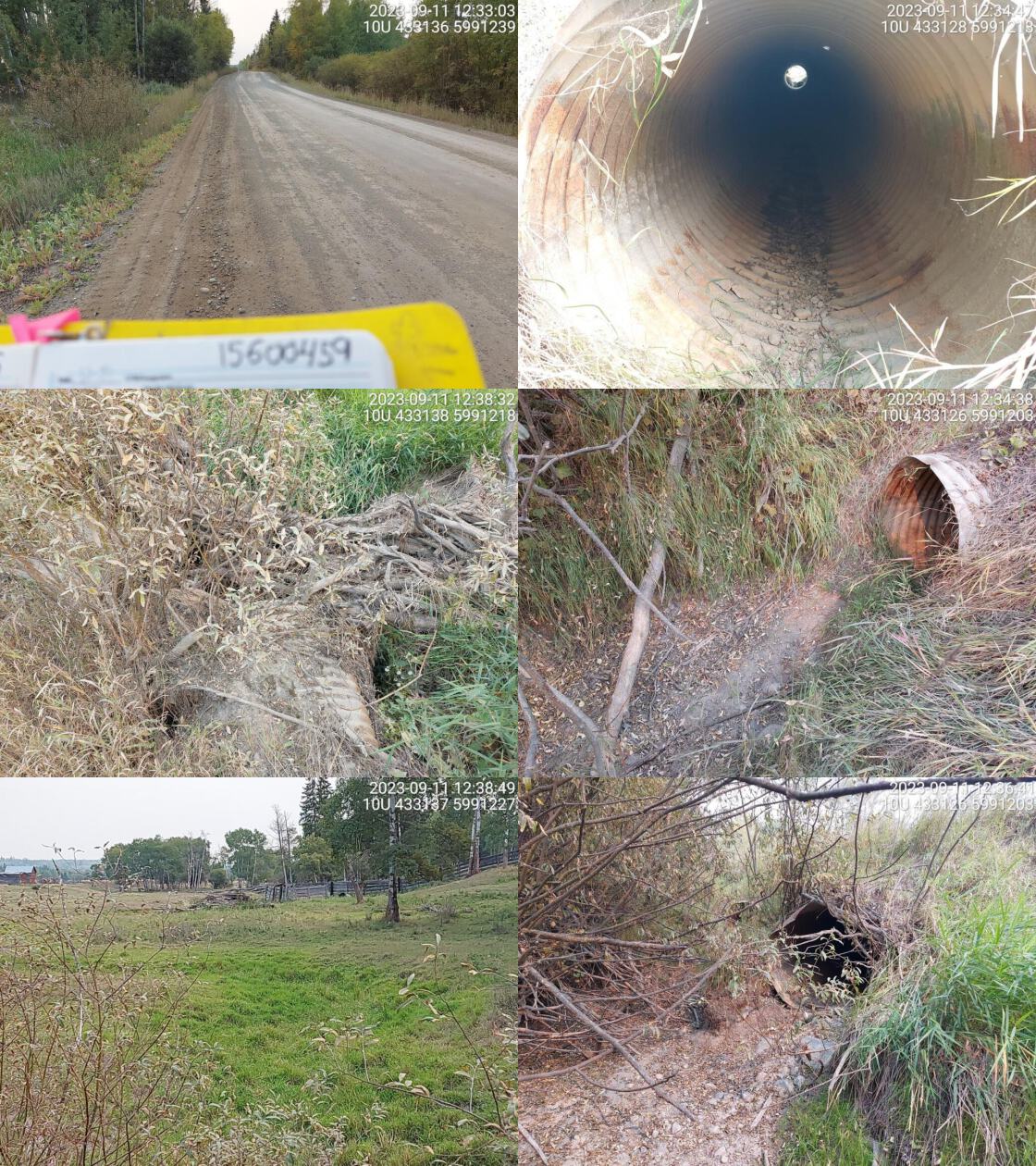 . From top left clockwise: Road/Site Card, Barrel, Outlet, Downstream, Upstream, Inlet.15600459 . From top left clockwise: Road/Site Card, Barrel, Outlet, Downstream, Upstream, Inlet.15600459
|
|||
| Comments: Three pipes. Dewatered at time of assessment. Culverts appear old and near end of life. Vegetated channel within pasture land upstream. Large debris jam blocking inlet of middle culvert. MoTi chris_culvert_id: 1806925, 1806926. 12:39:13 |
| Location and Stream Data |
|
Crossing Characteristics | – |
|---|---|---|---|
| Date | 2023-09-11 | Crossing Sub Type | Round Culvert |
| PSCIS ID | 199201 | Diameter (m) | 1.2 |
| External ID | 15600182 | Length (m) | 30 |
| Crew | MW | Embedded | No |
| UTM Zone | 10 | Depth Embedded (m) | – |
| Easting | 435117 | Resemble Channel | No |
| Northing | 5987010 | Backwatered | No |
| Stream | Tributary to Nechako River | Percent Backwatered | – |
| Road | Sackner Rd | Fill Depth (m) | 9.9 |
| Road Tenure | MOTI Local | Outlet Drop (m) | 1.2 |
| Channel Width (m) | 1.3 | Outlet Pool Depth (m) | 1.6 |
| Stream Slope (%) | 3 | Inlet Drop | No |
| Beaver Activity | No | Slope (%) | 1 |
| Habitat Value | Medium | Valley Fill | Deep Fill |
| Final score | 34 | Barrier Result | Barrier |
| Fix type | Replace Structure with Streambed Simulation CBS | Fix Span / Diameter | 3 |
Photos: PSCIS ID 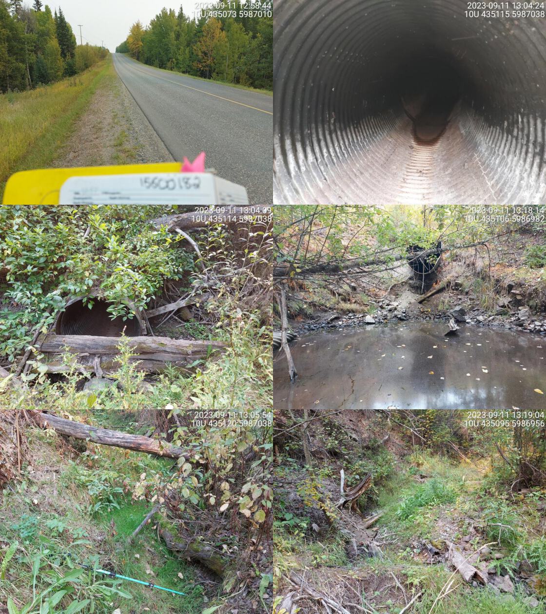 . From top left clockwise: Road/Site Card, Barrel, Outlet, Downstream, Upstream, Inlet.15600182 . From top left clockwise: Road/Site Card, Barrel, Outlet, Downstream, Upstream, Inlet.15600182
|
|||
| Comments: Very big outlet drop and deep outlet pool. Trickle of water flowing through culvert. Dewatered downstream of outlet pool and dewatered upstream of culvert. Channel width taken upstream but channel is wider downstream of crossing. Culvert is warped and a little corroded. Channel primarily vegetated.. 13:09:19 |
| Location and Stream Data |
|
Crossing Characteristics | – |
|---|---|---|---|
| Date | 2023-09-11 | Crossing Sub Type | Round Culvert |
| PSCIS ID | 199202 | Diameter (m) | 0.9 |
| External ID | 15600490 | Length (m) | 20 |
| Crew | MW | Embedded | No |
| UTM Zone | 10 | Depth Embedded (m) | – |
| Easting | 426233 | Resemble Channel | No |
| Northing | 5995486 | Backwatered | No |
| Stream | Tributary to Clear Creek | Percent Backwatered | – |
| Road | Highway 27 S | Fill Depth (m) | 3 |
| Road Tenure | MOTI | Outlet Drop (m) | 0.9 |
| Channel Width (m) | 1.1 | Outlet Pool Depth (m) | 0.5 |
| Stream Slope (%) | 3 | Inlet Drop | No |
| Beaver Activity | No | Slope (%) | 4 |
| Habitat Value | Medium | Valley Fill | Deep Fill |
| Final score | 36 | Barrier Result | Barrier |
| Fix type | Replace Structure with Streambed Simulation CBS | Fix Span / Diameter | 3 |
Photos: PSCIS ID 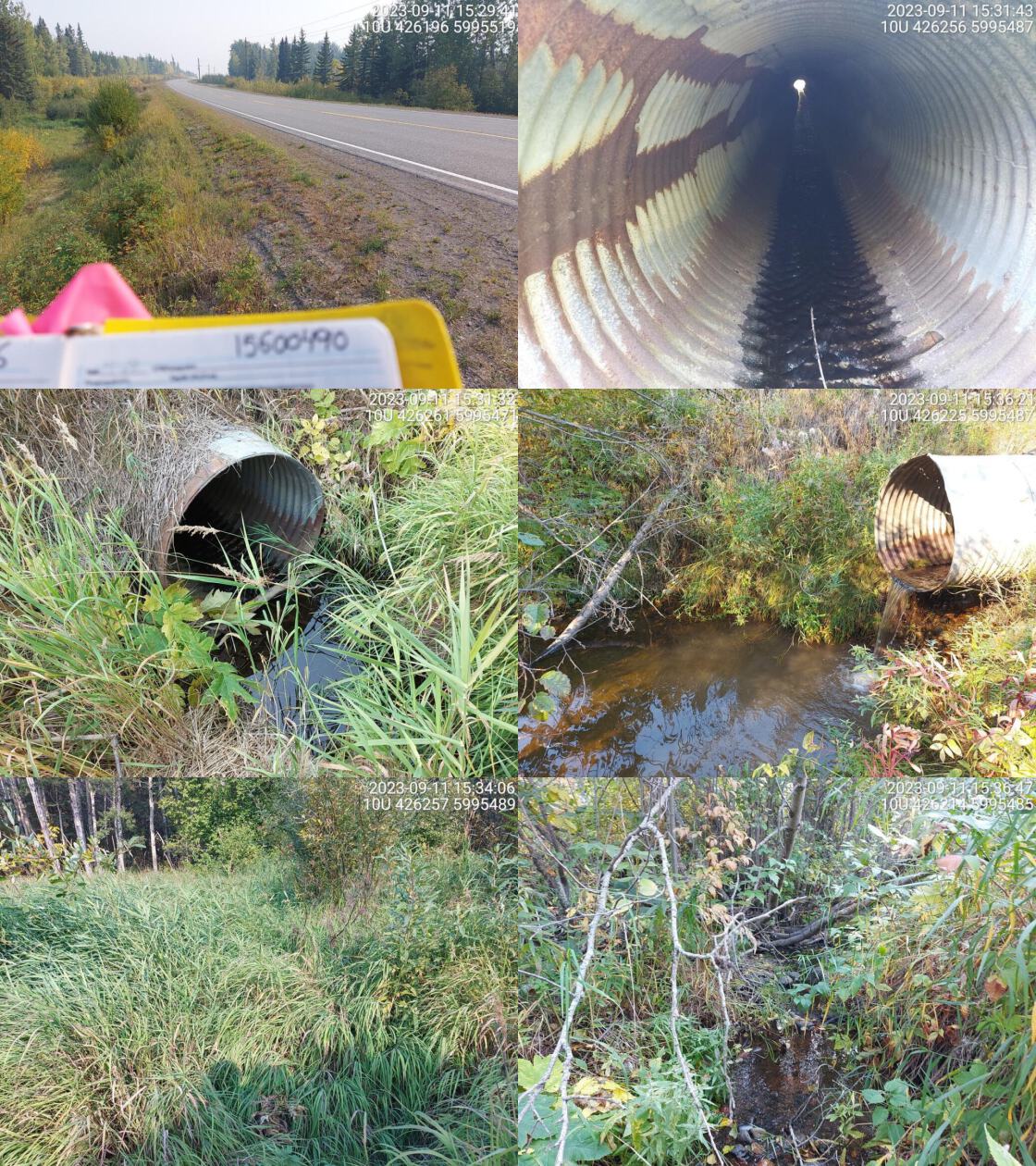 . From top left clockwise: Road/Site Card, Barrel, Outlet, Downstream, Upstream, Inlet.15600490 . From top left clockwise: Road/Site Card, Barrel, Outlet, Downstream, Upstream, Inlet.15600490
|
|||
| Comments: Very big outlet drop. Small channel upstream, grassy habitat near crossing. Chinook confirmed downstream on nearby Clear Creek. MoTi chris_culvert_id: 1806169. 15:41:05 |
| Location and Stream Data |
|
Crossing Characteristics | – |
|---|---|---|---|
| Date | 2023-09-11 | Crossing Sub Type | Round Culvert |
| PSCIS ID | 199203 | Diameter (m) | 2.6 |
| External ID | 15603729 | Length (m) | 12 |
| Crew | MW | Embedded | No |
| UTM Zone | 10 | Depth Embedded (m) | – |
| Easting | 403775 | Resemble Channel | No |
| Northing | 6000768 | Backwatered | No |
| Stream | Nine Mile Creek | Percent Backwatered | – |
| Road | Dog Creek FSR | Fill Depth (m) | 0.5 |
| Road Tenure | MOTI Unclassified | Outlet Drop (m) | 0 |
| Channel Width (m) | 2.4 | Outlet Pool Depth (m) | 0.5 |
| Stream Slope (%) | 1 | Inlet Drop | No |
| Beaver Activity | No | Slope (%) | 1 |
| Habitat Value | High | Valley Fill | Deep Fill |
| Final score | 15 | Barrier Result | Potential |
| Fix type | Replace with New Open Bottom Structure | Fix Span / Diameter | 15 |
Photos: PSCIS ID 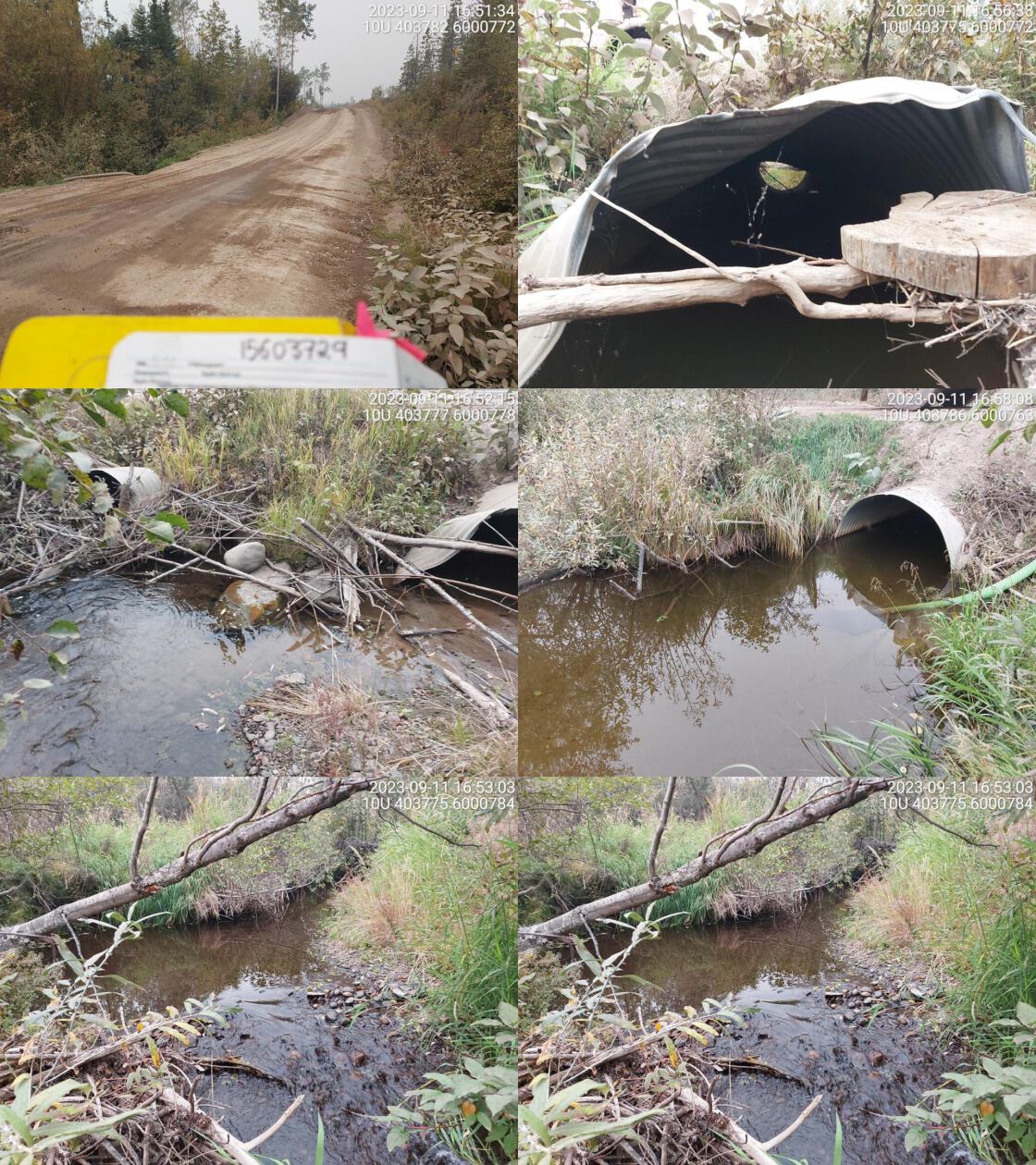 . From top left clockwise: Road/Site Card, Barrel, Outlet, Downstream, Upstream, Inlet.15603729 . From top left clockwise: Road/Site Card, Barrel, Outlet, Downstream, Upstream, Inlet.15603729
|
|||
| Comments: High habitat value. Abundant gravels and wide channel. Two pipes that look very old but fully backwatered. Chinook were captured downstream of Settlement Road culvert in 2021 (https://a100.gov.bc.ca/pub/acat/public/viewReport.do?reportId=61991). MoTi chris_culvert_id: 1794329, 1794330. 16:59:42 |
| Location and Stream Data |
|
Crossing Characteristics | – |
|---|---|---|---|
| Date | 2023-09-11 | Crossing Sub Type | Round Culvert |
| PSCIS ID | 199204 | Diameter (m) | 3 |
| External ID | 15600285 | Length (m) | 9 |
| Crew | MW | Embedded | No |
| UTM Zone | 10 | Depth Embedded (m) | – |
| Easting | 403897 | Resemble Channel | No |
| Northing | 5998780 | Backwatered | No |
| Stream | Nine Mile Creek | Percent Backwatered | – |
| Road | Settlement Rd | Fill Depth (m) | 0.5 |
| Road Tenure | MOTI Local | Outlet Drop (m) | 0.5 |
| Channel Width (m) | 3 | Outlet Pool Depth (m) | 2 |
| Stream Slope (%) | 2 | Inlet Drop | No |
| Beaver Activity | Yes | Slope (%) | 1 |
| Habitat Value | Medium | Valley Fill | Deep Fill |
| Final score | 28 | Barrier Result | Barrier |
| Fix type | Replace with New Open Bottom Structure | Fix Span / Diameter | 15 |
Photos: PSCIS ID 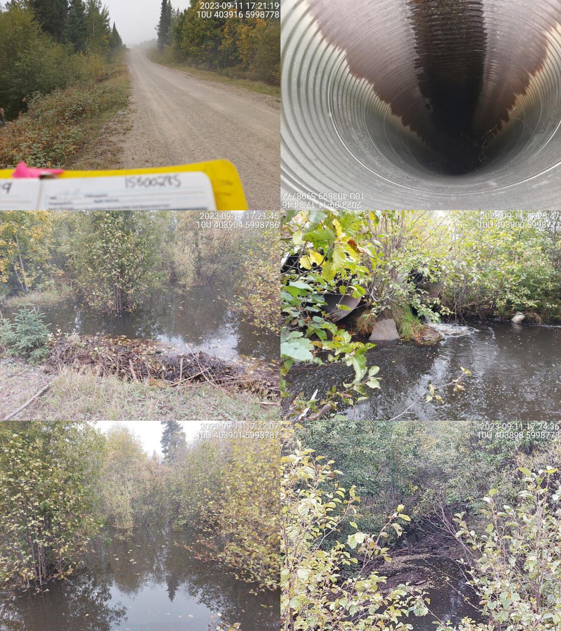 . From top left clockwise: Road/Site Card, Barrel, Outlet, Downstream, Upstream, Inlet.15600285 . From top left clockwise: Road/Site Card, Barrel, Outlet, Downstream, Upstream, Inlet.15600285
|
|||
| Comments: Two pipes (one at 1.8m, one at 1.5m), both with similar outlet drops. Inlet side has extensive beaver activity. Beaver dams are covering the inlet and culverts are not visible. Huge wetland upstream. Very big outlet pool so depth was estimated. Chinook were captured downstream of Settlement Road culvert in 2021 (https://a100.gov.bc.ca/pub/acat/public/viewReport.do?reportId=61991) and Rainbow Trout observed in stream from 2021-2023 (https://a100.gov.bc.ca/pub/acat/public/viewReport.do?reportId=61202 and https://a100.gov.bc.ca/pub/acat/public/viewReport.do?reportId=62942). Culverts should be replaced and beaver activity managed. Habitat looks good downstream. High habitat value at crossing upstream. MoTi chris_culvert_id: 1793922, 1793923. 17:26:25 |
| Location and Stream Data |
|
Crossing Characteristics | – |
|---|---|---|---|
| Date | 2023-09-12 | Crossing Sub Type | Round Culvert |
| PSCIS ID | 199205 | Diameter (m) | 2 |
| External ID | 15600427 | Length (m) | 26 |
| Crew | MW | Embedded | No |
| UTM Zone | 10 | Depth Embedded (m) | – |
| Easting | 424186 | Resemble Channel | No |
| Northing | 5985604 | Backwatered | No |
| Stream | Goldie Creek | Percent Backwatered | – |
| Road | Highway 16 W | Fill Depth (m) | 1 |
| Road Tenure | MOTI | Outlet Drop (m) | 0 |
| Channel Width (m) | 3.1 | Outlet Pool Depth (m) | 0.4 |
| Stream Slope (%) | 0.5 | Inlet Drop | No |
| Beaver Activity | No | Slope (%) | 2 |
| Habitat Value | Medium | Valley Fill | Deep Fill |
| Final score | 24 | Barrier Result | Barrier |
| Fix type | Replace with New Open Bottom Structure | Fix Span / Diameter | 15 |
Photos: PSCIS ID 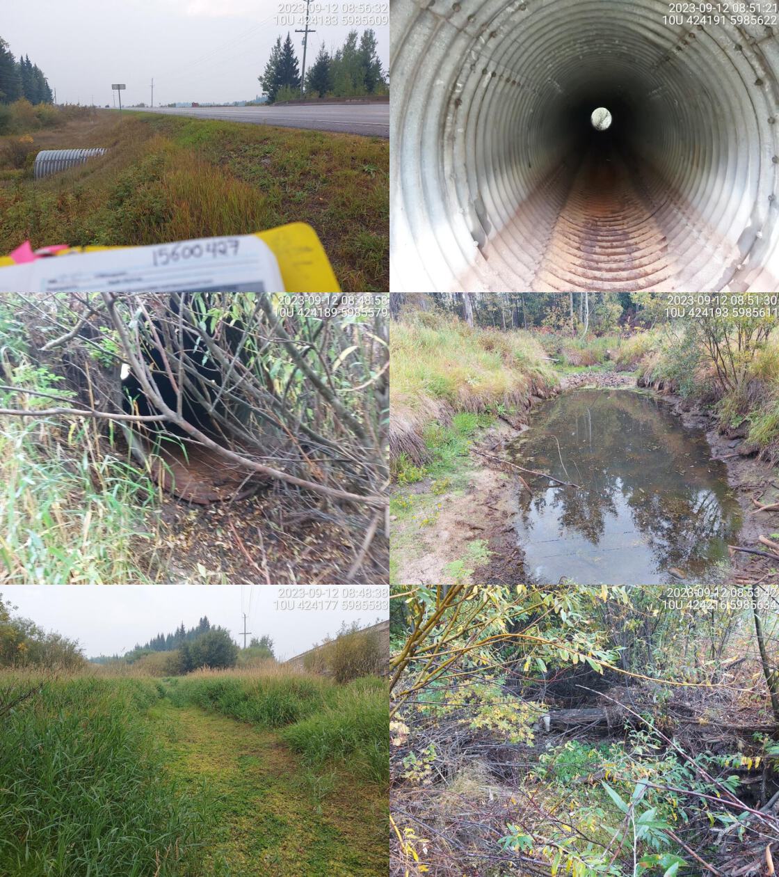 . From top left clockwise: Road/Site Card, Barrel, Outlet, Downstream, Upstream, Inlet.15600427 . From top left clockwise: Road/Site Card, Barrel, Outlet, Downstream, Upstream, Inlet.15600427
|
|||
| Comments: Dewatered stream. Large outlet pool. Pipe very corroded on outlet side. Wide stream channel upstream. Grassy channel downstream. Fully backwatered at time of assessdmnt. MoTi chris_culvert_id: 3738843. 08:55:03 |
| Location and Stream Data |
|
Crossing Characteristics | – |
|---|---|---|---|
| Date | 2023-09-12 | Crossing Sub Type | Round Culvert |
| PSCIS ID | 199206 | Diameter (m) | 0.9 |
| External ID | 15600478 | Length (m) | 10 |
| Crew | MW | Embedded | No |
| UTM Zone | 10 | Depth Embedded (m) | – |
| Easting | 418610 | Resemble Channel | No |
| Northing | 5987801 | Backwatered | No |
| Stream | Croft Creek | Percent Backwatered | – |
| Road | Landaluza Rd | Fill Depth (m) | 0.5 |
| Road Tenure | MOTI Local | Outlet Drop (m) | 0 |
| Channel Width (m) | 0.9 | Outlet Pool Depth (m) | 0 |
| Stream Slope (%) | 0 | Inlet Drop | No |
| Beaver Activity | No | Slope (%) | 1 |
| Habitat Value | Medium | Valley Fill | Deep Fill |
| Final score | 18 | Barrier Result | Potential |
| Fix type | Replace Structure with Streambed Simulation CBS | Fix Span / Diameter | 3 |
Photos: PSCIS ID 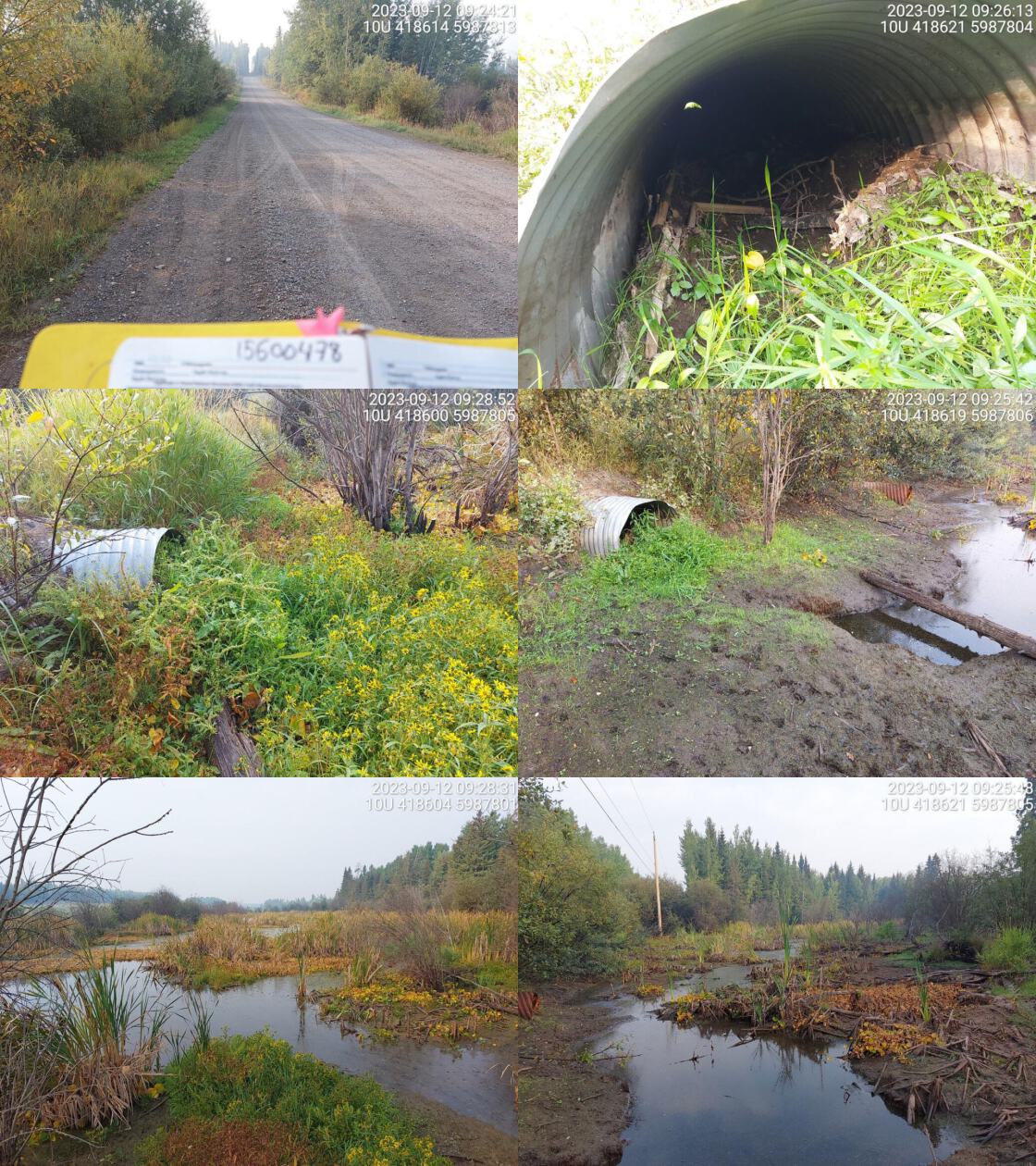 . From top left clockwise: Road/Site Card, Barrel, Outlet, Downstream, Upstream, Inlet.15600478 . From top left clockwise: Road/Site Card, Barrel, Outlet, Downstream, Upstream, Inlet.15600478
|
|||
| Comments: Wetland upstream and downstream. Culvert blocked with some debris and overgrown with vegetation. Probably hasn’t been flow through pipe in a while.. 09:26:55 |
| Location and Stream Data |
|
Crossing Characteristics | – |
|---|---|---|---|
| Date | 2023-09-28 | Crossing Sub Type | Round Culvert |
| PSCIS ID | 199207 | Diameter (m) | 2.5 |
| External ID | 5400450 | Length (m) | 32 |
| Crew | MW | Embedded | No |
| UTM Zone | 9 | Depth Embedded (m) | – |
| Easting | 693922 | Resemble Channel | No |
| Northing | 6032097 | Backwatered | No |
| Stream | Endako River | Percent Backwatered | – |
| Road | Highway 16 W | Fill Depth (m) | 2 |
| Road Tenure | MOTI | Outlet Drop (m) | 1 |
| Channel Width (m) | 3.1 | Outlet Pool Depth (m) | 0.9 |
| Stream Slope (%) | 2 | Inlet Drop | No |
| Beaver Activity | No | Slope (%) | 0 |
| Habitat Value | High | Valley Fill | Deep Fill |
| Final score | 29 | Barrier Result | Barrier |
| Fix type | Replace with New Open Bottom Structure | Fix Span / Diameter | 15 |
Photos: PSCIS ID 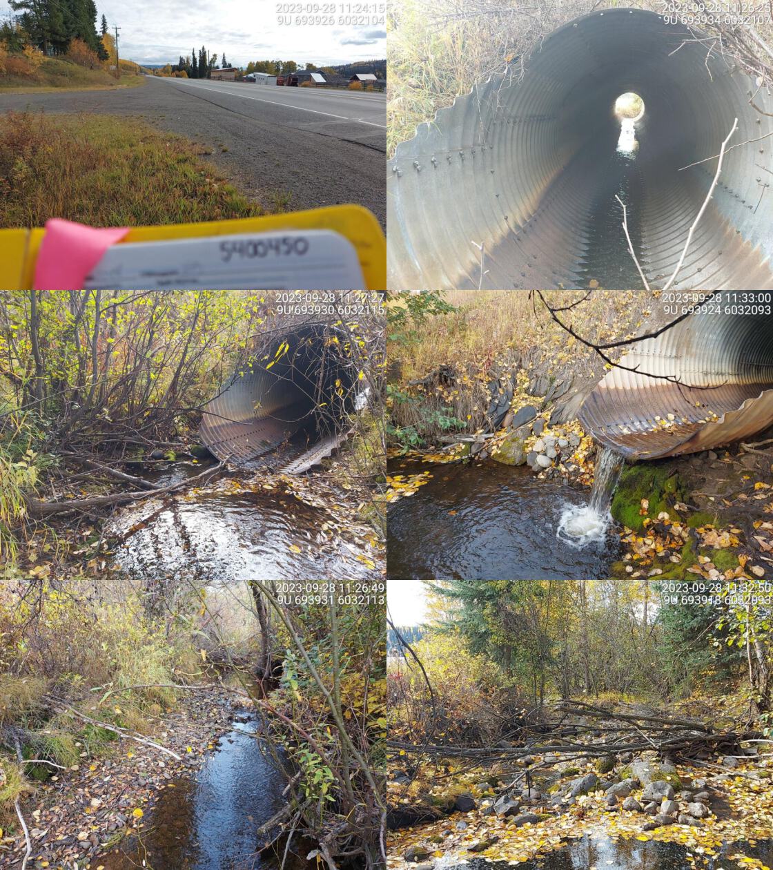 . From top left clockwise: Road/Site Card, Barrel, Outlet, Downstream, Upstream, Inlet.5400450 . From top left clockwise: Road/Site Card, Barrel, Outlet, Downstream, Upstream, Inlet.5400450
|
|||
| Comments: Moderate flow, wide stream with nice gravels upstream. Runs through rural area. Big outlet drop and deep pool. Erosion and embankment issues above culvert on outlet side. Rainbow confirmed upstream. FISS has 3m falls locaed 3.5km upstream of Decker Lake but suspect not actually an issue. MoTi chris_culvert_id: 3100663. 11:36:12 |
| Location and Stream Data |
|
Crossing Characteristics | – |
|---|---|---|---|
| Date | 2023-09-28 | Crossing Sub Type | Oval Culvert |
| PSCIS ID | 199208 | Diameter (m) | 2.6 |
| External ID | 5400445 | Length (m) | 16 |
| Crew | MW | Embedded | No |
| UTM Zone | 10 | Depth Embedded (m) | – |
| Easting | 309133 | Resemble Channel | No |
| Northing | 6028926 | Backwatered | No |
| Stream | Allen Creek | Percent Backwatered | – |
| Road | Highway 16 W | Fill Depth (m) | 0.4 |
| Road Tenure | MOTI | Outlet Drop (m) | 0 |
| Channel Width (m) | 3.4 | Outlet Pool Depth (m) | 0 |
| Stream Slope (%) | 1 | Inlet Drop | No |
| Beaver Activity | No | Slope (%) | 3 |
| Habitat Value | Medium | Valley Fill | Deep Fill |
| Final score | 29 | Barrier Result | Barrier |
| Fix type | Replace with New Open Bottom Structure | Fix Span / Diameter | 15 |
Photos: PSCIS ID  . From top left clockwise: Road/Site Card, Barrel, Outlet, Downstream, Upstream, Inlet.5400445 . From top left clockwise: Road/Site Card, Barrel, Outlet, Downstream, Upstream, Inlet.5400445
|
|||
| Comments: Dewatered at time of assessment. Wide channel, private land on both sides. Culvert looks old and corroded, abundant fill in barrel. MoTi chris_culvert_id: 2076438. 12:44:04 |
| Location and Stream Data |
|
Crossing Characteristics | – |
|---|---|---|---|
| Date | 2023-09-28 | Crossing Sub Type | Oval Culvert |
| PSCIS ID | 199209 | Diameter (m) | 2.3 |
| External ID | 5400440 | Length (m) | 20 |
| Crew | MW | Embedded | No |
| UTM Zone | 10 | Depth Embedded (m) | – |
| Easting | 313583 | Resemble Channel | No |
| Northing | 6022421 | Backwatered | No |
| Stream | Powder House Creek | Percent Backwatered | – |
| Road | Highway 16 W | Fill Depth (m) | 1 |
| Road Tenure | MOTI | Outlet Drop (m) | 0.2 |
| Channel Width (m) | 3.5 | Outlet Pool Depth (m) | 0 |
| Stream Slope (%) | 4 | Inlet Drop | Yes |
| Beaver Activity | No | Slope (%) | 5 |
| Habitat Value | Medium | Valley Fill | Deep Fill |
| Final score | 34 | Barrier Result | Barrier |
| Fix type | Replace with New Open Bottom Structure | Fix Span / Diameter | 15 |
Photos: PSCIS ID 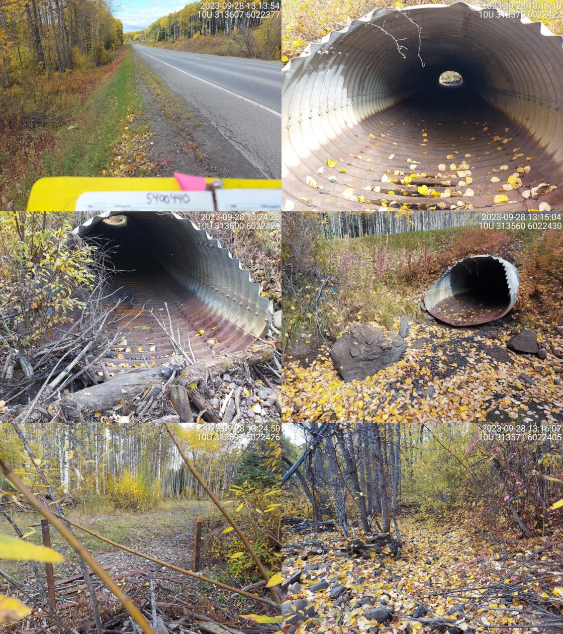 . From top left clockwise: Road/Site Card, Barrel, Outlet, Downstream, Upstream, Inlet.5400440 . From top left clockwise: Road/Site Card, Barrel, Outlet, Downstream, Upstream, Inlet.5400440
|
|||
| Comments: Dewatered at time of assessment. Small pool near outlet. Rainbow confirmed in past upstream. Two 3m falls noted 450m upstream. in FISS. Culvert is very old, corroded and has holes in bottom. MoTi chris_culvert_id: 2076418. 13:18:49 |
| Location and Stream Data |
|
Crossing Characteristics | – |
|---|---|---|---|
| Date | 2023-09-28 | Crossing Sub Type | Round Culvert |
| PSCIS ID | 199210 | Diameter (m) | 2.2 |
| External ID | 5406295 | Length (m) | 12 |
| Crew | MW | Embedded | No |
| UTM Zone | 10 | Depth Embedded (m) | – |
| Easting | 313514 | Resemble Channel | No |
| Northing | 6022401 | Backwatered | No |
| Stream | Powder House Creek | Percent Backwatered | – |
| Road | Rail | Fill Depth (m) | 1.2 |
| Road Tenure | CN Rail | Outlet Drop (m) | 0.5 |
| Channel Width (m) | 4.1 | Outlet Pool Depth (m) | 0 |
| Stream Slope (%) | 2 | Inlet Drop | No |
| Beaver Activity | No | Slope (%) | 5 |
| Habitat Value | Medium | Valley Fill | Deep Fill |
| Final score | 36 | Barrier Result | Barrier |
| Fix type | Replace with New Open Bottom Structure | Fix Span / Diameter | 15 |
Photos: PSCIS ID 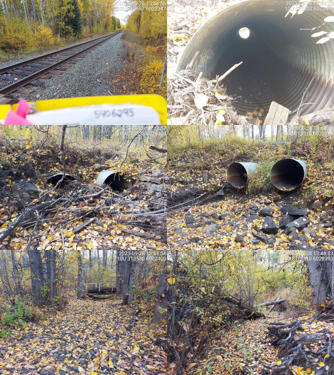 . From top left clockwise: Road/Site Card, Barrel, Outlet, Downstream, Upstream, Inlet.5406295 . From top left clockwise: Road/Site Card, Barrel, Outlet, Downstream, Upstream, Inlet.5406295
|
|||
| Comments: Two pipes at 1.1m diameter each. Debris jam blocking majority of inlet on both pipes. Large channel dewatered at time of assessment. Significant outlet drop on both culverts. Two 3m high falls documented in FISS at ~500-600m upstream. Rainbow trout historically captured upstream. RB have historically been captured upstream. 13:50:33 |
| Location and Stream Data |
|
Crossing Characteristics | – |
|---|---|---|---|
| Date | 2023-09-28 | Crossing Sub Type | Round Culvert |
| PSCIS ID | 199211 | Diameter (m) | 2.6 |
| External ID | 5400044 | Length (m) | 32 |
| Crew | MW | Embedded | No |
| UTM Zone | 10 | Depth Embedded (m) | – |
| Easting | 316235 | Resemble Channel | No |
| Northing | 6018694 | Backwatered | No |
| Stream | Decker Creek | Percent Backwatered | – |
| Road | Highway 16 W | Fill Depth (m) | 1.3 |
| Road Tenure | MOTI | Outlet Drop (m) | 0.6 |
| Channel Width (m) | 4.3 | Outlet Pool Depth (m) | 0 |
| Stream Slope (%) | 4 | Inlet Drop | No |
| Beaver Activity | No | Slope (%) | 2 |
| Habitat Value | Medium | Valley Fill | Deep Fill |
| Final score | 37 | Barrier Result | Barrier |
| Fix type | Replace with New Open Bottom Structure | Fix Span / Diameter | 15 |
Photos: PSCIS ID 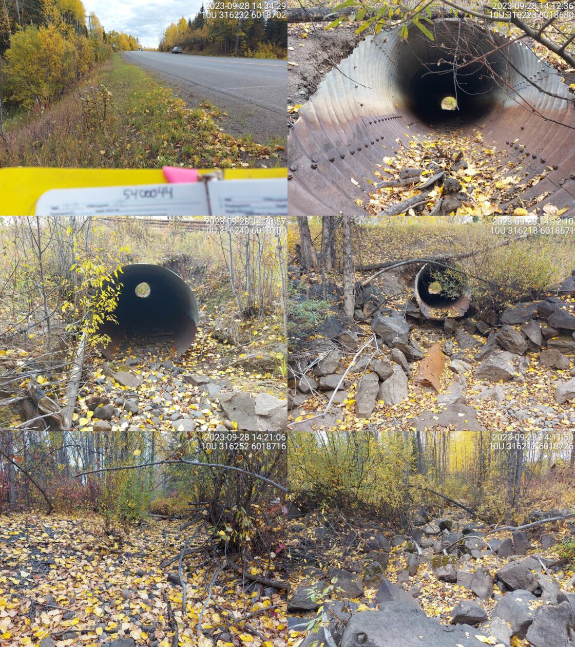 . From top left clockwise: Road/Site Card, Barrel, Outlet, Downstream, Upstream, Inlet.5400044 . From top left clockwise: Road/Site Card, Barrel, Outlet, Downstream, Upstream, Inlet.5400044
|
|||
| Comments: Dewatered stream at time of survey. Wide channel, abundant boulders downstream of crossing. Rainbow confirmed upstream in past. Culvert is old and corroded badly on outlet side. Stream most likely flows under culvert near outlet during high flow. MoTi chris_culvert_id: 2076407. 14:15:04 |
| Location and Stream Data |
|
Crossing Characteristics | – |
|---|---|---|---|
| Date | 2023-09-28 | Crossing Sub Type | Round Culvert |
| PSCIS ID | 199212 | Diameter (m) | 1.2 |
| External ID | 5400227 | Length (m) | 48 |
| Crew | MW | Embedded | No |
| UTM Zone | 10 | Depth Embedded (m) | – |
| Easting | 317315 | Resemble Channel | No |
| Northing | 6016973 | Backwatered | No |
| Stream | Gauvin Creek | Percent Backwatered | – |
| Road | Highway 16 W | Fill Depth (m) | 4 |
| Road Tenure | MOTI | Outlet Drop (m) | 0.2 |
| Channel Width (m) | 1.1 | Outlet Pool Depth (m) | 0 |
| Stream Slope (%) | 2 | Inlet Drop | No |
| Beaver Activity | No | Slope (%) | 2 |
| Habitat Value | Low | Valley Fill | Deep Fill |
| Final score | 26 | Barrier Result | Barrier |
| Fix type | Replace Structure with Streambed Simulation CBS | Fix Span / Diameter | 3 |
Photos: PSCIS ID 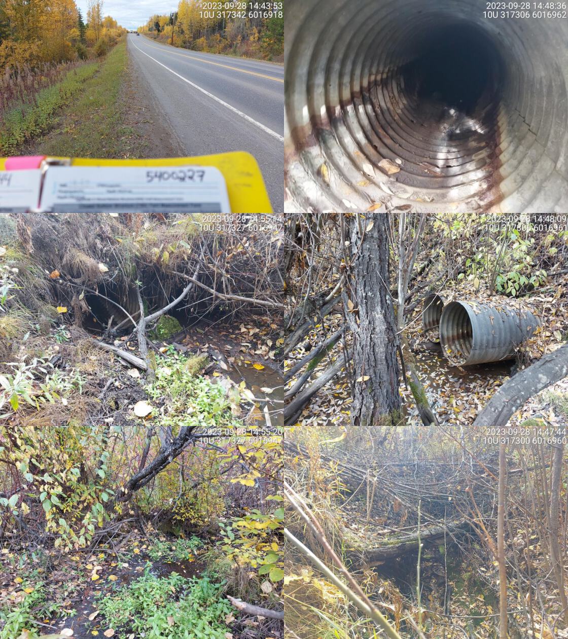 . From top left clockwise: Road/Site Card, Barrel, Outlet, Downstream, Upstream, Inlet.5400227 . From top left clockwise: Road/Site Card, Barrel, Outlet, Downstream, Upstream, Inlet.5400227
|
|||
| Comments: Very long culvert length and high fill depth, two pipes. Mostly dewatered stream. Small pools upstream, stagnant water. Small, confined channel. Can’t see the other end of pipe, culvert slope estimated. Might be some blockage or culvert is bent in middle. Unassessed railway crossing just downstream. MoTi chris_culvert_id: 2076402. 14:49:25 |
| Location and Stream Data |
|
Crossing Characteristics | – |
|---|---|---|---|
| Date | 2023-09-28 | Crossing Sub Type | Oval Culvert |
| PSCIS ID | 199213 | Diameter (m) | 4 |
| External ID | 5400286 | Length (m) | 22 |
| Crew | MW | Embedded | No |
| UTM Zone | 10 | Depth Embedded (m) | – |
| Easting | 320733 | Resemble Channel | No |
| Northing | 6009596 | Backwatered | No |
| Stream | Guyishton Creek | Percent Backwatered | – |
| Road | Highway 35 | Fill Depth (m) | 0.1 |
| Road Tenure | MOTI | Outlet Drop (m) | 0.6 |
| Channel Width (m) | 2.8 | Outlet Pool Depth (m) | 0.5 |
| Stream Slope (%) | 3 | Inlet Drop | No |
| Beaver Activity | No | Slope (%) | 2 |
| Habitat Value | High | Valley Fill | Deep Fill |
| Final score | 28 | Barrier Result | Barrier |
| Fix type | Replace with New Open Bottom Structure | Fix Span / Diameter | 15 |
Photos: PSCIS ID 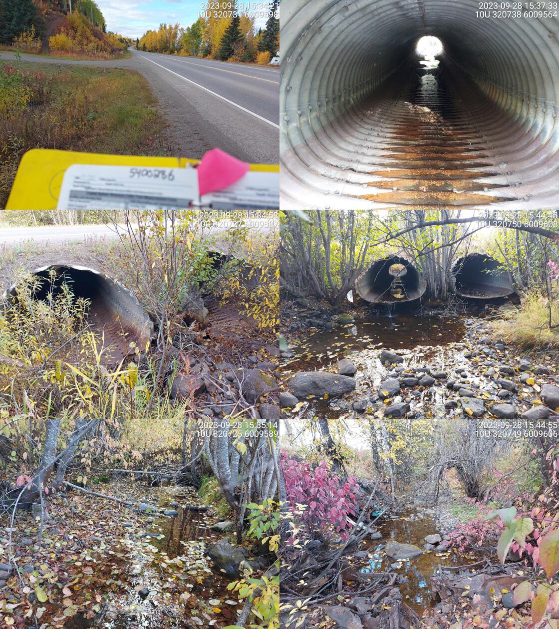 . From top left clockwise: Road/Site Card, Barrel, Outlet, Downstream, Upstream, Inlet.5400286 . From top left clockwise: Road/Site Card, Barrel, Outlet, Downstream, Upstream, Inlet.5400286
|
|||
| Comments: Small fry spotted in culvert and in outlet pool. Two pipes, both old and corroded with large outlet drops. Small holes in both pipes causing some water to flow under pipe. Very low fill depth, culverts almost at highway. Near Burns Lake, in residential area. Habitat looks good upstream. RB and LSU upstream in Guyishton Lake. MoTi chris_culvert_id: 2070299, 2070298. 15:48:58 |
| Location and Stream Data |
|
Crossing Characteristics | – |
|---|---|---|---|
| Date | 2023-09-28 | Crossing Sub Type | Round Culvert |
| PSCIS ID | 199214 | Diameter (m) | 3.5 |
| External ID | 5400042 | Length (m) | 30 |
| Crew | MW | Embedded | No |
| UTM Zone | 10 | Depth Embedded (m) | – |
| Easting | 322424 | Resemble Channel | No |
| Northing | 6011731 | Backwatered | No |
| Stream | Wardrop Creek | Percent Backwatered | – |
| Road | Highway 16 | Fill Depth (m) | 4 |
| Road Tenure | MOTI | Outlet Drop (m) | 0 |
| Channel Width (m) | 2.4 | Outlet Pool Depth (m) | 0 |
| Stream Slope (%) | 3 | Inlet Drop | No |
| Beaver Activity | No | Slope (%) | 4 |
| Habitat Value | High | Valley Fill | Deep Fill |
| Final score | 26 | Barrier Result | Barrier |
| Fix type | Replace with New Open Bottom Structure | Fix Span / Diameter | 18 |
Photos: PSCIS ID 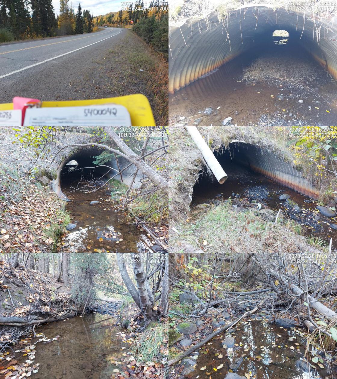 . From top left clockwise: Road/Site Card, Barrel, Outlet, Downstream, Upstream, Inlet.5400042 . From top left clockwise: Road/Site Card, Barrel, Outlet, Downstream, Upstream, Inlet.5400042
|
|||
| Comments: Culvert almost fully embedded except for small section at inlet side. Small fish seen in culvert and upstream of crossing. Moderate flow, wide channel. RB confirmed upstream in past. MoTi chris_hwy_structure_road_id: 3880. 16:36:18 |
| Location and Stream Data |
|
Crossing Characteristics | – |
|---|---|---|---|
| Date | 2023-09-29 | Crossing Sub Type | Round Culvert |
| PSCIS ID | 199215 | Diameter (m) | 2.6 |
| External ID | 5400157 | Length (m) | 52 |
| Crew | MW | Embedded | No |
| UTM Zone | 10 | Depth Embedded (m) | – |
| Easting | 337777 | Resemble Channel | No |
| Northing | 6007094 | Backwatered | No |
| Stream | Sheraton Creek | Percent Backwatered | – |
| Road | Highway 16 | Fill Depth (m) | 4 |
| Road Tenure | MOTI | Outlet Drop (m) | 1.8 |
| Channel Width (m) | 6.5 | Outlet Pool Depth (m) | 1.5 |
| Stream Slope (%) | 4 | Inlet Drop | No |
| Beaver Activity | No | Slope (%) | 3 |
| Habitat Value | High | Valley Fill | Deep Fill |
| Final score | 42 | Barrier Result | Barrier |
| Fix type | Replace with New Open Bottom Structure | Fix Span / Diameter | 18 |
Photos: PSCIS ID 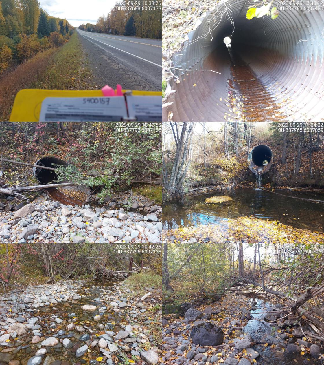 . From top left clockwise: Road/Site Card, Barrel, Outlet, Downstream, Upstream, Inlet.5400157 . From top left clockwise: Road/Site Card, Barrel, Outlet, Downstream, Upstream, Inlet.5400157
|
|||
| Comments: Very wide channel, culvert is undersized and perched. Deep outlet pool and massive outlet drop. Small fish seen in outlet pool. RB confirmed in past upstream and downstream. Just upstream of Babine Forest Products Ltd lumber yard. Railway downstream needs to be assessed. MoTi chris_culvert_id: 2069556. 11:11:26 |
| Location and Stream Data |
|
Crossing Characteristics | – |
|---|---|---|---|
| Date | 2023-09-29 | Crossing Sub Type | Round Culvert |
| PSCIS ID | 199216 | Diameter (m) | 2.5 |
| External ID | 5401774 | Length (m) | 14 |
| Crew | MW | Embedded | No |
| UTM Zone | 10 | Depth Embedded (m) | – |
| Easting | 337850 | Resemble Channel | No |
| Northing | 6006827 | Backwatered | No |
| Stream | Sheraton Creek | Percent Backwatered | – |
| Road | Unnamed | Fill Depth (m) | 1 |
| Road Tenure | Burns Lake | Outlet Drop (m) | 1.4 |
| Channel Width (m) | 5.6 | Outlet Pool Depth (m) | 2 |
| Stream Slope (%) | 3 | Inlet Drop | No |
| Beaver Activity | No | Slope (%) | 3 |
| Habitat Value | High | Valley Fill | Deep Fill |
| Final score | 36 | Barrier Result | Barrier |
| Fix type | Replace with New Open Bottom Structure | Fix Span / Diameter | 15 |
Photos: PSCIS ID 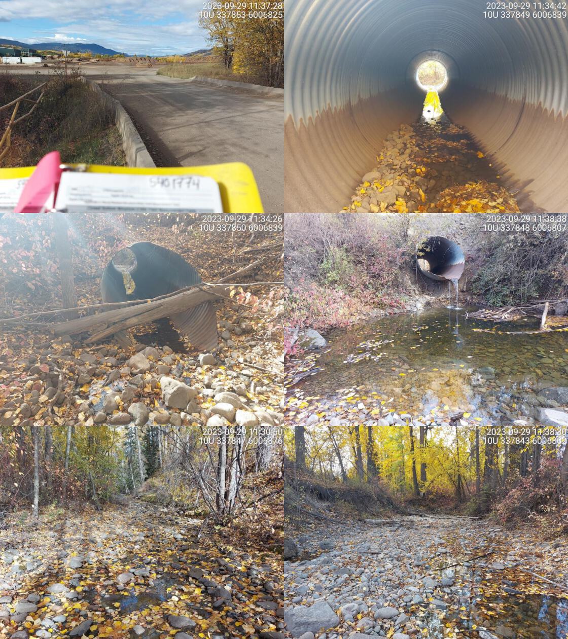 . From top left clockwise: Road/Site Card, Barrel, Outlet, Downstream, Upstream, Inlet.5401774 . From top left clockwise: Road/Site Card, Barrel, Outlet, Downstream, Upstream, Inlet.5401774
|
|||
| Comments: Near entrance to lumber yard, Babine Forest Products Ltd. Barrier just upstream. Railway downstream has not been assessed yet. Big outlet drop with very deep pool. Wide stream channel with low water levels. RB upstream.. 11:25:01 |
| Location and Stream Data |
|
Crossing Characteristics | – |
|---|---|---|---|
| Date | 2023-09-29 | Crossing Sub Type | Round Culvert |
| PSCIS ID | 199217 | Diameter (m) | 1.2 |
| External ID | 5400019 | Length (m) | 99 |
| Crew | MW | Embedded | No |
| UTM Zone | 10 | Depth Embedded (m) | – |
| Easting | 366638 | Resemble Channel | No |
| Northing | 5995282 | Backwatered | No |
| Stream | Four Mile Creek | Percent Backwatered | – |
| Road | Highway 16 | Fill Depth (m) | 6 |
| Road Tenure | MOTI | Outlet Drop (m) | 0 |
| Channel Width (m) | 1.1 | Outlet Pool Depth (m) | 0 |
| Stream Slope (%) | 3 | Inlet Drop | No |
| Beaver Activity | No | Slope (%) | 1 |
| Habitat Value | Low | Valley Fill | Deep Fill |
| Final score | 21 | Barrier Result | Barrier |
| Fix type | Replace Structure with Streambed Simulation CBS | Fix Span / Diameter | 3 |
Photos: PSCIS ID 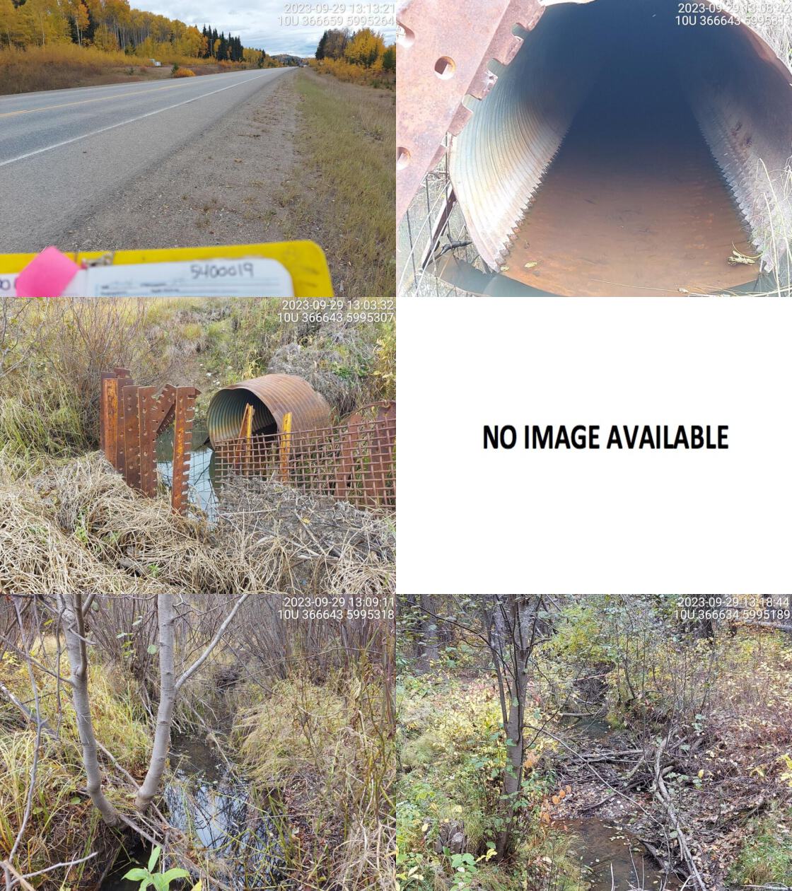 . From top left clockwise: Road/Site Card, Barrel, Outlet, Downstream, Upstream, Inlet.5400019 . From top left clockwise: Road/Site Card, Barrel, Outlet, Downstream, Upstream, Inlet.5400019
|
|||
| Comments: Culverts runs underneath highway and railway. Outlet could not be located Creek found below railway and flows to the Endako confluence. Beaver grate on inlet side. MoTi chris_culvert_id: 1793819. 13:07:39 |
| Location and Stream Data |
|
Crossing Characteristics | – |
|---|---|---|---|
| Date | 2023-09-29 | Crossing Sub Type | Round Culvert |
| PSCIS ID | 199218 | Diameter (m) | 1.5 |
| External ID | 5400239 | Length (m) | 45 |
| Crew | MW | Embedded | No |
| UTM Zone | 10 | Depth Embedded (m) | – |
| Easting | 381850 | Resemble Channel | No |
| Northing | 5991183 | Backwatered | No |
| Stream | Robertson Creek | Percent Backwatered | – |
| Road | Highway 16 | Fill Depth (m) | 5 |
| Road Tenure | MOTI | Outlet Drop (m) | 0.2 |
| Channel Width (m) | 2.3 | Outlet Pool Depth (m) | 0 |
| Stream Slope (%) | 2 | Inlet Drop | No |
| Beaver Activity | No | Slope (%) | 5 |
| Habitat Value | Low | Valley Fill | Deep Fill |
| Final score | 37 | Barrier Result | Barrier |
| Fix type | Replace with New Open Bottom Structure | Fix Span / Diameter | 21 |
Photos: PSCIS ID 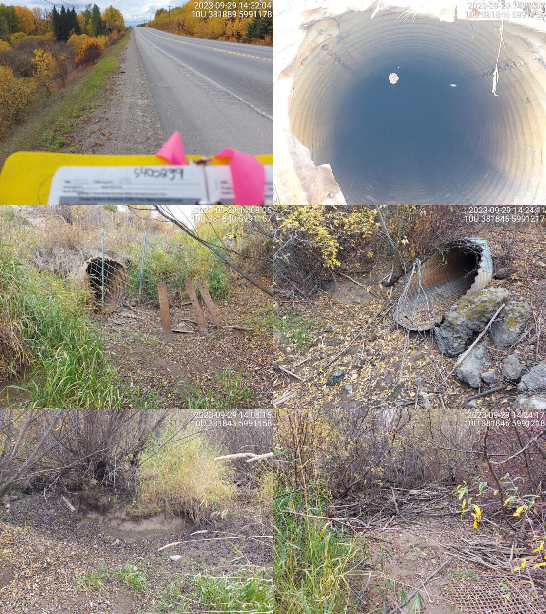 . From top left clockwise: Road/Site Card, Barrel, Outlet, Downstream, Upstream, Inlet.5400239 . From top left clockwise: Road/Site Card, Barrel, Outlet, Downstream, Upstream, Inlet.5400239
|
|||
| Comments: Dewatered at time of assessment. RB, LKC and LSU confirmed upstream in past. Foster Creek joins this stream just upstream of crossing. Old culvert, bent in middle. Unassessed railway crossing downstream. MoTi chris_culvert_id: 1793375. 14:27:03 |
| Location and Stream Data |
|
Crossing Characteristics | – |
|---|---|---|---|
| Date | 2023-09-29 | Crossing Sub Type | Round Culvert |
| PSCIS ID | 199219 | Diameter (m) | 1.4 |
| External ID | 15600265 | Length (m) | 18 |
| Crew | MW | Embedded | No |
| UTM Zone | 10 | Depth Embedded (m) | – |
| Easting | 399029 | Resemble Channel | No |
| Northing | 5988757 | Backwatered | No |
| Stream | Tributary to Nechako River | Percent Backwatered | – |
| Road | Lily Lake Rd | Fill Depth (m) | 1.5 |
| Road Tenure | MOTI Local | Outlet Drop (m) | 0.4 |
| Channel Width (m) | 1.9 | Outlet Pool Depth (m) | 0 |
| Stream Slope (%) | 3 | Inlet Drop | No |
| Beaver Activity | No | Slope (%) | 3 |
| Habitat Value | Low | Valley Fill | Deep Fill |
| Final score | 39 | Barrier Result | Barrier |
| Fix type | Replace Structure with Streambed Simulation CBS | Fix Span / Diameter | 3 |
Photos: PSCIS ID 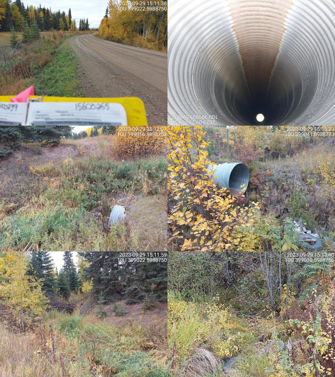 . From top left clockwise: Road/Site Card, Barrel, Outlet, Downstream, Upstream, Inlet.15600265 . From top left clockwise: Road/Site Card, Barrel, Outlet, Downstream, Upstream, Inlet.15600265
|
|||
| Comments: Dewatered at time of assessment. Fenced off private land on both sides. Small outlet drop. MoTi chris_culvert_id: 3343582. 15:19:42 |
| Location and Stream Data |
|
Crossing Characteristics | – |
|---|---|---|---|
| Date | 2023-09-29 | Crossing Sub Type | Round Culvert |
| PSCIS ID | 199220 | Diameter (m) | 1.2 |
| External ID | 15600301 | Length (m) | 24 |
| Crew | MW | Embedded | No |
| UTM Zone | 10 | Depth Embedded (m) | – |
| Easting | 401104 | Resemble Channel | No |
| Northing | 5983401 | Backwatered | No |
| Stream | Tributary to Smith Creek | Percent Backwatered | – |
| Road | Lily Lake Rd | Fill Depth (m) | 3 |
| Road Tenure | MOTI Local | Outlet Drop (m) | 0 |
| Channel Width (m) | 1.2 | Outlet Pool Depth (m) | 0 |
| Stream Slope (%) | 1 | Inlet Drop | No |
| Beaver Activity | Yes | Slope (%) | 2 |
| Habitat Value | Medium | Valley Fill | Deep Fill |
| Final score | 21 | Barrier Result | Barrier |
| Fix type | Replace Structure with Streambed Simulation CBS | Fix Span / Diameter | 3 |
Photos: PSCIS ID 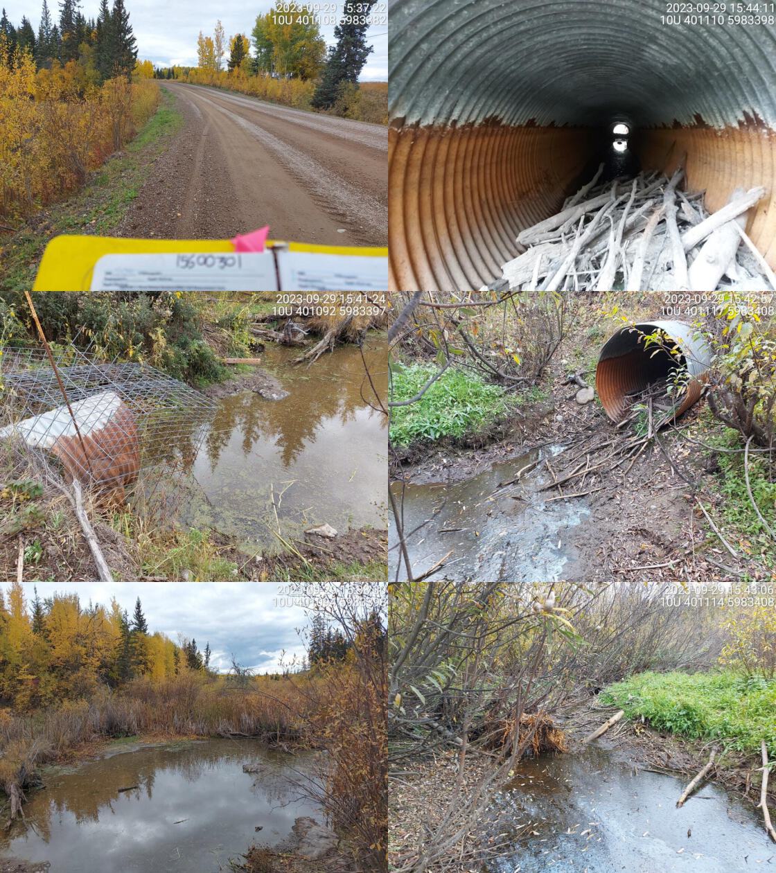 . From top left clockwise: Road/Site Card, Barrel, Outlet, Downstream, Upstream, Inlet.15600301 . From top left clockwise: Road/Site Card, Barrel, Outlet, Downstream, Upstream, Inlet.15600301
|
|||
| Comments: Wetland habitat upstream and downstream. Beaver in culvert at time of survey. Beaver exclusion cage on inlet. Small debris jam at outlet. Fish presence confirmed just downstream of culvert. Leg Lake just upstream. MoTi chris_culvert_id: 1795039. 15:51:16 |
| Location and Stream Data |
|
Crossing Characteristics | – |
|---|---|---|---|
| Date | 2023-09-29 | Crossing Sub Type | Oval Culvert |
| PSCIS ID | 199221 | Diameter (m) | 4 |
| External ID | 15600302 | Length (m) | 30 |
| Crew | MW | Embedded | No |
| UTM Zone | 10 | Depth Embedded (m) | – |
| Easting | 400866 | Resemble Channel | No |
| Northing | 5982476 | Backwatered | No |
| Stream | Smith Creek | Percent Backwatered | – |
| Road | Lily Lake Road | Fill Depth (m) | 0.8 |
| Road Tenure | MOTI Local | Outlet Drop (m) | 0 |
| Channel Width (m) | 6.1 | Outlet Pool Depth (m) | 0 |
| Stream Slope (%) | 2 | Inlet Drop | No |
| Beaver Activity | No | Slope (%) | 2 |
| Habitat Value | Medium | Valley Fill | Deep Fill |
| Final score | 27 | Barrier Result | Barrier |
| Fix type | Replace with New Open Bottom Structure | Fix Span / Diameter | 15 |
Photos: PSCIS ID 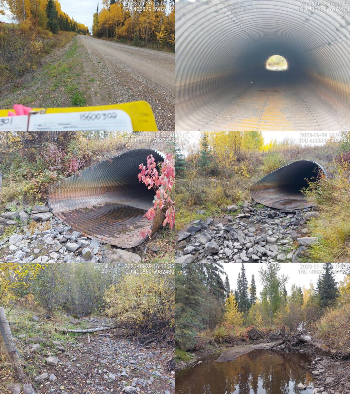 . From top left clockwise: Road/Site Card, Barrel, Outlet, Downstream, Upstream, Inlet.15600302 . From top left clockwise: Road/Site Card, Barrel, Outlet, Downstream, Upstream, Inlet.15600302
|
|||
| Comments: Wide stream channel, dewatered at time of survey. Small pool near outlet, no flowing water. Likely important migration corridor as this is a large system. MoTi chris_hwy_structure_road_id: 3743. 16:09:38 |
| Location and Stream Data |
|
Crossing Characteristics | – |
|---|---|---|---|
| Date | 2023-09-30 | Crossing Sub Type | Round Culvert |
| PSCIS ID | 199222 | Diameter (m) | 0.9 |
| External ID | 15600624 | Length (m) | 18 |
| Crew | MW | Embedded | No |
| UTM Zone | 10 | Depth Embedded (m) | – |
| Easting | 438428 | Resemble Channel | No |
| Northing | 5982155 | Backwatered | No |
| Stream | Neuro Creek | Percent Backwatered | – |
| Road | Ens Rd | Fill Depth (m) | 2.2 |
| Road Tenure | Vanderhoof | Outlet Drop (m) | 0 |
| Channel Width (m) | 0.9 | Outlet Pool Depth (m) | 0 |
| Stream Slope (%) | 1 | Inlet Drop | No |
| Beaver Activity | No | Slope (%) | 2.5 |
| Habitat Value | Low | Valley Fill | Deep Fill |
| Final score | 21 | Barrier Result | Barrier |
| Fix type | Replace Structure with Streambed Simulation CBS | Fix Span / Diameter | 3 |
Photos: PSCIS ID 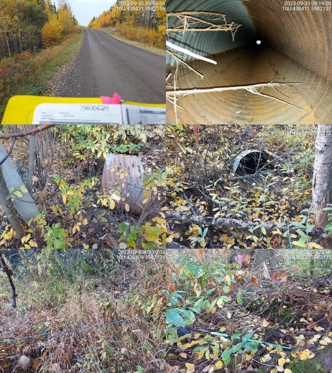 . From top left clockwise: Road/Site Card, Barrel, Outlet, Downstream, Upstream, Inlet.15600624 . From top left clockwise: Road/Site Card, Barrel, Outlet, Downstream, Upstream, Inlet.15600624
|
|||
| Comments: Dewatered at time of assessment. Very small and hard to find channel. Overgrown and little stream substrate present. Upstream fenced off on private land. . 09:24:18 |
| Location and Stream Data |
|
Crossing Characteristics | – |
|---|---|---|---|
| Date | 2023-09-30 | Crossing Sub Type | Round Culvert |
| PSCIS ID | 199223 | Diameter (m) | 1.5 |
| External ID | 15600626 | Length (m) | 20 |
| Crew | MW | Embedded | No |
| UTM Zone | 10 | Depth Embedded (m) | – |
| Easting | 438529 | Resemble Channel | No |
| Northing | 5982155 | Backwatered | No |
| Stream | Tributary to Neuco Creek | Percent Backwatered | – |
| Road | Ens Rd | Fill Depth (m) | 2 |
| Road Tenure | Vanderhoof | Outlet Drop (m) | 0.6 |
| Channel Width (m) | 1.6 | Outlet Pool Depth (m) | 0 |
| Stream Slope (%) | 0.5 | Inlet Drop | No |
| Beaver Activity | No | Slope (%) | 1 |
| Habitat Value | Low | Valley Fill | Deep Fill |
| Final score | 31 | Barrier Result | Barrier |
| Fix type | Replace Structure with Streambed Simulation CBS | Fix Span / Diameter | 3 |
Photos: PSCIS ID 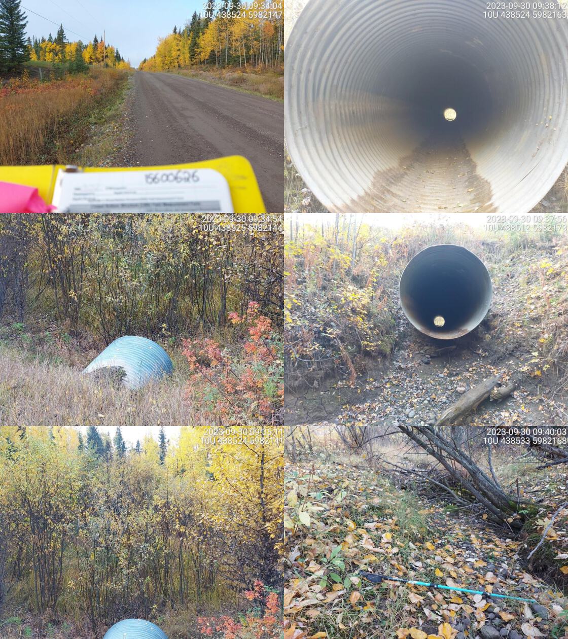 . From top left clockwise: Road/Site Card, Barrel, Outlet, Downstream, Upstream, Inlet.15600626 . From top left clockwise: Road/Site Card, Barrel, Outlet, Downstream, Upstream, Inlet.15600626
|
|||
| Comments: Dewatered stream. Upstream is in fenced off private land, no clear channel visible. More obvious channel downstream of crossing. Moderate outlet drop with big dry area that looks like it would be an outlet pool when the stream is flowing.. 09:45:55 |
| Location and Stream Data |
|
Crossing Characteristics | – |
|---|---|---|---|
| Date | 2023-09-30 | Crossing Sub Type | Round Culvert |
| PSCIS ID | 199224 | Diameter (m) | 1.8 |
| External ID | 15600076 | Length (m) | 48 |
| Crew | MW | Embedded | No |
| UTM Zone | 10 | Depth Embedded (m) | – |
| Easting | 449834 | Resemble Channel | No |
| Northing | 5977830 | Backwatered | No |
| Stream | Tributary to Hulatt Creek | Percent Backwatered | – |
| Road | Highway 16 | Fill Depth (m) | 5 |
| Road Tenure | MOTI | Outlet Drop (m) | 0 |
| Channel Width (m) | 1.2 | Outlet Pool Depth (m) | 0 |
| Stream Slope (%) | 1 | Inlet Drop | No |
| Beaver Activity | No | Slope (%) | 1 |
| Habitat Value | Low | Valley Fill | Deep Fill |
| Final score | 21 | Barrier Result | Barrier |
| Fix type | Replace Structure with Streambed Simulation CBS | Fix Span / Diameter | 3 |
Photos: PSCIS ID 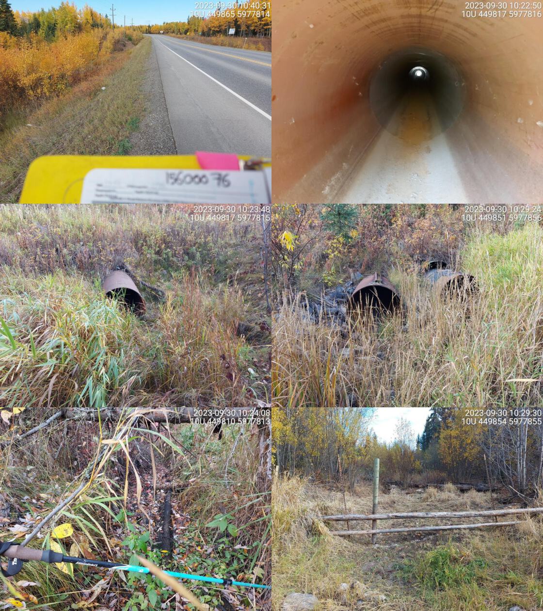 . From top left clockwise: Road/Site Card, Barrel, Outlet, Downstream, Upstream, Inlet.15600076 . From top left clockwise: Road/Site Card, Barrel, Outlet, Downstream, Upstream, Inlet.15600076
|
|||
| Comments: Two pipes, they are closer together at outlet compared to inlet so they must be bent in middle. Dewatered. Fenced off private land downstream. Little riparian and evidence of cattle trampling. Upstream is in better shape, small channel visible. MoTi chris_culvert_id: 1804941, 3693332. 10:17:48 |
| Location and Stream Data |
|
Crossing Characteristics | – |
|---|---|---|---|
| Date | 2023-09-30 | Crossing Sub Type | Round Culvert |
| PSCIS ID | 199225 | Diameter (m) | 1.5 |
| External ID | 15600629 | Length (m) | 90 |
| Crew | MW | Embedded | No |
| UTM Zone | 10 | Depth Embedded (m) | – |
| Easting | 451599 | Resemble Channel | No |
| Northing | 5975913 | Backwatered | No |
| Stream | Hulatt Creek | Percent Backwatered | – |
| Road | Highway 16 | Fill Depth (m) | 8 |
| Road Tenure | MOTI | Outlet Drop (m) | 0 |
| Channel Width (m) | 3.3 | Outlet Pool Depth (m) | 0 |
| Stream Slope (%) | 2 | Inlet Drop | No |
| Beaver Activity | No | Slope (%) | 3 |
| Habitat Value | Low | Valley Fill | Deep Fill |
| Final score | 32 | Barrier Result | Barrier |
| Fix type | Replace Structure with Streambed Simulation CBS | Fix Span / Diameter | 4.5 |
Photos: PSCIS ID 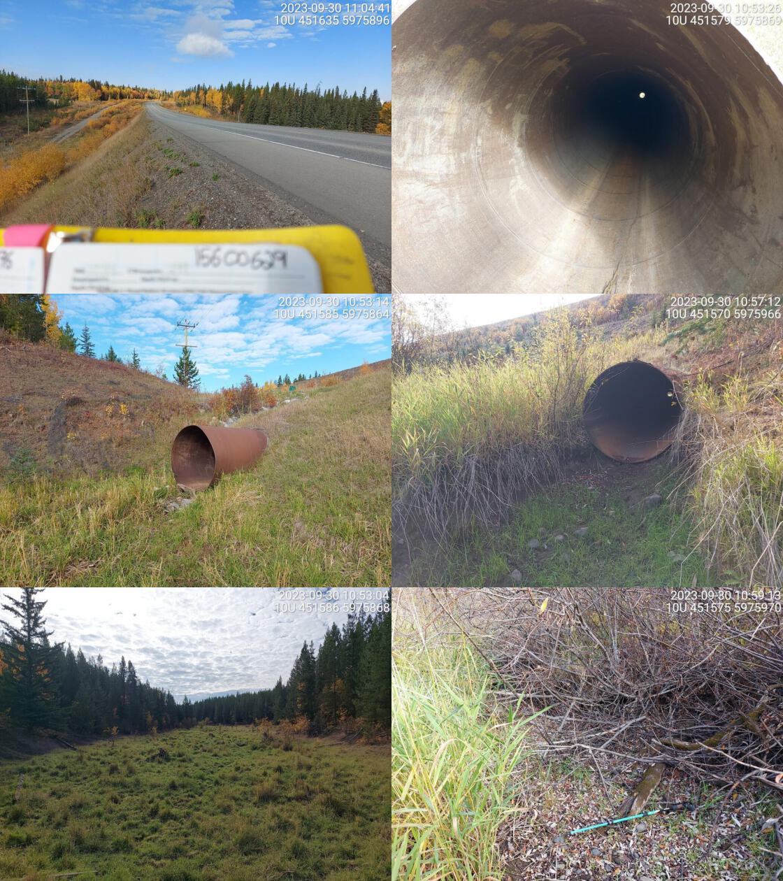 . From top left clockwise: Road/Site Card, Barrel, Outlet, Downstream, Upstream, Inlet.15600629 . From top left clockwise: Road/Site Card, Barrel, Outlet, Downstream, Upstream, Inlet.15600629
|
|||
| Comments: Dewatered. Fenced off private field upstream. Wide open grassy floodplain with little riparian and no channel visible. Downstream has wide area at outlet where pool used to be. Evidence of livestock trampling and/or big game near outlet. MoTi chris_culvert_id: 1804931. 11:06:49 |
| Location and Stream Data |
|
Crossing Characteristics | – |
|---|---|---|---|
| Date | 2023-09-30 | Crossing Sub Type | Round Culvert |
| PSCIS ID | 199226 | Diameter (m) | 2.4 |
| External ID | 15600057 | Length (m) | 66 |
| Crew | MW | Embedded | No |
| UTM Zone | 10 | Depth Embedded (m) | – |
| Easting | 464822 | Resemble Channel | No |
| Northing | 5971609 | Backwatered | No |
| Stream | Tributary to Cluculz Lake | Percent Backwatered | – |
| Road | Highway 16 | Fill Depth (m) | 5 |
| Road Tenure | MOTI | Outlet Drop (m) | 0 |
| Channel Width (m) | 2.6 | Outlet Pool Depth (m) | 0 |
| Stream Slope (%) | 0 | Inlet Drop | No |
| Beaver Activity | No | Slope (%) | 1 |
| Habitat Value | Medium | Valley Fill | Deep Fill |
| Final score | 24 | Barrier Result | Barrier |
| Fix type | Replace with New Open Bottom Structure | Fix Span / Diameter | 21 |
Photos: PSCIS ID 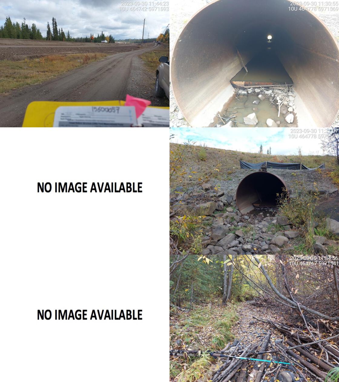 . From top left clockwise: Road/Site Card, Barrel, Outlet, Downstream, Upstream, Inlet.15600057 . From top left clockwise: Road/Site Card, Barrel, Outlet, Downstream, Upstream, Inlet.15600057
|
|||
| Comments: Culvert runs under active highway construction site. Inlet could not be accessed. Looks like they are excavating near inlet. Possible bridge construction? Stream is mostly dewatered but there is some stagnant water in culvert. Baffles in pipe. Habitat downstream looks good, with abundant woody debris and healthy riparian. MoTi chris_culvert_id: 1804902. 11:33:26 |
| Location and Stream Data |
|
Crossing Characteristics | – |
|---|---|---|---|
| Date | 2023-09-30 | Crossing Sub Type | Round Culvert |
| PSCIS ID | 199227 | Diameter (m) | 2.5 |
| External ID | 15603872 | Length (m) | 78 |
| Crew | MW | Embedded | No |
| UTM Zone | 10 | Depth Embedded (m) | – |
| Easting | 462928 | Resemble Channel | No |
| Northing | 5969213 | Backwatered | No |
| Stream | Norman Creek | Percent Backwatered | – |
| Road | Lloyd Dr | Fill Depth (m) | 5 |
| Road Tenure | MOTI Local | Outlet Drop (m) | 0 |
| Channel Width (m) | 3.1 | Outlet Pool Depth (m) | 0.3 |
| Stream Slope (%) | 3 | Inlet Drop | No |
| Beaver Activity | No | Slope (%) | 0 |
| Habitat Value | Medium | Valley Fill | Deep Fill |
| Final score | 19 | Barrier Result | Potential |
| Fix type | Replace with New Open Bottom Structure | Fix Span / Diameter | 21 |
Photos: PSCIS ID 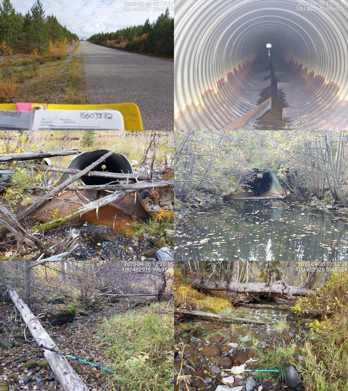 . From top left clockwise: Road/Site Card, Barrel, Outlet, Downstream, Upstream, Inlet.15603872 . From top left clockwise: Road/Site Card, Barrel, Outlet, Downstream, Upstream, Inlet.15603872
|
|||
| Comments: Numerous baffles in pipe. Smaller secondary culvert next to main pipe but installed higher up so likely doesn’t get much water. Little amount of flow in pipe but stops just short of outlet, most likely due to small split in pipe. Wide shallow outlet pool but no drop. Abundant algae on stream substrate upstream. RB and WSU confirmed up and downstream. MoTi chris_culvert_id: 1802792. 12:18:02 |
| Location and Stream Data |
|
Crossing Characteristics | – |
|---|---|---|---|
| Date | 2023-09-30 | Crossing Sub Type | Round Culvert |
| PSCIS ID | 199228 | Diameter (m) | 2 |
| External ID | 9902601 | Length (m) | 60 |
| Crew | MW | Embedded | No |
| UTM Zone | 10 | Depth Embedded (m) | – |
| Easting | 474705 | Resemble Channel | No |
| Northing | 5969325 | Backwatered | No |
| Stream | Tributary to Bednesti Lake | Percent Backwatered | – |
| Road | Highway 16 | Fill Depth (m) | 8 |
| Road Tenure | MOTI | Outlet Drop (m) | 0 |
| Channel Width (m) | 1.7 | Outlet Pool Depth (m) | 0 |
| Stream Slope (%) | 6 | Inlet Drop | No |
| Beaver Activity | No | Slope (%) | 3.5 |
| Habitat Value | Medium | Valley Fill | Deep Fill |
| Final score | 26 | Barrier Result | Barrier |
| Fix type | Replace Structure with Streambed Simulation CBS | Fix Span / Diameter | 3 |
Photos: PSCIS ID 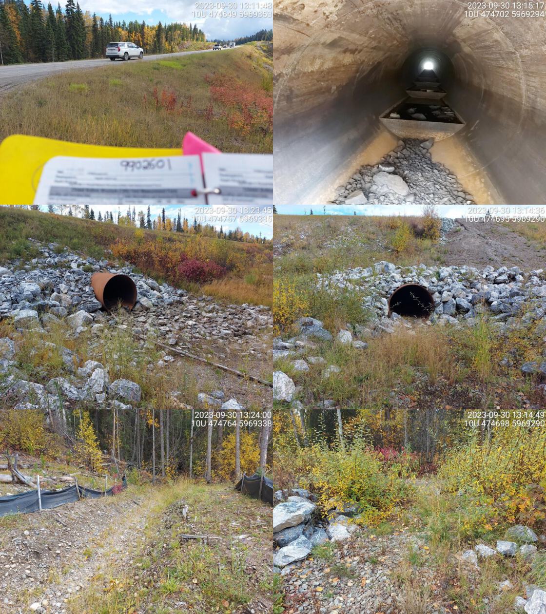 . From top left clockwise: Road/Site Card, Barrel, Outlet, Downstream, Upstream, Inlet.9902601 . From top left clockwise: Road/Site Card, Barrel, Outlet, Downstream, Upstream, Inlet.9902601
|
|||
| Comments: Dewatered upstream and downstream. Baffle steps in culvert containing pools with water but no flow. Efforts being made upstream to restore riparian vegetation with fencing and saplings present. No clear channel downstream. Fish confirmed upstream in 2020. MoTi chris_culvert_id: 1975143. 13:34:52 |
| Location and Stream Data |
|
Crossing Characteristics | – |
|---|---|---|---|
| Date | 2023-09-30 | Crossing Sub Type | Round Culvert |
| PSCIS ID | 199229 | Diameter (m) | 2.2 |
| External ID | 9903105 | Length (m) | 16 |
| Crew | MW | Embedded | No |
| UTM Zone | 10 | Depth Embedded (m) | – |
| Easting | 482695 | Resemble Channel | No |
| Northing | 5969819 | Backwatered | No |
| Stream | Zelkwas Creek | Percent Backwatered | – |
| Road | Isle Pierre Rd | Fill Depth (m) | 0.7 |
| Road Tenure | MOTI Local | Outlet Drop (m) | 0.1 |
| Channel Width (m) | 2.2 | Outlet Pool Depth (m) | 0.3 |
| Stream Slope (%) | 2 | Inlet Drop | No |
| Beaver Activity | No | Slope (%) | 1 |
| Habitat Value | Medium | Valley Fill | Deep Fill |
| Final score | 21 | Barrier Result | Barrier |
| Fix type | Replace with New Open Bottom Structure | Fix Span / Diameter | 15 |
Photos: PSCIS ID 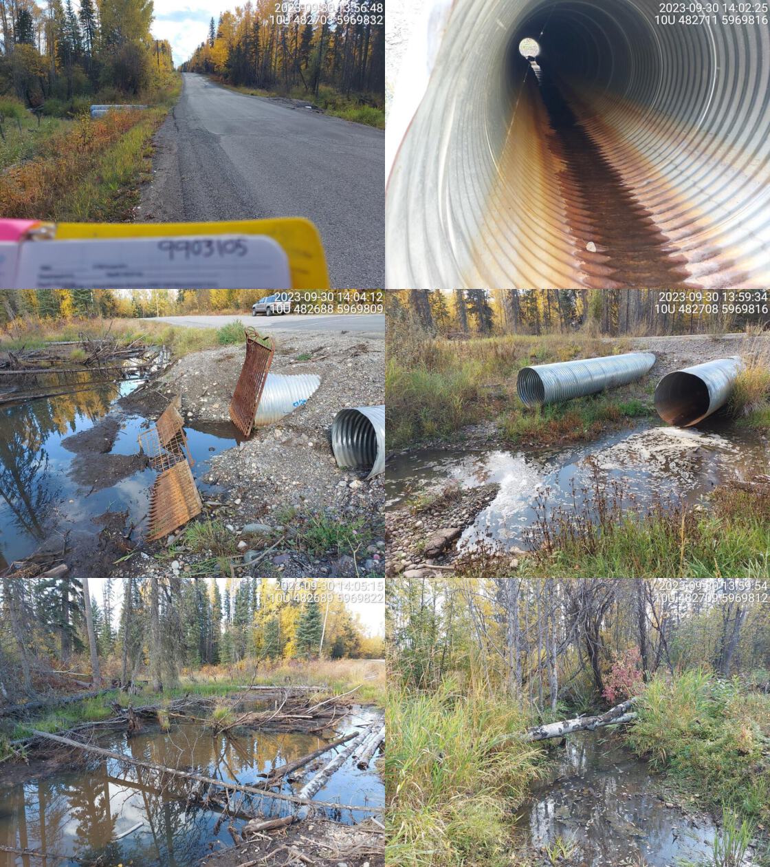 . From top left clockwise: Road/Site Card, Barrel, Outlet, Downstream, Upstream, Inlet.9903105 . From top left clockwise: Road/Site Card, Barrel, Outlet, Downstream, Upstream, Inlet.9903105
|
|||
| Comments: 2 pipes. Wetland area upstream, beaver grate on inlet. Signs of beaver activity, dam near outlet. Hard to determine stream channel width so used combined culvert diameter. Little trickle flowing through one pipe but other one is dewatered. Considered medium value habitat due to presence of suitale rearing habitat and water in drought period. MoTi chris_culvert_id: 1975493, 1975492. 14:05:44 |
| Location and Stream Data |
|
Crossing Characteristics | – |
|---|---|---|---|
| Date | 2023-09-30 | Crossing Sub Type | Round Culvert |
| PSCIS ID | 199230 | Diameter (m) | 1.7 |
| External ID | 9900404 | Length (m) | 56 |
| Crew | MW | Embedded | No |
| UTM Zone | 10 | Depth Embedded (m) | – |
| Easting | 494827 | Resemble Channel | No |
| Northing | 5963256 | Backwatered | No |
| Stream | Sweden Creek | Percent Backwatered | – |
| Road | Highway 16 | Fill Depth (m) | 6 |
| Road Tenure | MOTI | Outlet Drop (m) | 0.4 |
| Channel Width (m) | 2.2 | Outlet Pool Depth (m) | 0 |
| Stream Slope (%) | 1 | Inlet Drop | No |
| Beaver Activity | No | Slope (%) | 2 |
| Habitat Value | Medium | Valley Fill | Deep Fill |
| Final score | 34 | Barrier Result | Barrier |
| Fix type | Replace Structure with Streambed Simulation CBS | Fix Span / Diameter | 4.5 |
Photos: PSCIS ID 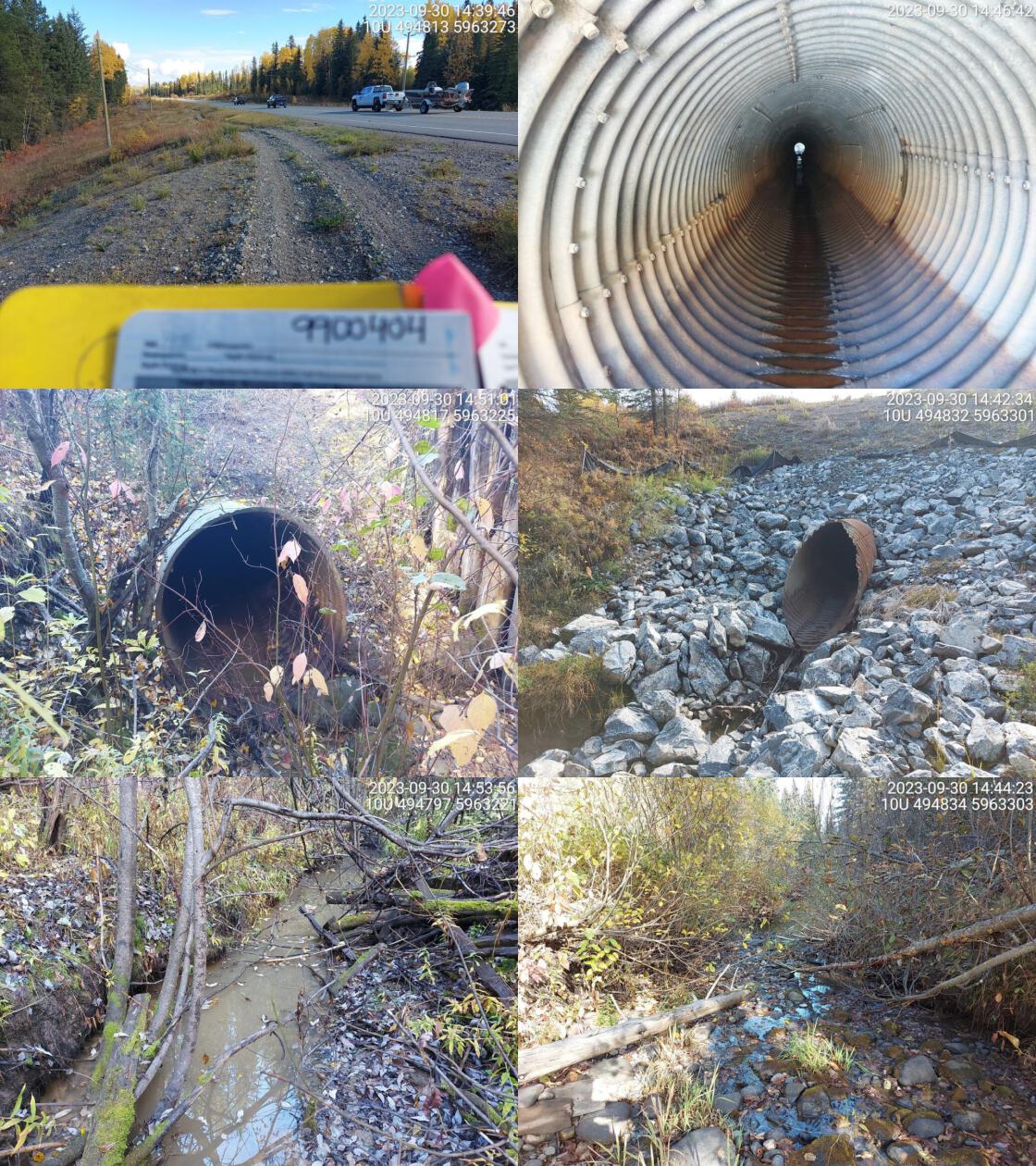 . From top left clockwise: Road/Site Card, Barrel, Outlet, Downstream, Upstream, Inlet.9900404 . From top left clockwise: Road/Site Card, Barrel, Outlet, Downstream, Upstream, Inlet.9900404
|
|||
| Comments: Outlet drop but no pool. Small amount of flow in pipe. Holes in bottom of pipe near outlet where water is flowing through and under. Very murky, turbid water upstream with no flow. Abundant boulders around outlet. MoTi chris_culvert_id: 3773627. 14:57:37 |
| Location and Stream Data |
|
Crossing Characteristics | – |
|---|---|---|---|
| Date | 2023-09-30 | Crossing Sub Type | Round Culvert |
| PSCIS ID | 199231 | Diameter (m) | 2.8 |
| External ID | 9900446 | Length (m) | 45 |
| Crew | MW | Embedded | No |
| UTM Zone | 10 | Depth Embedded (m) | – |
| Easting | 488990 | Resemble Channel | No |
| Northing | 5965724 | Backwatered | No |
| Stream | Kellogg Creek | Percent Backwatered | – |
| Road | Highway 16 | Fill Depth (m) | 5 |
| Road Tenure | MOTI | Outlet Drop (m) | 0.4 |
| Channel Width (m) | 4.1 | Outlet Pool Depth (m) | 2 |
| Stream Slope (%) | 1.5 | Inlet Drop | No |
| Beaver Activity | Yes | Slope (%) | 2 |
| Habitat Value | Medium | Valley Fill | Deep Fill |
| Final score | 37 | Barrier Result | Barrier |
| Fix type | Replace with New Open Bottom Structure | Fix Span / Diameter | 21 |
Photos: PSCIS ID 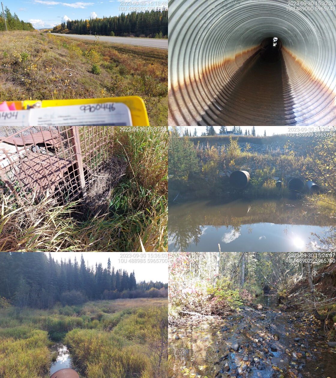 . From top left clockwise: Road/Site Card, Barrel, Outlet, Downstream, Upstream, Inlet.9900446 . From top left clockwise: Road/Site Card, Barrel, Outlet, Downstream, Upstream, Inlet.9900446
|
|||
| Comments: 4 pipes seen at outlet but only 2 bigger ones visible on inlet side. Only one big pipe has flowing water, has beaver grate on inlet. Small debris jam in front of inlet, likely from beaver. Upstream is grassy with little riparian on banks near crossing. Downstream is different, good habitat and wide channel. Very deep, wide outlet pool. Small fish seen in pool. No fish confirmed on system. MoTi chris_culvert_id: 3773624, 3773623, 1975211. 15:48:26 |
| Location and Stream Data |
|
Crossing Characteristics | – |
|---|---|---|---|
| Date | 2023-09-30 | Crossing Sub Type | Oval Culvert |
| PSCIS ID | 199232 | Diameter (m) | 6.5 |
| External ID | 9902577 | Length (m) | 26 |
| Crew | MW | Embedded | No |
| UTM Zone | 10 | Depth Embedded (m) | – |
| Easting | 502368 | Resemble Channel | No |
| Northing | 5962510 | Backwatered | No |
| Stream | Beaverley Creek | Percent Backwatered | – |
| Road | Highway 16 | Fill Depth (m) | 0.9 |
| Road Tenure | MOTI | Outlet Drop (m) | 0.6 |
| Channel Width (m) | 7.6 | Outlet Pool Depth (m) | 0.6 |
| Stream Slope (%) | 2.5 | Inlet Drop | No |
| Beaver Activity | No | Slope (%) | 3.5 |
| Habitat Value | High | Valley Fill | Deep Fill |
| Final score | 36 | Barrier Result | Barrier |
| Fix type | Replace with New Open Bottom Structure | Fix Span / Diameter | 15 |
Photos: PSCIS ID 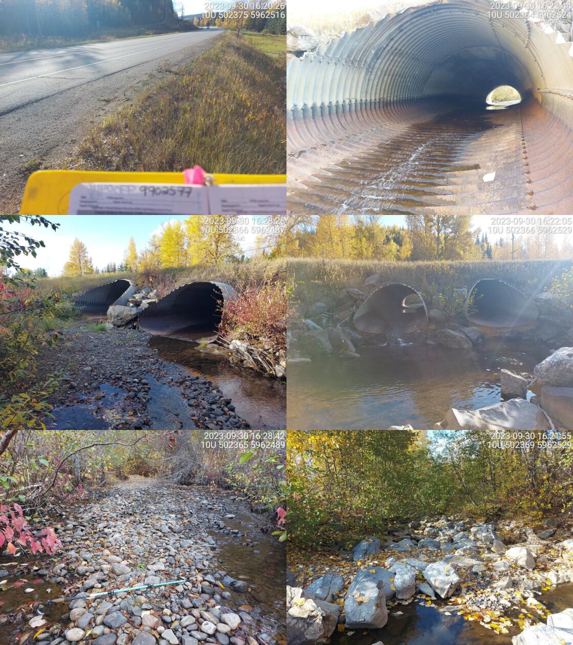 . From top left clockwise: Road/Site Card, Barrel, Outlet, Downstream, Upstream, Inlet.9902577 . From top left clockwise: Road/Site Card, Barrel, Outlet, Downstream, Upstream, Inlet.9902577
|
|||
| Comments: Chinook confirmed upstream in past. Two pipes, only one had water flowing through at time of survey. Small outlet drop. Abundant boulders present downstream. High value habitat upstream with wide channel and gravels present. MoTi chris_hwy_structure_road_id: 4166. 16:33:33 |
| Location and Stream Data |
|
Crossing Characteristics | – |
|---|---|---|---|
| Date | 2023-09-30 | Crossing Sub Type | Round Culvert |
| PSCIS ID | 199233 | Diameter (m) | 0.9 |
| External ID | 9900262 | Length (m) | 32 |
| Crew | MW | Embedded | No |
| UTM Zone | 10 | Depth Embedded (m) | – |
| Easting | 502603 | Resemble Channel | No |
| Northing | 5962435 | Backwatered | No |
| Stream | Little Beaverley Creek | Percent Backwatered | – |
| Road | Highway 16 | Fill Depth (m) | 2.5 |
| Road Tenure | MOTI | Outlet Drop (m) | 0 |
| Channel Width (m) | 0.8 | Outlet Pool Depth (m) | 0 |
| Stream Slope (%) | 2 | Inlet Drop | No |
| Beaver Activity | No | Slope (%) | 2 |
| Habitat Value | Medium | Valley Fill | Deep Fill |
| Final score | 21 | Barrier Result | Barrier |
| Fix type | Replace Structure with Streambed Simulation CBS | Fix Span / Diameter | 3 |
Photos: PSCIS ID 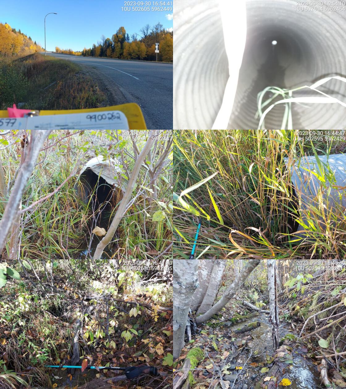 . From top left clockwise: Road/Site Card, Barrel, Outlet, Downstream, Upstream, Inlet.9900262 . From top left clockwise: Road/Site Card, Barrel, Outlet, Downstream, Upstream, Inlet.9900262
|
|||
| Comments: Two pipes but only one is functioning and has small amount of flow through it. Very small channel. Observed chinook in FISS downstream of confluence with Beaverley Creek at ~100m from the crossing and ~30m from the confluence. MoTi chris_culvert_id: 1975199. 16:46:37 |
| Location and Stream Data |
|
Crossing Characteristics | – |
|---|---|---|---|
| Date | 2023-10-01 | Crossing Sub Type | Round Culvert |
| PSCIS ID | 199234 | Diameter (m) | 0.6 |
| External ID | 9900380 | Length (m) | 22 |
| Crew | MW | Embedded | No |
| UTM Zone | 10 | Depth Embedded (m) | – |
| Easting | 500461 | Resemble Channel | No |
| Northing | 5958635 | Backwatered | No |
| Stream | Tributary to Chelako River | Percent Backwatered | – |
| Road | Upper Mud River Rd | Fill Depth (m) | 1 |
| Road Tenure | MOTI Local | Outlet Drop (m) | 1.5 |
| Channel Width (m) | 1.6 | Outlet Pool Depth (m) | 0.1 |
| Stream Slope (%) | 6 | Inlet Drop | No |
| Beaver Activity | No | Slope (%) | 4 |
| Habitat Value | Medium | Valley Fill | Deep Fill |
| Final score | 39 | Barrier Result | Barrier |
| Fix type | Replace Structure with Streambed Simulation CBS | Fix Span / Diameter | 3 |
Photos: PSCIS ID 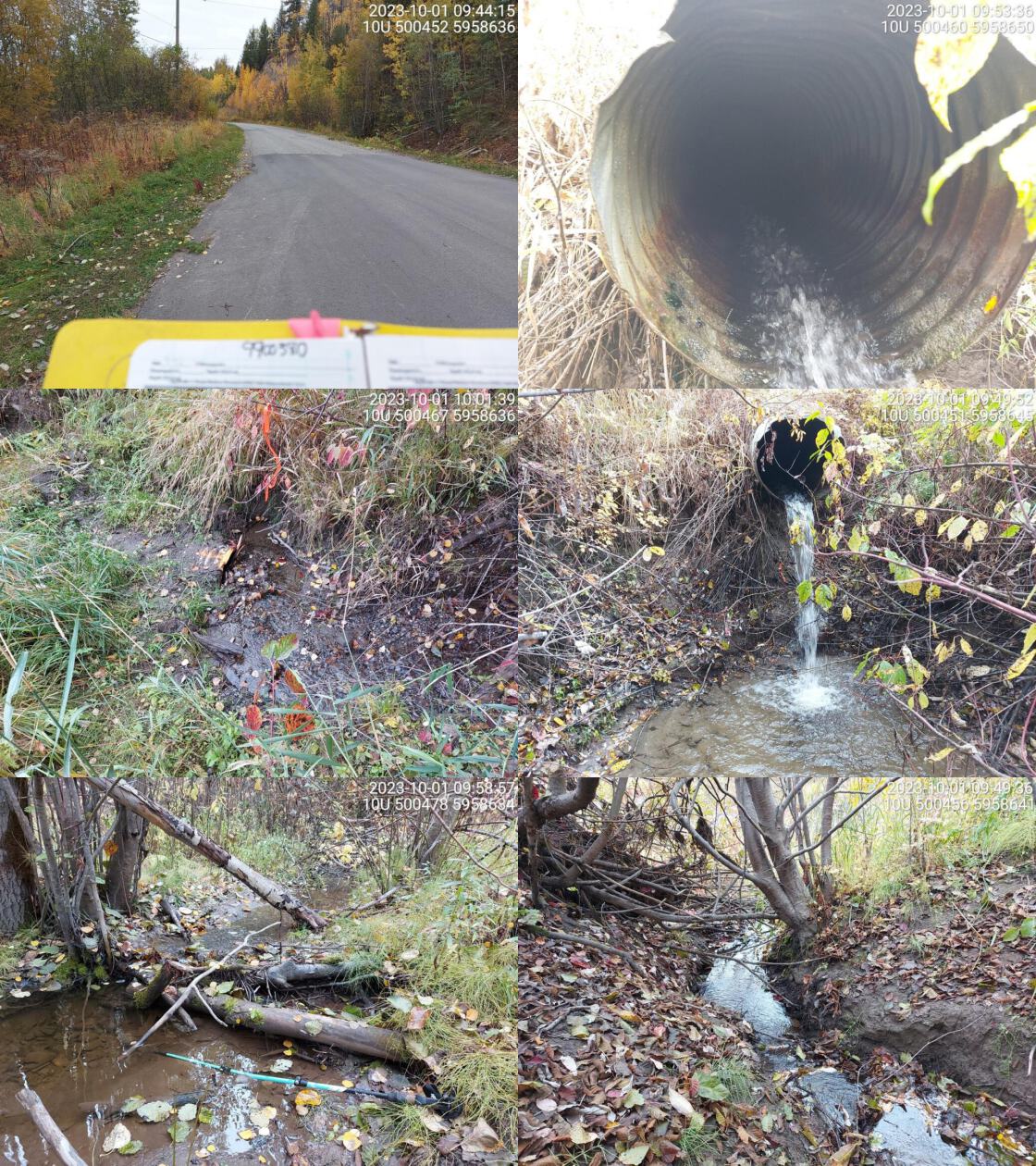 . From top left clockwise: Road/Site Card, Barrel, Outlet, Downstream, Upstream, Inlet.9900380 . From top left clockwise: Road/Site Card, Barrel, Outlet, Downstream, Upstream, Inlet.9900380
|
|||
| Comments: Small stream, very close to Chelako confluence. Large outlet drop but no deep outlet pool. Abundant gravels upstream. MoTi chris_culvert_id: 1975638. 09:45:56 |
| Location and Stream Data |
|
Crossing Characteristics | – |
|---|---|---|---|
| Date | 2023-10-01 | Crossing Sub Type | Round Culvert |
| PSCIS ID | 199235 | Diameter (m) | 0.6 |
| External ID | 9900385 | Length (m) | 15 |
| Crew | MW | Embedded | No |
| UTM Zone | 10 | Depth Embedded (m) | – |
| Easting | 496344 | Resemble Channel | No |
| Northing | 5954586 | Backwatered | No |
| Stream | Tributary to Chelako River | Percent Backwatered | – |
| Road | Upper Mud River Rd | Fill Depth (m) | 1.2 |
| Road Tenure | MOTI Local | Outlet Drop (m) | 0 |
| Channel Width (m) | 1.4 | Outlet Pool Depth (m) | 0 |
| Stream Slope (%) | 4.5 | Inlet Drop | No |
| Beaver Activity | No | Slope (%) | 3 |
| Habitat Value | Low | Valley Fill | Deep Fill |
| Final score | 29 | Barrier Result | Barrier |
| Fix type | Replace Structure with Streambed Simulation CBS | Fix Span / Diameter | 3 |
Photos: PSCIS ID 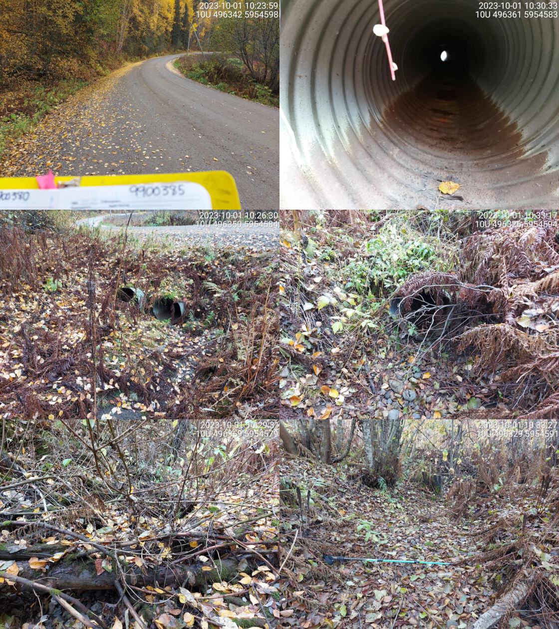 . From top left clockwise: Road/Site Card, Barrel, Outlet, Downstream, Upstream, Inlet.9900385 . From top left clockwise: Road/Site Card, Barrel, Outlet, Downstream, Upstream, Inlet.9900385
|
|||
| Comments: Dewatered stream, small channel with little to no gravels or cobbles. Two pipes but only one functioning. with other pipe is not visible at outlet. MoTi chris_culvert_id: 3389486. 10:26:08 |
| Location and Stream Data |
|
Crossing Characteristics | – |
|---|---|---|---|
| Date | 2023-10-01 | Crossing Sub Type | Round Culvert |
| PSCIS ID | 199236 | Diameter (m) | 2.5 |
| External ID | 9900277 | Length (m) | 20 |
| Crew | MW | Embedded | No |
| UTM Zone | 10 | Depth Embedded (m) | – |
| Easting | 508131 | Resemble Channel | No |
| Northing | 5960681 | Backwatered | No |
| Stream | Tributary to Beaverley Creek | Percent Backwatered | – |
| Road | East Beaverley Rd | Fill Depth (m) | 2 |
| Road Tenure | MOTI Local | Outlet Drop (m) | 0 |
| Channel Width (m) | 2.3 | Outlet Pool Depth (m) | 0 |
| Stream Slope (%) | 2 | Inlet Drop | No |
| Beaver Activity | Yes | Slope (%) | 1 |
| Habitat Value | Medium | Valley Fill | Deep Fill |
| Final score | 18 | Barrier Result | Potential |
| Fix type | Replace with New Open Bottom Structure | Fix Span / Diameter | 15 |
Photos: PSCIS ID 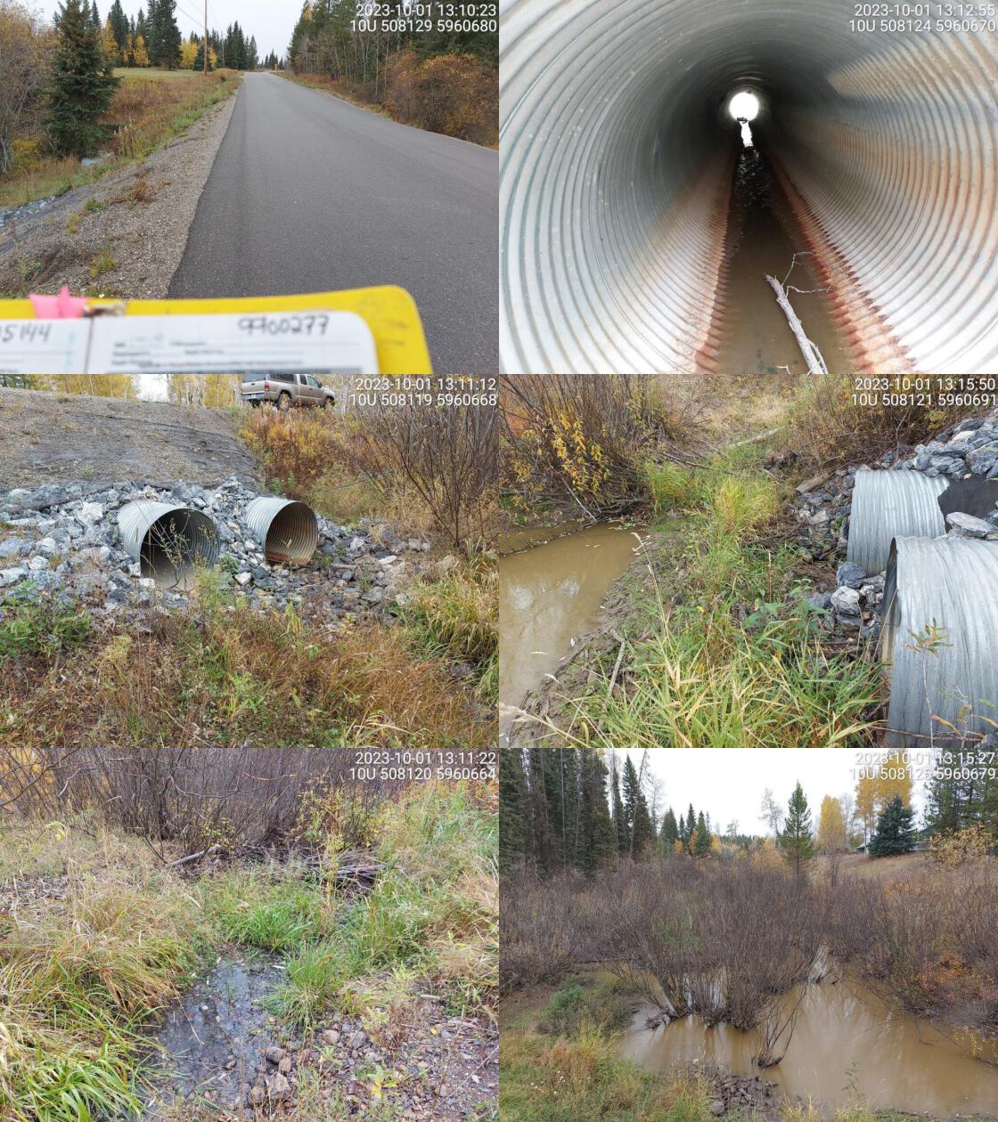 . From top left clockwise: Road/Site Card, Barrel, Outlet, Downstream, Upstream, Inlet.9900277 . From top left clockwise: Road/Site Card, Barrel, Outlet, Downstream, Upstream, Inlet.9900277
|
|||
| Comments: Two pipes and one overflow pipe. Small amount of flowing water through one pipe. Wetland type habitat downstream with beaver dam near outlet. Medium sized channel downstream with medium value habitat with functional woody debris and some gravels. MoTi chris_culvert_id: 1976123, 1976122. 13:17:26 |
| Location and Stream Data |
|
Crossing Characteristics | – |
|---|---|---|---|
| Date | 2023-09-12 | Crossing Sub Type | Oval Culvert |
| PSCIS ID | 199237 | Diameter (m) | 3.1 |
| External ID | 13900100 | Length (m) | 44 |
| Crew | AI | Embedded | No |
| UTM Zone | 10 | Depth Embedded (m) | – |
| Easting | 650774 | Resemble Channel | No |
| Northing | 5934861 | Backwatered | No |
| Stream | Snowshoe Creek | Percent Backwatered | – |
| Road | Highway 16a | Fill Depth (m) | 4.5 |
| Road Tenure | MOTI | Outlet Drop (m) | 0.35 |
| Channel Width (m) | 15 | Outlet Pool Depth (m) | 2 |
| Stream Slope (%) | 0.5 | Inlet Drop | No |
| Beaver Activity | No | Slope (%) | 2 |
| Habitat Value | High | Valley Fill | Deep Fill |
| Final score | 37 | Barrier Result | Barrier |
| Fix type | Replace with New Open Bottom Structure | Fix Span / Diameter | 19.5 |
Photos: PSCIS ID 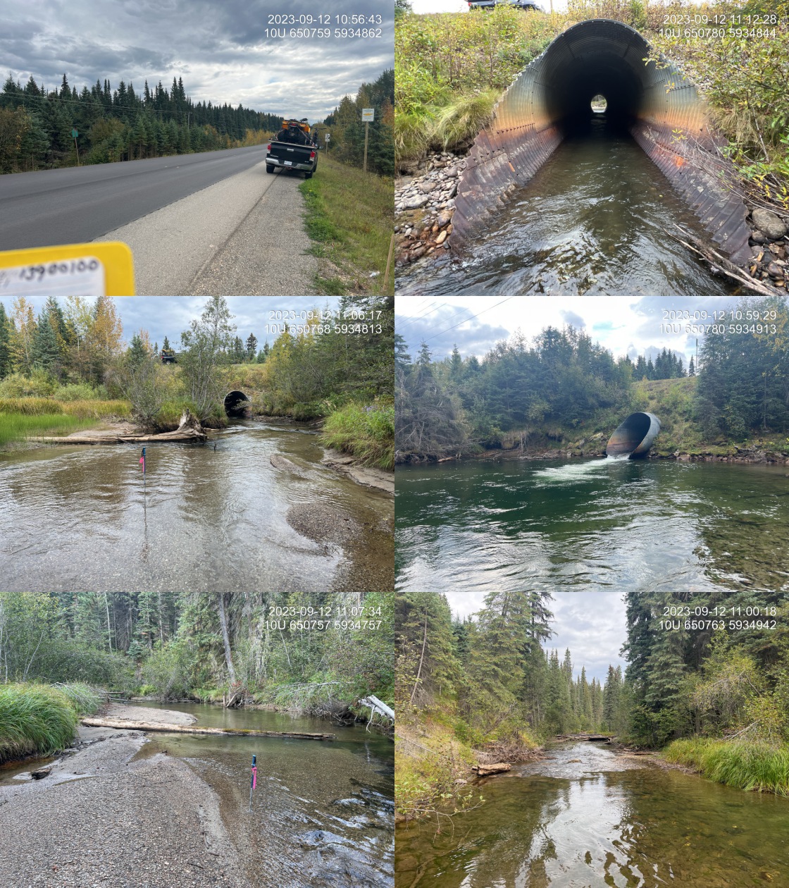 . From top left clockwise: Road/Site Card, Barrel, Outlet, Downstream, Upstream, Inlet.13900100 . From top left clockwise: Road/Site Card, Barrel, Outlet, Downstream, Upstream, Inlet.13900100
|
|||
| Comments: High value spawning and rearing habitat upstream. Massive outlet pool with erosion indicates culvert is extremely under sized. Candy et al 2002 notes chinoook spawning in this system. MoTi chris_hwy_structure_road_id: 3751. 17:54:33 |
| Location and Stream Data |
|
Crossing Characteristics | – |
|---|---|---|---|
| Date | 2023-10-03 | Crossing Sub Type | Round Culvert |
| PSCIS ID | 199238 | Diameter (m) | 0.6 |
| External ID | 13900026 | Length (m) | 10 |
| Crew | MW | Embedded | No |
| UTM Zone | 10 | Depth Embedded (m) | – |
| Easting | 611035 | Resemble Channel | No |
| Northing | 5968655 | Backwatered | No |
| Stream | Tributary to Fraser River | Percent Backwatered | – |
| Road | Penny Rd | Fill Depth (m) | 0.8 |
| Road Tenure | Unknown | Outlet Drop (m) | 0 |
| Channel Width (m) | 1.4 | Outlet Pool Depth (m) | 0 |
| Stream Slope (%) | 2 | Inlet Drop | No |
| Beaver Activity | No | Slope (%) | 3 |
| Habitat Value | Medium | Valley Fill | Deep Fill |
| Final score | 26 | Barrier Result | Barrier |
| Fix type | Replace Structure with Streambed Simulation CBS | Fix Span / Diameter | 3 |
Photos: PSCIS ID 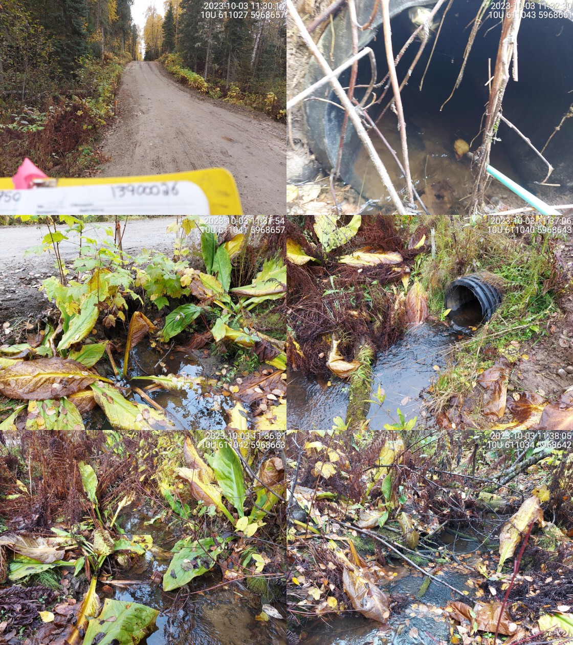 . From top left clockwise: Road/Site Card, Barrel, Outlet, Downstream, Upstream, Inlet.13900026 . From top left clockwise: Road/Site Card, Barrel, Outlet, Downstream, Upstream, Inlet.13900026
|
|||
| Comments: Small stream, overgrown with vegetation in sections. Pipe is made of plastic. Some gravels present, with moderate flow. Unassessed rail crossing just upstream that appears passable. Downstream crossings on private property.. 11:30:44 |
| Location and Stream Data |
|
Crossing Characteristics | – |
|---|---|---|---|
| Date | 2023-10-03 | Crossing Sub Type | Round Culvert |
| PSCIS ID | 199239 | Diameter (m) | 2.7 |
| External ID | 13905537 | Length (m) | 20 |
| Crew | AI | Embedded | No |
| UTM Zone | 10 | Depth Embedded (m) | – |
| Easting | 612146 | Resemble Channel | No |
| Northing | 5967655 | Backwatered | No |
| Stream | Tributary to Fraser River | Percent Backwatered | – |
| Road | Railway | Fill Depth (m) | 7 |
| Road Tenure | CN Rail | Outlet Drop (m) | 0.5 |
| Channel Width (m) | 3.3 | Outlet Pool Depth (m) | 0.3 |
| Stream Slope (%) | 0.5 | Inlet Drop | No |
| Beaver Activity | No | Slope (%) | 2.5 |
| Habitat Value | Medium | Valley Fill | Deep Fill |
| Final score | 31 | Barrier Result | Barrier |
| Fix type | Replace Structure with Streambed Simulation CBS | Fix Span / Diameter | 4.5 |
Photos: PSCIS ID 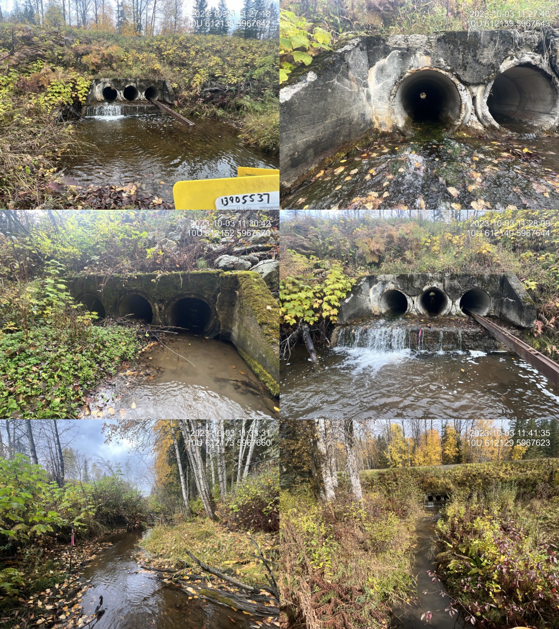 . From top left clockwise: Road/Site Card, Barrel, Outlet, Downstream, Upstream, Inlet.13905537 . From top left clockwise: Road/Site Card, Barrel, Outlet, Downstream, Upstream, Inlet.13905537
|
|||
| Comments: Three pipes at 0.9 m each, but only one has flowing water, other two are blocked by vegetation. Made of concrete and built in 1930. Nice stream with good flow. Abundant rearing habitat located upstream. Although the stream has a lot of volume, the depth in the one pipe functioning is extremely shallow and has a 50cm concrete drop at the outlet. This road is the only access to the town of Penny just downstream, therefore a wash out could leave them stranded.. 11:38:41 |
| Location and Stream Data |
|
Crossing Characteristics | – |
|---|---|---|---|
| Date | 2023-10-03 | Crossing Sub Type | Round Culvert |
| PSCIS ID | 199240 | Diameter (m) | 1.8 |
| External ID | 13900027 | Length (m) | 10 |
| Crew | AI | Embedded | No |
| UTM Zone | 10 | Depth Embedded (m) | – |
| Easting | 610540 | Resemble Channel | No |
| Northing | 5969263 | Backwatered | No |
| Stream | 72 Mile Creek | Percent Backwatered | – |
| Road | Penny Rd | Fill Depth (m) | 0.3 |
| Road Tenure | Unknown | Outlet Drop (m) | 0.2 |
| Channel Width (m) | 3.1 | Outlet Pool Depth (m) | 0.2 |
| Stream Slope (%) | 1 | Inlet Drop | No |
| Beaver Activity | No | Slope (%) | 1 |
| Habitat Value | Medium | Valley Fill | Deep Fill |
| Final score | 26 | Barrier Result | Barrier |
| Fix type | Replace with New Open Bottom Structure | Fix Span / Diameter | 15 |
Photos: PSCIS ID 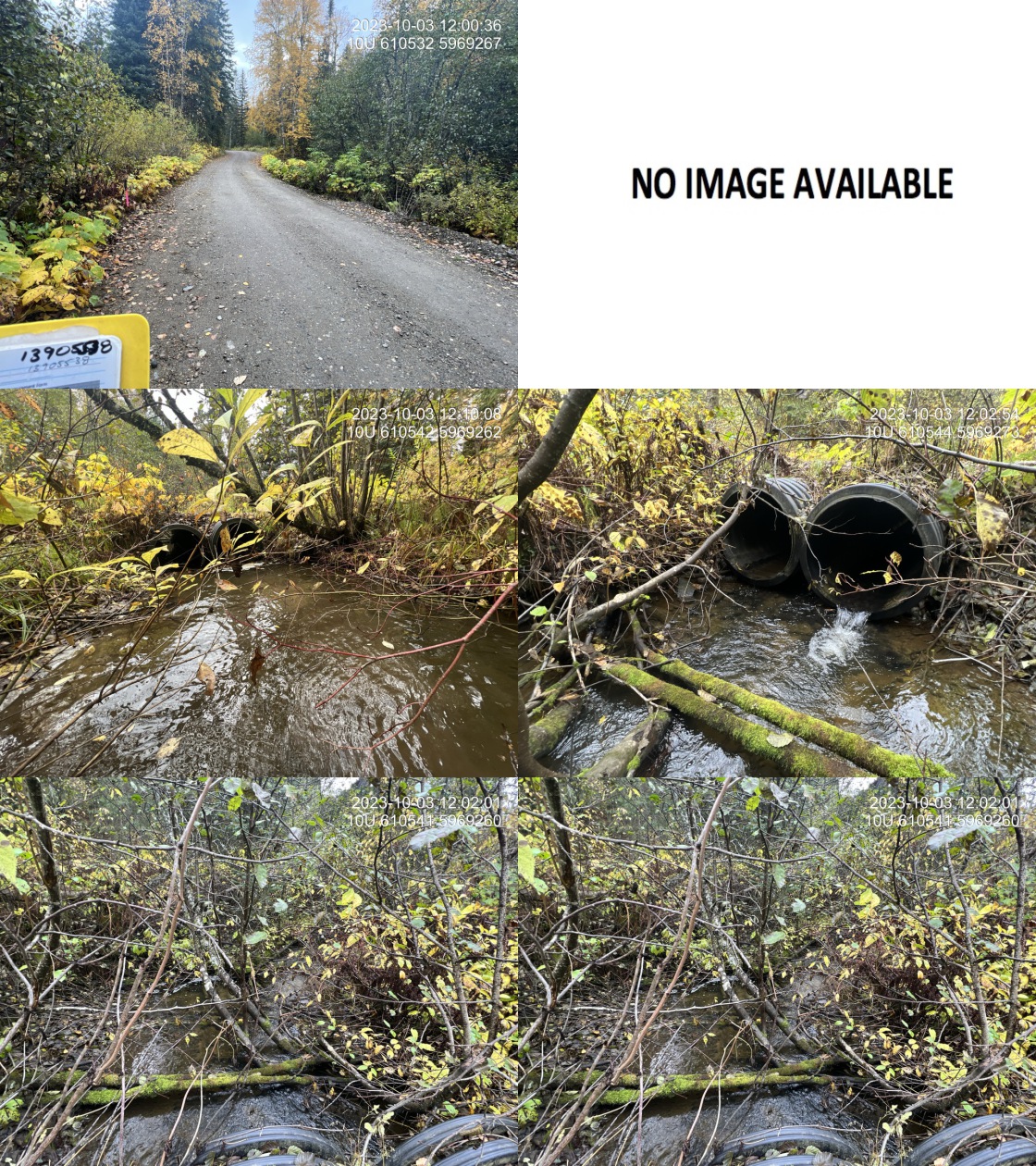 . From top left clockwise: Road/Site Card, Barrel, Outlet, Downstream, Upstream, Inlet.13900027 . From top left clockwise: Road/Site Card, Barrel, Outlet, Downstream, Upstream, Inlet.13900027
|
|||
| Comments: Two 0.9m pipes, both plastic. Nice stream with good flow. There is another culvert located downstream on the driveway to a private residence that has a small outlet drop (approximately 20cm). Some gravel is upstream of the railway. No barrel photos. Penny Street is the only vehicle access to and from the community of Penny located just up the road.. 12:00:42 |
| Location and Stream Data |
|
Crossing Characteristics | – |
|---|---|---|---|
| Date | 2023-10-03 | Crossing Sub Type | Round Culvert |
| PSCIS ID | 199241 | Diameter (m) | 1.8 |
| External ID | 13905538 | Length (m) | 31 |
| Crew | AI | Embedded | No |
| UTM Zone | 10 | Depth Embedded (m) | – |
| Easting | 610556 | Resemble Channel | No |
| Northing | 5969281 | Backwatered | No |
| Stream | Tributary to Fraser River | Percent Backwatered | – |
| Road | Railway | Fill Depth (m) | 9.9 |
| Road Tenure | CN Rail | Outlet Drop (m) | 0 |
| Channel Width (m) | 3.1 | Outlet Pool Depth (m) | 0.2 |
| Stream Slope (%) | 1 | Inlet Drop | No |
| Beaver Activity | No | Slope (%) | 0.5 |
| Habitat Value | Medium | Valley Fill | Deep Fill |
| Final score | 22 | Barrier Result | Barrier |
| Fix type | Replace Structure with Streambed Simulation CBS | Fix Span / Diameter | 4.5 |
Photos: PSCIS ID 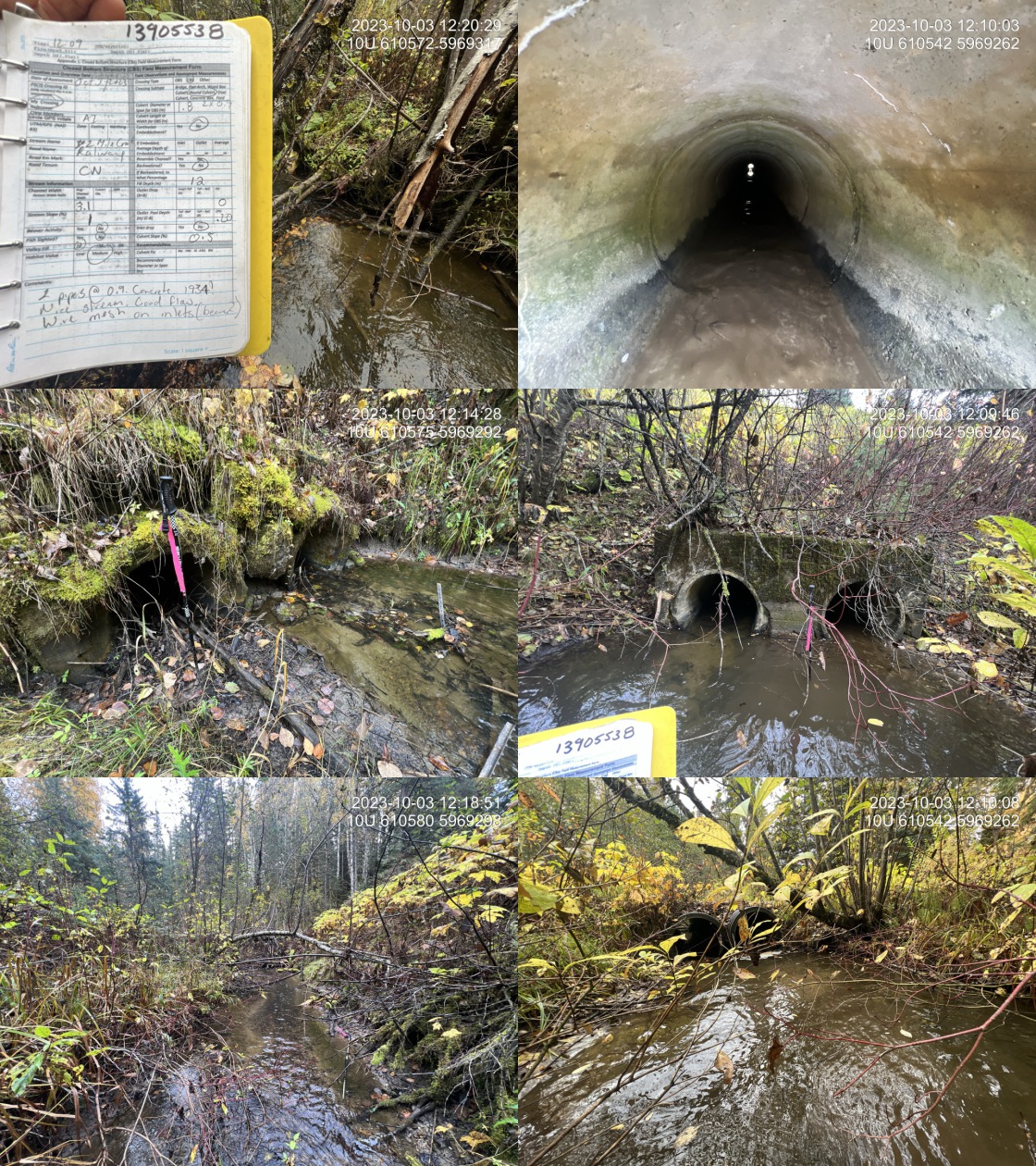 . From top left clockwise: Road/Site Card, Barrel, Outlet, Downstream, Upstream, Inlet.13905538 . From top left clockwise: Road/Site Card, Barrel, Outlet, Downstream, Upstream, Inlet.13905538
|
|||
| Comments: Two pipes made of concrete under the railway 0.9 m each. Crossing constructed in 1934. Nice stream good flow. Some small gravel’s located upstream. Wire mesh cages attached to inlets upstream - poentially for beaver. Fill depth measured at 12m, but changed to 9.9 to satisfy submission template macros.. 12:07:26 |
| Location and Stream Data |
|
Crossing Characteristics | – |
|---|---|---|---|
| Date | 2023-10-03 | Crossing Sub Type | Round Culvert |
| PSCIS ID | 199242 | Diameter (m) | 2 |
| External ID | 13900309 | Length (m) | 19 |
| Crew | MW | Embedded | No |
| UTM Zone | 10 | Depth Embedded (m) | – |
| Easting | 608028 | Resemble Channel | No |
| Northing | 5970651 | Backwatered | No |
| Stream | Tributary to Fraser River | Percent Backwatered | – |
| Road | Penny Rd | Fill Depth (m) | 1.6 |
| Road Tenure | Unknown | Outlet Drop (m) | 0.3 |
| Channel Width (m) | 3.8 | Outlet Pool Depth (m) | 1.2 |
| Stream Slope (%) | 1.5 | Inlet Drop | No |
| Beaver Activity | No | Slope (%) | 3 |
| Habitat Value | High | Valley Fill | Deep Fill |
| Final score | 39 | Barrier Result | Barrier |
| Fix type | Replace with New Open Bottom Structure | Fix Span / Diameter | 15 |
Photos: PSCIS ID 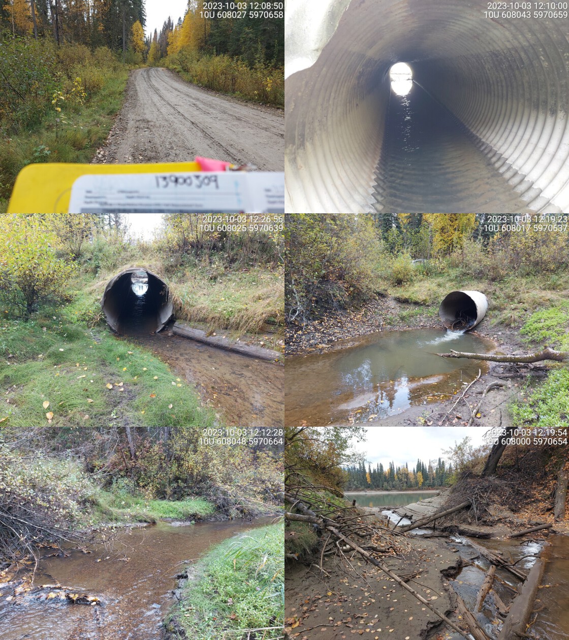 . From top left clockwise: Road/Site Card, Barrel, Outlet, Downstream, Upstream, Inlet.13900309 . From top left clockwise: Road/Site Card, Barrel, Outlet, Downstream, Upstream, Inlet.13900309
|
|||
| Comments: Predominantly fine substrate downstream but abundant gravels upstream as. Wide channel with good flow immediately adjacent to Fraser mainstem. Small debris jam near outlet, backwatering pipe. Does not appear to be a barrier to adults but could have value for juvenile rearing and potentially hindered access during high flow times when refuge needed. Sampling could help determine if chinook are accessing upstream. Very deep, muddy outlet pool. Unassessed railway crossing ~900m upstream.. 12:16:38 |
| Location and Stream Data |
|
Crossing Characteristics | – |
|---|---|---|---|
| Date | 2023-10-03 | Crossing Sub Type | Round Culvert |
| PSCIS ID | 199243 | Diameter (m) | 0.9 |
| External ID | 13900306 | Length (m) | 8 |
| Crew | AI | Embedded | No |
| UTM Zone | 10 | Depth Embedded (m) | – |
| Easting | 607661 | Resemble Channel | No |
| Northing | 5971153 | Backwatered | No |
| Stream | Tributary to Fraser River | Percent Backwatered | – |
| Road | Penny Rd | Fill Depth (m) | 2 |
| Road Tenure | Unknown | Outlet Drop (m) | 0 |
| Channel Width (m) | 3 | Outlet Pool Depth (m) | 0.7 |
| Stream Slope (%) | 0 | Inlet Drop | Yes |
| Beaver Activity | Yes | Slope (%) | 1 |
| Habitat Value | Medium | Valley Fill | Deep Fill |
| Final score | 21 | Barrier Result | Barrier |
| Fix type | Replace with New Open Bottom Structure | Fix Span / Diameter | 15 |
Photos: PSCIS ID 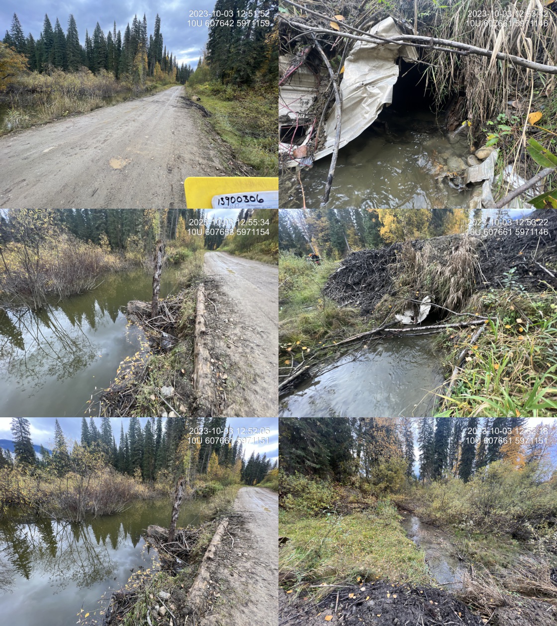 . From top left clockwise: Road/Site Card, Barrel, Outlet, Downstream, Upstream, Inlet.13900306 . From top left clockwise: Road/Site Card, Barrel, Outlet, Downstream, Upstream, Inlet.13900306
|
|||
| Comments: Wetland area upstream. Beaver exclusion cage on inlet but the cage is completely blocked with material so there is a wetland upstream. Appears to be recent maintenance on the site. Road prism is eroding at the location of the culvert with a piece of pipe set aside that has possibly been recently removed. Culvert slope estimated as could not see through the pipe. Unassessed railway crossing ~1.3km upstream.. 12:55:42 |
| Location and Stream Data |
|
Crossing Characteristics | – |
|---|---|---|---|
| Date | 2023-10-03 | Crossing Sub Type | Round Culvert |
| PSCIS ID | 199244 | Diameter (m) | 0.9 |
| External ID | 13900305 | Length (m) | 6 |
| Crew | AI | Embedded | No |
| UTM Zone | 10 | Depth Embedded (m) | – |
| Easting | 605976 | Resemble Channel | No |
| Northing | 5971827 | Backwatered | No |
| Stream | Tributary to Fraser River | Percent Backwatered | – |
| Road | Penny Rd | Fill Depth (m) | 0.5 |
| Road Tenure | Carrier R07924 | Outlet Drop (m) | 0 |
| Channel Width (m) | 2.2 | Outlet Pool Depth (m) | 0 |
| Stream Slope (%) | 2 | Inlet Drop | Yes |
| Beaver Activity | No | Slope (%) | 1 |
| Habitat Value | Low | Valley Fill | Deep Fill |
| Final score | 21 | Barrier Result | Barrier |
| Fix type | Replace with New Open Bottom Structure | Fix Span / Diameter | 15 |
Photos: PSCIS ID 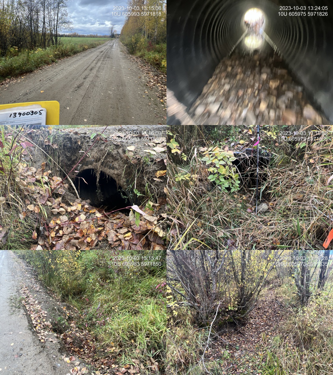 . From top left clockwise: Road/Site Card, Barrel, Outlet, Downstream, Upstream, Inlet.13900305 . From top left clockwise: Road/Site Card, Barrel, Outlet, Downstream, Upstream, Inlet.13900305
|
|||
| Comments: Stream dry the time assessment. Flows through agricultural field on both sides. Very minimal willow and cottonwood riparian. Stream is incorrectly mapped in the Freshwater Atlas and actually crosses under the road ~350m further east on Penny road. Satellite imagery shows there are signs of the old meandering channel near the FWA streamline, suggesting the stream may have been redirected at one point.Road embankment is sloughing around the inlet with pipe 50% blocked due to the road fill. Penny Road is the only access to the community of Penny.. 13:20:38 |
| Location and Stream Data |
|
Crossing Characteristics | – |
|---|---|---|---|
| Date | 2023-10-03 | Crossing Sub Type | Round Culvert |
| PSCIS ID | 199245 | Diameter (m) | 0.8 |
| External ID | 13903451 | Length (m) | 10 |
| Crew | MW | Embedded | No |
| UTM Zone | 10 | Depth Embedded (m) | – |
| Easting | 605208 | Resemble Channel | No |
| Northing | 5972373 | Backwatered | No |
| Stream | Tributary to Fraser River | Percent Backwatered | – |
| Road | Penny Rd | Fill Depth (m) | 1 |
| Road Tenure | Carrier R07924 | Outlet Drop (m) | 0.2 |
| Channel Width (m) | 1.4 | Outlet Pool Depth (m) | 0.2 |
| Stream Slope (%) | 2 | Inlet Drop | No |
| Beaver Activity | No | Slope (%) | 3 |
| Habitat Value | Medium | Valley Fill | Deep Fill |
| Final score | 31 | Barrier Result | Barrier |
| Fix type | Replace Structure with Streambed Simulation CBS | Fix Span / Diameter | 3 |
Photos: PSCIS ID 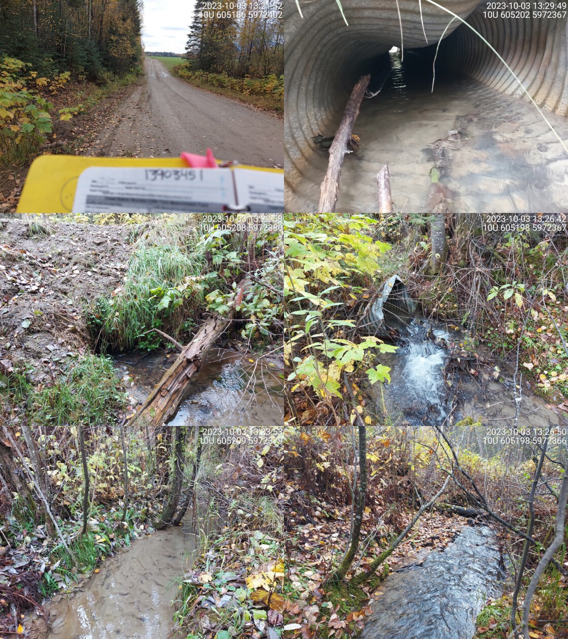 . From top left clockwise: Road/Site Card, Barrel, Outlet, Downstream, Upstream, Inlet.13903451 . From top left clockwise: Road/Site Card, Barrel, Outlet, Downstream, Upstream, Inlet.13903451
|
|||
| Comments: Small debris jam at outlet causing drop. Culvert is old and warped. Velocity is much higher in pipe than upstream. Predominantly fine substrate upstream, some gravels downstream.. 13:30:15 |
| Location and Stream Data |
|
Crossing Characteristics | – |
|---|---|---|---|
| Date | 2023-10-03 | Crossing Sub Type | Round Culvert |
| PSCIS ID | 199246 | Diameter (m) | 0.6 |
| External ID | 13903452 | Length (m) | 14 |
| Crew | AI | Embedded | No |
| UTM Zone | 10 | Depth Embedded (m) | – |
| Easting | 604828 | Resemble Channel | No |
| Northing | 5973094 | Backwatered | No |
| Stream | Tributary to Fraser River | Percent Backwatered | – |
| Road | Penny Rd | Fill Depth (m) | 1.5 |
| Road Tenure | Carrier R07924 | Outlet Drop (m) | 0.7 |
| Channel Width (m) | 3.2 | Outlet Pool Depth (m) | 0.6 |
| Stream Slope (%) | 2 | Inlet Drop | No |
| Beaver Activity | No | Slope (%) | 3 |
| Habitat Value | Medium | Valley Fill | Deep Fill |
| Final score | 36 | Barrier Result | Barrier |
| Fix type | Replace with New Open Bottom Structure | Fix Span / Diameter | 15 |
Photos: PSCIS ID 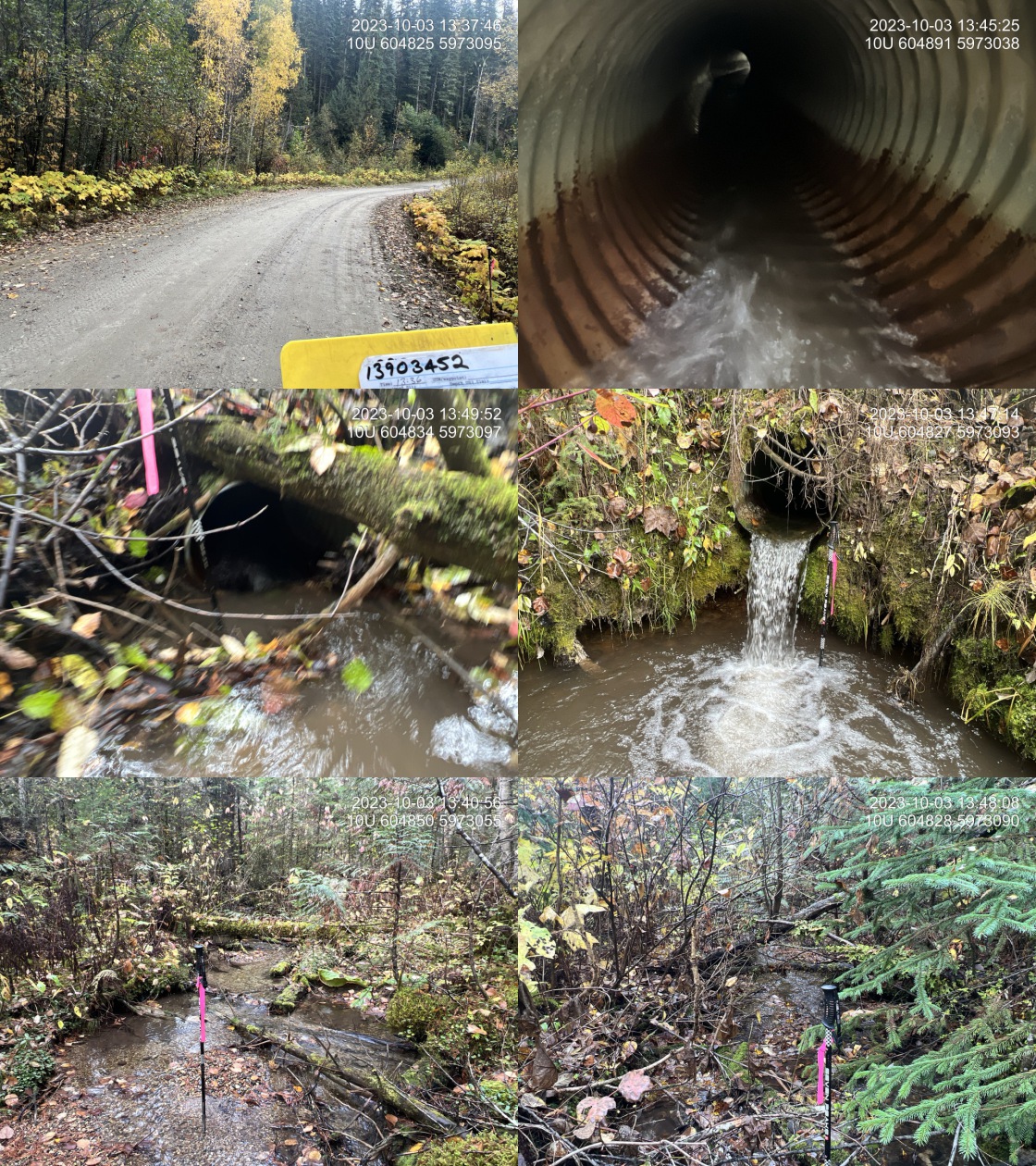 . From top left clockwise: Road/Site Card, Barrel, Outlet, Downstream, Upstream, Inlet.13903452 . From top left clockwise: Road/Site Card, Barrel, Outlet, Downstream, Upstream, Inlet.13903452
|
|||
| Comments: Very nice stream with abundant gravels and good flow upstream. Some old growth cedar within the upstream riparian area. Culvert must be bent in the middle because cannot see through. Pipe gradient estimated. Large outlet drop and deep outlet pool indicates culvert is extremely undersized. Penny Road is only access in and out of the community of Penny. Unassessed railway crossing ~300m upstream.. 13:38:13 |
| Location and Stream Data |
|
Crossing Characteristics | – |
|---|---|---|---|
| Date | 2023-10-03 | Crossing Sub Type | Round Culvert |
| PSCIS ID | 199247 | Diameter (m) | 1.3 |
| External ID | 13903450 | Length (m) | 10 |
| Crew | MW | Embedded | No |
| UTM Zone | 10 | Depth Embedded (m) | – |
| Easting | 604449 | Resemble Channel | No |
| Northing | 5973168 | Backwatered | No |
| Stream | Tributary to Fraser River | Percent Backwatered | – |
| Road | Penny Rd | Fill Depth (m) | 0.6 |
| Road Tenure | Carrier R07924 | Outlet Drop (m) | 0.5 |
| Channel Width (m) | 1.9 | Outlet Pool Depth (m) | 0.5 |
| Stream Slope (%) | 2 | Inlet Drop | No |
| Beaver Activity | Yes | Slope (%) | 4 |
| Habitat Value | Medium | Valley Fill | Deep Fill |
| Final score | 36 | Barrier Result | Barrier |
| Fix type | Replace Structure with Streambed Simulation CBS | Fix Span / Diameter | 3 |
Photos: PSCIS ID 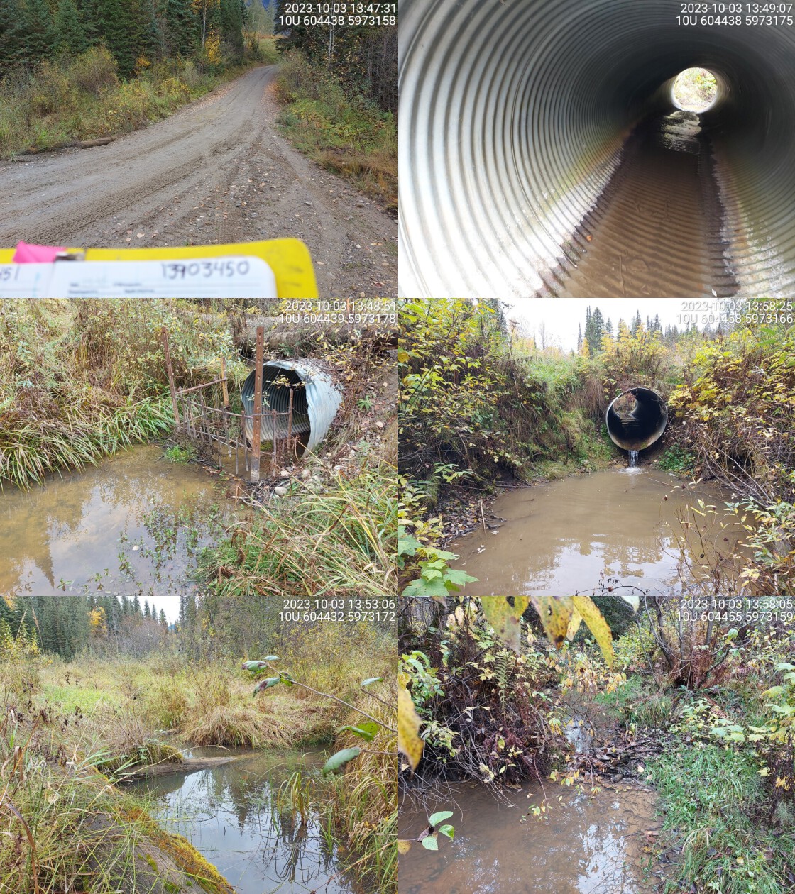 . From top left clockwise: Road/Site Card, Barrel, Outlet, Downstream, Upstream, Inlet.13903450 . From top left clockwise: Road/Site Card, Barrel, Outlet, Downstream, Upstream, Inlet.13903450
|
|||
| Comments: Beaver grate at inlet, moderate outlet drop and pool. Wetland type habitat upstream. Very turbid stream water.. 14:03:23 |
| Location and Stream Data |
|
Crossing Characteristics | – |
|---|---|---|---|
| Date | 2023-10-03 | Crossing Sub Type | Round Culvert |
| PSCIS ID | 199248 | Diameter (m) | 0.6 |
| External ID | 13903449 | Length (m) | 14 |
| Crew | AI | Embedded | No |
| UTM Zone | 10 | Depth Embedded (m) | – |
| Easting | 603342 | Resemble Channel | No |
| Northing | 5973549 | Backwatered | No |
| Stream | Tributary to Fraser River | Percent Backwatered | – |
| Road | Penny Rd | Fill Depth (m) | 1.1 |
| Road Tenure | Carrier R07924 | Outlet Drop (m) | 0.6 |
| Channel Width (m) | 0.7 | Outlet Pool Depth (m) | 0.65 |
| Stream Slope (%) | 1 | Inlet Drop | No |
| Beaver Activity | No | Slope (%) | 4 |
| Habitat Value | Low | Valley Fill | Deep Fill |
| Final score | 33 | Barrier Result | Barrier |
| Fix type | Replace Structure with Streambed Simulation CBS | Fix Span / Diameter | 3 |
Photos: PSCIS ID 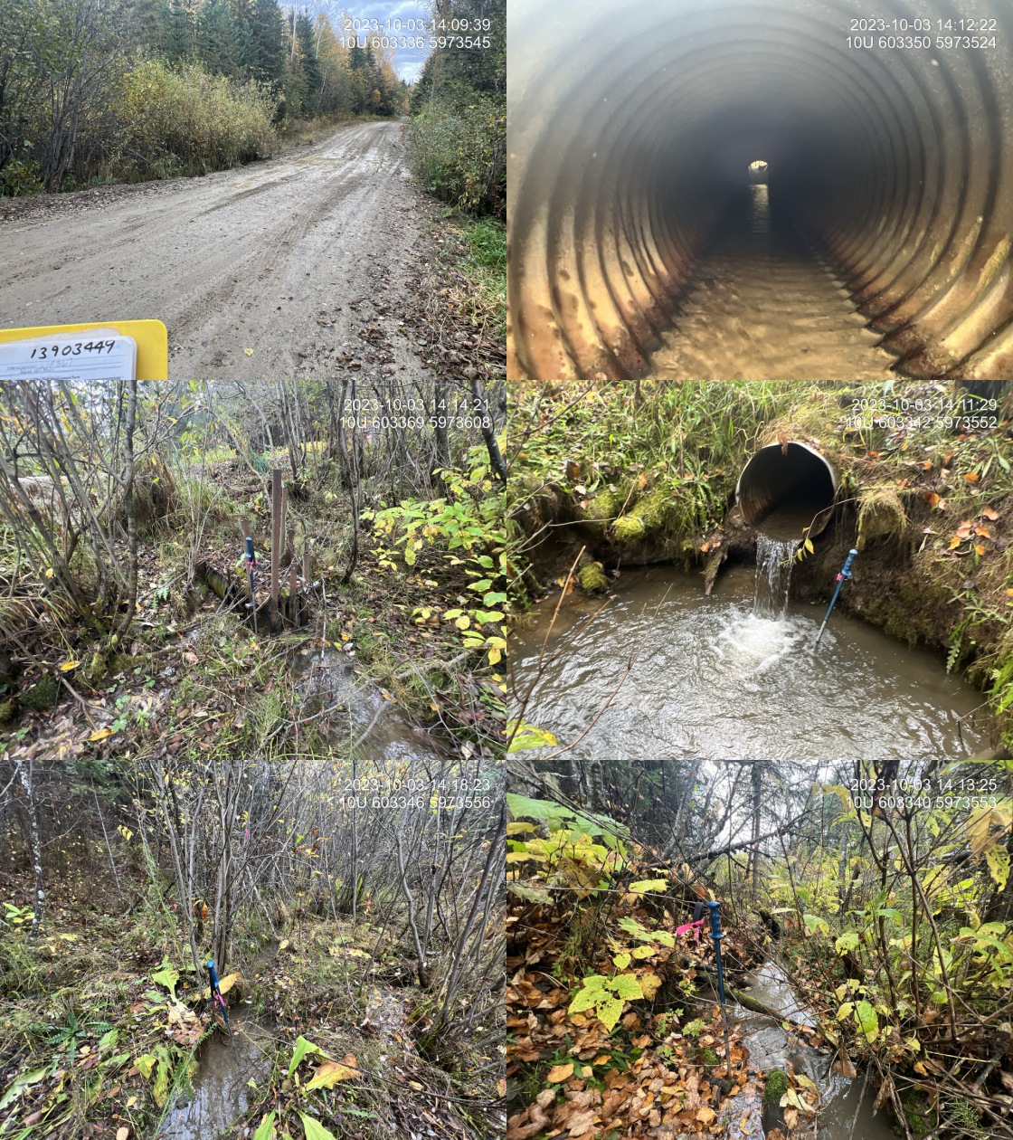 . From top left clockwise: Road/Site Card, Barrel, Outlet, Downstream, Upstream, Inlet.13903449 . From top left clockwise: Road/Site Card, Barrel, Outlet, Downstream, Upstream, Inlet.13903449
|
|||
| Comments: Good flow. Small channel with fine substrate. Pipe is bent up approximately 2m downstream of the inlet. Debris guard has been built around the inlet. Penny Road is the only access in and out of the community of Penny. Is 500m downstream to the fraser river confluence. with another crossing that should be considered.. 14:08:24 |
| Location and Stream Data |
|
Crossing Characteristics | – |
|---|---|---|---|
| Date | 2023-10-03 | Crossing Sub Type | Round Culvert |
| PSCIS ID | 199249 | Diameter (m) | 0.8 |
| External ID | 2023100301 | Length (m) | 11 |
| Crew | AI | Embedded | No |
| UTM Zone | 10 | Depth Embedded (m) | – |
| Easting | 601824 | Resemble Channel | No |
| Northing | 5974432 | Backwatered | No |
| Stream | Tributary to Read Creek | Percent Backwatered | – |
| Road | Gray Rd | Fill Depth (m) | 0.3 |
| Road Tenure | MOTI Local | Outlet Drop (m) | 0.08 |
| Channel Width (m) | 3.4 | Outlet Pool Depth (m) | 0.2 |
| Stream Slope (%) | 1.5 | Inlet Drop | No |
| Beaver Activity | No | Slope (%) | 2.5 |
| Habitat Value | Medium | Valley Fill | Deep Fill |
| Final score | 21 | Barrier Result | Barrier |
| Fix type | Replace with New Open Bottom Structure | Fix Span / Diameter | 15 |
Photos: PSCIS ID 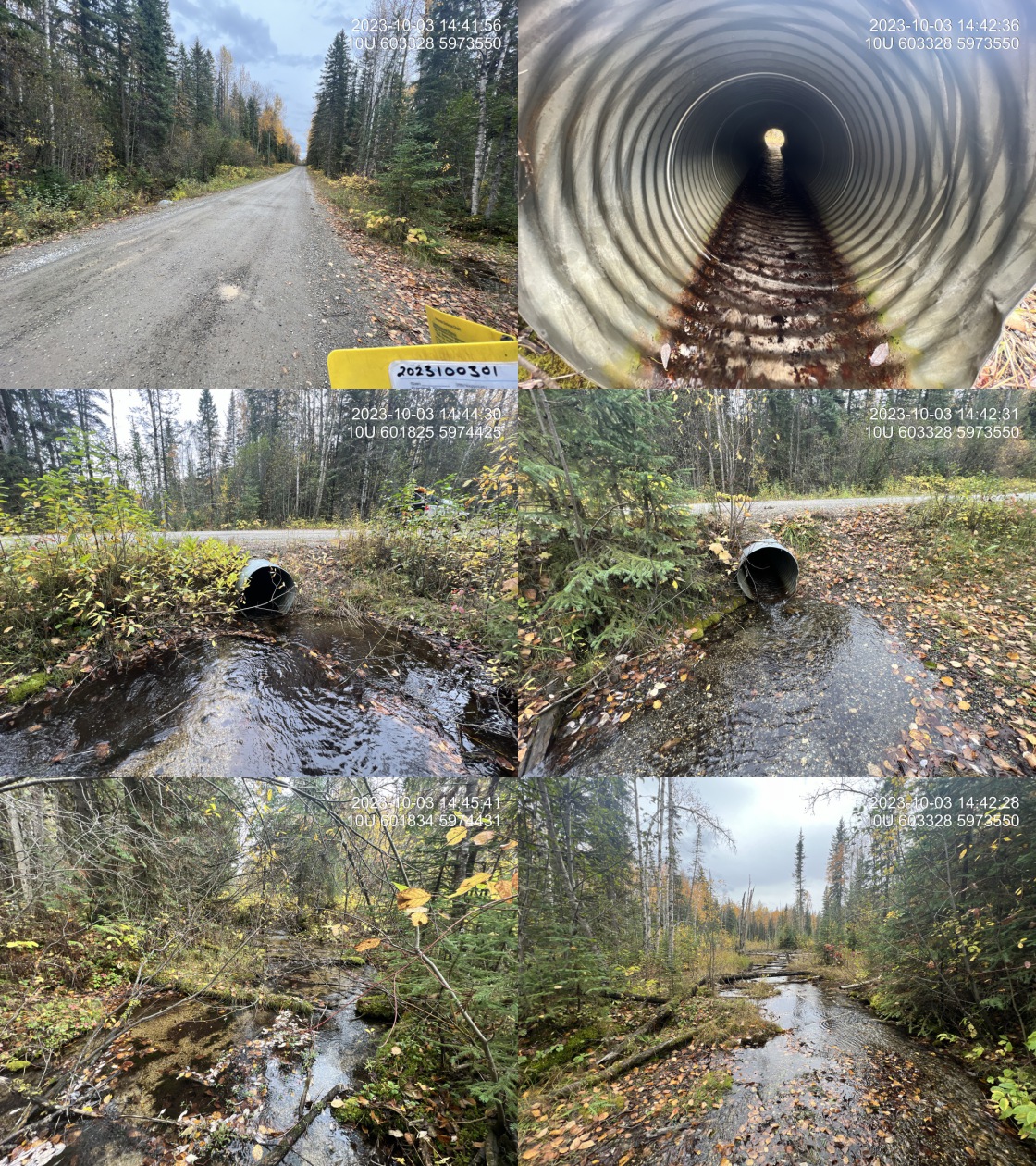 . From top left clockwise: Road/Site Card, Barrel, Outlet, Downstream, Upstream, Inlet.2023100301 . From top left clockwise: Road/Site Card, Barrel, Outlet, Downstream, Upstream, Inlet.2023100301
|
|||
| Comments: Stream not present at this location within freshwater atlas. Good flow and abundant, small gravels upstream and downstream. Although pipe appears undersized, the size and depth of the outlet pool indicates that it handles the flow decently well. MoTi chris_culvert_id: 1995103. 14:41:27 |
| Location and Stream Data |
|
Crossing Characteristics | – |
|---|---|---|---|
| Date | 2023-10-03 | Crossing Sub Type | Round Culvert |
| PSCIS ID | 199250 | Diameter (m) | 0.9 |
| External ID | 13900052 | Length (m) | 18 |
| Crew | MW | Embedded | No |
| UTM Zone | 10 | Depth Embedded (m) | – |
| Easting | 587885 | Resemble Channel | No |
| Northing | 5985390 | Backwatered | No |
| Stream | Robinson Creek | Percent Backwatered | – |
| Road | Upper Fraser Rd | Fill Depth (m) | 1 |
| Road Tenure | MOTI | Outlet Drop (m) | 0 |
| Channel Width (m) | 1.6 | Outlet Pool Depth (m) | 0 |
| Stream Slope (%) | 2.5 | Inlet Drop | No |
| Beaver Activity | No | Slope (%) | 3 |
| Habitat Value | Medium | Valley Fill | Deep Fill |
| Final score | 29 | Barrier Result | Barrier |
| Fix type | Replace Structure with Streambed Simulation CBS | Fix Span / Diameter | 3 |
Photos: PSCIS ID 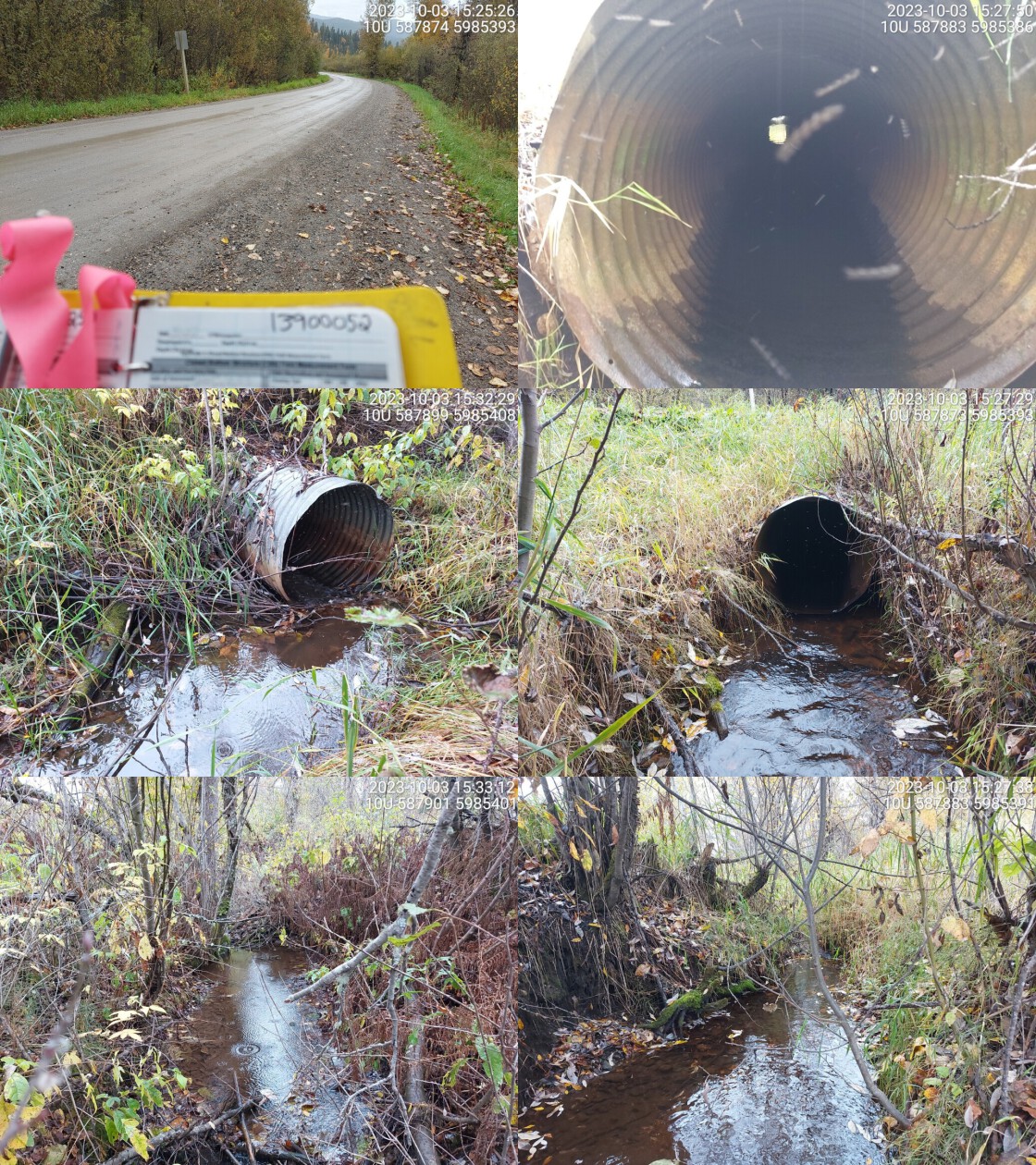 . From top left clockwise: Road/Site Card, Barrel, Outlet, Downstream, Upstream, Inlet.13900052 . From top left clockwise: Road/Site Card, Barrel, Outlet, Downstream, Upstream, Inlet.13900052
|
|||
| Comments: Small channel with no outlet drop or pool. Moderate flow and a lot of grassy vegetation on stream banks downstream. MoTi chris_culvert_id: 1994901. 15:31:18 |
| Location and Stream Data |
|
Crossing Characteristics | – |
|---|---|---|---|
| Date | 2023-10-03 | Crossing Sub Type | Round Culvert |
| PSCIS ID | 199251 | Diameter (m) | 0.9 |
| External ID | 13905581 | Length (m) | 12 |
| Crew | MW | Embedded | No |
| UTM Zone | 10 | Depth Embedded (m) | – |
| Easting | 587975 | Resemble Channel | No |
| Northing | 5985293 | Backwatered | No |
| Stream | Robinson Creek | Percent Backwatered | – |
| Road | Rail | Fill Depth (m) | 1.2 |
| Road Tenure | CN Rail | Outlet Drop (m) | 0 |
| Channel Width (m) | 1.1 | Outlet Pool Depth (m) | 0 |
| Stream Slope (%) | 2 | Inlet Drop | No |
| Beaver Activity | No | Slope (%) | 1 |
| Habitat Value | Low | Valley Fill | Deep Fill |
| Final score | 18 | Barrier Result | Potential |
| Fix type | Replace Structure with Streambed Simulation CBS | Fix Span / Diameter | 3 |
Photos: PSCIS ID 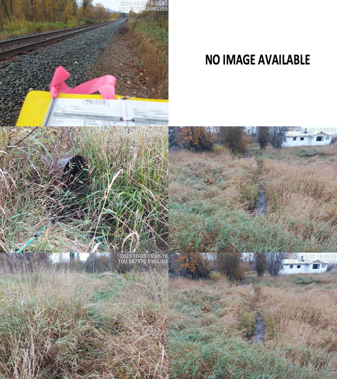 . From top left clockwise: Road/Site Card, Barrel, Outlet, Downstream, Upstream, Inlet.13905581 . From top left clockwise: Road/Site Card, Barrel, Outlet, Downstream, Upstream, Inlet.13905581
|
|||
| Comments: Grassy vegetation upstream and downstream, little to no riparian. Runs through private property downstream. Small channel with low flow.. 16:11:20 |
| Location and Stream Data |
|
Crossing Characteristics | – |
|---|---|---|---|
| Date | 2023-10-03 | Crossing Sub Type | Round Culvert |
| PSCIS ID | 199252 | Diameter (m) | 0.8 |
| External ID | 13900094 | Length (m) | 20 |
| Crew | AI | Embedded | No |
| UTM Zone | 10 | Depth Embedded (m) | – |
| Easting | 584227 | Resemble Channel | No |
| Northing | 5988493 | Backwatered | No |
| Stream | Tributary to Fraser River | Percent Backwatered | – |
| Road | Upper Fraser Road | Fill Depth (m) | 1.2 |
| Road Tenure | MOTI | Outlet Drop (m) | 0 |
| Channel Width (m) | 1.8 | Outlet Pool Depth (m) | 0.2 |
| Stream Slope (%) | 4.5 | Inlet Drop | No |
| Beaver Activity | Yes | Slope (%) | 2 |
| Habitat Value | Medium | Valley Fill | Deep Fill |
| Final score | 24 | Barrier Result | Barrier |
| Fix type | Replace Structure with Streambed Simulation CBS | Fix Span / Diameter | 3 |
Photos: PSCIS ID 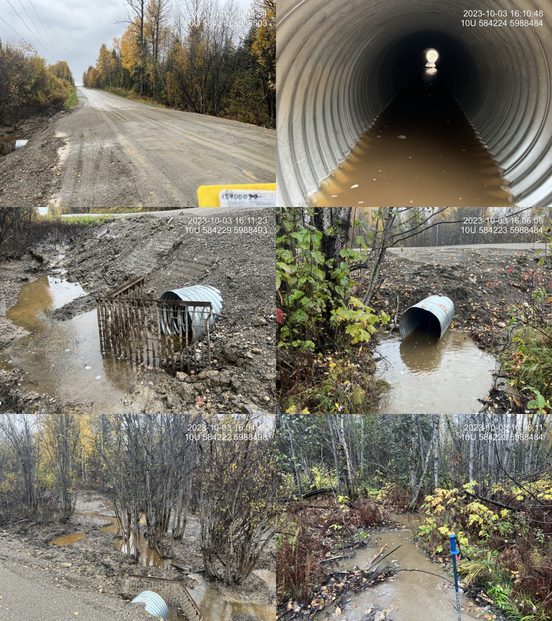 . From top left clockwise: Road/Site Card, Barrel, Outlet, Downstream, Upstream, Inlet.13900094 . From top left clockwise: Road/Site Card, Barrel, Outlet, Downstream, Upstream, Inlet.13900094
|
|||
| Comments: Newly installed pipe. Good flow with beaver activity prevalent upstream and downstream. MoTi chris_culvert_id: 1994777. 16:14:28 |
| Location and Stream Data |
|
Crossing Characteristics | – |
|---|---|---|---|
| Date | 2023-10-03 | Crossing Sub Type | Round Culvert |
| PSCIS ID | 199253 | Diameter (m) | 1.05 |
| External ID | 13903446 | Length (m) | 17 |
| Crew | AI | Embedded | No |
| UTM Zone | 10 | Depth Embedded (m) | – |
| Easting | 582480 | Resemble Channel | No |
| Northing | 5989487 | Backwatered | No |
| Stream | Tributary to Fraser River | Percent Backwatered | – |
| Road | Upper Fraser Road | Fill Depth (m) | 1.6 |
| Road Tenure | MOTI | Outlet Drop (m) | 0.05 |
| Channel Width (m) | 2 | Outlet Pool Depth (m) | 0.2 |
| Stream Slope (%) | 1 | Inlet Drop | No |
| Beaver Activity | No | Slope (%) | 2.5 |
| Habitat Value | Medium | Valley Fill | Deep Fill |
| Final score | 24 | Barrier Result | Barrier |
| Fix type | Replace with New Open Bottom Structure | Fix Span / Diameter | 15 |
Photos: PSCIS ID 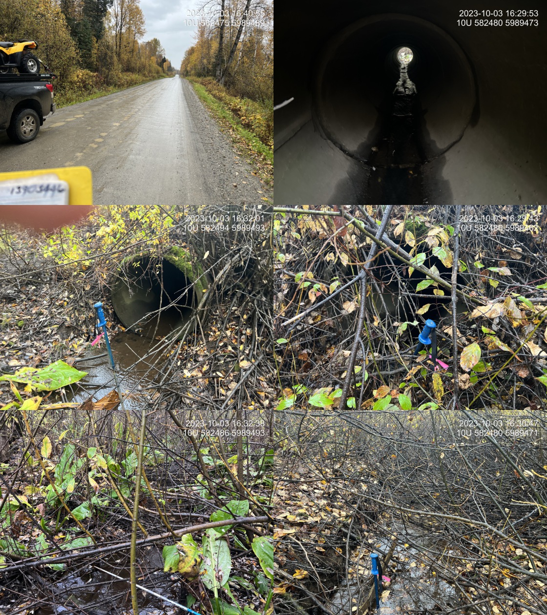 . From top left clockwise: Road/Site Card, Barrel, Outlet, Downstream, Upstream, Inlet.13903446 . From top left clockwise: Road/Site Card, Barrel, Outlet, Downstream, Upstream, Inlet.13903446
|
|||
| Comments: Concrete pipe. Smaller stream with some flow. Chinook observations upstream and downstream of this crossing in FISS. Located on Upper Fraser Road which is only access to communities beyond including town of Penny. MoTi chris_culvert_id: 1994747. 16:28:14 |
| Location and Stream Data |
|
Crossing Characteristics | – |
|---|---|---|---|
| Date | 2023-10-03 | Crossing Sub Type | Round Culvert |
| PSCIS ID | 199254 | Diameter (m) | 0.95 |
| External ID | 13900043 | Length (m) | 54 |
| Crew | MW | Embedded | No |
| UTM Zone | 10 | Depth Embedded (m) | – |
| Easting | 569895 | Resemble Channel | No |
| Northing | 5996572 | Backwatered | No |
| Stream | Tributary to Fraser River | Percent Backwatered | – |
| Road | Upper Fraser Rd | Fill Depth (m) | 4 |
| Road Tenure | MOTI | Outlet Drop (m) | 0.6 |
| Channel Width (m) | 2.3 | Outlet Pool Depth (m) | 0.2 |
| Stream Slope (%) | 4 | Inlet Drop | No |
| Beaver Activity | No | Slope (%) | 2 |
| Habitat Value | Medium | Valley Fill | Deep Fill |
| Final score | 37 | Barrier Result | Barrier |
| Fix type | Replace with New Open Bottom Structure | Fix Span / Diameter | 18 |
Photos: PSCIS ID 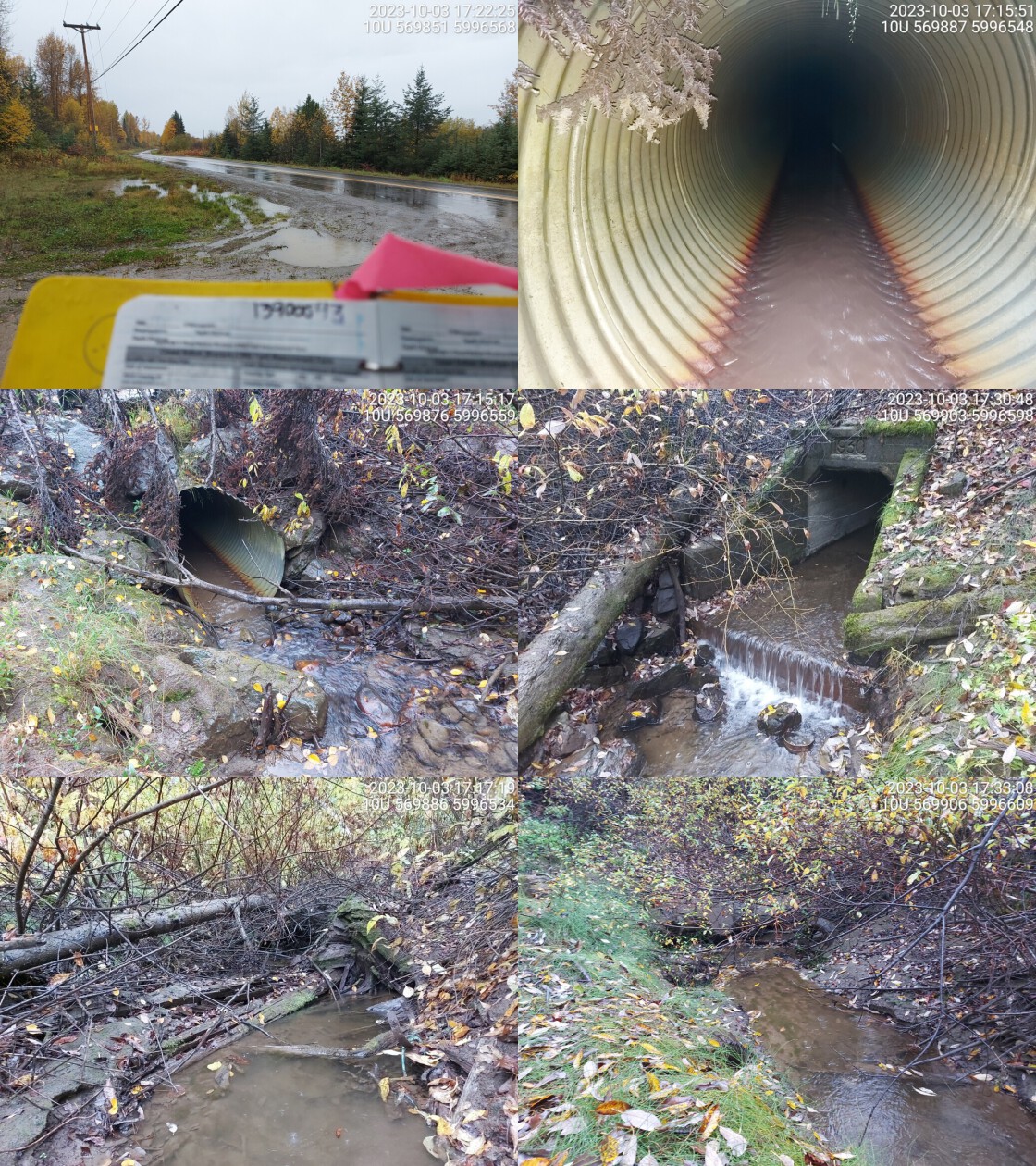 . From top left clockwise: Road/Site Card, Barrel, Outlet, Downstream, Upstream, Inlet.13900043 . From top left clockwise: Road/Site Card, Barrel, Outlet, Downstream, Upstream, Inlet.13900043
|
|||
| Comments: Chinook confirmed upstream in 2018. Structure goes under highway and railway. Culvert visible at inlet but outlet has different structure. Slope estimated. Small step at outlet creating drop. MoTi chris_culvert_id: 1994444. 17:35:22 |
| Location and Stream Data |
|
Crossing Characteristics | – |
|---|---|---|---|
| Date | 2023-10-04 | Crossing Sub Type | Round Culvert |
| PSCIS ID | 199255 | Diameter (m) | 1.1 |
| External ID | 13903617 | Length (m) | 17 |
| Crew | AI | Embedded | No |
| UTM Zone | 10 | Depth Embedded (m) | – |
| Easting | 578670 | Resemble Channel | No |
| Northing | 5973004 | Backwatered | No |
| Stream | Tributary to Kenneth Creek | Percent Backwatered | – |
| Road | Bowron FSR | Fill Depth (m) | 1.3 |
| Road Tenure | MOF | Outlet Drop (m) | 0.05 |
| Channel Width (m) | 2.6 | Outlet Pool Depth (m) | 0.05 |
| Stream Slope (%) | 2 | Inlet Drop | Yes |
| Beaver Activity | Yes | Slope (%) | 3 |
| Habitat Value | Medium | Valley Fill | Deep Fill |
| Final score | 29 | Barrier Result | Barrier |
| Fix type | Replace with New Open Bottom Structure | Fix Span / Diameter | 15 |
Photos: PSCIS ID 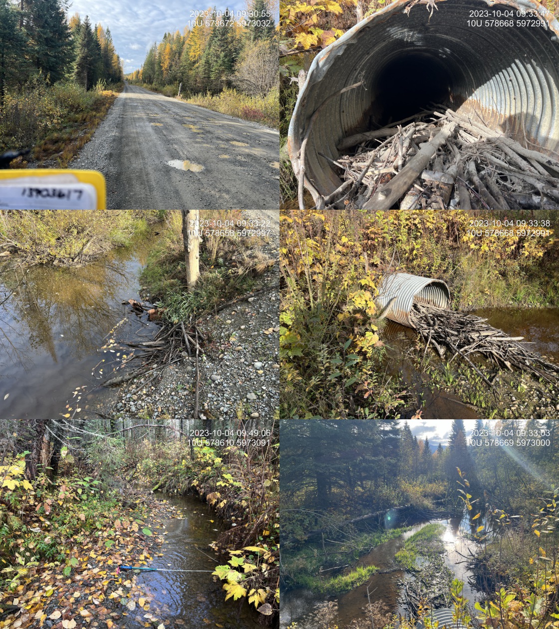 . From top left clockwise: Road/Site Card, Barrel, Outlet, Downstream, Upstream, Inlet.13903617 . From top left clockwise: Road/Site Card, Barrel, Outlet, Downstream, Upstream, Inlet.13903617
|
|||
| Comments: The crossing is actually located ~150m south of the modelled crossing (at km 31.9), on an unmapped Freshwater Atlas stream which flows into the crossing from the east, flowing along the ditch for approximately 60-70m. The streamline can be seen in satellite imagery. Very nice stream with good flow, abundant gravels, and some pools to 50cm deep. The inlet is completely buried and the outlet is blocked by beaver debris. Culvert slope estimated.. 09:31:27 |
| Location and Stream Data |
|
Crossing Characteristics | – |
|---|---|---|---|
| Date | 2023-10-04 | Crossing Sub Type | Oval Culvert |
| PSCIS ID | 199256 | Diameter (m) | 4.7 |
| External ID | 13903184 | Length (m) | 33 |
| Crew | MW | Embedded | No |
| UTM Zone | 10 | Depth Embedded (m) | – |
| Easting | 582276 | Resemble Channel | No |
| Northing | 5975078 | Backwatered | No |
| Stream | Kenneth Creek | Percent Backwatered | – |
| Road | Highway 16 | Fill Depth (m) | 1 |
| Road Tenure | MOTI | Outlet Drop (m) | 1 |
| Channel Width (m) | 9.4 | Outlet Pool Depth (m) | 2.4 |
| Stream Slope (%) | 1 | Inlet Drop | No |
| Beaver Activity | No | Slope (%) | 1.5 |
| Habitat Value | High | Valley Fill | Deep Fill |
| Final score | 37 | Barrier Result | Barrier |
| Fix type | Replace with New Open Bottom Structure | Fix Span / Diameter | 15 |
Photos: PSCIS ID 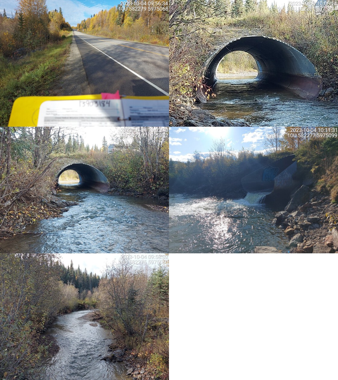 . From top left clockwise: Road/Site Card, Barrel, Outlet, Downstream, Upstream, Inlet.13903184 . From top left clockwise: Road/Site Card, Barrel, Outlet, Downstream, Upstream, Inlet.13903184
|
|||
| Comments: Very wide stream with high flow. Velocity is high in culvert. Very deep and big outlet pool, depth estimated. Known salmon spawning location. Chinook confirmed with carcass noted just upstream in 2022 by same field team. MoTi chris_hwy_structure_road_id: 3750. 10:13:57 |
| Location and Stream Data |
|
Crossing Characteristics | – |
|---|---|---|---|
| Date | 2023-10-04 | Crossing Sub Type | Round Culvert |
| PSCIS ID | 199257 | Diameter (m) | 1.2 |
| External ID | 13903183 | Length (m) | 30 |
| Crew | AI | Embedded | No |
| UTM Zone | 10 | Depth Embedded (m) | – |
| Easting | 582694 | Resemble Channel | No |
| Northing | 5975012 | Backwatered | No |
| Stream | Tributary to Kenneth Creek | Percent Backwatered | – |
| Road | Highway 16 | Fill Depth (m) | 3.5 |
| Road Tenure | MOTI | Outlet Drop (m) | 0.35 |
| Channel Width (m) | 2.2 | Outlet Pool Depth (m) | 0.7 |
| Stream Slope (%) | 1.5 | Inlet Drop | Yes |
| Beaver Activity | Yes | Slope (%) | 1.5 |
| Habitat Value | Medium | Valley Fill | Deep Fill |
| Final score | 37 | Barrier Result | Barrier |
| Fix type | Replace with New Open Bottom Structure | Fix Span / Diameter | 16.5 |
Photos: PSCIS ID 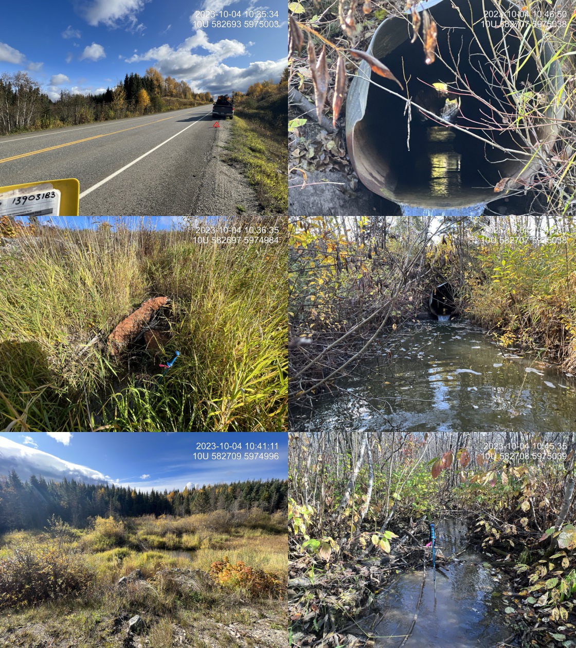 . From top left clockwise: Road/Site Card, Barrel, Outlet, Downstream, Upstream, Inlet.13903183 . From top left clockwise: Road/Site Card, Barrel, Outlet, Downstream, Upstream, Inlet.13903183
|
|||
| Comments: Wetland type habitat upstream with multiple small channels threaded through it. Inlet of pipe is extremely bent. Nice little stream with well defined channel downstream. Good amount of flow and connected to known chinook system. MoTi chris_culvert_id: 1992666. 10:35:14 |
| Location and Stream Data |
|
Crossing Characteristics | – |
|---|---|---|---|
| Date | 2023-10-04 | Crossing Sub Type | Round Culvert |
| PSCIS ID | 199258 | Diameter (m) | 1.2 |
| External ID | 13900192 | Length (m) | 31 |
| Crew | MW | Embedded | No |
| UTM Zone | 10 | Depth Embedded (m) | – |
| Easting | 585255 | Resemble Channel | No |
| Northing | 5973726 | Backwatered | No |
| Stream | Tributary to Kenneth Creek | Percent Backwatered | – |
| Road | Highway 16 | Fill Depth (m) | 2 |
| Road Tenure | MOTI | Outlet Drop (m) | 1.7 |
| Channel Width (m) | 2.3 | Outlet Pool Depth (m) | 0.6 |
| Stream Slope (%) | 4.5 | Inlet Drop | No |
| Beaver Activity | No | Slope (%) | 5 |
| Habitat Value | High | Valley Fill | Deep Fill |
| Final score | 42 | Barrier Result | Barrier |
| Fix type | Replace with New Open Bottom Structure | Fix Span / Diameter | 15 |
Photos: PSCIS ID 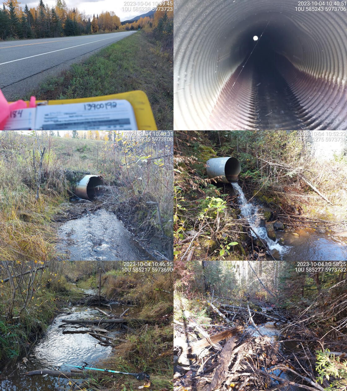 . From top left clockwise: Road/Site Card, Barrel, Outlet, Downstream, Upstream, Inlet.13900192 . From top left clockwise: Road/Site Card, Barrel, Outlet, Downstream, Upstream, Inlet.13900192
|
|||
| Comments: Very big outlet drop. Gravels present upstream that could be suitable for spawning. Small debris jam ~15m upstream of crossing but likely not a major barrier. MoTi chris_culvert_id: 1992618. 10:50:45 |
| Location and Stream Data |
|
Crossing Characteristics | – |
|---|---|---|---|
| Date | 2023-10-04 | Crossing Sub Type | Round Culvert |
| PSCIS ID | 199259 | Diameter (m) | 1.1 |
| External ID | 13900261 | Length (m) | 42 |
| Crew | AI | Embedded | No |
| UTM Zone | 10 | Depth Embedded (m) | – |
| Easting | 587876 | Resemble Channel | No |
| Northing | 5972476 | Backwatered | No |
| Stream | Tributary to Sugarbowl Creek | Percent Backwatered | – |
| Road | Highway 16 | Fill Depth (m) | 7 |
| Road Tenure | MOTI | Outlet Drop (m) | 0.2 |
| Channel Width (m) | 2.5 | Outlet Pool Depth (m) | 0.7 |
| Stream Slope (%) | 9 | Inlet Drop | Yes |
| Beaver Activity | No | Slope (%) | 12 |
| Habitat Value | Medium | Valley Fill | Deep Fill |
| Final score | 37 | Barrier Result | Barrier |
| Fix type | Replace Structure with Streambed Simulation CBS | Fix Span / Diameter | 4.5 |
Photos: PSCIS ID 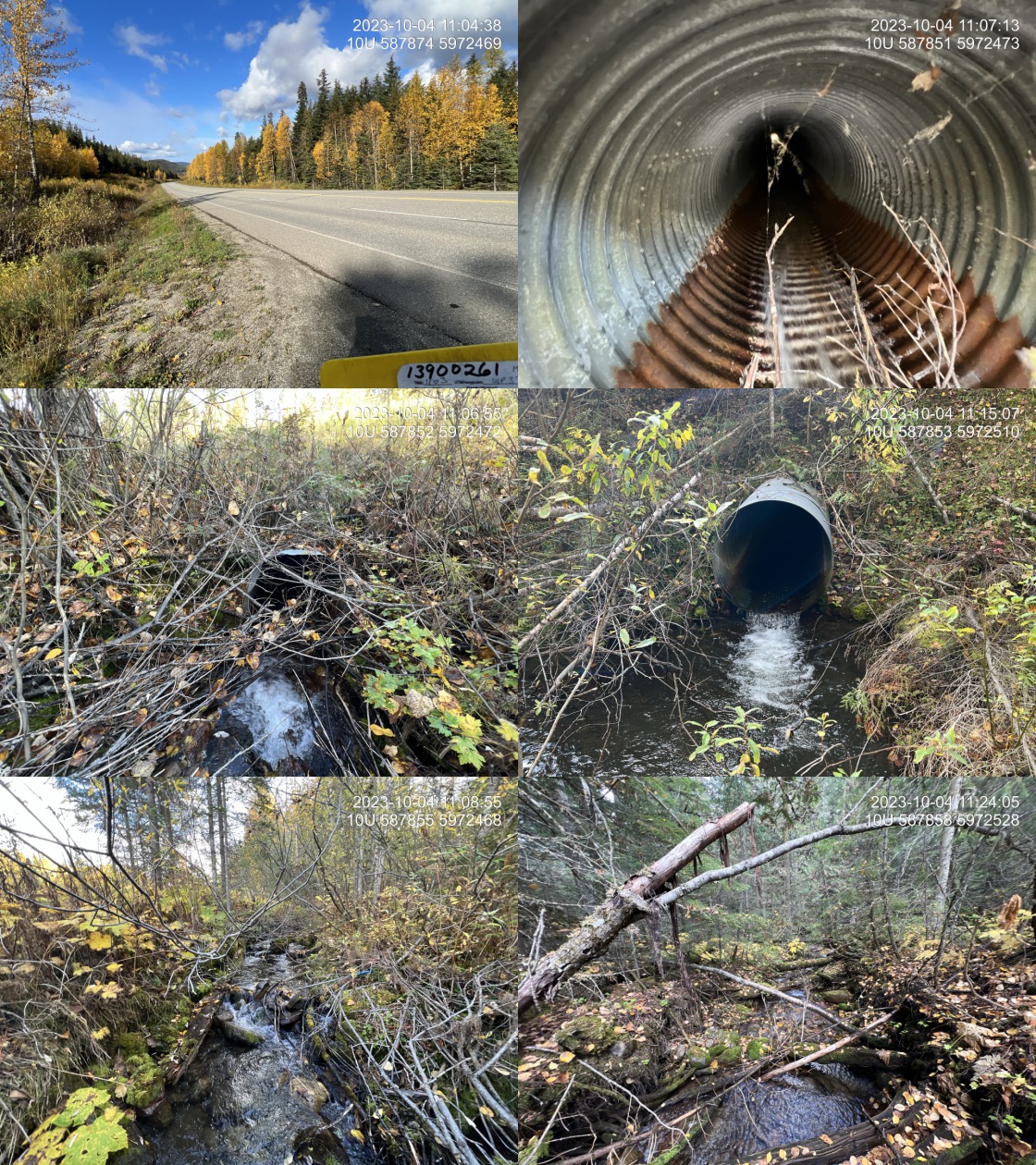 . From top left clockwise: Road/Site Card, Barrel, Outlet, Downstream, Upstream, Inlet.13900261 . From top left clockwise: Road/Site Card, Barrel, Outlet, Downstream, Upstream, Inlet.13900261
|
|||
| Comments: Very nice stream with steeper cobble boulder habitat, potentially valuable rearing for Bulltrout . Very steep and long pipe with transmission line vegetation cleared at outlet. There’s a 20m section of dewatered stream approximately 10m downstream of the outlet due to a graded substrate likely related to highway corridor. Crossing is within provincial park. MoTi chris_culvert_id: 1992817. 11:05:47 |
| Location and Stream Data |
|
Crossing Characteristics | – |
|---|---|---|---|
| Date | 2023-10-04 | Crossing Sub Type | Round Culvert |
| PSCIS ID | 199260 | Diameter (m) | 1.2 |
| External ID | 13900260 | Length (m) | 38 |
| Crew | AI | Embedded | No |
| UTM Zone | 10 | Depth Embedded (m) | – |
| Easting | 587936 | Resemble Channel | No |
| Northing | 5972452 | Backwatered | No |
| Stream | Tributary to Sugarbowl Creek | Percent Backwatered | – |
| Road | Highway 16 | Fill Depth (m) | 8 |
| Road Tenure | MOTI | Outlet Drop (m) | 1.15 |
| Channel Width (m) | 5.2 | Outlet Pool Depth (m) | 0.8 |
| Stream Slope (%) | 9 | Inlet Drop | Yes |
| Beaver Activity | No | Slope (%) | 7 |
| Habitat Value | High | Valley Fill | Deep Fill |
| Final score | 42 | Barrier Result | Barrier |
| Fix type | Replace with New Open Bottom Structure | Fix Span / Diameter | 30 |
Photos: PSCIS ID 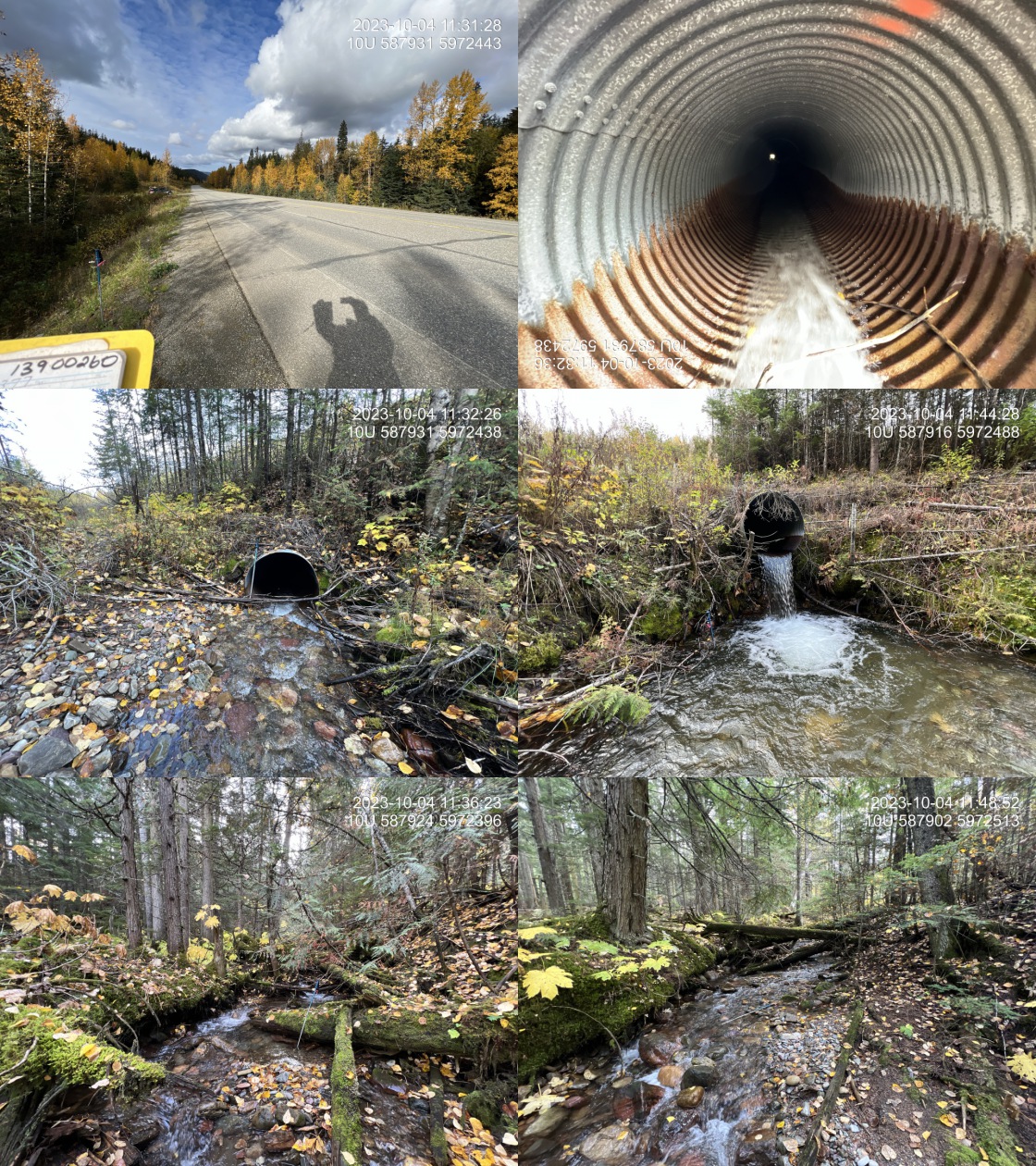 . From top left clockwise: Road/Site Card, Barrel, Outlet, Downstream, Upstream, Inlet.13900260 . From top left clockwise: Road/Site Card, Barrel, Outlet, Downstream, Upstream, Inlet.13900260
|
|||
| Comments: Large stream with abundant gravels present upstream suitable for spawning. Massive outlet drop with powerline riparian cleared downstream of the highway. Old growth cedar hemlock riparian within Sugar bowl grizzly den provincial park. Follow up with habitat confirmation recommended. MoTi chris_culvert_id: 1992815. 11:30:20 |
| Location and Stream Data |
|
Crossing Characteristics | – |
|---|---|---|---|
| Date | 2023-10-04 | Crossing Sub Type | Round Culvert |
| PSCIS ID | 199261 | Diameter (m) | 1.2 |
| External ID | 13900270 | Length (m) | 56 |
| Crew | MW | Embedded | No |
| UTM Zone | 10 | Depth Embedded (m) | – |
| Easting | 595602 | Resemble Channel | No |
| Northing | 5969818 | Backwatered | No |
| Stream | Tributary to Sugarbowl Creek | Percent Backwatered | – |
| Road | Highway 16 | Fill Depth (m) | 6 |
| Road Tenure | MOTI | Outlet Drop (m) | 0.9 |
| Channel Width (m) | 3.7 | Outlet Pool Depth (m) | 0.4 |
| Stream Slope (%) | 4 | Inlet Drop | No |
| Beaver Activity | Yes | Slope (%) | 3 |
| Habitat Value | Medium | Valley Fill | Deep Fill |
| Final score | 42 | Barrier Result | Barrier |
| Fix type | Replace with New Open Bottom Structure | Fix Span / Diameter | 24 |
Photos: PSCIS ID 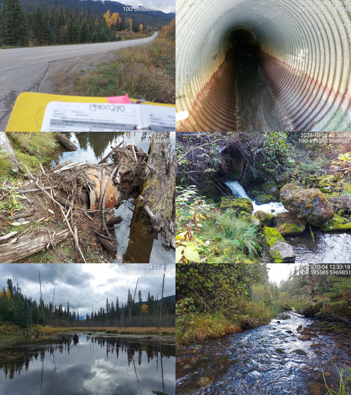 . From top left clockwise: Road/Site Card, Barrel, Outlet, Downstream, Upstream, Inlet.13900270 . From top left clockwise: Road/Site Card, Barrel, Outlet, Downstream, Upstream, Inlet.13900270
|
|||
| Comments: Culvert very old. Big wetland complex upstream. Inlet barely visible, covered in woody debris and rusty metal. Culvert slope estimated. High velocity coming out of outlet with moderate drop. Habitat looks good downstream, wide channel with high flow. Crossing is within the Sugarbowl grizzly den provincial park. MoTi chris_culvert_id: 1992569. 12:49:05 |
| Location and Stream Data |
|
Crossing Characteristics | – |
|---|---|---|---|
| Date | 2023-10-04 | Crossing Sub Type | Oval Culvert |
| PSCIS ID | 199262 | Diameter (m) | 5 |
| External ID | 13900196 | Length (m) | 31 |
| Crew | AI | Embedded | No |
| UTM Zone | 10 | Depth Embedded (m) | – |
| Easting | 596934 | Resemble Channel | No |
| Northing | 5969359 | Backwatered | No |
| Stream | Hungary Creek | Percent Backwatered | – |
| Road | Highway 16 | Fill Depth (m) | 2 |
| Road Tenure | MOTI | Outlet Drop (m) | 0.5 |
| Channel Width (m) | 11.6 | Outlet Pool Depth (m) | 1.4 |
| Stream Slope (%) | 1 | Inlet Drop | No |
| Beaver Activity | No | Slope (%) | 1 |
| Habitat Value | High | Valley Fill | Deep Fill |
| Final score | 37 | Barrier Result | Barrier |
| Fix type | Replace with New Open Bottom Structure | Fix Span / Diameter | 16.5 |
Photos: PSCIS ID 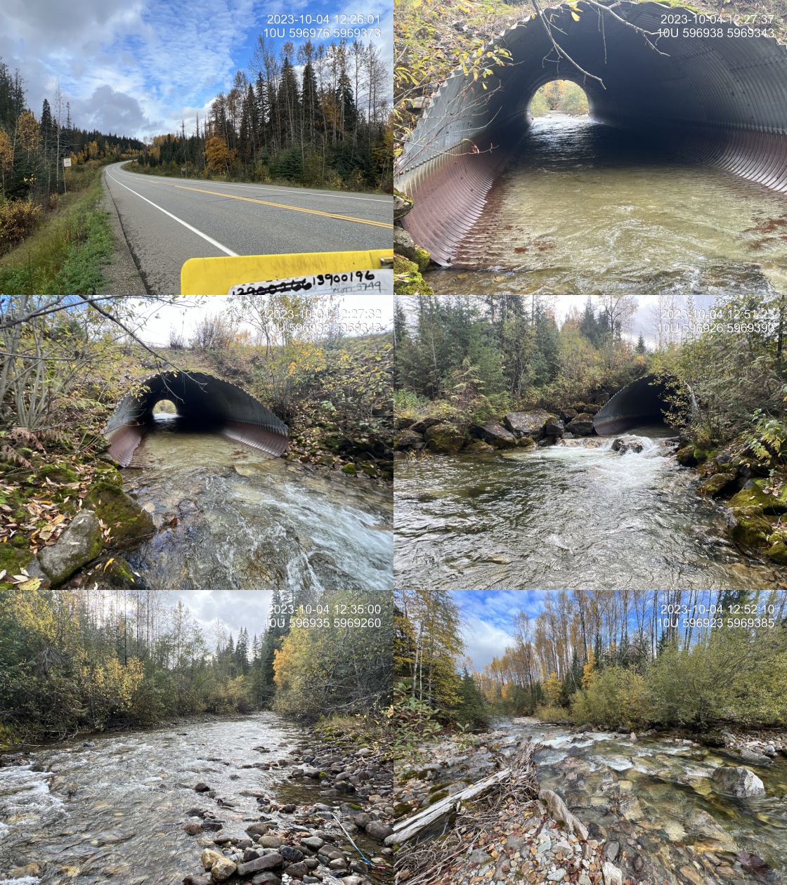 . From top left clockwise: Road/Site Card, Barrel, Outlet, Downstream, Upstream, Inlet.13900196 . From top left clockwise: Road/Site Card, Barrel, Outlet, Downstream, Upstream, Inlet.13900196
|
|||
| Comments: Very large, low gradient stream with chinook points. Hydrometric station upstream. Outlet drop is comprised of boulders, likely placed there to aid in passage. Located at the downstream end of powerline corridor, there is a steep cascade section for approximately 30m that is 8% gradient. Cascade could be as much or more of a passage issue as the pipe. MoTi chris_hwy_structure_road_id: 3749. 12:57:36 |
| Location and Stream Data |
|
Crossing Characteristics | – |
|---|---|---|---|
| Date | 2023-10-04 | Crossing Sub Type | Round Culvert |
| PSCIS ID | 199263 | Diameter (m) | 1.2 |
| External ID | 13900198 | Length (m) | 82 |
| Crew | MW | Embedded | No |
| UTM Zone | 10 | Depth Embedded (m) | – |
| Easting | 601647 | Resemble Channel | No |
| Northing | 5967974 | Backwatered | No |
| Stream | Lunate Creek | Percent Backwatered | – |
| Road | Highway 16 | Fill Depth (m) | 8 |
| Road Tenure | MOTI | Outlet Drop (m) | 2.8 |
| Channel Width (m) | 2.4 | Outlet Pool Depth (m) | 2 |
| Stream Slope (%) | 3 | Inlet Drop | No |
| Beaver Activity | Yes | Slope (%) | 2 |
| Habitat Value | Medium | Valley Fill | Deep Fill |
| Final score | 37 | Barrier Result | Barrier |
| Fix type | Replace Structure with Streambed Simulation CBS | Fix Span / Diameter | 4.5 |
Photos: PSCIS ID 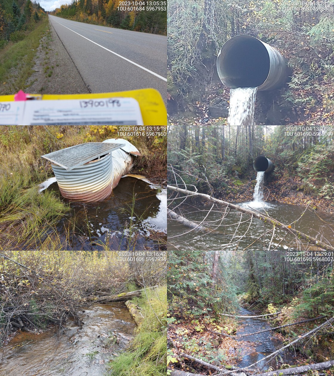 . From top left clockwise: Road/Site Card, Barrel, Outlet, Downstream, Upstream, Inlet.13900198 . From top left clockwise: Road/Site Card, Barrel, Outlet, Downstream, Upstream, Inlet.13900198
|
|||
| Comments: Massive outlet drop and deep pool, both depths estimated. Signs of beaver activity near inlet. There is an old well-like structure attached to inlet side.Water could be flowing through underneath surface, not visible. MoTi chris_culvert_id: 1992863. 13:34:08 |
| Location and Stream Data |
|
Crossing Characteristics | – |
|---|---|---|---|
| Date | 2023-10-04 | Crossing Sub Type | Round Culvert |
| PSCIS ID | 199264 | Diameter (m) | 0.6 |
| External ID | 13903179 | Length (m) | 20 |
| Crew | AI | Embedded | No |
| UTM Zone | 10 | Depth Embedded (m) | – |
| Easting | 610990 | Resemble Channel | No |
| Northing | 5966577 | Backwatered | No |
| Stream | Tributary to Fraser River | Percent Backwatered | – |
| Road | Penny Access Road | Fill Depth (m) | 3 |
| Road Tenure | MOTI | Outlet Drop (m) | 0.2 |
| Channel Width (m) | 1.6 | Outlet Pool Depth (m) | 0.2 |
| Stream Slope (%) | 0.25 | Inlet Drop | Yes |
| Beaver Activity | Yes | Slope (%) | 3 |
| Habitat Value | Medium | Valley Fill | Deep Fill |
| Final score | 34 | Barrier Result | Barrier |
| Fix type | Replace Structure with Streambed Simulation CBS | Fix Span / Diameter | 3 |
Photos: PSCIS ID 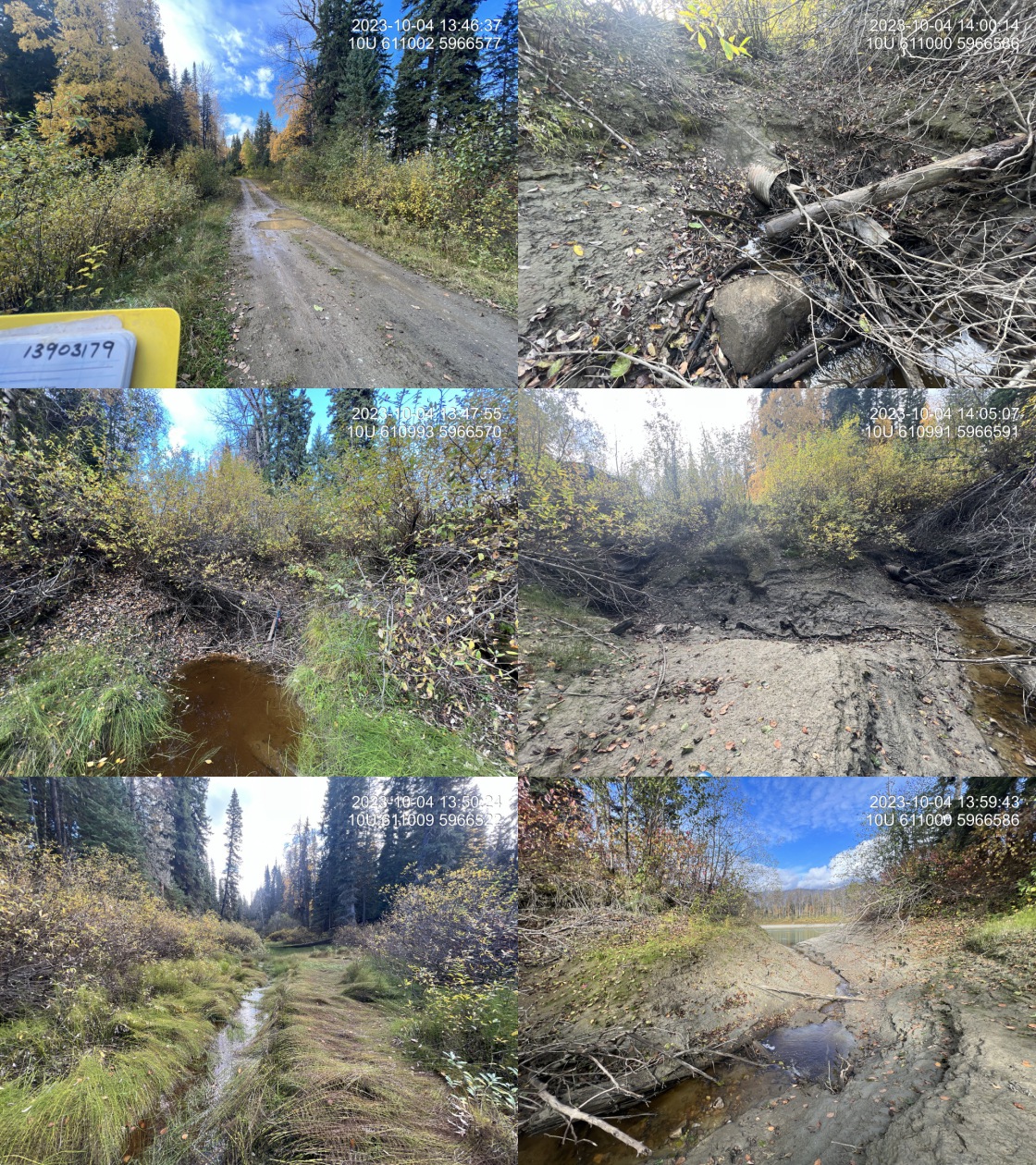 . From top left clockwise: Road/Site Card, Barrel, Outlet, Downstream, Upstream, Inlet.13903179 . From top left clockwise: Road/Site Card, Barrel, Outlet, Downstream, Upstream, Inlet.13903179
|
|||
| Comments: Horsetail and willow wetland upstream with a small well-defined channel with fine gradients. Pipe is blocked by beaver debris. There is a second pipe that’s approximately 1.5 m higher and 0.9m in diameter that is free of debris and functions as an overflow. Potential refuge area during periods of high flow in the Fraser river, which was only 40m downstream at the time of assessment. Gate at the end of the road preventing access to launch point for Penny. Could consider road deactivation as a solution. Crossing is located in the Ancient Forest/Chun T’oh Whudujut Protected Area. MoTi chris_culvert_id: 1993423. 13:44:19 |
| Location and Stream Data |
|
Crossing Characteristics | – |
|---|---|---|---|
| Date | 2023-10-04 | Crossing Sub Type | Round Culvert |
| PSCIS ID | 199265 | Diameter (m) | 0.6 |
| External ID | 13900200 | Length (m) | 36 |
| Crew | MW | Embedded | No |
| UTM Zone | 10 | Depth Embedded (m) | – |
| Easting | 604596 | Resemble Channel | No |
| Northing | 5966257 | Backwatered | No |
| Stream | Tributary to Driscoll Creek | Percent Backwatered | – |
| Road | Highway 16 | Fill Depth (m) | 4 |
| Road Tenure | MOTI | Outlet Drop (m) | 0.2 |
| Channel Width (m) | 1.1 | Outlet Pool Depth (m) | 0 |
| Stream Slope (%) | 2 | Inlet Drop | No |
| Beaver Activity | No | Slope (%) | 1.5 |
| Habitat Value | Low | Valley Fill | Deep Fill |
| Final score | 32 | Barrier Result | Barrier |
| Fix type | Replace Structure with Streambed Simulation CBS | Fix Span / Diameter | 3 |
Photos: PSCIS ID 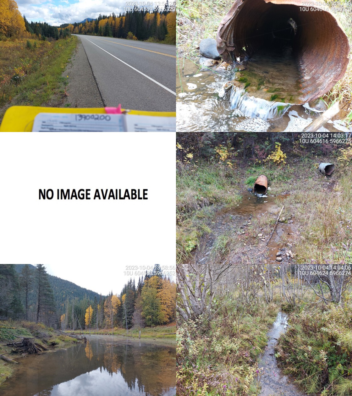 . From top left clockwise: Road/Site Card, Barrel, Outlet, Downstream, Upstream, Inlet.13900200 . From top left clockwise: Road/Site Card, Barrel, Outlet, Downstream, Upstream, Inlet.13900200
|
|||
| Comments: Big wetland upstream. Inlet could not be found, likely submerged. Small channel downstream, pipe looks old and in bad shape. Overflow pipe near first pipe but not functioning currently. MoTi chris_culvert_id: 1992855. 14:06:57 |
| Location and Stream Data |
|
Crossing Characteristics | – |
|---|---|---|---|
| Date | 2023-10-04 | Crossing Sub Type | Round Culvert |
| PSCIS ID | 199266 | Diameter (m) | 0.6 |
| External ID | 13900053 | Length (m) | 10 |
| Crew | AI | Embedded | No |
| UTM Zone | 10 | Depth Embedded (m) | – |
| Easting | 608807 | Resemble Channel | No |
| Northing | 5966506 | Backwatered | No |
| Stream | Tributary to Fraser River | Percent Backwatered | – |
| Road | Penny Access Road | Fill Depth (m) | 1 |
| Road Tenure | MOTI | Outlet Drop (m) | 0 |
| Channel Width (m) | 2 | Outlet Pool Depth (m) | 0 |
| Stream Slope (%) | 0 | Inlet Drop | No |
| Beaver Activity | Yes | Slope (%) | 0 |
| Habitat Value | Medium | Valley Fill | Deep Fill |
| Final score | 16 | Barrier Result | Potential |
| Fix type | Replace with New Open Bottom Structure | Fix Span / Diameter | 15 |
Photos: PSCIS ID 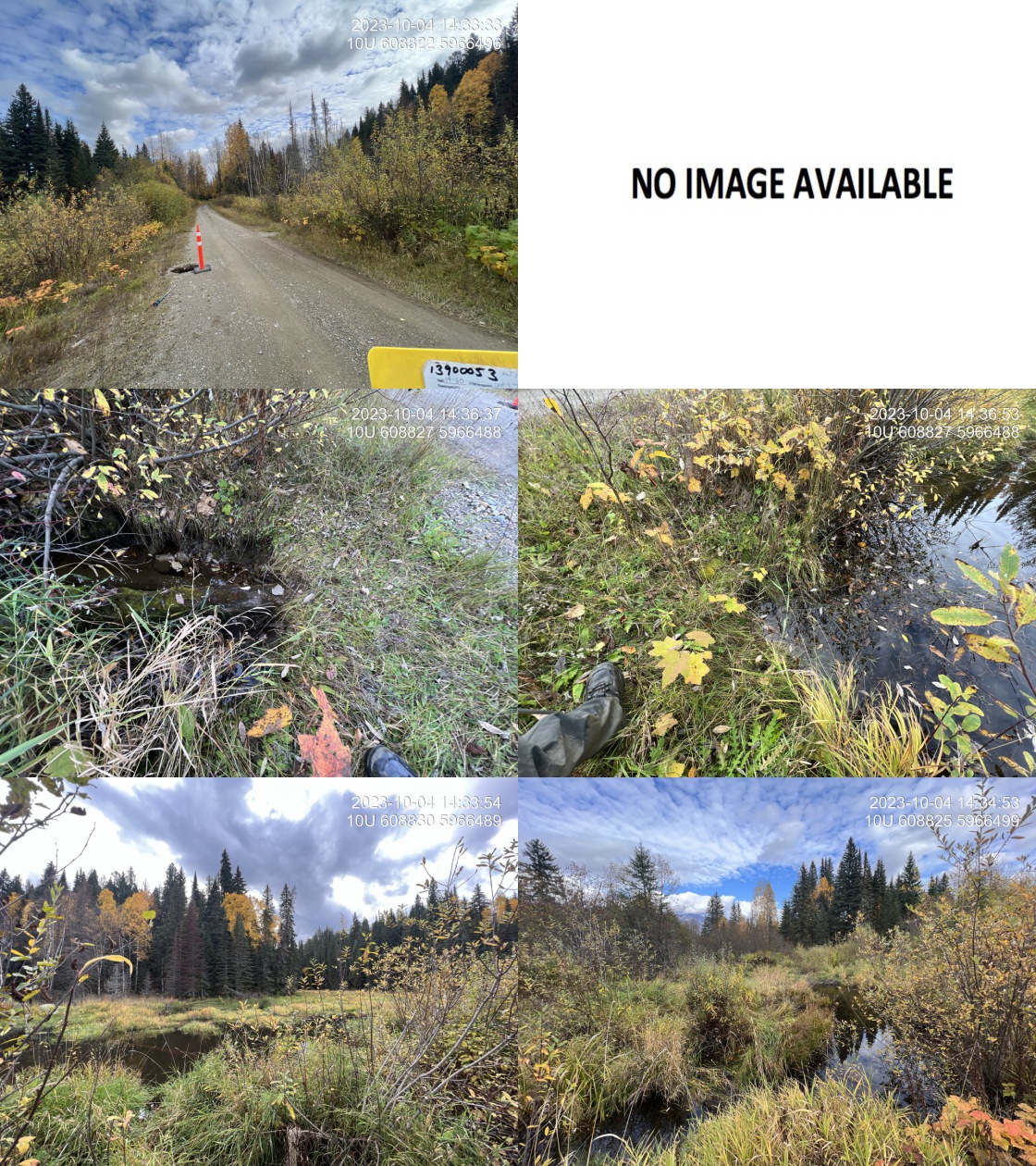 . From top left clockwise: Road/Site Card, Barrel, Outlet, Downstream, Upstream, Inlet.13900053 . From top left clockwise: Road/Site Card, Barrel, Outlet, Downstream, Upstream, Inlet.13900053
|
|||
| Comments: Could not locate pipe as it is underwater at both inlet and outlet. There appears to be a bunch of logs under the road so suspect that there may be no structure at all as the drainage may have been put in with logs - although MOT culvert layer says 0.6 m galvanized pipe.. Road is failing with 3 foot deep and 2 foot wide hole in the road marked with a pilon. MoTi chris_culvert_id: 1993428. 14:32:19 |
| Location and Stream Data |
|
Crossing Characteristics | – |
|---|---|---|---|
| Date | 2023-10-04 | Crossing Sub Type | Round Culvert |
| PSCIS ID | 199267 | Diameter (m) | 2.4 |
| External ID | 13900201 | Length (m) | 56 |
| Crew | MW | Embedded | No |
| UTM Zone | 10 | Depth Embedded (m) | – |
| Easting | 606374 | Resemble Channel | No |
| Northing | 5965784 | Backwatered | No |
| Stream | Driscoll Creek | Percent Backwatered | – |
| Road | Highway 16 | Fill Depth (m) | 3.5 |
| Road Tenure | MOTI | Outlet Drop (m) | 0.6 |
| Channel Width (m) | 6.4 | Outlet Pool Depth (m) | 0.7 |
| Stream Slope (%) | 2 | Inlet Drop | No |
| Beaver Activity | Yes | Slope (%) | 2 |
| Habitat Value | High | Valley Fill | Deep Fill |
| Final score | 37 | Barrier Result | Barrier |
| Fix type | Replace with New Open Bottom Structure | Fix Span / Diameter | 16.5 |
Photos: PSCIS ID 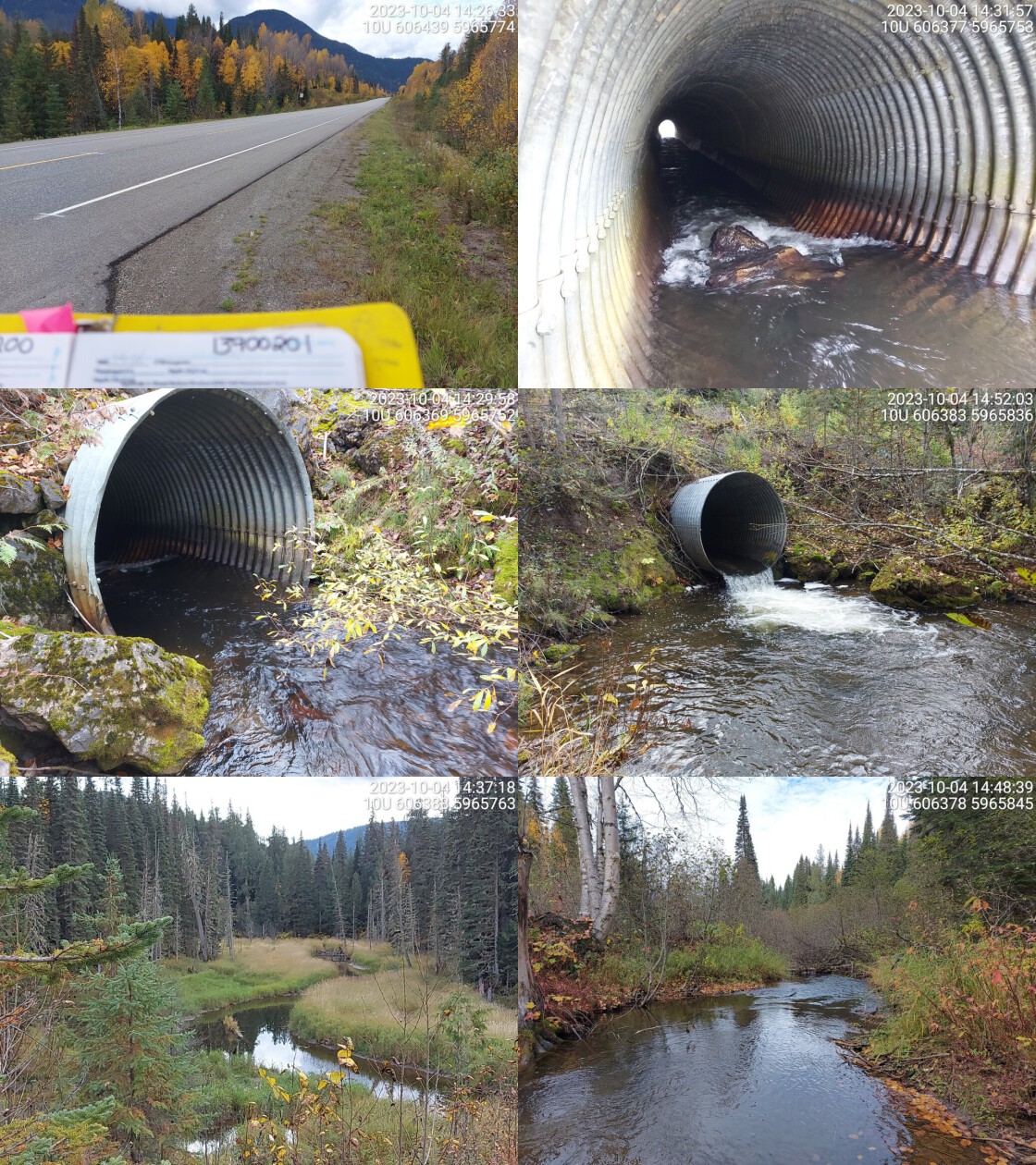 . From top left clockwise: Road/Site Card, Barrel, Outlet, Downstream, Upstream, Inlet.13900201 . From top left clockwise: Road/Site Card, Barrel, Outlet, Downstream, Upstream, Inlet.13900201
|
|||
| Comments: Big beaver dam near inlet of culvert spanning across whole channel approx 1.2m high. Boulders in pipe near inlet creating small drop and increasing velocity. Channel widens downstream, high value habitat. RB and CCG confirmed upstream and downstream with chinook observed way downstream at mouth. Low gradient upstream and downsteram with decent outlet drop so resampling to determine chinook presence could be insightful. MoTi chris_culvert_id: 1992674. 14:54:00 |
| Location and Stream Data |
|
Crossing Characteristics | – |
|---|---|---|---|
| Date | 2023-10-04 | Crossing Sub Type | Round Culvert |
| PSCIS ID | 199268 | Diameter (m) | 2.4 |
| External ID | 13900157 | Length (m) | 45 |
| Crew | AI | Embedded | No |
| UTM Zone | 10 | Depth Embedded (m) | – |
| Easting | 645733 | Resemble Channel | No |
| Northing | 5940526 | Backwatered | No |
| Stream | Catfish Creek | Percent Backwatered | – |
| Road | Highway 16 | Fill Depth (m) | 9.9 |
| Road Tenure | MOTI | Outlet Drop (m) | 1 |
| Channel Width (m) | 6.7 | Outlet Pool Depth (m) | 0.1 |
| Stream Slope (%) | 0 | Inlet Drop | Yes |
| Beaver Activity | Yes | Slope (%) | 2 |
| Habitat Value | High | Valley Fill | Shallow Fill |
| Final score | 37 | Barrier Result | Barrier |
| Fix type | Replace with New Open Bottom Structure | Fix Span / Diameter | 35.5 |
Photos: PSCIS ID 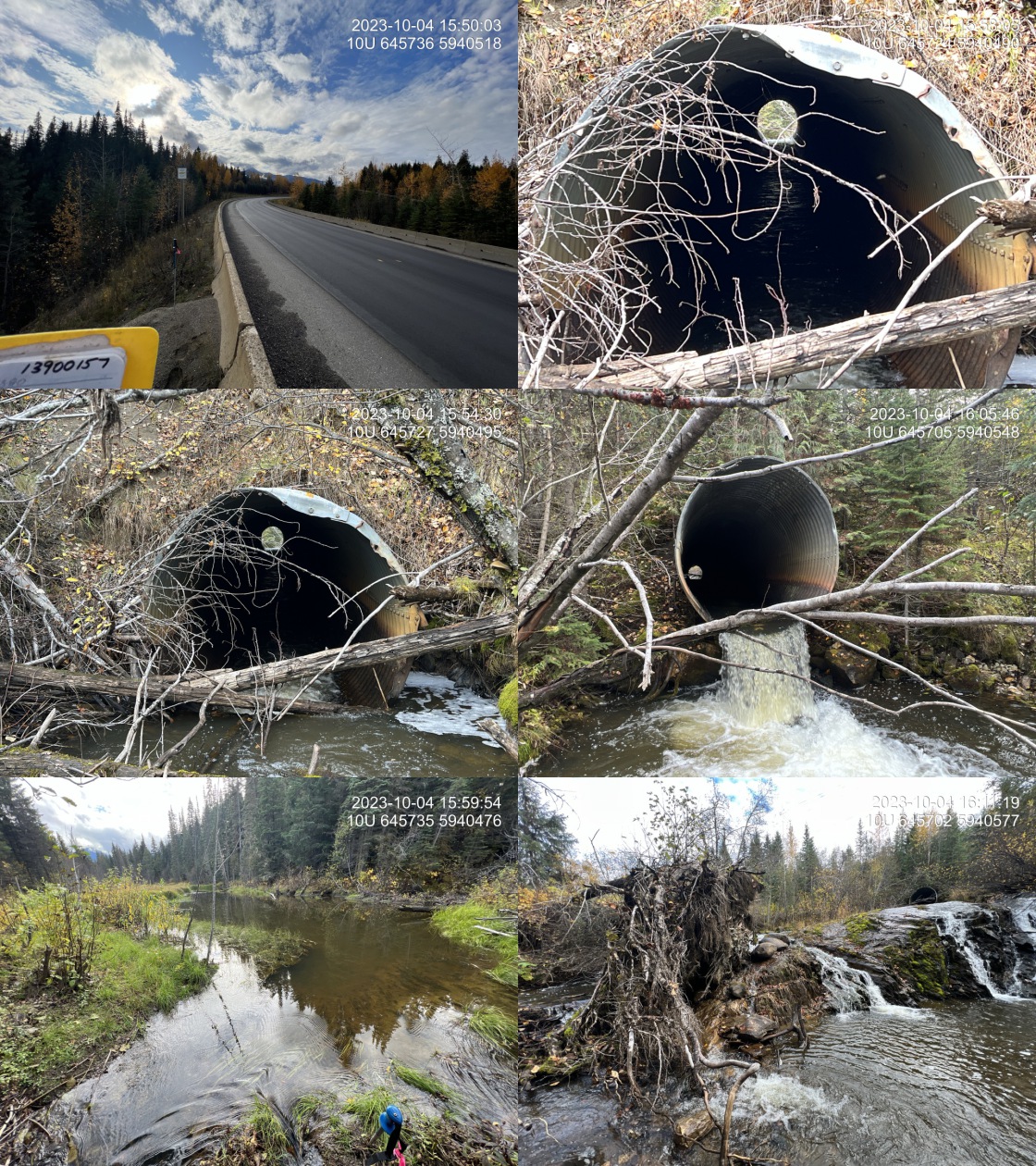 . From top left clockwise: Road/Site Card, Barrel, Outlet, Downstream, Upstream, Inlet.13900157 . From top left clockwise: Road/Site Card, Barrel, Outlet, Downstream, Upstream, Inlet.13900157
|
|||
| Comments: Very large system with beaver complex upstream, including a large beaver dam approximately 1.3m high located 25m upstream of the inlet. Approximately 20m downstream of the outlet is a rock chiute that is over 30% gradient but only for 5m with a total height of 1.7m. There are two other falls noted as FISS obstables between this crossing and the fraser river doenstream. There is significant erosion of the road prism on the upstream side above the culvert. Culvert is located on the bend of Highway 16 under 10m of road fill. Noted falls and lack of fish observations indicated access issues downstream. MoTi chris_culvert_id: 1992752. 16:16:08 |
| Location and Stream Data |
|
Crossing Characteristics | – |
|---|---|---|---|
| Date | 2023-10-04 | Crossing Sub Type | Round Culvert |
| PSCIS ID | 199269 | Diameter (m) | 1.3 |
| External ID | 13900019 | Length (m) | 27 |
| Crew | MW | Embedded | No |
| UTM Zone | 10 | Depth Embedded (m) | – |
| Easting | 660595 | Resemble Channel | No |
| Northing | 5929526 | Backwatered | No |
| Stream | Tributary to Fraser River | Percent Backwatered | – |
| Road | Highway 16 | Fill Depth (m) | 2 |
| Road Tenure | MOTI | Outlet Drop (m) | 0.3 |
| Channel Width (m) | 3.9 | Outlet Pool Depth (m) | 0 |
| Stream Slope (%) | 3.5 | Inlet Drop | No |
| Beaver Activity | No | Slope (%) | 1 |
| Habitat Value | High | Valley Fill | Deep Fill |
| Final score | 34 | Barrier Result | Barrier |
| Fix type | Replace with New Open Bottom Structure | Fix Span / Diameter | 15 |
Photos: PSCIS ID 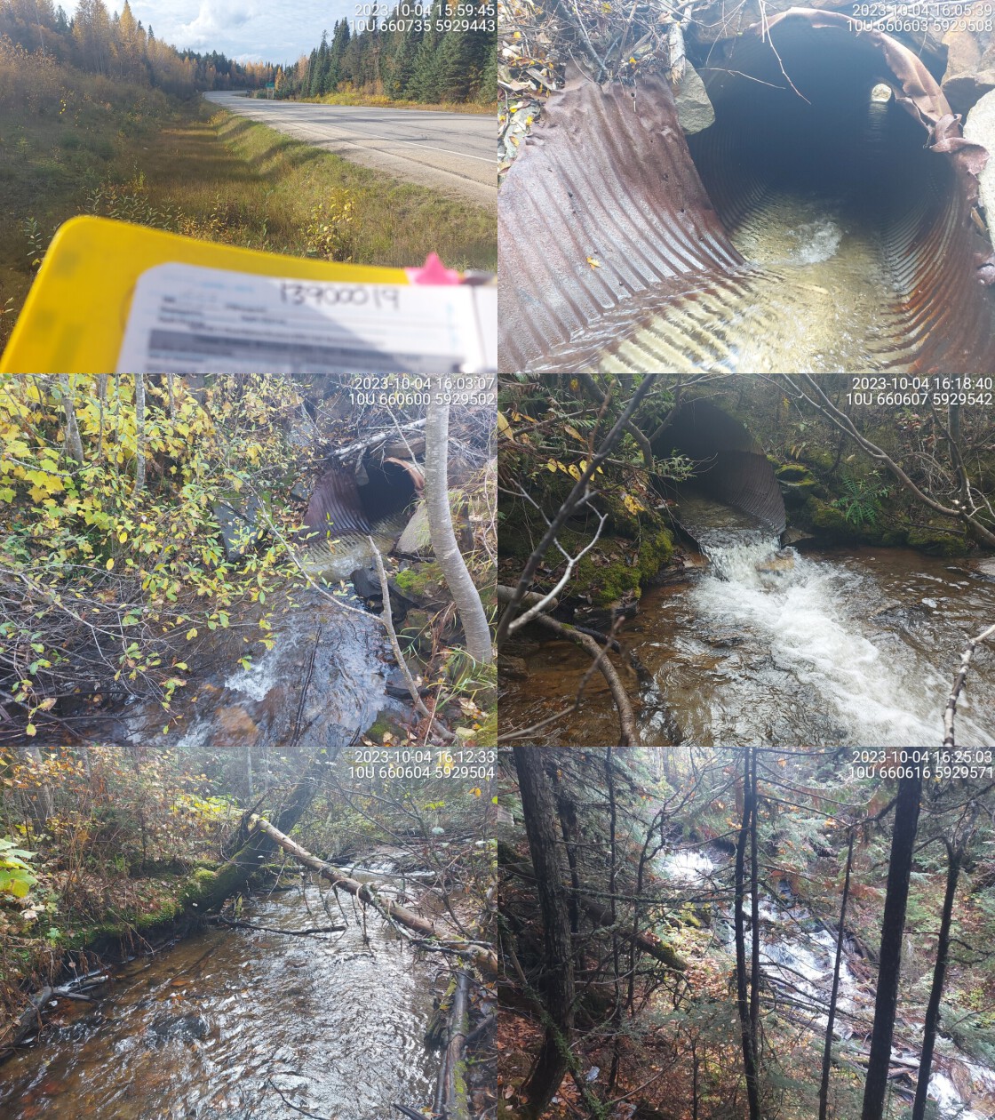 . From top left clockwise: Road/Site Card, Barrel, Outlet, Downstream, Upstream, Inlet.13900019 . From top left clockwise: Road/Site Card, Barrel, Outlet, Downstream, Upstream, Inlet.13900019
|
|||
| Comments: Steep waterfall 10m downstream of crossing, approximately 8m in height. Stream gradient and channel width taken upstream. Gravels present upstream, but definite barrier downstream. Crossing is within the West Twin Protected Area. MoTi chris_culvert_id: 1473114. 16:34:20 |
| Location and Stream Data |
|
Crossing Characteristics | – |
|---|---|---|---|
| Date | 2023-10-04 | Crossing Sub Type | Round Culvert |
| PSCIS ID | 199270 | Diameter (m) | 5 |
| External ID | 13900066 | Length (m) | 90 |
| Crew | AI | Embedded | No |
| UTM Zone | 10 | Depth Embedded (m) | – |
| Easting | 675449 | Resemble Channel | No |
| Northing | 5917446 | Backwatered | No |
| Stream | Clyde Creek | Percent Backwatered | – |
| Road | Highway 16 | Fill Depth (m) | 9.9 |
| Road Tenure | MOTI | Outlet Drop (m) | 0.75 |
| Channel Width (m) | 6.4 | Outlet Pool Depth (m) | 1.8 |
| Stream Slope (%) | 3.5 | Inlet Drop | Yes |
| Beaver Activity | No | Slope (%) | 4 |
| Habitat Value | High | Valley Fill | Deep Fill |
| Final score | 39 | Barrier Result | Barrier |
| Fix type | Replace with New Open Bottom Structure | Fix Span / Diameter | 35.5 |
Photos: PSCIS ID 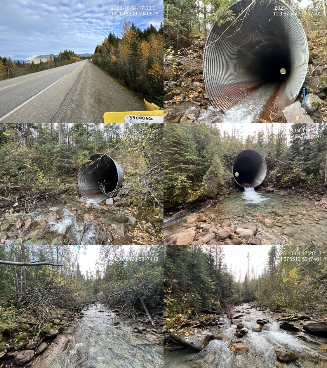 . From top left clockwise: Road/Site Card, Barrel, Outlet, Downstream, Upstream, Inlet.13900066 . From top left clockwise: Road/Site Card, Barrel, Outlet, Downstream, Upstream, Inlet.13900066
|
|||
| Comments: Absolutely massive structure with 12 m of fill plus the height of the culvert which appears to be approximately 7m. Fill depth changed to 9.9m to satisfy submission template macros. Very nice large stream with boulder step pool habitat suitable for bull trout. Falls noted just downstream in FISS but not observed in field with minmal survey. MoTi chris_hwy_structure_road_id: 3691. 17:00:34 |
| Location and Stream Data |
|
Crossing Characteristics | – |
|---|---|---|---|
| Date | 2023-10-04 | Crossing Sub Type | Round Culvert |
| PSCIS ID | 199271 | Diameter (m) | 4.1 |
| External ID | 13900064 | Length (m) | 52 |
| Crew | MW | Embedded | No |
| UTM Zone | 10 | Depth Embedded (m) | – |
| Easting | 677526 | Resemble Channel | No |
| Northing | 5916242 | Backwatered | No |
| Stream | McIntosh Creek | Percent Backwatered | – |
| Road | Highway 16 | Fill Depth (m) | 9.9 |
| Road Tenure | MOTI | Outlet Drop (m) | 2.4 |
| Channel Width (m) | 6.2 | Outlet Pool Depth (m) | 1.2 |
| Stream Slope (%) | 4 | Inlet Drop | No |
| Beaver Activity | No | Slope (%) | 2.5 |
| Habitat Value | High | Valley Fill | Deep Fill |
| Final score | 37 | Barrier Result | Barrier |
| Fix type | Replace with New Open Bottom Structure | Fix Span / Diameter | 35.5 |
Photos: PSCIS ID 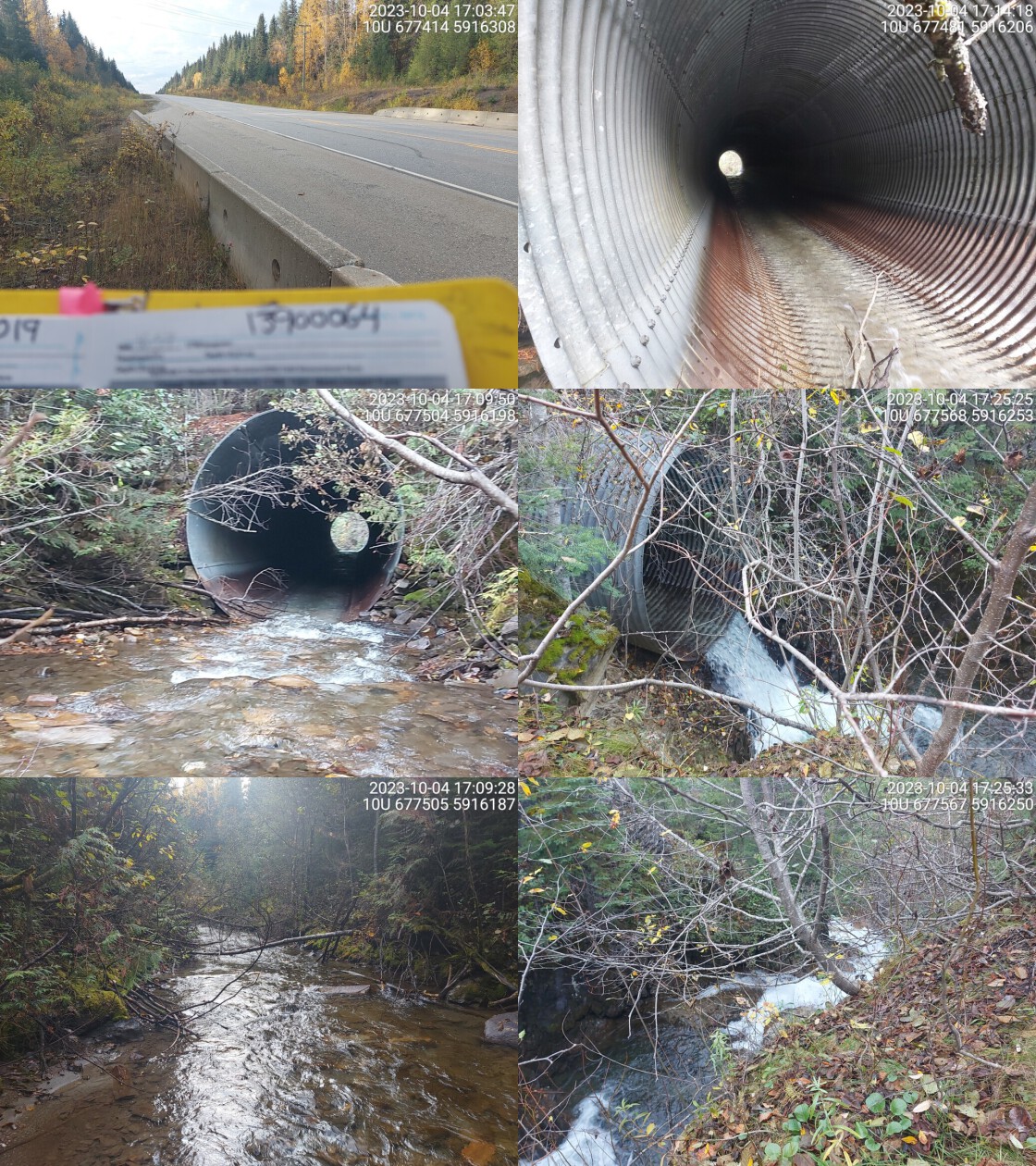 . From top left clockwise: Road/Site Card, Barrel, Outlet, Downstream, Upstream, Inlet.13900064 . From top left clockwise: Road/Site Card, Barrel, Outlet, Downstream, Upstream, Inlet.13900064
|
|||
| Comments: Deep canyon and high waterfall directly downstream of crossing which is a definite barrier to all fish. Rough estimate 20m height. Outlet drop and pool estimated because it was unsafe to get near stream due to steep embankment. RB confirmed upstream of crossing in 2017 and 2020, but the falls downstream is a definite barrier. MoTi chris_hwy_structure_road_id: 30367. 17:27:23 |
| Location and Stream Data |
|
Crossing Characteristics | – |
|---|---|---|---|
| Date | 2023-10-05 | Crossing Sub Type | Round Culvert |
| PSCIS ID | 199272 | Diameter (m) | 2.7 |
| External ID | 22200151 | Length (m) | 35 |
| Crew | AI | Embedded | No |
| UTM Zone | 11 | Depth Embedded (m) | – |
| Easting | 345349 | Resemble Channel | No |
| Northing | 5856053 | Backwatered | No |
| Stream | Cranberry Creek | Percent Backwatered | – |
| Road | Pine Road | Fill Depth (m) | 3 |
| Road Tenure | MOTI | Outlet Drop (m) | 0.38 |
| Channel Width (m) | 4 | Outlet Pool Depth (m) | 0.35 |
| Stream Slope (%) | 0 | Inlet Drop | Yes |
| Beaver Activity | Yes | Slope (%) | 2.5 |
| Habitat Value | High | Valley Fill | Deep Fill |
| Final score | 37 | Barrier Result | Barrier |
| Fix type | Replace with New Open Bottom Structure | Fix Span / Diameter | 15 |
Photos: PSCIS ID 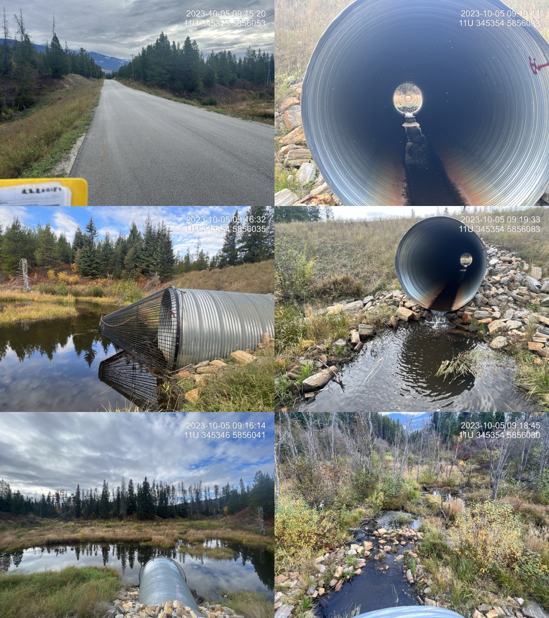 . From top left clockwise: Road/Site Card, Barrel, Outlet, Downstream, Upstream, Inlet.22200151 . From top left clockwise: Road/Site Card, Barrel, Outlet, Downstream, Upstream, Inlet.22200151
|
|||
| Comments: Newly installed culvert with beaver grate on inlet. Beaver influenced wetland area upstream and downstream. Channel width estimated as wetland areas present. Approximately 700m downstream this stream flows into Swift Creek which is a known chinook stream. MoTi chris_culvert_id: 1468490. 09:14:05 |
| Location and Stream Data |
|
Crossing Characteristics | – |
|---|---|---|---|
| Date | 2023-10-05 | Crossing Sub Type | Oval Culvert |
| PSCIS ID | 199273 | Diameter (m) | 4.5 |
| External ID | 13900077 | Length (m) | 28 |
| Crew | MW | Embedded | No |
| UTM Zone | 10 | Depth Embedded (m) | – |
| Easting | 691822 | Resemble Channel | No |
| Northing | 5904863 | Backwatered | No |
| Stream | Hankins Creek | Percent Backwatered | – |
| Road | Eddy Rd | Fill Depth (m) | 1.5 |
| Road Tenure | MOTI Local | Outlet Drop (m) | 0.3 |
| Channel Width (m) | 6.7 | Outlet Pool Depth (m) | 0.2 |
| Stream Slope (%) | 1.5 | Inlet Drop | No |
| Beaver Activity | No | Slope (%) | 0.5 |
| Habitat Value | High | Valley Fill | Deep Fill |
| Final score | 29 | Barrier Result | Barrier |
| Fix type | Replace with New Open Bottom Structure | Fix Span / Diameter | 15 |
Photos: PSCIS ID 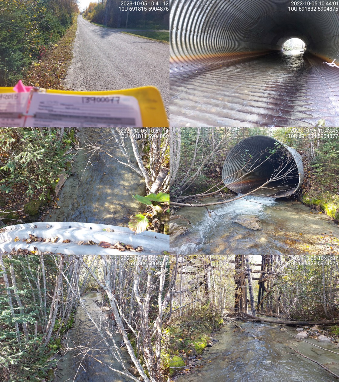 . From top left clockwise: Road/Site Card, Barrel, Outlet, Downstream, Upstream, Inlet.13900077 . From top left clockwise: Road/Site Card, Barrel, Outlet, Downstream, Upstream, Inlet.13900077
|
|||
| Comments: Wide channel and high flowing stream. Small outlet drop and high velocity in pipe with shallow flows over unembedded pipe. Chinook confirmed downstream near Fraser River confluence in the past. Railway bridge downstream seen in photos. MoTi chris_hwy_structure_road_id: 30365. 10:49:31 |
| Location and Stream Data |
|
Crossing Characteristics | – |
|---|---|---|---|
| Date | 2023-10-05 | Crossing Sub Type | Round Culvert |
| PSCIS ID | 199274 | Diameter (m) | 1.5 |
| External ID | 13900003 | Length (m) | 18 |
| Crew | MW | Embedded | No |
| UTM Zone | 10 | Depth Embedded (m) | – |
| Easting | 688720 | Resemble Channel | No |
| Northing | 5909202 | Backwatered | No |
| Stream | Dominion Creek | Percent Backwatered | – |
| Road | 1st Ave | Fill Depth (m) | 3 |
| Road Tenure | McBride | Outlet Drop (m) | 0 |
| Channel Width (m) | 2.3 | Outlet Pool Depth (m) | 0 |
| Stream Slope (%) | 2 | Inlet Drop | Yes |
| Beaver Activity | No | Slope (%) | 1 |
| Habitat Value | High | Valley Fill | Deep Fill |
| Final score | 24 | Barrier Result | Barrier |
| Fix type | Replace with New Open Bottom Structure | Fix Span / Diameter | 15 |
Photos: PSCIS ID 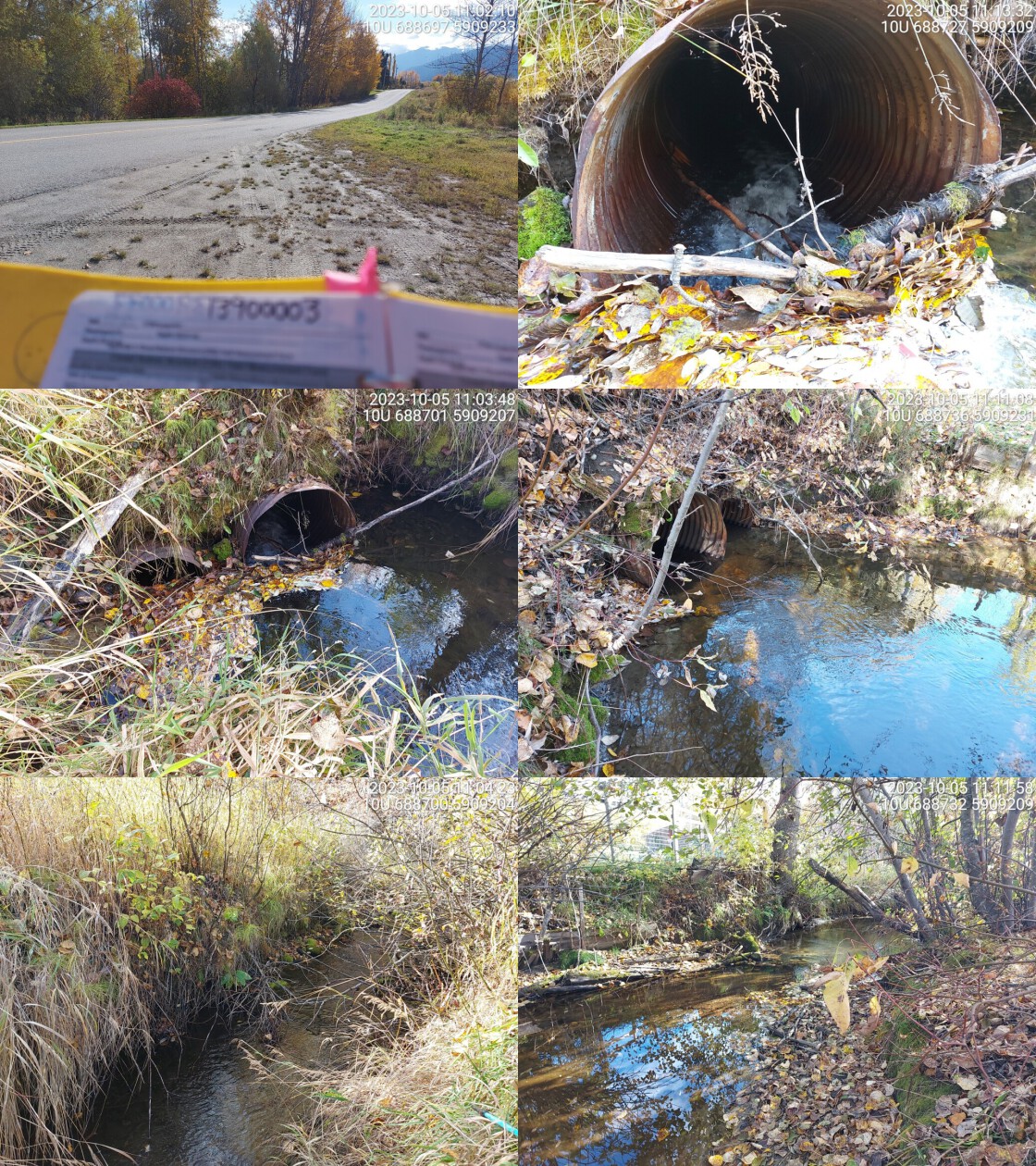 . From top left clockwise: Road/Site Card, Barrel, Outlet, Downstream, Upstream, Inlet.13900003 . From top left clockwise: Road/Site Card, Barrel, Outlet, Downstream, Upstream, Inlet.13900003
|
|||
| Comments: Two culverts, one bigger than the other. Debris jams at inlet creating drop and increasing stream velocity in pipe. Rail crossing upstream is a concrete OBS. Channel wider downstream than upstream.. 11:06:36 |
| Location and Stream Data |
|
Crossing Characteristics | – |
|---|---|---|---|
| Date | 2023-10-05 | Crossing Sub Type | Round Culvert |
| PSCIS ID | 199275 | Diameter (m) | 0.9 |
| External ID | 13900030 | Length (m) | 15 |
| Crew | MW | Embedded | No |
| UTM Zone | 10 | Depth Embedded (m) | – |
| Easting | 689523 | Resemble Channel | No |
| Northing | 5908856 | Backwatered | No |
| Stream | Tributary to Dominion Creek | Percent Backwatered | – |
| Road | Horseshoe Lake Rd | Fill Depth (m) | 0.5 |
| Road Tenure | MOTI Local | Outlet Drop (m) | 0 |
| Channel Width (m) | 0.9 | Outlet Pool Depth (m) | 0 |
| Stream Slope (%) | 1 | Inlet Drop | No |
| Beaver Activity | No | Slope (%) | 1 |
| Habitat Value | Low | Valley Fill | Deep Fill |
| Final score | 21 | Barrier Result | Barrier |
| Fix type | Replace Structure with Streambed Simulation CBS | Fix Span / Diameter | 3 |
Photos: PSCIS ID 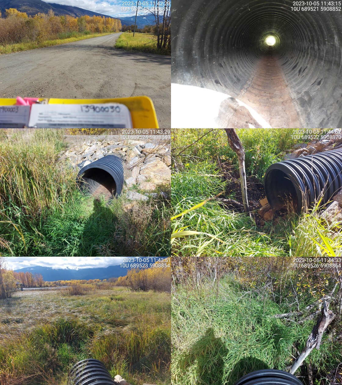 . From top left clockwise: Road/Site Card, Barrel, Outlet, Downstream, Upstream, Inlet.13900030 . From top left clockwise: Road/Site Card, Barrel, Outlet, Downstream, Upstream, Inlet.13900030
|
|||
| Comments: Dewateredat crossing with large wetland area upstream. Flow goes through mainstem of Dominion Creek just north through town. MoTi chris_culvert_id: 1462891. 11:52:44 |
| Location and Stream Data |
|
Crossing Characteristics | – |
|---|---|---|---|
| Date | 2023-10-05 | Crossing Sub Type | Oval Culvert |
| PSCIS ID | 199276 | Diameter (m) | 2.8 |
| External ID | 22200081 | Length (m) | 13 |
| Crew | MW | Embedded | No |
| UTM Zone | 11 | Depth Embedded (m) | – |
| Easting | 345396 | Resemble Channel | No |
| Northing | 5860898 | Backwatered | No |
| Stream | Crooked Creek | Percent Backwatered | – |
| Road | Loseth Road | Fill Depth (m) | 1 |
| Road Tenure | MOTI | Outlet Drop (m) | 0.42 |
| Channel Width (m) | 3.4 | Outlet Pool Depth (m) | 0.5 |
| Stream Slope (%) | 4.5 | Inlet Drop | No |
| Beaver Activity | No | Slope (%) | 4 |
| Habitat Value | Medium | Valley Fill | Deep Fill |
| Final score | 33 | Barrier Result | Barrier |
| Fix type | Replace with New Open Bottom Structure | Fix Span / Diameter | 15 |
Photos: PSCIS ID 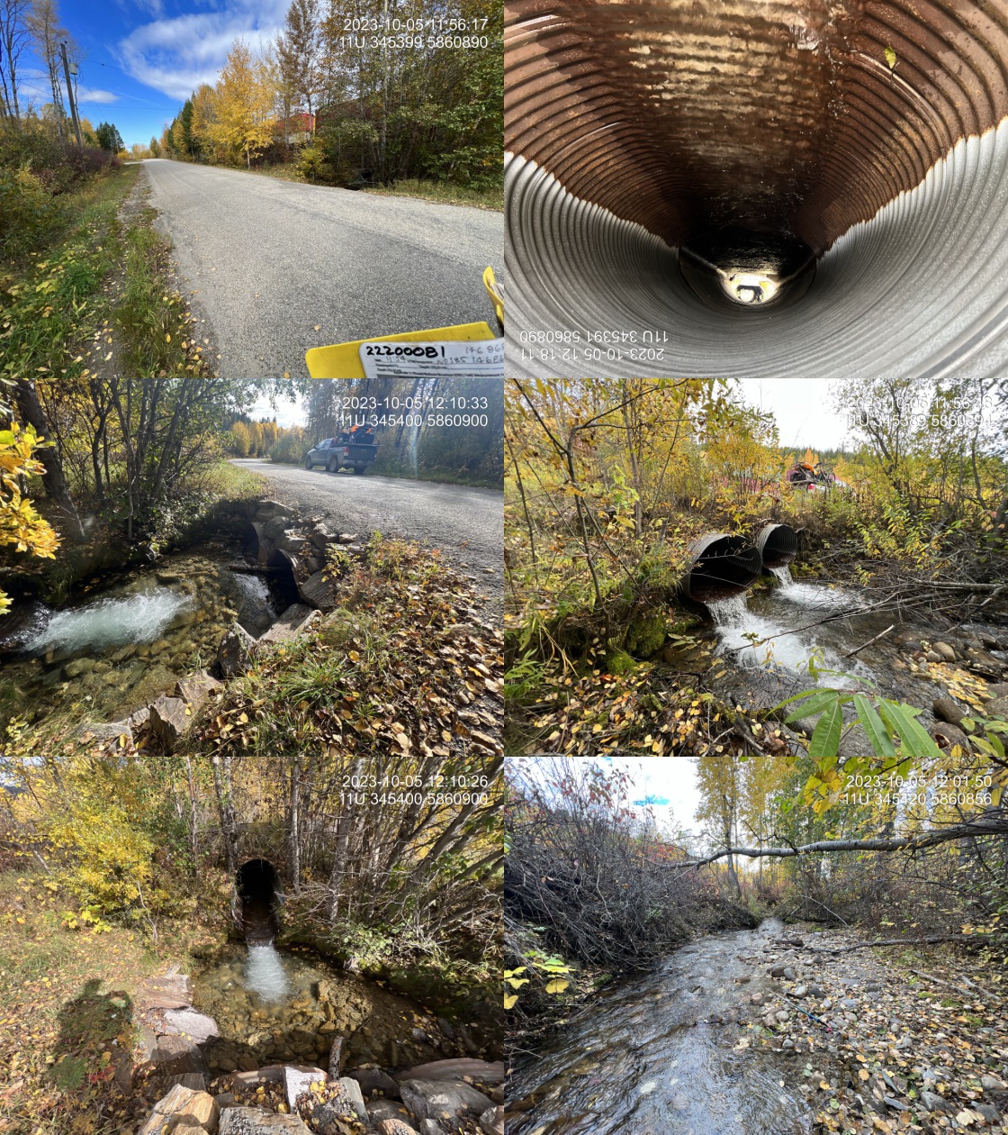 . From top left clockwise: Road/Site Card, Barrel, Outlet, Downstream, Upstream, Inlet.22200081 . From top left clockwise: Road/Site Card, Barrel, Outlet, Downstream, Upstream, Inlet.22200081
|
|||
| Comments: Two pipes at 1.4m diameter each. Crossing is only 5m downstream of the railway crossing. The stream has bigger volume of water at this location than it did below Highway 5 downstream. Water may be recharging beaver influenced wetlands downstream. Road edge has been armoured with riprap and downstream side of road bank is eroding significantly for approximately 60m. MoTi chris_culvert_id: 1468680, 1468681. 12:14:12 |
| Location and Stream Data |
|
Crossing Characteristics | – |
|---|---|---|---|
| Date | 2023-10-05 | Crossing Sub Type | Round Culvert |
| PSCIS ID | 199277 | Diameter (m) | 1.7 |
| External ID | 22201951 | Length (m) | 40 |
| Crew | MW | Embedded | No |
| UTM Zone | 11 | Depth Embedded (m) | – |
| Easting | 345405 | Resemble Channel | No |
| Northing | 5860914 | Backwatered | No |
| Stream | Crooked Creek | Percent Backwatered | – |
| Road | Railway | Fill Depth (m) | 2.5 |
| Road Tenure | CN Rail | Outlet Drop (m) | 0.2 |
| Channel Width (m) | 3.6 | Outlet Pool Depth (m) | 0.75 |
| Stream Slope (%) | 4.5 | Inlet Drop | Yes |
| Beaver Activity | No | Slope (%) | 2.5 |
| Habitat Value | Medium | Valley Fill | Deep Fill |
| Final score | 32 | Barrier Result | Barrier |
| Fix type | Replace with New Open Bottom Structure | Fix Span / Diameter | 15 |
Photos: PSCIS ID 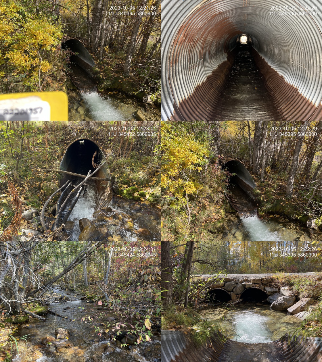 . From top left clockwise: Road/Site Card, Barrel, Outlet, Downstream, Upstream, Inlet.22201951 . From top left clockwise: Road/Site Card, Barrel, Outlet, Downstream, Upstream, Inlet.22201951
|
|||
| Comments: Culvert runs under both sets of tracks. Model Crossing will need to be removed from bcfishpass. Outlet of this pipe is immediately upstream of Loseth road with significant armouring around the outlet pool and road at the inlet downstream. Very nice stream with significant amounts of flow. Known rainbow stream. Much less flow downstream below Highway 5, which is very interesting.. 12:21:02 |
| Location and Stream Data |
|
Crossing Characteristics | – |
|---|---|---|---|
| Date | 2023-10-05 | Crossing Sub Type | Round Culvert |
| PSCIS ID | 199278 | Diameter (m) | 1.5 |
| External ID | 22201176 | Length (m) | 26 |
| Crew | MW | Embedded | No |
| UTM Zone | 11 | Depth Embedded (m) | – |
| Easting | 344016 | Resemble Channel | No |
| Northing | 5862741 | Backwatered | No |
| Stream | Teepee Creek | Percent Backwatered | – |
| Road | Highway 5 | Fill Depth (m) | 1.5 |
| Road Tenure | MOTI | Outlet Drop (m) | 0.4 |
| Channel Width (m) | 4.5 | Outlet Pool Depth (m) | 1 |
| Stream Slope (%) | 3.5 | Inlet Drop | Yes |
| Beaver Activity | No | Slope (%) | 1.5 |
| Habitat Value | High | Valley Fill | Deep Fill |
| Final score | 34 | Barrier Result | Barrier |
| Fix type | Replace with New Open Bottom Structure | Fix Span / Diameter | 15 |
Photos: PSCIS ID 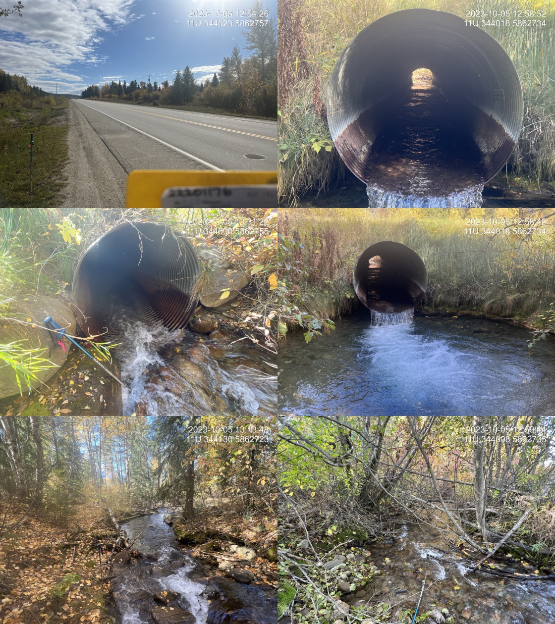 . From top left clockwise: Road/Site Card, Barrel, Outlet, Downstream, Upstream, Inlet.22201176 . From top left clockwise: Road/Site Card, Barrel, Outlet, Downstream, Upstream, Inlet.22201176
|
|||
| Comments: Very nice stream with salmon point in FISS located upstream. Very good flow with some pools present to 80cm deep upstream. Unassessed railway crossing approximately 200m upstream. There is no crossing at the pipeline but construction activities have resulted in a small cascade of boulders at the pipe which is similar to the natural cascade section observed approximately 50m upstream. Railway crossing downstream which is ranked as a barrier. MoTi chris_culvert_id: 1467202. 12:56:09 |
| Location and Stream Data |
|
Crossing Characteristics | – |
|---|---|---|---|
| Date | 2023-10-05 | Crossing Sub Type | Round Culvert |
| PSCIS ID | 199279 | Diameter (m) | 0.6 |
| External ID | 22200022 | Length (m) | 20 |
| Crew | MW | Embedded | No |
| UTM Zone | 11 | Depth Embedded (m) | – |
| Easting | 302951 | Resemble Channel | No |
| Northing | 5899072 | Backwatered | No |
| Stream | Tributary to Fraser river | Percent Backwatered | – |
| Road | Hinkelman Rd | Fill Depth (m) | 5 |
| Road Tenure | MOTI Local | Outlet Drop (m) | 0.7 |
| Channel Width (m) | 1.4 | Outlet Pool Depth (m) | 0 |
| Stream Slope (%) | 3 | Inlet Drop | No |
| Beaver Activity | No | Slope (%) | 1 |
| Habitat Value | Low | Valley Fill | Deep Fill |
| Final score | 34 | Barrier Result | Barrier |
| Fix type | Replace Structure with Streambed Simulation CBS | Fix Span / Diameter | 3 |
Photos: PSCIS ID  . From top left clockwise: Road/Site Card, Barrel, Outlet, Downstream, Upstream, Inlet.22200022 . From top left clockwise: Road/Site Card, Barrel, Outlet, Downstream, Upstream, Inlet.22200022
|
|||
| Comments: Very small stream with low flow. Embankment above outlet has been covered to prevent rockslide. MoTi chris_culvert_id: 1461358. 13:46:10 |
| Location and Stream Data |
|
Crossing Characteristics | – |
|---|---|---|---|
| Date | 2023-10-05 | Crossing Sub Type | Round Culvert |
| PSCIS ID | 199280 | Diameter (m) | 1.05 |
| External ID | 22200075 | Length (m) | 19 |
| Crew | MW | Embedded | No |
| UTM Zone | 11 | Depth Embedded (m) | – |
| Easting | 335908 | Resemble Channel | No |
| Northing | 5872652 | Backwatered | No |
| Stream | L’Esrange Creek | Percent Backwatered | Р|
| Road | L’heureux Road | Fill Depth (m) | 1.8 |
| Road Tenure | MOTI | Outlet Drop (m) | 0.5 |
| Channel Width (m) | 2.2 | Outlet Pool Depth (m) | 0.4 |
| Stream Slope (%) | 2 | Inlet Drop | No |
| Beaver Activity | No | Slope (%) | 3 |
| Habitat Value | Medium | Valley Fill | Deep Fill |
| Final score | 39 | Barrier Result | Barrier |
| Fix type | Replace with New Open Bottom Structure | Fix Span / Diameter | 15 |
Photos: PSCIS ID  . From top left clockwise: Road/Site Card, Barrel, Outlet, Downstream, Upstream, Inlet.22200075 . From top left clockwise: Road/Site Card, Barrel, Outlet, Downstream, Upstream, Inlet.22200075
|
|||
| Comments: Nice little stream with good flow and abundant small gravel’s upstream. There may be crossings downstream on private land. Significant amount of large riprap placed around inlet and outlet to protect the crossing. Outlet is placed on large piece of riprap, so 0.3m was added to the 0.2m outlet drop to account for the additional distance from the stream to the outlet. RB observed upstream. MoTi chris_culvert_id: 1466467. 14:00:15 |
| Location and Stream Data |
|
Crossing Characteristics | – |
|---|---|---|---|
| Date | 2023-10-05 | Crossing Sub Type | Oval Culvert |
| PSCIS ID | 199281 | Diameter (m) | 1.7 |
| External ID | 22201218 | Length (m) | 35 |
| Crew | MW | Embedded | No |
| UTM Zone | 11 | Depth Embedded (m) | – |
| Easting | 335375 | Resemble Channel | No |
| Northing | 5873132 | Backwatered | No |
| Stream | Goslin Creek | Percent Backwatered | – |
| Road | Highway 16 | Fill Depth (m) | 2 |
| Road Tenure | MOTI | Outlet Drop (m) | 0.4 |
| Channel Width (m) | 1 | Outlet Pool Depth (m) | 0.4 |
| Stream Slope (%) | 0 | Inlet Drop | No |
| Beaver Activity | No | Slope (%) | 2 |
| Habitat Value | Medium | Valley Fill | Deep Fill |
| Final score | 31 | Barrier Result | Barrier |
| Fix type | Replace Structure with Streambed Simulation CBS | Fix Span / Diameter | 3 |
Photos: PSCIS ID  . From top left clockwise: Road/Site Card, Barrel, Outlet, Downstream, Upstream, Inlet.22201218 . From top left clockwise: Road/Site Card, Barrel, Outlet, Downstream, Upstream, Inlet.22201218
|
|||
| Comments: Very nice stream with good flow and abundant gravels upstream. Pipe is an extremely bad shape with extensive corrosion inside of the pipe particularly at the downstream and - see photos. Likely at least one crossing downstream on private land. Transmission line corridor is located immediately upstream and the channel appears to be modified in this location to be straighter and narrower than its natural state. No crossing immediately upstream on Goslin Road (no road - crossing should be removed as potential barrier in bcfishpass) MoTi chris_culvert_id: 1465295. 14:28:28 |
| Location and Stream Data |
|
Crossing Characteristics | – |
|---|---|---|---|
| Date | 2023-10-05 | Crossing Sub Type | Round Culvert |
| PSCIS ID | 199282 | Diameter (m) | 2.5 |
| External ID | 22201229 | Length (m) | 56 |
| Crew | MW | Embedded | No |
| UTM Zone | 11 | Depth Embedded (m) | – |
| Easting | 305965 | Resemble Channel | No |
| Northing | 5896000 | Backwatered | No |
| Stream | Holliday Creek | Percent Backwatered | – |
| Road | Highway 16 | Fill Depth (m) | 2.3 |
| Road Tenure | MOTI | Outlet Drop (m) | 0.4 |
| Channel Width (m) | 10.8 | Outlet Pool Depth (m) | 0.3 |
| Stream Slope (%) | 5 | Inlet Drop | No |
| Beaver Activity | No | Slope (%) | 2 |
| Habitat Value | High | Valley Fill | Deep Fill |
| Final score | 37 | Barrier Result | Barrier |
| Fix type | Replace with New Open Bottom Structure | Fix Span / Diameter | 15 |
Photos: PSCIS ID 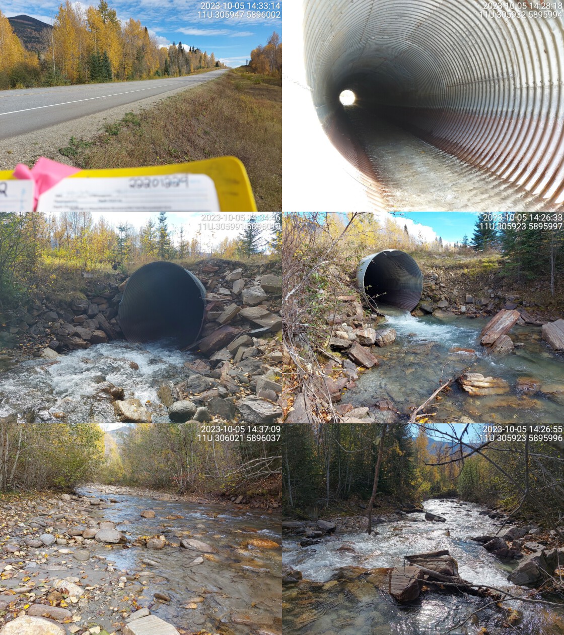 . From top left clockwise: Road/Site Card, Barrel, Outlet, Downstream, Upstream, Inlet.22201229 . From top left clockwise: Road/Site Card, Barrel, Outlet, Downstream, Upstream, Inlet.22201229
|
|||
| Comments: Culvert is undersized for a stream of this size. High flow, channel is just over 10m wide upstream. Chinook confirmed downstream in the past. MoTi chris_hwy_structure_road_id: 29925. 14:39:41 |
| Location and Stream Data |
|
Crossing Characteristics | – |
|---|---|---|---|
| Date | 2023-10-05 | Crossing Sub Type | Round Culvert |
| PSCIS ID | 199283 | Diameter (m) | 1.4 |
| External ID | 22200029 | Length (m) | 19 |
| Crew | MW | Embedded | No |
| UTM Zone | 11 | Depth Embedded (m) | – |
| Easting | 309830 | Resemble Channel | No |
| Northing | 5892394 | Backwatered | No |
| Stream | Tributary to Fraser River | Percent Backwatered | – |
| Road | River Rd | Fill Depth (m) | 2.2 |
| Road Tenure | MOTI Local | Outlet Drop (m) | 0.2 |
| Channel Width (m) | 1.2 | Outlet Pool Depth (m) | 0.2 |
| Stream Slope (%) | 3.5 | Inlet Drop | No |
| Beaver Activity | No | Slope (%) | 0 |
| Habitat Value | Low | Valley Fill | Deep Fill |
| Final score | 18 | Barrier Result | Potential |
| Fix type | Replace Structure with Streambed Simulation CBS | Fix Span / Diameter | 3 |
Photos: PSCIS ID 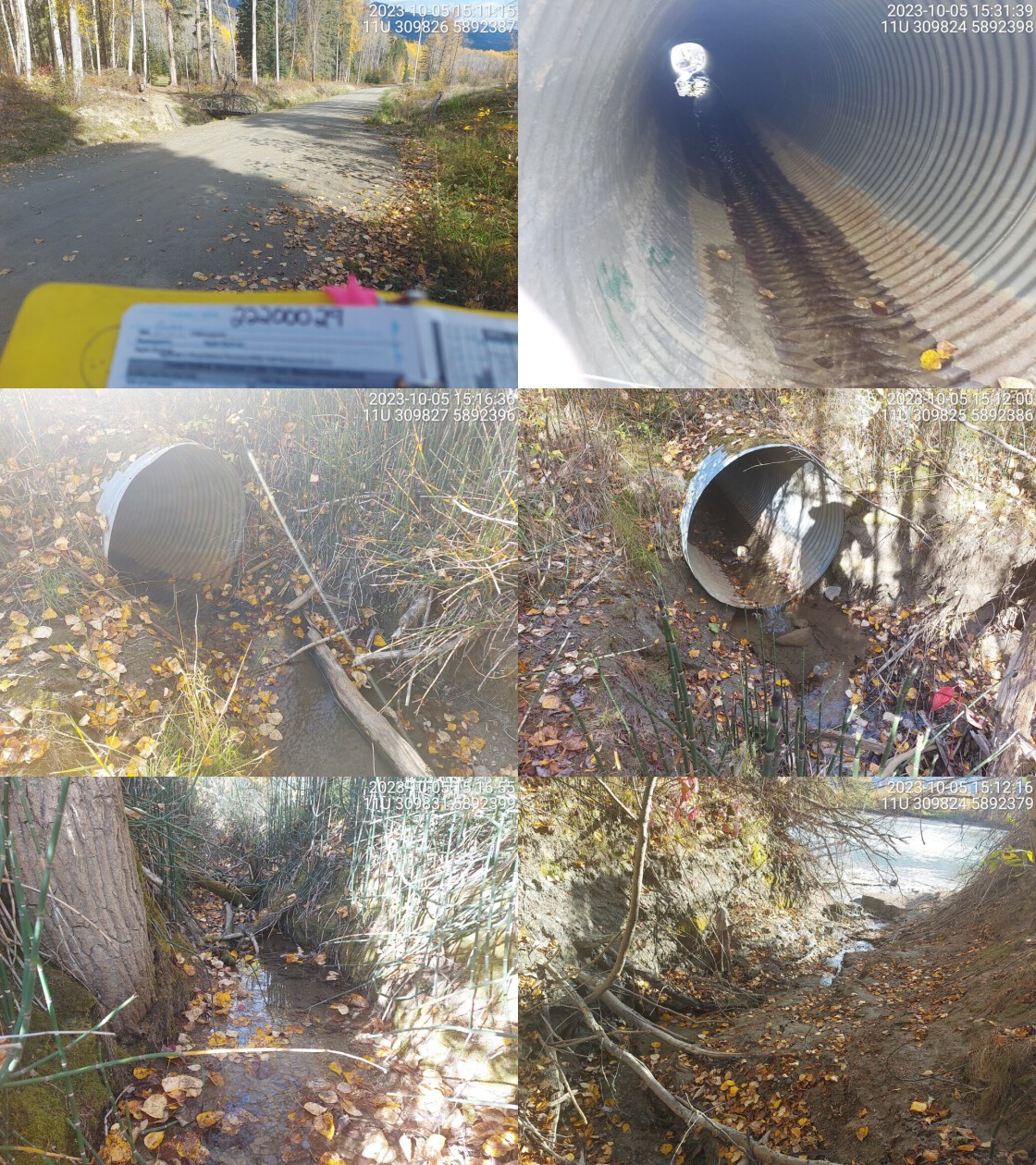 . From top left clockwise: Road/Site Card, Barrel, Outlet, Downstream, Upstream, Inlet.22200029 . From top left clockwise: Road/Site Card, Barrel, Outlet, Downstream, Upstream, Inlet.22200029
|
|||
| Comments: Small stream with low flow. Muddy, fine substrate makes up most of streambed. Very close to Fraser River. MoTi chris_culvert_id: 3189063. 15:17:53 |
| Location and Stream Data |
|
Crossing Characteristics | – |
|---|---|---|---|
| Date | 2023-10-05 | Crossing Sub Type | Round Culvert |
| PSCIS ID | 199284 | Diameter (m) | 2.6 |
| External ID | 22200067 | Length (m) | 18 |
| Crew | MW | Embedded | No |
| UTM Zone | 11 | Depth Embedded (m) | – |
| Easting | 331575 | Resemble Channel | No |
| Northing | 5875589 | Backwatered | No |
| Stream | Spittal Creek | Percent Backwatered | – |
| Road | Care Road | Fill Depth (m) | 1.5 |
| Road Tenure | MOTI | Outlet Drop (m) | 0 |
| Channel Width (m) | 5.8 | Outlet Pool Depth (m) | 0.4 |
| Stream Slope (%) | 6 | Inlet Drop | Yes |
| Beaver Activity | No | Slope (%) | 5 |
| Habitat Value | High | Valley Fill | Deep Fill |
| Final score | 29 | Barrier Result | Barrier |
| Fix type | Replace with New Open Bottom Structure | Fix Span / Diameter | 15 |
Photos: PSCIS ID 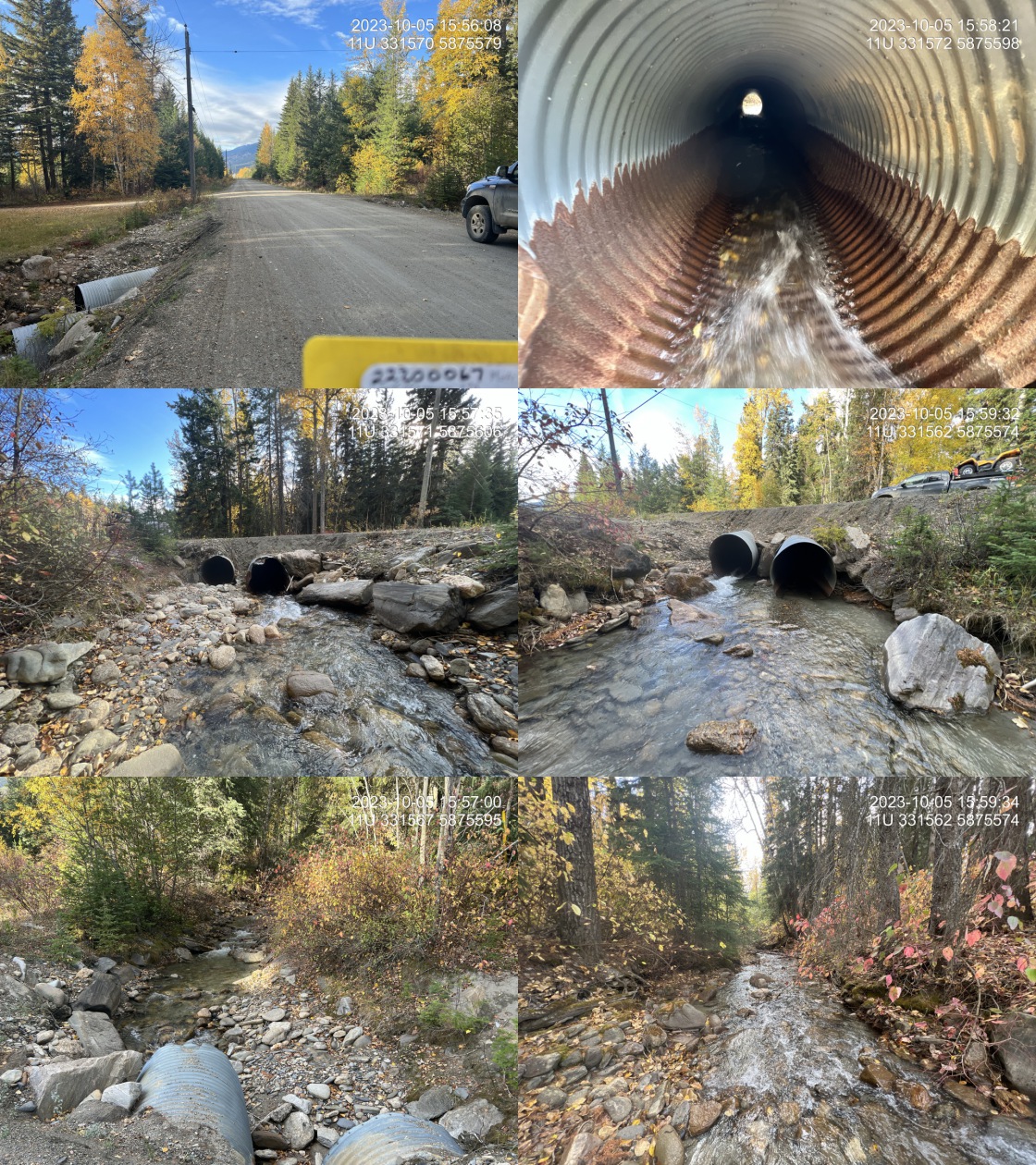 . From top left clockwise: Road/Site Card, Barrel, Outlet, Downstream, Upstream, Inlet.22200067 . From top left clockwise: Road/Site Card, Barrel, Outlet, Downstream, Upstream, Inlet.22200067
|
|||
| Comments: Pipes and road are in extremely poor condition with evidence of embankment failure and pipes rusted all the way through on the bottom side in places. Small side road parallel to Highway 16 with residences that could be accessed from either side. Removal of crossing could perhaps be considered. Large high value system suitable for bulltrout rearing. Culvert upstream is relatively new concrete box culvert on the highway which is over half embedded and 3.7m wide. MoTi chris_culvert_id: 1466350. 15:53:19 |
| Location and Stream Data |
|
Crossing Characteristics | – |
|---|---|---|---|
| Date | 2023-10-05 | Crossing Sub Type | Round Culvert |
| PSCIS ID | 199285 | Diameter (m) | 1.1 |
| External ID | 22200051 | Length (m) | 8 |
| Crew | MW | Embedded | No |
| UTM Zone | 11 | Depth Embedded (m) | – |
| Easting | 312484 | Resemble Channel | No |
| Northing | 5892004 | Backwatered | No |
| Stream | Tributary to Fraser River | Percent Backwatered | – |
| Road | Read Rd | Fill Depth (m) | 1 |
| Road Tenure | MOTI Local | Outlet Drop (m) | 0 |
| Channel Width (m) | 2.5 | Outlet Pool Depth (m) | 0 |
| Stream Slope (%) | 4.5 | Inlet Drop | No |
| Beaver Activity | No | Slope (%) | 5 |
| Habitat Value | Medium | Valley Fill | Deep Fill |
| Final score | 26 | Barrier Result | Barrier |
| Fix type | Replace with New Open Bottom Structure | Fix Span / Diameter | 15 |
Photos: PSCIS ID 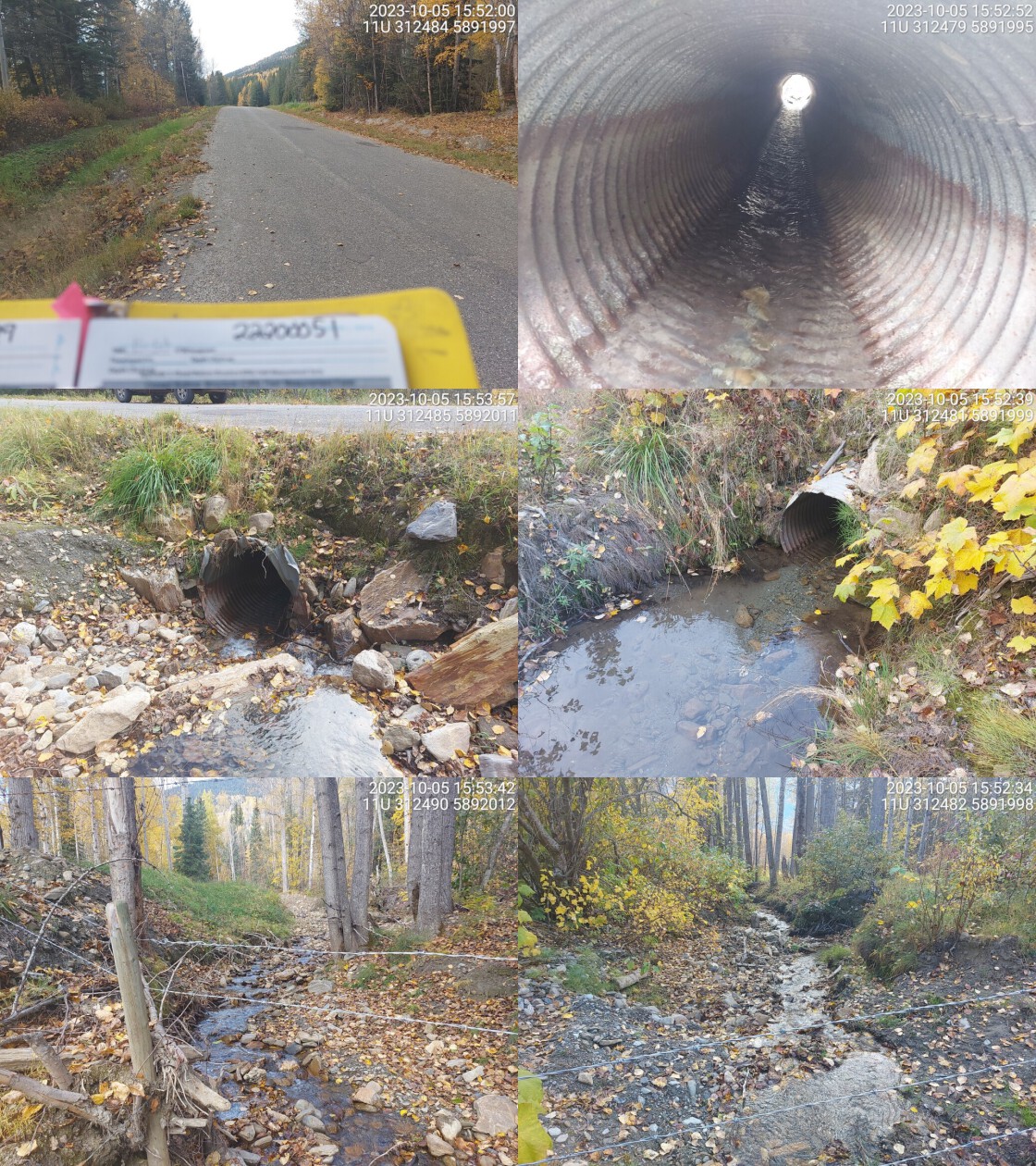 . From top left clockwise: Road/Site Card, Barrel, Outlet, Downstream, Upstream, Inlet.22200051 . From top left clockwise: Road/Site Card, Barrel, Outlet, Downstream, Upstream, Inlet.22200051
|
|||
| Comments: Stream flows through private fenced off land on both sides. Moderate flow and a wide entrenched channel upstream. It appears cobbles are the predominant stream substrate and gravels subdominant. MoTi chris_culvert_id: 1463590. 15:57:40 |
| Location and Stream Data |
|
Crossing Characteristics | – |
|---|---|---|---|
| Date | 2023-10-05 | Crossing Sub Type | Concrete Box |
| PSCIS ID | 199286 | Diameter (m) | 3.65 |
| External ID | 22200061 | Length (m) | 21 |
| Crew | MW | Embedded | No |
| UTM Zone | 11 | Depth Embedded (m) | – |
| Easting | 331629 | Resemble Channel | No |
| Northing | 5875684 | Backwatered | No |
| Stream | Spittal Creek | Percent Backwatered | – |
| Road | Highway 16 | Fill Depth (m) | 1.5 |
| Road Tenure | MOTI | Outlet Drop (m) | 0 |
| Channel Width (m) | 5.8 | Outlet Pool Depth (m) | 0.2 |
| Stream Slope (%) | 6 | Inlet Drop | Yes |
| Beaver Activity | No | Slope (%) | 6 |
| Habitat Value | High | Valley Fill | Deep Fill |
| Final score | 29 | Barrier Result | Barrier |
| Fix type | Replace with New Open Bottom Structure | Fix Span / Diameter | 15 |
Photos: PSCIS ID 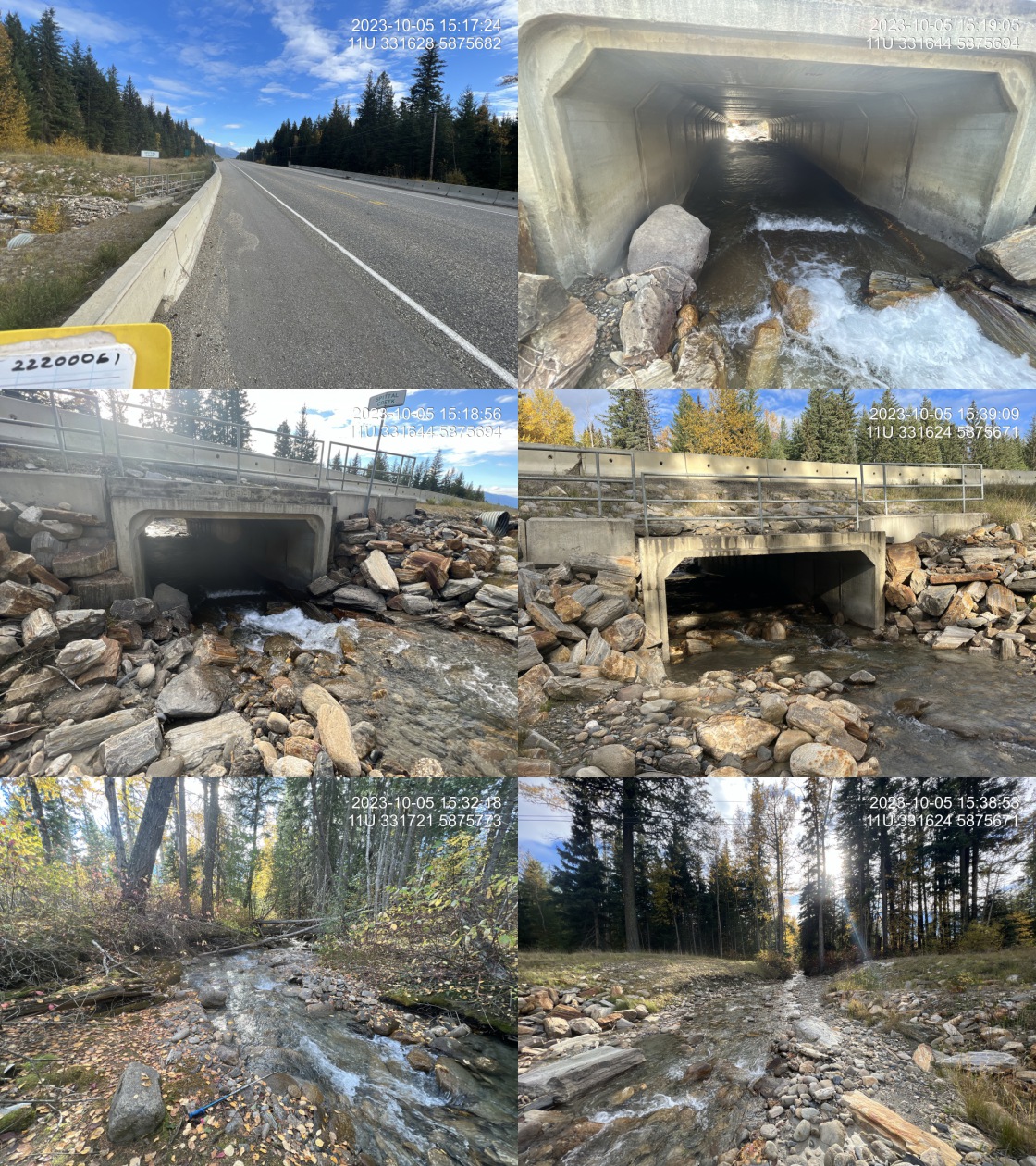 . From top left clockwise: Road/Site Card, Barrel, Outlet, Downstream, Upstream, Inlet.22200061 . From top left clockwise: Road/Site Card, Barrel, Outlet, Downstream, Upstream, Inlet.22200061
|
|||
| Comments: Large stream with cobble boulder substrate suitable for bull trout. Concrete box culvert is 60% embedded on the downstream side. Decent amount of debris is clogging the inlet. Although not perfect, this culvert appears to be fairly new with some embeddedment so not earmarked for follow up. MoTi chris_hwy_structure_road_id: 29885. 22:39:24 |
| Location and Stream Data |
|
Crossing Characteristics | – |
|---|---|---|---|
| Date | 2023-09-28 | Crossing Sub Type | Round Culvert |
| PSCIS ID | 199287 | Diameter (m) | 2.25 |
| External ID | 5400446 | Length (m) | 22 |
| Crew | AI | Embedded | No |
| UTM Zone | 10 | Depth Embedded (m) | – |
| Easting | 307446 | Resemble Channel | No |
| Northing | 6030655 | Backwatered | Yes |
| Stream | Rentoul Creek | Percent Backwatered | 100 |
| Road | Highway 16 | Fill Depth (m) | 1 |
| Road Tenure | MOTI | Outlet Drop (m) | 0 |
| Channel Width (m) | 3.8 | Outlet Pool Depth (m) | 0.3 |
| Stream Slope (%) | 2 | Inlet Drop | No |
| Beaver Activity | No | Slope (%) | 1.5 |
| Habitat Value | High | Valley Fill | Deep Fill |
| Final score | 24 | Barrier Result | Barrier |
| Fix type | Replace with New Open Bottom Structure | Fix Span / Diameter | 15 |
Photos: PSCIS ID 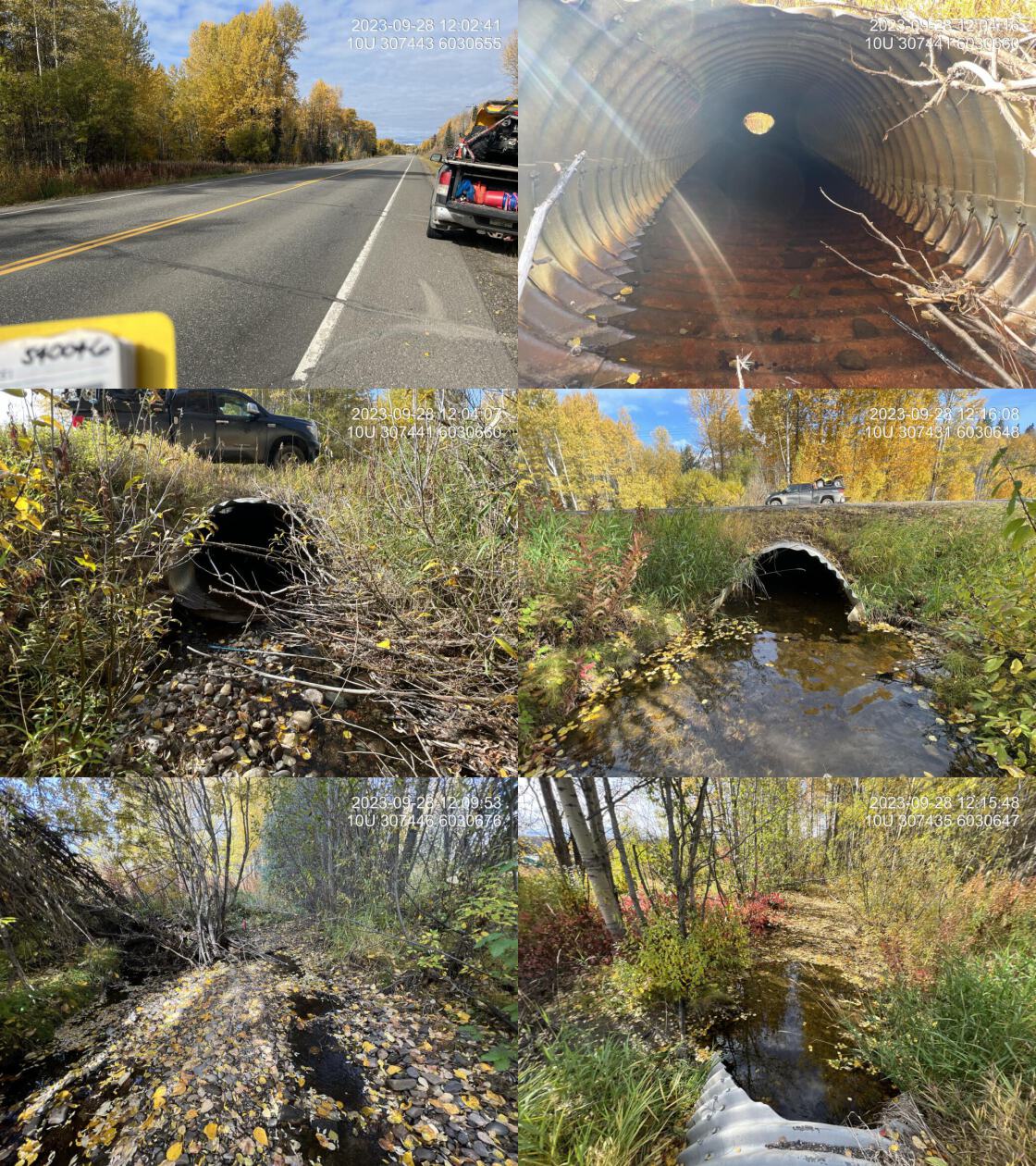 . From top left clockwise: Road/Site Card, Barrel, Outlet, Downstream, Upstream, Inlet.5400446 . From top left clockwise: Road/Site Card, Barrel, Outlet, Downstream, Upstream, Inlet.5400446
|
|||
| Comments: Nice stream with good flow and abundant gravel throughout low gradients. Adjacent property is northern wildlife design. Crossing is currently 100% backwaters and passable to all life stages and species at these lower flow levels. MoTi chris_culvert_id: 2076441. 12:01:27 |
| Location and Stream Data |
|
Crossing Characteristics | – |
|---|---|---|---|
| Date | 2023-09-28 | Crossing Sub Type | Round Culvert |
| PSCIS ID | 199288 | Diameter (m) | 1.7 |
| External ID | 5400589 | Length (m) | 22 |
| Crew | AI | Embedded | No |
| UTM Zone | 10 | Depth Embedded (m) | – |
| Easting | 311154 | Resemble Channel | No |
| Northing | 6025092 | Backwatered | Yes |
| Stream | Tributary to Endako River | Percent Backwatered | 100 |
| Road | West Decker Rd | Fill Depth (m) | 1 |
| Road Tenure | MOTI | Outlet Drop (m) | 0 |
| Channel Width (m) | 4.5 | Outlet Pool Depth (m) | 1 |
| Stream Slope (%) | 0 | Inlet Drop | No |
| Beaver Activity | Yes | Slope (%) | 0 |
| Habitat Value | Medium | Valley Fill | Deep Fill |
| Final score | 19 | Barrier Result | Potential |
| Fix type | Replace with New Open Bottom Structure | Fix Span / Diameter | 15 |
Photos: PSCIS ID 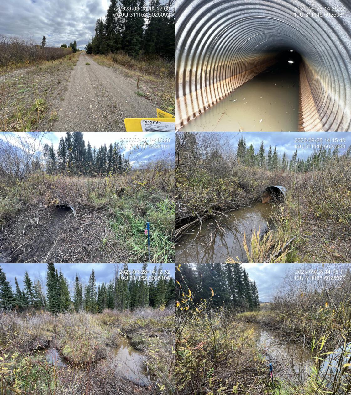 . From top left clockwise: Road/Site Card, Barrel, Outlet, Downstream, Upstream, Inlet.5400589 . From top left clockwise: Road/Site Card, Barrel, Outlet, Downstream, Upstream, Inlet.5400589
|
|||
| Comments: Major beaver activity with inlet of pipe 3/4 blocked by mud. 0.6m overflow pipe also present. Low gradient, willow dominated, beaver influenced floodplain habitat upstream and downstream. Pipe is backwatered however, the inlet is blocked so fish passage was not happening at time of assessment. Crossing on railway upstream, not yet assessed. MoTi chris_culvert_id: 2077136, 2077137. 14:10:33 |
| Location and Stream Data |
|
Crossing Characteristics | – |
|---|---|---|---|
| Date | 2023-09-29 | Crossing Sub Type | Round Culvert |
| PSCIS ID | 199289 | Diameter (m) | 3.6 |
| External ID | 5400423 | Length (m) | 22 |
| Crew | AI | Embedded | No |
| UTM Zone | 10 | Depth Embedded (m) | – |
| Easting | 327463 | Resemble Channel | No |
| Northing | 6011366 | Backwatered | Yes |
| Stream | Stearns Creek | Percent Backwatered | 60 |
| Road | Tintagel Road | Fill Depth (m) | 1 |
| Road Tenure | MOTI | Outlet Drop (m) | 0 |
| Channel Width (m) | 5 | Outlet Pool Depth (m) | 0.1 |
| Stream Slope (%) | 1.5 | Inlet Drop | No |
| Beaver Activity | No | Slope (%) | 1.5 |
| Habitat Value | High | Valley Fill | Deep Fill |
| Final score | 24 | Barrier Result | Barrier |
| Fix type | Replace with New Open Bottom Structure | Fix Span / Diameter | 15 |
Photos: PSCIS ID 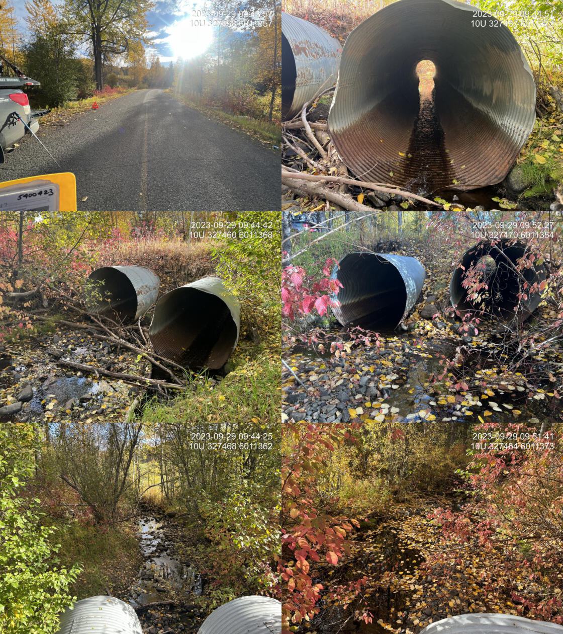 . From top left clockwise: Road/Site Card, Barrel, Outlet, Downstream, Upstream, Inlet.5400423 . From top left clockwise: Road/Site Card, Barrel, Outlet, Downstream, Upstream, Inlet.5400423
|
|||
| Comments: Two pipes at 1.8 m each, north pipe slightly lower than south pipe at outlet. Good sized stream with great flow for this time of year on a dry year. Abundant black algae on gravel and cobble substrate. Very nice stream. Appears to have decent riparian health adjacent to the crossing but riparian buffer to be enlarged particularly on upstream south side. Downstream crossing on highway was fully backwatered and not a barrier at the time of assessment. MoTi chris_culvert_id: 2070691, 2070692. 09:42:44 |
| Location and Stream Data |
|
Crossing Characteristics | – |
|---|---|---|---|
| Date | 2023-09-29 | Crossing Sub Type | Round Culvert |
| PSCIS ID | 199290 | Diameter (m) | 9.99 |
| External ID | 5400024 | Length (m) | 35 |
| Crew | AI | Embedded | No |
| UTM Zone | 10 | Depth Embedded (m) | – |
| Easting | 345676 | Resemble Channel | No |
| Northing | 6001245 | Backwatered | Yes |
| Stream | Endako River | Percent Backwatered | 100 |
| Road | Highway 16 | Fill Depth (m) | 3 |
| Road Tenure | MOTI | Outlet Drop (m) | 0 |
| Channel Width (m) | 17 | Outlet Pool Depth (m) | 0.7 |
| Stream Slope (%) | 0 | Inlet Drop | No |
| Beaver Activity | Yes | Slope (%) | 0.5 |
| Habitat Value | High | Valley Fill | Deep Fill |
| Final score | 22 | Barrier Result | Barrier |
| Fix type | Replace with New Open Bottom Structure | Fix Span / Diameter | 22 |
Photos: PSCIS ID 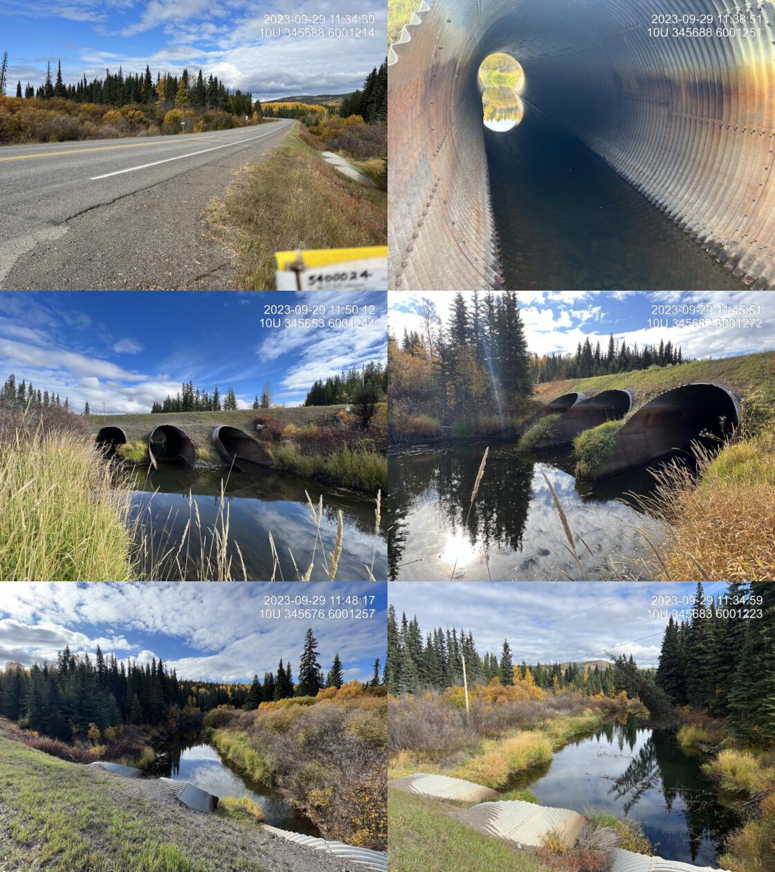 . From top left clockwise: Road/Site Card, Barrel, Outlet, Downstream, Upstream, Inlet.5400024 . From top left clockwise: Road/Site Card, Barrel, Outlet, Downstream, Upstream, Inlet.5400024
|
|||
| Comments: Three 4 m diameter pipes. All three pipes are 100% backwatered, and passable. Road prism and pipes appear to be in good condition. Extensive beaver activity upstream and downstream. Diameter changed from 12m to 9.99m to meet spreadsheet requirements. MoTi chris_hwy_structure_road_id: 3812. 11:35:39 |
| Location and Stream Data |
|
Crossing Characteristics | – |
|---|---|---|---|
| Date | 2023-09-29 | Crossing Sub Type | Round Culvert |
| PSCIS ID | 199291 | Diameter (m) | 1.5 |
| External ID | 15600273 | Length (m) | 18 |
| Crew | AI | Embedded | No |
| UTM Zone | 10 | Depth Embedded (m) | – |
| Easting | 398480 | Resemble Channel | No |
| Northing | 5976390 | Backwatered | Yes |
| Stream | Tahultzu Creek | Percent Backwatered | 100 |
| Road | Zalenski Road | Fill Depth (m) | 0.5 |
| Road Tenure | MOTI | Outlet Drop (m) | 0 |
| Channel Width (m) | 3 | Outlet Pool Depth (m) | 0.3 |
| Stream Slope (%) | 0 | Inlet Drop | No |
| Beaver Activity | No | Slope (%) | 0.5 |
| Habitat Value | Medium | Valley Fill | Deep Fill |
| Final score | 19 | Barrier Result | Potential |
| Fix type | Replace with New Open Bottom Structure | Fix Span / Diameter | 15 |
Photos: PSCIS ID 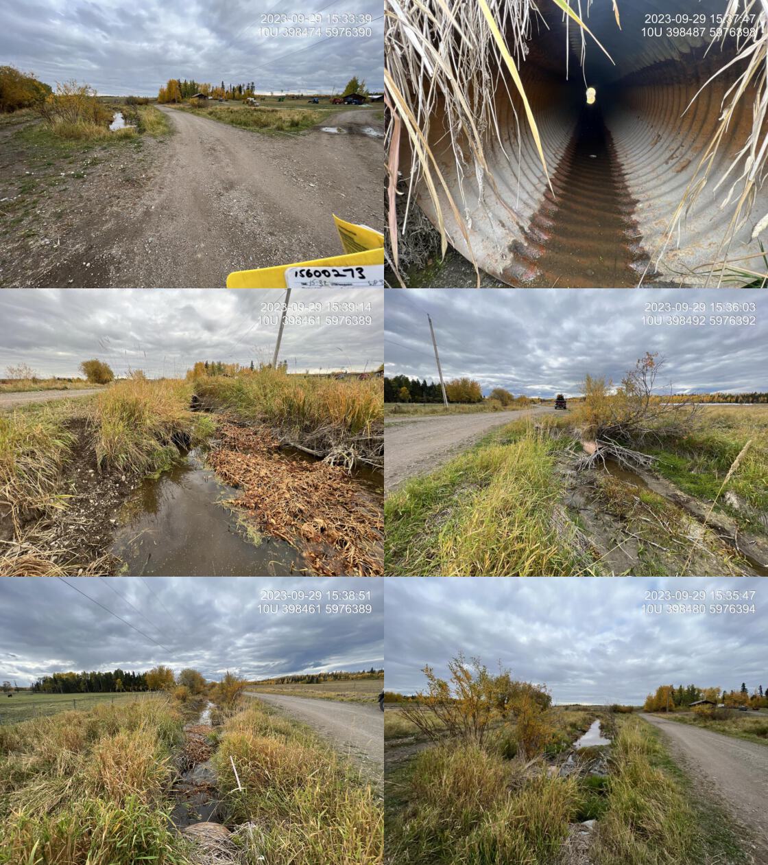 . From top left clockwise: Road/Site Card, Barrel, Outlet, Downstream, Upstream, Inlet.15600273 . From top left clockwise: Road/Site Card, Barrel, Outlet, Downstream, Upstream, Inlet.15600273
|
|||
| Comments: Stream is extremely impacted by cattle ranching. Banks eroded and trampled. Algae indicates nutrient inputs from cows are high. Pipes are old with a lot of rust. Habitat value is currently very poor, but historically would’ve been high. Still a good amount of flow for a dry year. 100% backwatered however, depth of the water is only approximately 1 cm. Absolutely no riparian vegetation or cattle exclusion fencing on the upstream side for as far as the eye can see (approximately 1 km.). MoTi chris_culvert_id: 1790770, 1790769. 15:33:57 |
| Location and Stream Data |
|
Crossing Characteristics | – |
|---|---|---|---|
| Date | 2023-09-30 | Crossing Sub Type | Oval Culvert |
| PSCIS ID | 199292 | Diameter (m) | 4.5 |
| External ID | 24727338 | Length (m) | 32 |
| Crew | AI | Embedded | No |
| UTM Zone | 10 | Depth Embedded (m) | – |
| Easting | 385711 | Resemble Channel | No |
| Northing | 5995594 | Backwatered | Yes |
| Stream | Ormond Creek | Percent Backwatered | 100 |
| Road | Stella Road | Fill Depth (m) | 1 |
| Road Tenure | MOTI | Outlet Drop (m) | 0 |
| Channel Width (m) | 6 | Outlet Pool Depth (m) | 1.3 |
| Stream Slope (%) | 0 | Inlet Drop | No |
| Beaver Activity | Yes | Slope (%) | 0 |
| Habitat Value | High | Valley Fill | Deep Fill |
| Final score | 22 | Barrier Result | Barrier |
| Fix type | Replace with New Open Bottom Structure | Fix Span / Diameter | 15 |
Photos: PSCIS ID 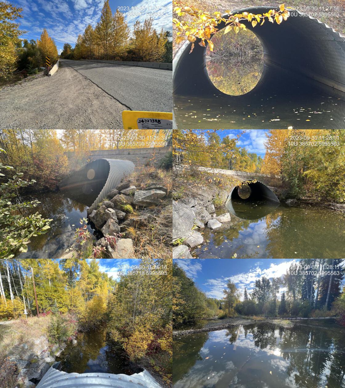 . From top left clockwise: Road/Site Card, Barrel, Outlet, Downstream, Upstream, Inlet.24727338 . From top left clockwise: Road/Site Card, Barrel, Outlet, Downstream, Upstream, Inlet.24727338
|
|||
| Comments: 100% backwatered at time of assessment. Beaver dams downstream backwatering the crossing. Pipe and road prism in great shape. Fully passable for all species and life stages at the time of assessment. Some small amount of embeddedment but only for a small piece of the pipe diameter. Known chinook system with significant restoration works upstream. MoTi chris_hwy_structure_road_id: 2678. 11:25:13 |
| Location and Stream Data |
|
Crossing Characteristics | – |
|---|---|---|---|
| Date | 2023-09-09 | Crossing Sub Type | Round Culvert |
| PSCIS ID | 199293 | Diameter (m) | 2.2 |
| External ID | 15600468 | Length (m) | 14 |
| Crew | MW | Embedded | No |
| UTM Zone | 10 | Depth Embedded (m) | – |
| Easting | 429073 | Resemble Channel | No |
| Northing | 5991955 | Backwatered | Yes |
| Stream | Murray Creek | Percent Backwatered | 100 |
| Road | Northside Rd | Fill Depth (m) | 1.5 |
| Road Tenure | MOTI | Outlet Drop (m) | 0 |
| Channel Width (m) | 2.7 | Outlet Pool Depth (m) | 0.5 |
| Stream Slope (%) | 0 | Inlet Drop | No |
| Beaver Activity | No | Slope (%) | 0.5 |
| Habitat Value | Medium | Valley Fill | Deep Fill |
| Final score | 13 | Barrier Result | Passable |
| Fix type | – | Fix Span / Diameter | – |
Photos: PSCIS ID 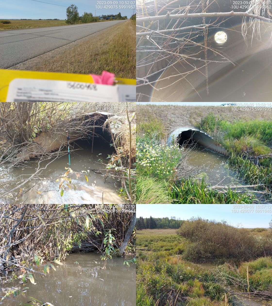 . From top left clockwise: Road/Site Card, Barrel, Outlet, Downstream, Upstream, Inlet.15600468 . From top left clockwise: Road/Site Card, Barrel, Outlet, Downstream, Upstream, Inlet.15600468
|
|||
| Comments: Agricultural land on both sides and cow pasture downstream. Fully backwatered culvert with no flowing water. Cows seen intruding into the stream channel at time of survey. MoTi chris_culvert_id: 1799951. 10:55:03 |
| Location and Stream Data |
|
Crossing Characteristics | – |
|---|---|---|---|
| Date | 2023-09-09 | Crossing Sub Type | Concrete Box |
| PSCIS ID | 199294 | Diameter (m) | 3.1 |
| External ID | 15600111 | Length (m) | 16 |
| Crew | MW | Embedded | No |
| UTM Zone | 10 | Depth Embedded (m) | – |
| Easting | 429944 | Resemble Channel | No |
| Northing | 5992722 | Backwatered | Yes |
| Stream | Murray Creek | Percent Backwatered | 100 |
| Road | Larson Road | Fill Depth (m) | 0.5 |
| Road Tenure | MOTI Local | Outlet Drop (m) | 0 |
| Channel Width (m) | 2.7 | Outlet Pool Depth (m) | 0.1 |
| Stream Slope (%) | 0.5 | Inlet Drop | No |
| Beaver Activity | No | Slope (%) | 0 |
| Habitat Value | High | Valley Fill | Deep Fill |
| Final score | 13 | Barrier Result | Passable |
| Fix type | – | Fix Span / Diameter | – |
Photos: PSCIS ID 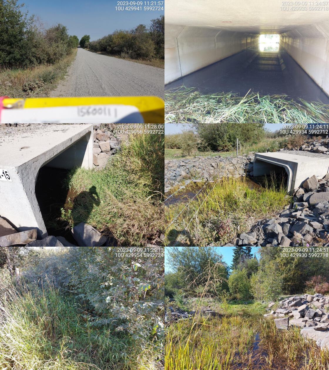 . From top left clockwise: Road/Site Card, Barrel, Outlet, Downstream, Upstream, Inlet.15600111 . From top left clockwise: Road/Site Card, Barrel, Outlet, Downstream, Upstream, Inlet.15600111
|
|||
| Comments: Stream section is part of rehab project. New - fully backwatered structure likley passable to all life stages and species at time of assessment. MoTi chris_hwy_structure_road_id: 26621. 11:25:02 |
| Location and Stream Data |
|
Crossing Characteristics | – |
|---|---|---|---|
| Date | 2023-09-09 | Crossing Sub Type | Round Culvert |
| PSCIS ID | 199295 | Diameter (m) | 2.5 |
| External ID | 15600106 | Length (m) | 18 |
| Crew | MW | Embedded | No |
| UTM Zone | 10 | Depth Embedded (m) | – |
| Easting | 431487 | Resemble Channel | No |
| Northing | 5990586 | Backwatered | Yes |
| Stream | East Murray Creek | Percent Backwatered | 100 |
| Road | Northside Rd | Fill Depth (m) | 3 |
| Road Tenure | MOTI | Outlet Drop (m) | 0 |
| Channel Width (m) | 2.5 | Outlet Pool Depth (m) | 1.5 |
| Stream Slope (%) | 1 | Inlet Drop | Yes |
| Beaver Activity | Yes | Slope (%) | 1 |
| Habitat Value | Low | Valley Fill | Deep Fill |
| Final score | 21 | Barrier Result | Barrier |
| Fix type | Replace with New Open Bottom Structure | Fix Span / Diameter | 15 |
Photos: PSCIS ID 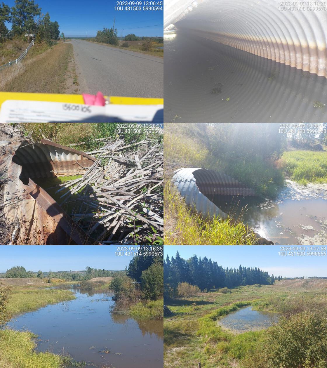 . From top left clockwise: Road/Site Card, Barrel, Outlet, Downstream, Upstream, Inlet.15600106 . From top left clockwise: Road/Site Card, Barrel, Outlet, Downstream, Upstream, Inlet.15600106
|
|||
| Comments: Wetland habitat upstream and downstream. Huge beaver dam on inlet side creating drop. Adjacent landowner Ron reports there are no fish near this location. He reports that beaver activity increased significantly in the past few years, that is the only reason there is water here. MoTi chris_hwy_structure_road_id: 30585. 13:09:51 |
| Location and Stream Data |
|
Crossing Characteristics | – |
|---|---|---|---|
| Date | 2023-09-10 | Crossing Sub Type | Round Culvert |
| PSCIS ID | 199296 | Diameter (m) | 1.3 |
| External ID | 15600488 | Length (m) | 20 |
| Crew | MW | Embedded | No |
| UTM Zone | 10 | Depth Embedded (m) | – |
| Easting | 427033 | Resemble Channel | No |
| Northing | 5994538 | Backwatered | Yes |
| Stream | Tributary to Clear Creek | Percent Backwatered | 100 |
| Road | Highway 27S | Fill Depth (m) | 2.5 |
| Road Tenure | MOTI | Outlet Drop (m) | 0 |
| Channel Width (m) | 1.3 | Outlet Pool Depth (m) | 0.8 |
| Stream Slope (%) | 1 | Inlet Drop | No |
| Beaver Activity | Yes | Slope (%) | 1 |
| Habitat Value | Medium | Valley Fill | Deep Fill |
| Final score | 21 | Barrier Result | Barrier |
| Fix type | Replace Structure with Streambed Simulation CBS | Fix Span / Diameter | 3 |
Photos: PSCIS ID 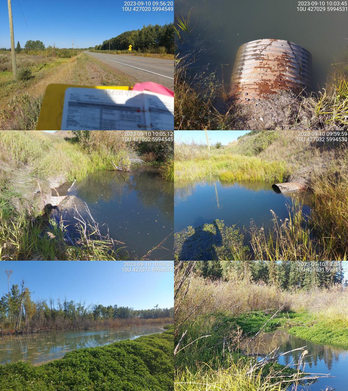 . From top left clockwise: Road/Site Card, Barrel, Outlet, Downstream, Upstream, Inlet.15600488 . From top left clockwise: Road/Site Card, Barrel, Outlet, Downstream, Upstream, Inlet.15600488
|
|||
| Comments: Wetland upstream and downstream. A lot of beaver activity upstream, big pond near inlet. Culvert is very warped on inlet side. Chinook observations downstream on nearby Clear Creek. MoTi chris_culvert_id: 1806178. 09:56:44 |
| Location and Stream Data |
|
Crossing Characteristics | – |
|---|---|---|---|
| Date | 2023-09-10 | Crossing Sub Type | Round Culvert |
| PSCIS ID | 199297 | Diameter (m) | 2.35 |
| External ID | 15600120 | Length (m) | 10 |
| Crew | MW | Embedded | No |
| UTM Zone | 10 | Depth Embedded (m) | – |
| Easting | 426006 | Resemble Channel | No |
| Northing | 5998858 | Backwatered | Yes |
| Stream | Clear Creek | Percent Backwatered | 100 |
| Road | Fourteen Mile Rd | Fill Depth (m) | 0.3 |
| Road Tenure | MOTI Local | Outlet Drop (m) | 0 |
| Channel Width (m) | 2.5 | Outlet Pool Depth (m) | 0.4 |
| Stream Slope (%) | 4 | Inlet Drop | No |
| Beaver Activity | Yes | Slope (%) | 1 |
| Habitat Value | Medium | Valley Fill | Deep Fill |
| Final score | 18 | Barrier Result | Potential |
| Fix type | Replace with New Open Bottom Structure | Fix Span / Diameter | 15 |
Photos: PSCIS ID 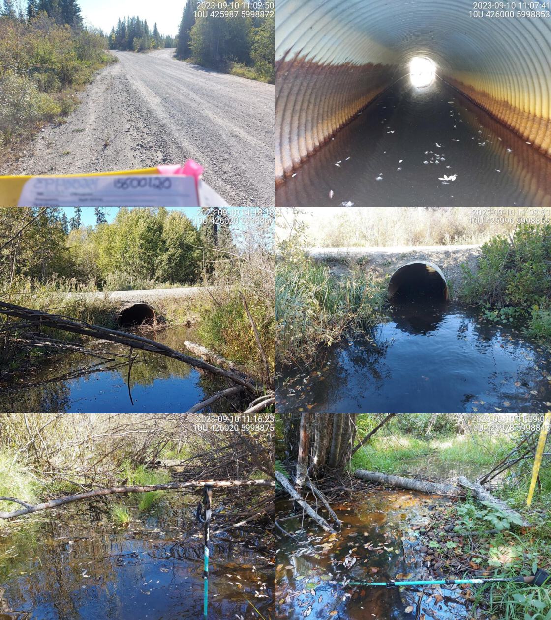 . From top left clockwise: Road/Site Card, Barrel, Outlet, Downstream, Upstream, Inlet.15600120 . From top left clockwise: Road/Site Card, Barrel, Outlet, Downstream, Upstream, Inlet.15600120
|
|||
| Comments: Two pipes, approx 15m apart but part of same system. No flowing water through either. Signs of beaver activity upstream. MoTi chris_culvert_id: 3343588. 11:05:23 |
| Location and Stream Data |
|
Crossing Characteristics | – |
|---|---|---|---|
| Date | 2023-09-11 | Crossing Sub Type | Round Culvert |
| PSCIS ID | 199298 | Diameter (m) | 0.8 |
| External ID | 15600158 | Length (m) | 16 |
| Crew | MW | Embedded | No |
| UTM Zone | 10 | Depth Embedded (m) | – |
| Easting | 434160 | Resemble Channel | No |
| Northing | 5985531 | Backwatered | Yes |
| Stream | Tributary to Nechako River | Percent Backwatered | 100 |
| Road | Chilco Ave | Fill Depth (m) | 2 |
| Road Tenure | Vanderhoof | Outlet Drop (m) | 0 |
| Channel Width (m) | 1.5 | Outlet Pool Depth (m) | 0 |
| Stream Slope (%) | 1 | Inlet Drop | No |
| Beaver Activity | No | Slope (%) | 0 |
| Habitat Value | Medium | Valley Fill | Deep Fill |
| Final score | 19 | Barrier Result | Potential |
| Fix type | Replace Structure with Streambed Simulation CBS | Fix Span / Diameter | 3 |
Photos: PSCIS ID 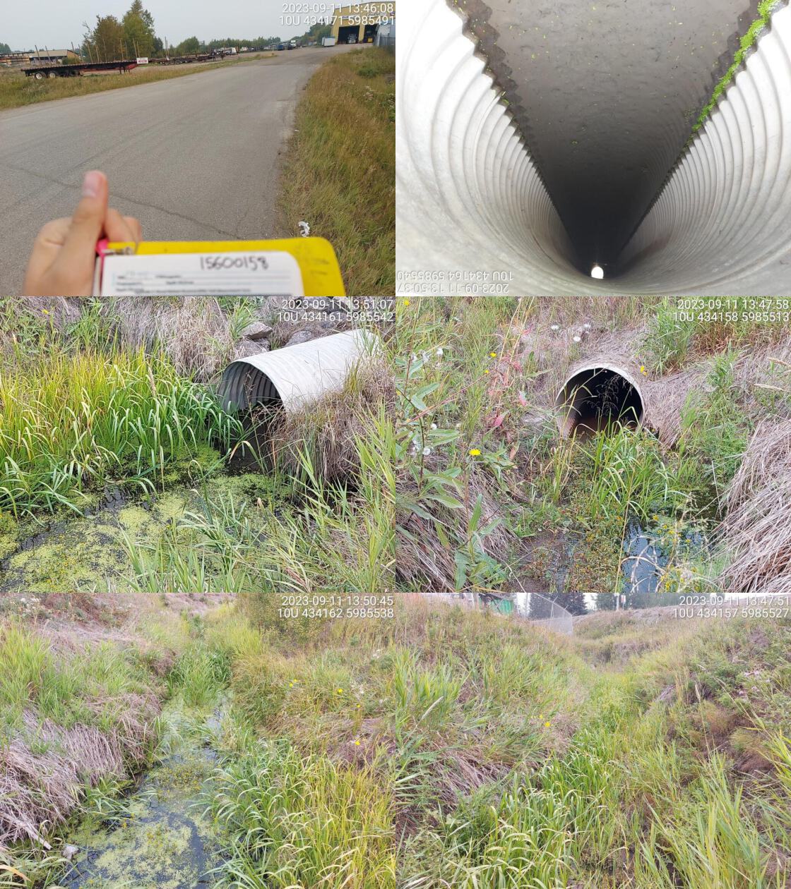 . From top left clockwise: Road/Site Card, Barrel, Outlet, Downstream, Upstream, Inlet.15600158 . From top left clockwise: Road/Site Card, Barrel, Outlet, Downstream, Upstream, Inlet.15600158
|
|||
| Comments: Very small channel downstream, wider upstream. Small amount of flow, grassy wetland habitat. Not likely fish bearing stream section. Considered medium habitat value due to larger size of watershed and presence of some water in drought period when many adjacent systems were dry.. 13:50:05 |
| Location and Stream Data |
|
Crossing Characteristics | – |
|---|---|---|---|
| Date | 2023-09-11 | Crossing Sub Type | Round Culvert |
| PSCIS ID | 199299 | Diameter (m) | 0.9 |
| External ID | 15605366 | Length (m) | 18 |
| Crew | MW | Embedded | No |
| UTM Zone | 10 | Depth Embedded (m) | – |
| Easting | 434208 | Resemble Channel | No |
| Northing | 5985603 | Backwatered | Yes |
| Stream | Tributary to Nechako River | Percent Backwatered | 100 |
| Road | Rail | Fill Depth (m) | 2 |
| Road Tenure | CN Rail | Outlet Drop (m) | 0 |
| Channel Width (m) | 1.3 | Outlet Pool Depth (m) | 0.5 |
| Stream Slope (%) | 0 | Inlet Drop | No |
| Beaver Activity | No | Slope (%) | 0 |
| Habitat Value | Low | Valley Fill | Deep Fill |
| Final score | 19 | Barrier Result | Potential |
| Fix type | Replace Structure with Streambed Simulation CBS | Fix Span / Diameter | 3 |
Photos: PSCIS ID 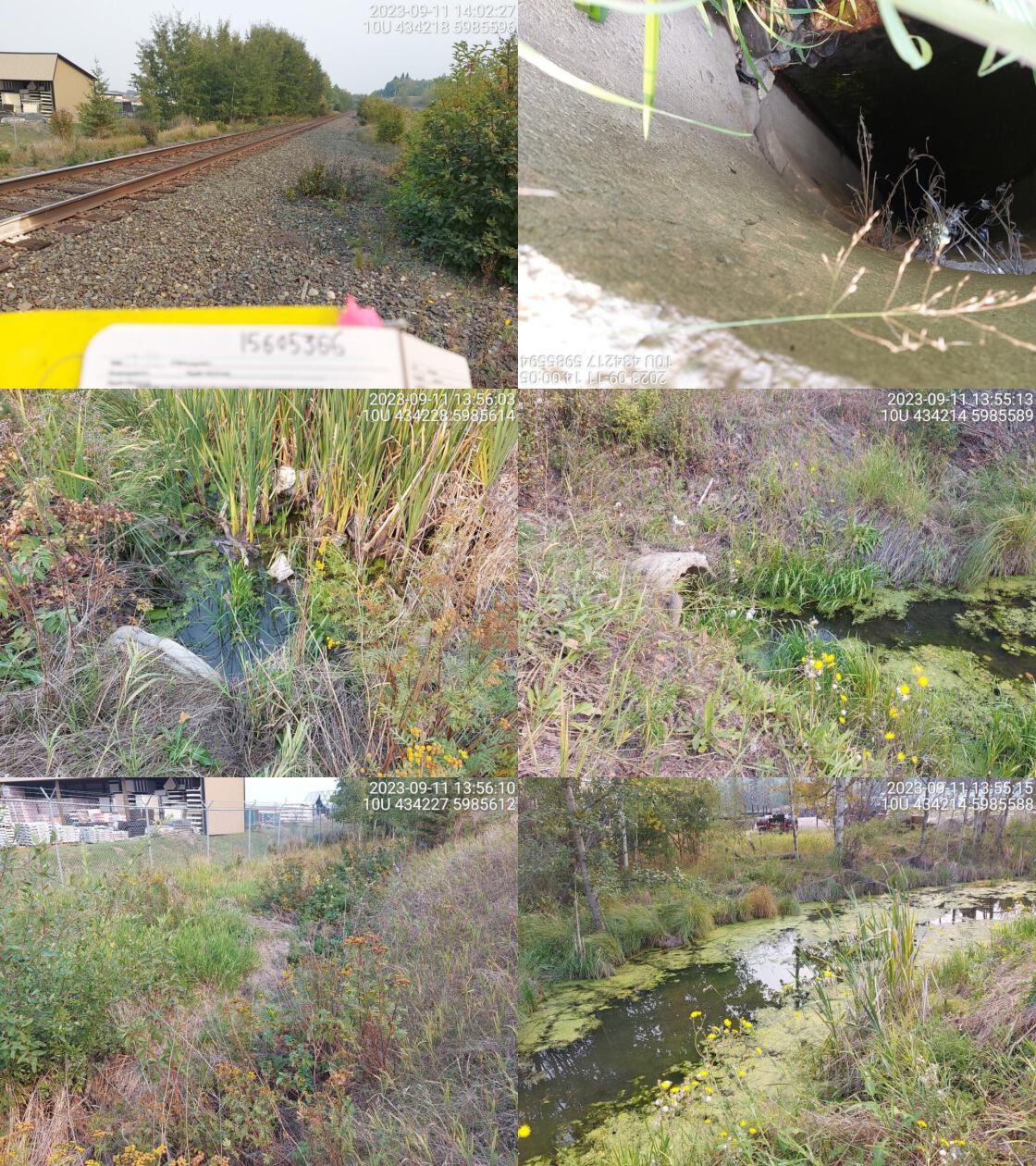 . From top left clockwise: Road/Site Card, Barrel, Outlet, Downstream, Upstream, Inlet.15605366 . From top left clockwise: Road/Site Card, Barrel, Outlet, Downstream, Upstream, Inlet.15605366
|
|||
| Comments: Wetland downstream. Vegetated channel upstream. Several unassessed crossings downstream.. 13:56:33 |
| Location and Stream Data |
|
Crossing Characteristics | – |
|---|---|---|---|
| Date | 2023-09-12 | Crossing Sub Type | Round Culvert |
| PSCIS ID | 199300 | Diameter (m) | 2.2 |
| External ID | 15600112 | Length (m) | 30 |
| Crew | MW | Embedded | No |
| UTM Zone | 10 | Depth Embedded (m) | – |
| Easting | 426644 | Resemble Channel | No |
| Northing | 5985671 | Backwatered | Yes |
| Stream | Goldie Creek | Percent Backwatered | 100 |
| Road | Highway 27 S | Fill Depth (m) | 4 |
| Road Tenure | MOTI | Outlet Drop (m) | 0 |
| Channel Width (m) | 2.2 | Outlet Pool Depth (m) | 0.5 |
| Stream Slope (%) | 1.5 | Inlet Drop | No |
| Beaver Activity | No | Slope (%) | 1 |
| Habitat Value | Medium | Valley Fill | Deep Fill |
| Final score | 24 | Barrier Result | Barrier |
| Fix type | Replace with New Open Bottom Structure | Fix Span / Diameter | 18 |
Photos: PSCIS ID 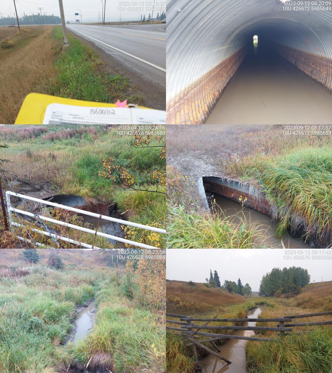 . From top left clockwise: Road/Site Card, Barrel, Outlet, Downstream, Upstream, Inlet.15600112 . From top left clockwise: Road/Site Card, Barrel, Outlet, Downstream, Upstream, Inlet.15600112
|
|||
| Comments: Stream not flowing at the time of assessment. Horse pasture downstream. Fenced off on both sides of pipe. Nechako Environment and Water Stewardship Society ( https://newssociety.org/watersheds/goldie-creek ) report that stream was historically impacted adjacent to this site when Highway 27 was constructed 20-30 years ago due to fill from the excavation of the highway contributing significant amounts of sediment into Stoney Creek and ultimately into the spawning beds of Nechako White Sturgeon just below the Stoney Creek/Nechako River confluence. Extensive works completed upstream of the crossing in 2021 including culvert replaced with bridge, installation of beaver dam analogues, riparian planting and addition of large woody debris just upstream of the crossing. MoTi chris_culvert_id: 1806217. 08:23:29 |
| Location and Stream Data |
|
Crossing Characteristics | – |
|---|---|---|---|
| Date | 2023-09-28 | Crossing Sub Type | Round Culvert |
| PSCIS ID | 199301 | Diameter (m) | 2.1 |
| External ID | 5400448 | Length (m) | 44 |
| Crew | MW | Embedded | No |
| UTM Zone | 10 | Depth Embedded (m) | – |
| Easting | 306137 | Resemble Channel | No |
| Northing | 6031749 | Backwatered | Yes |
| Stream | Relief Creek | Percent Backwatered | 25 |
| Road | Highway 16 W | Fill Depth (m) | 4 |
| Road Tenure | MOTI | Outlet Drop (m) | 0 |
| Channel Width (m) | 2.4 | Outlet Pool Depth (m) | 0.5 |
| Stream Slope (%) | 3 | Inlet Drop | No |
| Beaver Activity | No | Slope (%) | 3 |
| Habitat Value | High | Valley Fill | Deep Fill |
| Final score | 29 | Barrier Result | Barrier |
| Fix type | Replace with New Open Bottom Structure | Fix Span / Diameter | 18 |
Photos: PSCIS ID 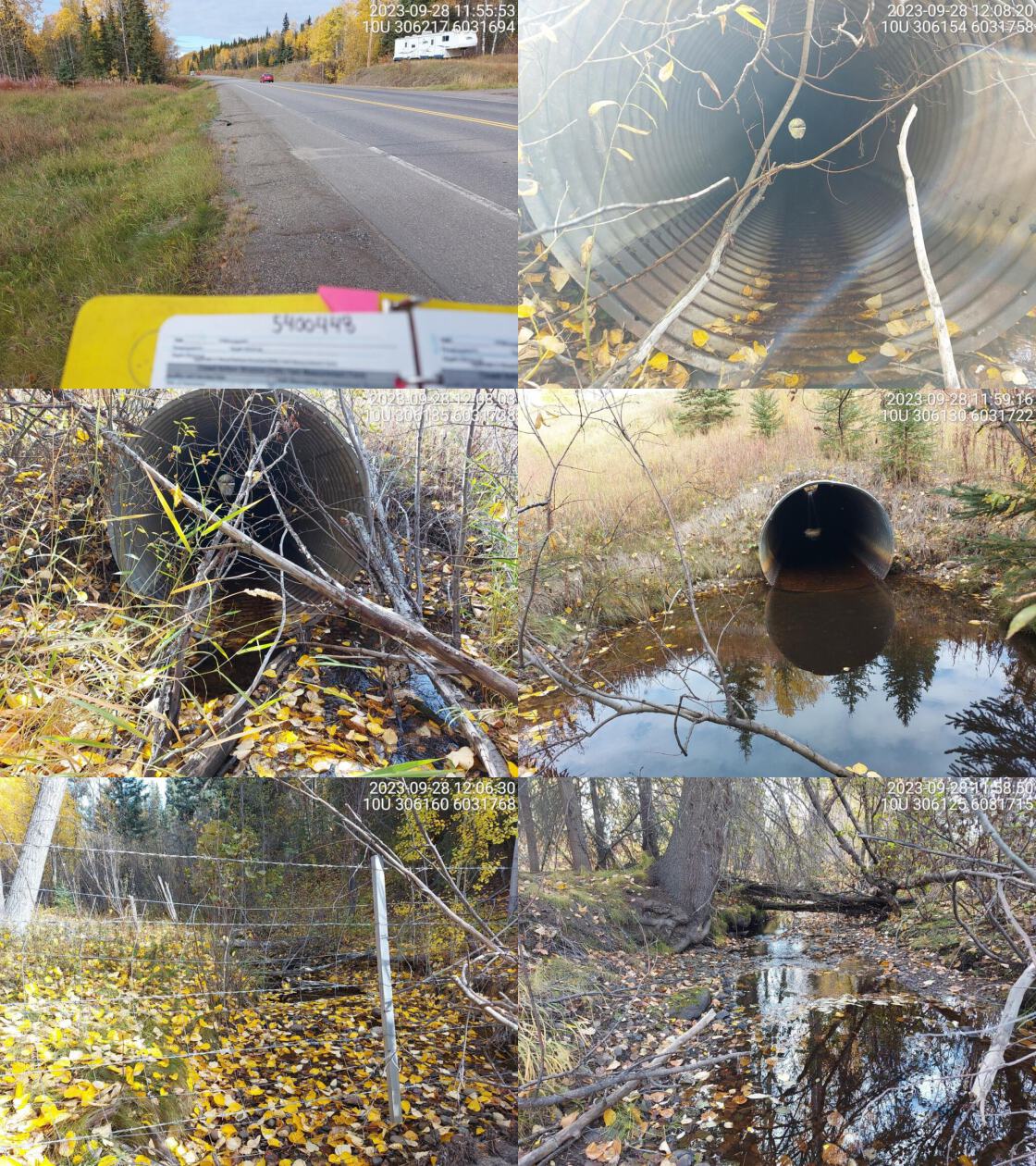 . From top left clockwise: Road/Site Card, Barrel, Outlet, Downstream, Upstream, Inlet.5400448 . From top left clockwise: Road/Site Card, Barrel, Outlet, Downstream, Upstream, Inlet.5400448
|
|||
| Comments: Long pipe, no outlet drop but culvert is partially backwatered at outlet. Small fish spotted in outlet pool. Upstream goes into private land and is fenced off. MoTi chris_culvert_id: 2076443. 12:13:13 |
| Location and Stream Data |
|
Crossing Characteristics | – |
|---|---|---|---|
| Date | 2023-09-28 | Crossing Sub Type | Round Culvert |
| PSCIS ID | 199302 | Diameter (m) | 0.8 |
| External ID | 5400181 | Length (m) | 28 |
| Crew | MW | Embedded | No |
| UTM Zone | 10 | Depth Embedded (m) | – |
| Easting | 321873 | Resemble Channel | No |
| Northing | 6012125 | Backwatered | Yes |
| Stream | Wardrop Creek | Percent Backwatered | 100 |
| Road | Roumieu drive | Fill Depth (m) | 3 |
| Road Tenure | Burns Lake | Outlet Drop (m) | 0 |
| Channel Width (m) | 0.8 | Outlet Pool Depth (m) | 0.5 |
| Stream Slope (%) | 1 | Inlet Drop | No |
| Beaver Activity | Yes | Slope (%) | 2 |
| Habitat Value | Medium | Valley Fill | Deep Fill |
| Final score | 21 | Barrier Result | Barrier |
| Fix type | Replace Structure with Streambed Simulation CBS | Fix Span / Diameter | 3 |
Photos: PSCIS ID 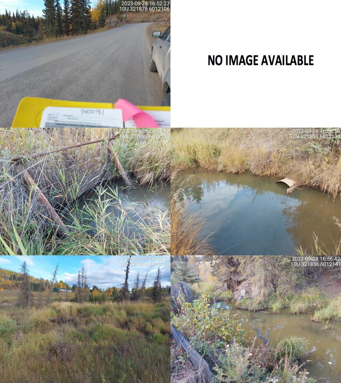 . From top left clockwise: Road/Site Card, Barrel, Outlet, Downstream, Upstream, Inlet.5400181 . From top left clockwise: Road/Site Card, Barrel, Outlet, Downstream, Upstream, Inlet.5400181
|
|||
| Comments: Culvert is backwatered and fully submerged on inlet side. Outlet side barely visible. Wetland/grassy habitat upstream and downstream. Stagnant water present in pools, no flowing water. Assuming beaver activity due to beaver grate on inlet and beaver dam seen downstream in photos. Silt fencing seen on downstream left bank and major erosion on downstream right bank, based on photos.. 17:02:58 |
| Location and Stream Data |
|
Crossing Characteristics | – |
|---|---|---|---|
| Date | 2023-09-29 | Crossing Sub Type | Round Culvert |
| PSCIS ID | 199303 | Diameter (m) | 1.7 |
| External ID | 5403082 | Length (m) | 22 |
| Crew | MW | Embedded | No |
| UTM Zone | 10 | Depth Embedded (m) | – |
| Easting | 327620 | Resemble Channel | No |
| Northing | 6010443 | Backwatered | Yes |
| Stream | Steams Creek | Percent Backwatered | 100 |
| Road | Highway 16 | Fill Depth (m) | 1.8 |
| Road Tenure | MOTI | Outlet Drop (m) | 0 |
| Channel Width (m) | 3.1 | Outlet Pool Depth (m) | 0 |
| Stream Slope (%) | 2 | Inlet Drop | No |
| Beaver Activity | No | Slope (%) | 2.5 |
| Habitat Value | High | Valley Fill | Deep Fill |
| Final score | 24 | Barrier Result | Barrier |
| Fix type | Replace with New Open Bottom Structure | Fix Span / Diameter | 15 |
Photos: PSCIS ID 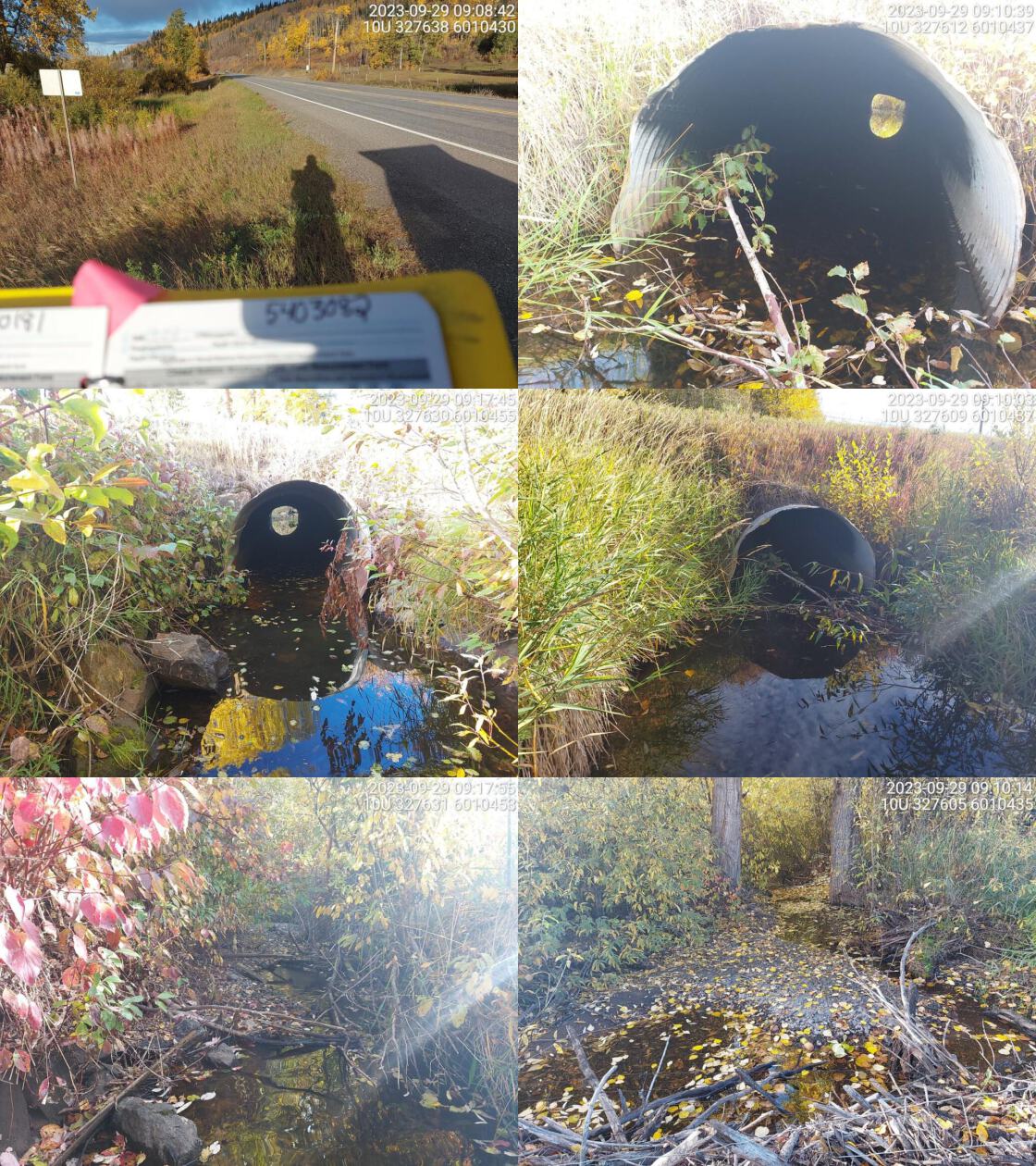 . From top left clockwise: Road/Site Card, Barrel, Outlet, Downstream, Upstream, Inlet.5403082 . From top left clockwise: Road/Site Card, Barrel, Outlet, Downstream, Upstream, Inlet.5403082
|
|||
| Comments: Backwatered at outlet but some flow upstream and downstream. Some gravels upstream. Private property on both sides. RB confirmed upstream. Downstream railway crossing yet to be assessed. MoTi chris_culvert_id: 3100655. 09:23:27 |
| Location and Stream Data |
|
Crossing Characteristics | – |
|---|---|---|---|
| Date | 2023-09-29 | Crossing Sub Type | Round Culvert |
| PSCIS ID | 199304 | Diameter (m) | 4 |
| External ID | 5400193 | Length (m) | 32 |
| Crew | MW | Embedded | No |
| UTM Zone | 10 | Depth Embedded (m) | – |
| Easting | 352357 | Resemble Channel | No |
| Northing | 5996976 | Backwatered | Yes |
| Stream | Tchesinkut Creek | Percent Backwatered | 100 |
| Road | Highway 16 | Fill Depth (m) | 2.2 |
| Road Tenure | MOTI | Outlet Drop (m) | 0 |
| Channel Width (m) | 8.4 | Outlet Pool Depth (m) | 0 |
| Stream Slope (%) | 1 | Inlet Drop | No |
| Beaver Activity | No | Slope (%) | 1 |
| Habitat Value | Medium | Valley Fill | Deep Fill |
| Final score | 27 | Barrier Result | Barrier |
| Fix type | Replace with New Open Bottom Structure | Fix Span / Diameter | 15 |
Photos: PSCIS ID 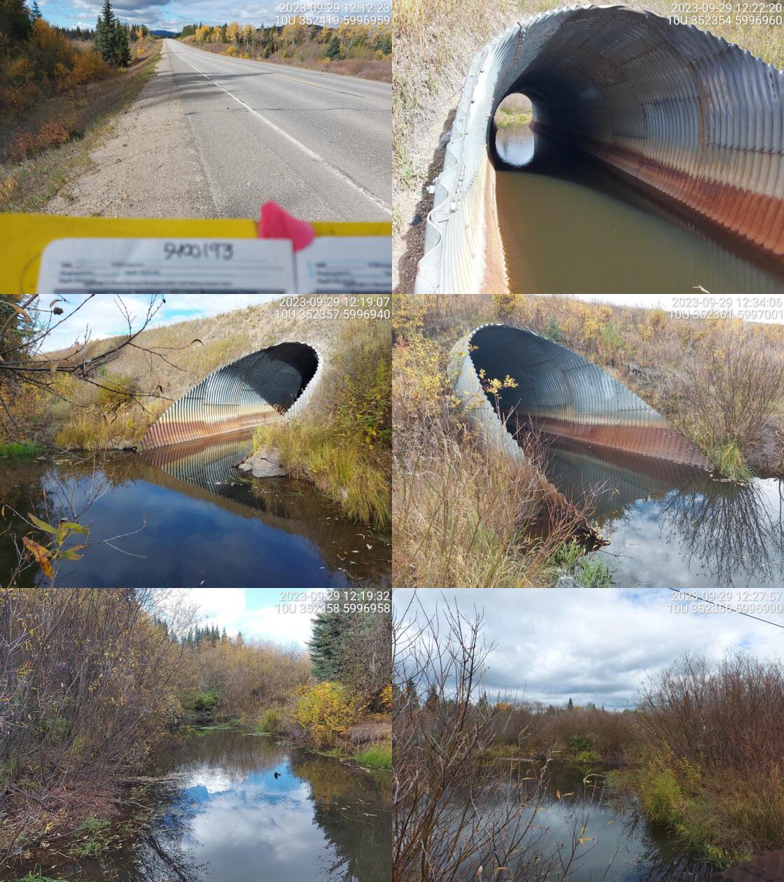 . From top left clockwise: Road/Site Card, Barrel, Outlet, Downstream, Upstream, Inlet.5400193 . From top left clockwise: Road/Site Card, Barrel, Outlet, Downstream, Upstream, Inlet.5400193
|
|||
| Comments: Wetland downstream and upstream. Stream channel upstream is more defined. Pipe is fully backwatered. Medium habitat value given due to presence of water at this location when other areas of this same stream were dry. MoTi chris_hwy_structure_road_id: 2141. 12:21:46 |
| Location and Stream Data |
|
Crossing Characteristics | – |
|---|---|---|---|
| Date | 2023-10-01 | Crossing Sub Type | Round Culvert |
| PSCIS ID | 199305 | Diameter (m) | 0.9 |
| External ID | 9905144 | Length (m) | 16 |
| Crew | MW | Embedded | No |
| UTM Zone | 10 | Depth Embedded (m) | – |
| Easting | 492375 | Resemble Channel | No |
| Northing | 5956652 | Backwatered | Yes |
| Stream | Tributary to Chilako River | Percent Backwatered | 100 |
| Road | Gregg FSR | Fill Depth (m) | 1.6 |
| Road Tenure | MOTI Local | Outlet Drop (m) | 0 |
| Channel Width (m) | 1 | Outlet Pool Depth (m) | 0.5 |
| Stream Slope (%) | 1 | Inlet Drop | No |
| Beaver Activity | Yes | Slope (%) | 1.5 |
| Habitat Value | Low | Valley Fill | Deep Fill |
| Final score | 21 | Barrier Result | Barrier |
| Fix type | Replace Structure with Streambed Simulation CBS | Fix Span / Diameter | 3 |
Photos: PSCIS ID 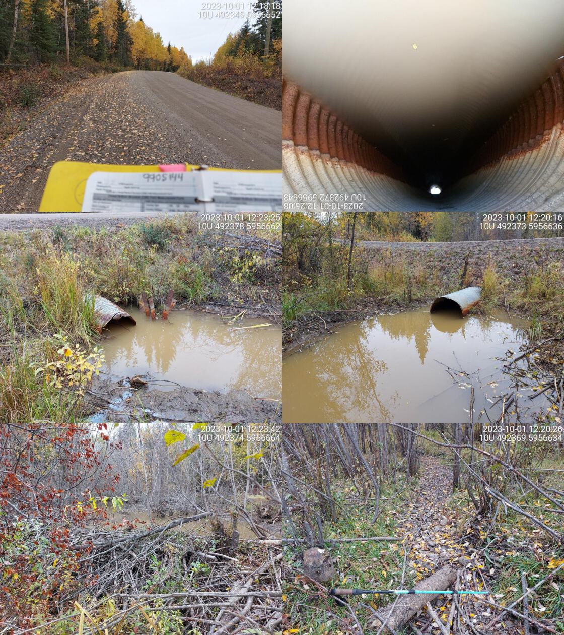 . From top left clockwise: Road/Site Card, Barrel, Outlet, Downstream, Upstream, Inlet.9905144 . From top left clockwise: Road/Site Card, Barrel, Outlet, Downstream, Upstream, Inlet.9905144
|
|||
| Comments: Obvious signs of beaver activity. Big dam near inlet and small dam just downstream of outlet as well. Small channel downstream with no water with wetland upstream. MoTi chris_culvert_id: 1976775. 12:19:45 |
| Location and Stream Data |
|
Crossing Characteristics | – |
|---|---|---|---|
| Date | 2023-10-03 | Crossing Sub Type | Round Culvert |
| PSCIS ID | 199306 | Diameter (m) | 1.4 |
| External ID | 13900028 | Length (m) | 10 |
| Crew | AI | Embedded | No |
| UTM Zone | 10 | Depth Embedded (m) | – |
| Easting | 612135 | Resemble Channel | No |
| Northing | 5967623 | Backwatered | Yes |
| Stream | Tributary to Fraser River | Percent Backwatered | 40 |
| Road | Penny street | Fill Depth (m) | 0.3 |
| Road Tenure | Northwood R02900 | Outlet Drop (m) | 0 |
| Channel Width (m) | 3.4 | Outlet Pool Depth (m) | 1 |
| Stream Slope (%) | 3 | Inlet Drop | No |
| Beaver Activity | No | Slope (%) | 1.5 |
| Habitat Value | Medium | Valley Fill | Deep Fill |
| Final score | 21 | Barrier Result | Barrier |
| Fix type | Replace with New Open Bottom Structure | Fix Span / Diameter | 15 |
Photos: PSCIS ID 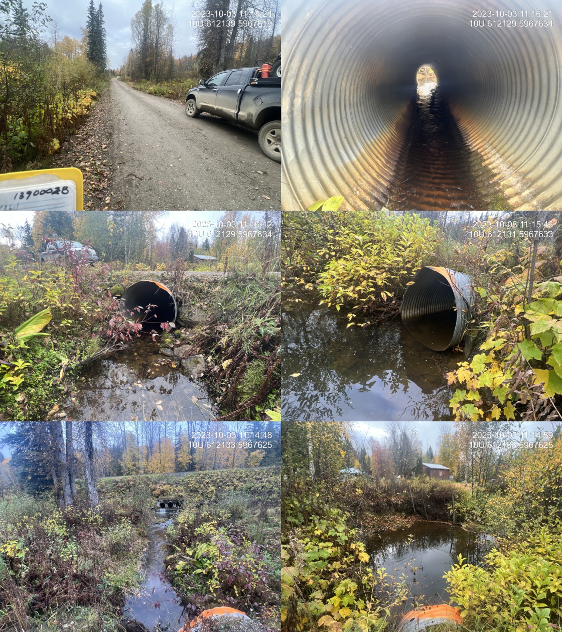 . From top left clockwise: Road/Site Card, Barrel, Outlet, Downstream, Upstream, Inlet.13900028 . From top left clockwise: Road/Site Card, Barrel, Outlet, Downstream, Upstream, Inlet.13900028
|
|||
| Comments: Nice stream with good flow. Railway crossings approximately 30 m upstream are much more of a barrier then the crossing on Penny Street.. 11:19:24 |
| Location and Stream Data |
|
Crossing Characteristics | – |
|---|---|---|---|
| Date | 2023-10-03 | Crossing Sub Type | Round Culvert |
| PSCIS ID | 199307 | Diameter (m) | 2 |
| External ID | 13900308 | Length (m) | 8 |
| Crew | MW | Embedded | No |
| UTM Zone | 10 | Depth Embedded (m) | – |
| Easting | 607110 | Resemble Channel | No |
| Northing | 5971294 | Backwatered | Yes |
| Stream | Tributary to Fraser River | Percent Backwatered | 100 |
| Road | Penny Rd | Fill Depth (m) | 0.7 |
| Road Tenure | Unknown | Outlet Drop (m) | 0 |
| Channel Width (m) | 5.9 | Outlet Pool Depth (m) | 0.6 |
| Stream Slope (%) | 3 | Inlet Drop | No |
| Beaver Activity | No | Slope (%) | 0 |
| Habitat Value | High | Valley Fill | Deep Fill |
| Final score | 16 | Barrier Result | Potential |
| Fix type | Replace with New Open Bottom Structure | Fix Span / Diameter | 15 |
Photos: PSCIS ID 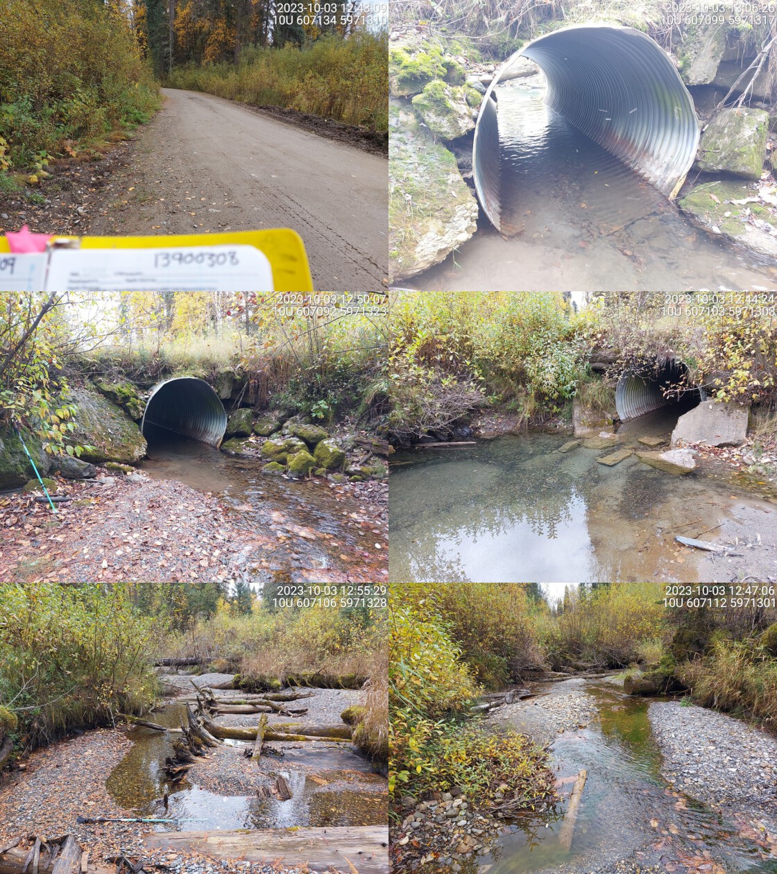 . From top left clockwise: Road/Site Card, Barrel, Outlet, Downstream, Upstream, Inlet.13900308 . From top left clockwise: Road/Site Card, Barrel, Outlet, Downstream, Upstream, Inlet.13900308
|
|||
| Comments: Abundant gravels present downstream and upstream. Small fish seen in culvert and downstream. There’s flow upstream and downstream but culvert is backwatered. Unassessed railway crossing ~900m upstream.. 12:52:51 |
| Location and Stream Data |
|
Crossing Characteristics | – |
|---|---|---|---|
| Date | 2023-10-03 | Crossing Sub Type | Round Culvert |
| PSCIS ID | 199308 | Diameter (m) | 3.3 |
| External ID | 13900252 | Length (m) | 7 |
| Crew | MW | Embedded | No |
| UTM Zone | 10 | Depth Embedded (m) | – |
| Easting | 590794 | Resemble Channel | No |
| Northing | 5982763 | Backwatered | Yes |
| Stream | Wolfe Creek | Percent Backwatered | 100 |
| Road | Upper Fraser Rd | Fill Depth (m) | 1 |
| Road Tenure | MOTI | Outlet Drop (m) | 0 |
| Channel Width (m) | 4.1 | Outlet Pool Depth (m) | 0 |
| Stream Slope (%) | 2 | Inlet Drop | No |
| Beaver Activity | No | Slope (%) | 1 |
| Habitat Value | High | Valley Fill | Deep Fill |
| Final score | 18 | Barrier Result | Potential |
| Fix type | Replace with New Open Bottom Structure | Fix Span / Diameter | 15 |
Photos: PSCIS ID 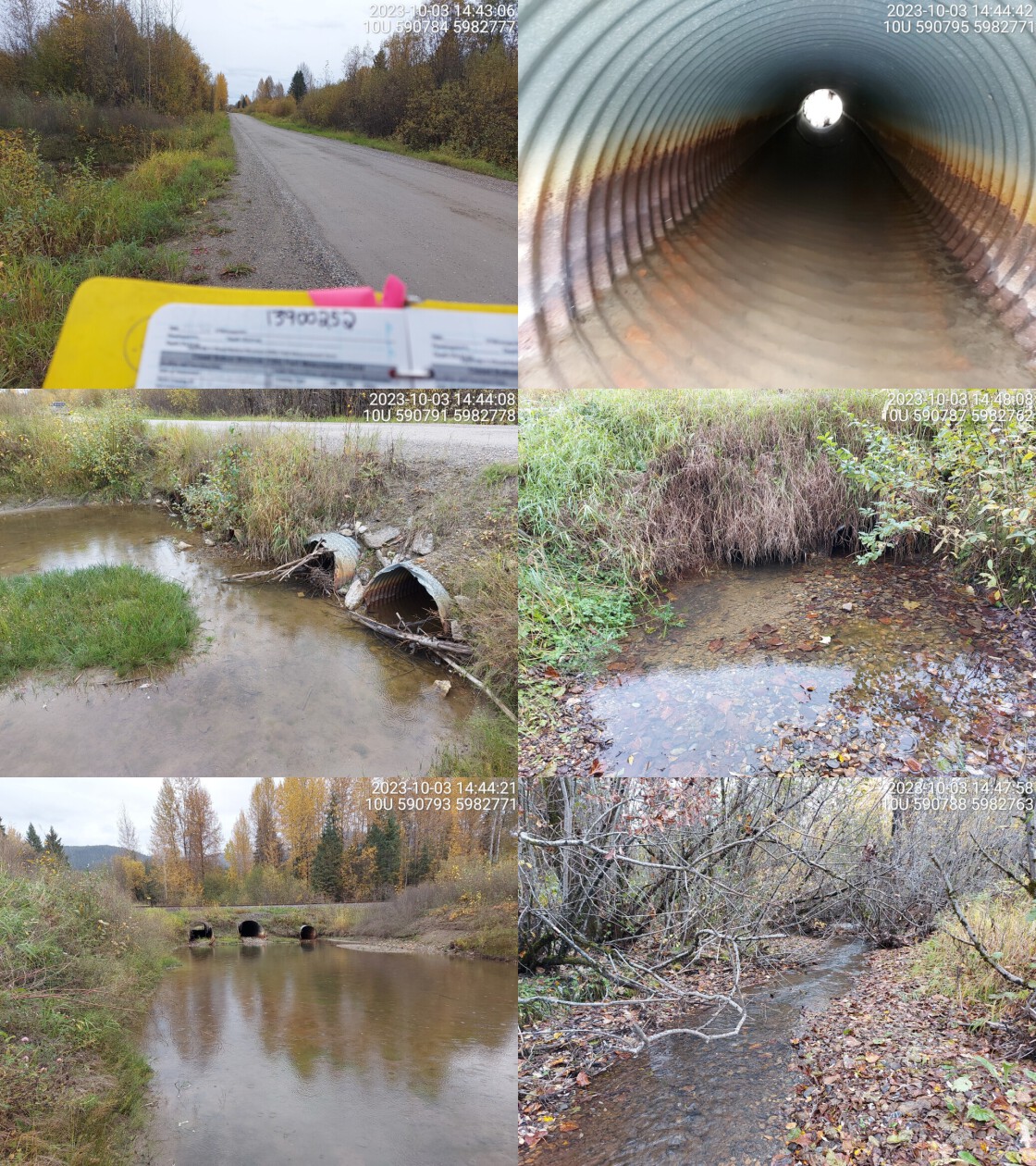 . From top left clockwise: Road/Site Card, Barrel, Outlet, Downstream, Upstream, Inlet.13900252 . From top left clockwise: Road/Site Card, Barrel, Outlet, Downstream, Upstream, Inlet.13900252
|
|||
| Comments: Wide channel with four culverts. Culvert diameter totaled for all 4 culverts. Two are in good condition, other two are bent and look older. Railway crossing just upstream which consists of three culverts and appears likely passable for most species at most flows. Abundant gravels present downstream of road. This road is the only to access the town of Penny. MoTi chris_culvert_id: 1994890, 1994893, 1994894. 14:48:37 |
| Location and Stream Data |
|
Crossing Characteristics | – |
|---|---|---|---|
| Date | 2023-10-03 | Crossing Sub Type | Round Culvert |
| PSCIS ID | 199309 | Diameter (m) | 0.8 |
| External ID | 13900050 | Length (m) | 12 |
| Crew | MW | Embedded | No |
| UTM Zone | 10 | Depth Embedded (m) | – |
| Easting | 582105 | Resemble Channel | No |
| Northing | 5989825 | Backwatered | Yes |
| Stream | Tributary to Fraser River | Percent Backwatered | 100 |
| Road | Upper Fraser Rd | Fill Depth (m) | 1.2 |
| Road Tenure | MOTI | Outlet Drop (m) | 0 |
| Channel Width (m) | 1.2 | Outlet Pool Depth (m) | 0 |
| Stream Slope (%) | 1.5 | Inlet Drop | No |
| Beaver Activity | No | Slope (%) | 2 |
| Habitat Value | Low | Valley Fill | Deep Fill |
| Final score | 21 | Barrier Result | Barrier |
| Fix type | Replace Structure with Streambed Simulation CBS | Fix Span / Diameter | 3 |
Photos: PSCIS ID 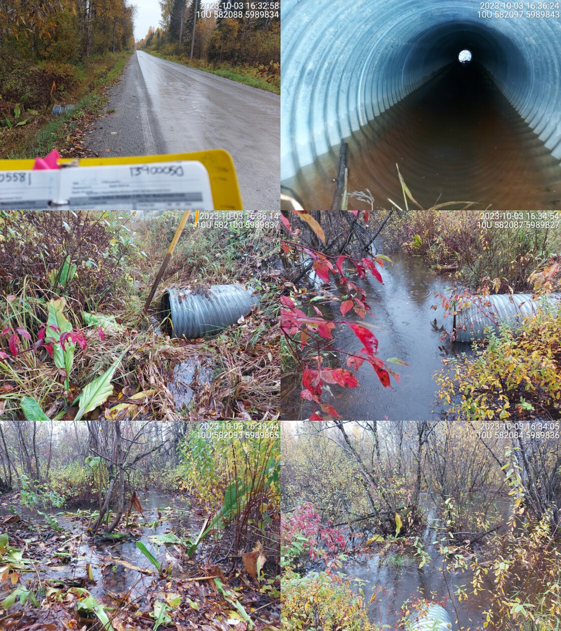 . From top left clockwise: Road/Site Card, Barrel, Outlet, Downstream, Upstream, Inlet.13900050 . From top left clockwise: Road/Site Card, Barrel, Outlet, Downstream, Upstream, Inlet.13900050
|
|||
| Comments: No well defined stream channel visible. Flooded wetland area downstream, surveyed during heavy rain. Backwatered pipe. MoTi chris_culvert_id: 1994950. 16:43:39 |
| Location and Stream Data |
|
Crossing Characteristics | – |
|---|---|---|---|
| Date | 2023-10-03 | Crossing Sub Type | Round Culvert |
| PSCIS ID | 199310 | Diameter (m) | 2 |
| External ID | 13900283 | Length (m) | 14 |
| Crew | AI | Embedded | No |
| UTM Zone | 10 | Depth Embedded (m) | – |
| Easting | 558697 | Resemble Channel | No |
| Northing | 5995816 | Backwatered | Yes |
| Stream | Tributary to Aleza Lake | Percent Backwatered | 100 |
| Road | Upper Fraser Rd | Fill Depth (m) | 2.5 |
| Road Tenure | MOTI | Outlet Drop (m) | 0 |
| Channel Width (m) | 2.5 | Outlet Pool Depth (m) | 0.7 |
| Stream Slope (%) | 0 | Inlet Drop | No |
| Beaver Activity | Yes | Slope (%) | 0 |
| Habitat Value | Medium | Valley Fill | Deep Fill |
| Final score | 13 | Barrier Result | Passable |
| Fix type | – | Fix Span / Diameter | – |
Photos: PSCIS ID 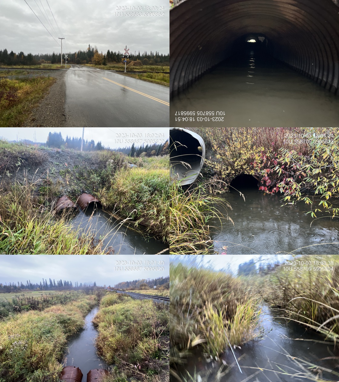 . From top left clockwise: Road/Site Card, Barrel, Outlet, Downstream, Upstream, Inlet.13900283 . From top left clockwise: Road/Site Card, Barrel, Outlet, Downstream, Upstream, Inlet.13900283
|
|||
| Comments: Two pipes each with 1m diameter on the south side of the railway. It is not clear where the stream crosses under the railway upstream, this crossing still needs to be assessed. Agricultural field located upstream with what appears to be very minimal riparian buffer. Stream has been channelized beside the railway. A 1m overflow pipe has been installed above the level of the other 2 pipes. MoTi chris_culvert_id: 1994283, 1994682, 1994683. 18:08:11 |
| Location and Stream Data |
|
Crossing Characteristics | – |
|---|---|---|---|
| Date | 2023-10-04 | Crossing Sub Type | Round Culvert |
| PSCIS ID | 199311 | Diameter (m) | 0.7 |
| External ID | 13903627 | Length (m) | 16 |
| Crew | MW | Embedded | No |
| UTM Zone | 10 | Depth Embedded (m) | – |
| Easting | 579525 | Resemble Channel | No |
| Northing | 5977412 | Backwatered | Yes |
| Stream | Tributary to Kenneth Creek | Percent Backwatered | 100 |
| Road | Bowron FSR | Fill Depth (m) | 1.5 |
| Road Tenure | MOF 7141 | Outlet Drop (m) | 0 |
| Channel Width (m) | 2.1 | Outlet Pool Depth (m) | 0 |
| Stream Slope (%) | 0 | Inlet Drop | No |
| Beaver Activity | No | Slope (%) | 1 |
| Habitat Value | Low | Valley Fill | Deep Fill |
| Final score | 24 | Barrier Result | Barrier |
| Fix type | Replace with New Open Bottom Structure | Fix Span / Diameter | 15 |
Photos: PSCIS ID 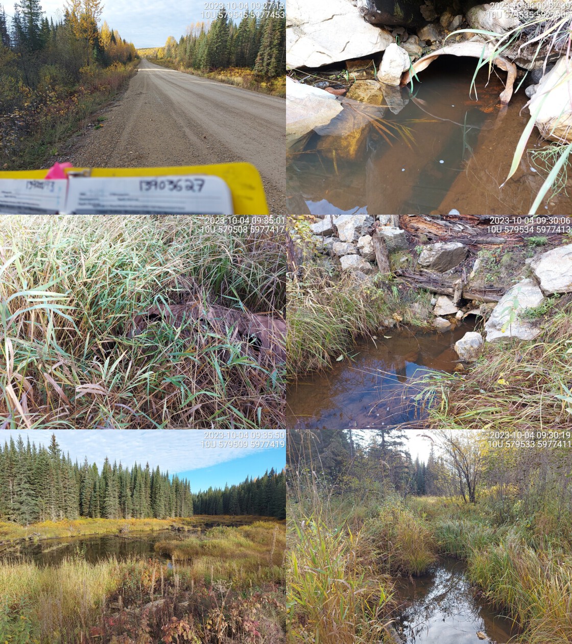 . From top left clockwise: Road/Site Card, Barrel, Outlet, Downstream, Upstream, Inlet.13903627 . From top left clockwise: Road/Site Card, Barrel, Outlet, Downstream, Upstream, Inlet.13903627
|
|||
| Comments: Big wetland area upstream. Smaller, grassy, wetland downstream. RB confirmed upstream in the past. Culvert is very old and in bad shape. There is a bigger overflow pipe present.. 09:37:55 |
| Location and Stream Data |
|
Crossing Characteristics | – |
|---|---|---|---|
| Date | 2023-10-04 | Crossing Sub Type | Round Culvert |
| PSCIS ID | 199312 | Diameter (m) | 0.9 |
| External ID | 13903618 | Length (m) | 18 |
| Crew | AI | Embedded | No |
| UTM Zone | 10 | Depth Embedded (m) | – |
| Easting | 578804 | Resemble Channel | No |
| Northing | 5973956 | Backwatered | Yes |
| Stream | Tributary to Kenneth Creek | Percent Backwatered | 50 |
| Road | Bowron FSR | Fill Depth (m) | 1.4 |
| Road Tenure | MOF 7141 | Outlet Drop (m) | 0 |
| Channel Width (m) | 1.8 | Outlet Pool Depth (m) | 0.5 |
| Stream Slope (%) | 1.5 | Inlet Drop | No |
| Beaver Activity | Yes | Slope (%) | 4 |
| Habitat Value | Medium | Valley Fill | Deep Fill |
| Final score | 29 | Barrier Result | Barrier |
| Fix type | Replace Structure with Streambed Simulation CBS | Fix Span / Diameter | 3 |
Photos: PSCIS ID 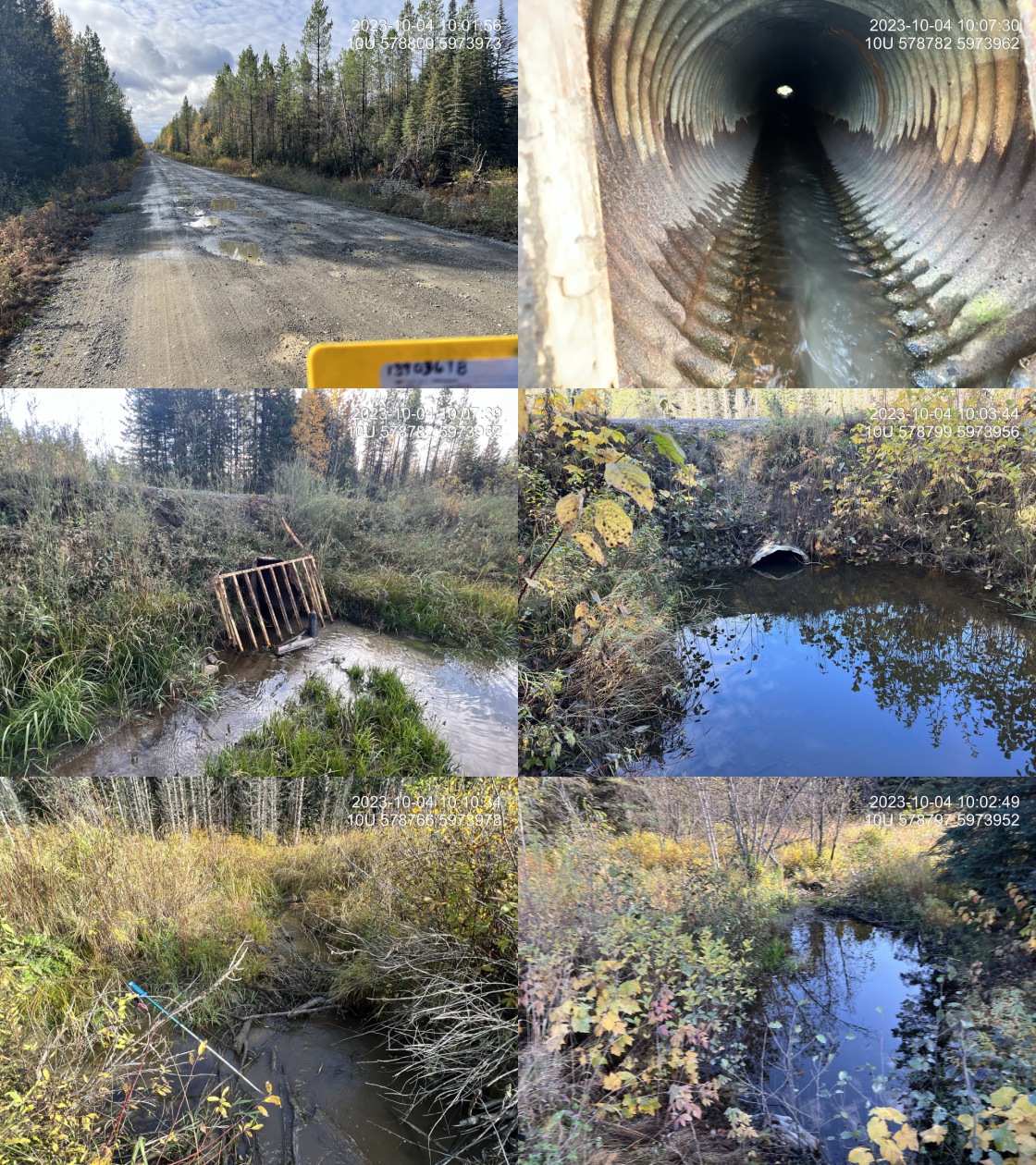 . From top left clockwise: Road/Site Card, Barrel, Outlet, Downstream, Upstream, Inlet.13903618 . From top left clockwise: Road/Site Card, Barrel, Outlet, Downstream, Upstream, Inlet.13903618
|
|||
| Comments: Wetland lake area upstream with small channels threaded through it. Beaver grate on culvert inlet and pipe is in poor shape as it is rusted and bent out of shape. Outlet backwater for 40%. Small stream with some flow.. 10:14:44 |
| Location and Stream Data |
|
Crossing Characteristics | – |
|---|---|---|---|
| Date | 2023-10-04 | Crossing Sub Type | Round Culvert |
| PSCIS ID | 199313 | Diameter (m) | 1.2 |
| External ID | 13900193 | Length (m) | 21 |
| Crew | MW | Embedded | No |
| UTM Zone | 10 | Depth Embedded (m) | – |
| Easting | 585722 | Resemble Channel | No |
| Northing | 5973394 | Backwatered | Yes |
| Stream | Tributary to Kenneth Creek | Percent Backwatered | – |
| Road | Highway 16 | Fill Depth (m) | 1.2 |
| Road Tenure | MOTI | Outlet Drop (m) | 0 |
| Channel Width (m) | 2.1 | Outlet Pool Depth (m) | 0 |
| Stream Slope (%) | 5 | Inlet Drop | Yes |
| Beaver Activity | No | Slope (%) | 4 |
| Habitat Value | High | Valley Fill | Deep Fill |
| Final score | 29 | Barrier Result | Barrier |
| Fix type | Replace with New Open Bottom Structure | Fix Span / Diameter | 15 |
Photos: PSCIS ID 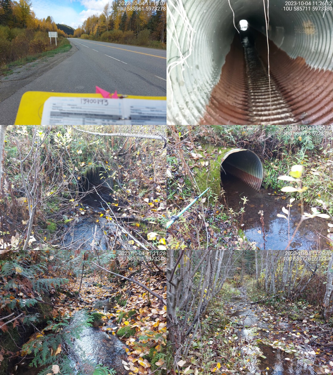 . From top left clockwise: Road/Site Card, Barrel, Outlet, Downstream, Upstream, Inlet.13900193 . From top left clockwise: Road/Site Card, Barrel, Outlet, Downstream, Upstream, Inlet.13900193
|
|||
| Comments: Culvert is a little backwatered at outlet. Small fish seen in pipe. Trib to major spawning stream. Crossing appears passable. Slight inlet drop due to woody debris. MoTi chris_culvert_id: 1992616. 11:30:43 |
| Location and Stream Data |
|
Crossing Characteristics | – |
|---|---|---|---|
| Date | 2023-10-05 | Crossing Sub Type | Round Culvert |
| PSCIS ID | 199314 | Diameter (m) | 1.05 |
| External ID | 13903148 | Length (m) | 32 |
| Crew | MW | Embedded | No |
| UTM Zone | 10 | Depth Embedded (m) | – |
| Easting | 689760 | Resemble Channel | No |
| Northing | 5909638 | Backwatered | Yes |
| Stream | Dominion Creek | Percent Backwatered | 100 |
| Road | Highway 16 | Fill Depth (m) | 1.3 |
| Road Tenure | MOTI | Outlet Drop (m) | 0 |
| Channel Width (m) | 2.9 | Outlet Pool Depth (m) | 0 |
| Stream Slope (%) | 0 | Inlet Drop | No |
| Beaver Activity | No | Slope (%) | 0 |
| Habitat Value | Low | Valley Fill | Deep Fill |
| Final score | 22 | Barrier Result | Barrier |
| Fix type | Replace with New Open Bottom Structure | Fix Span / Diameter | 15 |
Photos: PSCIS ID 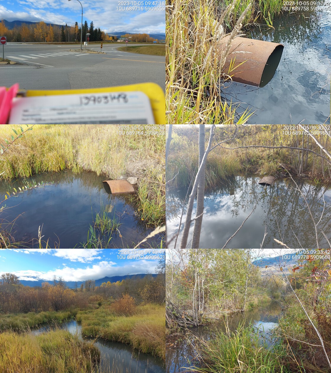 . From top left clockwise: Road/Site Card, Barrel, Outlet, Downstream, Upstream, Inlet.13903148 . From top left clockwise: Road/Site Card, Barrel, Outlet, Downstream, Upstream, Inlet.13903148
|
|||
| Comments: Wetland habitat upstream and downstream. Crossing is near transmission line so trees have been cut down. Backwatered culvert and pipe appears undersized. Chinook confirmed in the past downstream of crossing. MoTi chris_culvert_id: 1473381. 09:43:53 |
| Location and Stream Data |
|
Crossing Characteristics | – |
|---|---|---|---|
| Date | 2023-10-05 | Crossing Sub Type | Round Culvert |
| PSCIS ID | 199315 | Diameter (m) | 0.9 |
| External ID | 22200015 | Length (m) | 67 |
| Crew | AI | Embedded | No |
| UTM Zone | 11 | Depth Embedded (m) | – |
| Easting | 345011 | Resemble Channel | No |
| Northing | 5860593 | Backwatered | Yes |
| Stream | Crooked Creek | Percent Backwatered | 10 |
| Road | Highway 5 | Fill Depth (m) | 7.5 |
| Road Tenure | MOTI | Outlet Drop (m) | 0 |
| Channel Width (m) | 1.8 | Outlet Pool Depth (m) | 1 |
| Stream Slope (%) | 1.5 | Inlet Drop | No |
| Beaver Activity | Yes | Slope (%) | 3 |
| Habitat Value | Medium | Valley Fill | Deep Fill |
| Final score | 32 | Barrier Result | Barrier |
| Fix type | Replace Structure with Streambed Simulation CBS | Fix Span / Diameter | 3 |
Photos: PSCIS ID 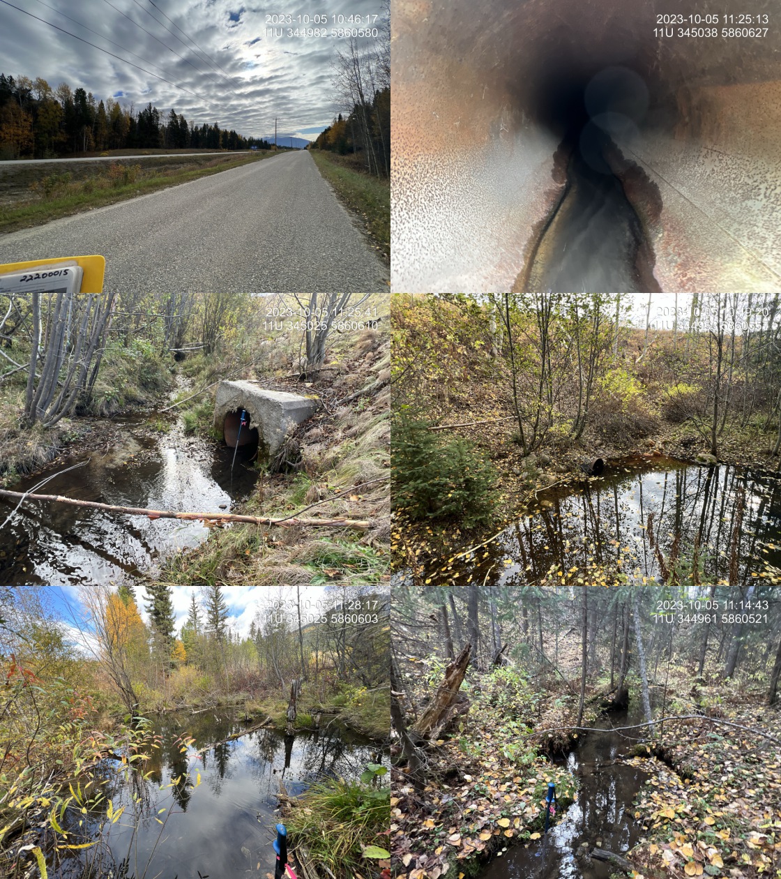 . From top left clockwise: Road/Site Card, Barrel, Outlet, Downstream, Upstream, Inlet.22200015 . From top left clockwise: Road/Site Card, Barrel, Outlet, Downstream, Upstream, Inlet.22200015
|
|||
| Comments: Culvert spans McLennan Rd and highway. Small stream with good flow and primarily fine substrate. Extensive beaver activity both upstream and downstream, with dams of up to 1 1/2 m high in both locations. Very long structure. Culvert gradient estimated as could not see through the pipe. MoTi chris_culvert_id: 1467210. 11:30:35 |
| Location and Stream Data |
|
Crossing Characteristics | – |
|---|---|---|---|
| Date | 2023-09-28 | Crossing Sub Type | Round Culvert |
| PSCIS ID | 199316 | Diameter (m) | 4.5 |
| External ID | 5400179 | Length (m) | 38 |
| Crew | AI | Embedded | Yes |
| UTM Zone | 10 | Depth Embedded (m) | 0.75 |
| Easting | 319471 | Resemble Channel | Yes |
| Northing | 6012988 | Backwatered | No |
| Stream | Sauls Creek | Percent Backwatered | – |
| Road | Railway Avenue | Fill Depth (m) | 1.5 |
| Road Tenure | Burns Lake | Outlet Drop (m) | 0 |
| Channel Width (m) | 2.8 | Outlet Pool Depth (m) | 0 |
| Stream Slope (%) | 0 | Inlet Drop | No |
| Beaver Activity | Yes | Slope (%) | 0 |
| Habitat Value | Medium | Valley Fill | Deep Fill |
| Final score | 11 | Barrier Result | Passable |
| Fix type | – | Fix Span / Diameter | – |
Photos: PSCIS ID 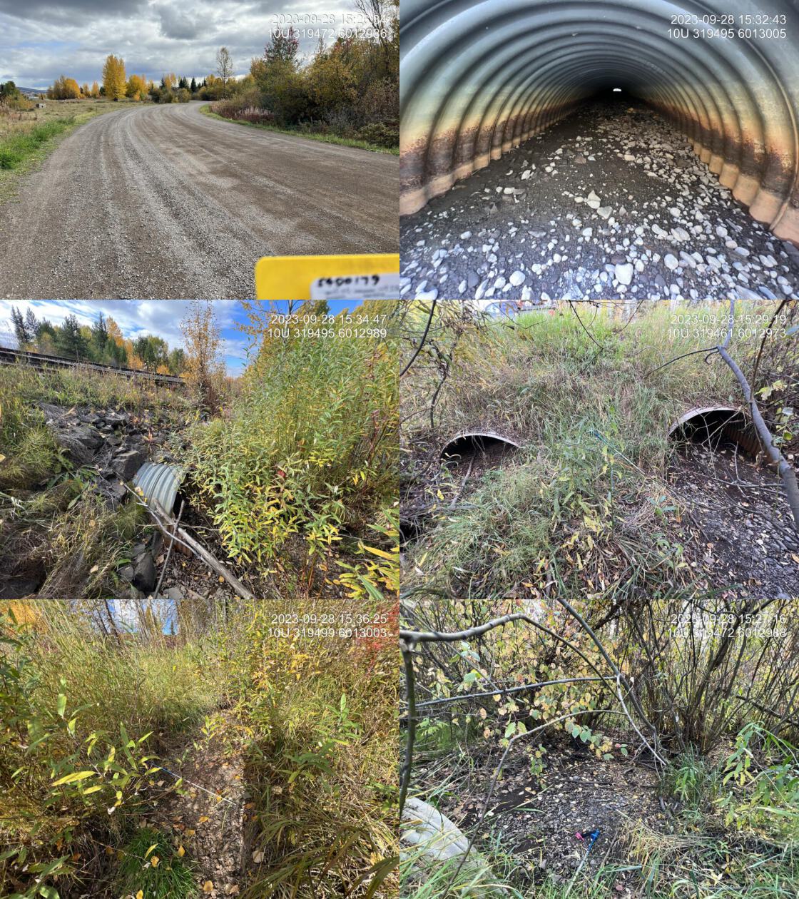 . From top left clockwise: Road/Site Card, Barrel, Outlet, Downstream, Upstream, Inlet.5400179 . From top left clockwise: Road/Site Card, Barrel, Outlet, Downstream, Upstream, Inlet.5400179
|
|||
| Comments: There are three 1.5m pipes located under Railway Avenue continuing all the way under the railway line. Pipes are embedded at or more than 50% of their depth. Stream was dry at the time of assessment and scoured channels indicate a fairly small system.. 15:25:25 |
| Location and Stream Data |
|
Crossing Characteristics | – |
|---|---|---|---|
| Date | 2023-09-09 | Crossing Sub Type | Round Culvert |
| PSCIS ID | 199317 | Diameter (m) | 2.7 |
| External ID | 15600147 | Length (m) | 16 |
| Crew | MW | Embedded | Yes |
| UTM Zone | 10 | Depth Embedded (m) | 0.3 |
| Easting | 438071 | Resemble Channel | No |
| Northing | 5986296 | Backwatered | No |
| Stream | Knight Creek | Percent Backwatered | – |
| Road | Sickness Road | Fill Depth (m) | 0.5 |
| Road Tenure | Vanderhoof | Outlet Drop (m) | 0 |
| Channel Width (m) | 1.9 | Outlet Pool Depth (m) | 0 |
| Stream Slope (%) | 2 | Inlet Drop | No |
| Beaver Activity | No | Slope (%) | 1 |
| Habitat Value | Medium | Valley Fill | Deep Fill |
| Final score | 13 | Barrier Result | Passable |
| Fix type | – | Fix Span / Diameter | – |
Photos: PSCIS ID 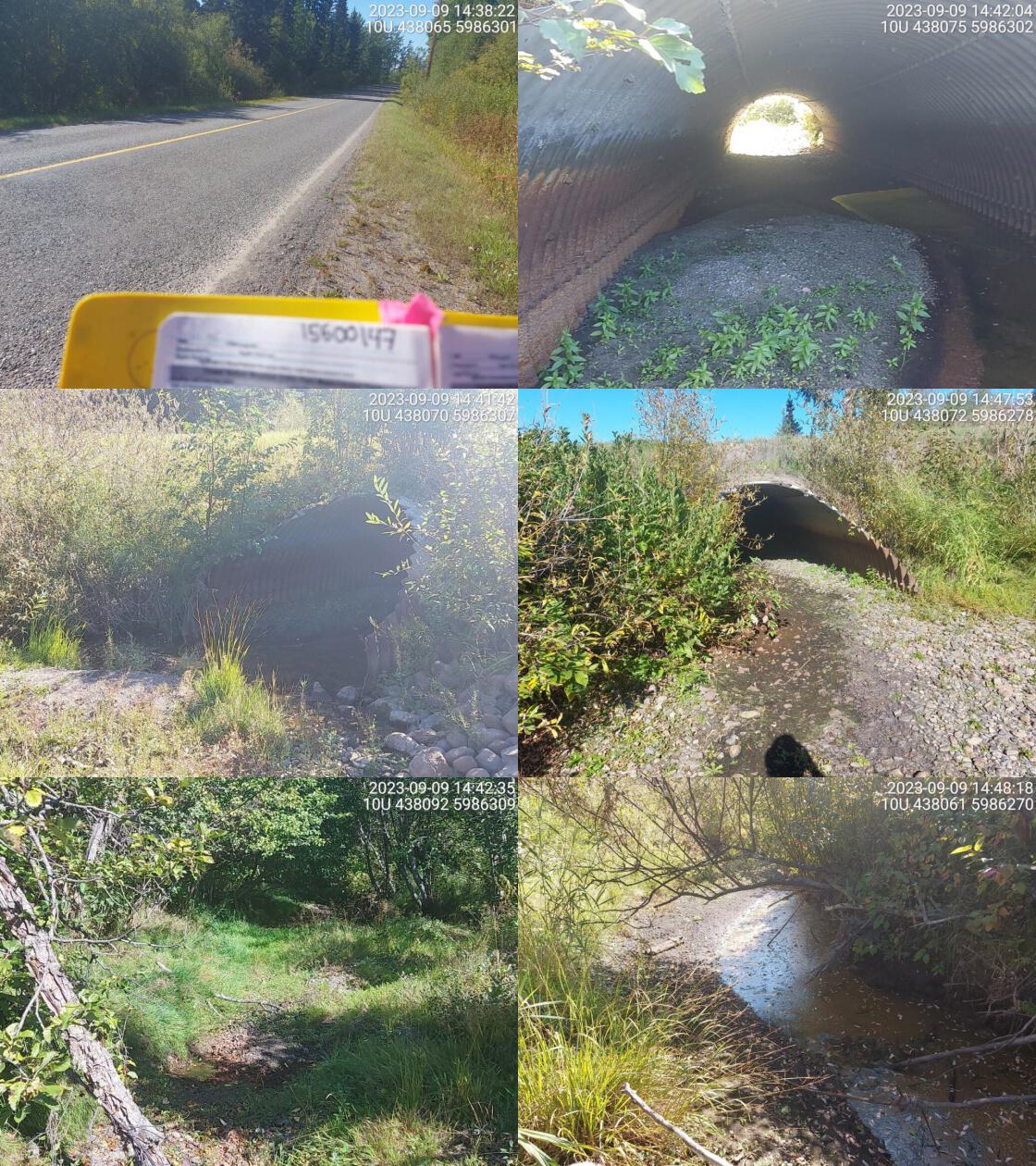 . From top left clockwise: Road/Site Card, Barrel, Outlet, Downstream, Upstream, Inlet.15600147 . From top left clockwise: Road/Site Card, Barrel, Outlet, Downstream, Upstream, Inlet.15600147
|
|||
| Comments: No water in pipe. Periodic pools of standing water upstream and downstream but no flowing water. NEWWS has completed restoration work for this site with sign posted at this location. Culvert appears fully embedded in photos so have changed inputs to reflect this.. 14:51:44 |
| Location and Stream Data |
|
Crossing Characteristics | – |
|---|---|---|---|
| Date | 2023-09-10 | Crossing Sub Type | Round Culvert |
| PSCIS ID | 199318 | Diameter (m) | 1 |
| External ID | 15600154 | Length (m) | 16 |
| Crew | MW | Embedded | Yes |
| UTM Zone | 10 | Depth Embedded (m) | 0.1 |
| Easting | 416009 | Resemble Channel | No |
| Northing | 5993732 | Backwatered | No |
| Stream | Trankle Creek | Percent Backwatered | – |
| Road | Braeside Rd | Fill Depth (m) | 1 |
| Road Tenure | MOTI | Outlet Drop (m) | 0 |
| Channel Width (m) | 1 | Outlet Pool Depth (m) | 0 |
| Stream Slope (%) | 2 | Inlet Drop | No |
| Beaver Activity | No | Slope (%) | 1 |
| Habitat Value | Low | Valley Fill | Deep Fill |
| Final score | 16 | Barrier Result | Potential |
| Fix type | Replace Structure with Streambed Simulation CBS | Fix Span / Diameter | 3 |
Photos: PSCIS ID 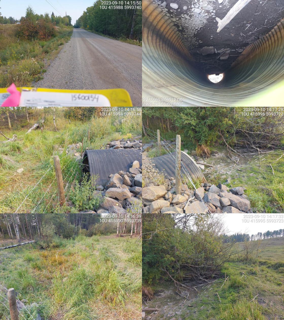 . From top left clockwise: Road/Site Card, Barrel, Outlet, Downstream, Upstream, Inlet.15600154 . From top left clockwise: Road/Site Card, Barrel, Outlet, Downstream, Upstream, Inlet.15600154
|
|||
| Comments: Dewatered, no well-defined stream channel. Agricultural fields on both sides. Embeddedness estimated from photos. MoTi chris_culvert_id: 1804664. 14:18:04 |
| Location and Stream Data |
|
Crossing Characteristics | – |
|---|---|---|---|
| Date | 2023-09-29 | Crossing Sub Type | Round Culvert |
| PSCIS ID | 199319 | Diameter (m) | 3.8 |
| External ID | 5400028 | Length (m) | 44 |
| Crew | MW | Embedded | Yes |
| UTM Zone | 10 | Depth Embedded (m) | 0.2 |
| Easting | 330232 | Resemble Channel | No |
| Northing | 6009362 | Backwatered | No |
| Stream | Tintagel Creek | Percent Backwatered | – |
| Road | Highway 16 | Fill Depth (m) | 2 |
| Road Tenure | MOTI | Outlet Drop (m) | 0 |
| Channel Width (m) | 3.6 | Outlet Pool Depth (m) | 0 |
| Stream Slope (%) | 1 | Inlet Drop | No |
| Beaver Activity | No | Slope (%) | 2 |
| Habitat Value | High | Valley Fill | Deep Fill |
| Final score | 16 | Barrier Result | Potential |
| Fix type | Replace with New Open Bottom Structure | Fix Span / Diameter | 15 |
Photos: PSCIS ID 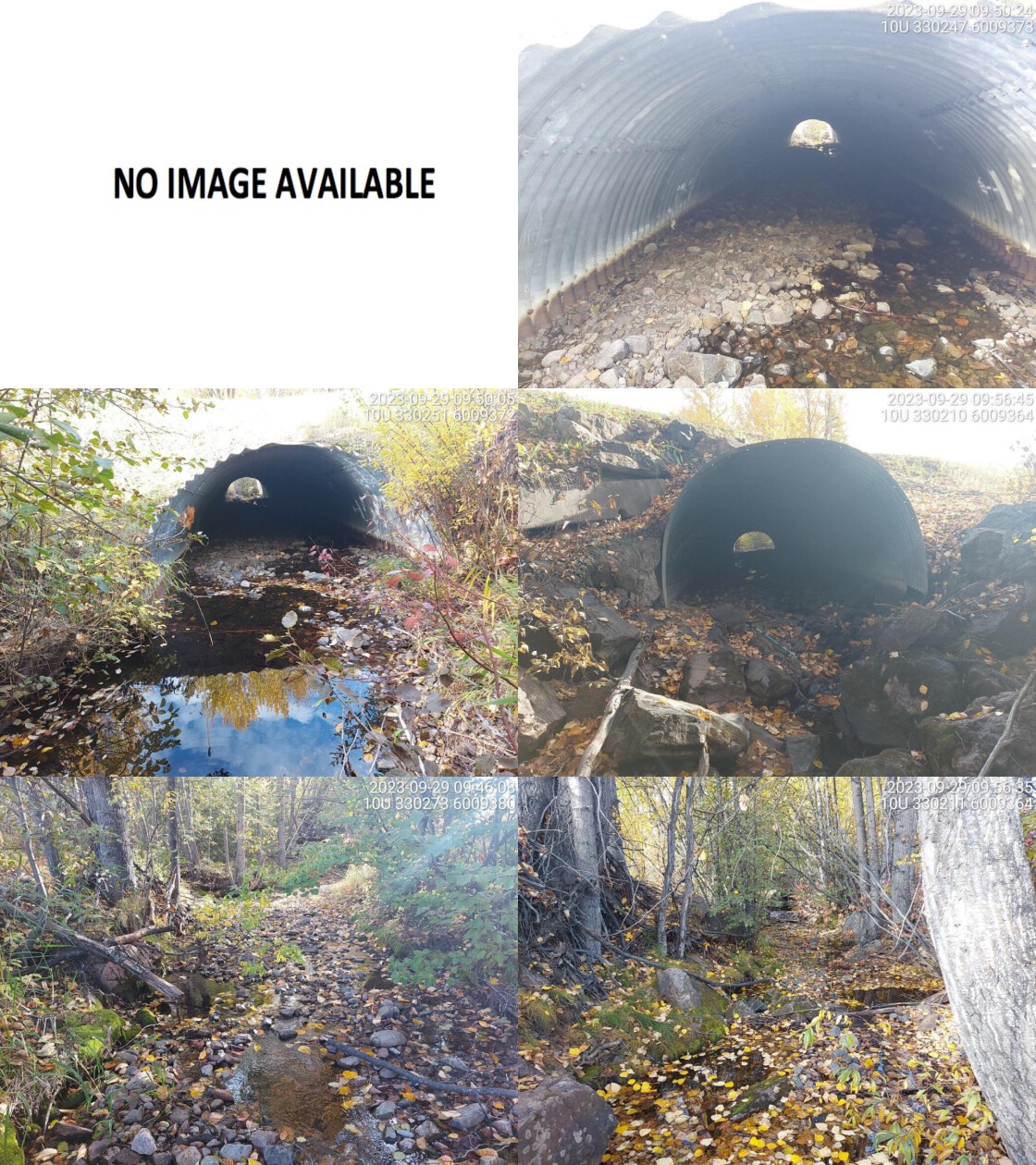 . From top left clockwise: Road/Site Card, Barrel, Outlet, Downstream, Upstream, Inlet.5400028 . From top left clockwise: Road/Site Card, Barrel, Outlet, Downstream, Upstream, Inlet.5400028
|
|||
| Comments: Wide channel, nicely installed moti major structure that appears passable as fully embedded. 3m falls noted in FISS as 1.3 km upstream. Railway crossing just downstream noted as passable in bcfishpass. MoTi chris_hwy_structure_road_id: 3811. 09:56:11 |
| Location and Stream Data |
|
Crossing Characteristics | – |
|---|---|---|---|
| Date | 2023-10-03 | Crossing Sub Type | Round Culvert |
| PSCIS ID | 199320 | Diameter (m) | 4.8 |
| External ID | 13905385 | Length (m) | 18 |
| Crew | AI | Embedded | Yes |
| UTM Zone | 10 | Depth Embedded (m) | 0.25 |
| Easting | 590814 | Resemble Channel | Yes |
| Northing | 5982800 | Backwatered | No |
| Stream | Wolfe Creek | Percent Backwatered | – |
| Road | Railway | Fill Depth (m) | 2 |
| Road Tenure | CN Rail | Outlet Drop (m) | 0 |
| Channel Width (m) | 3.3 | Outlet Pool Depth (m) | 0.1 |
| Stream Slope (%) | 1.5 | Inlet Drop | No |
| Beaver Activity | Yes | Slope (%) | 0 |
| Habitat Value | High | Valley Fill | Deep Fill |
| Final score | 8 | Barrier Result | Passable |
| Fix type | – | Fix Span / Diameter | – |
Photos: PSCIS ID 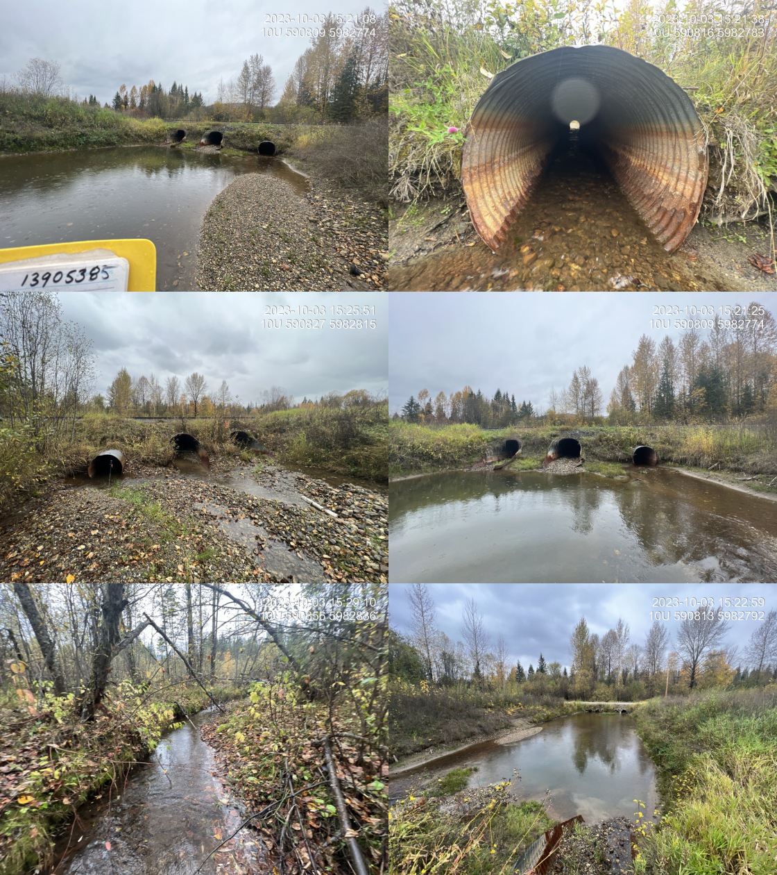 . From top left clockwise: Road/Site Card, Barrel, Outlet, Downstream, Upstream, Inlet.13905385 . From top left clockwise: Road/Site Card, Barrel, Outlet, Downstream, Upstream, Inlet.13905385
|
|||
| Comments: Fully embedded pipes. Three pipes total, with two at 1.8 m and one at 1.2m in diameter. Nice habitat upstream with abundant gravels, some deeper pools and deeply undercut banks.. 15:31:23 |
| Location and Stream Data |
|
Crossing Characteristics | – |
|---|---|---|---|
| Date | 2023-10-04 | Crossing Sub Type | Round Culvert |
| PSCIS ID | 199321 | Diameter (m) | 2 |
| External ID | 13900265 | Length (m) | 22 |
| Crew | MW | Embedded | Yes |
| UTM Zone | 10 | Depth Embedded (m) | 0.25 |
| Easting | 591253 | Resemble Channel | No |
| Northing | 5971048 | Backwatered | No |
| Stream | Sugarbowl Creek | Percent Backwatered | – |
| Road | Highway 16 | Fill Depth (m) | 0.8 |
| Road Tenure | MOTI | Outlet Drop (m) | 0 |
| Channel Width (m) | 6.2 | Outlet Pool Depth (m) | 0 |
| Stream Slope (%) | 5.5 | Inlet Drop | No |
| Beaver Activity | No | Slope (%) | 1 |
| Habitat Value | High | Valley Fill | Deep Fill |
| Final score | 19 | Barrier Result | Potential |
| Fix type | Replace with New Open Bottom Structure | Fix Span / Diameter | 15 |
Photos: PSCIS ID 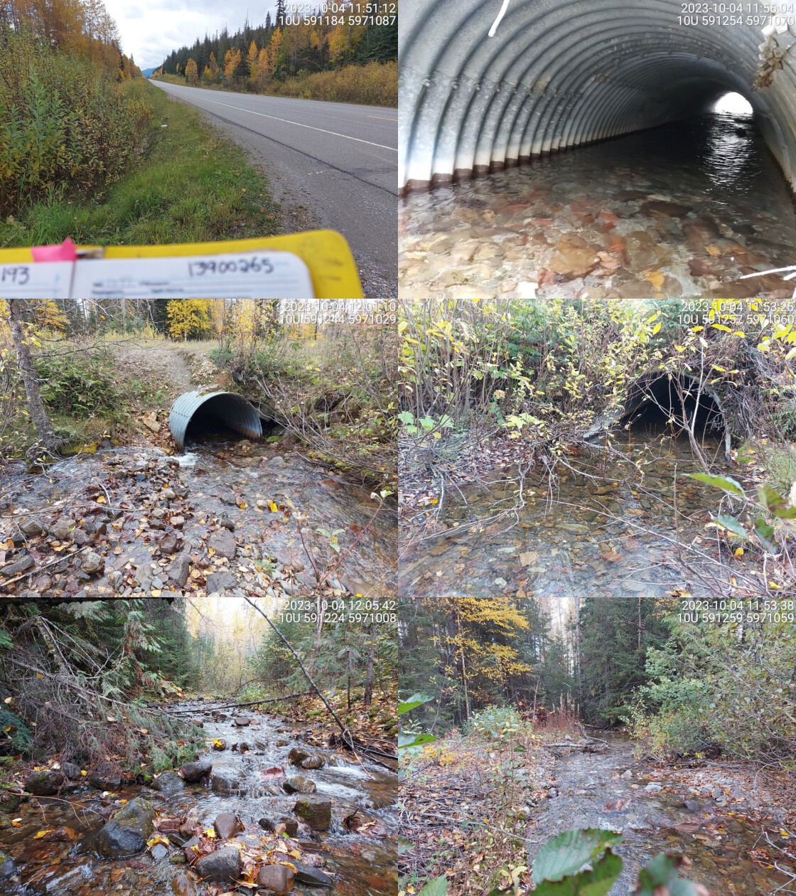 . From top left clockwise: Road/Site Card, Barrel, Outlet, Downstream, Upstream, Inlet.13900265 . From top left clockwise: Road/Site Card, Barrel, Outlet, Downstream, Upstream, Inlet.13900265
|
|||
| Comments: Embedded culvert, high flowing mountain stream. Very clear and wide channel. Gradient increases upstream. Fully embedded pipe so likley passable for all species and life stages at perhaps all but very high flows. MoTi chris_culvert_id: 1992808. 11:55:36 |
| Location and Stream Data |
|
Crossing Characteristics | – |
|---|---|---|---|
| Date | 2023-10-05 | Crossing Sub Type | Round Culvert |
| PSCIS ID | 199322 | Diameter (m) | 3 |
| External ID | 13900025 | Length (m) | 27 |
| Crew | MW | Embedded | Yes |
| UTM Zone | 10 | Depth Embedded (m) | 0.15 |
| Easting | 688754 | Resemble Channel | No |
| Northing | 5910557 | Backwatered | No |
| Stream | Shelby Creek | Percent Backwatered | – |
| Road | Airport Rd | Fill Depth (m) | 2.2 |
| Road Tenure | McBride | Outlet Drop (m) | 0 |
| Channel Width (m) | 1.4 | Outlet Pool Depth (m) | 0 |
| Stream Slope (%) | 2 | Inlet Drop | No |
| Beaver Activity | No | Slope (%) | 3 |
| Habitat Value | Medium | Valley Fill | Deep Fill |
| Final score | 18 | Barrier Result | Potential |
| Fix type | Replace Structure with Streambed Simulation CBS | Fix Span / Diameter | 3 |
Photos: PSCIS ID 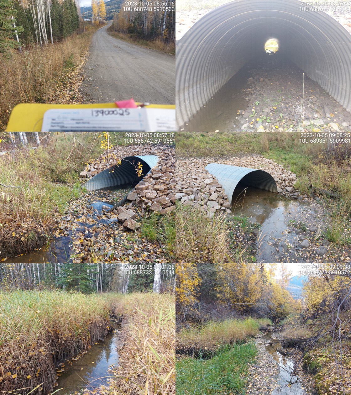 . From top left clockwise: Road/Site Card, Barrel, Outlet, Downstream, Upstream, Inlet.13900025 . From top left clockwise: Road/Site Card, Barrel, Outlet, Downstream, Upstream, Inlet.13900025
|
|||
| Comments: Chinook and mountain whitefish confirmed just upstream in 2019. Continuously embedded culvert. Grassy habitat upstream with little riparian on streambanks near crossing. Fines were the predominant stream substrate.. 09:09:59 |
| Location and Stream Data |
|
Crossing Characteristics | – |
|---|---|---|---|
| Date | 2023-10-05 | Crossing Sub Type | Round Culvert |
| PSCIS ID | 199323 | Diameter (m) | 0.75 |
| External ID | 22200082 | Length (m) | 12 |
| Crew | AI | Embedded | Yes |
| UTM Zone | 11 | Depth Embedded (m) | 0.18 |
| Easting | 345873 | Resemble Channel | Yes |
| Northing | 5855411 | Backwatered | No |
| Stream | Cranberry Creek | Percent Backwatered | – |
| Road | Cranberry Lake Road | Fill Depth (m) | 1 |
| Road Tenure | MOTI | Outlet Drop (m) | 0 |
| Channel Width (m) | 4 | Outlet Pool Depth (m) | 0 |
| Stream Slope (%) | 0 | Inlet Drop | No |
| Beaver Activity | Yes | Slope (%) | 0 |
| Habitat Value | Medium | Valley Fill | Deep Fill |
| Final score | 11 | Barrier Result | Passable |
| Fix type | – | Fix Span / Diameter | – |
Photos: PSCIS ID 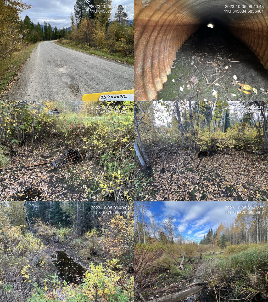 . From top left clockwise: Road/Site Card, Barrel, Outlet, Downstream, Upstream, Inlet.22200082 . From top left clockwise: Road/Site Card, Barrel, Outlet, Downstream, Upstream, Inlet.22200082
|
|||
| Comments: Stream is mostly dewatered. Large beaver dam (1.7m high) located approximately 30m upstream. Fully embedded pipe with beaver grate on the inlet. Unassessed crossing on private driveway upstream from here. Adjacent landowner has concerns about the recent lack of water and says it is un-characteristic for the section of stream. They have concerns that recent pipeline construction just upstream of this crossing has potentially influenced beaver populations and water flow.. 09:47:05 |
| Location and Stream Data |
|
Crossing Characteristics | – |
|---|---|---|---|
| Date | 2023-10-05 | Crossing Sub Type | Round Culvert |
| PSCIS ID | 199324 | Diameter (m) | 3.7 |
| External ID | 13900015 | Length (m) | 30 |
| Crew | MW | Embedded | Yes |
| UTM Zone | 10 | Depth Embedded (m) | 0.2 |
| Easting | 688844 | Resemble Channel | Yes |
| Northing | 5909209 | Backwatered | No |
| Stream | Dominion Creek | Percent Backwatered | – |
| Road | 2nd Ave | Fill Depth (m) | 2 |
| Road Tenure | McBride | Outlet Drop (m) | 0 |
| Channel Width (m) | 3.4 | Outlet Pool Depth (m) | 0 |
| Stream Slope (%) | 0 | Inlet Drop | No |
| Beaver Activity | No | Slope (%) | 1 |
| Habitat Value | High | Valley Fill | Deep Fill |
| Final score | 16 | Barrier Result | Potential |
| Fix type | Replace with New Open Bottom Structure | Fix Span / Diameter | 15 |
Photos: PSCIS ID 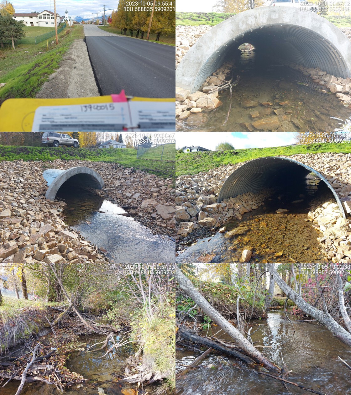 . From top left clockwise: Road/Site Card, Barrel, Outlet, Downstream, Upstream, Inlet.13900015 . From top left clockwise: Road/Site Card, Barrel, Outlet, Downstream, Upstream, Inlet.13900015
|
|||
| Comments: Continuously embedded culvert. Wide channel with moderate flow. High value habitat. 10:09:03 |
| Location and Stream Data |
|
Crossing Characteristics | – |
|---|---|---|---|
| Date | 2023-10-05 | Crossing Sub Type | Round Culvert |
| PSCIS ID | 199325 | Diameter (m) | 2.5 |
| External ID | 13900073 | Length (m) | 20 |
| Crew | MW | Embedded | Yes |
| UTM Zone | 10 | Depth Embedded (m) | 0.3 |
| Easting | 693145 | Resemble Channel | Yes |
| Northing | 5907919 | Backwatered | No |
| Stream | Teare Creek | Percent Backwatered | – |
| Road | Jeck Rd | Fill Depth (m) | 1.5 |
| Road Tenure | MOTI Local | Outlet Drop (m) | 0 |
| Channel Width (m) | 3.1 | Outlet Pool Depth (m) | 0.5 |
| Stream Slope (%) | 0 | Inlet Drop | No |
| Beaver Activity | No | Slope (%) | 1 |
| Habitat Value | Medium | Valley Fill | Deep Fill |
| Final score | 16 | Barrier Result | Potential |
| Fix type | Replace with New Open Bottom Structure | Fix Span / Diameter | 15 |
Photos: PSCIS ID 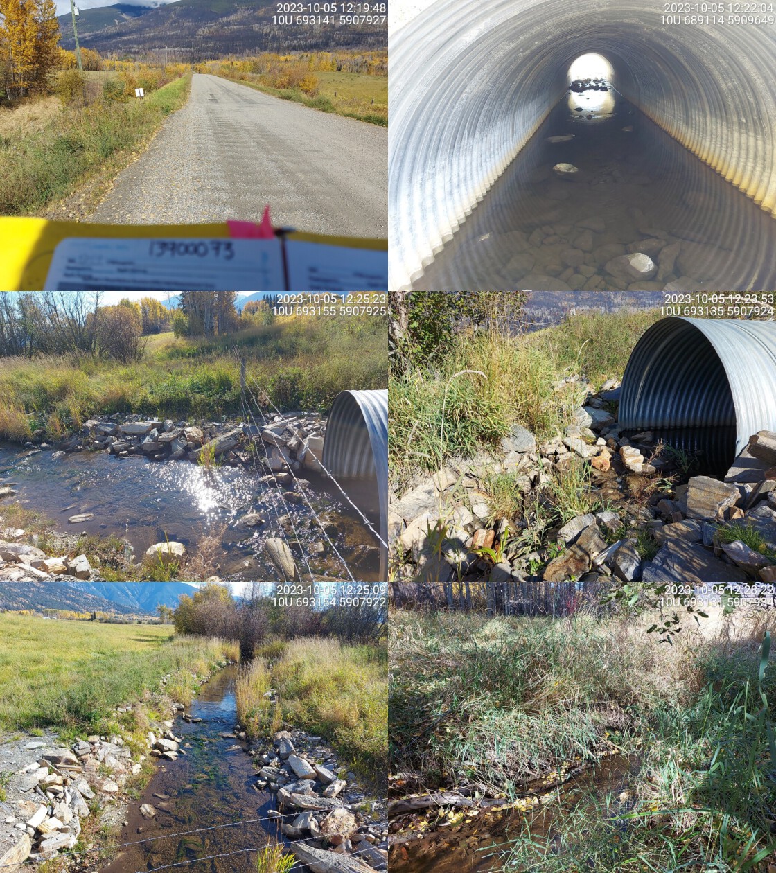 . From top left clockwise: Road/Site Card, Barrel, Outlet, Downstream, Upstream, Inlet.13900073 . From top left clockwise: Road/Site Card, Barrel, Outlet, Downstream, Upstream, Inlet.13900073
|
|||
| Comments: RB and CCG confirmed downstream in past. Private agricultural land upstream and downstream. Embedded culvert. Small wooden dam just downstream of crossing, approx 0.8m high. Small trickle of water beside structure that would allow fish to swim upstream. MoTi chris_culvert_id: 1461195. 12:32:44 |
| Location and Stream Data |
|
Crossing Characteristics | – |
|---|---|---|---|
| Date | 2023-10-05 | Crossing Sub Type | Round Culvert |
| PSCIS ID | 199326 | Diameter (m) | 2.5 |
| External ID | 13900012 | Length (m) | 32 |
| Crew | MW | Embedded | Yes |
| UTM Zone | 10 | Depth Embedded (m) | 0.2 |
| Easting | 693878 | Resemble Channel | Yes |
| Northing | 5908064 | Backwatered | No |
| Stream | Teare Creek | Percent Backwatered | – |
| Road | Highway 16 | Fill Depth (m) | 2.2 |
| Road Tenure | MOTI | Outlet Drop (m) | 0 |
| Channel Width (m) | 2.8 | Outlet Pool Depth (m) | 0 |
| Stream Slope (%) | 2 | Inlet Drop | No |
| Beaver Activity | No | Slope (%) | 1 |
| Habitat Value | Medium | Valley Fill | Deep Fill |
| Final score | 19 | Barrier Result | Potential |
| Fix type | Replace with New Open Bottom Structure | Fix Span / Diameter | 15 |
Photos: PSCIS ID 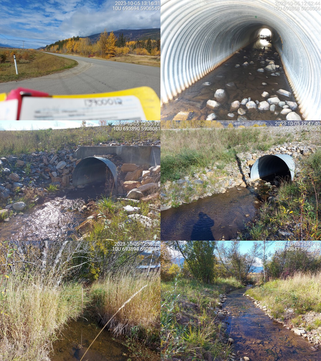 . From top left clockwise: Road/Site Card, Barrel, Outlet, Downstream, Upstream, Inlet.13900012 . From top left clockwise: Road/Site Card, Barrel, Outlet, Downstream, Upstream, Inlet.13900012
|
|||
| Comments: Continuously embedded culvert. Agricultural fields upstream and downstream. Very little riparian vegetation. Small fish seen near inlet. Channel looks like it gets smaller upstream, flows through cow field. Not a fish passage issue, but riparian restoration could be pursued. RB confirmed in the past near crossing. MoTi chris_culvert_id: 1473360. 12:54:06 |
| Location and Stream Data |
|
Crossing Characteristics | – |
|---|---|---|---|
| Date | 2023-09-29 | Crossing Sub Type | Round Culvert |
| PSCIS ID | 199327 | Diameter (m) | 1.8 |
| External ID | 15600048 | Length (m) | 17 |
| Crew | AI | Embedded | Yes |
| UTM Zone | 10 | Depth Embedded (m) | 0.2 |
| Easting | 397528 | Resemble Channel | Yes |
| Northing | 5976165 | Backwatered | Yes |
| Stream | Tahultzu Creek | Percent Backwatered | 100 |
| Road | Lily Lake Road | Fill Depth (m) | 1 |
| Road Tenure | MOTI | Outlet Drop (m) | 0 |
| Channel Width (m) | 3 | Outlet Pool Depth (m) | 0.3 |
| Stream Slope (%) | 0 | Inlet Drop | No |
| Beaver Activity | No | Slope (%) | 0 |
| Habitat Value | Medium | Valley Fill | Deep Fill |
| Final score | 14 | Barrier Result | Passable |
| Fix type | – | Fix Span / Diameter | – |
Photos: PSCIS ID 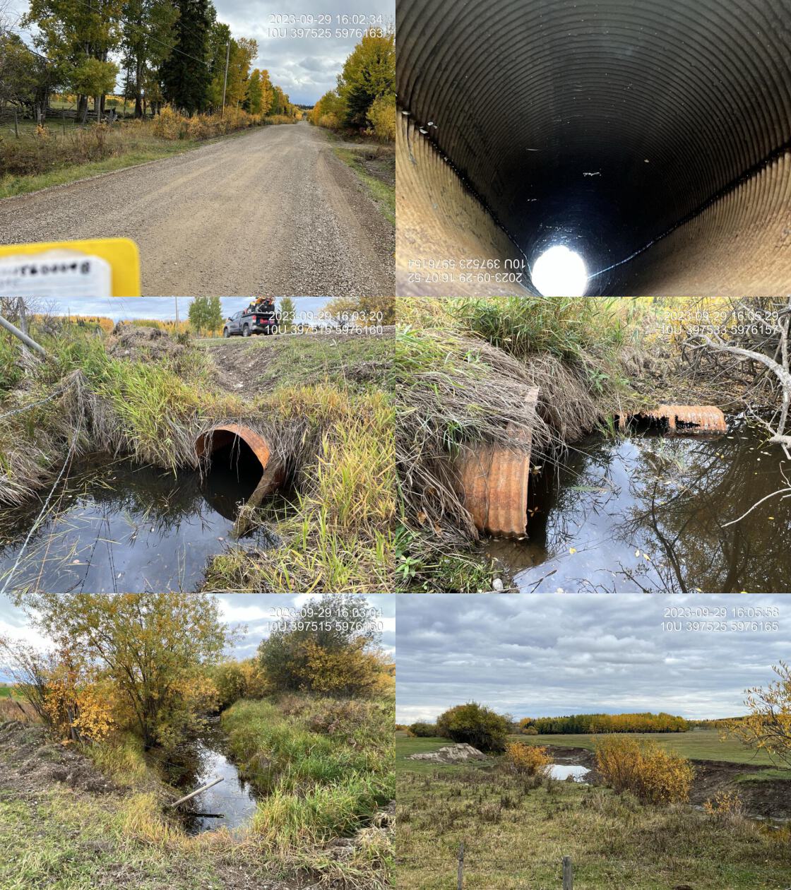 . From top left clockwise: Road/Site Card, Barrel, Outlet, Downstream, Upstream, Inlet.15600048 . From top left clockwise: Road/Site Card, Barrel, Outlet, Downstream, Upstream, Inlet.15600048
|
|||
| Comments: Two pipes (1.2m and 0.6m). 100% backwater. Guessing the pipes are embedded but cannot see due to poor water quality. This stream is extremely impacted by poor cattle ranching practices. There is no riparian fencing and cattle have completely trampled all the banks. There is no riparian vegetation and water quality is extremely poor. This stream could likely be very productive for chinook and other species if eventually restored. MoTi chris_culvert_id: 1795014, 1795015. 16:01:11 |
| Location and Stream Data |
|
Crossing Characteristics | – |
|---|---|---|---|
| Date | 2023-09-30 | Crossing Sub Type | Round Culvert |
| PSCIS ID | 199328 | Diameter (m) | 1.2 |
| External ID | 5400201 | Length (m) | 11 |
| Crew | AI | Embedded | Yes |
| UTM Zone | 10 | Depth Embedded (m) | 0.5 |
| Easting | 388367 | Resemble Channel | Yes |
| Northing | 5996767 | Backwatered | Yes |
| Stream | Scotch Creek | Percent Backwatered | 80 |
| Road | Gala Lake Road | Fill Depth (m) | 1.5 |
| Road Tenure | MOTI | Outlet Drop (m) | 0 |
| Channel Width (m) | 1.7 | Outlet Pool Depth (m) | 0.05 |
| Stream Slope (%) | 3 | Inlet Drop | No |
| Beaver Activity | No | Slope (%) | 0.2 |
| Habitat Value | Medium | Valley Fill | Deep Fill |
| Final score | 6 | Barrier Result | Passable |
| Fix type | – | Fix Span / Diameter | – |
Photos: PSCIS ID 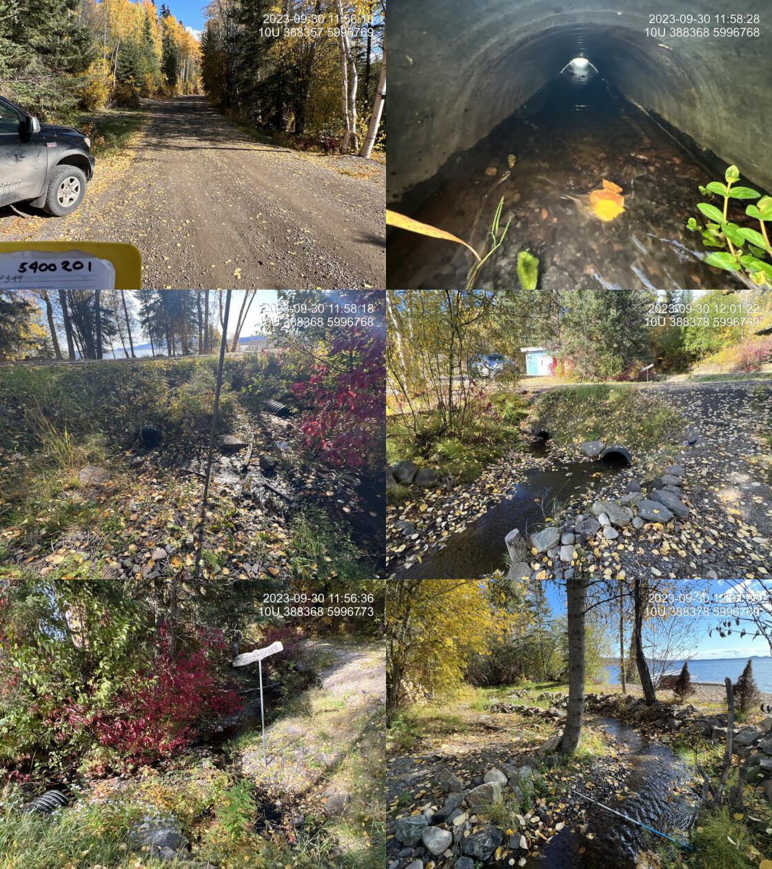 . From top left clockwise: Road/Site Card, Barrel, Outlet, Downstream, Upstream, Inlet.5400201 . From top left clockwise: Road/Site Card, Barrel, Outlet, Downstream, Upstream, Inlet.5400201
|
|||
| Comments: Good flow. Abundant gravel downstream and upstream. Pipes are both fully embedded with partial backwatering. Chinook point on the stream immediately adjacent to the site. Upstream left bank riparian has been cleared for what appears to be a parking space. Upstream crossing on Stella Road could be addressed by MoT. MoTi chris_culvert_id: 1790947, 3365573. 11:54:44 |
| Location and Stream Data |
|
Crossing Characteristics | – |
|---|---|---|---|
| Date | 2023-10-03 | Crossing Sub Type | Round Culvert |
| PSCIS ID | 199329 | Diameter (m) | 4.4 |
| External ID | 24715754 | Length (m) | 35 |
| Crew | AI | Embedded | Yes |
| UTM Zone | 10 | Depth Embedded (m) | 1.3 |
| Easting | 576134 | Resemble Channel | Yes |
| Northing | 5992813 | Backwatered | Yes |
| Stream | Tributary to Fraser River | Percent Backwatered | 100 |
| Road | Upper Fraser Road | Fill Depth (m) | 2.5 |
| Road Tenure | MOTI | Outlet Drop (m) | 0 |
| Channel Width (m) | 12 | Outlet Pool Depth (m) | 2 |
| Stream Slope (%) | 0 | Inlet Drop | No |
| Beaver Activity | Yes | Slope (%) | 0 |
| Habitat Value | High | Valley Fill | Deep Fill |
| Final score | 12 | Barrier Result | Passable |
| Fix type | – | Fix Span / Diameter | – |
Photos: PSCIS ID 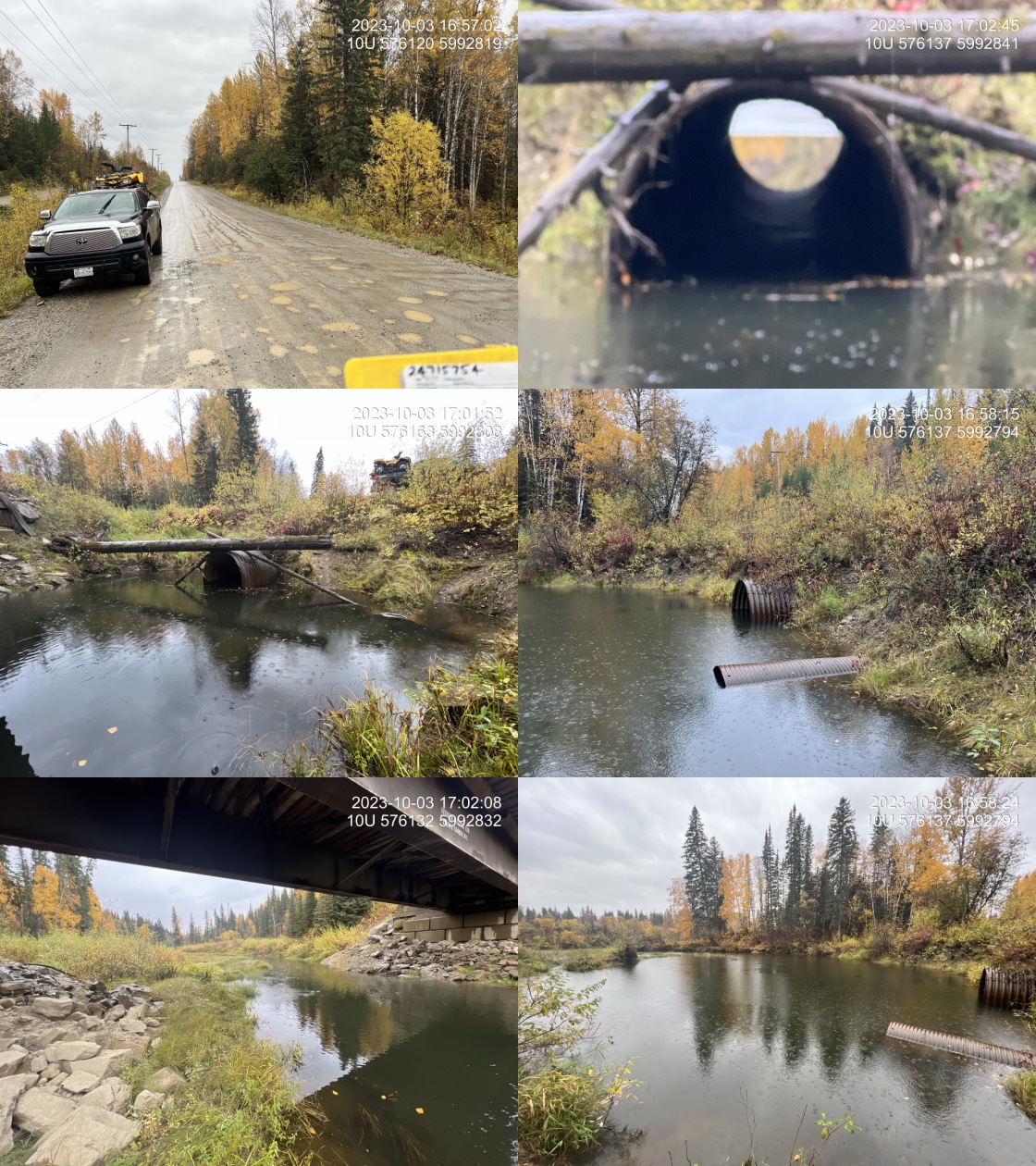 . From top left clockwise: Road/Site Card, Barrel, Outlet, Downstream, Upstream, Inlet.24715754 . From top left clockwise: Road/Site Card, Barrel, Outlet, Downstream, Upstream, Inlet.24715754
|
|||
| Comments: Three pipes total, two at 1.2m diameter which were completely submerged underwater and one at 2m diameter which was 100% backwatered. Assuming embedded due to the depth of the backwatering. Bridge located just upstream on River Road. Unassessed railway crossing located downstream which, based off satellite imagery, leads to a wetland area, but no modelled crossing present. There is a second unassessed crossing (24715896) downstream which should be assessed. Multiple non-salmonid FISS observations downstream. Chinook and sockeye salmon have been observed just upstream of the confluence of this creek with the Fraser River, roughly 1km downstream of the crossing. MoTi chris_culvert_id: 1994579, 1994580, 1994581. 17:04:42 |
| Location and Stream Data |
|
Crossing Characteristics | – |
|---|---|---|---|
| Date | 2023-09-28 | Crossing Sub Type | Bridge |
| PSCIS ID | 199330 | Diameter (m) | 4 |
| External ID | 5400159 | Length (m) | 11 |
| Crew | AI | Embedded | – |
| UTM Zone | 10 | Depth Embedded (m) | – |
| Easting | 319797 | Resemble Channel | – |
| Northing | 6012952 | Backwatered | – |
| Stream | Sauls Creek | Percent Backwatered | – |
| Road | Government Rd | Fill Depth (m) | – |
| Road Tenure | Burns Lake | Outlet Drop (m) | – |
| Channel Width (m) | – | Outlet Pool Depth (m) | – |
| Stream Slope (%) | – | Inlet Drop | – |
| Beaver Activity | – | Slope (%) | – |
| Habitat Value | – | Valley Fill | – |
| Final score | 0 | Barrier Result | Passable |
| Fix type | – | Fix Span / Diameter | – |
Photos: PSCIS ID 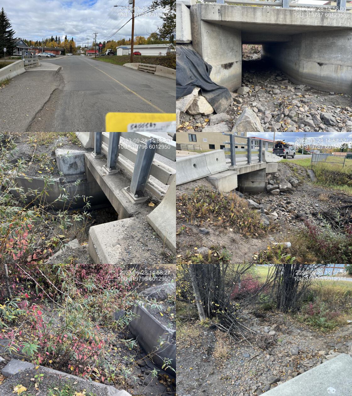 . From top left clockwise: Road/Site Card, Barrel, Outlet, Downstream, Upstream, Inlet.5400159 . From top left clockwise: Road/Site Card, Barrel, Outlet, Downstream, Upstream, Inlet.5400159
|
|||
| Comments: Dry channel. Bridge.. 14:56:53 |
| Location and Stream Data |
|
Crossing Characteristics | – |
|---|---|---|---|
| Date | 2023-09-29 | Crossing Sub Type | Pipe Arch |
| PSCIS ID | 199331 | Diameter (m) | 2.65 |
| External ID | 5400180 | Length (m) | 12 |
| Crew | AI | Embedded | – |
| UTM Zone | 10 | Depth Embedded (m) | – |
| Easting | 321069 | Resemble Channel | – |
| Northing | 6011579 | Backwatered | – |
| Stream | Wardrop Creek | Percent Backwatered | – |
| Road | Glans Drive | Fill Depth (m) | – |
| Road Tenure | Burns Lake | Outlet Drop (m) | – |
| Channel Width (m) | – | Outlet Pool Depth (m) | – |
| Stream Slope (%) | – | Inlet Drop | – |
| Beaver Activity | – | Slope (%) | – |
| Habitat Value | – | Valley Fill | – |
| Final score | 0 | Barrier Result | Passable |
| Fix type | – | Fix Span / Diameter | – |
Photos: PSCIS ID 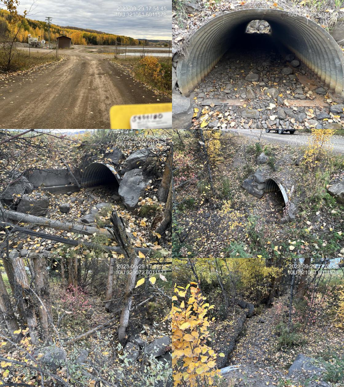 . From top left clockwise: Road/Site Card, Barrel, Outlet, Downstream, Upstream, Inlet.5400180 . From top left clockwise: Road/Site Card, Barrel, Outlet, Downstream, Upstream, Inlet.5400180
|
|||
| Comments: Pipe arch. Passable. Modelled crossings 5406290 and 5400675 downstream adjacent to Burn’s Lake shoreline have not been assessed.. 17:53:31 |
| Location and Stream Data |
|
Crossing Characteristics | – |
|---|---|---|---|
| Date | 2023-09-30 | Crossing Sub Type | Bridge |
| PSCIS ID | 199332 | Diameter (m) | 13 |
| External ID | 15604870 | Length (m) | 5 |
| Crew | AI | Embedded | – |
| UTM Zone | 10 | Depth Embedded (m) | – |
| Easting | 396140 | Resemble Channel | – |
| Northing | 5997722 | Backwatered | – |
| Stream | Tributary to Nechako River | Percent Backwatered | – |
| Road | Williams FSR | Fill Depth (m) | – |
| Road Tenure | West Fraser R09194 SE | Outlet Drop (m) | – |
| Channel Width (m) | – | Outlet Pool Depth (m) | – |
| Stream Slope (%) | – | Inlet Drop | – |
| Beaver Activity | – | Slope (%) | – |
| Habitat Value | – | Valley Fill | – |
| Final score | 0 | Barrier Result | Passable |
| Fix type | – | Fix Span / Diameter | – |
Photos: PSCIS ID 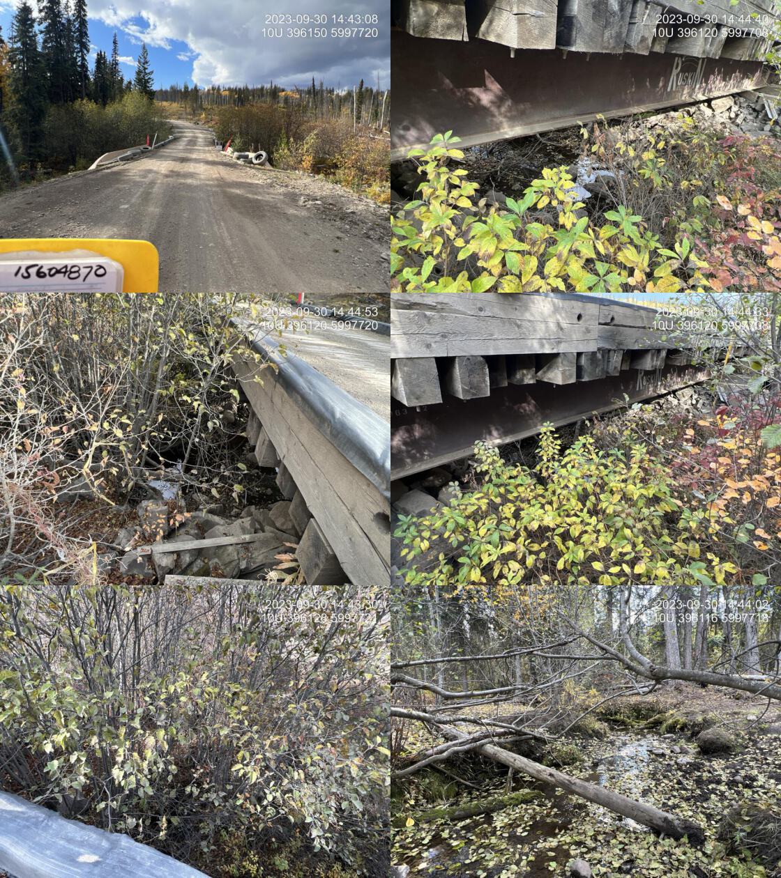 . From top left clockwise: Road/Site Card, Barrel, Outlet, Downstream, Upstream, Inlet.15604870 . From top left clockwise: Road/Site Card, Barrel, Outlet, Downstream, Upstream, Inlet.15604870
|
|||
| Comments: Bridge with sign from Fraser lake sawmills. Extensive cattle trampling underneath the bridge, but some decent amount of water at this location.. 14:46:03 |
| Location and Stream Data |
|
Crossing Characteristics | – |
|---|---|---|---|
| Date | 2023-09-30 | Crossing Sub Type | Bridge |
| PSCIS ID | 199333 | Diameter (m) | 20 |
| External ID | 15604704 | Length (m) | 5 |
| Crew | AI | Embedded | – |
| UTM Zone | 10 | Depth Embedded (m) | – |
| Easting | 395496 | Resemble Channel | – |
| Northing | 6003141 | Backwatered | – |
| Stream | Tatsutnai Creek | Percent Backwatered | – |
| Road | Barlow FSR | Fill Depth (m) | – |
| Road Tenure | Canfor R11286 | Outlet Drop (m) | – |
| Channel Width (m) | – | Outlet Pool Depth (m) | – |
| Stream Slope (%) | – | Inlet Drop | – |
| Beaver Activity | – | Slope (%) | – |
| Habitat Value | – | Valley Fill | – |
| Final score | 0 | Barrier Result | Passable |
| Fix type | – | Fix Span / Diameter | – |
Photos: PSCIS ID 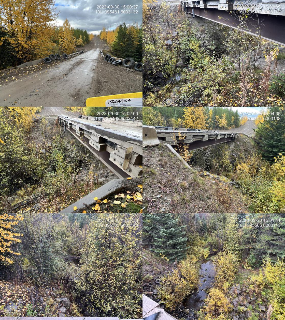 . From top left clockwise: Road/Site Card, Barrel, Outlet, Downstream, Upstream, Inlet.15604704 . From top left clockwise: Road/Site Card, Barrel, Outlet, Downstream, Upstream, Inlet.15604704
|
|||
| Comments: Bridge. Good flow. 15:02:17 |
| Location and Stream Data |
|
Crossing Characteristics | – |
|---|---|---|---|
| Date | 2023-09-11 | Crossing Sub Type | Bridge |
| PSCIS ID | 199334 | Diameter (m) | 13 |
| External ID | 15600065 | Length (m) | 4 |
| Crew | MW | Embedded | – |
| UTM Zone | 10 | Depth Embedded (m) | – |
| Easting | 441140 | Resemble Channel | – |
| Northing | 5989596 | Backwatered | – |
| Stream | Knight Creek | Percent Backwatered | – |
| Road | Spur | Fill Depth (m) | – |
| Road Tenure | MOTI Local | Outlet Drop (m) | – |
| Channel Width (m) | – | Outlet Pool Depth (m) | – |
| Stream Slope (%) | – | Inlet Drop | – |
| Beaver Activity | – | Slope (%) | – |
| Habitat Value | – | Valley Fill | – |
| Final score | 0 | Barrier Result | Passable |
| Fix type | – | Fix Span / Diameter | – |
Photos: PSCIS ID 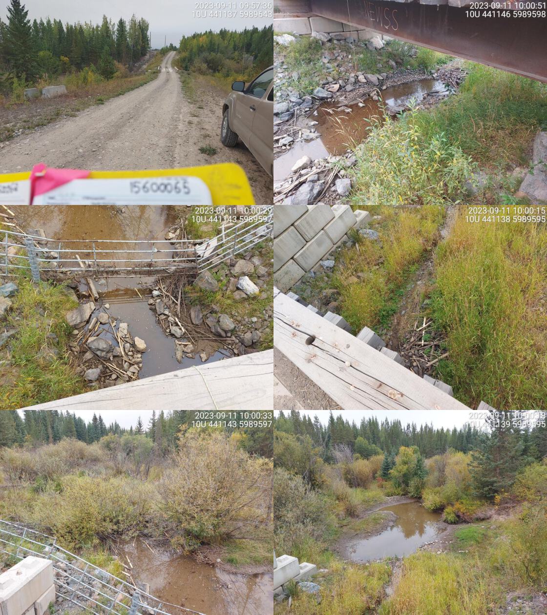 . From top left clockwise: Road/Site Card, Barrel, Outlet, Downstream, Upstream, Inlet.15600065 . From top left clockwise: Road/Site Card, Barrel, Outlet, Downstream, Upstream, Inlet.15600065
|
|||
| Comments: Restoration work conducted at this crossing. No flowing water at time of survey. Livestock field upstream. Goats seen trampling through stream channel.. 09:59:33 |
| Location and Stream Data |
|
Crossing Characteristics | – |
|---|---|---|---|
| Date | 2023-10-03 | Crossing Sub Type | Bridge |
| PSCIS ID | 199335 | Diameter (m) | 12 |
| External ID | 24715750 | Length (m) | 5 |
| Crew | MW | Embedded | – |
| UTM Zone | 10 | Depth Embedded (m) | – |
| Easting | 613206 | Resemble Channel | – |
| Northing | 5966880 | Backwatered | – |
| Stream | Redmountain Creek | Percent Backwatered | – |
| Road | Penny St | Fill Depth (m) | – |
| Road Tenure | MOTI Local | Outlet Drop (m) | – |
| Channel Width (m) | – | Outlet Pool Depth (m) | – |
| Stream Slope (%) | – | Inlet Drop | – |
| Beaver Activity | – | Slope (%) | – |
| Habitat Value | – | Valley Fill | – |
| Final score | 0 | Barrier Result | Passable |
| Fix type | – | Fix Span / Diameter | – |
Photos: PSCIS ID 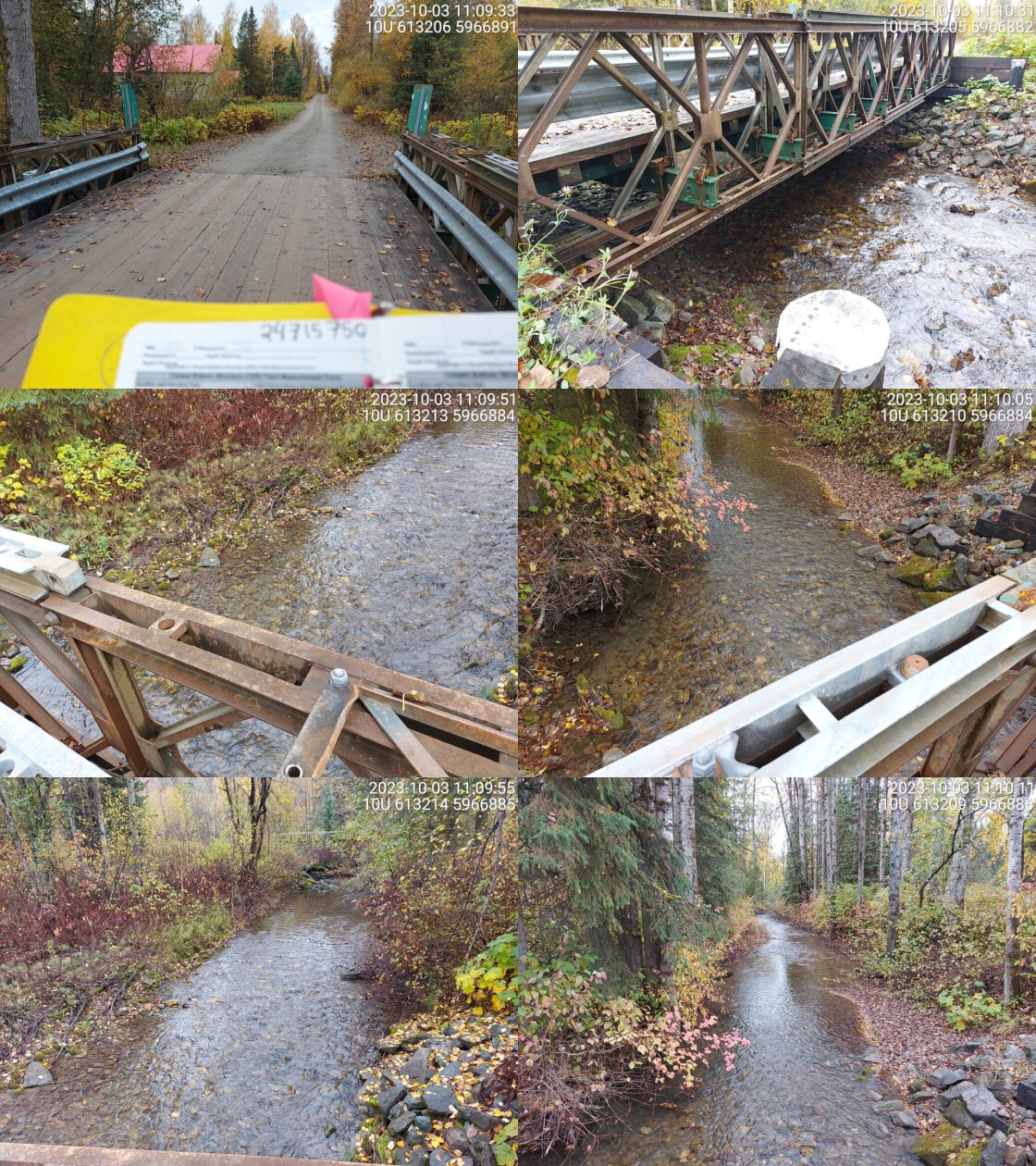 . From top left clockwise: Road/Site Card, Barrel, Outlet, Downstream, Upstream, Inlet.24715750 . From top left clockwise: Road/Site Card, Barrel, Outlet, Downstream, Upstream, Inlet.24715750
|
|||
| Comments: Wide stream with high flows and good habitat. Bridge on railway just upstream. Major moti structure was in the wrong spot on the map. MoTi chris_hwy_structure_road_id: 3626. 11:13:09 |
| Location and Stream Data |
|
Crossing Characteristics | – |
|---|---|---|---|
| Date | 2023-10-01 | Crossing Sub Type | Ford |
| PSCIS ID | 199336 | Diameter (m) | – |
| External ID | 9904385 | Length (m) | – |
| Crew | AI MW | Embedded | – |
| UTM Zone | 10 | Depth Embedded (m) | – |
| Easting | 485546 | Resemble Channel | – |
| Northing | 5954833 | Backwatered | – |
| Stream | Dahl Creek | Percent Backwatered | – |
| Road | Gregg Creek FSR | Fill Depth (m) | – |
| Road Tenure | MOF 5416 | Outlet Drop (m) | – |
| Channel Width (m) | – | Outlet Pool Depth (m) | – |
| Stream Slope (%) | – | Inlet Drop | – |
| Beaver Activity | – | Slope (%) | – |
| Habitat Value | – | Valley Fill | – |
| Final score | 0 | Barrier Result | Unknown |
| Fix type | – | Fix Span / Diameter | – |
Photos: PSCIS ID 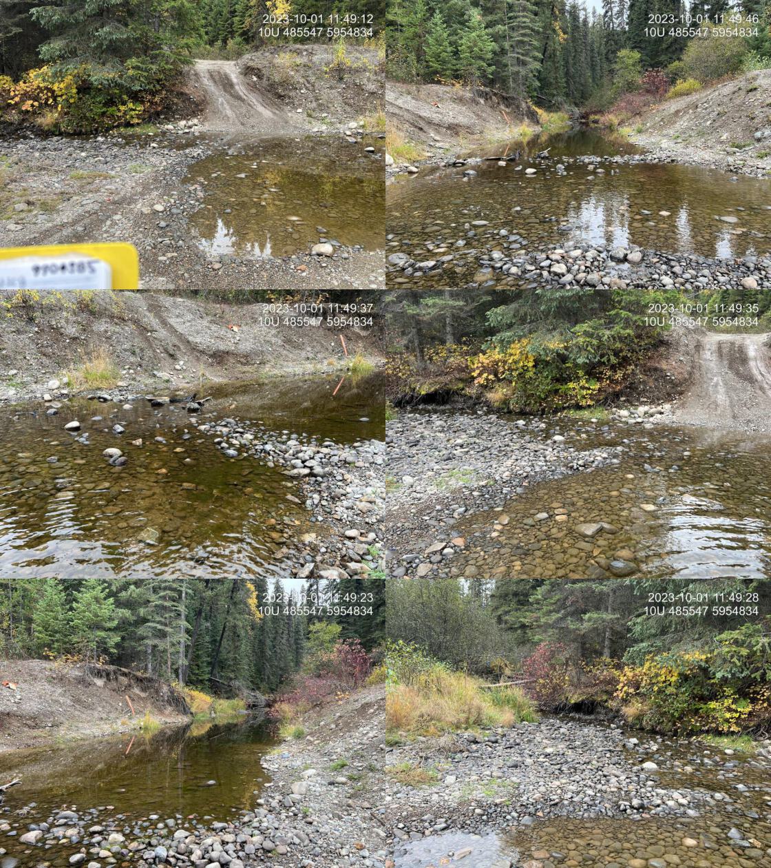 . From top left clockwise: Road/Site Card, Barrel, Outlet, Downstream, Upstream, Inlet.9904385 . From top left clockwise: Road/Site Card, Barrel, Outlet, Downstream, Upstream, Inlet.9904385
|
|||
| Comments: Deactivated road. Ford passable by 4x4 vehicles. 11:50:24 |
| Location and Stream Data |
|
Crossing Characteristics | – |
|---|---|---|---|
| Date | 2023-09-10 | Crossing Sub Type | Ford |
| PSCIS ID | 199337 | Diameter (m) | – |
| External ID | 15600486 | Length (m) | – |
| Crew | MW | Embedded | – |
| UTM Zone | 10 | Depth Embedded (m) | – |
| Easting | 420111 | Resemble Channel | – |
| Northing | 5994723 | Backwatered | – |
| Stream | Redmond Creek | Percent Backwatered | – |
| Road | Spur | Fill Depth (m) | – |
| Road Tenure | Unclassified | Outlet Drop (m) | – |
| Channel Width (m) | – | Outlet Pool Depth (m) | – |
| Stream Slope (%) | – | Inlet Drop | – |
| Beaver Activity | – | Slope (%) | – |
| Habitat Value | – | Valley Fill | – |
| Final score | 0 | Barrier Result | Unknown |
| Fix type | – | Fix Span / Diameter | – |
Photos: PSCIS ID 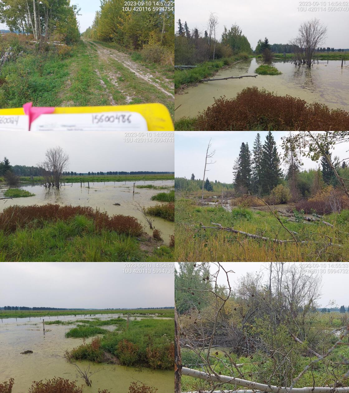 . From top left clockwise: Road/Site Card, Barrel, Outlet, Downstream, Upstream, Inlet.15600486 . From top left clockwise: Road/Site Card, Barrel, Outlet, Downstream, Upstream, Inlet.15600486
|
|||
| Comments: NA. 14:54:00 |
| Location and Stream Data |
|
Crossing Characteristics | – |
|---|---|---|---|
| Date | 2023-09-11 | Crossing Sub Type | Ford |
| PSCIS ID | 199338 | Diameter (m) | – |
| External ID | 15604176 | Length (m) | – |
| Crew | MW | Embedded | – |
| UTM Zone | 10 | Depth Embedded (m) | – |
| Easting | 412266 | Resemble Channel | – |
| Northing | 6001835 | Backwatered | – |
| Stream | Tributary to Nechako River | Percent Backwatered | – |
| Road | Spur | Fill Depth (m) | – |
| Road Tenure | Canfor R09185 | Outlet Drop (m) | – |
| Channel Width (m) | – | Outlet Pool Depth (m) | – |
| Stream Slope (%) | – | Inlet Drop | – |
| Beaver Activity | – | Slope (%) | – |
| Habitat Value | – | Valley Fill | – |
| Final score | 0 | Barrier Result | Unknown |
| Fix type | – | Fix Span / Diameter | – |
Photos: PSCIS ID 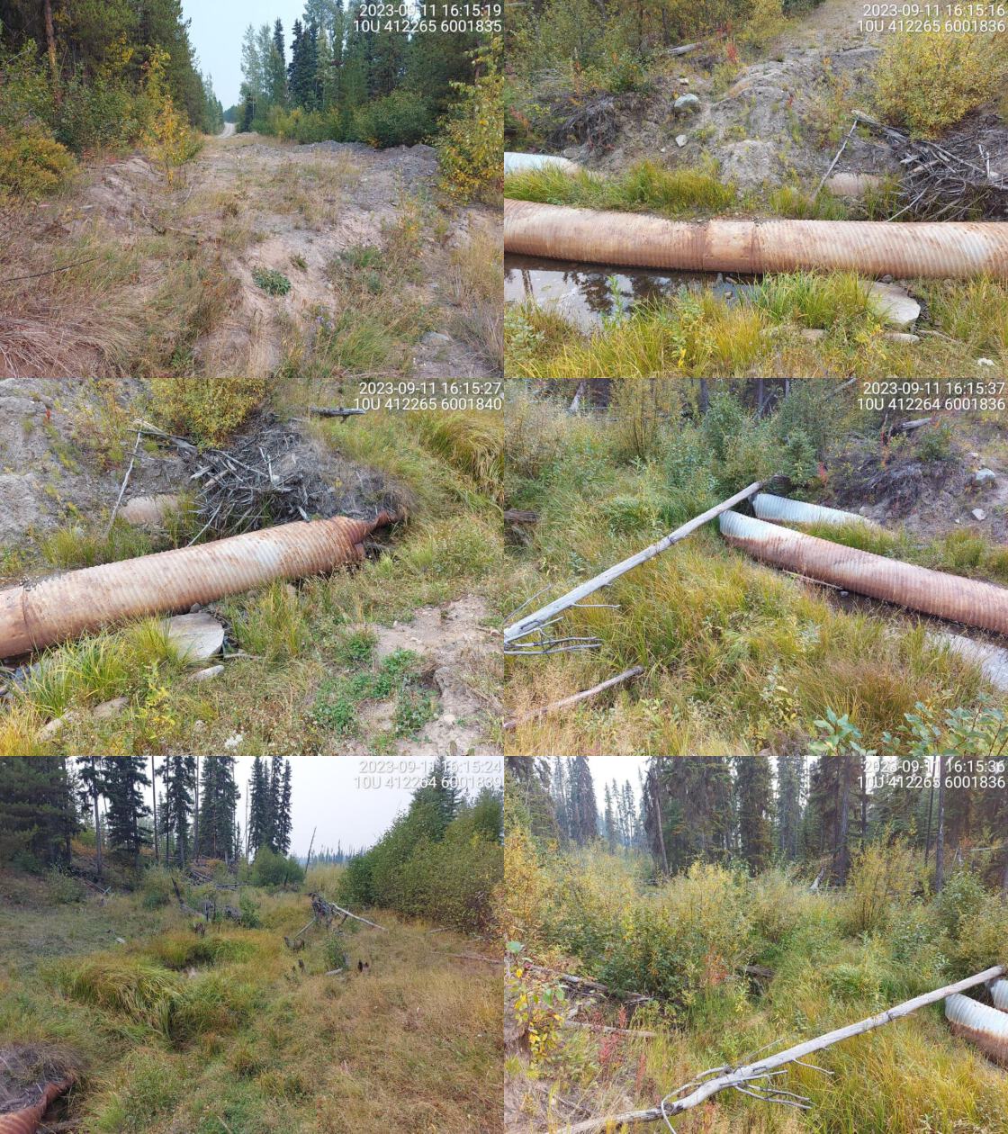 . From top left clockwise: Road/Site Card, Barrel, Outlet, Downstream, Upstream, Inlet.15604176 . From top left clockwise: Road/Site Card, Barrel, Outlet, Downstream, Upstream, Inlet.15604176
|
|||
| Comments: Deactivated road. Old culverts seen in pictures, now a ford.. 16:15:48 |
| Location and Stream Data |
|
Crossing Characteristics | – |
|---|---|---|---|
| Date | 2023-09-29 | Crossing Sub Type | Ford |
| PSCIS ID | 199339 | Diameter (m) | – |
| External ID | 5401513 | Length (m) | – |
| Crew | MW | Embedded | – |
| UTM Zone | 10 | Depth Embedded (m) | – |
| Easting | 330328 | Resemble Channel | – |
| Northing | 6009420 | Backwatered | – |
| Stream | Tintagel Creek | Percent Backwatered | – |
| Road | Unnamed | Fill Depth (m) | – |
| Road Tenure | Unclassified | Outlet Drop (m) | – |
| Channel Width (m) | – | Outlet Pool Depth (m) | – |
| Stream Slope (%) | – | Inlet Drop | – |
| Beaver Activity | – | Slope (%) | – |
| Habitat Value | – | Valley Fill | – |
| Final score | 0 | Barrier Result | Unknown |
| Fix type | – | Fix Span / Diameter | – |
Photos: PSCIS ID 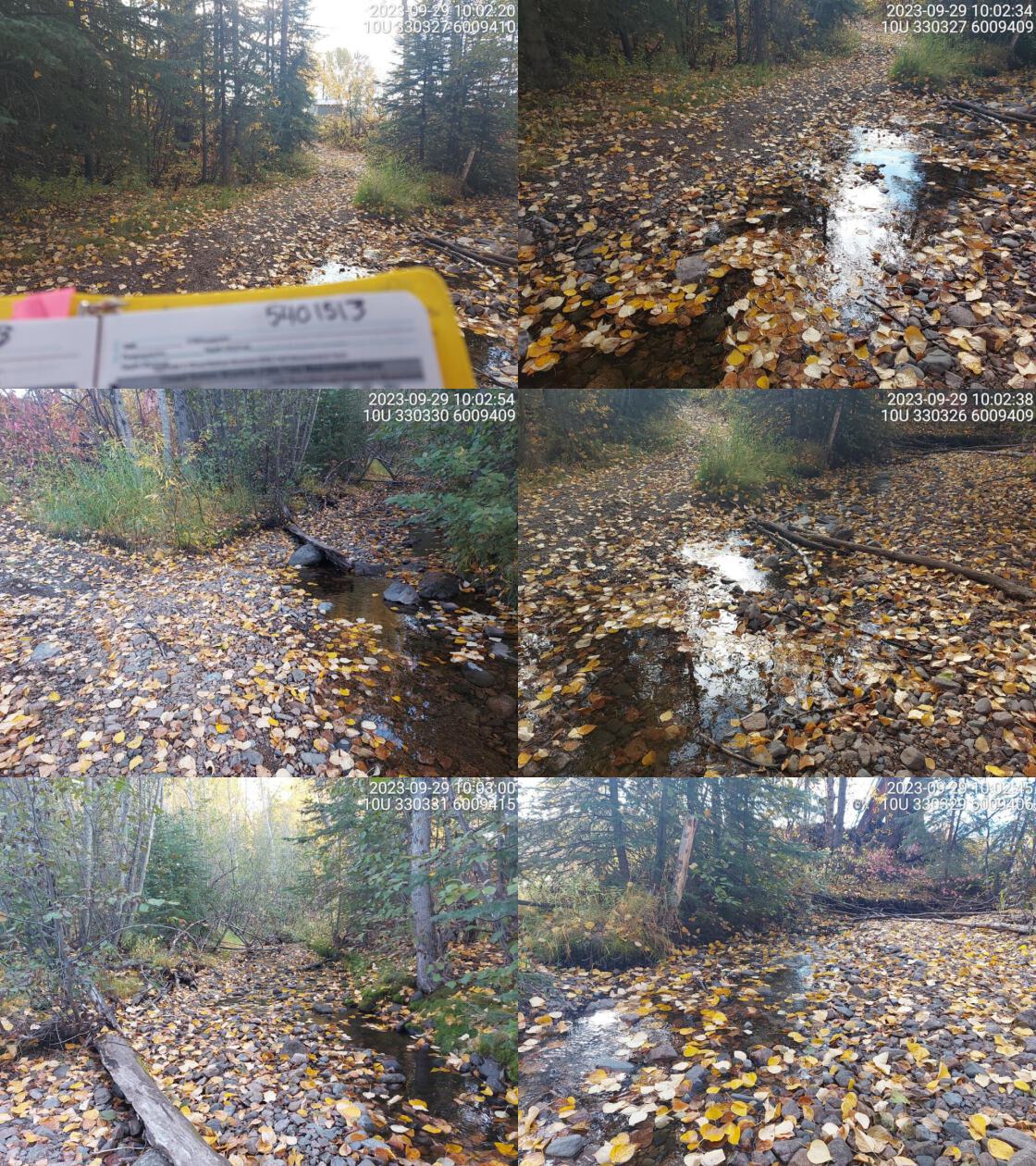 . From top left clockwise: Road/Site Card, Barrel, Outlet, Downstream, Upstream, Inlet.5401513 . From top left clockwise: Road/Site Card, Barrel, Outlet, Downstream, Upstream, Inlet.5401513
|
|||
| Comments: Small trail, wide channel.. 10:00:48 |
| Location and Stream Data |
|
Crossing Characteristics | – |
|---|---|---|---|
| Date | 2024-10-07 | Crossing Sub Type | Round Culvert |
| PSCIS ID | 203296 | Diameter (m) | 0.5 |
| External ID | 2024100701 | Length (m) | 20 |
| Crew | AI | Embedded | No |
| UTM Zone | 10 | Depth Embedded (m) | – |
| Easting | 578677 | Resemble Channel | No |
| Northing | 5973049 | Backwatered | No |
| Stream | Tributary To Kenneth Creek | Percent Backwatered | – |
| Road | Bowron FSR | Fill Depth (m) | 1 |
| Road Tenure | MoF | Outlet Drop (m) | 0.1 |
| Channel Width (m) | 0 | Outlet Pool Depth (m) | 0.15 |
| Stream Slope (%) | 0 | Inlet Drop | No |
| Beaver Activity | No | Slope (%) | 3 |
| Habitat Value | Medium | Valley Fill | Deep Fill |
| Final score | 23 | Barrier Result | Barrier |
| Fix type | Replace Structure with Streambed Simulation CBS | Fix Span / Diameter | 3 |
Photos: PSCIS ID 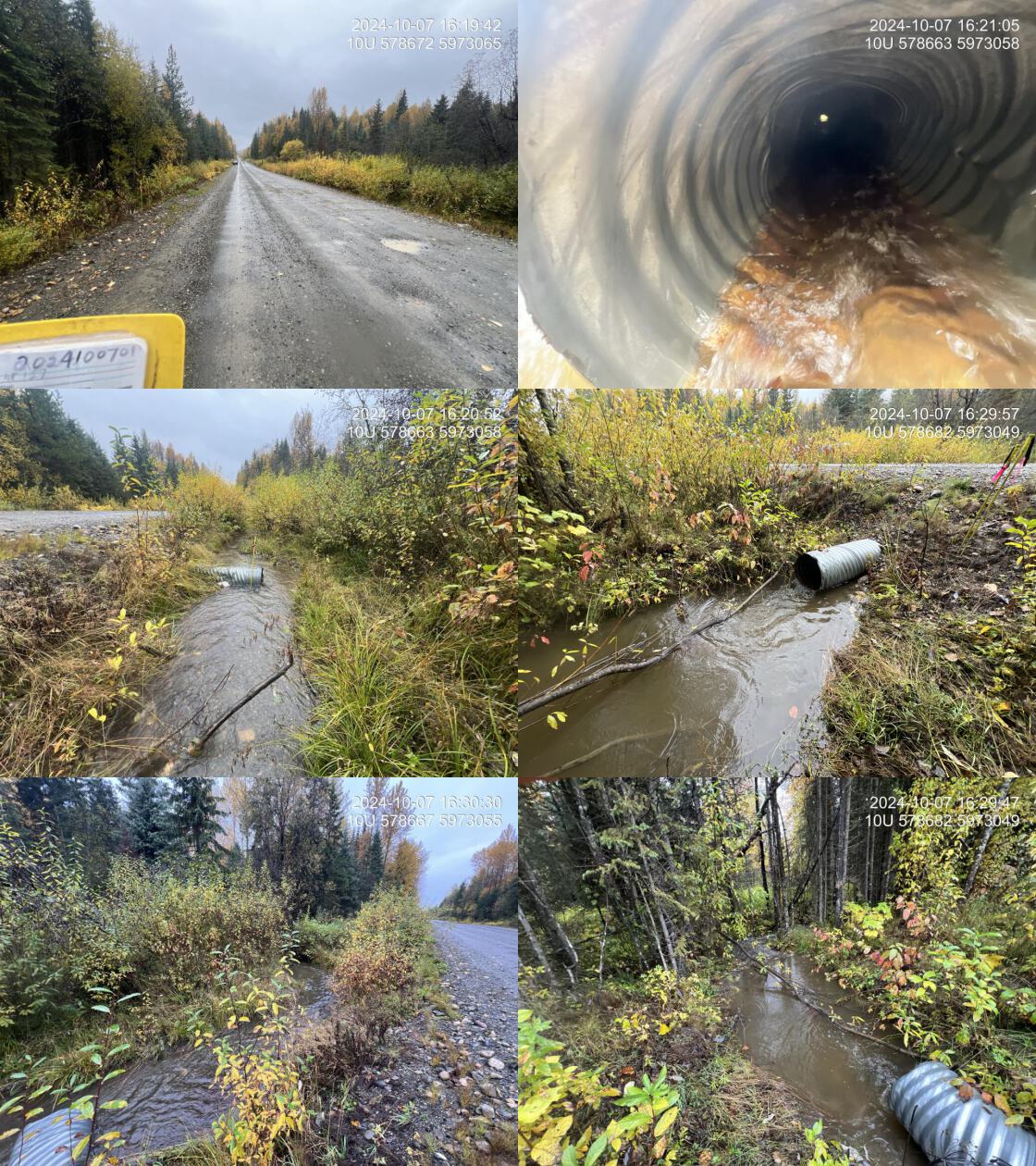 . From top left clockwise: Road/Site Card, Barrel, Outlet, Downstream, Upstream, Inlet.2024100701 . From top left clockwise: Road/Site Card, Barrel, Outlet, Downstream, Upstream, Inlet.2024100701
|
|||
| Comments: This was an overflow pipe for PSCIS crossing 199255, located 60m south. It may have been present and dry in 2023 when PSCIS crossing 199255 was initially assessed, but this is uncertain. Habitat confirmations were conducted upstream and downstream. Upstream habitat was a low-gradient gravel system with mature riparian vegetation and stable banks. |
| Location and Stream Data |
|
Crossing Characteristics | – |
|---|---|---|---|
| Date | 2024-10-04 | Crossing Sub Type | Round Culvert |
| PSCIS ID | 203297 | Diameter (m) | 1.05 |
| External ID | 2024100450 | Length (m) | 8 |
| Crew | LS | Embedded | No |
| UTM Zone | 10 | Depth Embedded (m) | – |
| Easting | 388199 | Resemble Channel | No |
| Northing | 5997060 | Backwatered | No |
| Stream | Scotch Creek | Percent Backwatered | – |
| Road | Private Driveway | Fill Depth (m) | 2 |
| Road Tenure | Private | Outlet Drop (m) | 0.7 |
| Channel Width (m) | 2.5 | Outlet Pool Depth (m) | 0.55 |
| Stream Slope (%) | 4 | Inlet Drop | No |
| Beaver Activity | No | Slope (%) | 2 |
| Habitat Value | Medium | Valley Fill | Deep Fill |
| Final score | 31 | Barrier Result | Barrier |
| Fix type | Replace with New Open Bottom Structure | Fix Span / Diameter | 15 |
Photos: PSCIS ID 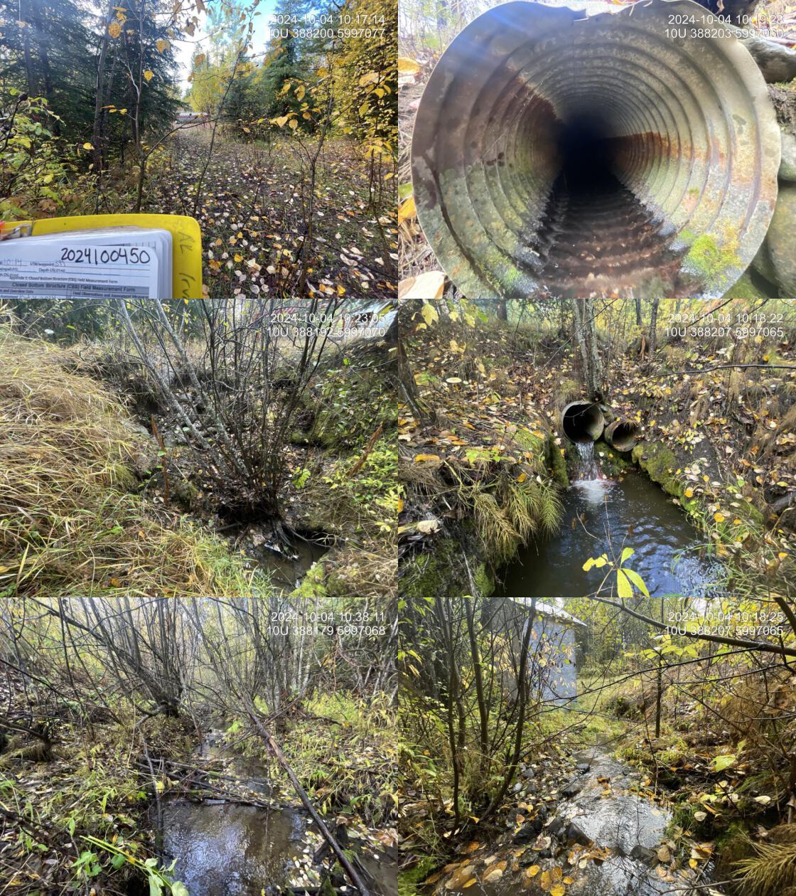 . From top left clockwise: Road/Site Card, Barrel, Outlet, Downstream, Upstream, Inlet.2024100450 . From top left clockwise: Road/Site Card, Barrel, Outlet, Downstream, Upstream, Inlet.2024100450
|
|||
| Comments: Two pipes, 0.6m and 0.45m in diameter, were present. There was a 0.7m outlet drop, and only the larger pipe conveyed flow. The inlet side of the road had completely eroded into the stream, obstructing the view of the inlet. No light was visible through the culverts from the outlet side, though water was still flowing. A landowner had placed a barricade across the road, likely to prevent access due to severe erosion of the road. The stream provided high-quality habitat with abundant large woody debris creating pools and gravels suitable for spawning. Just downstream, a functioning water intake shack was located in the middle of the stream, likely supplying the adjacent landowner’s property. Plastic pipes extended from the intake shack downstream to the lower Stella Road crossing. The heavily overgrown and collapsing road appeared to be private access and would be a good candidate for removal. Due to inlet erosion, culvert length and slope were estimated as the inlet could not be located. |
| Location and Stream Data |
|
Crossing Characteristics | – |
|---|---|---|---|
| Date | 2024-10-05 | Crossing Sub Type | Round Culvert |
| PSCIS ID | 203298 | Diameter (m) | 0.8 |
| External ID | 9902948 | Length (m) | 17 |
| Crew | LS | Embedded | Yes |
| UTM Zone | 10 | Depth Embedded (m) | 0.1 |
| Easting | 506082 | Resemble Channel | Yes |
| Northing | 5962275 | Backwatered | Yes |
| Stream | Tributary To Beaverley Creek | Percent Backwatered | 100 |
| Road | Muralt Road | Fill Depth (m) | 7 |
| Road Tenure | MOTI | Outlet Drop (m) | 0 |
| Channel Width (m) | 1.8 | Outlet Pool Depth (m) | 0.5 |
| Stream Slope (%) | 3 | Inlet Drop | No |
| Beaver Activity | No | Slope (%) | 1 |
| Habitat Value | Low | Valley Fill | Deep Fill |
| Final score | 19 | Barrier Result | Potential |
| Fix type | Replace Structure with Streambed Simulation CBS | Fix Span / Diameter | 27 |
Photos: PSCIS ID 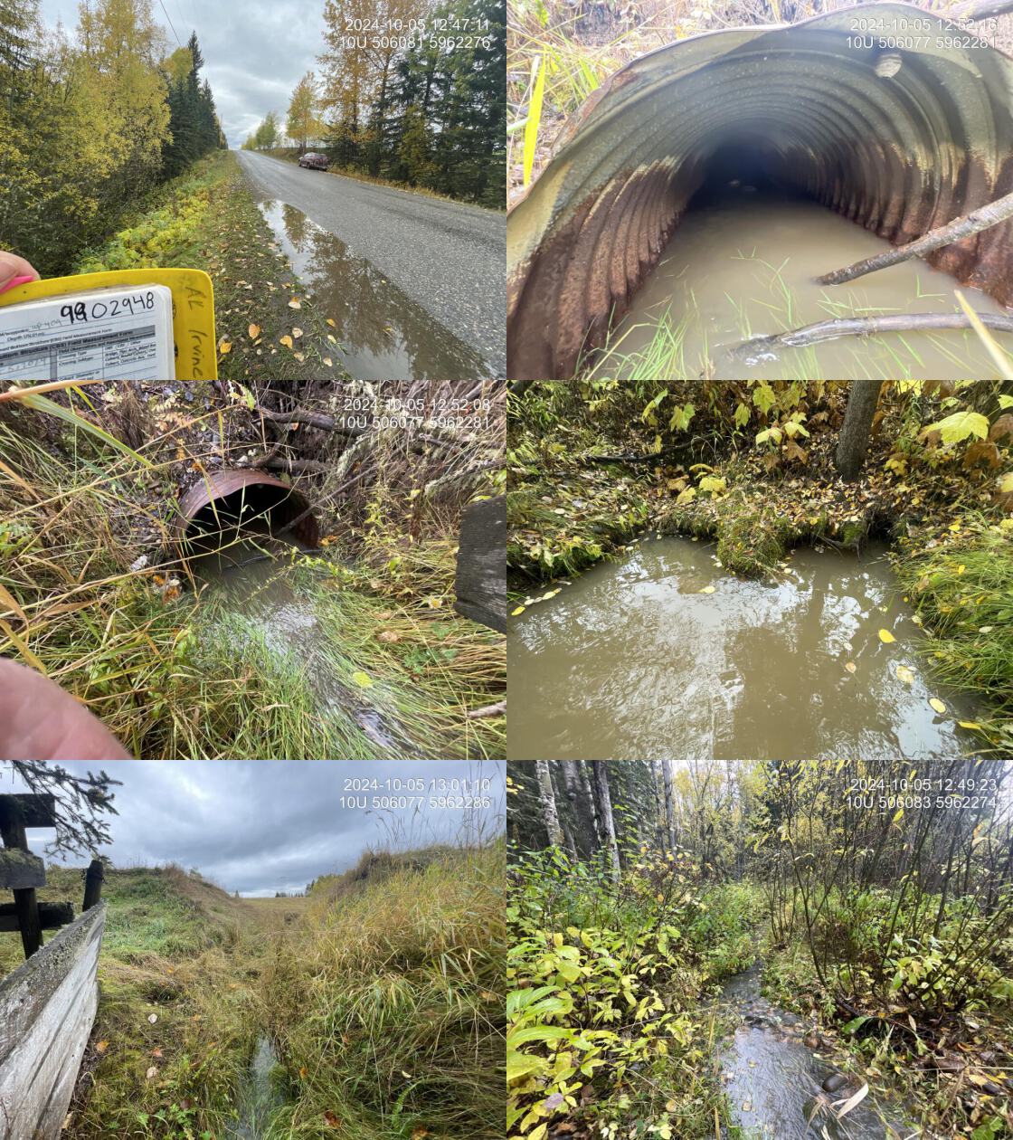 . From top left clockwise: Road/Site Card, Barrel, Outlet, Downstream, Upstream, Inlet.9902948 . From top left clockwise: Road/Site Card, Barrel, Outlet, Downstream, Upstream, Inlet.9902948
|
|||
| Comments: The culvert was fully backwatered, with the outlet completely submerged. The stream flowed through a grassy valley on private property upstream. The road column on the inlet side was eroding significantly. A V-shaped fence was positioned in front of the inlet for unknown reasons. Culvert slope and length were estimated, as the inlet was completely submerged and not visible. The culvert was embedded at the inlet and assumed to be fully embedded, though this could not be confirmed due to the submerged outlet. Just upstream of the inlet, remnants of a possible old dam were observed, with large piles of dirt on both sides and a dugout middle section allowing stream flow. See photos for details. MoTi chris_culvert_id: 1976182 |
| Location and Stream Data |
|
Crossing Characteristics | – |
|---|---|---|---|
| Date | 2024-10-04 | Crossing Sub Type | Bridge |
| PSCIS ID | 203299 | Diameter (m) | 10 |
| External ID | 15606280 | Length (m) | 2 |
| Crew | LS | Embedded | – |
| UTM Zone | 10 | Depth Embedded (m) | – |
| Easting | 425644 | Resemble Channel | – |
| Northing | 5995962 | Backwatered | – |
| Stream | Clear Creek | Percent Backwatered | – |
| Road | Private Drive | Fill Depth (m) | – |
| Road Tenure | Private | Outlet Drop (m) | – |
| Channel Width (m) | – | Outlet Pool Depth (m) | – |
| Stream Slope (%) | – | Inlet Drop | – |
| Beaver Activity | No | Slope (%) | – |
| Habitat Value | – | Valley Fill | – |
| Final score | 0 | Barrier Result | Passable |
| Fix type | – | Fix Span / Diameter | – |
Photos: PSCIS ID  . From top left clockwise: Road/Site Card, Barrel, Outlet, Downstream, Upstream, Inlet.15606280 . From top left clockwise: Road/Site Card, Barrel, Outlet, Downstream, Upstream, Inlet.15606280
|
|||
| Comments: The bridge crosses Clear Creek and appeared to provide access to private land. |
| Location and Stream Data |
|
Crossing Characteristics | – |
|---|---|---|---|
| Date | 2024-10-09 | Crossing Sub Type | Bridge |
| PSCIS ID | 203300 | Diameter (m) | 4 |
| External ID | 2024100950 | Length (m) | 2 |
| Crew | LS | Embedded | – |
| UTM Zone | 11 | Depth Embedded (m) | – |
| Easting | 343964 | Resemble Channel | – |
| Northing | 5862720 | Backwatered | – |
| Stream | Teepee Creek | Percent Backwatered | – |
| Road | Private Road | Fill Depth (m) | – |
| Road Tenure | Private | Outlet Drop (m) | – |
| Channel Width (m) | – | Outlet Pool Depth (m) | – |
| Stream Slope (%) | – | Inlet Drop | – |
| Beaver Activity | No | Slope (%) | – |
| Habitat Value | – | Valley Fill | – |
| Final score | 0 | Barrier Result | Passable |
| Fix type | – | Fix Span / Diameter | – |
Photos: PSCIS ID  . From top left clockwise: Road/Site Card, Barrel, Outlet, Downstream, Upstream, Inlet.2024100950 . From top left clockwise: Road/Site Card, Barrel, Outlet, Downstream, Upstream, Inlet.2024100950
|
|||
| Comments: A small wooden bridge crossed Teepee Creek on private land. |
| Location and Stream Data |
|
Crossing Characteristics | – |
|---|---|---|---|
| Date | 2024-10-04 | Crossing Sub Type | Ford |
| PSCIS ID | 203301 | Diameter (m) | – |
| External ID | 15602083 | Length (m) | – |
| Crew | LS | Embedded | – |
| UTM Zone | 10 | Depth Embedded (m) | – |
| Easting | 425630 | Resemble Channel | – |
| Northing | 5995920 | Backwatered | – |
| Stream | Clear Creek | Percent Backwatered | – |
| Road | Private Road | Fill Depth (m) | – |
| Road Tenure | Private | Outlet Drop (m) | – |
| Channel Width (m) | – | Outlet Pool Depth (m) | – |
| Stream Slope (%) | – | Inlet Drop | – |
| Beaver Activity | No | Slope (%) | – |
| Habitat Value | – | Valley Fill | – |
| Final score | 0 | Barrier Result | Unknown |
| Fix type | – | Fix Span / Diameter | – |
Photos: PSCIS ID  . From top left clockwise: Road/Site Card, Barrel, Outlet, Downstream, Upstream, Inlet.15602083 . From top left clockwise: Road/Site Card, Barrel, Outlet, Downstream, Upstream, Inlet.15602083
|
|||
| Comments: Ford crossing over Clear Creek on private land. |
| Location and Stream Data |
|
Crossing Characteristics | – |
|---|---|---|---|
| Date | 2024-10-09 | Crossing Sub Type | Round Culvert |
| PSCIS ID | 203302 | Diameter (m) | 2.7 |
| External ID | 22202142 | Length (m) | 14 |
| Crew | AI | Embedded | No |
| UTM Zone | 11 | Depth Embedded (m) | – |
| Easting | 344222 | Resemble Channel | No |
| Northing | 5862742 | Backwatered | No |
| Stream | Teepee Creek | Percent Backwatered | – |
| Road | Railway | Fill Depth (m) | 2 |
| Road Tenure | CN Rail | Outlet Drop (m) | 0.75 |
| Channel Width (m) | 4.2 | Outlet Pool Depth (m) | 0.25 |
| Stream Slope (%) | 7 | Inlet Drop | Yes |
| Beaver Activity | No | Slope (%) | 6 |
| Habitat Value | Medium | Valley Fill | Deep Fill |
| Final score | 36 | Barrier Result | Barrier |
| Fix type | Replace with New Open Bottom Structure | Fix Span / Diameter | 15 |
Photos: PSCIS ID 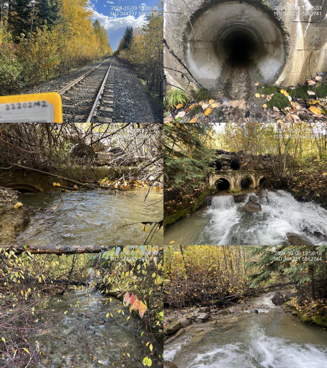 . From top left clockwise: Road/Site Card, Barrel, Outlet, Downstream, Upstream, Inlet.22202142 . From top left clockwise: Road/Site Card, Barrel, Outlet, Downstream, Upstream, Inlet.22202142
|
|||
| Comments: Three concrete pipes, each 0.9m in diameter, were present, along with two 0.9m corrugated overflow pipes above. A stamp on the structure indicated it was built in 1944. All three concrete pipes were clogged at the inlet, ranging from 80% to 100% clogged with debris. This was a known fish-bearing stream, with a salmon point documented ~100m downstream in the FISS database. At this location, the stream was a mid-sized, steeper cobble-boulder step-pool system with only rare pockets of unembedded gravels. Deep pools were present, formed by boulder and large woody debris scour. Numerous small steps, ranging from 30–60cm, were present due to the steep, boulder-dominated nature of the stream. Downstream of the highway crossing, the stream had a lower gradient with frequent pools 0.3–0.5m deep, providing good overwintering habitat for fish and abundant gravels suitable for spawning. |