Scotch Creek - 199328 & 199172 - Appendix
Site Location
PSCIS crossings 199328 and 199172 are located on Scotch Creek which flows into the northern side of Fraser Lake, BC, approximately 8km northwest of the Nadleh Whut’en First Nations community, in the Francois Lake watershed group (Figure 5.7). The stream name Scotch Creek is the local name for the waterway as it is not named
within the freshwater atlas. Crossing 199328 is located 230m upstream of Fraser Lake, on Gala Bay Road, and is the responsibility of the Ministry of Transportation and Infrastructure (chris_culvert_id: 1790947 and 3365573). A further 270m upstream, PSCIS crossing 199172 is located on Stella Road and is the responsibility of the Ministry of Transportation and Infrastructure (chris_culvert_id: 1794199).
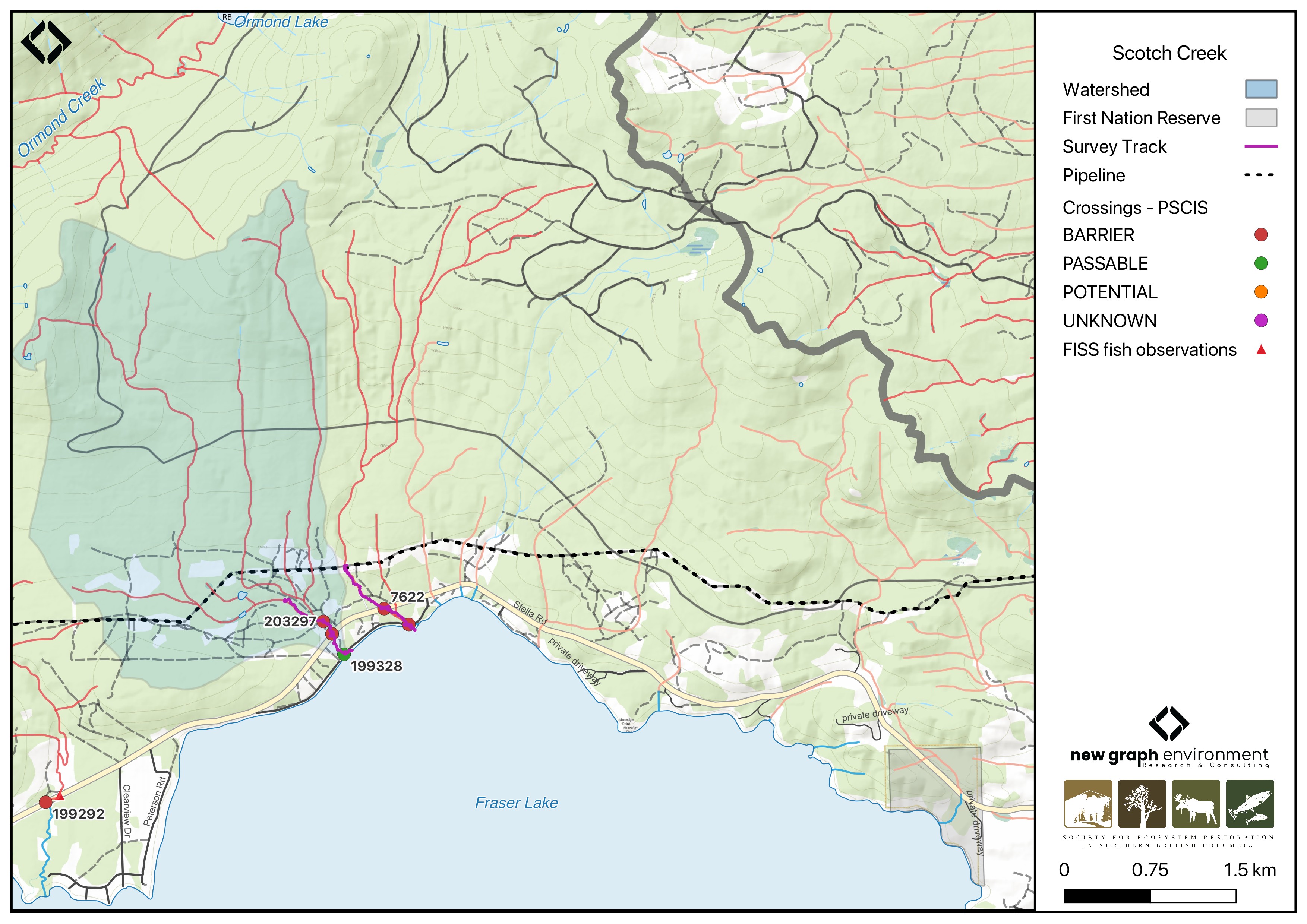
Figure 5.7: Map of Scotch Creek
Background
At the location of these crossings, Scotch Creek is a third order stream and drains a watershed of approximately 9.1km2. The watershed ranges in elevation from a maximum of 1091m to 680m near the lower crossing (Table 5.6).
In 2023, both crossings were assessed with fish passage assessments and prioritized for follow-up due to the presence of high-value habitat and a chinook observation from 2018 documented adjacent to crossing 199328 in the FISS database (Norris [2018] 2024; MoE 2024). A habitat confirmation assessment encompassing both crossings was conducted in 2024. Downstream in Fraser Lake, white sturgeon, chinook, bull trout, rainbow trout, kokanee, and other species have been previously recorded (Norris [2018] 2024; MoE 2024).
A summary of habitat modelling outputs for the crossing are presented in Table 5.7.
fpr::fpr_table_wshd_sum(site_id = my_site) |>
  fpr::fpr_kable(caption_text = paste0('Summary of derived upstream watershed statistics for PSCIS crossing ', my_site, '.'),
           footnote_text = 'Elev P60 = Elevation at which 60% of the watershed area is above',
scroll = F)| Site | Area Km | Elev Site | Elev Min | Elev Max | Elev Median | Elev P60 | Aspect |
|---|---|---|---|---|---|---|---|
| 199328 | 9.1 | 680 | 676 | 1091 | 834 | 795 | S |
| * Elev P60 = Elevation at which 60% of the watershed area is above |
| Habitat | Potential | Remediation Gain | Remediation Gain (%) |
|---|---|---|---|
| CH Spawning (km) | 0.0 | 0.0 | – |
| CH Rearing (km) | 0.0 | 0.0 | – |
| CO Spawning (km) | 0.0 | 0.0 | – |
| CO Rearing (km) | 0.0 | 0.0 | – |
| CO Rearing (ha) | 0.0 | 0.0 | – |
| SK Spawning (km) | 0.0 | 0.0 | – |
| SK Rearing (km) | 0.0 | 0.0 | – |
| SK Rearing (ha) | 0.0 | 0.0 | – |
| BT Rearing (km) | 1.9 | 0.2 | 11 |
| BT Spawning (km) | 1.2 | 0.2 | 17 |
| * Model data is preliminary and subject to adjustments. |
Stream Characteristics at Crossings 199328 and 199172
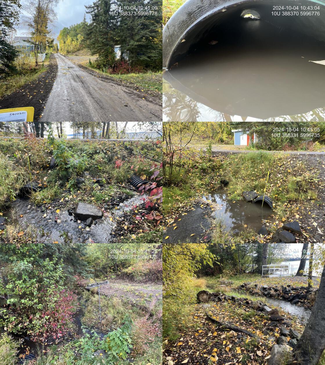
At the time of the 2024 assessment, PSCIS crossing 199328 on Gala Bay Road was embedded, 100% backwatered, and ranked as passable to upstream fish passage according to the provincial protocol (MoE 2011) (Table 5.8).
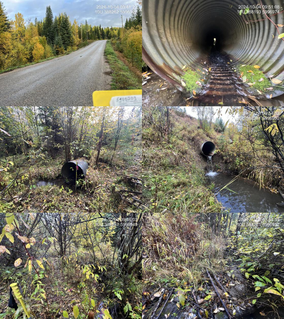
Further upstream, PSCIS crossing 199172 on Stella Road was un-embedded, non-backwatered and ranked as a barrier to upstream fish passage according to the provincial protocol (MoE 2011) (Table 5.9). This culvert had a significant 1.35m outlet drop.
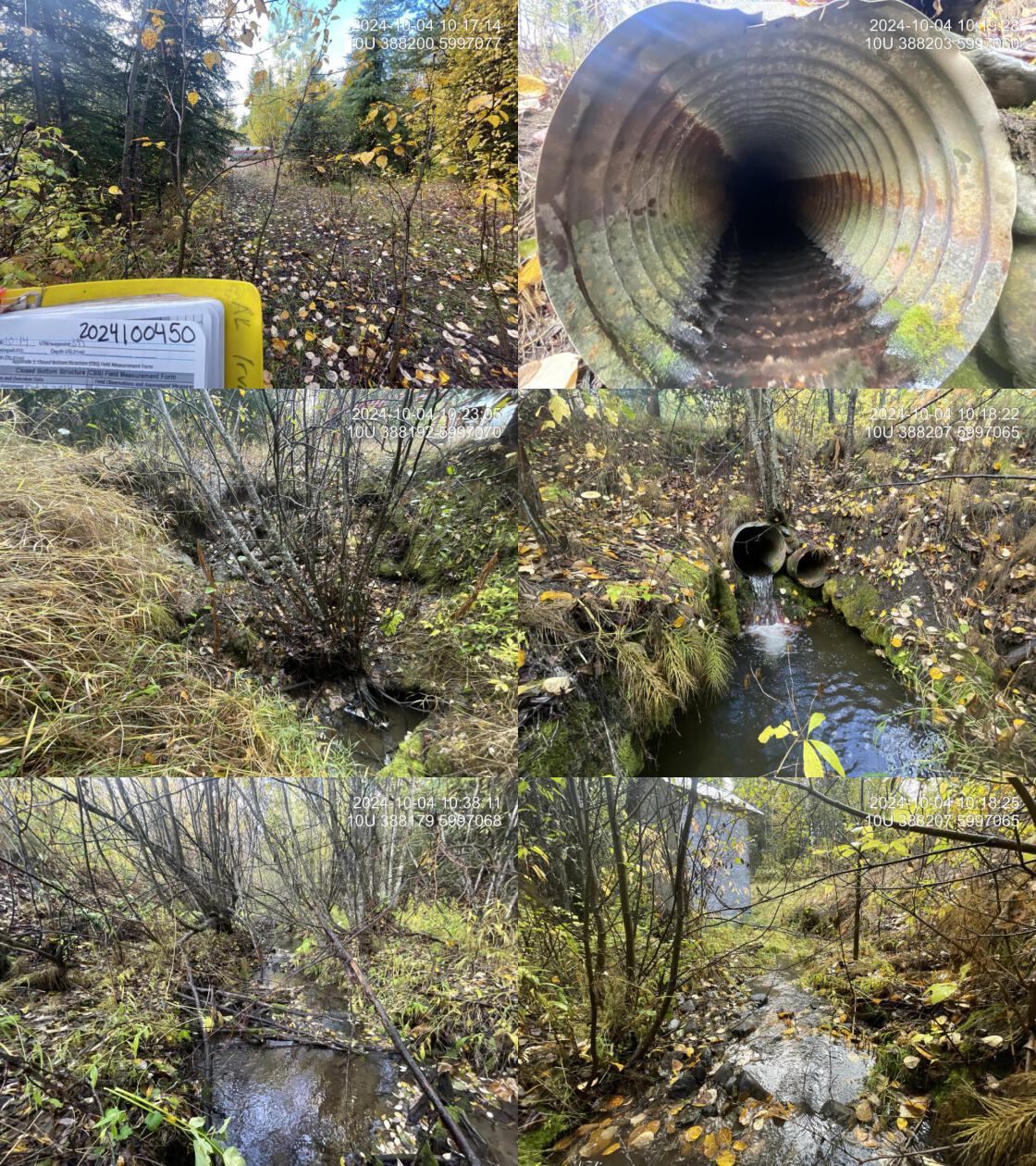
In 2024, a third crossing (PSCIS 203297) was assessed on a private road approximately 150m upstream of Stella Road, with results provided in Table 5.10. Two pipes were present, with the larger culvert having a significant 0.7m outlet drop. The inlet side of the road had completely eroded into the stream, obscuring the inlet from view. The road was heavily overgrown, collapsing, and appeared to be unused.
Water temperature was 5\(^\circ\)C, pH was 7.8 and conductivity was 208 uS/cm.
| Location and Stream Data |
|
Crossing Characteristics | – |
|---|---|---|---|
| Date | 2024-10-04 | Crossing Sub Type | Round Culvert |
| PSCIS ID | 199328 | Diameter (m) | 1.4 |
| External ID | – | Length (m) | 13 |
| Crew | AI | Embedded | Yes |
| UTM Zone | 10 | Depth Embedded (m) | 0.35 |
| Easting | 388380 | Resemble Channel | Yes |
| Northing | 5996779 | Backwatered | Yes |
| Stream | Scotch Creek | Percent Backwatered | 100 |
| Road | Gala Bay Road | Fill Depth (m) | 1.5 |
| Road Tenure | MoTi | Outlet Drop (m) | 0 |
| Channel Width (m) | 2 | Outlet Pool Depth (m) | 0.1 |
| Stream Slope (%) | 1.5 | Inlet Drop | No |
| Beaver Activity | No | Slope (%) | 0.5 |
| Habitat Value | Medium | Valley Fill | Deep Fill |
| Final score | 6 | Barrier Result | Passable |
| Fix type | – | Fix Span / Diameter | – |
| Comments: Two fully embedded PVC pipes, each 0.7m in diameter. One pipe was completely backwatered. Medium-value habitat was observed, with extensive gravels suitable for spawning upstream and downstream. A historic Chinook spawning point was recorded adjacent to the road. Habitat confirmations were conducted upstream, downstream, and above Stella Road. The local name of the stream is Scotch Creek. MoTi chris_culvert_id: 1790947 | |||
| Photos: From top left clockwise: Road/Site Card, Barrel, Outlet, Downstream, Upstream, Inlet. | |||
|
| Location and Stream Data |
|
Crossing Characteristics | – |
|---|---|---|---|
| Date | 2024-10-04 | Crossing Sub Type | Round Culvert |
| PSCIS ID | 199172 | Diameter (m) | 1.1 |
| External ID | – | Length (m) | 25 |
| Crew | AI | Embedded | No |
| UTM Zone | 10 | Depth Embedded (m) | – |
| Easting | 388269 | Resemble Channel | No |
| Northing | 5996948 | Backwatered | No |
| Stream | Scotch Creek | Percent Backwatered | – |
| Road | Stella Road | Fill Depth (m) | 4 |
| Road Tenure | MoTi | Outlet Drop (m) | 1.35 |
| Channel Width (m) | 2 | Outlet Pool Depth (m) | 0.28 |
| Stream Slope (%) | 0 | Inlet Drop | No |
| Beaver Activity | No | Slope (%) | 5 |
| Habitat Value | Medium | Valley Fill | Deep Fill |
| Final score | 39 | Barrier Result | Barrier |
| Fix type | Replace with New Open Bottom Structure | Fix Span / Diameter | 18 |
| Comments: The culvert was very undersized for the stream, as indicated by the large outlet drop. The stream had a good amount of given the time of year and uncharacteristically dry year. Habitat was of medium value, with abundant large woody debris creating complex habitat and pools, providing ample cover for fish. Adjacent landowners reported that the stream was previously used as a water source for bottling and distribution across the province. Habitat confirmations were completed upstream and downstream of Stella Road as well as below Gala Bay Road. The local name of the stream is Scotch Creek. MoTi chris_culvert_id: 1794199 | |||
| Photos: From top left clockwise: Road/Site Card, Barrel, Outlet, Downstream, Upstream, Inlet. | |||
|
# See issue https://github.com/NewGraphEnvironment/mybookdown-template/issues/65
fpr::fpr_table_cv_summary_memo(dat = pscis_all, site = 203297, site_photo_id = 203297)| Location and Stream Data |
|
Crossing Characteristics | – |
|---|---|---|---|
| Date | 2024-10-04 | Crossing Sub Type | Round Culvert |
| PSCIS ID | 203297 | Diameter (m) | 1.05 |
| External ID | 2024100450 | Length (m) | 8 |
| Crew | LS | Embedded | No |
| UTM Zone | 10 | Depth Embedded (m) | – |
| Easting | 388199 | Resemble Channel | No |
| Northing | 5997060 | Backwatered | No |
| Stream | Scotch Creek | Percent Backwatered | – |
| Road | Private Driveway | Fill Depth (m) | 2 |
| Road Tenure | Private | Outlet Drop (m) | 0.7 |
| Channel Width (m) | 2.5 | Outlet Pool Depth (m) | 0.55 |
| Stream Slope (%) | 4 | Inlet Drop | No |
| Beaver Activity | No | Slope (%) | 2 |
| Habitat Value | Medium | Valley Fill | Deep Fill |
| Final score | 31 | Barrier Result | Barrier |
| Fix type | Replace with New Open Bottom Structure | Fix Span / Diameter | 15 |
| Comments: Two pipes, 0.6m and 0.45m in diameter, were present. There was a 0.7m outlet drop, and only the larger pipe conveyed flow. The inlet side of the road had completely eroded into the stream, obstructing the view of the inlet. No light was visible through the culverts from the outlet side, though water was still flowing. A landowner had placed a barricade across the road, likely to prevent access due to severe erosion of the road. The stream provided high-quality habitat with abundant large woody debris creating pools and gravels suitable for spawning. Just downstream, a functioning water intake shack was located in the middle of the stream, likely supplying the adjacent landowner’s property. Plastic pipes extended from the intake shack downstream to the lower Stella Road crossing. The heavily overgrown and collapsing road appeared to be private access and would be a good candidate for removal. Due to inlet erosion, culvert length and slope were estimated as the inlet could not be located. | |||
| Photos: From top left clockwise: Road/Site Card, Barrel, Outlet, Downstream, Upstream, Inlet. | |||
|
Stream Characteristics Downstream of Crossing 199328
The stream was surveyed downstream from crossing 199328 for 230m (Figure 5.8). The stream was small, low-gradient, and gravel-dominated, with habitat rated as medium value for spawning and rearing. Channelization with riprap was present near the upstream end of the survey and again near the mouth at Fraser Lake. A possible algal bloom was observed along the lake shoreline (Figure 5.9). The dominant substrate was gravels with fines sub-dominant.The average channel width was 2.9m, the average wetted width was 1.6m, and the average gradient was 1.8%.Total cover amount was rated as moderate with overhanging vegetation dominant. Cover was also present as .
Stream Characteristics Upstream of Crossing 199328 and Downstream of Crossing 199172
The stream was surveyed from Gala Bay Road upstream to Stella Road, a distance of approximately 270m (Figure 5.10). The habitat was rated as medium value, with limited pools; however, abundant overhanging vegetation and small woody debris provided cover, and gravels suitable for resident salmonid spawning were present. Incision was evident, beginning with a deep cut at the culvert outlet under Stella Road and continuing downstream to Gala Bay Road. The riparian area was generally intact through most of the survey, except for the downstream 75m, where private land development on the north side had resulted in a lawn and riparian vegetation removal up to the channel edge. Total cover amount was rated as moderate with overhanging vegetation dominant. Cover was also present as small woody debris and undercut banks.The average channel width was 2.1m, the average wetted width was 1.3m, and the average gradient was 3%.The dominant substrate was gravels with cobbles sub-dominant.
Stream Characteristics Upstream of Crossing 199172
The stream was surveyed upstream from crossing 199172 for 550m (Figure 5.11). The habitat was rated as medium value, with abundant functional large woody debris creating pools 20 – 30cm deep, suitable for overwintering juvenile fish. Overhead cover was extensive, and occasional gravels were suitable for spawning. Approximately 400m upstream of Stella Road, the stream transitioned into a beaver-impounded area with four consecutive dams (1 – 1.5m high) impounding a large volume of water. Flow was maintained over or under the dams and the impounded area extended to the upper end of the surveyed area. A fish (~40mm) was observed after the second dam. The dominant substrate was gravels with fines sub-dominant.Total cover amount was rated as abundant with large woody debris dominant. Cover was also present as small woody debris, undercut banks, and overhanging vegetation.The average channel width was 2.6m, the average wetted width was 1.5m, and the average gradient was 4.3%.
PSCIS crossing 203297 was located approximately 150m upstream of Stella Road on a private road, where the culvert had a significant outlet drop, severe erosion at the inlet, and the road was collapsing.
Structure Remediation and Cost Estimate
At the time of reporting in 2025, crossing 199328 on Gala Bay Road was ranked as passable to upstream fish passage according to the provincial protocol and no remediation is required (MoE 2011).
Should restoration/maintenance activities proceed upstream, replacement of the Stella Road crossing (199172) with a bridge (18 m span) is recommended. This culvert had a 1.35m outlet drop, very likely inhibiting fish passage. At the time of reporting in 2025, the cost of the work is estimated at $ 3,600,000.
Further upstream, PSCIS crossing 203297 was located on a private road that appeared unused and was collapsing. With a 0.7m outlet drop, the site is a strong candidate for deactivation or removal. Follow-up engagement with the landowners is recommended to assess interest in restoration or road deactivation.
Conclusion
Scotch Creek is a small stream that flows into Fraser Lake, with a documented chinook observation from 2018 near the outflow into the lake (Norris [2018] 2024; MoE 2024). The downstream crossing on Gala Bay Road was ranked as passable; however, PSCIS crossing 199172 on Stella Road had a significant 1.35m outlet drop and presented a clear barrier to upstream fish passage. Fish sampling is recommended to determine whether fish are able to ascend past the Stella Road crossing. The crossing is a high priority for replacement. A further 150m upstream of Stella Road, PSCIS crossing 203297 was an additional barrier to fish passage, with a 0.7m outlet drop and severe erosion obstructing the inlet. The road was heavily overgrown and collapsing, appeared to be unused, and would be a strong candidate for deactivation and removal.
tab_hab_summary |>
  dplyr::filter(Site %in% c(my_site, my_site2)) |>
  fpr::fpr_kable(caption_text = paste0("Summary of habitat details for PSCIS crossings ", my_site, " and ", my_site2, "."),
scroll = F) | Site | Location | Length Surveyed (m) | Average Channel Width (m) | Average Wetted Width (m) | Average Pool Depth (m) | Average Gradient (%) | Total Cover | Habitat Value |
|---|---|---|---|---|---|---|---|---|
| 199172 | Downstream | 270 | 2.1 | 1.3 | 0.3 | 3.0 | moderate | medium |
| 199172 | Upstream | 550 | 2.6 | 1.5 | 0.2 | 4.3 | abundant | medium |
| 199328 | Downstream | 230 | 2.9 | 1.6 | 0.2 | 1.8 | moderate | medium |
my_photo1 = fpr::fpr_photo_pull_by_str(str_to_pull = 'ds_typical_2_')

my_caption1 = paste0('Typical habitat downstream of PSCIS crossing ', my_site, '.')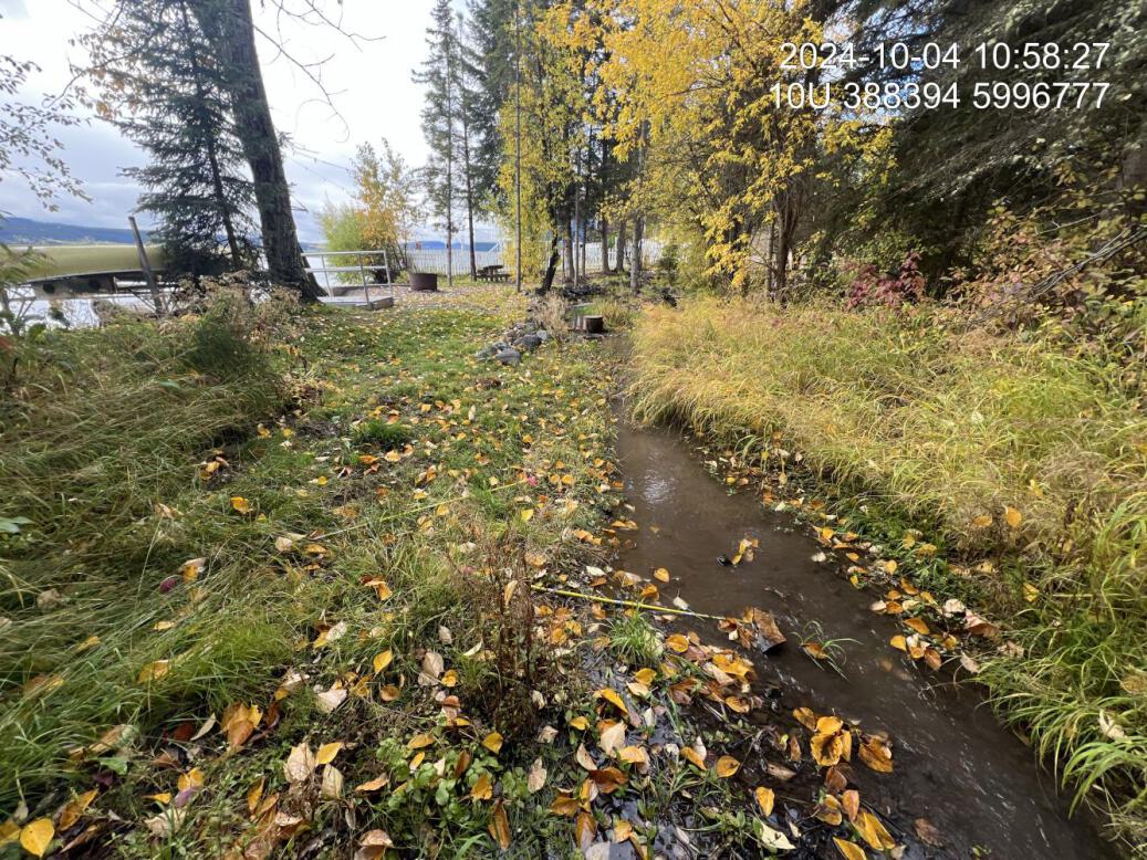
Figure 5.8: Typical habitat downstream of PSCIS crossing 199328.
my_photo2 = fpr::fpr_photo_pull_by_str(str_to_pull = 'ds_lakealgalbloom')

my_caption2 = paste0('Algal bloom observed downstream of PSCIS crossing ', my_site, ' in Fraser Lake.')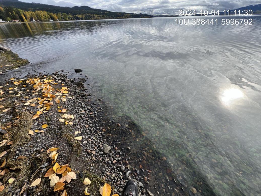
Figure 5.9: Algal bloom observed downstream of PSCIS crossing 199328 in Fraser Lake.
my_caption <- paste0('Left: ', my_caption1, ' Right: ', my_caption2)

knitr::include_graphics(my_photo1)
knitr::include_graphics("fig/pixel.png")
knitr::include_graphics(my_photo2)
my_photo1 = fpr::fpr_photo_pull_by_str(site = my_site2, str_to_pull = 'ds_typical_1_')
my_caption1 = paste0('Typical habitat upstream of PSCIS crossing ', my_site, ' and downstream of PSCIS crossing ', my_site2, '.')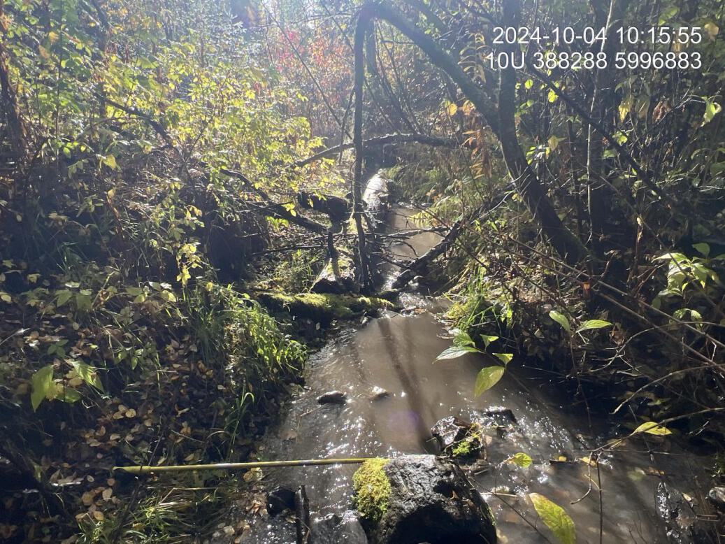
Figure 5.10: Typical habitat upstream of PSCIS crossing 199328 and downstream of PSCIS crossing 199172.
my_photo2 = fpr::fpr_photo_pull_by_str(site = my_site2, str_to_pull = 'us_typical_1_')

my_caption2 = paste0('Typical habitat upstream of PSCIS crossing ', my_site2, '.')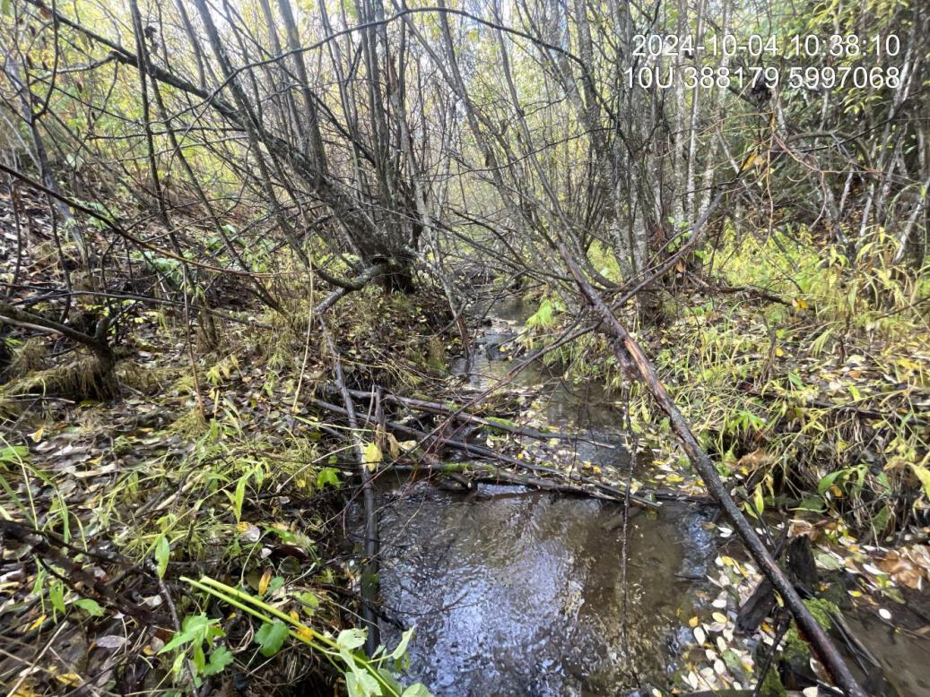
Figure 5.11: Typical habitat upstream of PSCIS crossing 199172.
my_caption <- paste0('Left: ', my_caption1, ' Right: ', my_caption2)

knitr::include_graphics(my_photo1)
knitr::include_graphics("fig/pixel.png")
knitr::include_graphics(my_photo2)